1991 | 1992 | 1993 | 1994 | 1995 | 1996 | 1997 | 1998 | 1999
1990
Chairman – Ian Brown
Secretary – Gerta Smythe
Treasurer – Larry Talarico
Events:
January 30 – Best of 30 years of Mountaineering – Calgary climber Chic Scott presented an illustrated talk on mountaineering in Canada, Europe and the Himalayas at UVic’s MacLaurin Building. Admission: $4.
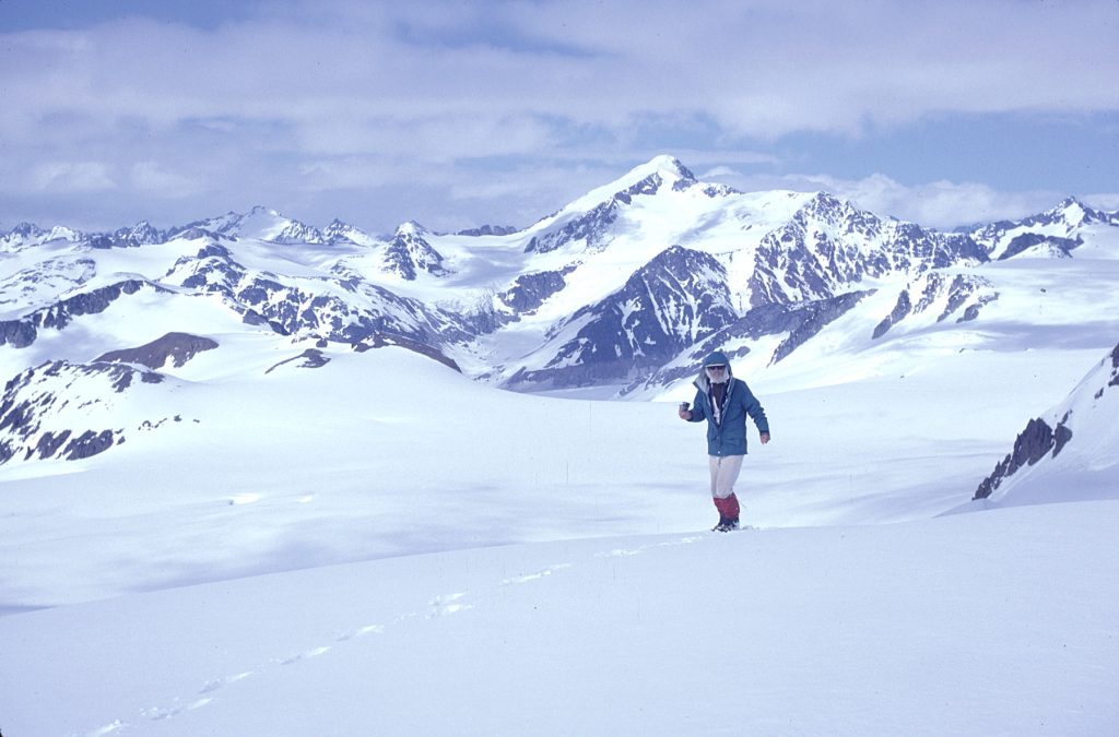
July – Gil Parker leads a party of ACCVI members on a month-long trip to the Caucasus Mountains in Georgia.
July 28 – Murrough O’Brien, Sandy Briggs, Craig Hollinger, Gil Parker, Gerta Smythe, Ian Brown, Margaret Brown, and Graham Maddocks summit Mt. Kasbek (5074m).
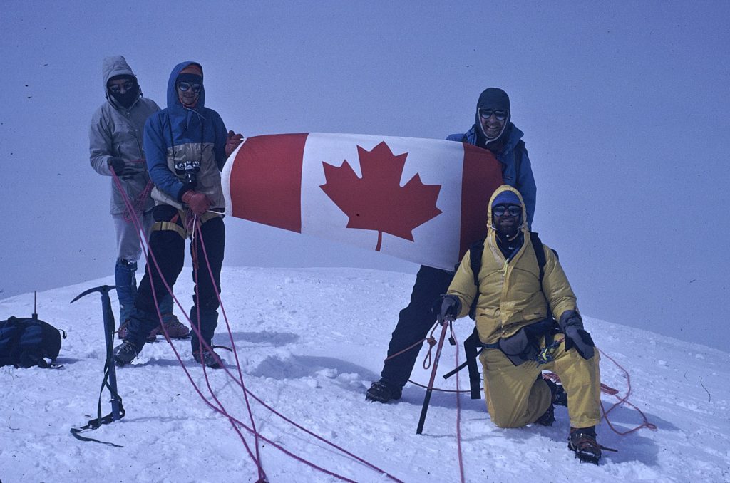
Graham Maddocks, Jim Graves, Sandy Briggs and Murrough O’Brien on the summit of Mt. Kasbek 1990 – possibly Gerta Smythe photo.
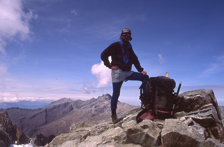
August 4 – Sandy Briggs, Craig Hollinger and James Graves summit Mt. Elbrus (5642m) the highest mountain in the Caucasus Mountains of southern Russia.
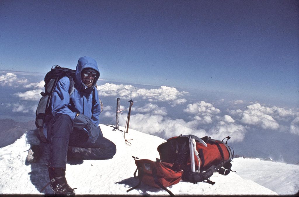
Sandy Briggs on the summit of Mt. Elbrus 1990 – Craig Hollinger photo.
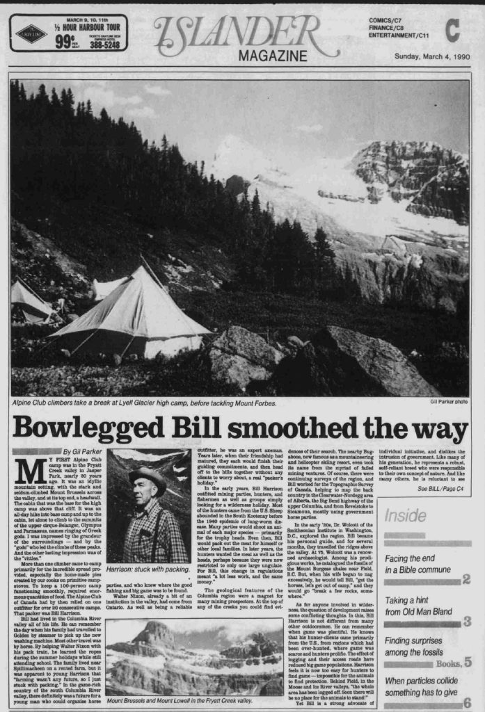
Islander Magazine, Sunday, March 4, 1990, article, “Bowlegged Bill smoothed the way.”
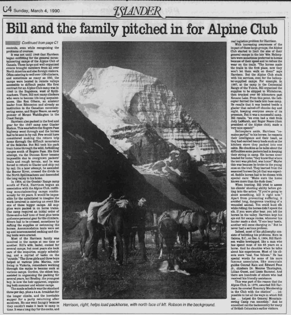
Islander Magazine, Sunday, March 4, 1989, article, “Bill and the family pitched in for the Alpine Club.”
Clearcutting Not the End
Reported in the Times Colonist March 22, 1990.
By Walter Guppy (Tofino)
The ‘wantitalls’ propose to hike across the mountains to Buttle Lake to get public support for their efforts to pressure the government into putting the upper part of the drainage of Bedwell River back into Strathcona Park as Class A park, which it never was before. If they make it across without the aid of a helicopter, it will prove that their wilderness prowess matches their political cunning. Actually, I don’t think their journey is really necessary. They won their battle when they pushed through the one-sided Larkin Report to supplant the recommendation of the Wilderness Advisory Committee. The Larkin Report rejects the economic benefits of mining and overlooks the fact that there was mining activity at Bedwell River before Strathcona Park was established and that there were no restrictions on mining there until 1974. They have emotion on their side and emotion is stronger than reason. If the upper part of Bedwell River is put back into the park – as it appears it soon will be – it will accomplish one thing besides costing the taxpayers money and locking away valuable mineral resources. It should put to rest for all time the notion that when an area has been clear-cut, it is ruined forever. Not many years ago, the Parks Branch mandarins and the environmental lobbyists said that the valley of the Bedwell River was ruined. That’s why the government didn’t anticipate any problems when they took it out of the park. Now there is a great hue and cry to have it put back again as a pristine wilderness.
1991
Chairman – Ian Brown
Secretary – Rick Eppler
Treasurer – Larry Talarico
Events:
May 17 – Sandy Briggs climbs Silverthrone Mountain in the Coast Mountains with John Clarke and one other.
John Clarke with Silverthrone Mountain behind 1991 – Sandy Briggs photo.
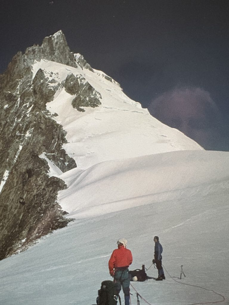
July 4-5 – Sandy Briggs and Ignaz Fluri (Zurich) climb a new route on Mt. Colonel Foster.
Section members who passed away in 1991: Fred Maurice (25 September) and Roger Neave (17 November).
Mt. Colonel Foster
West Buttress
By Sandy Briggs
Approach from Colonel Foster glacier and go up the snow gully and through the south col. We cramponed across the steep snow slopes on the west side after dripping down 50m from the col. (scree late in the season). A downward traverse leads to a flat meadow, from which a ridge leads upwards to the right of a prominent snow or scree gully. This gully is the one directly below the gendarme on the west side, and maybe (?) the one used by the pioneers. To the left of this snow gully a ridge rises steeply to a crest which separates the main summit and the gendarme. We decided not to try the lower part of the ridge as it looked steep and intimidating. We went up the snow gully about 50m and then left to the ridge (actually a sort of spur of the ridge proper). From here a short scramble led to the base of pitch 1, which started in a reddish alcove facing left. After a 6 metre traverse to a right facing dihedral, a prominent white vertical scar goes up at about 5.8 and then we had to haul the sacks up this, then three more rope lengths of mainly class 3-4. Then a short climb up a steep reddish wall, then onto stacked blocks on the left side. The top part is about 5.8 (both of us took falls here). Two more rope lengths to the top of the crest. We bivouacked here and descended the next morning over the south summits. The route gets no stars and should only appeal to those whose fancy runs to interestingly stacked blocks. Its name – “Shunts Utopia.”
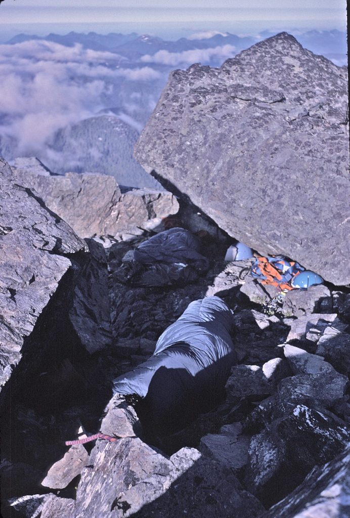
The bivvy site on Mt. Colonel Foster during Sandy Briggs and Ignaz Fluri’s climb of “Shunts Utopia” – Sandy Briggs photo.
Peaks Commemorating Intrepid Park Explorers
Reported in The Campbell River Mirror October 30, 1991.
By Lindsay Elms
In September of 1989, Brian McClure and myself decided to go in and climb Mt. Donner from Pamela Creek. From Gold River we took the Ucona Road out of town and just before we crossed Pamela Creek, we took the U-21 logging road which followed on the eastern side of the creek. It was a good road which didn’t require use of a 4×4 and that we followed until we arrived at the little stream which flowed out of Pamela Lake on the western aspect of Mt. Donner. From the road we took off up through the old growth forest onto the northern side of the stream. To avoid bluffs and waterfalls we stayed about 100 metres from the stream. From there we just skirted around the lake on game trails to a little grave; beach where we set up camp. Next morning, we were up early and followed the stream up that flowed into the lake. We first decided to climb the unnamed peak to the south of Mt. Donner and then traverse across to it. The creek ascended up to a basin and from there it was an easy scramble up onto the north ridge. There was no sign of anyone having been up there previously, but that’s not to say some one had not. We spent half an hour sitting on the summit in glorious weather admiring the views. Mt. Splendor certainly looed splendid, Matchlee Mountain looked mighty and Mt. Colonel Foster … well it looked impressively rugged. We then descended back down the north ridge to a saddle below Mt. Donner. Brian decided to stay there and swim in the mountain tarns, but the lure of the mountain was too great for me, so off up Donner I went, arriving on the summit 40 minutes later. From the top I was able to look down on Donner Lake and the encroaching clearcuts. It was really frightening to see how close they were logging to this beautiful alpine region, but luckily, we were just inside the boundary of Strathcona Provincial Park (unless they decide to do some land swapping again). Back at Strathcona Park Lodge, Brian and I were sitting on the balcony of the bar looking at the map recalling the trip, when we decided maybe we could give a name to this unnamed mountain. I had been trying to find information about two early visitors to the park back in the 1910’s: Messrs. W.R. Kent and W.W. Urquhart. They were hired by Reginald H. Thompson to survey and map the park for him, and over the two summers [1913/14] they did just that, resulting in an accurate topographical map. Urquhart was the leader, a Scottish Canadian surveyor, and Kent, a Canadian, was the photographer. Both gentlemen were about 60 years old at the time, and neither were what one would call mountaineers. This was related to me by an elderly gentleman of Campbell River, Einar Anderson (94), a Dane who moved to Campbell River at the age of 16 and who was hired by Kent and Urquhart to help them. Einar passed away in 1991 but before he did, I met with him at his home and he gave me an account of a climb he did with them of a mountain called the Roosters Comb. Urquhart was always stressing safety and Einar was told never to travel in the mountains after dark. However, one afternoon Kent wanted to go to the top of the Roosters Comb and asked Einar to guide him. Einar said there wasn’t enough time to go up and down safely before dark, but Kent insisted. Darkness fell while they were descending and Einar wanted to camp and stay for the night, especially since Kent had poor eyesight, but Kent could see the glow from Urquhart’s campfire and desperately wanted to get back to the tent. Einar found a stick, a piece of cedar about eight foot long and he held the leading end with Kent holding the other end, and then they inched their way to camp. Back at camp Urquhart berated Einar for travelling in the dark against his instructions, but Kent admitted his insistence. When Urquhart found that the Roosters Comb was the highest mountain on the island, he then asked Einar to guide him to the top. Einar found a piece of yellow cedar and carved their names into it, then when they arrived at the summit he built a rock cairn over it. The mountain has since been named the Golden Hinde. With all this in mind, I wrote to the Toponomy Department of the Ministry of Crown Lands and proposed that the unnamed mountain Brian and I climbed be named Mt. Kent-Urquhart after the two gentlemen. Once the office had completed their documentary research on Kent and Urquhart [their first names remained a mystery but their initials are known], they proposed that maybe we should name two mountains, one after each of them. I had no problem with that and suggest a mountain a little further south of the peak we had climbed. Just recently, I was informed that Mt. Kent and Mt. Urquhart have been adopted on 26 April 1991 as official place names in British Columbia. Those names will be shown on future editions of the topographical maps of the area. I am pleased to see that Kent and Urquhart’s contribution to Strathcona’s history will not be forgotten, and that when ever anyone happens to be on these two mountains, they will remember these two gentlemen.
Addendum:
Eventually it was discovered that that the southern peak labeled Mt. Urquhart had already been named M.S. Mountain but the name had been incorrectly placed on the corresponding map. Mount Urquhart was rescinded and the original name, Mt. Kent-Urquhart reinstated on 11 October 1994. An undated diazo map of Strathcona Park held in the Provincial Archives identifies Urquhart as “topographer” and Kent’s 560+ photos are also in the Archives. PABC GR 1558: field notes, diary. Based on Kent’s 1913 and 1914 photos taken from their summits, Kent, Urquhart and Einar Anderson are credited with first ascents of the following peaks: Puzzle Mtn, Kings Peak, El Piveto Mtn, Mt. DeVoe, Mt. Laing, Mt. Filberg, Mt. Cobb, Mt. Con Reid and Mt. Burman. The personal recollections of Einar Anderson, then a teenaged lineman under the supervision of Mr. Urquhart during the two summers, are on file B.1.38. At the Campbell River at Museum is a recording of an interview with Einar Anderson by one of their staff on file in their archives.
Mt. Kent-Urquhart from Mt. Donner 2023 – Barry Hansen photo.
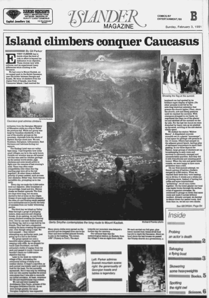
Islander Magazine, Sunday, February 3, 1991, article, “Island climbers conquer Caucasus.”
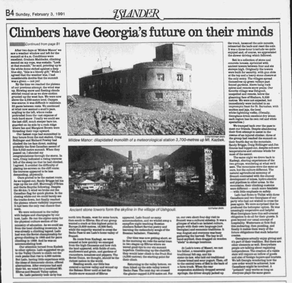
Islander Magazine, Sunday, February 3, 1991, article, “Climbers have Georgia’s future on their mind.”
1992
Chairman – Ian Brown
Secretary – Reinhard Illner
Treasurer – Jules Thomson
Events:
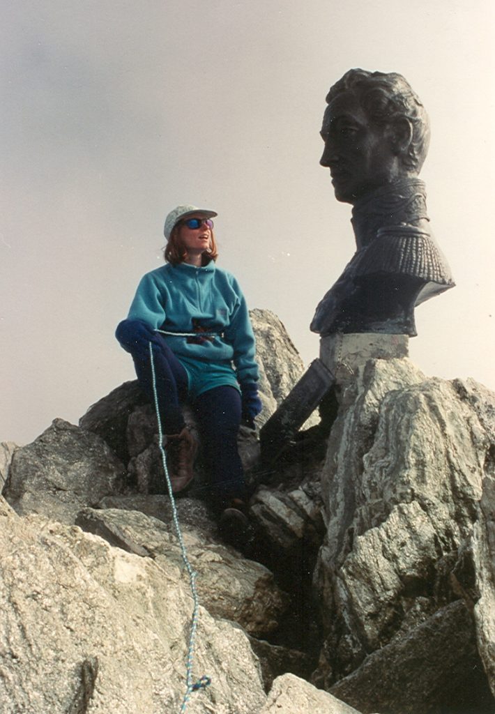
May 2–June 6 – Sandy Briggs and John Dunn skied from Resolute Bay (Cornwallis Island) to Grise Fiord (Ellesmere Island) across the interior of Devon Island.

John Dunn sledding along the ice foot of Smith Island in Jones Sound, en route to Grise Fiord 1992 – Sandy Briggs photo.
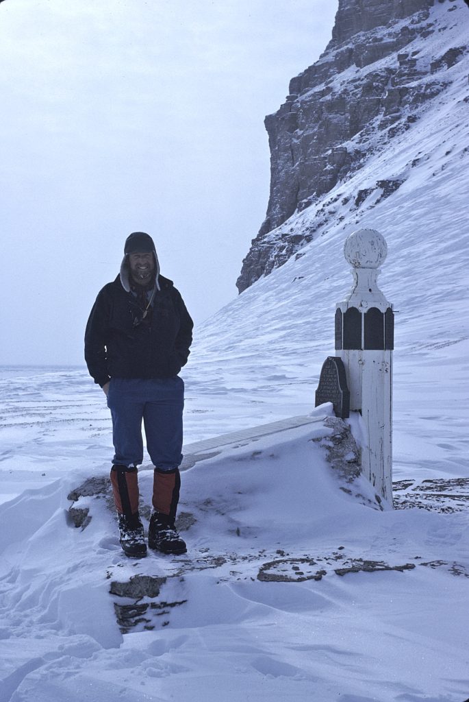
Sandy Briggs at the Franklin Memorial, Beechey Island 1992 – Sandy Briggs photo.
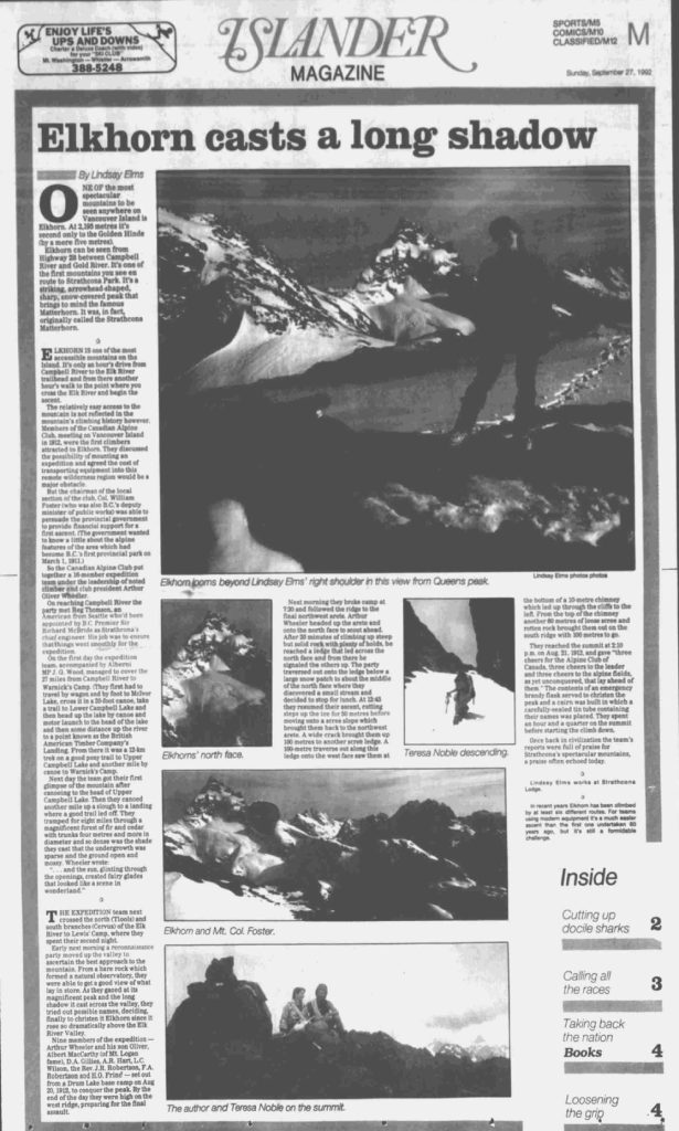
Islander Magazine, Sunday, September 27, 1992, article, “Elkhorn casts a long shadow.”
1993
Chairman – Ian Brown
Secretary – Reinhard Illner
Treasurer – Jules Thomson
Events:
ACCVI wrote to the CRD asking it to buy the entire Gowlland Range as a public park from the First National Properties. (see Times Colonist Friday October 1, 1993. p.21.)
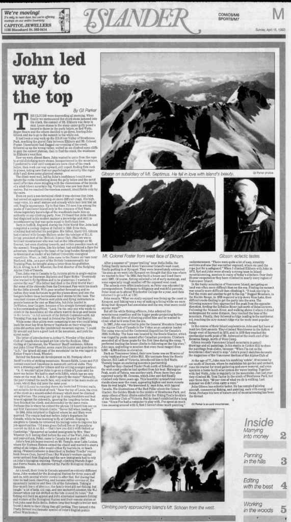
Islander Magazine, Sunday, April 18, 1993, article, “John led way to the top.”
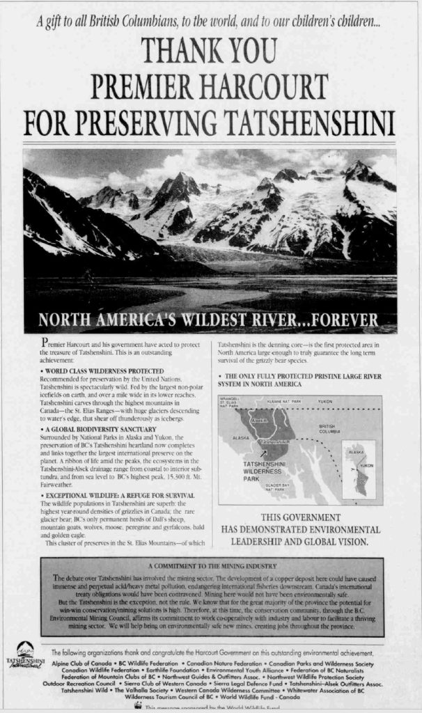
Article acknowledging the preservation of the Tatshenshini River.
1994
Chairman – Ian Brown
Secretary – Reinhard Illner
Treasurer – Jules Thomson
Events:
February 1–April 1 – Lindsay Elms and Elaine Kerr climb the tepui Mt. Roraima (2810m) in the Gran Sabana and then Pico Humboltd (4942m), Pico Bonpland (4883m) and Pico Bolivar (5007m) in the Sierra Nevada above Merida. The three highest mountains in Venezuela.
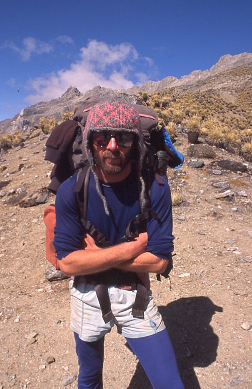
Lindsay Elms on the hike to Pico Bolivar 1994 – Elaine Kerr photo.
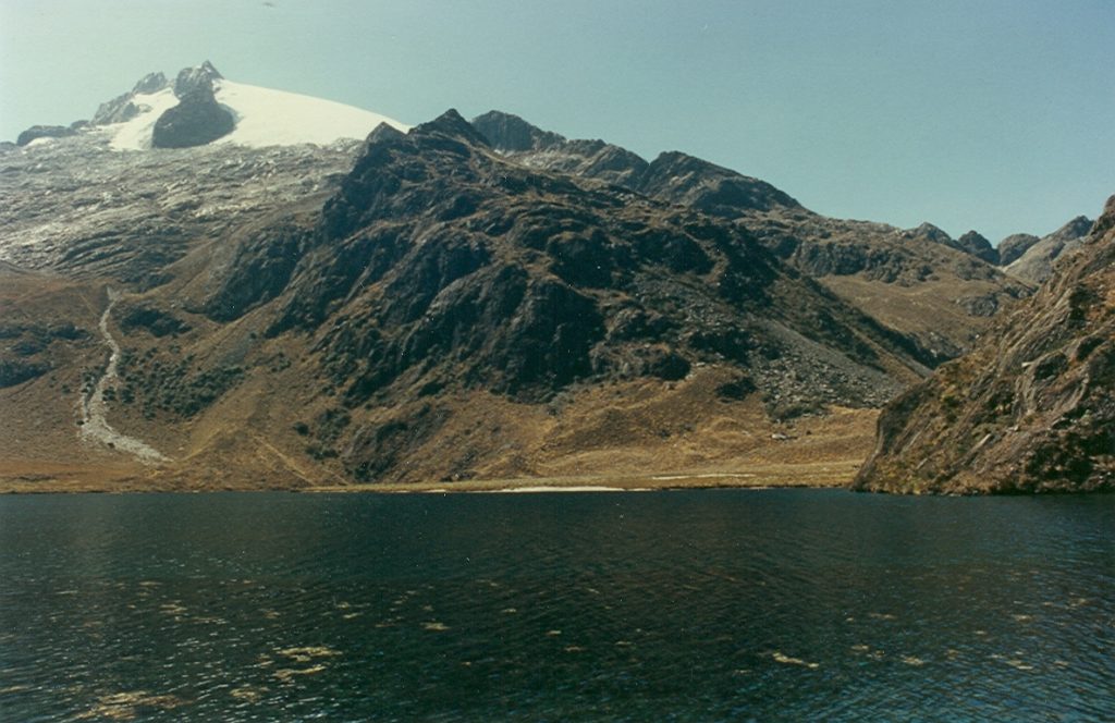
Pico Humboldt viewed from Laguna Verde 1994 – Lindsay Elms photo.
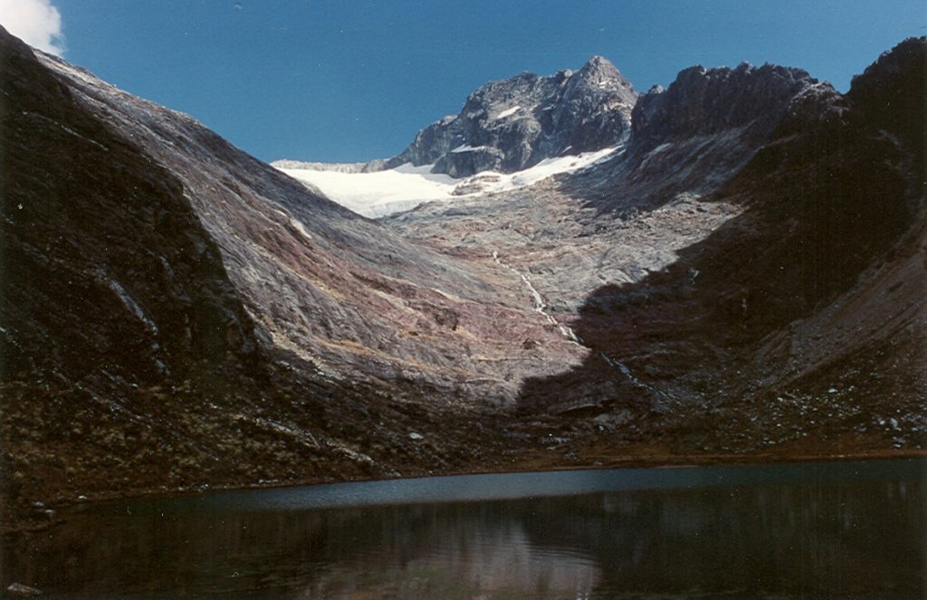
Pico Bonpland from basecamp 1994 – Lindsay Elms photo.
Lindsay Elms on the summit of Pico Bonpland with Pico Bolivar in the background 1994 – Elaine Kerr photo.
Elaine Kerr on the summit of Pico Bolivar 1994 – Lindsay Elms photo.
April 28-August 20 – Sandy Briggs, Graeme Magor, John Dunn, Mike Sharp and Bob Saunders traverse Baffin Island from end to end.
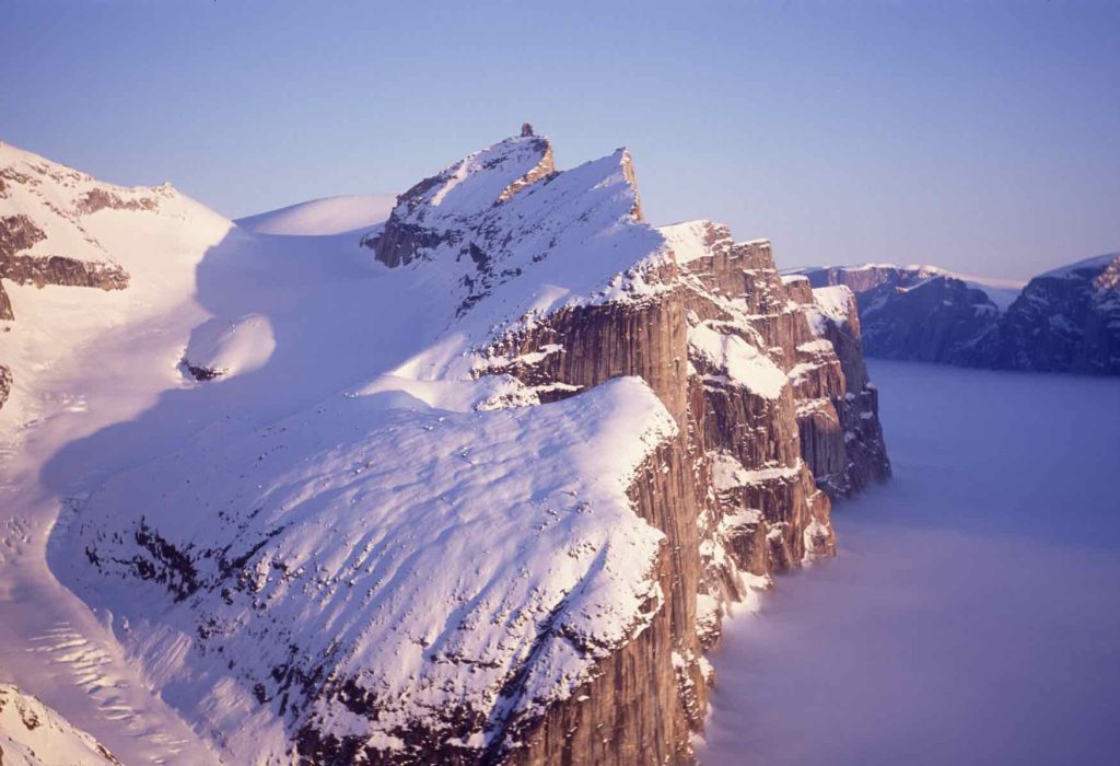
Midnight sun illuminates the peaks and cliffs of the south side of Gibbs Fiord, Baffin Island 1994 Sandy Briggs photo.
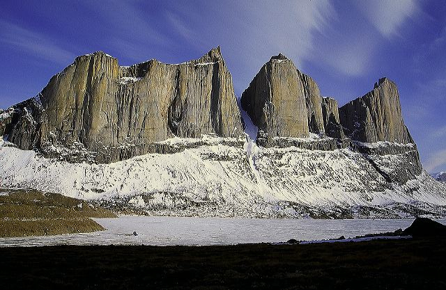
The Sail Peaks, with Great Sail Peak on the right. Stewart Valley, off Walker Arm. East Baffin Island 1994 – Sandy Briggs photo.
August 4 – Lindsay Elms, Mike Baikie and Chris Lawrence climb Mt. Waddington (4019m) in the Coast Mountains.
Chris Lawrence and Mike Baikie on the Bravo Glacier below the summit of Mt. Waddington – Lindsay Elms photo.
August – Gerta Smythe climbs Nevada Uros (5483m) and Huascaran (6768m) the highest mountain in the Cordillera Blanca of Peru.
Section members who passed away in 1994: Elizabeth Pearce (13 January).
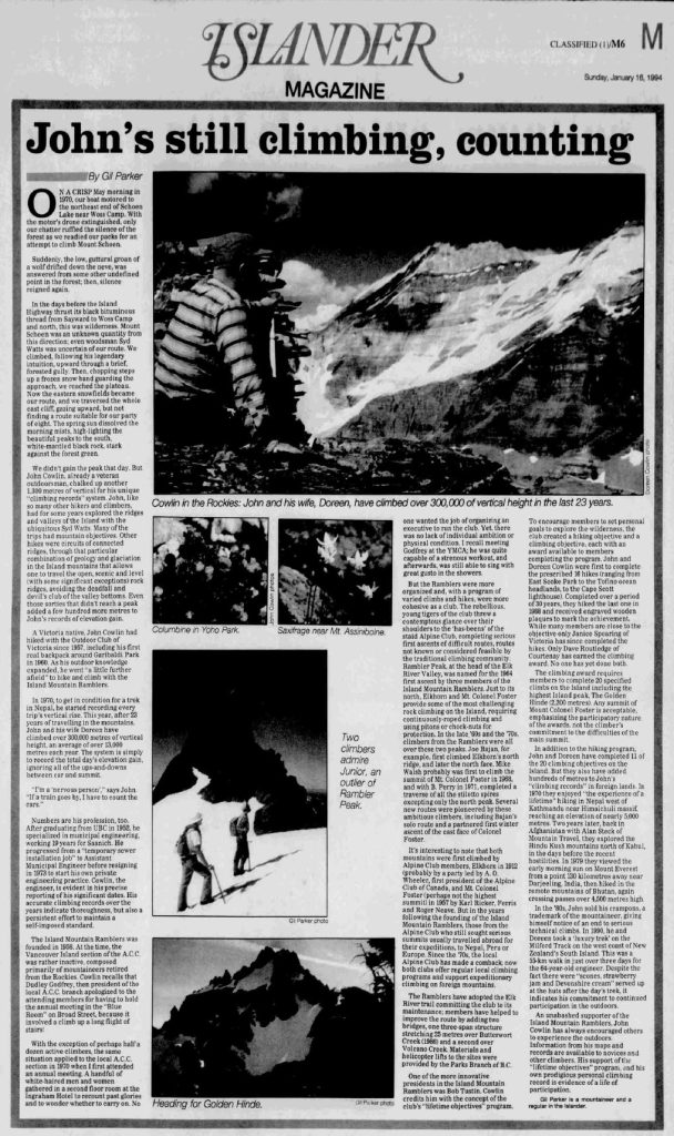
Islander Magazine, Sunday, January 16, 1994, article, “John still climbing, counting.”
Logging And Mining
Reported in the Times Colonist March 14, 1994.
By Walter Guppy (Tofino)
If the CORE committee had any consideration for sustainability of logging and mining on Vancouver Island – and not just a desire to appease the people who want to shut it all down – they surely would have enough intelligence to realize that restricting the land base is not the way to do it. If more land is closed to logging, there will be more pressure on what remains, larger clear-cuts and less time for regeneration, or there will have to be a curtailing of the industry, resulting in massive unemployment and severe economic consequences. With regard to mining, it is sustained through exploration. Mineral deposits that would support producing mines are few and far between. Too much geologically-favorable area on Vancouver Island is closed to mining already, such as upper Bedwell River and Drinkwater Creek, where there are known mineral deposits and claims dating to before the turn of the century. The Wilderness Advisory Committee recommended that this area be designated a multiple-use area where mining would be permitted but this recommendation was defeated by the same element that – with considerable reinforcements – is now trying to shut down the logging industry. I’m pleased to see people of resource-based communities are finally waking up and defending their livelihood.
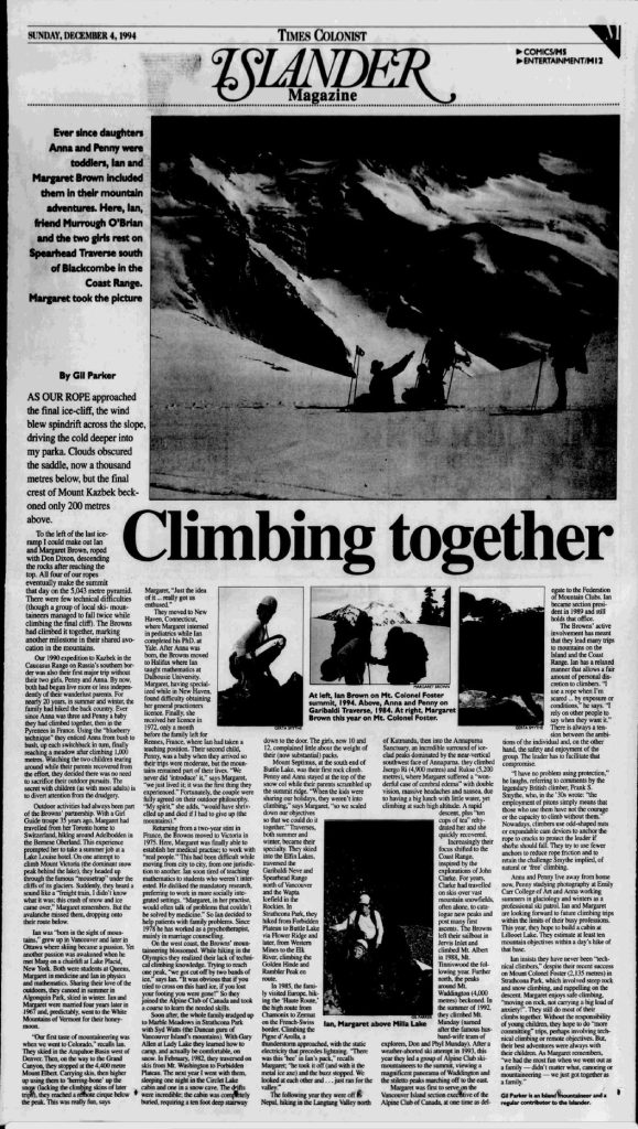
Islander Magazine, Sunday, December 4, 1994, article, “Climbing together.”
1995
Chairman – Ian Brown
Secretary – Reinhard Illner
Treasurer – Jules Thomson
Events:
August – Peter Curtis and Stu Crabe climb Mt. Stephens/k’we (1592m).
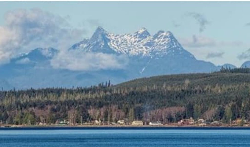
Looking across Malcom Island to Mt. Stephens/k’we (1592m). This is the most conspicuous peak when looking northeast from Port McNeill towards the mainland. It is northeast of Nimmo Bay (off Mackenzie Sound) and west of Kingcome Inlet.
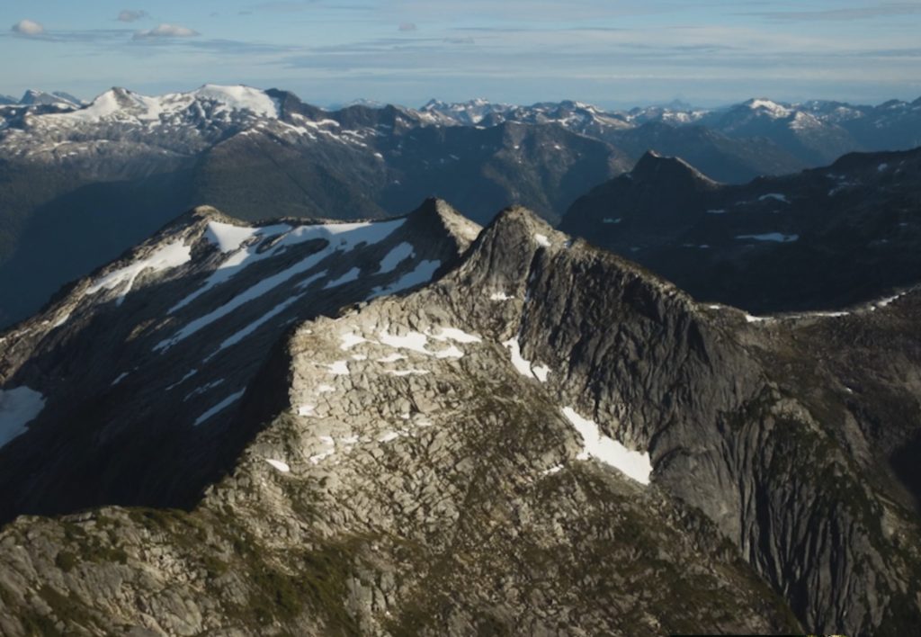
An aerial photo of Mt. Stephens/k’we.
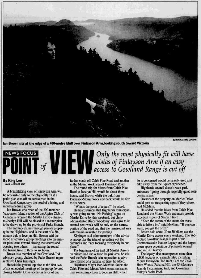
Point of view. Only the most physically fit will have vistas of Finlayson Arm is an easy access to Gowland Range is cut off.
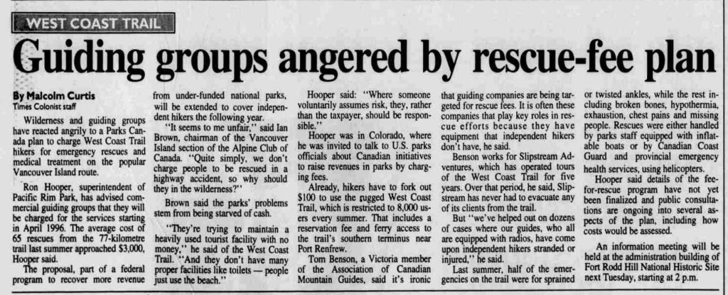
Guiding groups angered by rescue-fee plan.
1996
Chairman – Ian Brown
Secretary – Reinhard Illner
Treasurer – Jules Thomson
Events:
May 10-31 – Sandy Briggs, Lindsay Elms, Dave Holden and Julie Micksch climb Mt. Logan (5959m) the highest mountain in Canada.
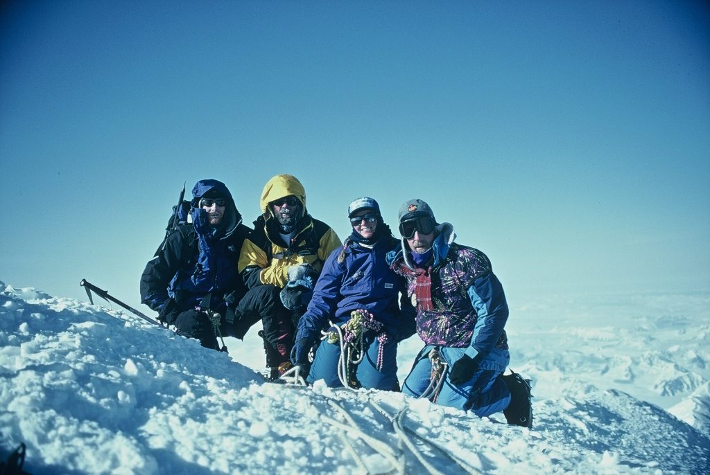
Dave Holden, Lindsay Elms, Julie Micksch and Sandy Briggs on the summit of Mt. Logan 28 May 1996 – Sandy Briggs photo.
Lindsay Elms on the summit of Mt. Logan 1996 – Sandy Briggs photo.
August – Ian Brown, Rob Macdonald and Rudi Brugger climb Mt. Waddington (4019m) in the Coast Mountains.
Section members who passed away in 1996: Elizabeth “Betty” Tuckey (14 January).
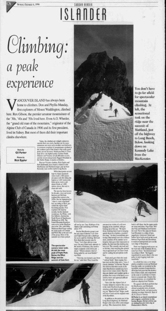
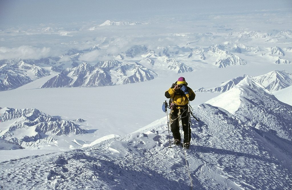
Islander Magazine, Sunday, October 6, 1996, article, “Climbing: a peak experience.”
1997
Chairman – Claire Ebendinger
Secretary – Albert Hestler
Treasurer – Jules Thomson
Events:
January 17 – Alpine Club of Canada presents Fred Beckey, David Lam Auditorium, MacLaurin Building, UVic, 7:30 p.m. Tickets: $8.
June – Gerta Smythe and Reinhard Illner climb Nevada Uros (5483m), Nevada Ishinca (5546m) and Huascaran (6768m) in the Cordillera Blanca of Peru with an ACC guided party.
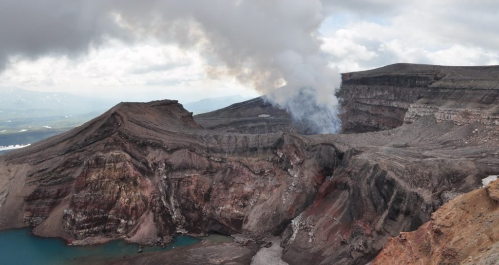
?? – Gil Parker climbs Mt. Zimina (3080m), Mt. Gorely (1799m) and Mt. Mutnovsky (2322m) on Kamchatka Peninsula (Russia).
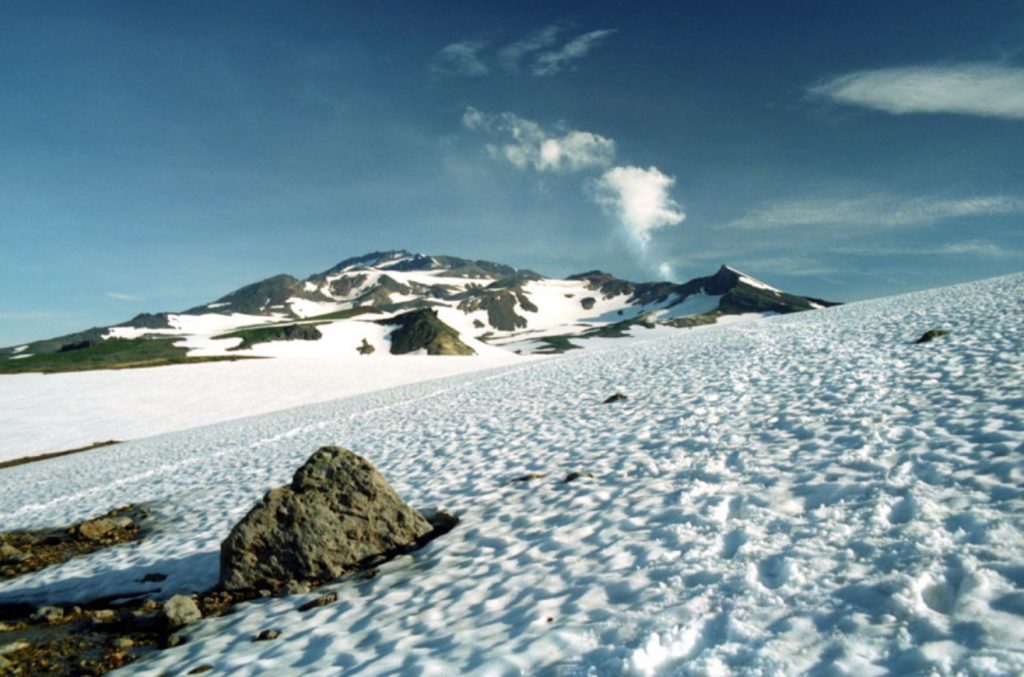
Mt. Mutnovsky on the Kamchatka Peninsula.
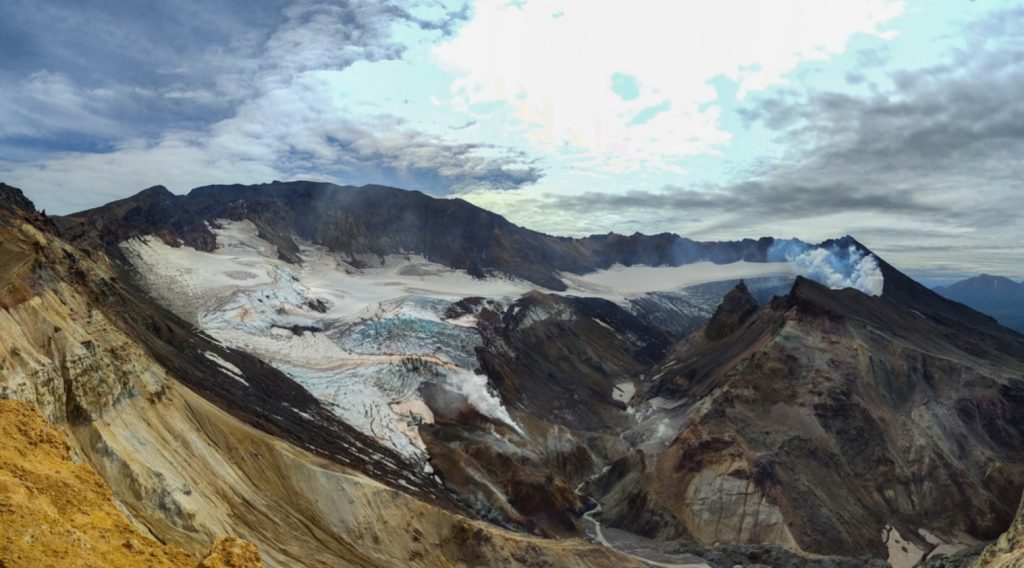
Mt. Mutnovsky.
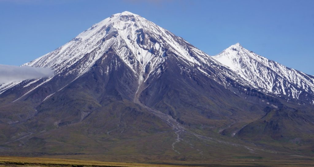
Mt. Zimina on the Kamchatka Peninsula.
Mt. Gorely on the Kamchatka Peninsula.
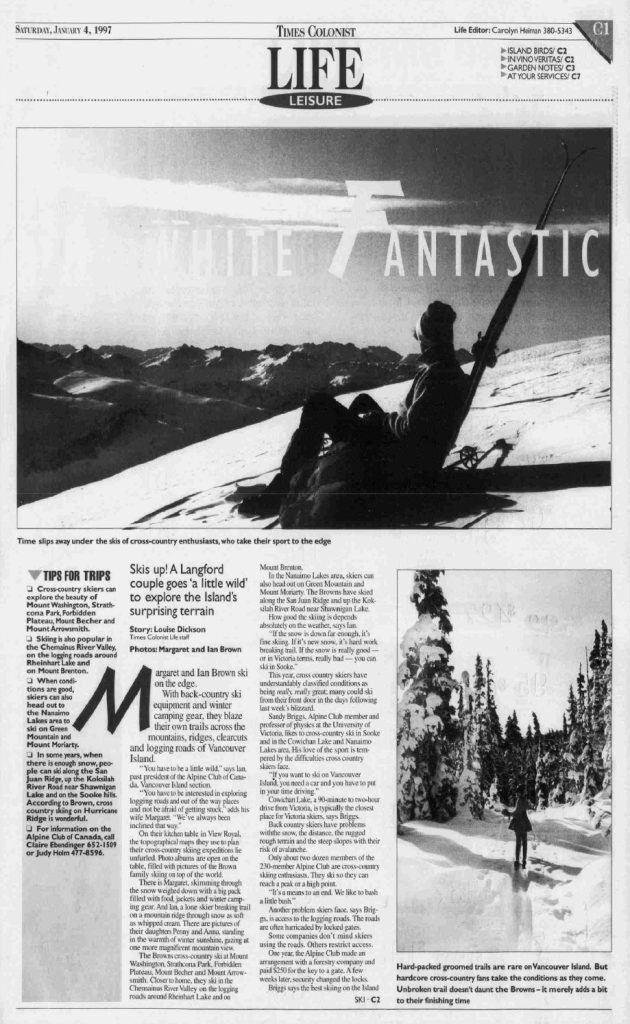
Islander Magazine, Sunday, January 4, 1997, article, “White fantastic.”
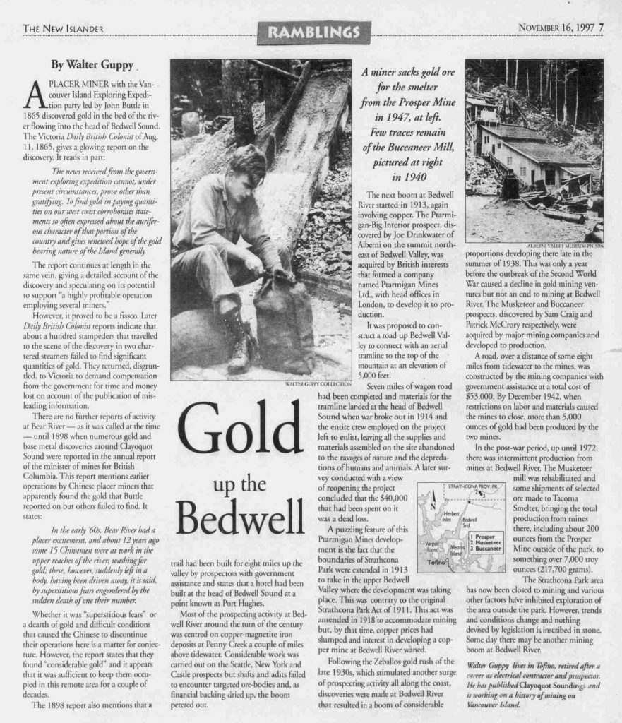
Islander Magazine, Sunday, November 16, 1997, article, “Gold up the Bedwell.”
1998
Chairman – Claire Ebendinger
Secretary – Jules Thomson
Treasurer – Rick Eppler
Events:
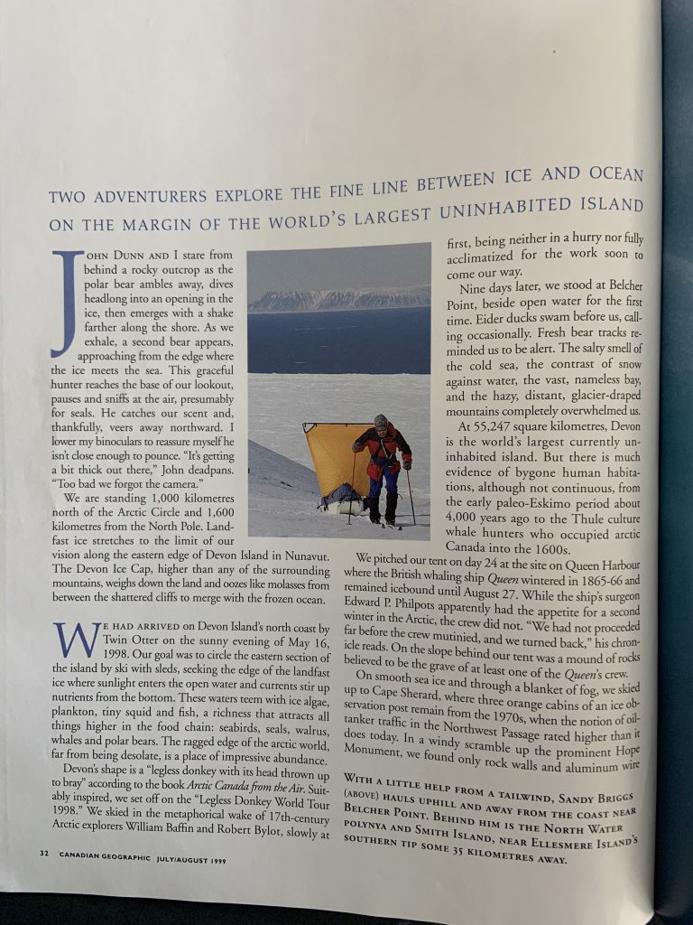
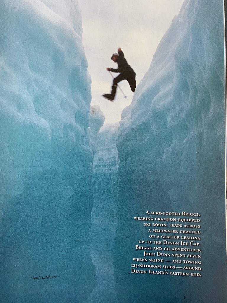
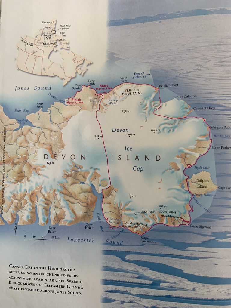
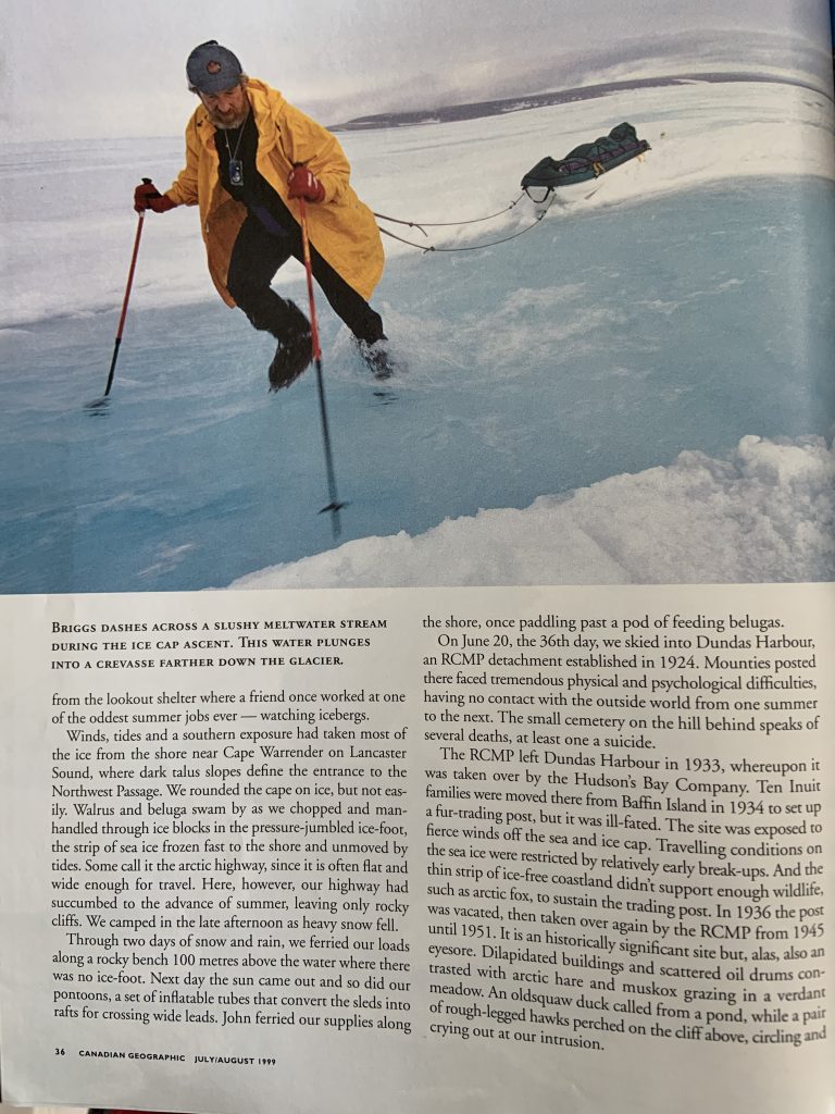
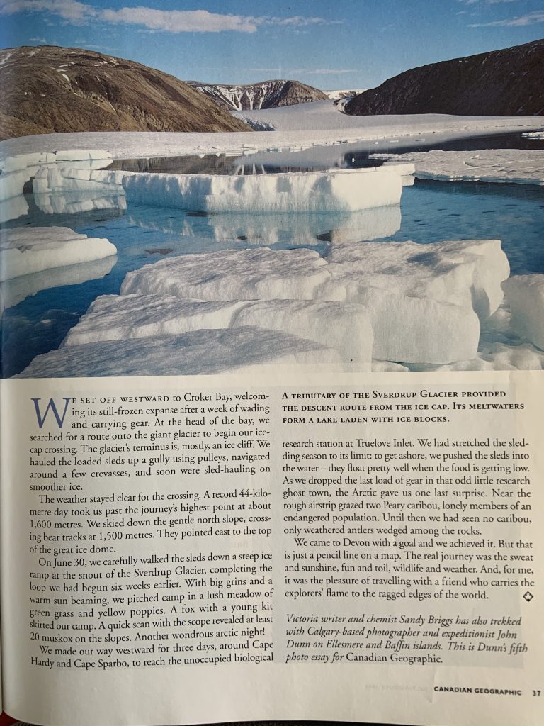
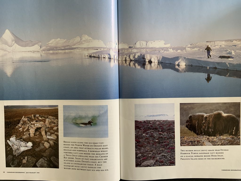
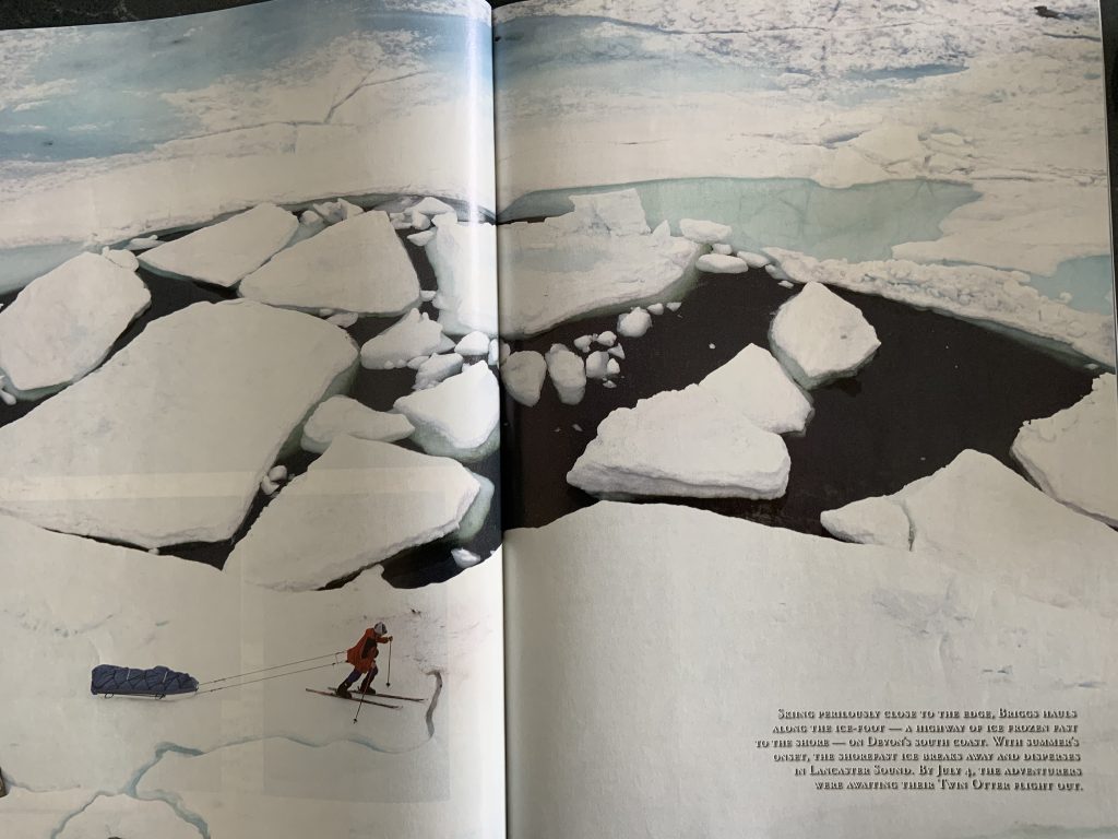
May 16-July 4 – Sandy Briggs and John Dunn circumnavigated the eastern end of Devon Island and returned across the Devon Ice Cap to the starting point.
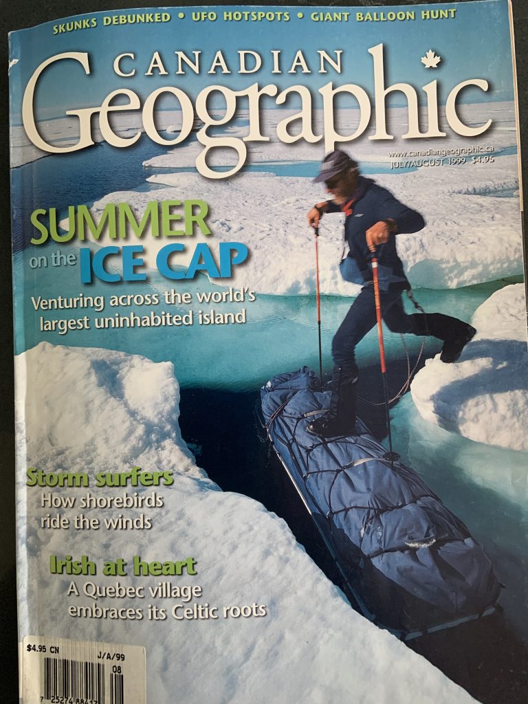
The cover of the July 1999 issue of the Canadian Geographic Magazine.
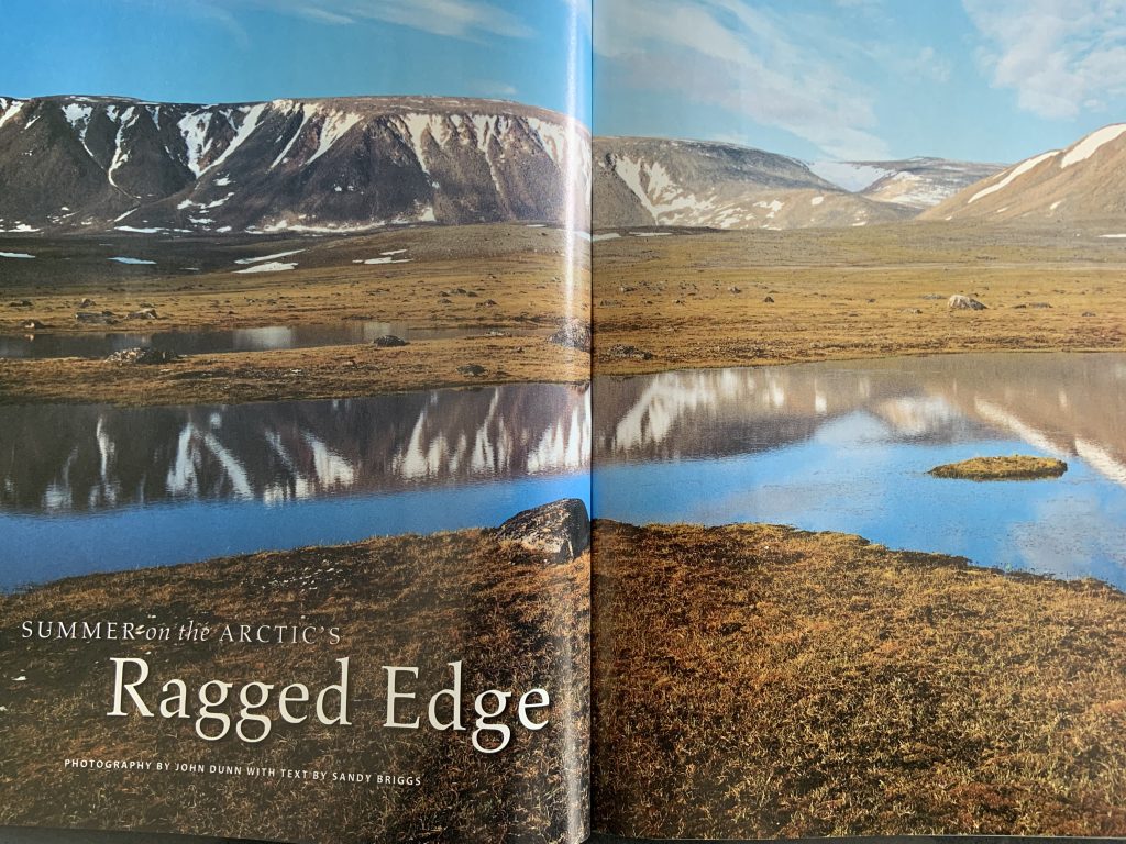
Summer on the Arctic’s Ragged Edge – Photos by John Dunn with text by Sandy Briggs.
Summer on the Arctic’s Ragged Edge – Photos by John Dunn with text by Sandy Briggs.
Summer on the Arctic’s Ragged Edge – Photos by John Dunn with text by Sandy Briggs.
Summer on the Arctic’s Ragged Edge – Photos by John Dunn with text by Sandy Briggs.
Summer on the Arctic’s Ragged Edge – Photos by John Dunn with text by Sandy Briggs.
Summer on the Arctic’s Ragged Edge – Photos by John Dunn with text by Sandy Briggs.
Summer on the Arctic’s Ragged Edge – Photos by John Dunn with text by Sandy Briggs.
Summer on the Arctic’s Ragged Edge – Photos by John Dunn with text by Sandy Briggs.
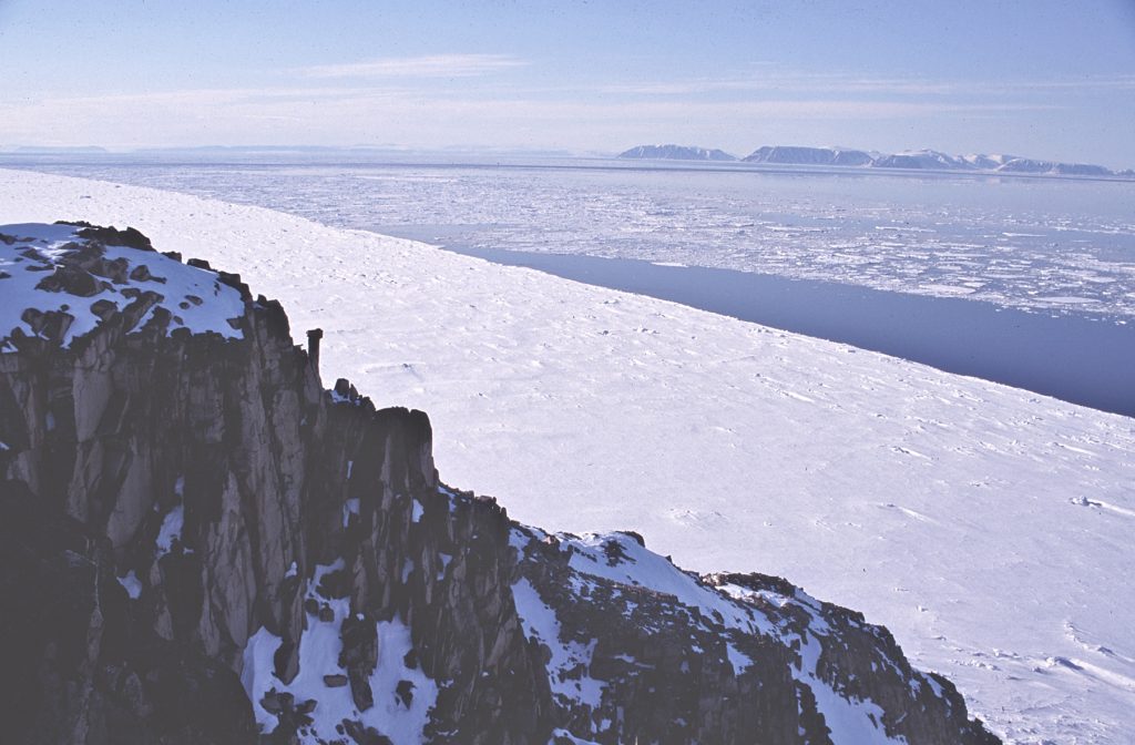
View of the ice edge, Lady Ann Strait, and distant Coburg Island from northeast Devon Island, 1998 – Sandy Briggs photo.
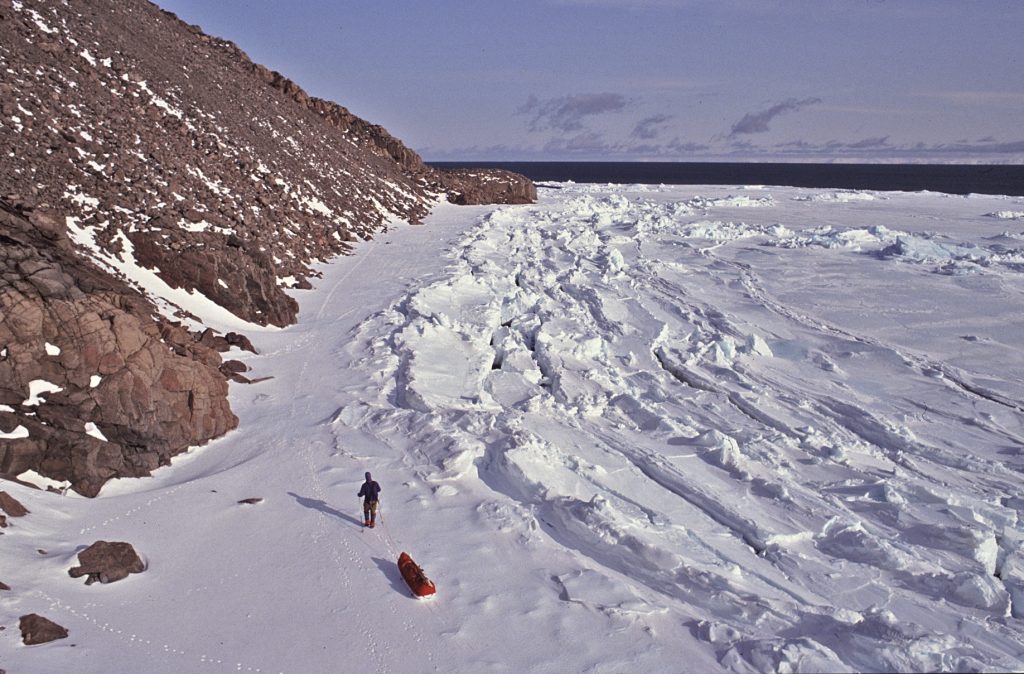
John Dunn at the ice edge, east Devon Island 1998 – Sandy Briggs photo.
August 12 – Lindsay Elms and Keith Wakelin run the Golden Hinde return in 23 hours 58 minutes. Others followed suit gradually bringing the time down as the trail in became better. The Fastest Known Time (FKT) is now held by Nick Elson at 10 hours 1 minute and 53 seconds on 29 August 2020.
November 12 – Lindsay Elms and Elaine Kerr climb Nevado de Toluca (4558m) the fourth highest mountain in Mexico.

Islander Magazine, Sunday, January 25, 1998, article, “The Comox Glacier and other myths of the West Coast.”
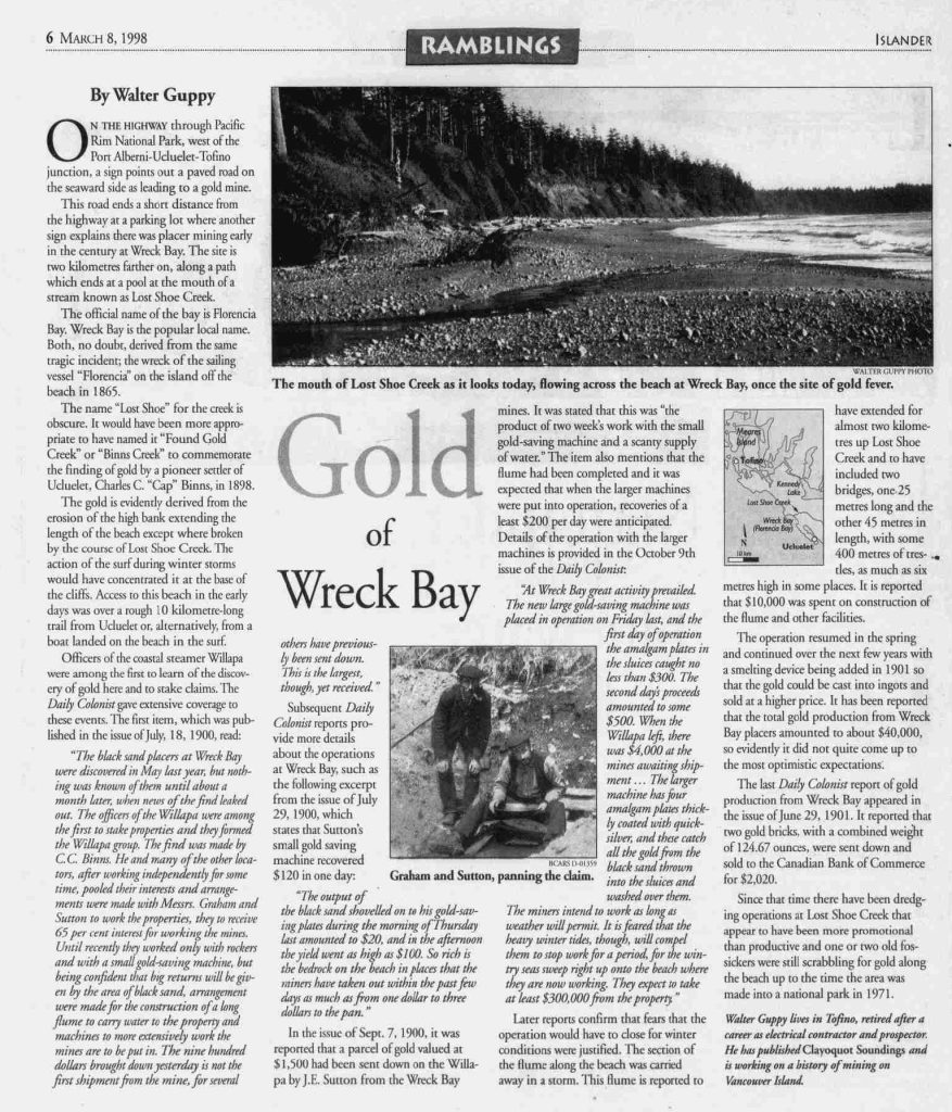
Islander Magazine, Sunday, March 8, 1998, article, “Gold of Wreck Bay.”
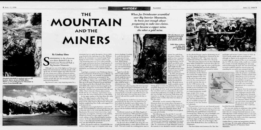
Islander Magazine, Sunday, April 12, 1998, article, “The mountains and the miners.”
More On Mining
Reported in the Times Colonist Islander Section Sunday May 3, 1998. p.14.
By Walter Guppy (Tofino)
I can provide a sequel to the excellent article by Lindsay Elms on the historical mining in Strathcona Park in your April 12 issue. Although in 1917 an amendment to the Strathcona Park Act was passed to legalize the mining activity that had been taking place earlier in the area described in the article, depressed copper prices for copper and the difficult access discouraged further plans to develop the Big Interior property to production until the mining boom of the early 1960’s when Big I Mines Ltd. carried out extensive diamond drilling of the prospect from Great Central Lake. In 1964, Andrew Robertson, president of Big I Mines Ltd. and R&P Metals Corporation, purchased Clayoquot Lodge on Stubbs Island as well as half interests in Maquinna Hotel in Tofino with the intention of making this his headquarters for mining operations on Big Interior Mountain. He was however, discouraged by restrictions imposed on mining operations in the Strathcona Park area over the next few years and no further work was done on the project. In 1987, on the recommendation of the Wilderness Advisory Committee, a “recreational corridor” in which mining would be permitted, was established, extending from the existing Class B park area at Bedwell River to the Westmin Mine operation at Buttle Lake. Big Interior would have been within this corridor. At the time Robertson announced that his company intended to mine the Big Interior prospect from a low-level adit on the Bedwell River side. This would have entailed opening up the access road to the upper Bedwell valley but would not have disturbed the scenic alpine area shown in Lindsay Elms’ article. The valley of the Bedwell River, which had been the scene of mining operations since the last century and was extensively logged during the 1960’s, would have been deleted from Strathcona Park entirely on the recommendations of the WAC. However, there was concerned opposition to the proposal and the Vander Zalm government was pressured into reversing the WAC recommendations and putting the entire area back into Strathcona Park as a Class A, in which Bedwell River never was before.
Lake Named for Local Hero
Squadron Leader Never Returned from Bombing Mission in WWII
Reported in the Comox Valley Echo Friday November 6, 1998. p.B4.
By Ruth Masters
The Mapping and Surveys branch in Victoria recently accepted “Carter Lake” as the official name for a lovely alpine lake in Strathcona Park, honouring WWII casualty, Squadron Leader Frank Carter, who grew up in Courtenay during the 1930’s. Classmates remember Frank as a shy young fellow, who left high school after his second year. He went to Ontario where he studied to qualify for RCAF aircrew. After graduating as a pilot, he spent a couple of years in Canada instructing pilot trainees. Then, in February 1943, he was posted to Britain, where he served with the RCAF Bomber Command. He made numerous bombing flights over Germany until on February 15, 1944, he failed to return. As far as is known, Franks rests with his plane and crew on the bottom of the North Sea. Last year, Frank’s niece, Vivian Muir, of Victoria, requested Comox District Mountaineering Club to identify a suitable feature in our area to honour her uncle. Then, this past August, a mountaineering club party led by Otto Winnig, made an 11-day hike from Elk River to Westmin. Photographs his party took of this pretty lake near our tallest mountain, the Golden Hinde, were shown to Vivian Muir, who approved. Carter Lake lies to the south of the height-of-land below Schjeldrup Lake (named for another Comox Valley hero), flows north-easterly down the Wolf River to Buttle Lake. Frank was 24 years old when he died. He left a wife in Ontario and his small son Ernie, whom he never saw. Such was the tragedy of war. Fellows left ordinary lives for a military career of danger, excitement, responsibility, glamour, and prestige beyond their wildest expectations. Sadly, however, thousands did not get back. For Frank Carter, it was a hard way to get on the map.
Carter Lake with the Golden Hinde in the back ground 2006 – Lindsay Elms photo.
1999
Chairman – Claire Ebendinger
Secretary – Jules Thomson
Treasurer – Rick Eppler
Events:
Section members who passed away in 1999: Peter Bennett (31 August) and Dave Tansley.
In 1954, Peter organized and led the first attempt to traverse on skis the eight main icefields of the Canadian Rockies from Jasper to Wapta Lake. In 1960, he made the first ski ascent of Whistler Mountain and was a founding director of the Garibaldi Olympic Development Association.
Ruth Masters Lake – It’s Official
Reported in the Comox Valley Echo Friday April 24, 1999. p.A12.
For decades, a small turquoise-blue lake deep in the wilderness of Strathcona Park has been informally known as Ruth Masters Lake. Jack Shark and Karen Peterson are thought to have named the lake during a hike from Paradise Meadows to Buttle Lake in the mid-1960’s. On December 11, 2008, the naming of Ruth Masters Lake became official. Other geographical features are named after people who have been dead for some time. Fortunately, this is not the case with Ruth Masters (1920-2018) who is, as she puts it, “on the right side of the grass.” Ruth is well-known as a person of action in our community. She is a tireless advocate for the environment, animal rights, and women’s rights. In 2004, Ruth generously donated 18 acres of her property along the Puntledge River to be a permanent greenway and wildlife corridor. Ruth has also made many valuable contributions to Strathcona Park, B.C.’s oldest park which was created in 1911. Having discovered her love of wilderness and hiking in the local mountains as a teenager, Ruth joined the Comox District Mountaineering Club (CDMC) in the 1930’s. Since that time she has spent countless volunteer hours building trails, and constructing handcrafted wooden trail signs and summit markers. When Strathcona Park was threatened, Ruth stood up to protect it. In the 1950’s, Ruth Masters and Roderick Haig-brown were virtually alone in objecting to the damming of Buttle Lake, which was to forever alter the park’s landscape. In the late 1980’s, Ruth and members of the Friends of Strathcona garnered international attention when they blockaded successfully to stop mining exploration around Cream Lake, one of the Park’s jewels. Many of Strathcona Park’s lakes and mountains have been named, thanks to Ruth. Over the years, Ruth has championed the naming of at least 50 features in Strathcona Park and the Beaufort Range to the south. Many of these landmarks are named for men who lost their lives in WW1 and WW2. Others are named for people who have made outstanding contributions to the community, including prominent Komox First Nations chiefs. Considering all that Ruth Masters has given to our community, and to Strathcona Park, it is fitting that Ruth Masters Lake is now officially “on the map.”
Looking down on Ruth Masters Lake – Matthew Lettington photo.
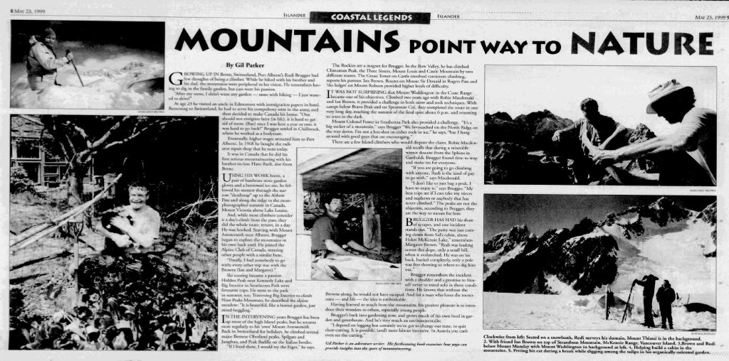
Islander Magazine, Sunday, May 23, 1999, article, “Mountains point way to nature.”
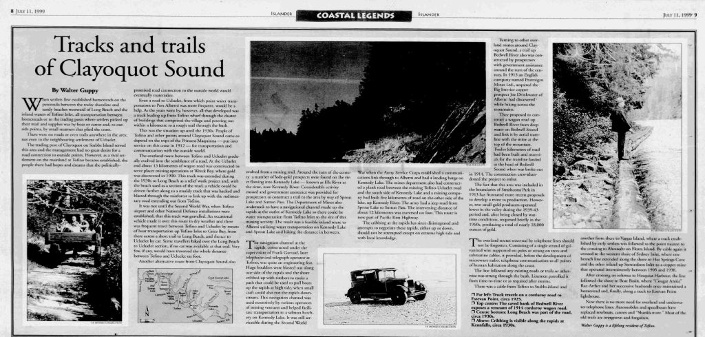
Islander Magazine, Sunday, July 11, 1999, article, “Tracks and trails of Clayoquot Sound.”
The Next Decade: 2000 – 2009
For more history, adventures and exploits of Alpine Club members, please visit our archive of Island Bushwhacker Annuals. The Island Bushwhacker Annual archive has digital editions from 1993. But you can search for information as early as 1973 using the Google-enhanced search field.
ACCVI History is a work in progress.