1965
ACCVI executive:
Chair – Noel Lax
Secretary – Kathleen Tuckey
Events:
July 23 – A party of Port Alberni scouts (Rolf Bernstein, Ralph Bernstein, Jamie Bracht, Gene Demens, David Roach and Richard Myrfield) climb Marjorie’s Load.
August – Ralph Hutchinson climbs Beauty Peak north of Capilano Lake.
August 16 – “They Hold The Heights They Won” plaque placed on the summit of Victoria Peak by Robert Hagman and 12 inmates from Lakeview Forestry Camp north of Campbell River.
Section members who passed away in 1965: Anne Norrington, Norman Stewart.
Strathcona Park Story – Richer Than Fort Knox
Reported in The Daily Colonist Thursday February 25, 1965. p.41.
By Jack Fry
Halfway up Vancouver Island lies a string of mountains which may hold enough minerals to make Fort Knox look like a piggybank—mountains which are within the boundaries of Strathcona Park. Since the late 1950’s the mines department has rebuffed attempts at mining in Strathcona Park. The only exception was Western Mines Ltd. which had already established here when the new policy came into effect and which was given permission to mine its gold, copper, silver, lead and zinc minerals near the southwestern end of Buttle Lake. A new problem has now arisen. The mines department has adhered to an agreement made several years ago with the recreation and conservation department that mining will be confined to an 18-sqaure-mile portion of the 787-square-mile park. But indications of rich mineral deposits have been found in other parts of the provincial park, northwest of the present mining area, and pressure apparently mounting for the government to open these to mining interests.
Major Discovery
Some 300 mineral claims are recorded around Myra Creek at the southwestern end of Buttle Lake, including those held by Western Mines Ltd. Buttle Lake Mining Co. Ltd. has about 60 claims and Noranda Exploration Co. Ltd. has holdings there. These were the findings of soil sample and geological surveys conducted by another large B.C. mining company. This company applied for records but was refused because of the mines recreation department’s agreement. To this day, the company which made the discovery has no holdings there. The mines department sent geologists to the new area in 1963. Their findings: “Good indications” that minerals extend in a northwesterly direction into the park from Myra Creek holdings. How large are the mineral deposits there? There could be a King’s ransom in minerals inside the 504,179-acre park but no one is getting to it yet. Applications for records at least 100 claims have been refused in the past several years because of recreation department’s policy of restricting development to some 12,000 acres of Myra creek.
Only One Way In
“There could be another Sullivan Mine (Kimberley, B.C., mineral mine) in there but nobody knows,” said the official. “There had been no extensive exploration because it is a rugged wilderness park with no way of getting in, except the lake.” Ironically, the inaccessibility of Strathcona Park prevented one of the first men who came upon its riches from cashing in his find. Mines officials still remember the day back in the 1920’s when James Cross of Victoria came into their office thinking he has struck it rich. “He was sure he had a mine. He was right, but he didn’t live to enjoy it,” said one official. “He didn’t know how extensive it was but he was a good enough prospector to know there should be some exploration there.” There were the days when the staking of claims and mining in the park were authorized under the Strathcona Park Act, but economics and transportation of the period apparently were major obstacles in Mr. Cross’ path. The Strathcona Park Act was rescinded in March 1957, when the park was brough under the Department of Recreation and Conservation Act.
Negotiations Now
Mining firms which had a toe-hold at the time in the area southwest of Buttle Lake were subsequently allowed to pursue their interests and Western Mines found the riches ores. Western Mines now is negotiating with the recreation and conservation departments with a view to establishing a mining town near its mine inside the park. The company has already been given permission to build a 22-mile road along the east shore of the lake to its mine at Myra Creek. The housing negotiations stirred a new burst of protest from outdoor enthusiasts who say opening of the park to one mining firm will be the thin edge of a wedge which will eventually destroy the wilderness. Whether the present park policy of closure to mining interests will be maintained or whether the government may decide to alter Strathcona Park boundaries to permit more mining has yet to be learned. Until a change is announced the mines department will maintain its present policy. “You cannot get a record for a mineral claim in a Class A park without the approval of the Deputy Minister of Recreation and Conservation, and their policy to date has been not granting more claims,” a mines official said.
Part Of Key Park Protected
Reported in The Daily Colonist Saturday May 15, 1965. p.5.
By Ian Street – Legislative Reporter
Three large nature conservancies covering about three-fifths of Strathcona Park were established Friday by provincial cabinet order. Recreation Minister William Kiernan said the 302,974 acres involved now are fully protected from all forms of exploitation and “we are serving notice that, as far as we are concerned, these areas are inviolate.” The remaining 227,525 acres in the park revert to Class B parkland status, including the controversial Western Mines Development on the southwest shore of Buttle Lake and what Mr. Kiernan called timber licences, crown-granted mineral claims and recorded mineral claims numbering “in the hundreds.” In Class B parks commercial ventures may be allowed when judged not detrimental to recreational values. Mr. Kiernan said existing alienations in Strathcona will remain and his department will entertain applications for commercial development “on merit.” He said “choice” areas free of alienation make up the nature conservancies. The largest covering most of the western part of the park, includes about 15 miles of the western shore of Buttle lake. It preserves virgin forest, alpine regions and the entire 16-mile length of Moyeha River. This river runs from the glaciated heights of 5,883-foot Mt. Tom Taylor to the head of Clayoquot Sound on the west Island coast. Mr. Kiernan said the Moyeha is the only stream protected throughout its entire length in B.C. and one of the few in this category in North America.
Lakes And Glaciers
In the eastern part of the park, next to Forbidden Plateau, protection was given to an area including The Red Pillar, Memory Lake and several other small lakes and glaciers. In the north, the third conservancy guards Myra and Nola Lakes. A one-mile-wide corridor of Class B parkland was created along the private logging road serving Gold River. A public road to the west planned by the end of this year will also pass through the corridor.
Campsite Planned
Mr. Kiernan said a proposed road to serve Western Mines, running down the eastern shore of Buttle Lake, will also serve a government campsite near Buttle Lake Narrows. Providing this road goes through this year, he said, the government hopes to spend $100,000 in 1966 on construction of the campsite. It will eventually have at least two boat launching ramps and 300 tenting and trailer places.
Circle Route
The campsite could serve as a base for trips to wilderness areas in the nature conservancies. Hiking trails following a circle route are planned in the vicinity of Wolf River and Phillips Creek on the west shore of Buttle Lake. The only other nature conservancy in B.C. is the Black Tusk Meadows region of Garibaldi Park. A fifth is planned at Bowron Lake Park near Barkerville.
Prisoners Home After Saving Injured Guard
Walk For Help After Tumble
Reported in the Victoria Daily Times Thursday August 19, 1965, p. 19.
Thirteen weary prisoners trudged back into jail today after 40 hours of forced freedom. The prisoners, from Lakeview minimum security camp near Campbell River suddenly found themselves alone after their instructor guard fell and injured himself Tuesday. All had left the camp Sunday to climb Victoria Peak, 25 miles west of Campbell River. During the descent their instructor Robert Hagman, 28, of Comox, fell 60 feet onto rocks. Afraid to move in case of internal injuries, the men removed some of their own clothing and built a fire to keep the father of three warm.
Overnight Trek
Then two of them set off through dense forest for an overnight trek to the nearest phone at Sayward. It was well into Wednesday afternoon before they completed the 23-mile march. Meanwhile their companions had down the best they could to make Mr. Hagman comfortable for the night. Wednesday afternoon an RCAF air-sea helicopter guided by instructions from the two men set out to find the party. They located him above the tree-line on the 7,075-foot mountain. The injured guard was whisked to Campbell River hospital where he was in good condition today. He was undergoing surgery at noon for head wounds and a suspected broken wrist. Left without a leader, the prisoners set about making their own way back to camp. On the way they were joined by another party of prisoners led by instructor Joe Kennedy.
Nine Strong
This group, nine strong, had been attempting to climb the mountain from the other side. The climbing expeditions are part of a mountaineering training program aimed at teaching the prisoners leadership and self-reliance. Praising the men’s rescue operation today, camp boss Donald Gray said by radio telephone: “They did a wonderful job. They couldn’t have better demonstrated the value of the course.”
Prisoners Save Guard
Reported in The Daily Colonist Thursday August 19, 1965. p.1 & 2.
Campbell River—Twelve men are walking through 25 miles of dense bush to reach home, after heroic actions in caring for the leader of their mountain-climbing expedition, who was seriously injured in a fall. The 12 men are prison inmates. The man they cared for as he lay unconscious was a prison officer.
Home In Jail
“They’ll come home. They’re almost without food, and they are men serving prison terms for various offenses. They’ve been hiking for five days and they are exhausted. But they will come home.” So said Donald Clay, the officer in charge of Lakeview Forestry Camp, an open prison near here, as he looked with pride on his institution’s rugged mountaineering training program.
Saved Life
That program probably saved the life of 28-year-old correctional officer Robert Hagman, a former Vancouver milkman, who has been working with prisoners only a year. Last Sunday [August 15] morning, Mr. Hagman and 12 inmates started out through the bush, and walked 25 miles through wild country to reach Victoria Peak, west of Campbell River.
Placed Plaque
They began climbing the 7,075-foot mountain early this week, reached the top of the mountain, and placed a commemorative plaque. After a short rest, the men began the descent. “It was tricky and the officer fell,” said Mr. Clay. He fell 80 feet and landed head-on against a rock face. The time was 4:30 Tuesday.
Stripped Clothing
The dozen men climbed as quickly as they could to the spot where the officer lay unconscious. He had severe head injuries, and bruises covered his body. Several prisoners stripped off their clothes and wrapped the officer in them. They supplied what first aid the could. They knew he could not be moved.
Started Fire
Other prisoners rushed down to the timberline, collected wood, carried it back up the cliff, and started a fire to warm Mr. Hagman. Two men, started into the bush at twilight, and walked through the night and the day, with unerring sense of direction, to the nearest telephone at Sayward. At 3 p.m. Wednesday, Mr. Clay was telephoned by one of the men, who gave details of the accident. The prisoner spoke to Air Sea Rescue at Comox, and tried to provide the location in the wilderness. A helicopter took off, followed the directions exactly and touched down several hundred feet from the injured man and prisoners. An Air Sea Rescue official said the accuracy of directions given by the inmate was “almost unbelievable.” When Mr. Hagman was taken aboard the helicopter, air force officials asked the 12 unsupervised men what they planned to do. “Our mission was to come through the bush, climb the mountain, and return through the bush,” a prisoner said. “That’s what we are going to do.” They walked off towards the timberline. Mr. Clay, who was an ardent mountaineer in Kenya a year ago, said he often leads these mountain expeditions himself, and only by chance he did not go on this trip. “This is the essence of our rehabilitation training—self-reliance, responsibility,” said Mr. Clay. The injured man is married, lives in Comox, has three children and another on the way.
Prison Guard Felt Trouble Was Coming Before His Plunge
Reported in the Victoria Daily Times Friday August 20, 1965, p. 17.
By Terry Izzard
Prison guard Robert Hagman had a premonition of disaster shortly before he fell and injured himself. From a hospital bed in Campbell River today, the 28-year-old instructor said: “I had a funny feeling something was wrong. I tried to shake it off but it just wouldn’t go.” On Tuesday the father of three almost lost his life when he slipped and fell almost 200 feet while descending Victoria Peak, a 7,050-foot mountain west of Campbell River. For the next 24 hours he lay in freezing temperatures, delirious, with nothing to eat. “I’d have died of exposure if it hadn’t been for the boys,” said the Comox man. The boys were a group of 11 prisoners from Lakeview minimum security camp who accompanied Hagman on the expedition. Said their instructor: “I couldn’t have asked for anything better. They gave themselves completely. They gave me all the clothing they could and tucked me in close to the fire.” The party had only one blanket. All the expedition members had to keep them warm were their prison coveralls. Two of the youths removed their coveralls to place over Mr. Hagman. “I don’t know how they managed to survive,” said the injured man. “They just froze that’s all.” At first light one of the party, a 21-year-old from Vancouver offered to make the gruelling trek to the nearest telephone – 25 miles away in Sayward. A 19-year-old accompanied him leaving the others at the 5,300-foot level to look after Mr. Hagman, who by this time had become feverish. The Vancouver youth ran most of the way and arrived before his companion. Said Mr. Hagman: “I’ll never know how he did it. We’d had nothing to eat for 36 hours except two small cans of corned beef.” It was Wednesday evening when the youth finally phoned air-sea rescue headquarters. Using the instructions given by the youth, a helicopter managed to pinpoint the injured man first time.
I Was Lucky
He was winched into the copter and rushed to hospital. Thursday he underwent surgery for multiple head injuries and a dislodged finger. Mr. Hagman said: “I was lucky. I slid 150 feet down a crevasse, hit a stone wall, then fell head first for another 20 feet. “I really didn’t know what was happening but the boys apparently lowered me to a safer position. I owe my life to them.”
Convicts Straggle In
Seven Still in Bush
Reported in The Daily Colonist Friday August 20, 1965. p.16.
Three prisoners spent a fifth night in the bush under cloudy skies and showers, on their return trip to camp after their heroic action in caring for the leader of their mountain-climbing expedition who was injured in a fall. Seven other prisoners returned to jail Thursday, weary and unsupervised for 40 hours, amid praise for their part in the action. “The boys were just wonderful,” said Mrs. Robert Hagman, wife of the injured man.
I’m Proud
“I’m proud of those boys,” said Donald Clay, officer in charge of Lakeview Forestry Camp. “This is a good illustration of the success of the training program,” said a spokesman for the attorney-general’s office. The prisoners were part of 12 from Lakeview camp who, accompanied by instructor-guard Robert Hagman, had climbed 7,075-foot Victoria Peak, west of Campbell River.
Rehabilitation
Mountain-climbing is art of the rehabilitation program offered at the camp. On the descent, Mr. Hagman, 28, slipped and fell 60 feet, landing head-on against a rock face. The 12 men climbed down to where the officer lay unconscious, suffering from head injuries, dislocated fingers, and covered with bruises. Five of the men were delegated to remain on the scene while the other seven started the 25-mile hike back to camp.
Walked For Help
Two of the remaining men started into the bush at twilight, and walked through the night and day to the nearest telephone at Sayward. At 5 p.m. Wednesday, Mr. Clay was telephoned by one of the men who gave details of the accident. He telephoned Search and Rescue who sent a helicopter to the injured man following the directions given by the prisoners. Mr. Hagman was flown to Campbell River Hospital, where he is in good condition.
Truck Sent
Mr. Clay Wednesday sent out a truck from the camp to pick up the two men at Sayward. They were back at the camp before the helicopter arrived in Campbell River. Shortage of space in the helicopter forced the other three prisoners who were nursing the injured man to start back to camp afoot, with little food and no sleeping bags. Early Thursday, the seven unsupervised prisoners returning to camp joined up with another group led by instructor Joe Kennedy. This group had attempted to climb the same mountain from the other side.
Final Phase
A spokesman for the attorney-general’s department explained the mountain hike was the final phase of a nine-week training program of athletic and outdoor exercise. During the course, men are taught first aid and survival methods, as well as athletics of various types, including mountain climbing. The program is successful because when the boys go there (Lakeview Camp) they are the toughest and roughest, and in many cases it takes a while in the program before they start to respond,” he said. “These people are against everything, particularly against authority,” he added, “but the program can get them out of their sulky moods by building their self-confidence and self-discipline.
Hikers Tell Story: Guard Fell Giving Aid to Prisoner
Reported in The Daily Colonist Saturday August 21, 1965. p.1 & 2.
By William Thomas
Campbell River—”We were high on Victoria Peak when Mr. Hagman fell,” said Don, a young convict at the Lakeview Forestry Camp, “way beyond the timberline amongst sheets of ice and deep snow.” Robert Hagman, 28, had taken a group of 11 prisoners mountain-climbing, as part of a program to develop their initiative. Jim, just 19, and already an outcast from other B.C. prisons chimed in to say, “We had warned Mr. Hagman not to go near the glacier ice, for two of the other boys had already fallen. It got to be a bit of a joke, us warning him.”
Inmate Slipped
Suddenly it was no joke one of the boys fell on the ice and cut his head as he slithered over into a small gully. Mr. Hagman went to help him and instead he fell, sliding and turning for 30 feet before he dropped over the edge of the ice into a 20-foot ravine.
Man Shocked
I was just stunned and ran across the ice,” said Don. “I knew right away Mr. Hagman was injured.” In an instant the initiative had shifted. Bob Hagman lay streaming blood from head cuts, his wrist useless and his chest aching.
Sudden Drama
The mountain hike had taken on elements of a stark drama. Mr. Hagman was in trouble barely able to move, 7,000 feet up an isolated mountain with little food, no camping equipment and above all dependent on the whim of tough convicts. The events that followed were explained by the two inmates who were instrumental in saving him. We sat in the office of camp director Donald Clay after a massive breakfast of cereal, grapefruit, eggs, sausages, toast, jam and coffee—all prepared by the inmates.
Self Assured
Jim, a lanky, dark-haired youngster with a real sense of assurance, pulled out a map from his hip pocket and gave us the facts. He sounded very much like a military commander outlining a detailed operation. But let him tell it:
Face Down
“I could see Mr. Hagman face down on the ice hard against a rock. By kicking the ice from the overhang I was able to lower my belt to him, and with his good hand he grabbed it. As he came over the lip of the ice he just mumbled ‘I guess I did it this time.’ And he really had.”
Down The Mountain
Don, who was anxious to clear up the details as he saw them, butted in. He was the oldest member of the party—just 21. “I ran down the mountain to where the trees began and with two other boys started tearing up dead branches to get a fire going. It was really tough getting it going.”
No Supplies
By now it was getting dark and all essential supplies were thousands of feet below, at the base of the climb. “Mr. Hagman looked a mess—a bruise over his eye and the blood running down his face made it difficult to realize who he was.”
Made Bandages
It was about now that Mr. Hagman seemed to have gone into shock, explained Jim, who had taken command. “We took off our coveralls and tried to make him as comfortable as possible. By tearing up our undershirts we made bandages and wash cloths to clear up some of the cuts and stop the blood It seemed the longest night most of us had ever spent, just sitting up there on the mountain. The fire helped but when daylight broke by 5:45 a.m. we were ready to put our rescue plan into action. Two of us were to stay with Bob Hagman, three men were sent up the White River to contact another hiking party on the far side of Victoria Peak; another was to hike to base camp and return up the mountain with our blankets and some food while Don and I struck out for a logging operation we knew was in the valley below.” It sounds practical and straightforward but it took hours to complete.
Logging Road
“It was late in the afternoon before Don and I heard the sound of a truck in the distance. We started running through the bush until we hit a logging road. It was just our luck one trucker was a little late in pulling off the job and we yelled to him to stop. It was after 4:30 p.m. and we had been hiking as fast as we could since daybreak. A radiophone in the truck put us in touch with our own camp.”
RCAF Praise
Camp director Clay called rescue officials at RCAF Comox and a helicopter was sent to the site. An RCAF officer later told Mr. Clay, “The way your boys pinpointed the location with their map references was just uncanny.” The same evening the boys who got the message out were allowed to visit Mr. Hagman in Campbell River Hospital. Thursday they were awarded a day off to rest up from their ordeal.
Last Come Home
The first words of one of the three inmates to arrive back at the forestry camp after six hard days in the bush were, “How’s Mr. Hagman?” The last three came in at 3 p.m. Friday. They were hungry and tired but prison officials said, “They were in very good spirits.”
Motto Came to Life
“They Hold the Heights They Won”
Reported in The Daily Colonist Saturday August 21, 1965. p.1.
Campbell River—”They hold the heights they won.” This is the inscription on a small brass plate installed in a cairn of looses stones at the peak of 7,075-foot Victoria Peak, in dense bushland north of Campbell River.
Tough Criminals
It sums up the hopes of the entire staff at Lakeview Forestry Camp, an open prison for some of the toughest criminals in B.C. In almost storybook fashion the motto came to life this week, just minutes after the hiking party from the prison installed the plaque, the 11 inmates were called upon to live it up.
Cold Defied
The boys, their average age just 19, came through with flying colors. They defied cold and harsh, dense brush to rescue an injured guard—traditionally no friend of the hardened convict. Don’t be fooled by their tender years. The staff at the camp will concede that the camp has some of the toughest boys that the prison system has produced. For many, the bold experiment at Lakeview is a last resort. Camp director Donald Clay has pioneered the system of initiative development and training in this province, based on the British plan evolved at the Outward Bound School in Wales. Mr. Clay, a former district commissioner in the colonial service in Kenya, is not a professional corrections officer, and neither are the members of his 18-man staff. All have military background, and the essence of the plan is to impart the feeling of spirit de corps that goes with the crack regiment.
Jail Aims High
The training leans heavily on rescue work and proficiency in the bush under tough going. The action of the rescue team this week had the same effect on the Lakeview staff that a major discovery has on a research scientist. Months of training and planning, frustration, opposition, were all drawn to a climax when the accident to Robert Hagman put the whole program to its ultimate test. The boys, who could easily have run away seeking temporary freedom, stayed on the job because of the sense of pride they have developed in Lakeview and its staff.
Had The Guts
B.A. Cave-Brown, an officer at the camp, is a product of one of Britain’s oldest public schools – Winchester. He said, “I hope that as time goes along these young inmates will look back with pride in having had the guts to stick it through the training here. For instructors, it’s not the best paid job in the world, but we all have a sense of purpose and I think the boys here feel this.”
Tough Times Ahead
There will be tough times ahead for the program, but this rescue-for-real will have set a new stamp on the camp and the inmates are already puffing out their chests a little because they are all part of it. Maybe tough military discipline, the wide outdoors, good food and leaders with a sense of dedication will be able to do something where locked doors and iron bars have failed so sadly. Possibly the inmates at Lakeview Camp will set a trend for other camps, where young men will get a chance to prove they too can make a comeback.
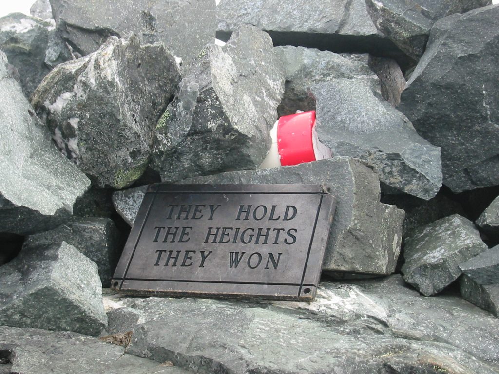
“They Hold The Heights They Won” – Lindsay Elms photo.
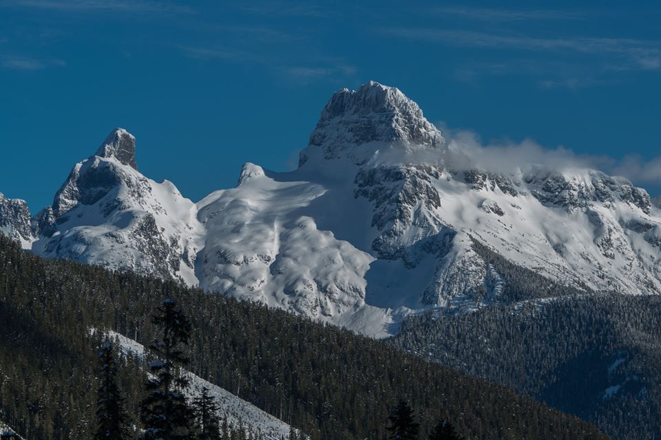
Victoria Peak north face – Hunter Lee photo.
Two Fires Blamed on Hunters
27,000,000 Feet Burned
Reported in The Daily Colonist Thursday September 30, 1965. p.27.
By Alec Merriman
Hunters have been blamed for two fires which destroyed more than 27,000,000 feet of timber in Vancouver Island forest lands in the past few days. The biggest fire was in MacMillan Bloedel and Powell River Company holdings on the east side of Hkusam Mountain in the Kelsey Bay logging division which burned over 1,700 acres. The other fire burned over two acres of crown timberland in the Shaw Creek area back of Cowichan Lake. It appeared as if a hunter came out of the woods wet, lit a fire and didn’t bother to put it out. Fortunately, a timber cruising party in the area chanced upon the fire before it really got going and it was confined to a small area. Even at that fire, fighting costs to the public will be about $2,000. Fire suppression costs of the Kelsey Bay fire will be about $15,000 plus loss of production time. At the peak of the fire 40 men, three tankers and two cats were employed. Monday 15 men, two tankers and one tractor were still fighting the fire and Wednesday patrols were on the spot. The Mac-Powell spokesman said that the fire destroyed113 acres of prime timber, 1,200 acres of marginal timber, and 145 acres of second growth timber. The spokesman said it is not planned to ban recreationalists from the woods because of the fire, but he appealed for more caution in the woods. Evidence points pretty solidly to hunter carelessness. At noon Friday crews were alerted to a fire and when they arrived it was a one-acre fire. But it was in difficult terrain, up a sidehill which acted like a funnel to fan the fire. On the road immediately below the fire were spent shells. Leading to the road from the centre of the fire was a trail of blood. Beside the road were entrails and deer antlers. “It was pretty obvious to us that someone had stood on the road, shot a deer, went up to drag it down to the road to clean it and started the fire by throwing away a cigarette or a match,” the spokesman said. The spokesman said the fire was in a non-operational area where the company doesn’t stop hunters entering on weekdays. The fire was started in an area where there was no one employed, but at least one hunter was known to be in the area and to have bagged a deer. A Pacific Logging Co. spokesman said another hunter left a fire burning in the 19 Creek area around Cowichan Lake, but it was discovered before any damage was done.
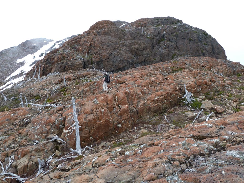
Remnants of the 1965 fire near the summit of Hkusam Mountain 2010 – Lindsay Elms photos.
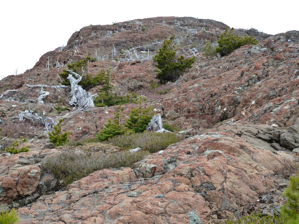
Remnants of the 1965 fire near the summit of Hkusam Mountain 2010 – Lindsay Elms photos.
Dr. Anne Norrington 1876-1965
Reported in the Canadian Alpine Journal Vol. 49, 1966, p.212.
Dr. Anne Norrington, a life member of the A.C.C., who was born at Exeter, Devon, England, in July 1876, died in Victoria, B.C., in her 90th year on October 31, 1965. Dr. Norrington’s early studies were completed in England and after teaching in Exeter she went to Jamaica in 1904, where she taught for four years, then in 1908 she came to Canada to teach at Havergal College, Toronto. In 1917, she obtained her B.Sc. at the University of Manitoba and had an honour of being the first woman to graduate from the University with her degree. Later she obtained her Ph.D. at the University of Chicago. She spent many years teaching in the Western Provinces, including five years at the University of Alberta while doing research work, and she also taught for two summer sessions at the Biological Station of the University of Washington. Due to her extensive work in botany, Dr. Norrington was always a keen observer of alpine flora and during her time spent in the Kootenay’s she made a study of the flowers of the Kokanee Glacier, and an illustrated article on these flowers was published in the National Geographic Magazine. It was in 1914 that Dr. Norrington attended her first A.C.C. camp in the Yoho Valley and became a life member. She graduated on Mt. President under the leadership of Ernst Feuz. In all she attended six Club camps and had outings with the Nelson Mountaineers, and in the Cascades with the Washington Mountaineers. During her life Dr. Norrington travelled a great deal and she was always intensely interested in the distinct lines of flowers growing at different levels in the mountains. On retirement Dr. Norrington made her home at her summer cottage in Cresent Bay near Nelson, B.C. and spent her winters in Victoria. Up to her last year she was very interested in the activities of the newly formed Kootenay Section of the Alpine Club of Canada., as she herself had been active in that area in the twenties with the Kootenay Mountaineering Club. She donated her complete set of Canadian Alpine Journals to the KMC in 1964. Our sincere sympathy is extended to Dr. Norrington’s surviving sisters, brothers, and family.
1966
ACCVI executive:
Chairman – Dudley Godfrey
Secretary – Kathleen Tuckey
Events:
April 30-May 1 – Rosseau Chalet work party.
May 21/22/23 – A large party from various club’s attempt Mt. Cobb and Filberg.
June 4/5 – Marble Meadows trail work party.
June 18/19 – A party climbs Klitsa Mtn.
July 9 – Patrick Guilbride, Peter Perfect and Kurt Pfiefer make 1st ascent of Warden Peak.
July – Section member Tom Hall climbs Mt. Logan, Kings Peak and Queens Peak (1st ascent).
July 22/23 – Marble Meadows trail work party.
July 31 – Mike Hanry, Ralph Hutchison, Ron Facer, Bob Tustin, Syd Watts, Mike Walsh, Elizabeth and Patrick Guilbride, Doug Jones, Doreen and John Cowlin, Ray Paine make 2nd ascent of Rambler Peak. Ron Facer and Mike Hanry make 1st ascent of Rambler Junior.
August 1 – Ron Facer, Mike Hanry and Ralph Hutchinson make 2nd ascent of the Southwest Summit of Mt. Colonel Foster.
August 3 – Bob Tustin, Syd Watts, Mike Walsh, Elizabeth and Patrick Guilbride, Doreen and John Cowlin, and Ray Paine make 1st ascent of El Piveto Mtn.
August 4 – Patrick and Elizabeth Guilbride climb Mt. DeVoe.
August 5 – Mike Walsh climbs The Behinde. Takes a fall and sprains an ankle needing helicopter evacuation.
September 3-5 – Syd Watts, Mike Walsh, Ron Facer, Bob Tustin, Doug Jones, Don Apps, Keith Morton, Brian Hooper, John and Doreen Cowlin, and others climb Puzzle Mtn from the Elk River.
October 8/9/10 – Syd Watts leads a trip up Rees Creek.
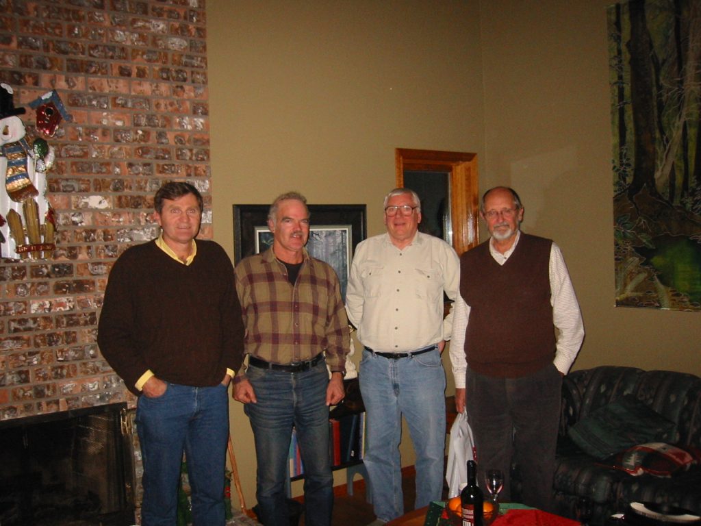
Joe Bajan, Ron Facer, Bob Tustin and Ralph Hutchinson 1998 – Lindsay Elms photo.
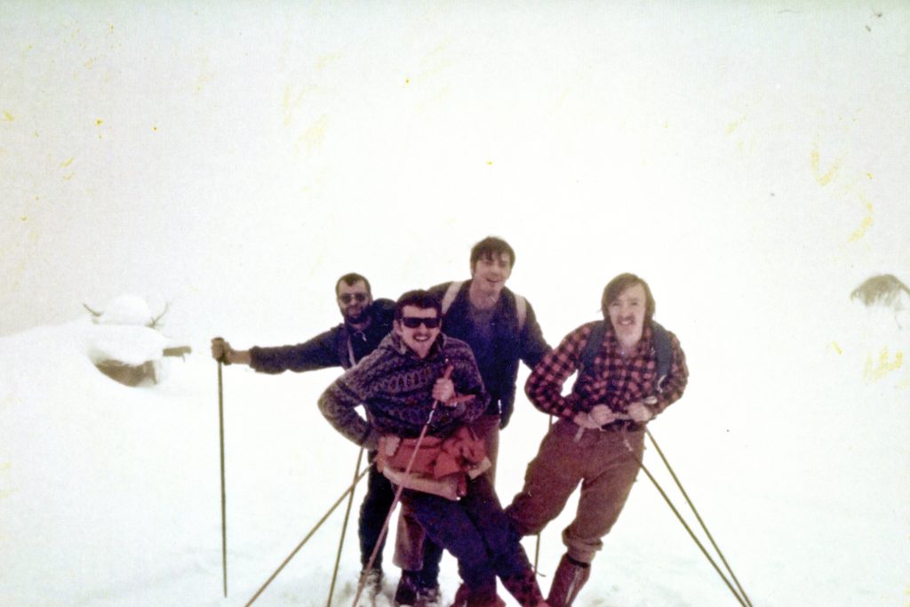
Ron Facer, Mike Walsh, Bob Tustin and Bryan Lee unknown location – Bryan Lee photo.
Section members who passed away in 1966: Ted Greig
Outdoorsmen Oppose Townsite
Reported in The Daily Colonist Thursday March 10, 1966. p.23.
A delegation of Vancouver Island outdoorsmen oppose to location of the Western Mines townsite inside Strathcona Provincial Park will present a brief to a special legislative committee at 9:30 a.m. Friday [March 11]. Sparkplug for the group is Keith Morton of Comox District Mountaineering Club. A caravan will head toward Victoria early Friday morning, picking up along the way delegates from the Courtenay and Campbell River Fish and Game Club, the Island Mountain Ramblers, and Nanaimo, Duncan and Victoria outdoors groups.
Color Slides
During the same hearing, Colonist outdoors editor, Alec Merriman will give the committee a 20-minute showing of color slides taken at Buttle Lake and Strathcona Park. Committee chairman William Speare (SC, Cariboo) said Wednesday the committee would go into an in-camera session after meeting with the outdoors groups and Mr. Merriman, to deliberate recommendations to legislature about the townsite location.
Townsite in Park Would Hit Values
Bad Precedent-Sportsman
Reported in The Daily Colonist Saturday March 12, 1966. p.9.
A precedent for the opening of other provincial parks to commercial developments will be site if Western mines is allowed to have a townsite in Strathcona park, a special legislative committee studying the problem was warned Friday. Keith Morton of Courtenay, who headed a caravan of up-Island outdoorsmen to Victoria, told the committee that a townsite anywhere within the park boundaries would be detrimental to park values. Edward Mankelow of Chemainus, another member of the delegation pointed out that the Western Mines problem is a test case which will greatly influence similar decisions which may have to be made in the future. “It is unlikely that future requests for townsites in parks will be referred to committee. The minister will probably take your findings on this study as the reflection of the views of the public,” said Mankelow.
Public Reflection
Resources Minister Ray Williston told the outdoor group; “We are all emotionally charged in the same direction but we’ve got a practical problem to face up to.” He said the facts cannot be ignored that the mine will go into operation this summer on Myra Creek at the southern end of Buttle lake, and that ore trucks and mine workers will be shuttling back and forth daily along the 25-mile access road into the park.
Notes On Marble Meadow Work Party
June 4/5 & July 22/23, 1966.
Reported in the Timberline Tales of the Island Mountain Ramblers Number 3, January 1967. p.9/10.
In May 1966, permission was secured from Mr. H.G. McWilliams, Director of the Parks Branch to construct a trail from Buttle Lake at the mouth of Phillips Creek to Marble Meadows, elevation 5,000 feet to open up one of the better hiking areas in the park. The letter of permission stipulated that the maximum gradient was not to exceed 15 per cent, cut as little as possible and scatter it well off the trail, and not blaze the trail. During the two work parties approximately one quarter of the trail was taped to the maximum grade, cleared of debris and cut out with a mattock and shovel. In the coming years the trail construction will progress more rapidly in that we will have access to the Western Mines road, thus reducing the time to travel on Buttle Lake. The trail construction will be the major construction of the club [Island Mountain Ramblers] during the next few years.
Rees Creek
October 8/9/10, 1966.
Reported in the Timberline Tales of the Island Mountain Ramblers Number 3, January 1967. p.15/16.
By Syd Watts
Due to the very poor weather forecast the regular Thanksgiving weekend trip was cancelled, and the weather turned out to be perfect. Never again will I cancel a trip due to the weather. So as not to miss a hike during this weekend, a few hikers tried to go up to Memory Lake to see the camping area for the 1967 week’s trip. On meeting at the Comox Lake gate at 8:30 on the Sunday morning, we drove up the Cruikshank main road to the new grade on the left which is just before the Rees Creek crossing. This route soon proved to be of no help as it headed for Capes Lake. Returning to the main road, we drove in on the old Rees Creek grade that leaves the Cruikshank’s main road at the north end of the creek bed. This grade has overgrown and, after driving half a mile, ends in the creek. On leaving the cars we hiked up the old road to the point where it crosses the main creek. We should have crossed over here and stayed on the old grade, but instead, we hiked up on the north sidehill and came on to the grade again on a switchback. A short section of grade is very poor but soon it improves, even though it keeps close to Rees Creek instead of climbing towards the Carey Lakes, as shown on the map. At the crossing of the tributary immediately south of the Carey Lakes, there is a ridge which leads up to the alpine area. This is the route which I had intended to climb – it turned out to be the only route. As the grade looked so good, and as we thought we could climb to the left of the waterfall at the head of Rees valley, we stayed in the valley bottom. Jack Ware and Bill Lash turned back to their car and drove over to the Forbidden Plateau trail to hike to Moat Lake, which Bill had not seen. The rest of the party continued up the grade to its end at the 1900-foot level, which was also the end of the logging operations. Continuing in the timber proved impractical due to the large boulders and the devil’s club. Since the creek bed at this point was dry we followed in the valley bottom, making good time. By now we could see that we were not going to get out of the valley, with walls 1500 to 2000 feet high. It looked like there was a ledge on the north side which would lead us out of the canyon, but after climbing 1000 feet, an open rock fault stopped us from continuing. As it was getting late, we headed back down the valley to get out to the gate before it was closed. This area is worth a trip in to see the canyon. The ridge on the north side of Rees Creek to the Alpine area should have a trail. If the old grade were also opened, one could hike from Buttle Lake at Ralph Creek to the Cruikshank valley. This route would also provide an alternative route to the Comox Glacier and the Forbidden Plateau.
Participants: Syd Watts, Dorothy and Bill Lash, Bill Jackson, Karl Stevenson, Lorne Lanyon, Brian Hooper, Jack Ware.
Rescue Aftermath: Payment For Watch
Reported in The Daily Colonist Saturday July 23, 1966. p.32.
An instructor at a Vancouver Island detention camp, whose wrist watch was lost during an accident last August, will be given $100.53 by the provincial government to make up for the loss. A cabinet order Friday authorized payment of the money to Rober Hagman, a senior instructor at Lakeview Forest Camp. Mr. Hagman was in charge of 11 inmates form the camp. The party had climbed the rugged 7,075 Victoria Peak north of Campbell River and put a plaque on the top. Mr. Hagman went down to help one of the party, slipped and fell 50 feet into a precipice. Two of the inmates walked out of the bush overnight for help. Through excellent pinpointing of the officer’s position on a map an Air Sea Rescue helicopter was able to locate the party next day and carry Mr. Hagman to safety.
Three Climbers Scale Mountain
Reported in the Campbell River Mirror July 1966.
By Mary Baldwin
The Thursday’s Province, three Japanese businessmen who had climbed 13 peaks in the Rockies, expressed their surprise that more B.C. people failed to take up the challenge of climbing. These gentlemen have not met a climbing family of Campbell River, the Stapley’s. Frank Stapley is an experienced climber, both of mountain peaks on the island and the mainland. Now his two older boys are following in his footsteps, for they have climbed the Golden Hinde, a mountain in Strathcona Park 7,219 feet high. This is just a beginning. Last weekend, Frank, his two sons Dick and Dougie aged 13 and 12 respectively, together with Mr. and Mrs. Forrest Stotzer of Miracle Beach, left by Island Airlines Beaver plane for Burman Lake, altitude 3,000 feet on the first leg of the journey. This is an isolated lake and has no attraction to the sports-fisherman for there are no fish in this lake. They started climbing on Friday from her, establishing a base camp, but on Saturday morning, they were forced to return to base, for the fog and mist rolled down obliterating the landscape. Frank is no foolhardy climber, he has respect for the climatic conditions, for he has often climbed alone when a false step could be fatal. That was why he decided they must return to base, although they were halfway to their objective. On Sunday the day broke bright and clear, and at 7 a.m. they left for their climb to the peak. They reached the summit at 11 a.m. After a rest and a long survey from this pinnacle, they retraced their steps arriving at the base camp at 3 p.m., all well satisfied with the weekend climb. But at the camp the heavens opened and deluging rain descended on them. It was decided to stay in camp until Monday, in the hope that the weather would clear. Monday did what was expected, and in dry weather the party walked to the Western Mines project at the southern end of Buttle Lake. Here they were treated right royally by mine manager Bruce Laing and the personnel. They were shown over the mine, much to the delight of Dick and Dougie. Then Mrs. Phyllis Stapley was contacted by radio-telephone to be ready to meet the party by car at the Western Mines wharf lower down the lake, for they were being brought there by the mine launch. So the weekend ended happily, but the appetite for climbing has been whetted so that perhaps the Japanese gentlemen who complained mildly about our indifference to climbing will find that there are school children as well as adults who appreciate the thrill of mountaineering.
Outdoors
Reported in The Daily Colonist Wednesday October 19, 1966. p.11.
By Alec Merriman
A new logging road being built by Crown Zellerbach will bring Courtenay’s Forbidden Plateau alpine lake wonderland to within a 15-minute hike for ordinary recreationists who lack stamina of mountain climbers. When plans were announced for a shortcut road through Paradise Meadows to Crown Zellerbach’s operations to the north, in the headwaters of Piggott and Rossiter Creeks, they brought a storm of protests from Island and Vancouver alpine and outdoor groups. They feared the timber bounding Paradise Meadows would be logged and the area would be spoiled. About 200 acres of alpine area was involved. But when we flew into the area on Monday, Crown Zellerbach’s Courtneay division manager Tony Poje assured us the Paradise Creek timber will not be logged “for two or three years. But we have to push a road through there to get access to our timber holdings on the Piggott and Rossiter,” he explained. The hillside overlooking the meadow is wooded, and “we will leave a strip of timber a minimum of 400 feet wide between the road and the meadow.” He also said that when the road is constructed public access will be allowed under normal company access policies, which means during fishing and hunting seasons, except when there is extreme fire hazard. During hot weather responsible organized groups will be able to apply for special permission to use the road to reach Forbidden Plateau access areas.
Satisfied For Now
Comox District Mountaineering Club president Keith Morton told us Tuesday his group is satisfied with the arrangements for the present. It will undertake to place signs pointing the way into the Forbidden Plateau alpine lake area and will mark and improve the old Dove Creek trail, which leads off from Paradise Meadows and used to be the main access route to the area. Morton said the timber corridor plan will give his club and other groups time to try to arrange an exchange of timber so the area may be preserved. Recreation Minister Kiernan told us his parks branch is still interested in the Forbidden Plateau area adjacent to Strathcona Park, and will listen to any proposals the outdoors group may make. But the land in question is E & N land grant property on which all mineral rights, except gold and silver, are held outright. Mr. Kiernan said he is wary of taking over as a park any area with mineral alienations. He didn’t think there would be any chance of negotiating mineral rights except at a fantastic cost and added there have been “interesting mineral discoveries in the Forbidden Plateau area.” Crown Zellerbach brought its Paradise Creek area from the CPR’s E & N land grant properties last year but there remains a corridor of land still owned by the CPR under the grant. It’s the area within Strathcona Park game reserve and adjoining the central-eastern park boundary which contains the lake and alpine areas most used by recreationalists and sought for annexation to the park. Mr. Kiernan said use of the area for recreation purposes will have to be under the multiple use concept.
Within Easy Walk
This alpine lake area is already used by recreationalists who hike in from Forbidden Plateau lodge to the southeast, or use Crown Zellerbach’s branch 62 road to Wolfe Lake and up Brown’s River system—which now end six miles before Paradise Meadows. The new road, to follow the old Dove Creek trail, will be an extension of that branch within easy walking distance of the plateau alpine area. It will be a 22-mile trip from Courtenay. Some of the lakes that will be brought six miles closer to ordinary recreationalists are battleship lake, Lake Helen Mackenzie, Lady Lake, Croteau Lake, Mariwood Lake, Panther Lake and Lake Beautiful. Many have been recently stocked with trout. Moat Lake, biggest of the fabulous chain, may be reached by the Comox Lake-Cruikshank Canyon Zellerbach logging roads which take hikers to within two or three miles of Moat Lake, but expert knowledge is required to get through the network of logging roads. The Comox Glacier may also be reached fairly easily from the Cruikshank Canyon logging roads. The old Dove Creek Trail connects all the lakes.
First Ascent of Warden Peak
Reported in The Canadian Alpine Journal Vol. 50, 1967. p. 55.
By Patrick D. Guilbride
This 6,500-foot rock tower just north of Victoria Peak some 35 miles west of the town of Campbell River remained unclimbed until July 9, 1966, more because of its inaccessibility than its difficulty. This fact was not known to Kurt Pfiefer, Peter Perfect and myself as, after flying into Stewart Lake (about 5 miles east of Victoria Peak) we left our camp at the 4,500-foot level on the southeast slope or Victoria Peak at 7 a.m. in perfect weather. From all sides—from the highway or from Victoria Peak—the summit tower appears to rise unbroken and nearly vertical for 700 feet. The normal route to Victoria Peak was followed to the east spur at 6,000 feet. Here we roped and began a traverse across the east face of Victoria to the glacier in the Warden-Victoria Col. The next quarter mile took nearly 4 hours of step kicking. The route is nearly level, on a 40-degree snow ledge, with a sheer drop of never less than 500 feet always just on your right. The face above sends down rocks to relieve the monotony of step-kicking in the hard snow. We moved one at a time, always keeping two axe belays on the rope. The col was reached at 1 p.m. after a roped glissade down the glacier. Scree and more steep snow brought us under a gully leading to the west ridge of Warden about 300 feet below the summit. Some scrambling up very good rock on the north face resulted in our reaching the summit at 4 p.m., where a cairn was built and names deposited. Thinking that we would surely be benighted somewhere on the traverse, we did not linger. Thanks to our steps of the morning, now frozen and secure, plus a few short-cuts on rock rather than snow, we made it back to camp before darkness. Supper was being eaten and tea consumed until midnight. Drizzle next morning, but sunshine by the time we reached Stewart Lake, and we had the afternoon to spent fishing (fruitless), swimming, and sun-bathing. The Alert Bay Airlines floatplane finally arrived at 8 p.m. The shortness of the lake and possibility of down-draughts necessitated very careful checking of the weight-load for take-off.
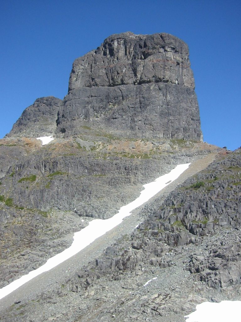
Warden Peak 2006 – Lindsay Elms photo
Second Ascent of Mount Colonel Foster
Reported in The Canadian Alpine Journal Vol. 50, 1967. p. 55/56.
By Ralph Hutchinson
The first ascent of the South [Southwest] Peak of Mt. Colonel Foster in Strathcona Park, Vancouver Island, was made in 1957 by a party that climbed a couloir up the west face. On joining the summit ridge, which runs north and south, they said a route looked feasible from the south if the descend could be made from the subsidiary summit to the south. On August 1, 1966, six climbers from the Island Mountain Ramblers’ camp on the ridge that divides the watershed of the Elk River and the Wolf River, set off to traverse the subsidiary summit to the south (known in this article as the East Peak) and climb the ridge route to the main South Peak. By 11:15 a.m. all members of the party were on the summit of the East Peak after an interesting and pleasant grade 3 rock climb. The weather was beautiful and for half an hour the party considered the route off to the north which looked both exposed and difficult. The ridge to the South Peak from the East Peak is obvious in that there is only one practical route. After rappelling 25 feet to an insecure stance, three of the party, Ron Facer, Mike Hanry, and I proceeded gingerly along the knife-edge ridge. This is spectacularly exposed and dips to a notch where a gully joins the ridge before rising up to the South Summit. The rock was firm and provided good holds and good grade 4 climbing. At the point where the ridge ended, there were alternative routes; one was northerly up the rock face which was probed by Ron Facer. The alternative route led down to the west in the gully for 200 feet, and then by a traverse to the north joined a branch of the same gully. This latter route was chosen and led up, first under a colossal chock stone and then onto a point on the ridge to the south of the summit. From there an easy scramble took us onto the pinnacle that forms the summit tower. It was now 2 p.m. and we dug into the cairn and found the 1957 record in excellent condition. Our ambition had not been sated and as the centre peak on the ridge is almost as high as the South Peak, we investigated the route along the ridge off to the north. We were now some distance from the campsite and did not have any bivouac equipment so we felt no more than mild curiosity to see if the ridge would go; on finding difficult climbing ahead, we retraced our steps and rejoined our friends Mike Walsh, Ray Paine and Bob Tustin. Mount Colonel Foster has a remarkably dramatic east face. This forms an arc around a lake at 3000 feet and the face rises to the summit ridge at 7000 feet in an uninterrupted sweep. There are several small couloirs up the face and towards its southerly side are two snowfields perched somewhat precariously on the rock. The three of us who had been to the South Summit decided to make a bid for the centre peak by traversing between the two snowfields. If that could be achieved, then the ridge could be gained from the top of the upper snowfield without too much difficulty, and lead to the base of the centre peak. The Bitterlich [Ulf and Adolf] brothers had tried this route in 1955 although we did not know this at the time. We were able to gain the top of the first snowfield without untoward difficulty although the climbing was interesting and exposed. From there we made several false leads in our endeavours to get over to the second snowfield. Some hours later the attempt was abandoned after some extremely difficult leads had been made by Ron Facer. At this point it is most difficult to see the route as parts of the mountain overhang and the mountain is very broken up partly as a result of the strata and partly as a result of a large earthquake about 20 years ago. The earthquake had its advantages as there is very little loose rock on the east face of the mountain. The route chosen across the east face is feasible and when mastered will provide a varied and excellent ascent to the unclimbed centre peak.
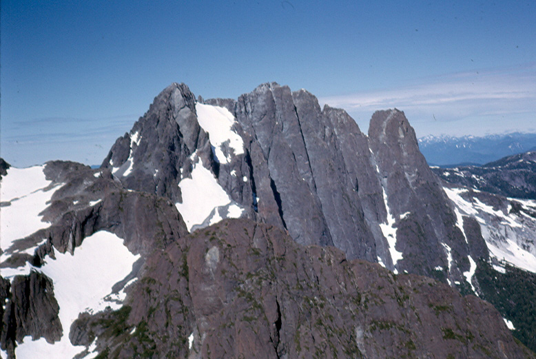
The sweeping East Face of Mt. Colonel Foster taken while flying in to Elk Pass July 30, 1966 – Ralph Hutchinson photo.
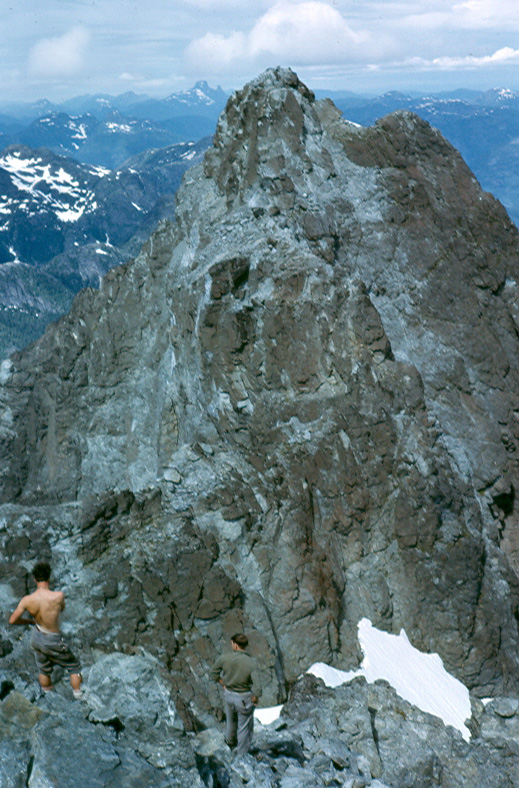
On the Southeast Summit of Mt. Colonel Foster looking towards the Southwest Summit, August 1, 1966 – Ralph Hutchinson photo.
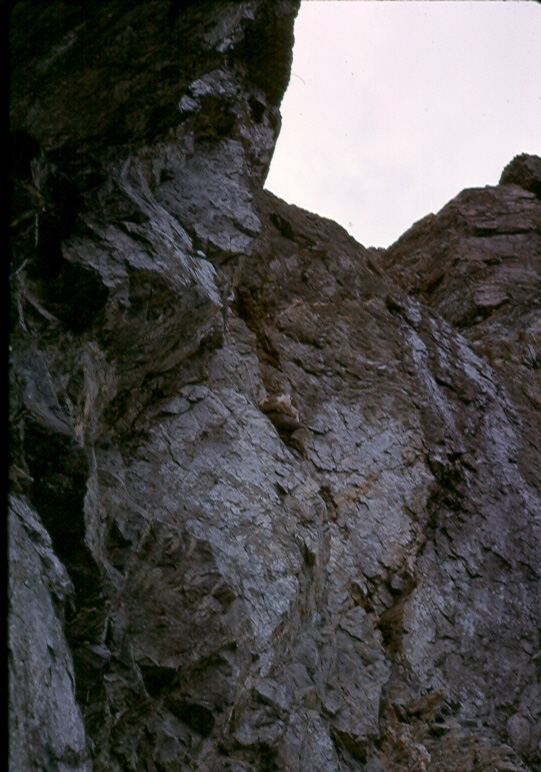
Climber (possibly Ron Facer) ascending the west gully up to the ridge on the Southwest Summit of Mt. Colonel Foster, August 1, 1966 – Ralph Hutchinson photo.
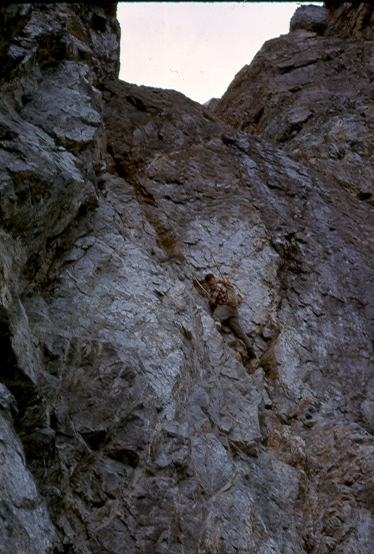
Climber (possibly Ron Facer) ascending the west gully up to the ridge on the Southwest Summit of Mt. Colonel Foster, August 1, 1966 – Ralph Hutchinson photo.
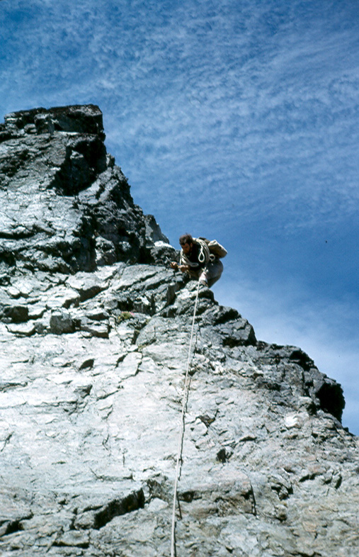
Climber (possibly Ron Facer) on the final ridge to the Southwest Summit of Mt. Colonel Foster, August 1, 1966 – Ralph Hutchinson photo.
Week on Elk-Ucona Pass
July 30 to August 6, 1966.
Reported in the Timberline Tales of the Island Mountain Ramblers Number 3, January 1967. p.10/11/12/13.
By John Cowlin and Elizabeth Guilbride
July 30 – A party of 11 met the Okanagan helicopter at the burrow pit beside the junction of the Gold River and Cervus Creek. At 20 minutes per return flight we soon travelled in pairs, effortlessly but expensively, up the Cervus Valley, between Elkhorn South and Rambler North to the snow-covered pass. A greeting party consisting of Ray Paine and Dave Birch who had hiked in from Buttle Lake, and Mike Walsh and Doug Jones [hiked in the Elk River] were glad to see us. After setting up our tents at various locations where we would find a snow-free clearing near the pass, we meet by a campfire and planned to climb Rambler Peak the following day.
July 31 – Rambler Peak, Ron Facer leader (second ascent). A party of 12 left the pass at 8:30, ascended the south saddle to elevation 5,700’ and scrambled to the snowfield [via Spiral Gully] to the east side of the main peak of Rambler, where we divided into two groups. Mike Hanry and Ray Paine climbed the East face of the main peak, while the rest of the party scrambled up a chimney on the north-east slope, reaching the summit soon. After lunch Ron Facer and Mike Hanry made a first ascent of the south peak [Rambler Junior] of Rambler by a traverse along the east face and back up the southerly skyline ridge to the summit. The rest of the party watched and dozed on a nearby knoll in the warm afternoon sun.
August 1 – Mt. Colonel Foster 7,000’. In 1957 the first ascent of the South Peak [Southwest Summit] of Mount Colonel Foster was made by Ferris Neave, Hugh Neave and Karl Ricker. This was reached by climbing the couloir that led up the west face, and the party had previously bushwhacked up Butterwort Creek to gain the gully. (The Canadian Alpine Journal, Vol. 49, 1957. p.35). On August 1, a party consisting of Mike Walsh, Ray Paine, Bob Tustin, Mike Hanry, Ron Facer and Ralph Hutchinson, set off intent on climbing the subsidiary summit to the south, known in this article as the East Peak [Southeast Summit]. That peak had been climbed first in 1954 by Syd Watts, Pat Guilbride, Bill Lash and Mallory Lash, [in fact the first ascent was in 1936 by Alfred Slocomb and Jack Horbury] and we hoped to negotiate the intervening ridge. By 9:30 we were on the col to the south of the mountain and by 11:15 had reached the East Peak. The weather was glorious and this fine mountain invited some further investigation, so we reconnoitered the ridge leading to the north, and after a great deal of hesitation, three of the party took the plunge and rappelled onto the knife-edge ridge that dipped down before rising up to the South Summit. This ridge was spectacularly exposed and in places appeared to overhang the East Face, but the rock was firm and had good holds. At a point where the ridge ended there were alternative routes: one was northerly up a rock face which was probed by Ron Facer. The alternative was down the gully to the west for 200’ and then traversing to the north to join a branch of the same gully. This latter route was chosen and led up, first under a huge chock stone, and then on to a point on the ridge south of the summit. From there an easy scramble took us onto the pinnacle that forms the summit and we found the 1957 record in remarkably good condition. It was now 2 p.m., so we investigated the route off to the north, but found no practical way of carrying on the ridge. After spending some minutes in that area we retraced our steps. As none of us had mastered the art of rappelling uphill we were concerned about the last few feet up to the East Peak. When we returned there we found a fine crack, which in conjunction with a right angle in the rock formation that gave plenty of purchase for the back, enable us to rejoin our friends without their assistance. On the South Summit had been Ron Facer, Mike Hanry and Ralph Hutchinson.
August 2 – Restful day. After two energetic climbs and still good weather, the party took a day of rest. The Guilbride’s [Pat and Elizabeth] hiked around the lake immediately south of the pass, the boys hiked to the lake just south of Colonel Foster, while Syd Watts, Doreen and John Cowlin hiked onto the ridge southwest of the campsite. Ralph Hutchinson and Ray Paine remained at camp to relax and catch up with domestic chores. During the morning Doug Jones, Gregg Shoop and Gregg’s lass from London reluctantly left the party and took a slow twelve hours hike down the Elk Valley to the Gold River Road and civilization.
August 3 – El Piveto Mountain 6,400’ Leader Pat Guilbride (First Ascent). A party of five left the pass at 7:30, climbed the south spur of Rambler Peak and dropped down to a lake at elevation 4,400’. Ray Paine, Mike Walsh and Bob Tustin followed, but the latter two left their packs at the lake as they had planned to hike to the Forbidden Plateau to join the second week group. From the lake the two parties climbed the westerly slope to the northerly ridge of an unnamed 5,600’ bump [Cervus Mountain] upon which a cairn was erected. Descending the easterly slope, we crossed a snow saddle and started up El Piveto Mountain. From the pass we veered south-easterly to scramble up the southerly rock to the snow slopes which led to the summit. Near the summit this mountain is a mass of conglomerate cemented together with reddish rock. Mike Walsh had beat us to the top and erected a cairn, after which w saw Bob and ray climbing the lower northerly peak and joined them. Just before Bob and Ray reached the summit ridge, a large rock dislodged, gashing Ray’s leg and bruising Bob’s chest. While Bob escaped with bruises, Ray had to be bandaged with his undershirt, the only available bandage. From the summit of El Piveto we enjoyed a magnificent view of the Golden Hinde, McBride, Cobb, Con Reid and Rambler, to name some of the higher peaks. We also saw the south fork of the Wolf River and even part of Buttle Lake. Ray, Mike and Bob descended slowly by the same route to the lake where Mike and Bob picked up their packs and hiked southerly to a round lake at elevation 3,800’ where they camped. The rest of the party retraced their steps to camp, taking about twelve hours for the return trip. Those making the first ascent were Mike Walsh, Bob Tustin, Ray Paine, Pat and Elizabeth Guilbride, Syd Watts, Doreen and John Cowlin. At the same time Ralph Hutchinson, Ron Facer and Mike Hanry climbed the northerly ridge of Rambler Peak to look across and find a possible route up the North Peak of Colonel Foster.
August 4 – Three days later Mike Hanry, Ron Facer and Ralph Hutchinson revisited Colonel Foster with the view to forcing a route across the East Face to the Centre Peak. There are two snowfields on the East Face and, if a party could negotiate the traverse from the southerly snowfield to the upper snowfield, the route should be both varied and fast. This opinion had been reached after considering the ridge route from the south. It appears the Bitterlich Brothers [Ulf and Adolf] tried the East face in 1955, but were unsuccessful, though we did not know this at the time. Unfortunately, we were no more successful, and several false leads used up valuable time and energy. After some hours the attempt was abandoned, but not before some impressive climbing on the part of Ron Facer, amply protected by safety pitons and well encouraged by the abuse of his belayers who preferred larger holds and less exposure. The climbing on the East Face is excellent as the rock is firm, the exposure is dramatic (the face sweeps down 4,000’ to the lake and is well guarded) but the holds are minimal and smooth. When this route is mastered, it will provide a fine climb to the centre peak.
Mt. DeVoe. The Thursday, another fine day, saw varied hikes, depending upon the desire of the participants. Pat and Elizabeth Guilbride hiked southerly to Mt. DeVoe by way of the ridge south of the pass, the west shore of the circular lake and connecting ridge to the summit. Syd Watts, Doreen and I [John Cowlin] set out to see if any Douglasia was growing on the southerly face of Rambler Peak. This pretty pink flower which was thought to be native only to the Olympics, has been found on the higher peaks in Strathcona Park, above the level of the last ice age. We found a bright clump well above the level of vegetation, and completely surrounded by bare rock.
August 5 – As this was the last day before the helicopter was due to come and pick us up, we decided not to go far from camp in case it came in early to leave a message. So five of us hiked up on the south spur of Rambler Peak and spent an easy day taking photos, looking for wild flowers, and eating a very leisurely lunch. The party consisted of Syd Watts, Doreen and John Cowlin, and Pat and Elizabeth Guilbride.
August 6 – When the helicopter arrived at 10 a.m. we were already to load the equipment just as soon as it landed. At $140 per your rental, no minutes can be wasted. Shortly after 11 o’clock the seven of us were out in four trips. Mike Walsh and Ron face had walked out the previous day. The weather, the challenge of the mountains, the flowers, and most important, the company made this a memorable week’s holiday.
Postscript
By Lindsay Elms
After climbing The Behinde, Mike Walsh fell and sprain his ankle and needed helicopter evacuation. Bob Tustin rushed out to Buttle Lake and got help for his injured mate. Many of the others from the previous trip—Syd Watts, Doreen and John Cowlin, Doug Jones—returned to Forbidden Plateau for a second week of hiking and climbing with other members. Bob Tustin [and Don Apps who joined this part of the trip] eventually caught up with the party on Monday night at Circlet Lake. Doreen Cowlin takes up the story.
August 9 – Late last night I awoke to hear two unknown visitors come into our camp, and wondered just who wandered around this area in the middle of the night. My curiosity hurried me out of the tent in the morning and I discovered that the late arrivals were Bob Tustin and Don Apps. The last time I saw Bob was six days ago. On that day Bob and Mike Walsh left the group near the Elk-Ucona Pass with plans to backpack across to the Golden Hinde, then westerly to Buttle Lake and the Forbidden Plateau. On the previous Friday [August 5], as Bob and Mike were descending The Behinde when Mike sprained his ankle. Bob made sure that Mike had sufficient food and was comfortable, then continued alone over the Marble Plateau and down the new trail, arriving at Buttle Lake Saturday night. All day Sunday Bob was busy signaling and calling to attract the attention of fishermen to take him across the lake. In the evening Jim Boulding from Strathcona Park Lodge was passing by in his boat and came to Bob’s rescue. Arrangements were made for a helicopter to pick Mike up from the south-easterly ridge of the Golden Hinde. Bob and Don Apps left Mt. Becher at 4 p.m. on Monday and walked the 18 miles by way of the Becher Trail and with a flashlight to Circlet Lake.
Participants: Mike Hanry, Ralph Hutchison, Ron Facer, Bob Tustin, Syd Watts, Mike Walsh, Elizabeth and Patrick Guilbride, Doug Jones, Gregg Shoop and his girlfriend, Doreen and John Cowlin, Ray Paine, Dave Birch.
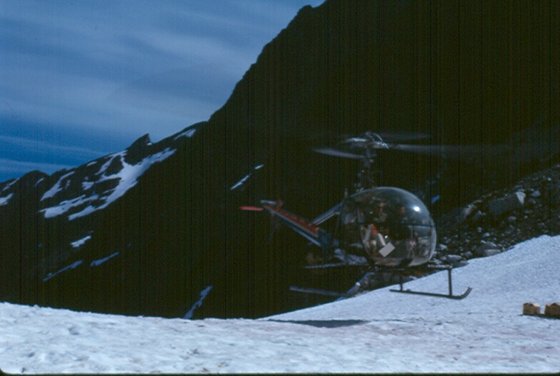
The helicopter flying climbers to Elk Pass, July 30, 1966 – John Cowlin photo.
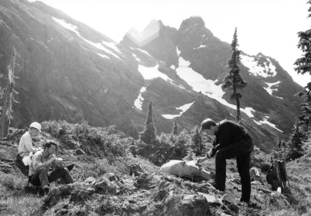
Climbers (L to R – Doug Jones, Mike Walsh, Bob Tustin) in the upper branch of the East Elk River below Rambler Peak, 1966 – Bob Tustin photo.
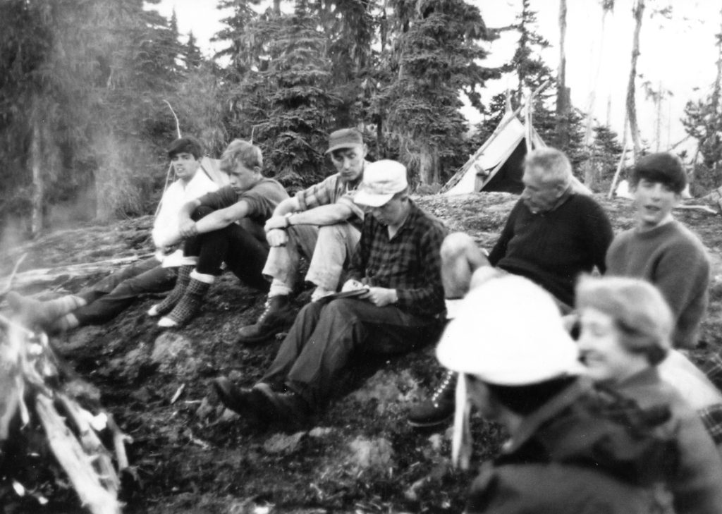
Syd Watts (hat), John (writing) and Doreen Cowlin (lower right) and others at camp on Elk Pass, 1966 – Bob Tustin photo.
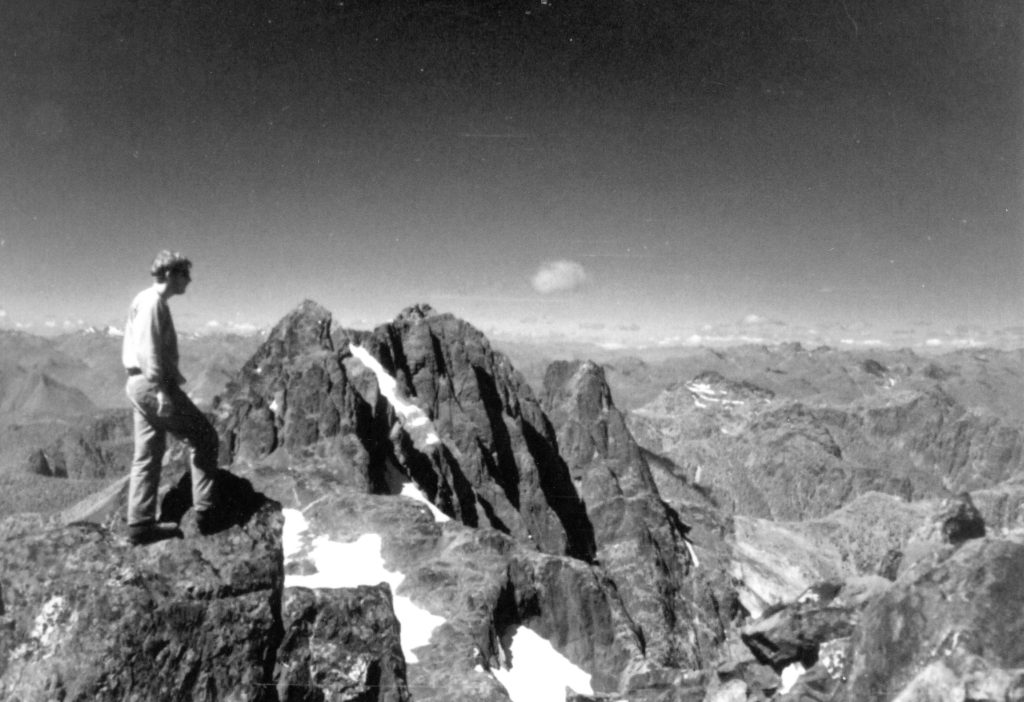
Bob Tustin standing on the summit of Rambler Peak, 1966 – Bob Tustin photo.
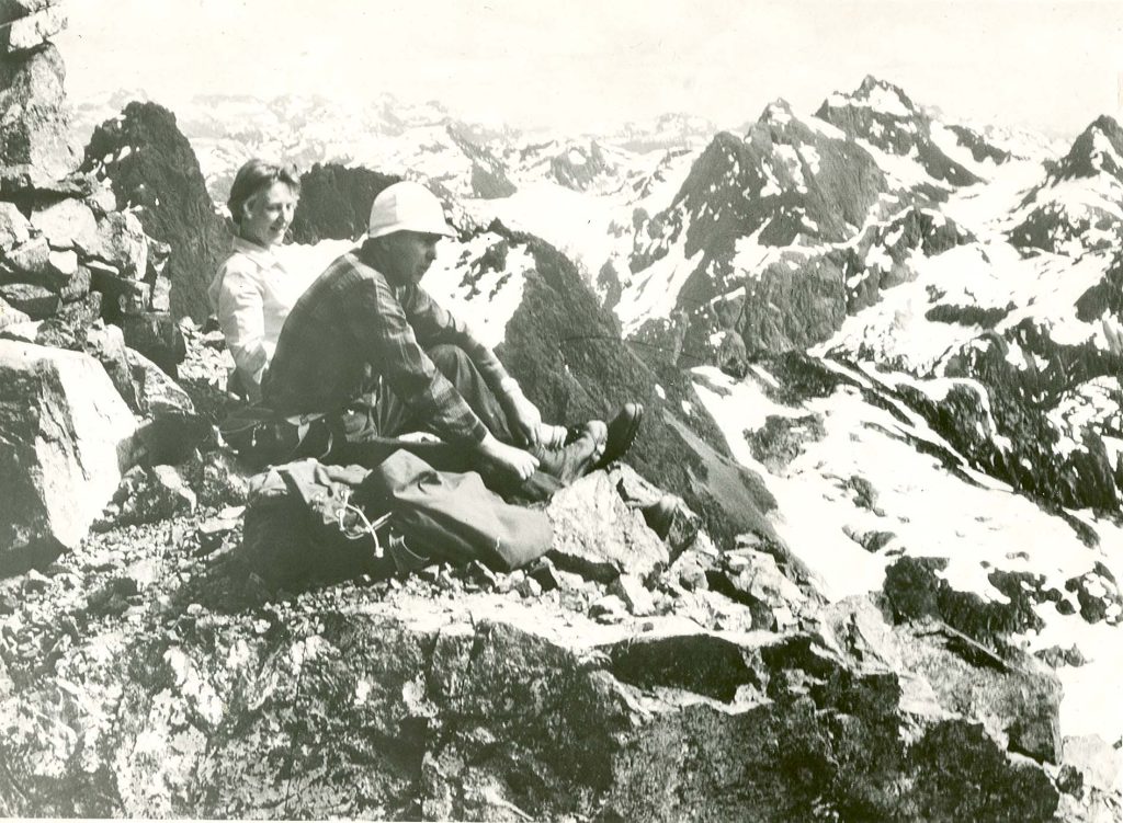
John and Doreen Cowlin sitting on the Southeast Summit of Mt. Colonel Foster, 1966 – Bob Tustin photo.
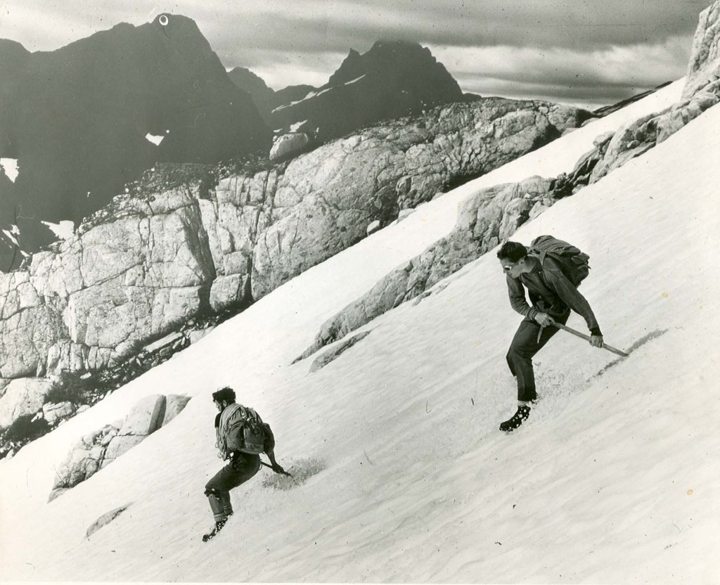
Bob Tustin and Ron Facer glissading off Rambler Peak, 1966. Bob Tustin photo.
Copter Rescues Climber
Flyer Plucked off Mountain
Reported in The Vancouver Sun Wednesday, August 10, 1966. p.10.
COMOX—An injured airman was plucked by helicopter from a 4,200-foot mountain ledge near here Monday after spending two nights alone on the mountain. Leading aircraftman Michael Walsh, 21, sprained his foot while climbing with a friend [Friday August 5]. The friend, civilian Bob Tustin, hiked down the mountain to give the alarm while Walsh waited for rescue. “It was a difficult rescue job because the country around there is so rugged,” said Lieutenant Commander E.L. Hauff, pilot of the U.S. coast guard helicopter which picked up Walsh. The U.S. coast guard had to be called in to help by RCAF Comox because the only RCAF helicopter was out of service. The U.S. helicopter arrived at about noon Monday at Walsh’s mountain camp site above Burman Lake, 33 miles west of Comox. “We could not set down there because it was so rocky,” said Hauff. “As soon as we arrived, we saw Walsh standing beside his tent and waving at us so we knew he could walk. We lowered a steel rescue basket down to him, he climbed in and we hoisted him into the plane.” Hauff said the young man appeared to be in good condition and good spirits and received medical treatment on the flight back to Comox from a pararescue crew member. Walsh, who is stationed at Comox air force base, comes from Shediac, New Brunswick. He was treated at the base hospital for a severely sprained foot and sent home on leave.
Mountain Climber Undaunted by Fall
Reported in The Vancouver Sun Thursday, August 11, 1966. p.55.
COMOX—LAC Michael Walsh says he will be back climbing mountains this weekend. A 30-foot fall, a badly sprained ankle and two nights alone on a mountain haven’t discouraged he eagerness for climbing. “I’ll hobble off somewhere this weekend and climb a few mountains,” Walsh, 21, said Tuesday in a telephone call. Walsh was picked up by helicopter from a 3,700-foot mountain ledge in Strathcona Park on Monday after spending two nights alone on the mountain. “Bob Tustin, a friend of mine, and I were climbing the west peak of the Golden Hinde [The Behinde] west of Buttle Lake on Friday [August 5],” said Walsh. “We were about the 6,200-foot level when I slipped and fell about 30 feet onto rocks. Then I slithered about another 100 feet down the mountain. My ankle hurt badly but, with Bob’s help, I managed to make it to about the 3,700-foot level. I thought I might be able to walk by morning, but I couldn’t. So – it was Saturday morning then – Bob started to hike out on his own to get help. I had a tent and a fair amount of food. It rained all day Sunday, but I made out all right.”
Alpinists Open Trail for Public
Reported in The Daily Colonist Sunday September 18, 1966. p.12.
By Alec Merriman
The people who roam over 130 miles of Strathcona Park mountain ridges and climb the highest peaks on Vancouver Island are now building a six-mile-long trail that will bring the alpine areas within reach of just ordinary recreationists. The Marble Plateau Trail will take recreationists from Phillips Creek on the west shore of Buttle Lake to the Marble Plateau, above the timberline to the 5,000-foot level. There recreationists will find meadows filled with alpine flowers in late July and early August, plenty of browsing deer and a myriad of more than 20 small unnamed lakes, which may or not contain trout, but which could easily be stocked. Island Mountain Ramblers have undertaken construction of the trail as its own special centennial project. Membership of that club comes from all over Vancouver Island.
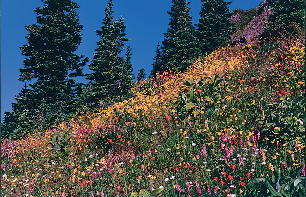
Flowers in full bloom on Marble Meadows 1970’s – Syd Watts photo
Big Project
President is John Cowlin of the Saanich engineering department, who heads the Outdoor Club of Victoria which often joins forces with the Ramblers for ambitious undertakings. From Phillips Creek to Marble Plateau is about two miles as the crow flies, but will be six miles by graded trail. Club members have already completed about 1½ miles of the trail which will be a three or four-year construction project. It will be a series of switch-backs to climb 4,200 feet in four or five hours at an easy climbing rate for the average recreationist. The Phillips Creek start of the hiking trail has already been marked by a rustic sign and the new Strathcona Park Western Mines road down the east shore of Buttle Lake will provide an easy jumping-off point by boat from the proposed campsite, adjacent to the Western Mines townsite at Shepherd-Ralph River.
Ideal Campsite
Phillips Creek is a primitive provincial campsite across the lake and a mile or so north of Shepherd-Ralph River. The provincial parks branch has given approval to the club to build the new trail. The parks branch is working on another Strathcona Park Trail at Wolf River on Buttle Lake, close to the northern boundary of Strathcona Park and has finished about one-quarter mile of the trail. Mr. Cowlin says Marble Plateau’s score of lakes and little clumps of trees make it an ideal spot for a primitive campsite. Because of the limestone formation in the ridges there are plenty of fossils for rockhounds and collectors to find. In season the meadows are a mass of alpine flowers – blue woolly lupins, yellow arnica, purple mountain daisy, orange paintbrush and yellow monkey flower, to mention a few of the more prolific varieties. From Marble Plateau there is ample opportunity for more ambitious mountain rambling. Marble Peak, 5,300 feet high may be reached in a four-hour hike there and back with no special equipment required, although it would require some scrambling. Mt. McBride, 6,829 feet high, makes a 12-hour return trip and it is a walk all the way. The Island Mountain Ramblers are marking the route with tape as they design the properly graded and engineered trail. They have marked the route for about half a mile beyond the 1½ miles of completed trail. From there hikers can follow the ridge to the Marble Plateau. Volunteer workers plan to complete the trial mile by mile as they go, not to build a rough trail first and then complete it.
Several Trips
The Island Mountain Ramblers held several work parties on the trial this summer, but that hasn’t stopped them from making several trips and assaults on Strathcona park’s mountains. On the Labour Day Week-end Mike Walsh of the Comox Air Force base made the top of Elkhorn Mountain, second highest peak on the Island and reputed to be the most difficult of the high mountain peaks to climb. It has probably only been climbed six or seven times before, two of these last year. The Golden Hinde, 7,219 feet, is the highest on the Island, but comparatively easy to climb,
Long Climb
Don Apps of Cumberland and Doug Jones of Courtenay were with Walsh on the trip, but only Walsh got to the top. Earlier this year a party of Island Mountain Ramblers climbed 5,997-foot Puzzle Mountain with four of them—Doreen and John Cowlin of Victoria, Keith Morton of Courtenay and Syd Watts of Duncan—making the top. Puzzle Mountain is south of the Elk River Road in Strathcona Park and is reached from the next ridge west of Elkhorn Mountain. The climb took 13½ hours. In August, the Ramblers climbed 7,000-foot Mt. Colonel Foster, 6,900-foot Rambler Peak, 6,400-foot El Piveto Mountain marking the first time the latter mountain has been climbed by anyone on record. The Comox District Mountaineering Club has spent this summer marking trails and special places of interest in the Forbidden Plateau country as its centennial project.
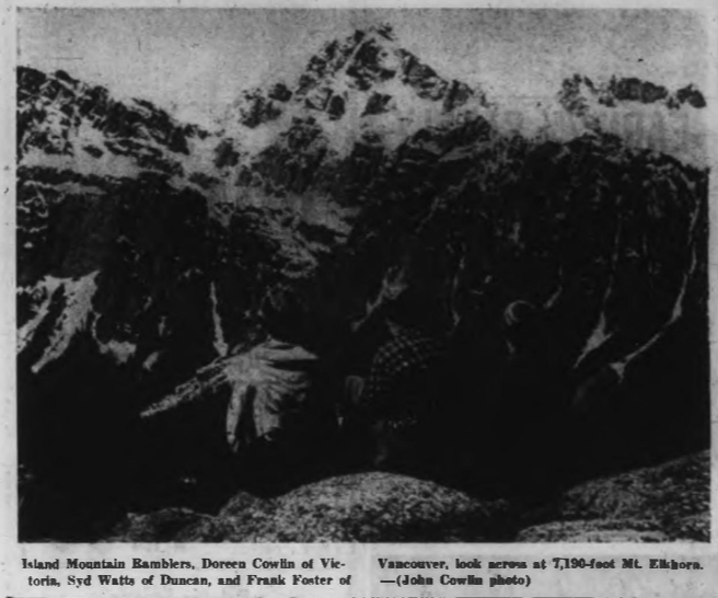
Island Mountain Ramblers, Doreen Cowlin of Victoria, Sydney Watts of Duncan, and Frank Foster of Vancouver, look across at 7,190-foot Mt. Elkhorn. — (John Cowlin photo)
1967
ACCVI executive:
Chair – Dudley Godfrey
Secretary – Kathleen Tuckey
Events:
July – Herb Warren, Joyce Clearihue, Ruth Masters, Vi Chagranes, and Phyllis and Bill Hill are part of a large Victoria Outdoor Club trip to Hansens Lagoon.
July – Ralph Hutchinson and others make the 1st ascent of Mt. British Columbia as part of the Yukon Alpine Centennial Expedition.
July – Paddy Sherman and others make the 1st ascent of Mt. Manitoba as part of the Yukon Alpine Centennial Expedition.
Section members who passed away in 1967: Alan Campbell, David Gillies.
He Climbed Every Mountain Forded Every Stream
Alan Campbell Surveyed the Rocky Mountain Boundary between Alberta And British Columbia
Reported in The Daily Colonist (The Islander section) Sunday January 8, 1967. p.4, 5, 6.
By Norman Senior
Locating the exact position of the mountain peak border was a tremendous undertaking carried out half a century ago by a Boundary Commission. The man who knows most about it, who spent 12 years on the project, and who almost literally “climbed every mountain, forded every stream,” between the United States border and the point where the inter-provincial boundary leaves the mountain chain to follow the 120th meridian northward, is now living in quiet retirement at 1128 Dallas Road in Victoria. He is Alan J. Campbell, former chief topographer for British Columbia. In the technical sense he retired from the provincial government service about 15 years ago, but so valuable in this knowledge of British Columbia’s mountain terrain that he went right on taking out field parties for the survey branch for long years afterwards. Colleagues say no man living knows more about the Rocky Mountains and the mountains of British Columbia than A.J., as they habitually call him. The surveys that he has conducted over almost every part of the province. In locating, marking and mapping the Alberta-British Columbia boundary in the 12 years from 1913 to 1924 the surveyors used a method not long previously introduced into this country by the famous Dr. Edward G.D. Deville, Surveyor General of Canada. It is known as phototopographical surveying and although the system was first employed in other countries the Alberta-British Columbia boundary survey stands as unquestionably the most comprehensive project to which it has ever been applied. A serpentine line whose extremities lie 350 miles apart as the crow flies has so many sinuosities that the ground covered by the survey would be several times the straight-line distance from point to point. The 12 years undertaking involved up to five months a year in the field, with the remainder of the time spent in the studies or office reducing the photographic evidence and field notes to definitive maps. A legal description of the boundary had been established many years previously, prior even to confederation, by an Act of the British Parliament. It is found in the Act of 1856 writing the crown colonies of Vancouver Island and British Columbia, the centenary of which event the provinces recently celebrated in colorful ceremony. The territorial limits of British Columbia are defined as follows:
“1. Until the Union, British Columbia shall comprise all such territories within the dominion of Her Majesty as are bounded on the south by the territories of the United States of America, to the west by the Pacific Ocean and the frontier of the Russian territories in North American, in the north by the 50th parallel of north latitude, and to the east by the Rocky Mountains and the 120th meridian of west longitude . . .”
“2. After the Union, British Columbia shall comprise all the territories and islands aforesaid and Vancouver Island.”
In the light of later knowledge some of that language is extraordinarily vague, as Canadians found as their cost in its reference, for instance, in “the frontier of Russian territories.” However, the Acts easy assumption that it had settled the boundary between British Columbia and the rest of Canada by its reference to the vast wilderness of the Rocky Mountains appears to have given rise to no difficulty until shortly subsequent to the creation of the Province of Alberta in 1905. But when coal mining was commenced in the Crow’s Nest Pass, there developed legal doubts about which province had licensing and regulatory jurisdiction. The provincial administrations were also uncertain where in several of the most traveled passes their respective responsibilities began and ended in such important matters as road building and policing. Accordingly, the three governments of Canada, Alberta and British Columbia entered into negotiations to clarify the situation. Firstly, they agreed that “between the international boundary (of the Unites States) and the 120th degree of longitude the interprovincial boundary is the line dividing the waters flowing into the Pacific from those flowing elsewhere.” In short, the boundary was to be the watershed. That simple work “elsewhere,” covers a lot of territory. Some of the waters in question flow into the Arctic via the Mackenzie, some into Hudson Bay through Saskatchewan, others to the Gulf of Mexico by way of Missouri and Mississippi. Following agreement on the watershed line, the next step was the appointment of a three-man boundary survey commission, charged with the task of locating the physical boundary on the ground, marking it clearly, and recording it on definitive maps. Members of the Commission were Messrs. J.M. Wallace for Canada, B.W. Cautley for Alberta, and Arthur O. Wheeler for British Columbia. Responsibility for defining their task, which in the first instance covered only that portion of the boundary between the United States and the 120th meridian, was nominally signed to the three surveyor-generals, but was in fact, by mutual consent, largely carried out by Dr. Deville, who issued the written instructions. Mr. Cautley was entrusted with surveying the principal passes, which work he carried out by normal procedure of transit and chain. Mr. Wallace was merely to visit the operations occasionally so that he could assure the federal government that the work was being carried out correctly. (In the event, he withdrew from participation after the first year or two, when the federal responsibility was assigned to Mr. Cautley, since the interests of Alberta and Ottawa were identical.) Pertinent in this narrative is the following sentence in the instructions:
“Mr. A.O. Wheeler shall be in charge of the topographical survey and the establishment of survey measurements on the points adjacent to the passes . . .”
Selection of Mr. Wheeler for this, the roughest and undoubtedly most difficult part of the undertaking, was influenced by the fact that he had already distinguished himself in such work through his survey of the Selkirk Range in 1901 and 1902. The results of that survey he recorded in a volume published by the department of the interior and entitled The Selkirk Range, British Columbia. Additionally, Mr. Wheeler’s taste for mountaineering had led him to help found the Alpine Club of Canada, of which for many years he was the director. Most important was that in the Selkirk survey Mr. Wheeler had acquired valuable experience in the phototopographical technique which it was found desirable to employ in the boundary survey. In crude milage the distance covered by Mr. Cautley’s party in the passes would probably account for about five per cent of the aggregate length of the boundary line between the 120th meridian and the U.S. border. But since it is in the passes that the traffic exists, it was here that every foot of the line had to be precisely marked on the ground as well as recorded on maps. (This is probably the place to mention that when the survey was completed Mr. Cautley went on the locate the boundary along the 120th meridian through the scrub timber and the plains to the north.) To carry out the formidable task of mapping the wilderness of mountain peaks assigned to Commissioner Wheeler that gentleman engaged the services of a former associate and business partner, Alan J. Campbell. Mr. Campbell was born and reared in an Ontario town and after graduating in engineering at University of Toronto qualified as a Dominion land surveyor in 1909. He moved west to serve with Mr. Wheeler, topographer for the department of the interior, at Calgary. Although topographical surveying was the function for which the office was established, Frank Oliver, minister of the department at the time, had other ideas that he regarded as of greater value. He wanted more and ever more land laid out for agricultural settlement. Messrs. Wheeler and Campbell dutifully completed several land classification maps under this regime, but since that kind of work did not greatly interest Mr. Wheeler he resigned and set up his own private firm of Wheeler, Campbell and McCaw [Robert McCaw]. Shortly afterwards for personal reasons he moved his home to Sidney, where his illustrious father-in-law, the late Professor John Macoun, the noted botanist credited with introducing the growing of wheat to the Canadian prairies, continued his research in semi-retirement. Mr. Campbell took his B.C. land surveyor examination in 1912 and has lived int eh coastal province ever since. His appointment to carry out field work under Commissioner Wheeler’s portion of the boundary survey occurred simultaneously with the move to British Columbia. For Mr. Wheeler and his fellow members of the Alpine Club of Canada, as for thousands of young and athletically-minded men and women throughout the world, mountain climbing is a thrilling sport. When Alan Campbell was assigned to the boundary survey, he realized that he had never been on a mountain in his life. “In my first year or so,” he recalled recently, “whenever I climbed a high mountain, I was mortally afraid I’d never be able to get down.” Colleagues have said since that today Canada possesses no more expert mountaineer than Alan Campbell and that nobody knows the Rocky Mountains better than he. Although to him mountain climbing is not and never has been a sport, he has always enjoyed the life, which yields him the kind of satisfaction that work well done brings to all skilled craftsmen and professionals. If evidence be needed that only highly competent mountaineers could carry out the duties, he undertook it is to be found in the following except from Page 15 of Volume 1 of the three-volume report presented by the Boundary Commission and published by the department of the interior.
“The work … is carried on by ascending to previously selected stations at the summits of the peaks, or to high points on mountain ridges that command a view of the area to be mapped. From these a series of views is taken and their direction established by the men of the transit theodolite, FREQUENTLY ENTAILING A PRECARIOUS BALANCING OVER DIZZY DEPTHS. Rock cairns are erected at the selected stations either in advance or at the time they are occupied, and are used for identification purposes … The chief advantage of the method is its rapidity for work in the field. It is much more rapid than any other than can be applied to the same class of country and the standard of accuracy is a high one … Only a small party, generally a surveyor and one or two assistants, is required to carry instruments, take the views, record the transit readings and build the rock cairns or other signals that may be erected to mark the stations it is desired to perpetuate. THE INSTRUMENTAL OUTFIT, ADAPTED BY MR. DEVILLE, WEIGHS ABOUT 45 POUNDS AND IS SO DESPOSED AS TO BE EASILY CARRIED EVEN WHEN THE CLIMBING IS DANGEROUS.”
The bold are mine and not found in the laconic official report. Mr. Campbell says he acquired his first knowledge of mountaineering science from a celebrated so-called “Swiss” guide Conrad Kain, who was actually a native of the Austrian Tyrol. His exploits in several countries formed the theme for a book Where the Clouds Can Go. Kain was engaged by the Boundary Survey Commission and in their first summer he demonstrated mountain climbing techniques and lectured about them until, as Mr. Campbell says, “he removed the fear.” Another valued member of the Wheeler-Campbell party in 1913 was a prairie farmer named Alfred H. Brinkman, whose hobby was collecting varieties of mosses. As early as 1911 he assisted in a survey of what is now Tweedsmuir Park and on several occasions was employed by the Alpine Club of Canada to set up camp sites for the annual climbs. Always he discovered new varieties of mosses for his fine collection. Hugh Boyd, well-known as an agricultural reported on the Winnipeg Free Press and later as radio commentator on similar topics, worked with the survey party for several seasons in the 1922 to 1924 years. Also retired and living a few blocks from the Campbell residence in Victoria is Alan (Spike) Thomson, a brilliant draftsman who worked in the field with Mr. Campbell for several seasons, then moved to Sidney where he produced most of the several hundred detail maps recording the boundary location. The relief map of the Banff area admired by thousands of visitors in the CPR station at Banff was his handiwork. Although, broadly speaking, the survey was begun in the south and progressed northward, the work did not consist of a direct march from one limit to the other. According to Mr. Campbell his first year’s work was from the Kicking Horse Pass southward to Mt. Assiniboine. In 1914 and 1915 the survey proceeded from the Crow’s Nest Pass to the United States border. In 1916, which he recalled as the best year for photography encountered throughout the entire 12 seasons, he worked north from the Crow’s Nest Pass until the line was linked up with the Mt. Assiniboine program of earlier years. Following this the Campbell party progressed northwest from the Kicking Horse, while the Cautley party operated at Yellowhead Pass. The several years until 1921 were employed in completing the work between Yellowhead and the Kicking Horse, Mr. Campbell operating sometimes from one direction, sometimes from the other. Throughout this era Mr. Campbell said that it was necessary to gain access to the boundary region from the Alberta side, as the slopes upward from the Columbia are extremely steep. But when the undertaking entered the region north of the Athabaska River the surveyors criss-crossed the height of land a dozen or more times a season in pursuit of the easiest route to the summit. Of the 21 passes mapped by the Cautley party the most northerly was Robson. All passes to the north of Robson were left for the topographical crew. Among the instructions issued to the commission was that every monument and every cairn must be visible from the next line. This stipulation was met by the Campbell party erecting its cairns on the peaks of the mountains. In 1965, on a nostalgic return visit by helicopter to several of the highest points in Robson Pass Mr. Campbell found that cairns erected more than 50 years previously were standing unimpaired and as clearly discernable as on the day they were set up. Some idea of the amount of mountain climbing involved in the 12-year survey is conveyed by the fact that approximately 400 of those cairns were built at the average rate of 30 a season. In the passes Mr. Cautley was able to use cement in erecting monuments bearing brass plates, one facing each direction to indicate which side was Alberta and which was British Columbia. Conveying such material to the mountain tops was not practicable, but loose rock was usually readily available for cairn construction. At the end of each season Commissioner Wheeler and Cautley, who frequently accompanied their assistants in the field for short periods to check the operations, met to go over work carried out by the two teams of surveyors. It is a tribute to their objective integrity and to the efficiency of the field work that in only one case was there a definite conflict of opinion between the representatives of the two provinces. That difference arose in Phillips Pass, a part of the Crow’s Nest region, surveyed in the second year. Final settlement of the difference was not affected until more than 10 years later at the conclusion of the entire project. The point at issue is worth describing, as it illustrates the major field in which the commissioners and their assistants, were unable to find clear-cut evidence of the watershed, had to exercise discretion. At the summit of Phillips Pass is a small lake, about 100 yards wide. It has no visible outlet. All to the east is Alberta and to the west British Columbia, but the absence of evidence as to which way the lake drains led to a difference of opinion between the two commissioners. Mr. Wheeler observed that the east shore of the lake rose to a higher level than to the west. He contended in such circumstances that the only possible outlet was to the west. Mr. Cautley on the other hand, detected what might have been a spring well down the mountain side below the lake. The water from this spring flowed into an eastbound stream. Mr. Cautley contended that this was no spring, but the actual outlet of the lake. A proposed color test was for some reason not undertaken. Instead, the 10-year disagreement was resolved by adopting the judgement of Solomon. The lake was divided in half, boundary monuments were erected on each shore so that the line cuts across the waist of the lake. This solution, the commissioners frankly conceded in their report, was simply a compromise. Still it has served to this day without incident. The greatest difficulty in determining the exact line of the watershed was encountered in the swampy muskeg with which the mountain passes abound. It was an agreed principle, embodied in the instructions, that the conditions actually prevailing at the time of the survey should govern, even in the face of evidence that in earlier years or other seasons the flow of the water might have been in a different direction. It was this hard and fast rule that led to the rather surprising inclusion entirely within British Columbia of the whole of Mount Robson, known to be the highest peak in the Canadian Rockies. The report conceded that with the periodic advances and recessions of the glaciers the watershed could change from time to time. What the Boundary Commission was instructed to do was to record the situation as it actually existed on the surface at the time of the survey. So despite the great altitude of Mount Robson, the Commission had no alternative, on the evidence as found by the surveyors in 1922 and 1924, but to establish the line to the northeast of this lofty peak. From all slopes the drainage was seen to head towards the Fraser River and the Pacific. It may disappoint others, as it did me, to learn from the Commissioners’ report that this great mountain was not, as popular legend has it, named after one or other of the two illustrious Robson brothers who made a major contribution to the early development of British Columbia. One, John Robson, was premier; the other Ebenezer, is revered as a pioneer missionary. Although it was o special responsibility of the Boundary Commission to investigate the matter, they saw fir in their report to quote the reliable authority of H.J. Moberly that the mountain was named for the foreman of a hunting party long prior to the days in which the statesman and his missionary brother were sufficiently eminent to be so recognized. Two illustrations of the problem of determining the location of the watershed in muskeg country may be given, one as described to the writer by Mr. Campbell, the other quoted from the official report. Aa Fortress Lake, about 50 miles south of Jasper, the generally northwest-southeast direction of the boundary is broken by a deep bay projecting westward. Here Mr. Campbell encountered an unusual phenomenon in that Chaba River, which flows north to the Athabaska on the Alberta side, is higher than the nearby lake to the west, so that a short and easily opened channel would divert the whole of Chaba River into Fortress Lake, thus placing the entire river basin, a tract of substantial area, in British Columbia. The assumption that some such channel had existed in the not too distant past was almost irresistible, but Mr. Campbell said the commission was bound by its instructions to deal with the situation as it was when the survey passed through. The boundary was driven between lake and river and thus it remains. The situation found at Carcajou Pass is graphically described in the report:
“The pass is of peculiar formation … the valley lies to the west of the Smoky, and is wide and thickly timbered for the first mile and a half of its course. The bottom then opens out in abroad morass where lie many ponds of water, several of considerable extent. Through this morass the stream divides into numerous channels, of which by far the greatest number and volume flow northwesterly to form the headwaters of Holmes River, the lesser number flowing northerly to unite later in the bed of Carcajou Creek. Somewhere in this indefinite morass is the watershed, but as the whole is more or less under water, it is difficult to say where it lies …”
A hint of what the survey involved in the matter of physical exertion is given in the statement that for mapping the Bess and Carcajou Passes nine camera stations were occupied as follows:
“Chown Creek N., No. 1, at 7,592 feet; Chown Creek S., No. 2, at 7,912 feet; Chown E., at 6,370 feet; Bess S.A.E., at 8,219 feet; Bess S.W., at 8,490 feet; Mt. Jessie, at 8,702 feet; Carcajou Creek N., at 7,273 feet; Wolverine Mtn., at 9,110 feet; Wolverine Shoulder, at 8,405 feet.”
The photographic aspect of the operation have their own interest. In those days use of film was not general and the views were recorded on 6½” by 4¾” glass plates. For the first couple of seasons these were taken to the office at Sidney for developing and printing. Later, however, the department made its facilities at Ottawa available and the plates went there for processing. Of the thousands of plates exposed very few were lost or spoiled. One newly exposed lot had a narrow escape when the horse on which the plateholders were packed ran away to have a swim in a nearby lake. Nevertheless, the plates were recovered, dried off and, resultant prints were still clearly visible. Outdoor photography, of course, depends upon the weather. One summer the work was badly handicapped by forest fires. On another occasion—typical in the way—when Messrs. Wheeler and Campbell had toiled to an 11,000-foot peak near Laggan in bright sunshine, they were suddenly enveloped in quick-forming dense cloud for so long that Mr. Wheeler was about to abandon the attempt and leave the site for Mr. Campbell to cover on another day when just as suddenly the cloud moved away and the required photographs were obtained. Where the 120th meridian cuts across the mountain range it was found advantageous to establish the exact point of contact by working south from the level plain until the divide was reached. Thence northward to the 60th parallel Commissioner Cautley’s organization ran the straight boundary line along the meridian. Although the legal boundary was quite definitely established by law, knowledge of the exact location on the ground had to be ascertained and marked. Although the Alberta-British Columbia boundary is likely to remain as the most extensive phot-topographical survey on record it is not the only undertaking of its kind in this mountainous province. Following the completion of the boundary project Mr. Campbell entered the direct service of the British Columbia government as topographer, retiring a few years ago as chief of the division. Among numerous areas that he personally covered by photographic methods are the watershed serving the Greater Vancouver water district, the Coquitlam Lake area, Garibaldi Park and the territory around Mt. Alexander Mackenzie. Between 1941 and 1950 (by which time it will be realized Mr. Campbell was no longer a young man) he made a second survey of the British Columbia-Yukon border along the 60th parallel, running his line as high as 6,400 feet, mostly in bad weather. One of the privileges that fell to him in the boundary and other surveys was that of naming sundry mountains and passes. In this he says he preferred to employ descriptive terms rather than commemorate the names of persons. Thus Mallard Lake and Mt. Isosceles call for no explanation. It was on July 31, 1924, when the boundary survey was within weeks of completion that a deserved compliment was paid to Alan Campbell for his notable part in the undertaking. Arrangements were made by the several governments to unveil a memorial monument in Robson Pass, to commemorate the commissioner’s achievement. Mr. Campbell who had run the survey through this part of the boundary, was at the time far away at the northerly limits of his territory line when he received instructions to be present for this occasion. Only a hurried and rough journey enabled him to arrive in the park just in time to learn to his gratified surprise that the honor of unveiling the monument had been conferred upon Mrs. Campbell, who had been brought to the site for the occasion. In addition to the members of the Alpine Club of Canada who (perhaps not entirely by accident, since Mr. Wheeler was their director) were holding their annual encampment in the vicinity, the occasion was graced by official representatives of the three governments concerned. The official report presented to the government by the commission on completion of their work records that the selection of Mrs. Campbell to perform this ceremony was “a tribute to the excellent work done by her husband in the survey of the boundary.” (Obituary notice in The Daily Colonist Thursday December 28, 1967. p.21.)
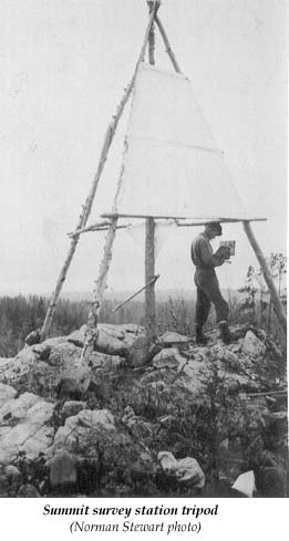
A typical survey station (unknown location) – Norman Stewart photo.
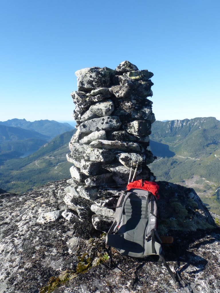
A surveyors cairn left on the summit of Mt. Kleeptee north of Muchalaht Inlet 2012 – Lindsay Elms photo
Slope Job Planned
Reported in The Daily Colonist Sunday February 19, 1967. p.21.
By Mildred Kurtz
PARKSVILLE – A winter sports ground development in the Mount Arrowsmith area would lengthen the tourist season. Parksville Chamber of Commerce has hailed the project, which will be a recreation spot for the local residents. Ken G. Campbell, a spokesperson for the group in the Alberni Valley hoping to form a company to undertake the project, outlined the scheme to a meeting of the chamber. Mr. Campbell is a ski enthusiast who has been working to promote the mountain. For 15 years he has felt it should be a winter playground. Biggest problem has been gaining access to the ski slopes. Skiers have hiked to the mountain for years, but Mr. Campbell said, “it is time the general public was able to enjoy this slope.” He said it is “terrific country,” and snow is between 15 and 20 feet deep. With an altitude of 3,500 to 5,200 feet. Mount Cokely, facing Mount Arrowsmith, is sheltered from the sea wind, and snow stays on the slopes longer than on most Island mountains now used for skiing. Th slope faces north so in January the sun doesn’t reach it, and even in July skiing is possible. Most of the ski area is above the timberline, with only scattered clumps of tree on the lower slopes. Negotiations are already underway with two logging companies and the CPR for permission to extend an existing logging road. The group also wants a parking area established, and then a rope tow would be installed. The parking area would be six miles from the Alberni Highway at Cameron Lake. Access would be 14 miles from both the Twin Cities and Parksville. The group hopes to have a chair lift eventually. The company will sell shares and increase facilities as funds become available, and if negotiations can be completed work on the site will start in the spring. Tentative name for the company is Mt. Arrowsmith Ski Lift Limited.
1968
ACCVI executive:
Chair – Bill Lash
Secretary – Pamela Mitchell
Events:
March 23/24 – First winter ascent of Elkhorn Mountain by Alaister Watts and Peter Busch.
March 24 – Syd Watts leads a party up Buttle Peak near Lake Cowichan.
May 4/5 – Marble Meadows trail work party led by Jack Ware.
May 26 – Mike Walsh, Peter Busch, Dick Martin climb Mt. Mitchell.
May 26 – Syd Watts leads a party up Mt. Whymper.
June 8/9 – Marble Meadows work party led by Jack Shark.
June 29–July 1 – Dick Martin leads a party up Mt. Laing.
July 13/14 – Bill Lash leads a party up Mt. Arrowsmith.
July – Mike Walsh makes first ascent of Mt. Colonel Foster.
July 27–August 4 – Memory Lake camp led by Syd Watts.
August 5/6/7/8 – A party of IMR’s climb Rugged Mountain and unnamed peak (Ya’ai Peak).
August 9 – Mike Walsh and Ralph Hutchinson climb Mt. Schoen.
August 11-17 – Bob Tustin, Mike Walsh, Doug Jones, Blair Paterson, Tom Volkers spent a week on Marble Meadows.
December – Rick Hudson, with Ferdi Fischer, Bash Atwell and Martin Hutton-Squire climb Mt. Kilimanjaro (5895m).
Section members who passed away in 1968: Ethel “Jean” Bruce, Gordon Cameron.
The First Winter Ascent of Elkhorn
March 23-24, 1968
An email letter from Alastair Watt to Lindsay Elms
By Alastair Watt
As this was a two-day trip, we had the luxury of a late start. We [Peter Busch and Alastair Watt] left Victoria on Saturday, March 23rd, at about 9 a.m. in Peter’s bare-bones, stripped down Volkswagen Beetle. By “stripped-down” I mean it had no hood on the engine — “natural engine-cooling”, as some wit described it. There was no snow on the road, and still none by the time we reached Campbell River. I commented that it might be a summer rather than a winter ascent, but Peter demurred: he had been up in the Strathcona Park area at this time of year before and knew what conditions would be like. He was right. By the time we got to the Elk River, there was deep snow at the roadside. There was no trailhead in those days, so we just pulled off the road under some trees. I discovered that I had forgotten to buy film for my camera and so reluctantly left it in the Volkswagen. Just after we left, Peter pointed out that his car did not lock — another Buschian economy! — but as we were already on the trail, it was too late to do anything about it. Initially, the going was easy. The snow was a crust, with about two inches of powder on top. Later, however, as we penetrated south up the Elk, the crust started breaking and we found ourselves up to our calves and eventually our knees in snow. We were carrying about 50-lbs each: ice-axes, a tent, spare clothes, sleeping bags, food, cooking gear, some slings, carabineers and rock pegs, a hammer and a couple of ice screws — we had no idea what we’d find up there. I carried the rope and the hardware, Peter the tent. Our route ran at first up the right, or west bank of the Elk. We could see Puzzle Mountain and Kings Peak on our left. Eventually, Elkhorn itself hove into view, displaying its distinctive Matterhorn-ish curved peak and rugged North Face. I remember thinking that it was all quite intimidating and that we would not get up it. We crossed the Elk about three miles short of the peak. I think the river may have been frozen, for we had no difficulties and did not have to resort to fallen tree trunks or aerial traverses as summer parties do. On the other side, we proceeded along a series of benches by which we gradually gained height. Looking grimly foreboding, Mount Colonel Foster loomed at the foot of the valley, to the south-west. We’d been on the approach for about five hours, and though Peter was going well, we were both tired, especially me. As it was about 6 p.m. and dusk was creeping in, we decided to pitch camp within sight of Elkhorn and go for it the next day. Here befell a serious miscalculation. Peter’s tent was not the most up to date; it was army-surplus, and while its floor was, as we thought, rubberized, it was not, as it turned out, waterproof. In our exhaustion, we assumed it was waterproof and that that would save us digging out a snow base for the tent; we just pitched it, cooked some soup on the primus, rolled out our sleeping bags and crashed. Thus began the coldest and most uncomfortable night I have ever spent in the mountains—even worse that my involuntary bivouac and subsequent frostbite on Ben MacDhui in the Cairngorms. First, the heat of our bodies melted the snow under the tent, and the water penetrated the non-waterproof floor and soaked us. Then, as we were camped at about 3,000 feet, the temperature dropped to -10C to -15C, froze the melt, and in doing so froze us. From about 2 a.m. we were so cold that we could not sleep. There was no point in putting on more clothes because they were all soaked. So we chattered our way to dawn. Finally, at first light, we rose as a man, threw the cooking gear and the ice-solid sleeping bags in the tent, and took off. We had neither time nor inclination for breakfast: the only things on our minds were to get moving and warm up. Our approach to Elkhorn was roughly from the north-west. A series of rising tiers or natural banquettes seemed to lead to the rock face. The only thing was you had to keep climbing to the left, from one to the next level, otherwise natural gravitation would lead you to the foot of the valley. The tiers were separated one from the other by steep slopes of about 30-40 feet, but fortunately for us there were occasional fault-lines in these walls in the form of gullies and chimneys which we utilized on two or three occasions to scramble from one level to the other. Thus, by a combination of axe-work and knees-and-elbows, we were able to work a route towards the rock face, which by now had disaggregated itself into the summit ridge and, guarding it on the right, a massive and impressive-looking gendarme. The climbing was not technically hard, but rather muscular and strenuous, and by this time we had warmed up sufficiently to break into profuse sweat. The landscape had taken on that stark, monochromatic hue that appears only in true Alpine winter wilderness. The trees and rock face were black against a bleak white snow-scape. The sky was leaden grey, and ominous flurries periodically obscured the gendarme. I was still worried that the ridge and gendarme would pose problems that we, in our undernourished and sleep-deprived states, would not be up to. By this time, because we were climbing above the dangerous West Face, we were roped, moving in prescribed Alpine fashion. Peter breasted the top of another small gulley, brought me up and waved me on. To my incredulous eyes, it looked as though the slope on which we now stood ran at a 30-degree incline right up to the gendarme. I pressed on for a rope length, then brought up Peter. We still had 100 feet to go, and were perched precipitously right above the West Face. While he rested, moving with unctuous care, I approached the gendarme, peeked round it, and to my joy and relief, found no sting in the scorpion’s tail: before me, the slope fell away to a magnificent Golden Hinde, some six miles away, and to the left, the summit ridge beckoned to the top of Elkhorn, some 200 feet away. All mountaineers know the agony of apprehension that precedes a summiting, followed by the warm glow of triumph that succeeds it. We were no different. It was 10.30 a.m., the flurries had temporarily abated, and somehow it just felt warmer. Peter pottered around on the summit, taking shots of Mount Colonel Foster, Rambler Peak, Golden Hinde and me, while I stood pensively looking at the panorama of peaks around us, knowing that this was one the greatest “one-offs” we would ever experience. The sun came out momentarily, but we had to get down. Again, negotiating the slopes above the West Face with care (axe-belays and punctilious roping down), we moved faster on the flat, and even in the interconnecting gullies which were so full of snow that we could not do ourselves any damage. Within an hour and a half we were back in camp. Tent down and packed, a quick handful of trail food and a candy bar each for sustenance, and then, driven by pure exhilaration, we were off helter-skelter down the Elk, to arrive some three hours later, exhausted and half-starving, at the trailhead. And yes, fulfilling my premonition, person or persons unknown had riffled through the Volkswagen and taken my camera while we were away. So someone in the Gold River area is probably to this day still enjoying a very fine Kodak camera! The next day, back in Victoria, I had one of those moments of cosmic incongruity. Outside, when I rose, the sun was out, crocuses were pushing into bloom, and the whole of the area I lived in (Fairfield) was covered in those beautiful pink cherry blossoms that flourish there in spring. Try as I might, I could not reconcile this scene with the blank whiteness and cold winter wastes of the Elkhorn that we had trod the day before. In fact, driving to work, every corner I turned I half-expected the winter landscape to re-assert itself, such was the impression it had made on me. Shades of the myth of Pluto and Persephone, in which the vitalistic life-force Persephone escapes annually from the wintry fastness of Pluto!
Postscript:
By Alastair Watt
I wrote this article some 43 years after the fact, not having been aware of any interest in this ascent. I returned shortly afterwards to the UK, where I stayed for three years, and in doing so lost touch with Peter. But let me say that this was Peter’s climb: he wanted to do something in winter in the Strathcona Park area, and short of Colonel Foster, which had not even been climbed in the summer (Mike Walsh was to do this in July 1968, some three months later), Elkhorn seemed do-able. Peter it was who broke trail and dragged me along behind him, who rose above the privations of a terrible night, and who willed us on to the summit. He was a bull of a man, possessed of an incredible energy which relented only when we were safely back down. I owe him this ascent. I have looked at the route description in the Strathcona Park Guide, and note that it bears very little resemblance to my version. That is neither here nor there. If Peter wrote it, it merely shows how his impressions of the climb differed from mine. If someone else wrote it, then they too encountered a different set of challenges. Experience is individual. As to the grading of the climb, I see the Guide gives it a Grade 3. Technically, it was not a hard climb. The only place where I felt discomfort was when we were contouring the steep snow slope above the West Face, and that was because of exposure rather than severity. But as a major expedition, extending over two days and involving some 14 hours of actual climbing, I would agree it warrants a 3. It is a climb that requires high levels of stamina, determination, and inner resources, and is not an expedition to be undertaken lightly.
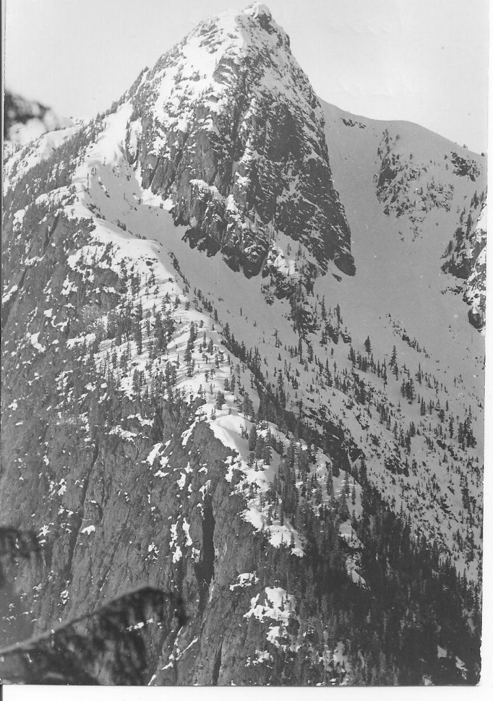
Puzzle Mountain seen from the slopes of Elkhorn 24 March 1968 – Alastair Watt photo.
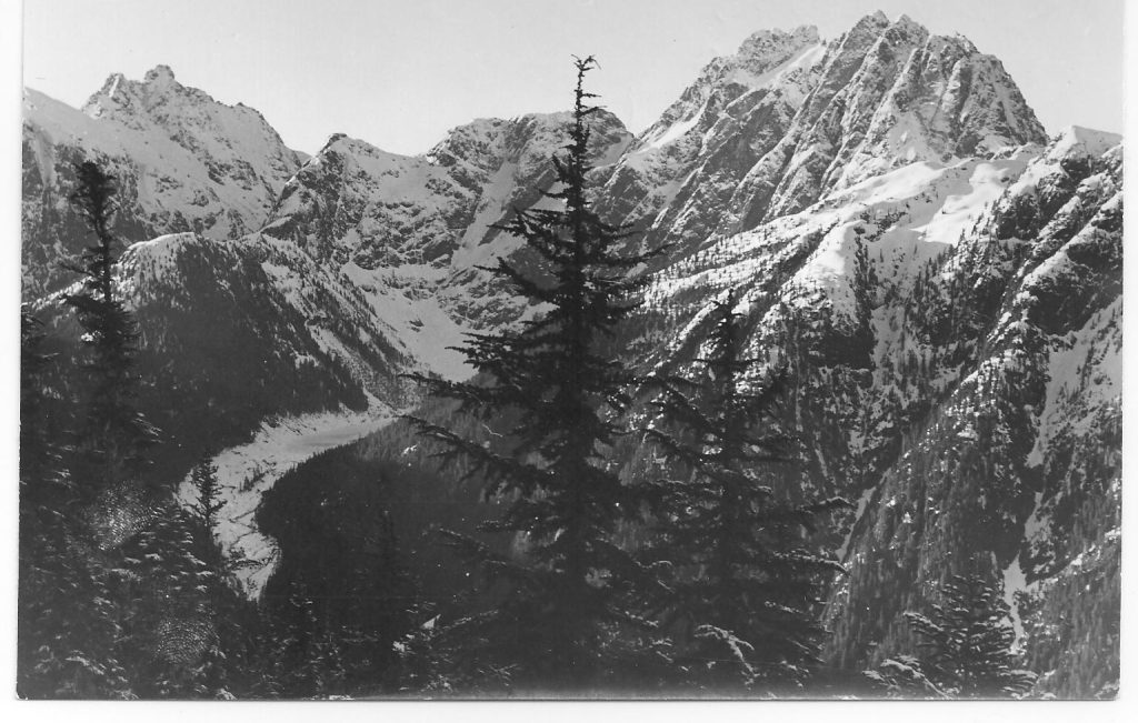
Mount Colonel Foster seen from the slopes of Elkhorn 24 March 1968 – Alastair Watt photo.
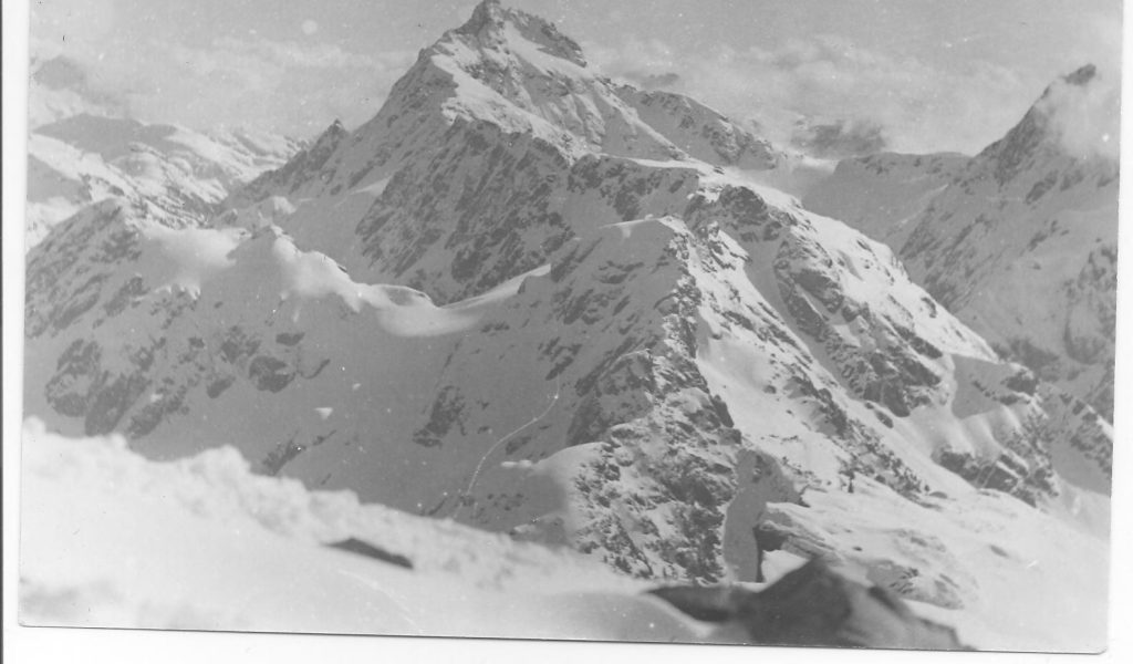
The Golden Hinde seen from the slopes of Elkhorn 24 March 1968 – Alastair Watt photo.
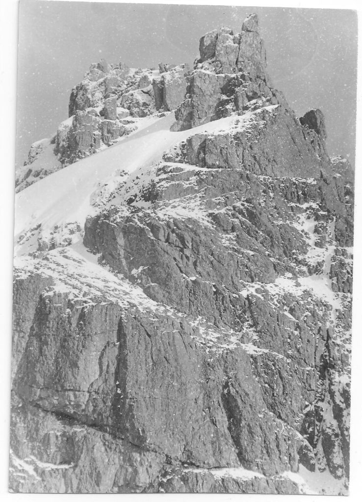
Looking up at the gendarme on Elkhorn 24 March 1968 – Alastair Watt photo.
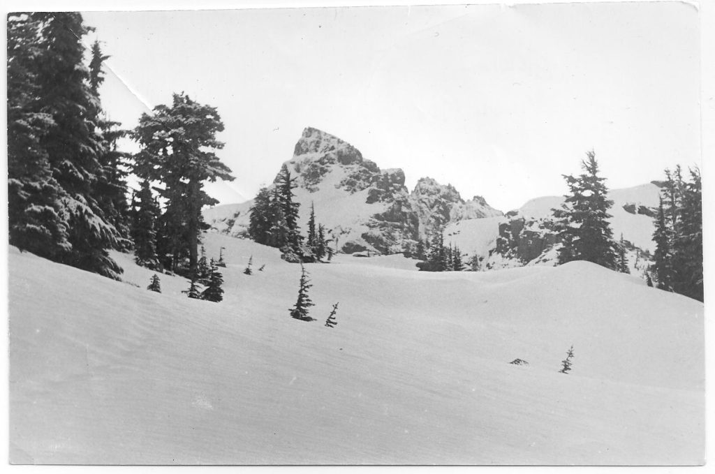
Looking towards Elkhorn 24 March 1968 – Alastair Watt photo.
Ex-Candidate, Pioneer Flyer Gordon Cameron Dies At 72
Reported in The Victoria Daily Times Saturday April 12, 1968. p.37.
Funeral services will be held in St. Matthias Anglican Church Tuesday at 1:30 p.m. for Gordon Arthur Cameron, QC, well-known city lawyer who died in Royal Jubilee Hospital Thursday at the age of 72. Canon John Robers and Reverand Angus Cameron of Lundavra will officiate and interment will follow in Royal Oak Burial Park. Mr. Cameron, who lived at 2021 Runnymede, was a past president of B.C. Progressive Conservative Association and in 1949 was conservative candidate in Victoria in the federal election. In that contest he won 10,154 votes against R.W. Mayhew’s 19,324. Born at Calgary, Mr. Cameron was a member of the field survey team which laid out the boundaries between British Columbia and Alberta. He joined the Canadian Army in Victoria in 1916 and went overseas with the 62nd Battery. In 1918, he transferred to the Royal Air Force and was shot down over France. After returning to Victoria, Mr. Cameron helped found the Aerial league of Canada and on August 11, 1918, made the first flight from Victoria to Nanaimo with James Gray in an old Jenny Pathfinder II. Later he was a driving force in B.C. Airways Ltd., which was formed in 1928 and provided the first service between, Victoria, Vancouver and Seattle. Mr. Cameron was a member of the Alpine Club of Canada and Vancouver Quadra Lodge No. 2, AF and AM. He is survived by the widow, Beatrice; one son, Donald G. Cameron, Victoria, barrister; and a daughter Mrs. D.F. (Shirley) Wingate, Pasadena, California.
First Ascent of Mt. Colonel Foster – 7000’
July 1968
Reported in the Timberline Tales the newsletter of the Island Mountain Ramblers, No. 5. Jan. 1969. p.16/17
By Mike Walsh
Mt. Colonel Foster is comprised of six major peaks, four of which exceed 6900 feet and one of them 7000 feet. This makes it the fourth highest mountain on Vancouver Island. The fact that until July 1968, only two of these peaks had been climbed, speaks well for the difficulty of the remaining four peaks. The two peaks which had been climbed were the ones at the southern extremity of the massif (both exceed 6900 feet). The most westerly of these was considered to be the culminating point of the mountain by a 1957 party which fought their way to this peak, climbed it and reported in the 1958 Canadian Alpine Journal that they had done the first ascent of the Colonel. Many of us believe that the true summit of the mountain lies further to the north. In 1966, an Island Mountain Rambler party reached the peak that was climbed in 1957 [Southeast Peak] and from its summit they saw what appeared to be a higher point to the north. With this in mind the party (consisting of Ralph Hutchinson, Ron Facer and Mike Hanry) attempted a route across the east face to the higher peak, but were repulsed. Armed with this information and some that I gleaned from research at Mapping and Survey Branch plus what I had learned from speaking to people who knew this area in question, I set out in July 1968 on a reconnaissance trip to the north shoulder of Colonel Foster, hoping to find a route of attack for the following week when Ralph Hutchinson and I had planned an attack. This was to be a pleasant and restful week in the alpine country of Strathcona Provincial Park. After a sodden slog up the Elk Valley in pouring rain, and a not-too-strenuous ascent of Butterwort Creek, I began an ascending traverse toward Colonel Foster’s most northerly peak as soon as it came into sight from the valley. I set up camp at 5000’, just below the col immediately under the imposing north rampart of the north peak. Still the rain continued, and so it did the next day until 4.p.m. At this time I departed on a reconnaissance of the north peak (6500 feet), climbing to the névé on its west, and into a fairly steep snow couloir separating this peak from the one to its south. This couloir was followed to the bergschrund at which point I took to the rocks on the left and followed a system of ledges (covered with loose rubble) and chimneys to the summit with no particular difficulty other than an awkward corner, and an ice-filled chimney. This peak is spectacular when seen from any angle, but the climbing is only class 3 at the most. I was back at the tent at 8 p.m. The next morning, I awoke early and left camp at 7 a.m. in a foray to find a route up one of the three remaining unclimbed peaks. My route followed the previous afternoon’s as far as the bergschrund. From there I climbed a small snow couloir in the wall to the right and followed ledges across the west face, occasionally being forced to climb severe pitches of 10-15 feet to the next band. The clouds hovered at about the level of the summit and every now and then a wisp would descend and obliterate everything from sight. Scrambling upward, I reached the summit ridge and followed it to the south over large slabs and splinters of rock, finally arriving on the summit at 10 a.m. The clouds obscured all views to the south for about 15 minutes, but when it finally broke, I was confronted with a spectacular view of a peak at least 200 feet higher than the one I occupied and separated from me by an extremely abrupt descent to a col fully 500 feet below my stance. Above this col the next peak loomed 700 feet of very steep rock. I committed myself to the descent to the col, and crossing its 10-foot expanse, started up the wall, which was vertical in places, and had a small overhanging bulge about 50’ above the col. Beyond this the climbing was easier on a spur which I descended to the southeast, scrambling along its steep, shattered crest. This crest led to a rounded summit ridge broken by a narrow col and covered with enormous blocks of rock, in turn covered with rubble. I rounded several of the higher points of the ridge, keeping to the west and arrived on the highest point of this peak just shortly before noon. A few minutes after my arrival, the clouds lifted and allowed me a view of the next peak, the last remaining unclimbed peak of Colonel Foster. The route to it appeared quite straightforward, down to a col, across it, and up the other side. In actual fact there are only a few difficult spots. I arrived on the summit ridge and followed it, looking for the highest point. I finally spotted what appeared to be the true summit, separated from me by a sharp, but shallow col. The descent to the col was touchy because of a loose flake which had to be traversed delicately. One tricky step around an exposed corner and a short scramble and the mountain was won — no it wasn’t! I had passed a higher peak and had to re-cross the col and tip-toe past the loose flake back to the apex of the mountain. From this stance, the two peaks to the south appeared lower than the one on which I stood. I made an excursion to the south in an effort to reach the two south peaks, but got only as far as the large gendarme before the skies opened up and rained down on me. It was 3 p.m. and I had to get down from there. My descent followed closely my line of ascent as far as the deep col, where I decided to descend the steep snow couloir to the west. The upper gully went well, but about half way down I was stopped by a vast break in the snow, the continuation of which was fully 50 feet below the chock stone on which I stood. Some tricky climbing over the edge and back under the boulder and into the back of the chimney beneath it required over an hour, but it put me back onto the snow. A few long glissades, interrupted by minor chock stone breaks and more chimney climbing and sorties onto one or the other of the walls took me out onto the avalanche cone at the bottom of the west flank on the mountain. A tedious and thoroughly wet traverse to the north across the scrub cedar and alder-covered flank took me back to the névé from which I had started. A short hike through the eternal downpour took me back to my tent at 9 p.m., just before dusk. The reconnaissance had been too successful, and even though I did the ascent alone and without rope or pitons, I do not recommend these tactics to any future aspirants to Colonel Foster’s northern peaks. It was a foolhardy foray. The climbing proved to be mostly class three with many short pitches of class four, and I can think of several places where a piton would have found good use; if not for physical support, definitely for moral support, as the exposure was severe in many places. The rock, for all that I had heard of its being rotten, was surprisingly sound, although broken up on the summit ridges. A better approach to the mountain could be made by hiking up the Elk River as far as the lake at the base of Colonel Foster and ascending to the col to the north of the most northerly peak. This route would eliminate the bushwhacking found in Butterwort Creek, but would facilitate any of the climbing on the peaks.
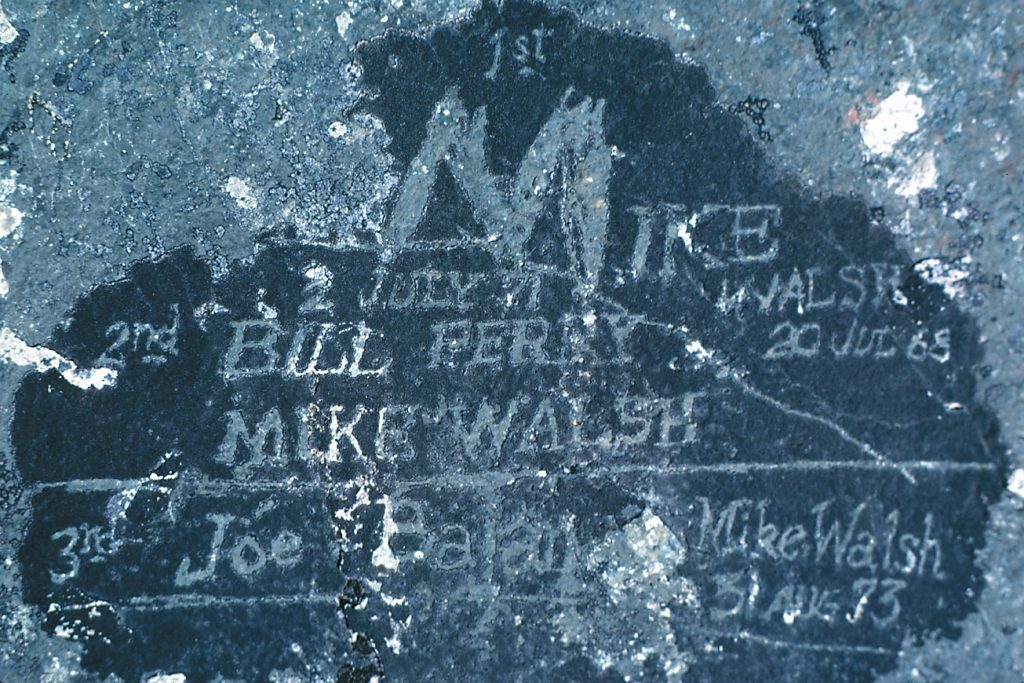
Names of the first three ascents of Mt. Colonel Foster etched into lichen along the summit ridge. Found in 1982 – Don Berryman photo.
Memory Lake
July 27 to August 4, 1968
Reported in the Timberline Tales the newsletter of the Island Mountain Ramblers, No. 5. Jan. 1969. p.10/11/12
By John and Doreen Cowlin
Leader: Syd Watts
Those on the trip who flew into Memory Lake were Syd Watts and Don Bolton (Duncan), John and Doreen Cowlin (Victoria), and Mike Tynon (Edmonton), a zoologist who was looking for ice worms; Dick Martin (Victoria), Blair Paterson (Nanaimo), Steve Webber (Courtenay), and Tom Stockhausen (Cassidy) who left Buttle Lake at 2 o’clock on Saturday and packed to the 3800-foot level that evening on the ridge between Ralph River and Shepherd Creek. There was practically no water on the ascent to the westerly edge of the ridge. Bob Tustin (Nanaimo) and Sue Wheeler (a guest from Rhodesia staying at Nanaimo) packed in via the same route on Sunday. The party of five left the Island Air Lines at Campbell River by Beaver at 11:30 a.m. and arrived at Memory Lake half an hour later. As the plane approached the lake we noticed snowbanks at the southerly end. On landing at the south end of the lake, we jumped ashore alongside a tremendous boulder at the foot of a steep rock-strewn slope. After lunch we packed up the 700-foot southerly rocky slope in the hot sun to the saddle overlooking Mirren Lake and the Comox Glacier which was a good spot for photographs. We then packed westerly approximately 300 feet up the ridge and then turned southerly contouring across the snow filled gully to a diagonal fault which led us on to the sheer ridge on the south side of the gully. From here we lost 300 feet altitude as we traversed across the last steep portions of the snow, scree and heather slope to the 5000-foot contour at the southerly end of Rees Ridge. Our campsite was situated beside some small pools between Mirren Lake and Milla Lake facing the northerly escarpment of Comox Glacier, Argus Mountain, and Mount Harmston. On Sunday morning, Syd and John and Doreen hiked up onto Rees Ridge and climbed the 6695-foot summit and the peak to the north from which we could see Ink Lake. The lake is well named in that the waters are dark blue. East of the last mentioned summit we enjoyed lunch beside a small pool. Near the pool there was sedimentary stone which was cemented together with a rust-colored rock which was similar to that scene near the summit of El Piveto Mountain. After lunch we headed northerly across the Aureole Snowfield and marked the route across the 6300-foot and 6400-foot bumps with stone Cairns. From the latter bump which is E.S.E. of Ink Lake we looked in vain to see Dick Martin and the boy’s packing across the ridge to the north of Ink and Delight Lakes. When sitting by the campfire that night we watched a small avalanche coming down the northerly face of the Comox Glacier. On Monday morning, the group hiked down to the southerly end of Milla Lake and walked along the easterly shore to the Moving Glacier. The lower edge of this glacier is heavily crevassed, as the ice higher up the glacier pushes the leading edge into Milla Lake. To the east of the glacier, Mike was looking for ice worms, but found none. As we retraced our steps from the lake, we walked northerly along the easterly shoreline across an area which, within the past century, has been scarred by the Moving Glacier, when it was much larger. While having lunch back at the campsite, we heard Dick Martin and his party calling from the 6488-foot triangulation point on Rees Ridge. They were not certain where we had camped and were looking for us. As they came down to the ridge, we were busy packing in order to be ready to continue on our trip. Don Bolton and Steve Webber stayed at the base camp as they did not have ice axes and were unfamiliar with hiking on snow and ice. The rest of the party left at 3:45 to climb the northerly face of the Comox Glacier. There was much more snow than usual, which covered much of the scree slope. This meant that we had to be delayed across the steep snow slope, and had to pick steps approximately 300 feet up another slope, all of which took considerable time. At the top of the last slope, we rock climbed with our packs up a fault to the 5900-foot col above the Moving Glacier arriving at our camp at 8:45. With darkness coming, we had a hurried supper, laid our sleeping bags and draped tents over them. Fortunately, it was a clear, although very windy night. As we were making breakfast on the Tuesday morning a deer was trying to pass through our campsite, which was located on his regular route through this country. We left at 9 o’clock, expecting to arrive at our next campsite on the westerly side of the Cliffe Glacier in time for lunch. Unfortunately, the bergshrund on the south side of Argus Mountain was blocked, and we lost considerable time belaying across a steep exposed snow slope. In order to reach the Cliff Glacier, we had to descend a 75-foot chimney and then traverse to the right and descend another 25 feet to the snowfield. Our campsite was located at elevation 5200 feet above Tzela Lake. As Mike Tynon crossed the summit of the glacier, he spotted his first ice worms, which were within 6 inches of the surface. At this time the air temperature was 75°F, making it a very hot day, considering the location and altitude. On Wednesday morning we left camp at 7 o’clock and we were on top of Argus Mountain by way of the West Ridge, by 9:30. This route involves some scrambling, and the use of a rope at one exposed location. Returning to the Cliffe Glacier we tackled the Red Pillar. After climbing the slope to a col to the west of the summit at elevation 5500 feet, we dropped down less than 20 feet on the southerly side and turned east to climb a rock slope and various chimneys to reach the top at 1:15 for lunch. This is an excellent rock climb with various routes which involve belaying, chimneying, and crawling on all fours along a narrow, exposed ledge. The summit of the Red Pillar is very flat. There is enough space on top for a football field, which is unusual for a peak as high as 6665 feet. Much of the top was covered with snow. On our return across the glacier, we stopped to see Mike’s ice worms which he had pickled for future study. We left this beautiful campsite the following morning to start back to civilization. At noon a few of the party hiked up to the pass immediately west of Mount Harmston, to find an easier route for three of the party, going back to Memory Lake. As we were having lunch, Bob and Sue, who had camped within 100 yards of our lunch stop, joined us. They had started backpacking up the ridge from Buttle Lake on the Sunday, but as a result of not feeling well, did not catch up with the rest of the party. They camped on Tuesday night at the outlet of Milla Lake and packed up to this pass the following day. After lunch, the party split with Mike, Doreen and John remaining while the rest crossed as high as practical around the northerly side of Tzela Lake, hiked up the valley north of this lake and veered to the west up onto the ridge between Henshaw and Shepherd Creeks. The three of us made camp in a meadow below the pass and less than 100 feet above the creek which drains the Cliffe Glacier. While Mike was looking for more ice worms the following day, the Cowlin’s followed the southerly shore of the creek out of the Cliffe Glacier to Tzela Lake. Part of the route is very steep and involves dropping down bushy slopes between the creek and the rocky faces to the south of the creek. As they approached the meadow beside the lake, they yelled to scare away a black bear. They then hiked around the lake, crossing the lush meadows along the shoreline. There were masses of lupine arnica, fleabane, yellow and pink mimulus, and false hellebore. Knowing that bears like to eat the hellebore, the Cowlin’s called out as they crossed the meadows. Suddenly, they and a bear were very startled to find how close they were to each other. As the bear snorted and bounded off across the meadow, he never looked back. At the outlet of the lake, they waded across the channel which was knee deep in places, and dashed cold. Continuing around the lake they photographed the beautiful green colour of this lake, with the Red Pillar in the background. The return trip to camp from the lake took one and a half hours. That evening, the first clouds to be seen during that week gathered in the west. The return trip to Memory Lake was by way of the pass immediately west of Mount Harmston. From here they dropped down to the westerly scree slopes to the snow slope and followed their outlet to Shepherd Creek. Turning easterly the party of three hiked up the slope parallel to and 100 feet to 300 feet south of the creek, to Milla Lake, where they crossed the creek on a snow bridge. After lunch they headed northerly to a creek which drains the southerly end of the Aureole Snowfield. Climbing some distance up beside this creek bed, they turned to the right of a side tributary, then traversed and climbed to the 5500-foot elevation, before dropping down to the first campsite. While eating supper they enjoyed reading a note from Don and Steve who had returned to Memory Lake several days before. After supper, the party retraced their footsteps to the saddle above Memory Lake where they made camp, and while sitting by the fire, watched the clouds cover the summit of the Comox Glacier and then dissipate. The final morning was sunny but the cloud ceiling was dropping by noon. As they hiked down the slope to the lake the party was pleased to meet Steve and Don who hiked up from Memory Lake to meet them. At 2 o’clock the cloud was so low that they could hardly see the opposite shore of the lake, as they heard the plane flying overhead. Not knowing how long the cloud would remain, the group collected firewood and built a large bonfire between huge boulders on the shore of the lake. By 5 o’clock, with the weather still unsuitable for flying, they put together their meagre resources and had a supper of pancakes, and a little stewed fruit. While chatting by the fire, Don mentioned that Steve had been swimming in Memory Lake, and not too far from a snow slope which was feeding the lake. Shortly before 7 o’clock clouds lifted a little and the plane came in to take us out to the pleasures of civilization.
Participants: John and Doreen Cowlin, Syd Watts, Don Bolton, Dick Martin, Blair Paterson, Steven Webber, Tom Stockhausen, Bob Tustin, Sue Wheeler.
Rugged Mountain August 5-8, 1968
By Lindsay Elms from interviews with Ralph Hutchinson (1994/2007) and Bob Tustin.
In August 1968 a team of Island Mountain Ramblers made a trip to the Haihte Range with the objective of climbing Rugged Mountain. The party comprised of Ralph Hutchinson, Ron Facer, Mike Walsh, Blair Paterson, Bob Tustin and Tom Volkers. While Tom Volkers stayed in camp, all five others climbed Rugged Mountain by traversing across the North Face and ascending a route up the West Face. The next day Mike Walsh and Ron Facer made the first ascent of an unnamed peak. [This peak wasn’t named until twenty-two years later when an ACCVI party that included Rick Eppler, Sandy Briggs, Frank Wille Jr., Dennis Manke and Al Johnson climbed the peak on 21 September 1990 (see Island Bushwhacker Vol. 19:4, Fall 1991. p.20/21.) On the summit they found a film canister containing a note left by Mike Walsh and Ron Facer dated 7 August 1968. Later Sandy named the peak Ya’ai Peak. In Phillip Drucker’s Northern and Central Nootkan Tribes he wrote a chapter on the Nootka’s religious life and described: “a vast and complex world of supernatural beings, some benign or nurturing, others horrible and dangerous. There were salmon-people and herring-people, each tribe occupying half a great undersea house off the coast of Vancouver Island; a race of spirits called ya’ai who paddled supernatural canoes and could bestow great power and wealth on human beings or destroy ceremonially unclean persons who encountered them.”]
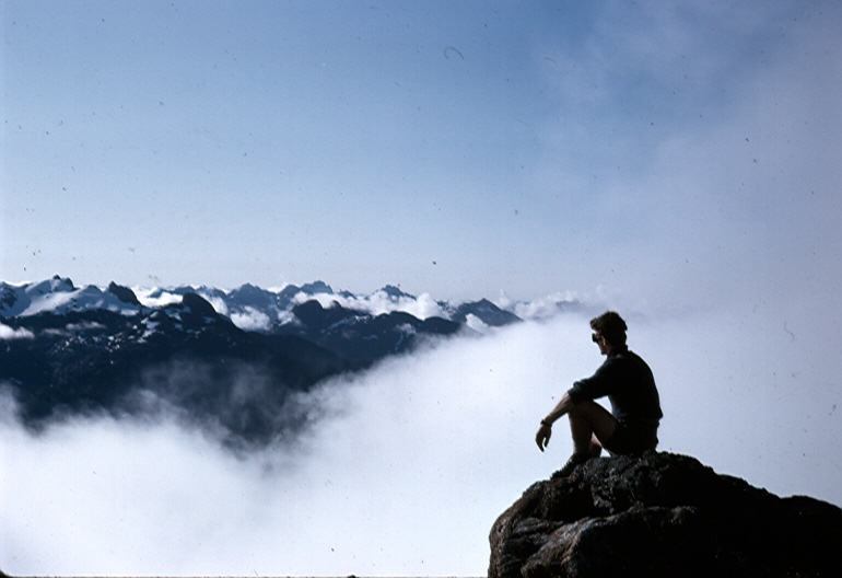
Rugged Mountain August 5-8, 1968
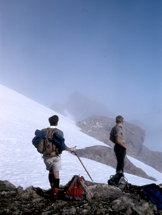
Ron Facer and Blair Paterson looking at Rugged Mountain through the mist 5 August 1968 – Ralph Hutchinson photo.
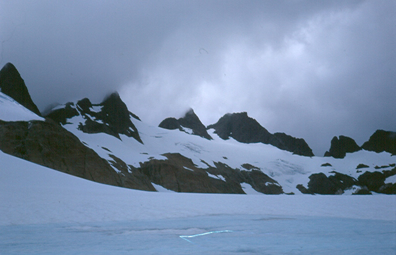
View of the Haihte Range 1968 – Ralph Hutchinson photo.
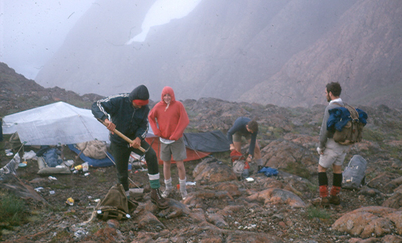
Facer, Walsh and Tustin preparing to leave camp on the North Col to climb Rugged Mountain. Tom Volkers (hoodie) stayed in camp 6 August 1968 – Ralph Hutchinson photo.
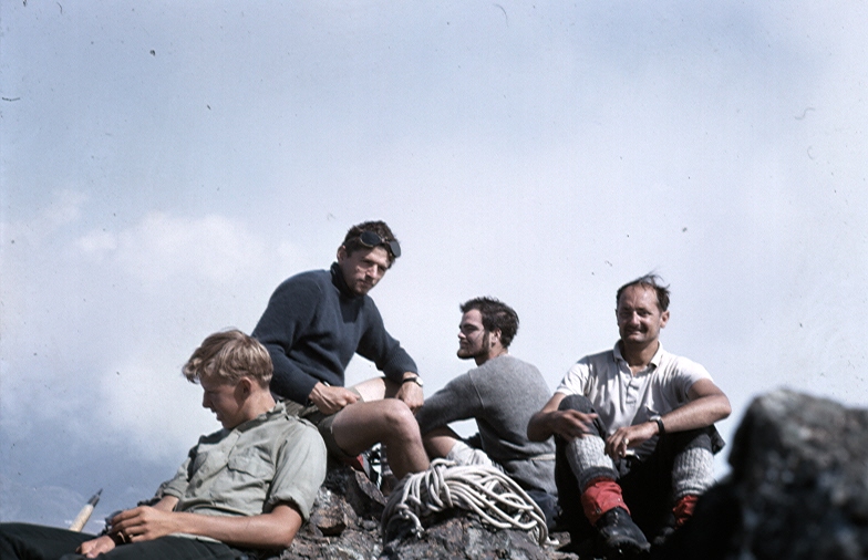
The summit of Rugged Mountain 6 August 1968. L to R: Blair Paterson, Mike Walsh, Ron Facer, Ralph Hutchinson – Ralph Hutchinson photo.
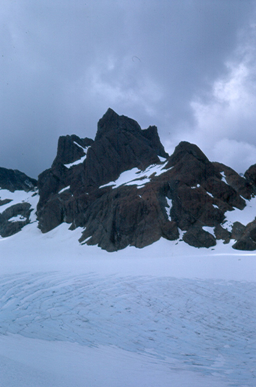
Ya’ai Peak 1968 – Ralph Hutchinson photo.
1969
ACCVI executive:
Chair – Bill Lash
Secretary – Pamela Mitchell
Events:
January – Rick Hudson, with Ferdi Fischer, Bash Atwell and Martin Hutton-Squire climb Mt. Kenya including the highest peak Batian (5199m), Nelion (5188m), Pt John (4883m), Midget Peak (4700m), Pt Lenana (4985m) and a few minor points.
February 20 – Joyce Clearihue gave a talk on her recent trip to Russia, Siberia and Mongolia at the Douglas building Cafeteria at 8 p.m.
March 28/29/30 –Members of the IMR, CDMC and ACCVI (Bill Perry, Carl Lund, Bryan Lee, Brian Foan) climb Elkhorn Mountain just outside of the official winter season.
May 31 – Members of ACCVI (including Ethne and Kathleen Gibson, Pamela and Mark Mitchell) and IMR climb Mt. Finlayson with Sir Edmund Hillary.
June – Section member Paddy Sherman, Ralph Hutchinson and others climbs Huascaran (22,300’) in Peru.
July 5/6 – Syd and Emily Watts, Norman Goudy, Keith Glover, Lyle Shaw and Ray Pringle climb Crown Mtn.
July/August – Section member Don Morton attempts Noshaq (24,580’) in Afghanistan.
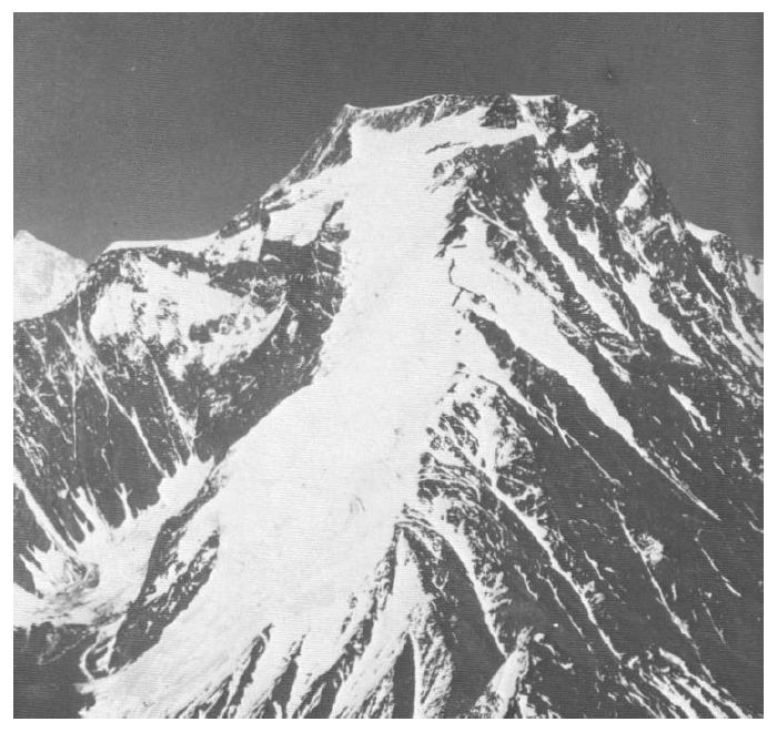
The west ridge of Noshaq (Afghanistan) 1969 – Don Morton photo.
August 30-Sept.1 – Attempt by Bob Tustin, John and Doreen Cowlin, Vic Harrison and Bill Jackson on Mt. Filberg.
August 30-Sept. 1 – Syd and Emily Watts, Alan Robinson, John Gibson, Keith Waterfall, Carl Lund, Brian Foan, Barry Waters and Dennis Davis climb the Golden Hinde.
The Chalet at Cameron Lake
Reported in the Alberni Valley Times Monday March 17, 1969.
Cameron Lake Chalet was the “in” place in 1912 when Alberni Valley residents, breaking the journey to or from the east coast of the Island, might get a taste of the cosmopolitan along with their tea. Built about 1910 as the Esquimalt & Nanaimo Railway right-of-way was being extended from Wellington to Port Alberni, surveyors and railway officials were its first guests. For a while the Chalet at the east end of the lake was the end of the line. Rails were being laid on the mountain stretch between Cameron Lake and the Alberni Valley and, until the Victoria-Port Alberni schedule went into effect in December 1911, the stage picked up passengers at the Chalet. For some years the railway company put in managers to run the stopping place, but later the building was leased and a succession of landlords operated the resort. The place became known to the affluent of the Old Country and the USA who were beginning to discover world travel and were drawn to Vancouver Island to look at frontier life. More than half a century later there are rumours that the Chalet is to be demolished. The bridge on the road leading to it has collapsed. Passenger service on the railway was discontinued years ago. The days of hospitality on the grand scale are over for the Chalet. In its heyday some parties came by chauffeur-driven cars, accompanied by maid servants. Some traveled by train and stopped over for a weekend. Then there were the day-trippers from Alberni or Qualicum, some in early vintage cars and others in horse-drawn buggies. Farmers and storekeepers from the Valley would drop in, drink tea in the dining room overlooking the lake and, perhaps, rub elbows with the rich and titled. Some of the heavy dark furniture from the bedrooms of the Chalet has been acquired by Alberni District Museum and Historical Society. Also in the Society’s storeroom in the basement of the old Alberni Post Office are registers dating from June 1912. Names familiar to people still living in the Valley are there, along with those of visitors from afar. On August 8, 1912, for instance, we found Leonard Frank, a photographer of world fame who had lived for years in the Alberni Valley; A.E. Waterhouse, Port Alberni’s first mayor; E.G. Prior, a former M.L.A., M.P. and Premier of B.C. who was later to serve as Lieutenant-Governor of the province. On the same day a Harold Haynes of Alberni Valley and Norman Butt, then of Duncan, Mr. Justice O’Connor and D.N. O’Connor, Sydney, Australia; J.P. Foley, Cork, Ireland, and H.H. Brown, surveyor, Victoria were also registered. Mr. Butt, now living in Port Alberni, recalls several trips he made as a driver for Corfield Motors Ltd., when the journey was broken by a stop for lunch at the Chalet. He can’t recall who was operating the place but he does remember that the Chalet had a distinctive atmosphere. “It was a home away from home,” he said. The vehicle he drove from Duncan that day was an American Everett, which he remembers as similar to the Canadian Tudhope, manufactured for a brief period later. On that August day in 1912, Mr. Butt was chauffeuring Sergeant-Major James Mitchell Mutter of Duncan, warden of Oakalla, and his daughter, Miss Mutter. On November 20, 1912, guests at the Chalet were a Miss Woodland, Nome, Alaska; Miss Babe Petter, Ottawa; Homer Jennings, San Francisco; W.J. Kelsey, St. Louis, and Captain Gordon Davis of London. One could speculate on these entries in the register. A pioneer physician of the Albernis, Dr. A.D. Morgan, and Miss Morgan; pioneer publisher R.J. Burde, his wife and little daughter, Margaret, were among those whose names were on the books on Sunday, September 6, 1914, while on Friday, September 18, Lady Rosalind Northcote of Exeter, England, arrived with a party. On September 23 there was a party from Switzerland. Lady Rosalind was only one of a number of titled people to visit the place while it played the double role of railway station and resort. There was a certain pretension befitting the prestige of Canada’s farthest west hostelry of the type. Sir Somebody and his lady with maid and chauffeur of Qualicum Beach and London, England, might come only for tea, but the names of the principals in the party would be on the register. The building at the edge of thick woods and overlooking the lake with its surrounding mountains must have seemed like the last outpost to world travellers. A family from St. Joseph’s, Montana, were guests in the summer of 1914. Leonard Frank and J.E. Burket had come for tea. A party from Crichel, Dorset, was there in April 1913. Through the years people who have made B.C. history wrote their names in the register. A.E. Tranfield, a guest in 1916, was one of these. Alexander Tranfield, then living in Ladysmith, could look back on the days when he had been a special constable, when whites and Indians along the coast were not exactly in harmony. Mr. and Mrs. George Woollett relieved Mrs. Monks of the Chalet operation for a year at the start of the 1920’s. Mrs. Woollett recalls the special train 999, which brought railway manager John Kennedy and his sister, Miss Florence, to stay. Mrs. Monks returned after her year’s holiday, but she was becoming discouraged with the business which had started with high hopes. Her husband, who was to help with the management and act as hunter and fishing guide, was killed in World War I. She persevered for a time after her return but finally gave up after the Chalet was ransacked and robbed on one of the rare occasions when it was left unattended. Her good silver and china, many of the furnishings, even the curtains were stolen and the premises left in shambles. The Woolletts returned for a period of four years in the 1930’s after Mr. Woollett had retired as head steward of CPR coastal ships. Among Mrs. Woollett’s memories of the Chalet is the occasion when a snow storm cut them off from the outside world and they waited several days for the snow ploughs. There was no electricity. One of the chores of the establishment, of course, was the filling and cleaning of coal oil lamps. The house had five bedrooms on two floors for guests. The beds were large with high headboards, and each room was equipped with wash stand and the traditional set of chinaware. A baggage room faced the railway track; there was the long dining room across the south end and wide verandahs on two sides. Some holidayer’s would come for a week and spend their time fishing or hiking. During the summer holidays a line of tents between house and lake would accommodate the overflow from the main building. Lunches and Sunday dinners attracted many people from the Alberni Valley, Nanaimo, and the Parksville-Qualicum area. Mr. Woollett’s high standard, acquired during his years as a ship’s steward, were not relaxed for the out-of-the-way establishment in the bush. When guests came for tea, they sat down to tables covered with embroidered cloths and set with willow pattern china. A Chinese cook prepared the meals and Mrs. Wollett baked the bread, a major chore during the busy periods of summer. Still remembered by Mrs. Woollett is Bill Stove, who lived in a nearby shack and helped out on many occasions. He had worked on construction of the railway and stayed on to become the perfect neighbor to the Chalet’s operators. Mrs. Woollett, whose husband died in 1962, is now 97 years old, alert and blessed with a fine memory. She lives in Victoria but spends weeks at a time with her niece, Mrs. Ken Toms, in Port Alberni. After the couple left the Chalet, the building was leased by the C.P.R. through Marathon Realty to a succession of landlords with various plans for the property. From 1938 until 1947, the lessee was E.W. Ingle, then Jack and Fred Farmer held the lease until 1952. Roderick L. Van and George S. Bertram came in quick succession, followed by William H.E. Bone, 1954 to 1958; Jacques LaRocque, until 1966, and then Leonard C. Manklow. The years have taken their toll and the building deteriorated. No one has come forward to take on the major job of renovation. Perhaps the attractive little cottages on the south side of the creek fit into the more modern idea of a holiday resort. In far corners of the world, though, there may be even yet memories of moonlight on the water as viewed long ago from the verandah of the Chalet.
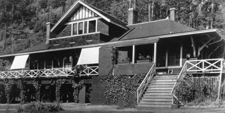
The Cameron Lake Chalet.
Elkhorn Mountain – Easter (March 28/29/30) 1969
Reported in the B.C. Mountaineer Volume 48, No 5, May 1970.
By Brian Foan
At least we were a representative group: Don Apps of the Island Mountain Ramblers, Bryan Lee of the Courtenay and District Mountaineering Club, Carl Lund of the Alpine Club, Bill Perry, an itinerant Yankee late of Appalachia, and myself [Brian Foan]. The Elk River trail offered a gentle beginning to get used to the burden of one’s pack after the long winter’s rest. After two miles a major creek joins the river from the east. Here all gentleness ended. We crossed the river and bashed our way up the west ridge of Elkhorn. The snow we soon encountered was soft and deep. The sun shone but it was a cold, wet afternoon. In our efforts to avoid the slush we scrambled on ledges and in chimneys and clawed our way up vegetated slopes but it was always there to come back to. Eventually on the lip of the cwm formed in the amphitheater of King’s Peak and Elkhorn we made camp. The site offered no more than running water and a reasonable degree of flatness. We were at about 4,000 feet. An early morning start put us on the snow while it was frozen. We soon had our first look at Elkhorn, a magnificent sight from its northern slopes. Its symmetry is broken only by a huge, jagged gendarme on its west ridge; while the summit rises in a ridge proffered by an awesome view of the fluted east face of Colonel Foster across the Elk River valley. The whole massif stands like a gigantic organ and is the most fierce mountaineering view on Vancouver Island. We circled around the gendarme on the south side of the ridge and gained altitude through a series of steep gullies. At the top of the first of these Don decided to turn back and Carl belayed him down to walking country. Above this the way was firm and step-cutting for foot and hand holds became the mode. Bryan seemed to take all the critical leads despite his protests of inexperience on snow and ice. Mostly I seemed to be huddled in gullies being showered with ice while the other two improved his steps. At last we were on the summit and although the exhilaration we experienced was possibly out of proportion to the importance of the peak, it was totally justified by the effort we had expended. Under the high overcast with the sun shining on the sea to the west and the east of us the lighting had a surrealistic yellow-green-grey effect etching the mountains in a startlingly dramatic way. We climaxed the careful descent with a long rappel down the final gully but not before some discussion on the economics of sacrificing a sling. Carl: “Hell! You spend two dollars on a show. I don’t mind spending forty cents to save my life.” Surely the clincher, but it was Bill who left the sling behind. We pushed the last couple of hours and got back to camp before nightfall. It had been a rewarding though long, cold day. Frost bitten toes were endemic among the four who had been to the summit. The next morning we headed out. The snow was unpleasantly icy. We insisted on trying to glissade and met our deserts. Bill fell first and fought his ice-axe down a bumpy ride before being halted by some snags. Then I fell and discovered how lively an ice-axe could be on that rough, hard surface. I slashed my wrist and ended the fall looking like an abortive suicide attempt. My equilibrium restored and the flow of blood stemmed, I strapped my crampons on and walked sedately down the rest of that gully. A short rappel through the rock band and we were on substantial, debris-littered, snow slope which tool us to our exit stream. The way down the Elk River in that uncertain snow was one of those unpleasant West Coast bush whacks that are the atonement for pleasures of the mountains in this part of the world. But, before long, we were lying on the river flats basking in the sunshine and comparing our frost bite now elevated to the status of battle wounds.

Bill Perry, Joe Bajan, Lindsay Elms and Bryan Lee 2019 – Lindsay Elms photo.
The Ascent of Mt. Finlayson with Sir Edmund Hillary May 1969
Reported in The Timberline Tales, newsletter of the Island Mountain Ramblers, No. 6, Jan. 1971, p.13/14.
By Robin Carter
In my declining years I’ll be able to gather my grandchildren around me and tell them how once I climbed with the man who conquered Everest; Sir Edmund Hillary. What I probably won’t tell them is the mountain involved was Mt. Finlayson, and Sir Edmund wore tennis shoes. Our hike had its beginning in the spring of 1969 when it was announced that Sir Edmund was going to be the guest speaker at the University of Victoria convention. He was contacted about the possibility of going on a climb and responded that his crowded schedule allowed only half a day hike. Since most of his time in Victoria was going to be spent socializing, it was thought that he might appreciate a quiet time with a fairly small number of people. Those present from the Alpine Club of Canada were Dr. Mark Mitchell and his wife Pam Mitchell, Mrs. Ethne Gibson and daughter Kathleen. Rambler members present were Bob and Flo Dadds, John and Doreen Cowlin, Robin and Barb Carter, and Jim Stanton, a guest from Vancouver. At Sir Edmund’s insistence the Dadd’s and Carter’s children were also invited. The hike consisted of following the nature trail from Goldstream Park, near Victoria, to the top of Mt. Finlayson (1,300’), and down the other side, with a stop at the summit for a breather and photos. It was the first Rambler hike on which the only photos taken were of the hikers rather than the scenery! Naturally enough, we were all keen to find out something about what our guest is really like. We found him to be a kind, friendly man with a lot of common sense, a great sense of humour, and no pretentions whatsoever. He really does climb in tennis shoes, at least until he gets to the glaciers. He thinks the big stiff boots many of us wear are an uncomfortable waste of money. He is very concerned with the welfare of the Sherpas and spends about half his time trying to improve it. He is a great storyteller whose tales are full of names that would make a climber’s mouth water. But his yarns are not about his well-known triumphs. Rather they are about the amusing things that happened on little known recces or side trips. Even though he seems to have done everything, there are a lot of things he would still like to try. He mentioned a desire to drive across Tibet (The Chinese won’t allow it) and he indicated an interest in some climbs in the Andes. In short, he is everything one would hope him to be. My only problem now is figuring out what to do with a day pack that is so old and battered that it should be retired. I hate to part with it since Sir Edmund Hillary once carried it on the descent of the north face of Mount Finlayson.
Tube Reveals Evidence of Early Mountaineers
Hikers Open Trail
Reported in The Victoria Daily Times Thursday August 7, 1969, p.36.
By Ed Gould
When six members of the Island Mountain Ramblers climbed 6,000-foot Crown Mountain in Strathcona Park last month, they found more than a stunning view and alpine meadows. In a rock cairn at the top, the group uncovered a brass cylinder with a cork stopper that held information about the original climbers who scaled the peak on July 10, 1910. That year, a joint Canadian-American survey crew under the leadership of Price Ellison, minister of lands and forests, hacked their way to the mountain from the coast. Advance publicity of their venture was written in the old Vancouver World and Province newspapers and copies were found in the cylinder along with names of the climbers and a handful of coins. The coins included two 25-cent pieces dated 1892 and 1894, and a “new” 1910 dime. But the Ramblers were not the first group to make the climb since. Another government survey team visited the cairn in 1936 (Norman Stewart), and in 1958, Bob Ahrens, director of parks, left evidence of his visit while reconnoitering Strathcona for a provincial park. Although finding the cairn and its cylinder was interesting, the party’s main reason for climbing Crown Mountain was for the fun of hiking in the fresh, clean air of an alpine wonderland. And Strathcona is one of the best parks on the coast for wilderness hiking and backpacking, says Syd Watts of Duncan, an automobile service department manager who led the most recent assault on Crown. “There are very few trails, but many miles of open alpine ridges. All areas of the park above 4,000 feet are alpine, that is, above timberline, and all the ridges connect to make a series of two or three-day hikes or one to three-week trips.” Strathcona Park is a half-million-acre wilderness almost in the centre of Vancouver Island, about 35 miles from Campbell River and accessible from the Gold River Highway. Although the early climbers had rough going to even get to the base of Crown Mountain from the coast, the mountain is accessible now from logging roads. “But not for much longer.” Watts said. “The roads aren’t used anymore and are deteriorating fast. The next climbers will probably find it more rugged than we did.” Preserving Strathcona Park has been the prime aim of the Island Mountain Ramblers who were in the forefront of a battle for Buttle Lake against its eventual damming. There are four hiking clubs on Vancouver Island, one of them, the Alpine Club of Canada, which dates back to 1912, is also a climbing club. Others are the Comox District Mountaineering Club, formed in 1928, the Outdoor Club of Victoria started in the last 1930.s, and the Island Mountain Ramblers started in 1958. Members ages range from 14 to 70. Syd Watts, who made the Crown Mountain ascent with his wife Emily, Ray Pringle of Campbell River, Lyle Shaw of Victoria, and two youngsters, said Crown is the most prominent mountain in the park. “All major peaks—including Forbidden Plateau, Mt. Septimus and Big Interior Mountain can be seen from there.” With hardly any time to catch their breath from the onslaught on Crown Mountain, Watts and his wife were off to Marble Meadows west of Buttle lake. Under leader Jack Ware of Ladysmith, the group will spend a week of fishing, looking for fossils, exploring caves and photographing scenery and alpine flowers. But a large portion of the time will be spent grubbing out a trail to the top with mattocks and picks. The Ramblers have spent about four years clearing Marble Meadows trail to the 3,200-foot level and hope to complete it to the 5,000-foot plateau this year. With a maximum gradient between 15 and 30 per cent, even the oldest hiker will be able to walk it without difficulty, Watts said. But why would anyone want to spend their hard-earned vacation time clearing mountain trails for others to walk over? “So all this magnificent scenery is easily accessible to the largest number of people possible Watts said.
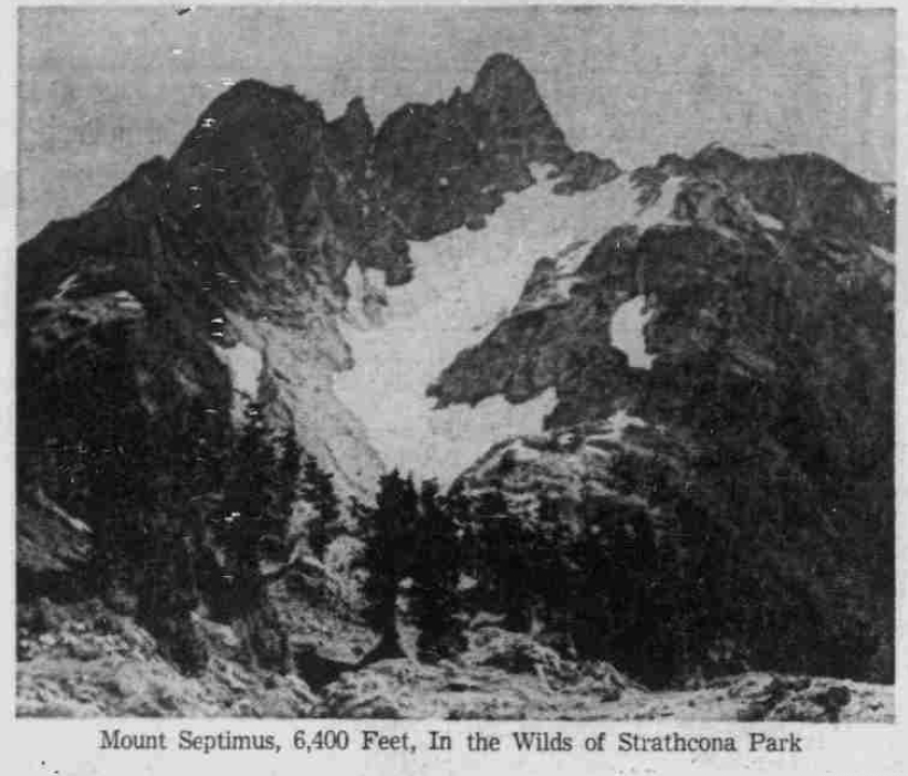
Mount Septimus, 6,400 Feet, In the Wilds of Strathcona Park
Golden Hinde
Reported in The Timberline Tales, newsletter of the Island Mountain Ramblers, No. 6, Jan. 1971, p.10.
By Syd Watts
The weatherman held forth the long weekend, and as the nine of us loaded gear ta the Island Airlines (Campbell River), bright morning sun on Strathcona peak proved to be right. Take off time was 11 a.m. and shortly after, we were winging our way over mountains we had climbed a few weeks before. The north slopes of Mount McBride and all the tops of the high peaks were dusted with new snow. Our pilot flew us past the south face of the Golden Hinde, then a long turn around Burman Lake, over the east end and taxing down to the outlet. The second plane arrived a few minutes later, pick up time was arranged for 11 a.m. Monday, and they were off, leaving us to the quiet of the mountains. We lunched on the beach and then set up camp at a pleasant campsite about 100 yards from the north shore. The northwest side of the lake is open alpine, and there are so many fine campsites. After lunch we hiked over to the 5000-foot ridge west of Burman Lake. This is reached by following the 4000-foot contour around the southeast side of the Golden Hinde. It offers fine views of the Burman valley and the group of lakes northwest of it. A pleasant evening at the campfire ended the day. On Sunday we left camp at 8 a.m. and climbed slowly up the southwest ridge to the west peak. This is easy going if one locates the game trail. After the first 400 feet it is all in the open and an easy walk, and it is a most enjoyable one with not a cloud in the sky and Mount Burman mirrored in the lake below. At the base of the southwest ridge the party split, John Gibson to lead a climb on the west ridge and I (Syd Watts) to take the party around the regular route up the southeast ridge. Normally the route is just a scramble but due to a cold August and fresh new snow, the going was more difficult and necessitated ropes on the last gully. This held us up for sometime till John Gibson came down from the summit with another rope. Soon we were sitting on the summit enjoying lunch and a magnificent view of Vancouver Island from the dark blue of the sea at Cape Scott to the mountains around Lake Cowichan. Thanks to the weekend closure of the pulp mills, the air was crystal clear. We left the top reluctantly at 3:45 and started down the regular route. I would not recommend such a large group on this upper part of the route, as the rock is very loose. As we walked the last 100 yards to camp, the setting sun turned Mount Burman into a rosy dome: end of a perfect day. We woke to yet another sparkling day, but as our plane was due early, we variously took pictures, swam, and lazed about. Our return flight was as beautiful as the trip in.
Participants: Alan Robinson, John Gibson, Syd and Emily Watts, Carl Lund, Brian Foan, Barry Waters, Dennis Davis, Keith Waterfalls.
The Golden Hinde by the West Ridge
A personal letter from John Gibson to Lindsay Elms – 2 April 1993.
Sunday August 30. Up at 6 a.m. and the nine of us got away at 8 a.m. We all stayed together until we reached the shoulder below the west ridge, and then split up, Syd leading the main party by the ordinary route, with his wife Emily, Alan Robinson, Keith Waterfall and Barry Waters. I led the other party, with Carl Lund, Dennis Davis and Brian Foan. Alan had been coming up with us, but Syd wanted one reasonably experienced man in his party. Carl and Dennis had ropes, so we were entitled to be on the west ridge party, Brian had come with Carl, and I, though without a rope of my own, was to lead the west ridge party, as that route was my idea. (Bill Lash had suggested it to me.) So we set off up the ridge, while the others traversed below the south face to the ordinary route. About 10 a.m. we roped, with me and Dennis on the first rope, Carl and Brian on the second. The route began at the col with a traverse across a steep snow slope at the top of a gully (1-2, hidden from view on the sketch) on the north side of the ridge, then across broken rock and scree (2-3) on the south side to the foot of the steep slab or wall. I found a belay at 100 feet, to which I tied up while Dennis came up. Then he had to juggle a bit with the rope, to pass our rope down to Carl, to belay him while he brought Brian up, as they had only 80 feet of rope. That was the hardest pitch of the climb, which I think can be avoided by taking easier ground to the right, as one faces the mountain. I chose it because I liked the look of it and I think the others did too. After that the angle eased and we came to the foot of a steep tower on the ridge (4), which we decided looked too hard for us. We traversed to the right along a prominent ledge running across the south face, which is plainly visible from Burman Lake. From here there seemed quite a choice of routes. An honest west ridge climb might, or might not, go straight up steep rocks (the line between sunshine and shadow on my sketch) and could be a very good climb, but we decided it looked a bit too ambitious for us. At the end of the ledge, we turned left and went up a white colored gully (5) which brought us to the summit ridge (6) and we reached the summit (7) at 1:20 p.m. No sign of others, but soon we heard shouts and gathered the others were having difficulty in a gully, which should have been scree, but was snow and ice. They had only one rope for five of them and some had no ice axe, so we went down to the top of the gully and lowered a rope, which helped those members of the party who needed help. We had a wonderful hour and a half on the summit. Warm sun, no wind, and all Vancouver Island at our feet and a good deal more besides. Syd pointed out the main Vancouver Island peaks, and Waddington far away, which stood out a head and shoulders above everything else. The Brooks Peninsula was very clear, with Eliza Ears hiding Cape Cook, and you could almost see to Cape Scott through other gaps. The fog bank over the west coast stretched for miles, with little patches of water visible, somewhere in Nootka Sound, perhaps, somewhere near Hot Springs Cove, and some of those offshore islands near Ahousat. Then to the south was the McKenzie Range and a bit off the coast near Nitinat, and Arrowsmith almost but not quite hidden by the Red Pillar, and in the distance beyond it the Whymper group. After soaking up this view, we all set off down the mountain together, by the ordinary route, but avoiding the snow gully and taking another to the left (looking down), and soon we had the choice of a gully or a pleasant rock ridge, more airy than the gully but not difficult. Below that there was one more steep bit on which some needed the rope, before we coiled the ropes and all proceeded free. We got a bit spread out then and someone dislodged a small rock which smashed my watch crystal, but the watch, which stopped, protected my wrist. Then there was a digression while we searched for a pack Emily had left on the way up. It was finally found and we carried on down without further event, and reached camp at 8 p.m., cooked supper and turned it.
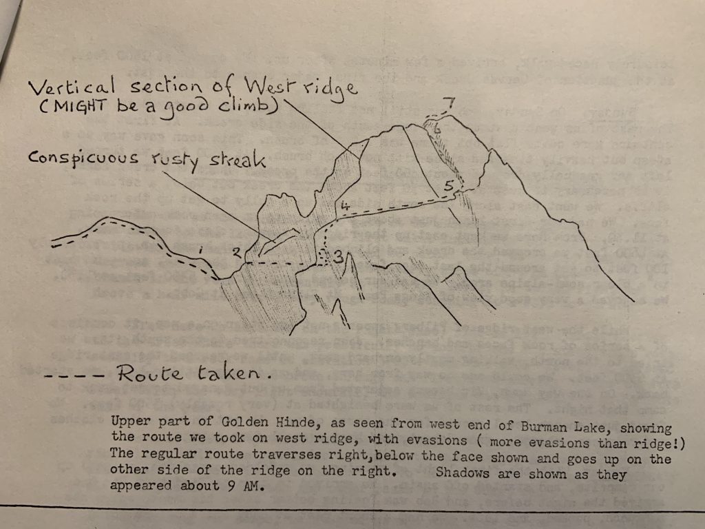
John Gibson’s drawing of the route on the west ridge/south face of the Golden Hinde 1969.
Vandals Hit Hikers Cabin
Reported in the Alberni Valley Times Monday October 27, 1969. p.7.
Rosseau Chalet, which for 14 years has provided shelter for hikers on Mt. Arrowsmith, has been vandalized, according to a report from Les Stewart. Mr. Stewart and Art Skipsey have taken on responsibility for care and maintenance of the cabin at the 3,000-foot level. Scouts and other groups of young people have used it and helped to carry in materials and make repairs. Other adults too have contributed volunteer labor. Now the days of back-packing are over with extensions of a MacMillan Bloedel logging road into the area, but the easier access has resulted in new acts of vandalism. According to Mr. Stewart, a hole was hacked through the shake roof the volunteers had put on the Chalet and windows had been broken. White cedar bunks renewed after a previous attack by vandals had been damaged.
Get A Key
He emphasized that people wishing to use the cabin are welcome to do so. Both he and Art Skipsey have keys which may be obtained on application. Anyone wishing to spend a night in the Chalet should phone Mr. Stewart or Mr. Skipsey in Qualicum to make arrangements to pick up the key. Guests should leave stove-wood chopped for the next persons who seek shelter, said Mr. Stewart, pointing out the unwritten law of the woods.
Logging Road
According to the report, the Cameron Division logging road was routed around the cabin and it is the intention of the company to log to the 3,800-foot level. However, those who have an interest in keeping Rosseau Chalet as a haven for hikers are hoping that an area around the building and six other cabins in the vicinity will be left unlogged. Building of the Chalet was started by Ralph Rosseau, well known as a mountaineer. After his death in a mountain accident, it was turned over for the use of others interested in the outdoors. Through the years volunteer workers have made hundreds of trips up the trail carrying materials and equipment. A new wood-burning stove was packed up the steep hillside.
Vandals Attack Cabin
Reported in The Daily Colonist Tuesday October 28, 1969. p.35.
PORT ALBERNI—Vandals have attacked a hikers’ shelter which has served foot-weary explorers of Mount Arrowsmith for 14 years. Rosseau Chalet, a cabin at the 3,200-foot level was found last week with a hole hacked through the shake rook. Windows and bunks have also been broken. Les Stewart and Art Skipsey, who recently cared for the cabin, reported the damage. Scouts and other young volunteers helped carry in the materials for the cabin before a MacMillan Bloedel logging road reached the area. The proximity of the road is blamed for the damage.
The next five years: 1970 – 1974.

The History of ACCVI is a work in progress.