1955
ACCVI executive:
Chairman – Bill Lash
Secretary – Margery Thomas
Executive Committee – Connie Bonner, Cyril Jones, Patrick Guilbride, Noel Lax, Mabel Duggan
Events:
The Vancouver Island section had a very satisfactory year of climbs, hikes, photography and skiing. The section was well represented at the ski camp and again at the summer camp. All of the club’s outings were followed without cancellations or changes, regardless of the weather. An average of twelve members attended each climb and on three occasions we were joined by members of the RCAF rescue group from the station at Comox.
The first outing of the year was a ski trip to Panorama Ridge in Garibaldi Provincial Park. The weather was clear and cold and the snow was deep powder.
March 26 – Club’s annual banquet held at ??? Raymond Patterson was the guest speaker showing slides of the “Dangerous River” the Nahanni which is also the title of his acclaimed book. Forty-four members and guests attended.
May – Mt. Tzouhalem’s rocks provided good pitches for the May rock school.
May 21/22 – Club trip to Mt. Porter. Members camped by the Sproat River Falls.
June – Club trip to Mt. Joan (Beaufort Range).
July 1/2/3/4 – A club trip to Dosewallips State Park in Washington to climb Mt. Constance. Twenty members attended the trip.
July – A club trip to Sansum Narrows on the ketch Tzu Hang, by Miles Smeeton, was well attended.
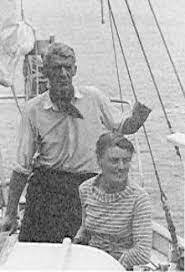
Miles and Beryl Smeeton on their ketch Tzu Hang – Clio Smeeton photo.
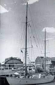
The ketch Tzu Hang in Victoria Harbour – Clio Smeeton photo.
August 27 to September 4– Club camp up the Drinkwater Creek where Nine Peaks, Mt. Septimus and Big Interior Mountain were climbed. As far as we know, Mt. Septimus had only been climbed once before. Eleven members attended the camp.
October 8/9/10 – A club trip to Mt. Arrowsmith for the Thanksgiving Weekend. Six members attempted to climb the mountain, but rain, snow, sleet and Hurricane Hazel’s little brother drove the climbers back to a cabin which was very kindly lent to the club by the Alberni Ski Club.
November – The annual meeting of the section was held at the home of Muriel and Aileen Aylard. The club welcomed two prospective members Ulf and Adolf Bitterlich who showed slides of their two-man assault on Mt. Waddington in August.
December 24 – Elizabeth Larrett and Patrick Guilbride, both Active and Life members of the section, were married on Christmas Eve.
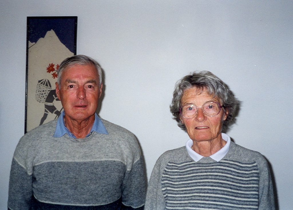
Patrick and Elizabeth Guilbride in 2001 – Lindsay Elms photo.
The April Ski Camp was at Glacier with the Vancouver Island section having the most attendees and the most boil-ups.
Section members who attended the ACC general summer camp at Mount Robson July 25 to August 7: Mabel Duggan, Judith Davis, Ted Goodall, Ethne Gibson, Rex Gibson, Sylvia Lash, Bill Lash, Elizabeth Larrett [Guilbride], Fred and Edith Maurice, Mark Mitchell, Margery Thomas
Mountain Climber Honored
Reported in The Vancouver Sun Wednesday February 9, 1955. p.10.
OTTAWA—A Port Alberni immigrant has been recommended for a humane association award for three daring mountain rescues carried out within five months last year. The immigrant is Ulf Bitterlich, formerly an experienced mountaineer in the German Alps and the Urals. His first rescue was carried out on July 3 on Mt. Septimus near Alberni, when two climbers fell through a snow bridge, killing one. Bitterlich descended to the bottom of the 200-foot crevasse to bring up an injured girl, Alma Currie> he brought her down the mountain and then returned to bring out the body of his friend, Ralph Rosseau. On October 11, Bitterlich was climbing on Mt. Arrowsmith with his brother when they heard what sounded like an aircraft crashing. The German climber sent his brother to summon the RCMP and spent the rest of the night in an unsuccessful attempt to find the wreck. It was found the following day after he had been joined by a search party. Two weeks later the Alberni lumber workers climbed Mt. Arrowsmith at night in a blinding storm with winds up to 70 miles-an-hour to bring down a climber with a broken lag. Bitterlich, with one companion, climbed 6,000 feet in half the normal time to bring down Charles Faulkner.
Mountaineer Hero of Three Rescues Proposed for Top Humane Award
Reported in The Vancouver Province Thursday February 10, 1955. p.28.
A Port Alberni mountaineer who played the leading role in three mountain rescue bids in five months has been recommended by Port Alberni citizens for one of the top wards of the Royal Canadian Humane Association. The association is now considering what action to take. The climber is Ulf Bitterlich, who came to Canada from German in 1951. In July he was climbing Mt. Septimus on Vancouver Island with three friends when two of them fell through a snow bridge into a rocky gully. Ralph Roseau, Port Alberni teacher, was killed. Bitterlich rescued the survivor, made the rest of the party comfortable, then tramped many hours to bring help. In October he was the leader of a climbing party which found the wreck of an RCAF Expediter on Mt. Arrowsmith. Four men died in the crash. Bitterlich and his brother Adolf stayed at the scene with RCAF men to bring the bodies and equipment out, and cut a staircase in ice to help parties reach the spot. And two weeks after he left the mountain, Charles Faulkner of Victoria broke his leg near the summit of Arrowsmith. Bitterlich climbed to the scene at night, then ended up with two injured on his hands, when falling rock injured his companion, Leo Lynn. Bitterlich, a former member of the German mountain rescue organization, supervised all the rescue work.
Ski Club Moves for Park at Mt. Brenton
Ask Royal Commission Set Aside 2,500 Acres For recreation Area
Reported in The Victoria Daily Times Monday March 28, 1955. p.13.
Victorian Sno Birds Ski Club today recommended to the Sloan Royal Commission that a 2,500-acre park be created on Mount Brenton near Chemainus. Club official Anthony Emery presented a brief to the commission, asking that the provincial government take over the tract “for recreational use of the citizens of the province.” The land is now owned by Van-West Logging Co., but Mr. Emery said his group is of the opinion “they would be prepared to negotiate for its outright sale at a reasonable figure.” The Ski Club has already constructed a large cabin at Silver Lake, and operates a 500-foot ski tow from January to May, Mr. Emery said. He told Chief Justice Gordon Sloan there is no provincial park on Vancouver Island providing skiing facilities similar to those available at Mount Brenton. Mr. Emery said the proposed park’s location puts it in a central position to 90 percent of the residents of Vancouver Island. He said, it possesses great natural beauty, with a view from the Brenton Bluffs across Georgia Strait “unparalleled on the southern half of the Island.”
Sno-Birds Win First Sanctioned Meet on Mt. Brenton
Reported in The Daily Colonist Tuesday March 29, 1955. p.9.
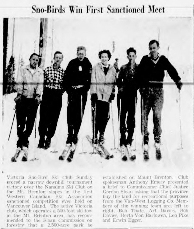
Sno-Birds Win First Sanctioned Meet. Victoria Sno-Bird Ski Club Sunday scored a narrow downhill tournament victory over the Nanaimo Ski Club on the Mt. Brenton slopes in the first Western Canadian Ski Association sanctioned competition ever held on Vancouver Island. The active Victoria club, which operates a 500-foot ski tow in the Mt. Brenton area, has recommended to the Sloan Commission on forestry that a 2,500-acre park be established on Mount Brenton. Club spokesman Anthony Emery presented a brief to Commissioner Chief Justice Gordon Sloan asking that the province buy the land for recreational purposes from the Van-West Logging Co. Members of the winning team are, left to right, Bob Thate, Art Davies, Bob Davies, Herta Von Barlowen, Leo Pike and Erwin Egger.
Immigrant Wins Medal for Bravery
Alberni Man Honored for Daring Rescue On Mountainside
Reported in The Vancouver Sun Friday June 24, 1955. p.27.
A German immigrant, hero of Vancouver Island mountain-top rescue, heads for the list of Canadians honored today for civilian bravery by the Royal Canadian Humane Society. Named recipient of the eleventh silver medal in the society’s 61-year history is Ulf Bitterlich of Port Alberni. Bitterlich, a modest, shy 26-year-old, won top recognition for his role in the rescue of Victoria climber Charles Faulkner from the 6,000-foot Mount Arrowsmith, highest mountain on Vancouver Island, last November.
Young Alberni Alpinist Wins Medal for Heroism
Reported in The Victoria Daily Times Friday June 24, 1955. p.25.
Alpine climber, Ulf Bitterlich of Alberni has been awarded the Royal Canadian Humane Association’s prized silver medal for bravery for his outstanding example of heroism in the rescue of Charles Faulkner Jr., of Victoria, from the summit of Mount Arrowsmith last fall. The silver medal topped the list of awards to Canadians for heroism made by the association at Hamilton, Ontario, today. The medal is the 11th to be awarded by the organization since its inception 62 years ago. Bitterlich, a German immigrant who came to Canada shortly after the war, received the medal for the part he played in saving the life of Faulkner, who fractured his leg in a fall from the peak of Arrowsmith. Faulkner, an expert climber, fell and tumbled onto a treacherous ledge overlooking a sheer 200-foot precipice. He was unable to move because of his leg injury and he lay only a few inches from the precipice.
Night Exploit
Bitterlich and a companion Leo Lynn, climbed the 6,000-foot peak to assist the injured climber. It was night when the rescuers got there. Seventy mile-an-hour winds whipped at them and rocks fell constantly from overhead. One hit Lynn on the head injuring him fairly severely. They treated the injured climber, but were forced to wait until daylight before attempting to move him with the assistance of a rescue party. Bitterlich worked strenuously for 45 hours on the rescue, playing the major part in the operation.
Long Exposure
Faulkner was finally taken down the mountain with great difficulty after spending two nights exposed to lashing winds and rain on the slopes of the peak. He is still recovering from his leg injury. Bitterlich is regarded as one of Vancouver island’s best mountaineers. He took part in one other mountain rescue early last summer.
Seven Higher Peaks
Reported in The Vancouver Sun Thursday June 30, 1955. p.4.
Editor. Sir,—On page two of your issue of June 24 you print an article of a German immigrant hero receiving a silver medal for having rescued a Victoria climber, Charles Faulkner, from the 6,000-foot level of Mt. Arrowsmith, “the highest mountain on Vancouver Island,” last November. I’d appreciate it if you’d tell me how one could effect a rescue at the 6,000-foot level of a mountain which has a maximum altitude of 5,976 feet? There are seven mountain peaks on Vancouver Island higher than Mt. Arrowsmith. The highest peak on Vancouver Island is the Golden Hinde, otherwise known as “The Rooster’s Comb.” The Golden Hinde is named in honor of the ship in which Sir Francis Drake made his epic voyage to the Pacific in the days of Good Queen Bess. The other mountains which are higher than Arrowsmith are: Elkhorn Mountain, 7,200 feet; Victoria Peak, 7,095 feet; Mt. Albert Edward, 7,000 feet; Mt. Alexandra, 6,394 feet; Crown Mountain, 6,082 feet; Mt. Jutland, 6,000 feet. Mounts Albert Edward, Jutland, Elkhorn, Golden Hinde, Crown and Alexandra Peak are all situated in the Strathcona Park area and Forbidden Plateau region. The Golden Hinde rises from the shores of Burman Lake and is in a very beautiful setting dominating Strathcona Park.
Samuel J. Hartnell
ACCVI Trip to Mount Constance, Washington State
Reported in the personal diaries of Geoffrey Capes, 1-3 July 1955.
July 1. Friday – Phyllis dropped Katherine and me in front of the store about 8. Ken Stoker came along about 8:15 with Corporal Bill Chapman. We piled our stuff in the middle of the back seat. Katherine and I sat on each side and were quite comfortable. With a stop for gas and a stop for coffee on the Malahat, we arrived at the dock in Victoria about 12:15 in time to get in the line up for the State of Washington ferry, the “Kalakala”. It rained at one point on the way. We met the rest of the Victoria Section of the Alpine Club there. We had lunch on board and arrived in Port Angeles in about 1½ hours. We spent about an hour there while Ken and Bill did some shopping. It is a very busy little town, hardly a parking site and sidewalks full of people. Highway 101 running East as far as Sequim through more or less flat farming counties. We noticed one or two big herds of cows. Turning south at Discovery Bay the road runs with mountainous country all the way. It rained on this section of the journey. Before turning off on the road that parallels Dosewallips River, we ran for a short distance along the shore of Hood Canal. One of the sights of the journey from Port Angeles was the Rhododendrons. The blossoming was just about over. On the lower part of the Dosewallips River, the foxgloves made quite a showing. There were scattered dwellings for the first few miles then the road became rougher and there were some very steep grades, particularly just before reaching the camp site, 13 miles from the main road. It was about 65 miles altogether. The camp site is on a wooded flat alongside the Dosewallips River. Each site having tables and bench, and a fireplace made of precast cement and grating. There must be a hundred of these sites, and by the time we left every one was occupied. Ted had arrived and had the tent up. I got an air mattress and sleeping bag laid out, then we cooked supper. Ken and Bill erected their RCAF emergency tent and everyone of our party came to look at it. There was a sing song during the evening. I turned in about 9:45.
July 2, Saturday – Cyril Jones gave his rooster call about 4. The camp roused itself by about 4:30. It was 6:30 before we started. We drove back along the road to where the Lake Constance Trail leads up the mountain. The trail followed a noisy creek. It was very steep the whole way to Lake Constance. I suppose about 4,000 feet. We followed round the small lake and crossed the creek. Snow lay here in the timber. In a short time we emerged on to snow fields. I had “Skreen” on my face and put on dark glasses though the sun was not very strong. Except for one or two islands of rock, the snow fields covered everything and we rose steadily. We paused for lunch on one of the rocky islands. Where the snow steepened, I went on a rope led by Syd Watts. Katherine, Ted and a chap called Pete Thomas also. Katherine and Pete had no ice axes. The snow was hard. We came to a gulley free of snow. Here we noticed fresh snow from yesterday and there were small icicles hanging from the walls. Visibility was poor. It was difficult. In parts impossible to see the mountain tops. Ted elected to stay there. If there had not been a very cold wind blowing, I would have done so too. We traversed a steep snow slope for some distance then climbed up the slope to a long scree and rock gulley. Up this on to more snow. Turned left to where one of the peaks of Mount Constance came in view. Several times I had told Syd I wanted to quit and wait for the return. My thighs were giving trouble however, I went on. Those we found had left their ice axes so we followed suit. We scrambled up a rock slab and came to rest on a kind of terrace. The stronger climbers were above us trying to find a route to the summit. The rest of us waited in a bitter wind. I took the opportunity to have a short sleep. This went on. We cannot have been more than 150 feet from the summit of the 7735-foot mountain. A route was not found. We heard later we should have gone through a crack, made a finger traverse with an 800-foot drop below. About 3:15 we started down. On the way up just after we started on the traverse, Pete, who had no ice axe, slipped. He did not go far as the snow was soft. I had a coil round my ice axe. At the head of the gulley we unroped and for a thousand feet or so slid down the scree. The lower part was rougher. By the time we got to the long snow fields, only Katherine and I were left. Pete made faster progress and disappeared. Rx Gibson and Syd Watts soon passed out of sight. After Katherine and I had gone some distance we were surprised to find Cyril Jones catching us up. He was very tired the same as I was. The snow was safter than it had been in the morning. I was rather pleasant. There was no wind. There was a slight fog and little visibility. In due time we arrived at lake Constance. We stopped for a drink of water. Once off the snow Katherine went ahead with two of the others. Cyril and I dragged our weary bodies down the steep trail. I shared what was left of lunch. We stopped often to rest. Twenty men, boys and women must have passed us going up and there were one or two lots of people camping at the lake. At 8:50. About an hour later than everyone else we emerged on the road to find Syd waiting. Margery Thomas and Dr. Mark Mitchell who had not been with the twenty that invaded the mountains, had hot soup for us. Dr. Mitchell had lighted all the cooking fires. We had a leisurely Supper. I managed to eat quite a lot. It was wonderful to wrap with the sleeping bag.
July 3. Sunday – Sunday up about 7:30 not feeling too bad. A leisurely breakfast. Got everything packed up and as Ken did not appear to be nearly ready, I had a look around. Spoke to the Ranger and walked about half a mile up the trail pasted her cabin. I met some boys with fishing rods. Our party as usual then had to leave. We stopped to photograph the falls then went on. It was raining and it continued to rain all the way to Port Angeles. Soon after emerging on the highway, we stopped to lunch at the Olympic Inn overlooking the Hood Canal It is a nice place, magazines scattered about. Strangely enough the July copy of the National Geographic magazine had an article on the Olympics. Ken did not waste time driving through the steady rain to Port Angeles as the ferry does not reserve places for cars. One has to take a chance on a line-up and it is usual to be in place an hour before the Ferry sails. We were only half an hour but we got on the last row. Although there was no wind the “Kalakala” rolled in the swell from the pacific. Had a cup of tea on board. The customs asked a few questions in Victoria. It had been raining in Victoria, but it was now fine. We took the new unfinished Highway to Goldstream. Stopped for a sandwich and a cup of tea on the Malahat. Ken does not like being in a line of cars and he maneuvered his Morris, that we passed everything on the road. Somewhere around Chemainus an old panel truck was parked on the side of the road with smoke and steam enveloping it. A number of cars were present. We did not stop. Ken and Bill had to get a picture of the beautiful sunset so arrived in Courtenay. We crossed the Dyke. Ken then drove Katherine and me home. It had not rained in Courtenay. We arrived about 9:30.
Included in the party were Geoffrey Capes, Katherine Capes, Syd Watts, Cyril Jones, Rex Gibson, Bill Chapman, Mark Mitchell, Margery Thomas, Ken Stoker, Peter Thomas.
Rain, Snow End Alpinists’ Bid on Mount Robson
Reported in The Victoria Daily Times Monday August 8, 1955, p.3.
JASPER, Alta.—Members of the Alpine Club of Canada Sunday described their first attempt in 30 years to scale 11,068-foot Mount Robson as a “disappointment.” Rain and fresh snow which fell almost continuously during the first 11 days of the two-week camp made the climb to the summit too dangerous. Friday another party led by Major Rex Gibson of Victoria, scaled The Dome, 10,098 feet, an outlier of Robson.
Buttle Lake
Reported in The Daily Colonist Friday August 12, 1955. p.5.
I get sick and tired reading all the phoney stuff about Buttle Lake by the power commission. My home is at Buttle Lake and I have lived there for 28 years. The government says that only millionaires with planes can get to the lake. Bunk! The cars at the foot of the lake have been so thick the last three summers that I have been thinking of opening a parking lot. A lot of them tow their boats on trailers and I have seen over 30 strange boats on my end of the lake at one time. Thousands of people have come in to the lake since I have lived here—very few of them in planes. We had a good trail for pack horses for more than 20 years; the government built it and kept in in condition. The Elk River Timber Company logged over it and while they were logging the visitors came in on the ERT speeders and work trains. When the Elk River Company was forced to stop logging in the lake, they did not open the trail. During the six years that the government kept the trail closed, we had to walk out to Upper Campbell on the logging railroad. Then the power commission thought they could build a dam here, and build a good auto road to the lake. If the crowds don’t stop coming, I’m going to have to move. Guess I’ll have to move anyway, because I’ve seen timber cruisers in here the last three years that it looks like a cinch, they are going to log out the timber. One of the cruisers told me that there was over 700,000,000 feet—mostly Douglas fir—that could be pulled into the lake. One thing I have learned for sure during my 40 years in B.C. is that where Douglas fir is, loggers will go—park or no park.
Harry Roger
Buttle Lake, B.C.
Save Strathcona Park! Slimy Chaos Alternative to Beauty
Reported in The Daily Colonist Friday August 19, 1955. p.1. & 2.
By Roderick Haig-Brown
There are two alternatives in the future of Strathcona Park and Buttle Lake. The first is mud and slime, stumps and debris, chaos of logging, hazard of fire. It will be followed by years of blowdown creeping gradually back into the tall forest, creating new fire hazard, building logs and brush and second growth. It will mean destruction of natural spawning beds, flooding of flats that are life itself to the wintering elk herds, drowning of swamps and deciduous trees that are food for beaver and ruffled grouse. It will bring about an enormous and destructive change to every natural balance within the park boundary. The second alternative is an untouched, unchanged natural area, more beautiful than any other on the island, true to the original cycles and balances as no other area can ever be. And the difference between these two alternatives is something less than fifteen feet of water; perhaps less than ten feet. If the lake and the park are saved as they must be, what is their future? It has been said many times in the present controversy that the park is inaccessible, that the public cannot get into it. Only a few millionaires fly in there and keep it to themselves. This is a lie. Until the old trail was logged over the park was always accessible to the public. Even after that, people who had been going in for years continued to go in, over the abandoned railroad grades. Within the past year or two, people have gone in by hundreds, over the narrow twisting logging road that is too often barred by gates. But all this is not the measure of the lie. The true measure of the lie is in the suggestion that any lake lying thirty miles back from salt water and only 700 feet above it could possible be called inaccessible. That is a lie so obvious that it should never have fooled anyone. But it has fooled people. Any government of the past ten years awake to its responsibilities could have built a good road into the lake for less money than was spent on the old trail. And the people who foster the lie know this very well. If you don’t choose to cross a street, it is true that you won’t get to the other side; but that doesn’t make it inaccessible. Strathcona is the most readily accessible major park in British Columbia. Building a road into Buttle Lake is a cheap and simple operation by any standards. It is long overdue and it is a natural first step in the development of the park. The present logging road is not a good enough entrance to a great provincial park, and the public must not be left dependent upon the good will of logging companies. It is equally urgent that the park boundaries be changed to take in the full length of Buttle Lake and at least part of the new lake that will be formed. This can easily be done by exchange of forest land, since there are valuable timber licenses on the western slope of the park, beyond the high mountains, which could and should be released into management licenses or working circles. Additional funds realized from this must be earmarked to pay for the road and other development. At the end of the road a concession will be granted for boat rental and for a lodge and cabins, to be built under supervision of the Parks Division. Development farther up the lake should move more slowly; safe and simple campsites near the best beaches are the first obvious need. Trails should be built on the west side of the lake up Wolf, Phillips and Myra Creeks to the alpine country around the Golden Hinde. On the east side of the lake it is a relatively simple matter to build a trail up Shepherd’s Creek and Ralph Creek into the Forbidden Plateau. And sooner or later there will certainly be a road through the pass from Price Creek, at the head of the lake, to the Alberni’s. This is a skeleton plan of simple and low-cost development that would give Vancouver Island its first and only large-scale park. Within two or three years of such development the park would be used by thousands of people and other development would follow logically. Buttle Lake with Myra Falls and the magnificent timber flats at Marble, Wolf, Phillips and other creek mouths is far and away the greatest attraction in the park, as well as its only logical route of access. But there is an infinity of lesser attractions—Flower Ridge, Marble Mountain and Marble Lakes, the Golden Hinde and a dozen other great peaks, to name only a few of them—which would eventually be opened up. All this depends on preserving the shoreline of Buttle Lake. There is not one park expert in Canada who can honestly say that the true possibilities of the park can be realized if flooding takes place. The moment a clearing axe is laid to the first tree something wonderful and irreplaceable will be lost forever. No park official will say. None will be allowed to. I learned long ago from a great Chief Forester of this province, the late E.C. Manning, that the civil servants must always suffer silence under errors of the government policy, however serious; the only alternative is resignation and leaving the affair to some lesser man who will say what he is told to day. If this was true in Manning’s day, it is equally true today. The public must judge for itself and speak for itself to have a hope of having its birthright. And what is it all about? A few thousand horsepower in a total over a quarter of a million. Nature provided a 400-foot head at Elk Falls. The commission has taken fifty-eight feet of storage at Lower Campbell Lake. It will be taking another 120 feet or more at Upper Campbell and Buttle. Do we have to crawl on our hands and knees and beg for just ten or twelve feet of this massive storage to save Strathcona Park? Is there not one man in the provincial cabinet with the vision to measure ten feet of water storage against the only wilderness park on Vancouver Island? Is nothing left of the dream men dreamed in 1911, now that it is within realization? Talk can go on forever. It surely will, if the shoreline of Buttle Lake is desecrated. No torrents of talk can change it, nor the dismal figures of a hundred engineers. Ten feet of storage, a few miserable kilowatts of electricity, expendable in neon signs, against the only wilderness park, the only unravaged shoreline of Vancouver Island. We may be a materialistic people, living in a materialistic age, caring little for anything beyond our own time. But surely we can afford this one tiny gesture of generosity to the future, and leave Strathcona Park untouched. All the electric power in the world can never build anything like it again.
Dam to Raise Level of Buttle Lake Will Be Constructed Immediately
Reported in The Daily Colonist Friday August 19, 1955. p.13.
Work will start almost immediately on construction of a 160-foot dam two miles below the outlet of Upper Campbell Lake, which will eventually create one big lake of Upper Campbell and Buttle lakes, and raise the level of Buttle Lake by nineteen feet. But B.C. Power Commission officials said yesterday that the level of Buttle Lake will not be affected until late 1957 at the earliest. Contract to build the Upper Campbell dam was awarded yesterday to Dawson Wade & Co. LTD., for $4,921,875. The BCPC hopes the dam will be sufficiently advanced by November, 1956, that there will be water storage in Upper Campbell Lake available downstream generating plants at Ladore Falls and the John Hart units. Originally expected to be a two-stage development, the Upper Campbell project will now be one continuous effort to provide power as soon as possible. But it will depend on natural runoffs as to how long it takes to fill storage space at Upper Campbell and then Buttle Lake. Power Commission officials hope that by the end of 1957 Buttle will start rising to the new level of nineteen feet above the average high-water level. Before the level of Buttle is raised a twenty-four-foot strip around the lake will be logged and cleared. Final details for this project have to be ironed out with the water comptroller and forest service before tenders are called for the work. All timber affected within the Strathcona Park boundaries will be sold by public auction. The BCPC expects to make an early start on the installation of two 42,000 horsepower generating units at the Upper Campbell dam site and would like to have these in operation by 1957. Roderick Haig-brown, noted Campbell River conservationist and author who has consistently opposed any interference with Buttle Lake on grounds that it would spoil one of the last wilderness areas, and ruin Strathcona Park, expressed surprise last night when he heard a contract had been let to erect the dam to its full height. “They have made a mistake in letting that contract,” he said. “It is quite needless and sloppy handling.” He said it is not yet known how much flooding Buttle Lake can stand; for it is not known how much horsepower the last few feet the lake is raised will generate; and that Vancouver Island will have to go somewhere else for its power soon anyway. “All they have to do is advance the Bute Inlet project by a year and leave Buttle Lake as it is,” Mr. Haig-Brown said. He added “there is no problem in getting power for the Island. Ultimately, we won’t be short of power because we will have to get it from the mainland.”
Leave Awful Mess
He said the flooding of Buttle Lake will leave an “awful mess.” Clearing of the bush, he said, is an impossible task and “if the proper conditions were enforced there would be no dam because the cost would be prohibitive.” But B.C. Power Commission argues the lake will be more accessible to the public as roads will be built. Restriction of the water licence to the BCPC insist that proper campsites are cleared, boat landings built, but access roads constructed. There is a rough road to Buttle Lake now, but it passes through two privately-owned logging company operations, which are sometimes barred by gates. Since the BCPC constructed a rough road to the head of the lake last year, Buttle has been used by the general public more than it has been since the old trail was overgrown and logged over, but strictly speaking, the general public has no right of access by road. Colonist reporters, who flew over Buttle Lake yesterday, observed three or four tents pitched on the lakeshore, but saw no boats fishing in the lake. When the Upper Campbell project is completed, it will bring the Campbell River system up to 322,000 horsepower capacity – 84,000 at Upper Campbell, 70,000 at Ladore and 168,000 at the John Hart plant. The new dam will be earth-fill construction 160 feet high and 1,800 feet long at the top. It will be 1,000 feet thick at the existing river level and 36 feet at the top. About 2,000,000 cubic yards of earth will be used in construction. The generating plant will be on the downstream side of the dam at the west end to which water will be carried through a 22-foot diameter penstock to two 42,000-horsepower units. When the job is completed the storge behind the dam will form one large 30-mile-long lake out of Buttle and Upper Campbell. The power commission will have the job of gathering and removing a tremendous amount of old logs and debris which now lie around Upper Campbell and Elk River valley, which is now a logged-off mess.
Climbing In Strathcona Park
August 27 to September 4, 1955.
Recorded in the Canadian Alpine Journal Volume 39, 1956. p.59–63.
By Elizabeth Guilbride and Margery Thomas
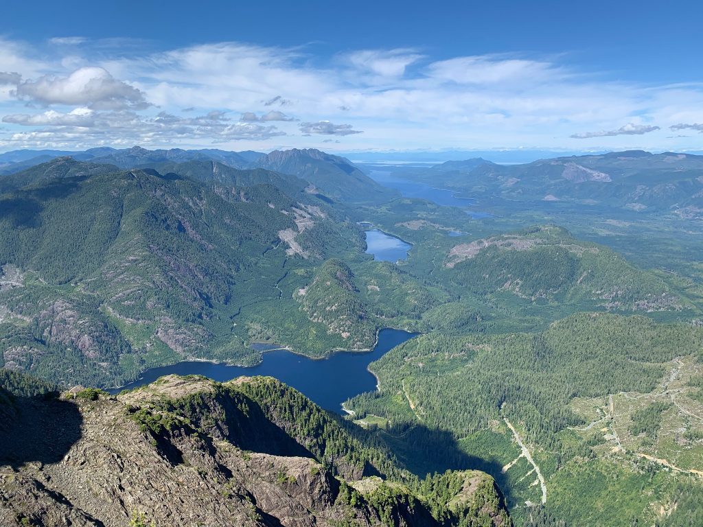
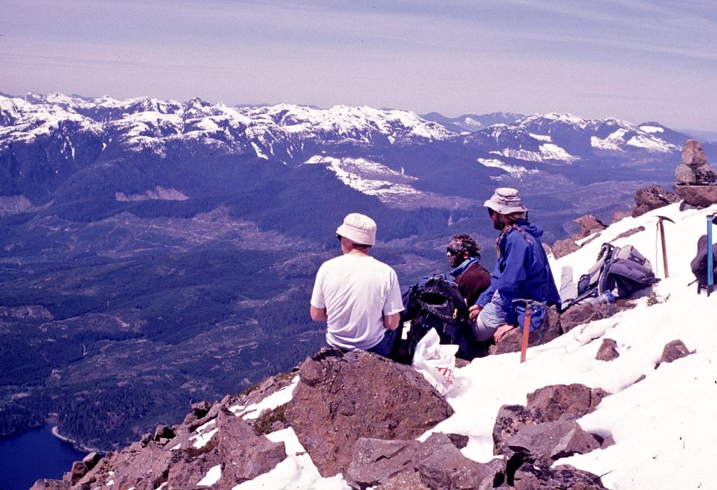
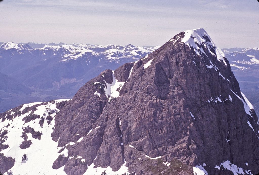
Late in August 1955, eleven members of Victoria section set off for Strathcona park, Vancouver Island, to climb, and to see for themselves more of the beauties of this island. The objective was to climb Nine Peaks (6,000 feet) Mt. Septimus (6,400 feet) and Big Interior Mountain (6,107 feet). These mountains rise steeply from the Drinkwater Valley which lies to the north of Great Central Lake. Though they are miniature mountains they provide interesting climbing and truly alpine conditions. The first campsite, was chosen in advance for its beauty, lay beside Drinkwater Creek at the foot of Della Falls. These falls drop vertically for 1,580 feet and with the lake above them were named after the wife of Joe Drinkwater, a prospector who lived in this valley years ago. Della Falls together with the lesser streams from Love Lake and Beauty Lake form the riotous creek named after Joe. The climbers, three women and eight me, arrived at this campsite at 6 p.m. on August 27. They had left Victoria at 3:30 a.m. on that day, driven 130 miles to Great Central Lake, taken Paddy Burke’s boat for about 20 miles up the lake and walked with heavy packs for 9 miles up the valley to this lovely, sheltered spot. Next day (August 28) the men went back to the head of the lake for the rest of the supplies. Climbing ropes and ice axes, sleeping bags, air mattresses and tents, cooking pots and food for the party for eight days were then assembled at this campsite. On August 29, Nine Peaks was climbed. The route led up beside Della Falls onto the meadows by Della Falls, up the rocks and onto the glacier, round the crevasses and across a snow bridge, over a bergschrund and onto the rocks again to the first summit. Three of the party crossed a col to the second peak then went up more rock to the third, which is the true summit. Below lay Della Lake, Beauty lake and Love Lake and in the distance beyond, Cream Lake could be seen in a scooped-out hollow at the foot of Mt. Septimus. The following day (August 30) a party of four started out to reconnoiter a route up to Cream Lake. Through creek beds and patches of slide alder, they followed the valley nearly to its head and thence went up a gully, arriving at dusk on a small col that overlooked Love Lake. From the col there was a good view of Mt. Septimus and the sight of the fog rolling from the Pacific with the setting sun behind it was especially beautiful. In the morning (August 31), having failed to find a route around Mt. Septimus that would lead to Cream Lake there was no alternative but to climb with full packs up to 5,600 feet then down some fairly steep snow for 1,200 feet to Cream Lake at the foot of the moraine. A beautiful spot for a camp was found beside this small round lake, not cream in color but a deep clear blue. Streams flow into Buttle Lake which lies deep in the next valley. Soon after the four arrived at Cream Lake the weather closed in and visibility was nil. It was uncertain whether the rest of the party would find then until voices were heard through the mist and three more people appeared. No route to Cream Lake with full packs could be called easy, but the second party had found an easier route at the extreme end of the valley and up a tongue of snow to the ridge. The rest of the group arrived the next day (September 1), also having taken the easier route. It took them longer because they had sauntered along admiring the tiger lilies, valerian and wild asters in the valley and the heather-covered ridge dotted with tarns. On September 2 a party of six started out on Mt. Septimus. The mountain, believed to have been climbed only once before [Ralph Rosseau 1947], presented some difficulty in regard to the route. There was no doubt as to which of the seven peaks was the summit. A rope of three went up the most westerly peak and after some tricky and exposed pitches reached the top only to find it was not the true summit. It was too late then to look for another route so they returned to camp at 5 p.m. The other three, Elizabeth and Pat Guilbride and Syd Watts, went up a chimney only to find that it wouldn’t go, so down they went onto the snow to start up another gully from which the second peak was reached without much difficulty. Again they found it was not the top and descended again to the snow and started up another gully farther to the east. About 300 feet below the summit one other member “folded” and was left on a ledge while her companions reached the true summit after a few airy pitches. They were unable to retrace their steps so had to descend again to the snow and climb up to fetch her down. Camp was reached at 9 p.m. Next day (September 3) a party of four climbed Big Interior Mountain in beautiful weather. From the summit were magnificent views in all directions—to the west breakers of the Pacific 20 miles away; to the east the Coast Range and Mt. Waddington; and to the south Mt. Arrowsmith, Klitsa Mountain and Mt. Moriarty were clearly visible. On the last day (September 4), the group walked out to Great Central Lake in blazing sunshine. One of the party was dragging a little and he arrived at the lake after dark. It was discovered that along with his personal stuff and a billy or two he was carrying a large crow bar, a small crow bar and a sledge hammer from a deserted mine 9 miles back They had taken his fancy so he carried them out. During the last days three pairs of boots had been repaired, their soles tied to the upper with cod-line. Several pairs of trousers had been well sutured and probably would not be able to undertake another trip. The climbers themselves after 38 miles of back-packing felt well set up for the winter. We had achieved out objective in the three climbs. We had enjoyed swimming in the lakes and tarns. The food was good and adequate, augmented now and then with blueberries. We learned that Connie Bonner’s art does not stop with the brush and palette but extends to the more practical art of cooking. Her pumpkin powder jam made at Cream Lake camp was greatly appreciated. Except for one evening of fog the weather was fine and clear. The expenses were modest, $10.50 each for the whole trip. It was an excellent trip but we all felt that if we could get a helicopter next year, it would greatly increase our climbing range and capacity.
Included in the party were Elizabeth Larrett [Guilbride], Margery Thomas, Connie Bonner, Syd Watts, Patrick Guilbride and 6 others.
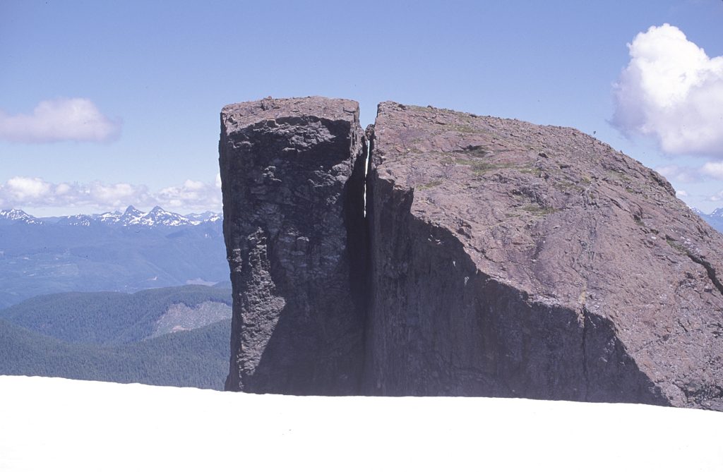
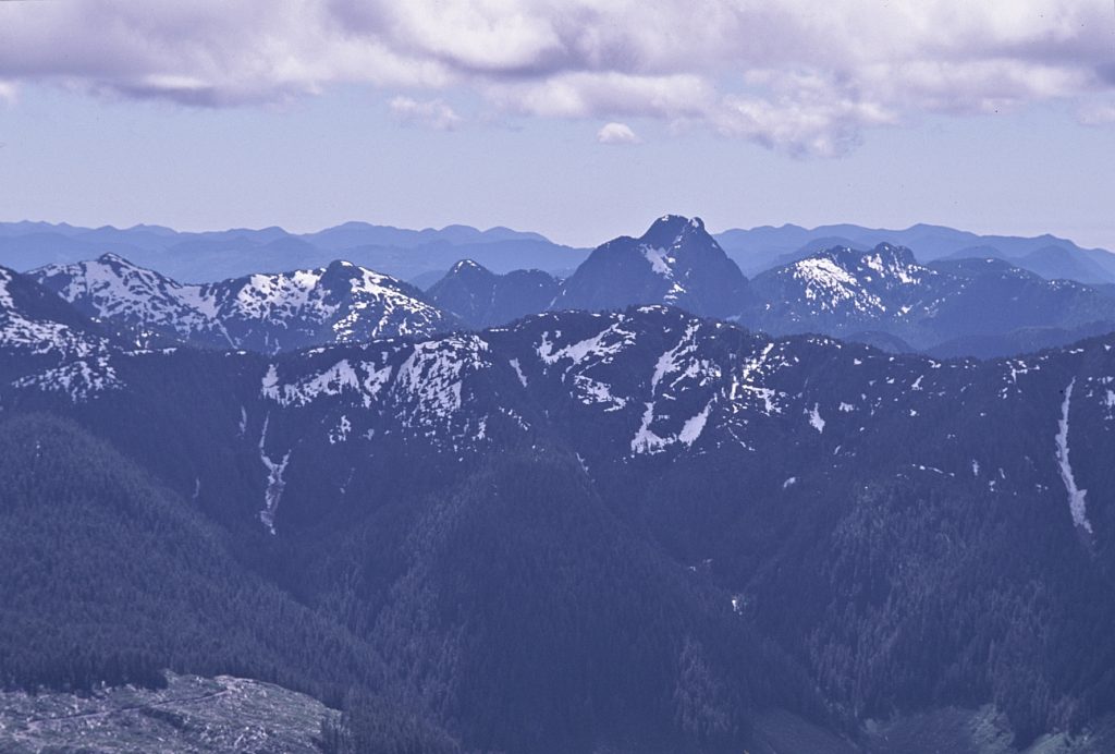
Nine Peaks – Connie Bonner photo.
Cream Lake and Mt. Septimus – Connie Bonner photo.
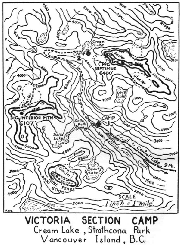
1955 Cream Lake Route Map
Pinder Peak 4 September 1955
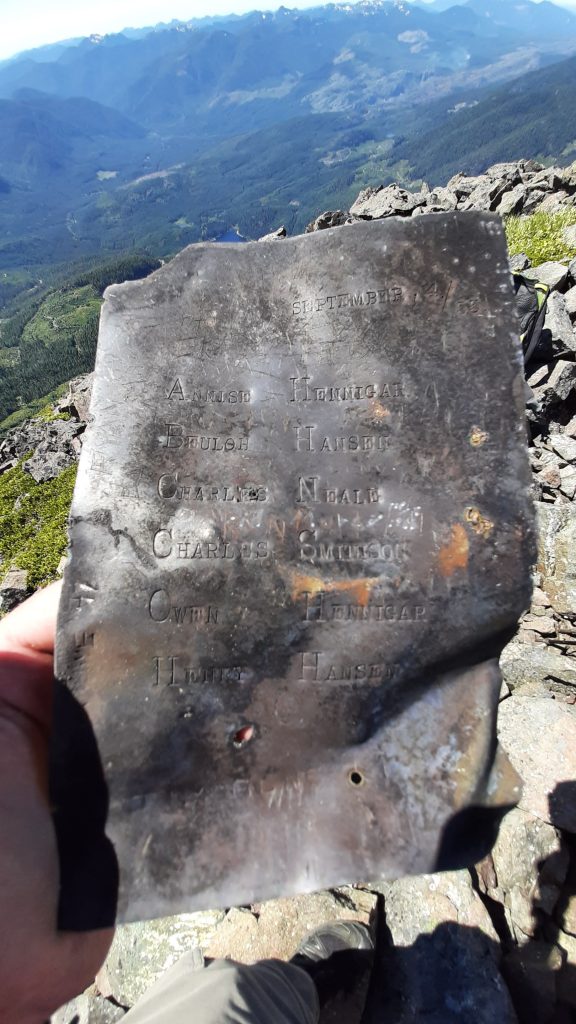
The engraved metal plate with the names Annise and Owen Hennigar, Beulah Hansen, Henry Hansen, Charles Neale and Charles Smithson, that was left on the summit of Pinder Peak in 1955 – Jason Hare photo 2017.
Northward Next on Vancouver Island
Reported in The Daily Colonist (The Islander Section) Sunday September 4, 1955. p.1.
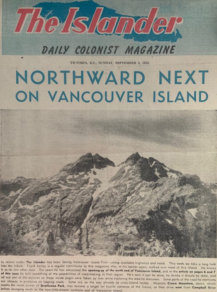
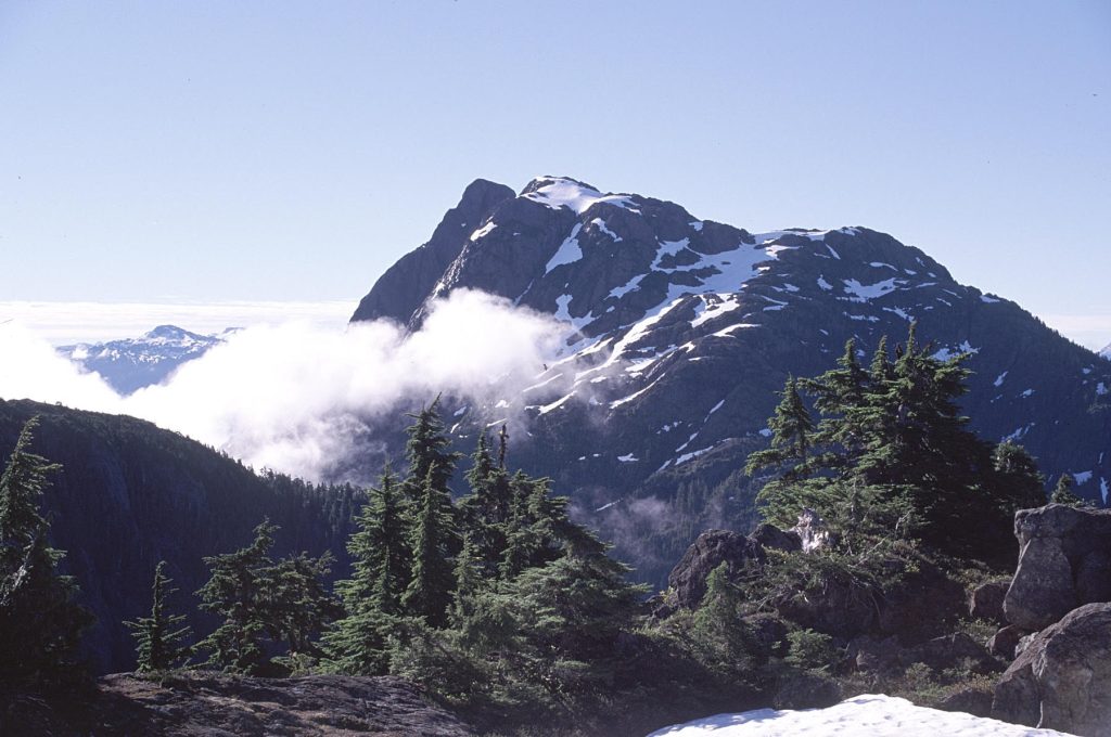
Northward Next on Vancouver Island. In recent weeks The Islander has been Seeing Vancouver Island First — along available highways and roads. This week we take a long look into the future. Frank Kelley is a regular contributor to this magazine who, in his earlier years, walked over most of this Island. He knows it as do few other men. For years he has advocated the opening-up of the north end of Vancouver Island, and in the article on pages 6 and 7 of this issue he tells something of the possibilities of road-making in that region. He’s sure it can be done; he thinks it should be done, and all but one of the pictures on those inside pages were taken by him while exploring the area he discusses. Some parts of the road he mentions are already in existence as logging roads. Some are on the way already as cross-Island routes. Majestic Crown Mountain, above, which marks the north corner of Strathcona Park, may become a target for tourist cameras of the future, as they drive west from Campbell River before swinging north to the now-little-known northern end of Vancouver Island.
Nine Peaks
Reported in The Victoria Daily Times Tuesday November 8, 1955. p.12.
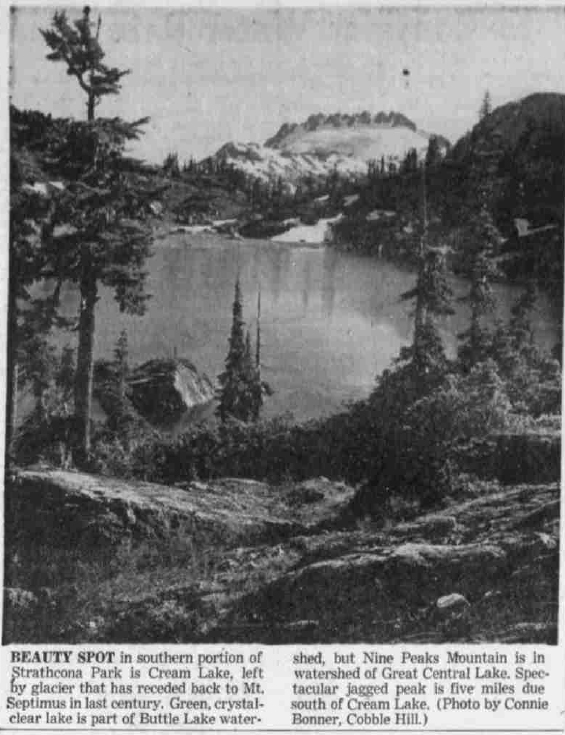
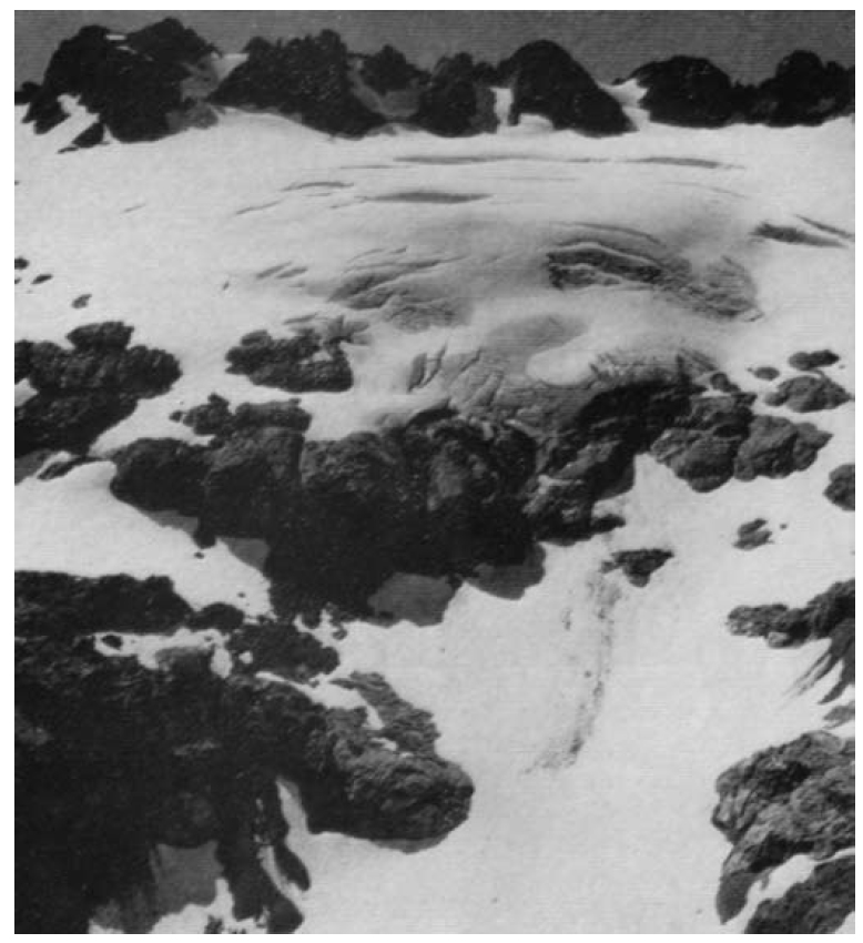
BEAUTY SPOT in southern portion of Sathcona Park is Cream Lake, left by glacier that has receded back to Mt. Septimus in last century. Green, crystal-clear lake is part of Buttle Lake watershed, but Nine Peaks Mountain is in watershed of Great Central Lake. Spectacular jagged peal is five miles due south of Cream Lake. (Photo by Connie Bonner, Cobble Hill.)
Big Interior Mountain
Reported in The Victoria Daily Times Wednesday November 16, 1955. p.6.
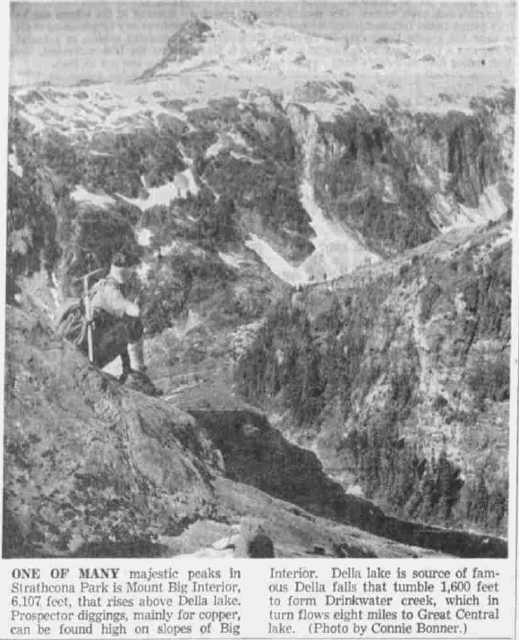
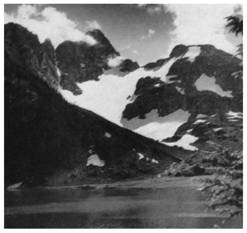
ONE OF MANY majestic peaks in Strathcona Park is Mount Big Interior, 6,107 feet, that rises above Della lake. Prospector diggings, mainly for copper, can be found high on slopes of Big Interior. Della lake is source of famous Della falls that tumble 1,600 feet to form Drinkwater creek, which in turn flows eight miles to Great Central lake. (Photo by Connie Bonner.)
A Sno-Bird Takes Flight
Reported in The Victoria Daily Times Thursday December 8, 1955. p.10.
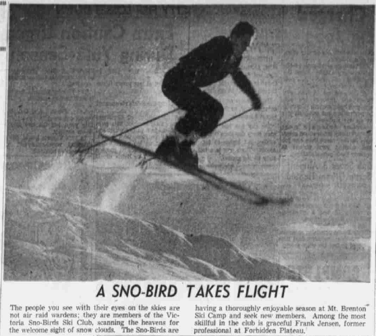
A Sno-Bird Takes Flight
The people you see with their eyes on the skies are not air raid wardens; they are members of the Victoria Sno-Birds Ski Club, scanning the heavens for the welcome sight of snow clouds. The Sno-Birds are having a thoroughly enjoyable season at Mt. Brenton Ski Camp and seek new members. Among the most skillful in the club is graceful Frank Jensen, former professional at Forbidden Plateau.
1956
ACCVI executive:
Chairman – Bill Lash
Secretary – Margery Thomas
Events:
The first official outing of 1956 was a boat trip to Mt. Tuam, Salt Spring Island.
Six Section members attended the ACC Columbia Icefields Ski Camp.
March – The sections annual banquet was held at the Pacific Club. The guest speaker was Fred Ayres of Portland. He showed slides and told the story of his climbs in the Andes.
Several ski trips to Mt. Baker, usually in small parties of two or four members. A ski camping trip to Mt. Porter near Port Alberni was carried out by two members but they were soon chased home by a downpour.
June 10 – Four members hiked up Mt. Sutton near Lake Cowichan. Summit weather was misty with snow flurries but a pleasant boil-up was organized.
July 1 – A club trip to the Dosewallips in Washington with an attempt by fifteen members, the second year in a row, to climb Mt. Constance. This mountain has been eluding the section for several years mostly because of the foul weather it brews. Five climbers had an easy scramble to the summit in glorious weather, despite tales of icy slopes and finger traverses.
July 7 – Three members climbed Hkusam Mountain at the extreme northern end of the highway on the east coast of Vancouver Island. The day was clear and the view of Johnstone Straits and the Coast range was magnificent.
August 25 to September 2 – Nine members attended the section camp at Garibaldi. They were all flown into Garibaldi Lake where they had the area to themselves. The climbers bagged Black Tusk, Castle Towers and Mt. Garibaldi while the botanists and photographers explored the meadows, lakes and glaciers. The notorious Garibaldi weather was reasonably kind and the camp was a complete success. A change from the bushwhacking involved on the usual camps in Strathcona Park. Party included: Patrick Guilbride, Syd Watts, ??
November 23/24/25 – Thanksgiving Weekend camping by the Chemainus River. El Capitan Mountain and Mt. Landalt climbed. [Mt. Landalt was changed on 6 May 1975 to Mt. Landale to reflect the correct form of the family name of John James Landale, engineer with the Robert Brown 1864 Vancouver Island Exploring Expedition.]
A party of six including two women made the ascent of the Northwest Peak of Mt. Waddington on August 13. Ulf and Adolf Bitterlich, Sylvia Lash, Philippe Delasalle, Sarka Spinkova and Earl Whipple. Three of the party were from the Vancouver Island Section.
November – The annual business meeting of the section was held at the home of Mark Mitchell. Noel Lax was elected Chairman. Ulf Bitterlich showed slides of his ascent of the Northwest Peak of Mt. Waddington.
Noel Frank Lax age 24.
Section members who attended the ACC general summer Glacier Camp in the Selkirks July 16 to July 29: Geoffrey Capes, Aileen Aylard, Muriel Aylard, Adolf Bitterlich, Rex Gibson, Ethne Gibson, William Innes, Sylvia Lash, Bill Lash, Eleanora “Nora” Piggott.
Section members who passed away in 1956: Cyril Jones, Alan Morkill, Leroy Cokely, Albert MacCarthy
Funeral Rites Thursday for Cyril Jones
Reported in The Victoria Daily Times Wednesday January 25, 1956. p.17.
Cyril Jones, Victoria’s former city engineer and a well-known alpine climber, died at the Royal Jubilee Hospital Tuesday. He was 66 years old. Mr. Jones entered hospital four days ago. He had been in poor health since he underwent a brain operation in Vancouver last August. He was city engineer from 1949 until his retirement at the end of 1955. Born in Swansea, Wales, and a resident of Victoria for the past 31 years, Mr. Jones was a veteran of the First World War. He served with the Royal Engineers and was wounded in Flanders. For a time Mr. Jones was a science master at Brentwood College and a surveyor. An active outdoor man, Mr. Jones was a member of the Alpine Club of Canada. He had climbed some of the highest peaks on Vancouver Island, as well as in the Rockies. He is survived by his widow; a son, Peter, in Vancouver; a daughter, Mrs. Pamela Stone, Nanaimo, and another daughter in England.
Mt. Brenton Ski Rivalry Resumes
Reported in The Victoria Daily Times Thursday March 1, 1956. p.11.
Traditional skiing foes, Victoria and Courtenay, will resume their rivalry this week-end in the sixth annual Mt. Brenton Trophy. The Victoria Sno Birds will host the visiting team for the annual races at Mt. Brenton. In conjunction with the team trophy event will be an individual competition open to all Canadian Ski Association authorized racers.
Dr. Jean McDonald
Reported in The Daily Colonist (The Islander section) Sunday April 22, 1956, p1 & 8.
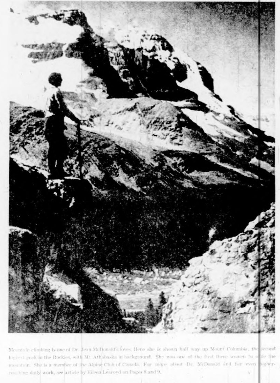
Mountain climbing is one of Dr. Jean McDonald’s loves. Here she is shown half way up Mount Columbia, the second highest peak in the Rockies, with Mt. Athabaska in background. She was one of the first three women to scale the mountain. She is a member of the Alpine Club of Canada. For more about Dr. McDonald and her even higher-reaching daily work, see article by Eileen Learoyd on Pages 8 and 9.
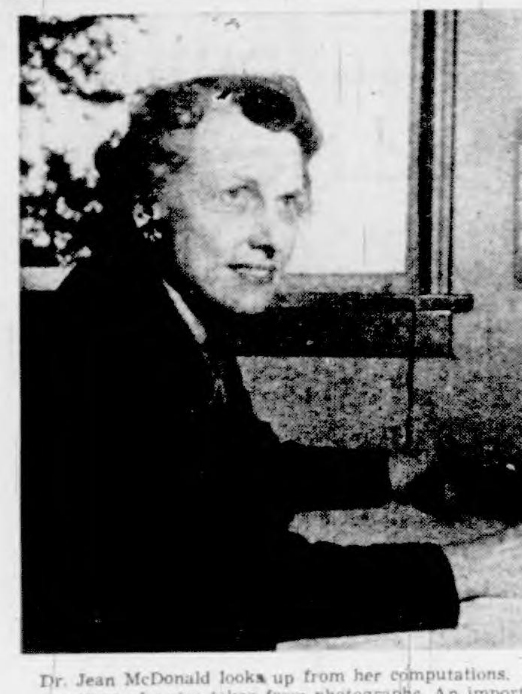
Dr. Jean McDonald looks up from her computations…
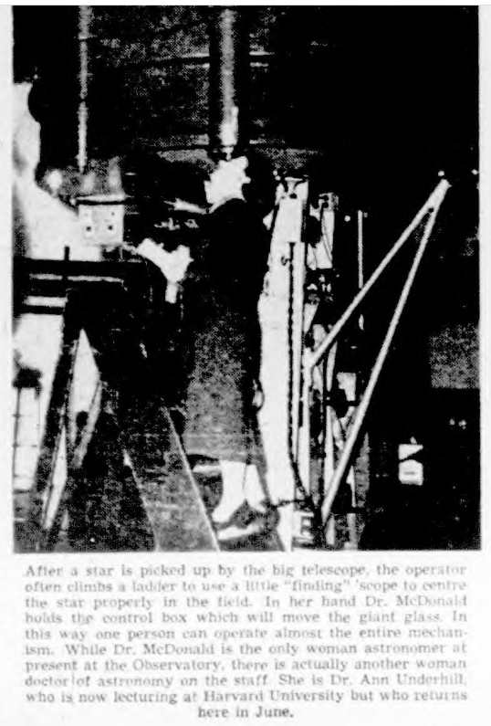
After a star is picked up by the big telescope, the operator often climbs a ladder to use a little “finding” scope to centre the star properly in the field. In her hand Dr. MeDonald holds the control box which will move the giant glass. In this way one person can operate almost the entire mechanIsm. While Dr. MeDonald is the only woman astronomer at present at the Observatory, there is actually another woman
doctor of astronomy on the staff. She is Dr. Ann Underhill, who is now lecturing at Harvard University but who returns here in June.
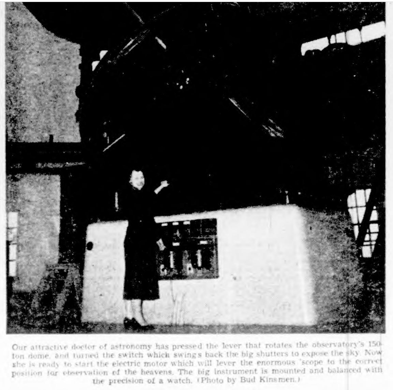
Our attractive doctor of astronomy has pressed the lever that rotates the observatory’s 150-ton dome, and turned the switch which swings back the big shutters to expose the sky. Now she is ready to start the electric motor which will lever the enormous ‘scope to the correct position for observation of the heavens. The big instrument is mounted and balanced with the precision of a watch. (Photo by Bud Kinsmen. )
Resting In a World of White
Reported in The Victoria Daily Times Saturday April 7, 1956. p.14.
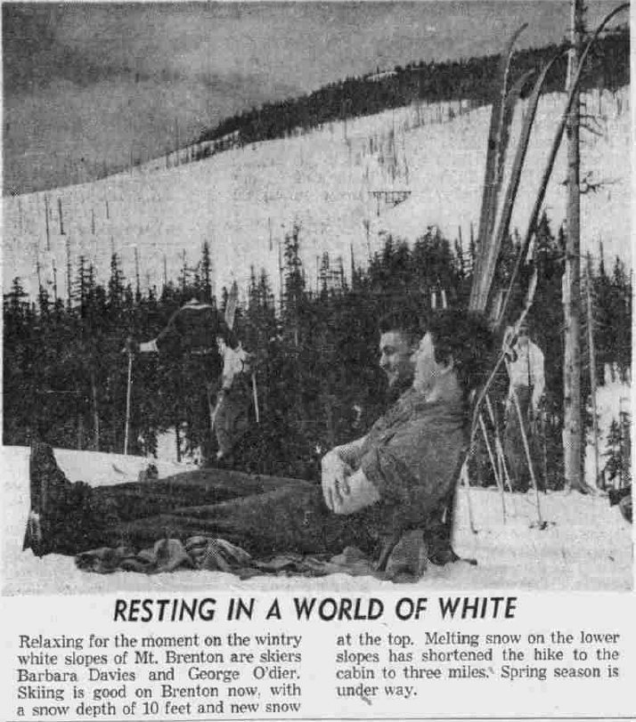
Relaxing for the moment on the wintry white slopes of Mt. Brenton are skiers Barbara Davies and George O’dier. Skiing is good on Brenton now, with a snow depth of 10 feet and new snow at the top. Melting snow on the lower slopes has shortened the hike to the cabin to three miles. Spring season is under way.
Fine Skiing for All Their Goal
Reported in The Daily Colonist The Islander section Sunday April 8, 1956, p12.
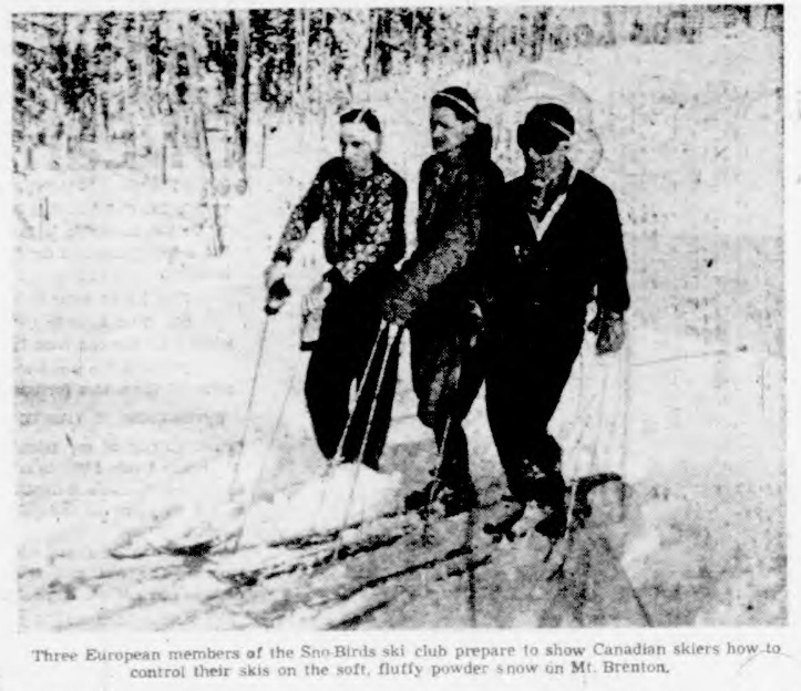
Three European members of the Sno-Birds ski club prepare to show Canadian skiers how to control their skis on the soft, fluffy powder on Mt. Brenton.
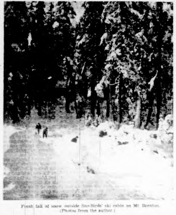
Fresh fall of snow outside Son-Birds’ ski cabin on Mt. Brenton. (Photos from the author.)
Soldier, Scholar, Gardener
Reported in The Victoria Daily Times Tuesday May 1, 1956. p.4.
Alan Morkill will not see Victoria’s radiant spring time gardens again. He died when the blossoms he so much loved were coming into bloom. But by those who knew how much he had to do with making the city the beauty spot it is, he’ll always be remembered with tenderness and gratitude. Born in Sherbrooke, Quebec, of an old and distinguished family, he came to British Columbia in his teens and entered the Bank of Commerce. Badly wounded, a mere lad, he came home from the First World War a captain with MC and bars. Thought a bank manager when Second World War broke out he enlisted as a private, rose to be a major and second in command at Debert. He married Eleanor Francis Mara, daughter of a well-known Victoria family, a nice of Sir Frank Barnard and Senator Barry Barnard. Mrs. Morkill was for some years commissioner of Girl Guides for British Columbia. Banker, gallant soldier, scholar, very prefect gentleman, Alan Morkill was loved by all with whom he came into contact; helpful without a stint to those in trouble. But he will probably be most remembered as a collector of plants, a gardener. He explored the mountains of British Columbia far afield; brought home specimens to acclimatize and propagate. He fired numbers of people with his own enthusiasm; started the Rock Garden Club and was for many years its president and mainstay. Spring Garden’s Week would never have become the international festival it is without Alan Morkill’s help. A modest man he’ll be remembered in the modest flowers that bloom in Victoria’s rockeries. – Gordon Cameron.
Mount Arrowsmith Chalet Dedicated
Reported in the Twin City Times Thursday July 5, 1956. p.1.
A chalet, at the 3500-foot level on Mount Arrowsmith was officially dedicated to the use of youth organizations of the Alberni’s in the memory of the late Ralph Rosseau when ceremonies were held Saturday afternoon. The cabin started by Mr. Rosseau and completed by volunteers, was declared officially open by Mrs. Rosseau who cut the yellow cedar bark ribbon across the doorway. Bill Reith, prominent in the Boy Scout movement here, unveiled the cedar and brass plaque on the hostel. The plaque was the work of Carl Rogg and Wally McEachern. Also taking part in the ceremonies was Art Skipsey, who told how the project was undertaken by volunteers after the death of Mr. Rosseau in a mountain accident two years ago. Approximately 85 persons attended, many of them remaining the night and taking part in a climb to the summit of the mountain. Following the dedication ceremonies, guests signed their names in a guest book made for the hostel by Pete Karsholt. An outdoor supper was served and Scouts and Guides presented entertainment to the group gathered around campfires. Color slides including some taken by Mrs. Rosseau and others showing progress work on the chalet were shown. Mr. Art Skipsey, Hayo Huisman and George McGarrigle received humorous awards for their part in the project.
Rosseau Chalet Officially Open; Dedicated to Youth
Completed Chalet Stands as a Perpetual Memorial to Ralph Rosseau and His Love for The Mountains: Two Years to Finish
Reported in the West Coast Advocate Thursday July 5, 1956. p.7.
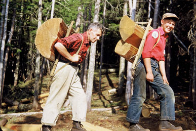
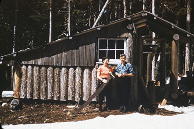
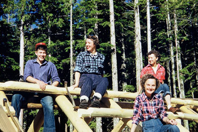
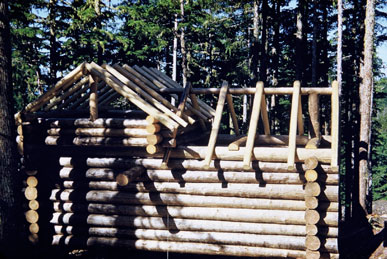
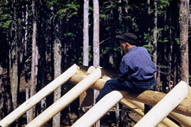
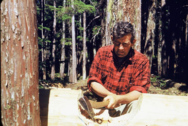
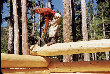
Saturday, June 30, 1956, was a happy day for Alberni Valley Mountaineers. Rosseau Chalet, 3,500 feet up on the western slopes of Mt. Arrowsmith, was officially opened and dedicated to the use of young people and others interested in mountain climbing and skiing. Two years earlier, almost to the hour, a snow bridge on Mt. Septimus collapsed, dropping Ralph Rosseau to his death. Ralph was well known and much liked by people of the Albernis, a quiet man with a ready smile and a willingness to help others. He loved mountains, rarely missed an opportunity to climb or ski and almost every trip added to his collection of beautiful colour slides. The origin of the Rosseau Chalet came as a direct result of closing China Creek watershed to the public about eight years ago. Until then, Mr. Rosseau and other skiers had used King Solomon Basin, headwaters of China creek, as a winter playground. Several exploratory jaunts on Arrowsmith finally revealed an ideal ski run and near it a cabin site. Ralph and Lillah, his wife, liked the area so well that following the construction of their small, log ski hut they decided to build a big cabin which would give an extra measure of comfort during their trips – and more room for friends. At the time of Ralph’s death, the cabin was better than half completed. Mrs. Rosseau felt that it would have been her husband’s wish to have it completed for the use of young people, many of whom he had given their first taste of mountain air. A committee, headed by Art Skipsey, was set up to carry out the job of completing the cabin – a task which took nearly two years and a great deal of hard work, as every ounce of material not indigenous to the immediate area had to be packed in on men’s backs. It could not have been a better day for the opening. Rain clouds of earlier in the week moved aside for a clear, bright day, just pleasantly warm and affording a good view of the valley below. Camera enthusiasts were able to make good use of their film. Over eighty people, including Guides and Scouts, attended the opening. A few went up on Friday to help with last-minute preparations, the majority arrived from early Saturday until a few minutes before the opening ceremony. The trail, in distinct contrast to the earlier days of the cabin, is now clearly marked and well-trodden. The most outstanding improvement is a new, amply wide suspension bridge which replaces the somewhat precarious hemlock log across the rushing water of the Cameron River. This fine bridge is due to the efforts of George McGarrigle. At 4 p.m. Art Skipsey began the opening ceremony by giving a short resume of the cabin’s history, then presented Mrs. Rosseau with the key. At the time she was also presented with a pretty corsage of mountain flowers. Mrs. Rosseau cut the ribbon of yellow cedar bark stretched across the doorway and declared the chalet open. Inside on the west wall is the joint work of Wally McEachern and Charlie Rogg – a brass memorial plaque, mounted on a yellow cedar shield inlaid with red cedar. Above the plaque is a portrait of Ralph Rosseau, flanked by a photograph of Mt. Septimus, one peak named after Rosseau. Placed nearby is a beautiful visitors’ book, made by Peter Karsholt. The covers are yellow cedar burl cut to show a marking similar to birds-eye maple. The first pages are suitable illustrated with pen drawings in mountaineering motif done by Mrs. Jennie Reith. Before and during the short dedication talk and prayer the plaque was concealed by a curtain of red cedar bark cleverly fabricated by Mrs. Dorothy Armstrong. Mountain heather and purple penstemon tastefully decorated the valance of the bark curtain which was drawn aside to conclude the dedication. The ceremony was closely followed by an excellent supper prepared and served by the Rangers (senior Girl Guides) under the direction of Mrs. Abernethy and Mrs. Armstrong. After supper those who were staying the night, with the intention of climbing Arrowsmith peak next day, went in search of bed places. These varied from bunks in the chalet and neighboring cabins to under the stars on mossy ground beneath a sheltering tree. The evening program of entertainment began with showing a few of Ralph Rosseau’s color slides, views of and from Arrowsmith, early progress of the cabin and two excellent close-ups of ptarmigan. Explanatory comments on the slides were made by Mrs. Rosseau. Also shown were slides by Art Skipsey showing later progress of the cabin building and snow conditions there during last winter. Three comic awards were made in lighter vein to George McGarrigle, Hayo Huisman and Art Skipsey for bridgework.
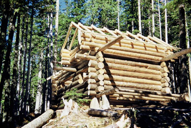


The construction of the Rosseau Chalet. All photos are courtesy of Louise Eck (nee Rosseau.)
Art Skipsey handing the key to Lillah Rosseau at the opening of the Rosseau Chalet.
Chalet Honors Mountaineer
Reported in The Daily Colonist (Sunday Magazine) Sunday August 26, 1956. p.12.
By William D. Reith
I remember Ralph Rosseau as a smallish man not much over five feet, energetic, with a ready smile and a willingness to help others. He usually wore heavy walking shoes and walked to and from work to keep him trim for mountain climbing. His slight stoop was grinningly attributed to packboard carrying. A stock of somewhat unruly, wavy, brown hair tumbled over his forehead above lovely blue eyes that twinkled humorously unless the situation was very grave indeed. His good humor polarized him with students and parents alike during his many years as teacher in Alberni Valley schools. From 1950 until his death, he was principal of Gill Elementary School. Ralph was killed two years ago while climbing Mount Septimus with his wife Lillah and two friends. His companions, by some miracle, escaped sharing his fate when a snow bridge they were crossing collapsed, dropping him to rocks below. Since then, a peak nearby the accident scene has been named Mount Rosseau in his honor.
Cabin Dedicated
On June 30 this year more than 80 of Ralph Rosseau’s friends, many of them Scouts and Guides who had hiked or climbed with him in the past, climbed 3,500 feet up the western slopes of Mount Arrowsmith to dedicate a log cabin as his memorial. Ralph had a great love for mountains and rarely missed a chance to climb or ski. Once, while yarning, he told me that while teaching in Bamfield, where the only handy hill of any height is the low mound of Pachena Cone [named in 1861 by Captain George H. Richards R.N. 672 m. Pachena in its original form means ‘sea foam’ or ‘foam on the rocks.’] he reckoned he had worn a groove in its side climbing it so frequently, trying to satisfy his appetite for climbing. A keen photographer, he had a wonderful collection of color slides. One I remember particularly was taken from the depths of a crevasse, into which he lowered himself to capture on film the beautiful blue of sunlight filtering through ice. Before his marriage to Lillah he quite often went out by himself, and it was on one of these lone tris across Comox Glacier that he took this unusual crevasse picture. He did not lack courage. Rosseau Chalet came into being as a direct result of closing China Creek watershed to the public about eight years ago. It is now a game reserve and supplies water for Port Alberni. Until it was closed off, King Solomon Basin, headwaters of China Creek, had been a popular ski ground for Ralph and others of similar interests. Left with nowhere handy to ski, he turned to Mount Arrowsmith, outstanding landmark of Alberni Valley’s east wall. A number of exploratory jaunts on Arrowsmith finally disclosed an ideal ski run and near it a cabin site. He and Lillah liked it so well that, on completion of their small log ski hut, they decided to built a big, durable cabin to afford greater comfort during their frequent trips up the mountain—and make room for friends. Ralph had never built a large log cabin before, although he had, as many do, dreamed of having one someday.
Long Study
To make up for lack of experience he gathered all the written information available; studied long and hard, asked many questions—and finally felt prepared to tackle the job. A better site could not have been chosen. Only a few yards from their ski hut, a year-round creek ran by and a view of Alberni Valley unfolded below. Their ski run was only a few minutes away and the summit, to which Ralph had climbed 30 times could be reached in an hour and a half. Building went slowly, trees for logs were carefully selected, peeled and seasoned. Each log consumed about eight hours of work to become part of the cabin. Cedar for shakes was not available nearby—they were split and packed up from half a mile away and 600 feet lower in altitude. Now and then climbers would drop in, wondering about the route to complete the ascent. Often as not, Ralph would drop his work on the cabin to show the way personally. These incidents held up progress, but he did not mind, the job was meant to be pleasure, not a burden. That he took pride in careful workmanship is evident to those seeing the well-fitted sturdiness of the cabin today. At the time of his death the cabin was more than half completed. Mrs. Rosseau felt that it would have been her husband’s wish to complete it and make it available to young people interested in climbing and outdoor recreation. Often he had taken parties of students, Scouts, Guides and young people of other organizations on mountain climbs, giving them an introduction which, in many cases, sparked a lasting interest. No one could miss his love of mountain environment or fail to be influenced by it. Many times I’ve heard, “Never forget my first trip Mr. Rosseau took us—he was wonderful.”
Two Years
A committee headed by Arthur [Art] Skipsey, a keen Alberni Scoutmaster, was set up to administer the work of completing the cabin. The job was done in two years of weekends and other spare time by people too numerous to list. They worked hard and worked well. Trips were made up the mountain in weather that would otherwise have kept them at home, and loads were carried that would not have been carried for any lesser reason. A fine suspension bridge was built across the Cameron River to replace a log previously used, the trail was relocated in places and improved throughout.
Ceremony Short
As opening day approached, many speculations were made regarding weather which had been wet and dreary throughout June, but nature smiled and the weather was perfect. Even those unaccustomed to the strenuous climb enjoyed themselves on the trail. Songbirds cheered them on and whiskey-jacks came to beg whenever food was produced. The ceremony was short but impressive. A brief talk on the history of the cabin preceded Mrs. Rosseau declaring the Chalet officially open by cutting an appropriate ribbon of yellow cedar bark. Inside a brass plaque was unveiled and the building was blessed to its worthy cause.
Portrait On Wall
On the wall above the plaque is a portrait of Ralph Rosseau, and beside it a large photograph showing Mt. Septimus and Mt. Rosseau. Nearby is a beautiful visitors book—the covers are made of yellow cedar burl—signed by all who attended, and it is hoped will in time fill with names of many who find pleasure in using the cabin. A supper, made by Alberni Valley Guides, followed the ceremony, and the remainder of the evening was spent enjoying campfire singing and skits put on by various groups. Looking down from the Chalet, lakes and waterways shone silvery in fading daylight, city lights twinkled through as darkness welled up to engulf mountains reaching to a clear starry sky. Cabin windows glowed warmly into the night and happy sounds came from within. Everyone was, as it would have been had Ralph completed his task himself.
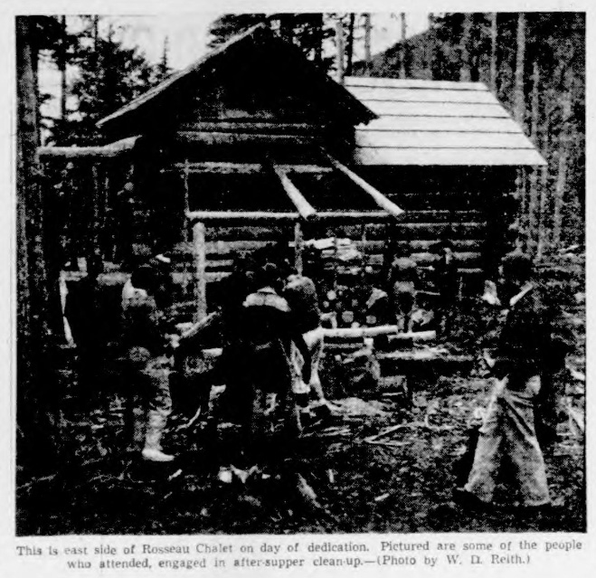
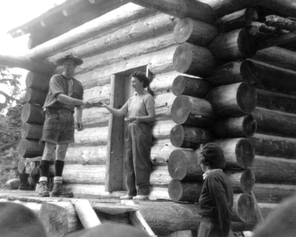
This is east side of Rosseau Chalet on day of dedication. Pictured are some of the people who attended, engaged in after-supper clean-up.—(Photo by W. D. Reith.)
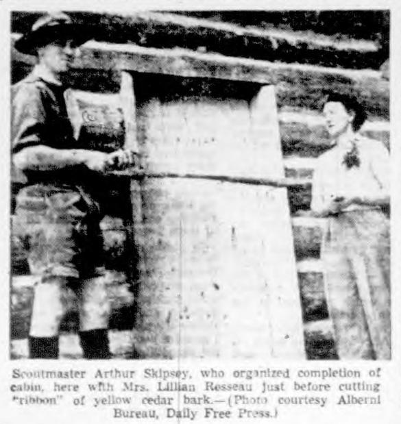
Scoutmaster Arthur Skipsey, who organized completion of cabin, here with Mrs. Lillian Rosseau Just before cutting “ribbon” of yellow cedar bark. — (Photo courtesy Alberni Bureau, Dally Free Press.)
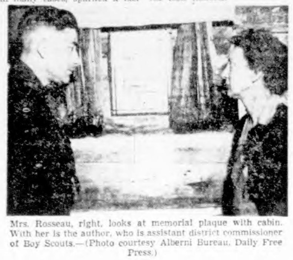
Mrs. Rosseau, right, looks at memorial plaque with cabin. With her Is the author, who is assistant district commissioner of Boy Scouts.— (Photo courtesy Alberni Bureau, Daily Free Press.)
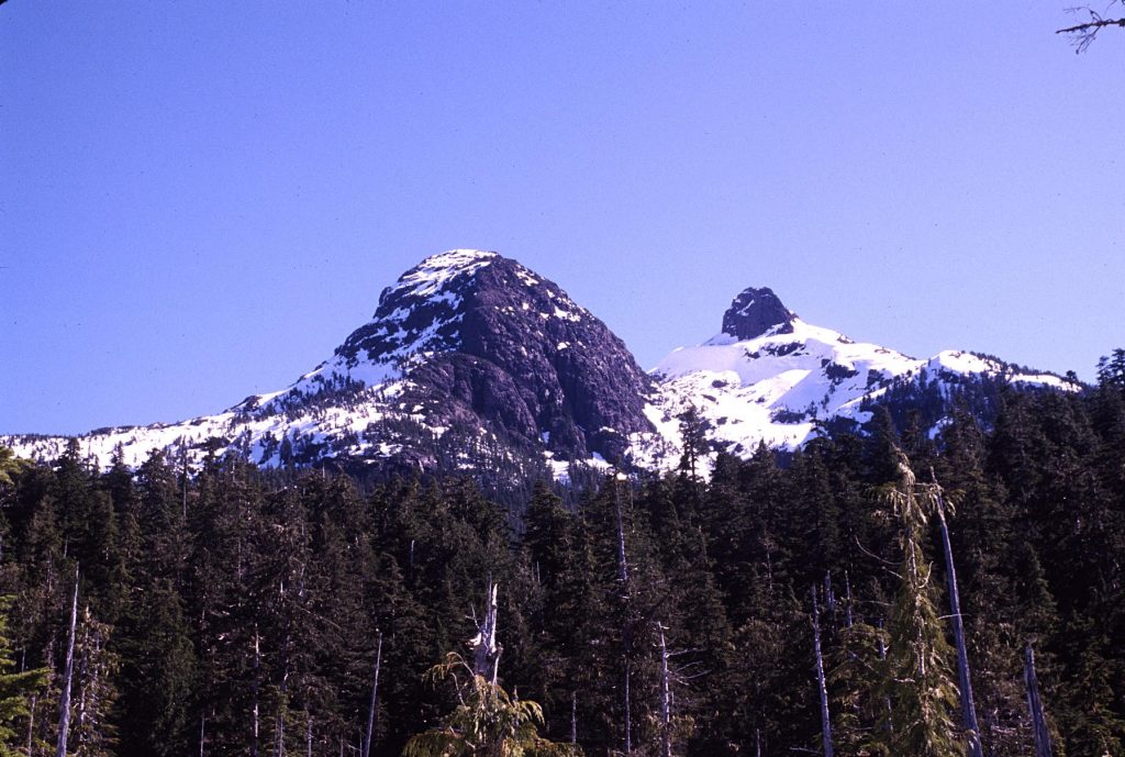
Mount Karmutzen and Pinder Peak
From an interview with George Lepore by Lindsay Elms in the 1990’s.
In 1955, George Lepore emigrated to Canada from Padua, Italy and moved to the Nimpkish Valley. It was while living in Italy that Lepore found a passion for mountaineering and found himself climbing on the steep limestone cliffs of the Dolomites. After moving to the logging village of Nimpkish he reacquainted his interest in mountaineering and started climbing the local mountains, although he found their geology very different to what he was used to. In August or September 1956, Lepore made a long day ascent of Mount Karmutzen with four Italian friends. After rowing from his home across Nimpkish Lake early in the morning, they climbed a steep treed route directly to the summit. Lepore said there was no cairn on the summit so they built one. Not long after climbing Mount Karmutzen he made an ascent of Pinder Peak with another four friends. From the bridge that crosses Atluck Creek on the logging road between Mukwilla Lake and Atluck Lake, they walked down the valley to Atluck Lake and there found a row boat that had been stashed by a friend. Lepore, being the only boatman, rowed them down the lake to a small island. From the island they rowed across to the south shore and began the climb. Big open timber made travelling easy and they arrived on the summit about 1:30 p.m. On the summit they found a large cairn probably built by surveyors in the 1930’s. Lepore normally liked to relax on the summit and spent some time enjoying the view, but his friends wanted to get down and back to Nimpkish for a show that evening. Lepore was rather annoyed so took off running and arrived at the lake shore a couple of hours later. While waiting he fell asleep and woke up at 7:00 p.m. when they finally arrived down. They missed the show!
Mount Karmutzen from the summit of Mount Hoy 2014 – Lindsay Elms photo.
Postscript:
By Lindsay Elms
Mount Karmutzen was adopted 31 March 1924 from the 18th Report of the Geographic Board of Canada. It was identified in Dawson’s geological survey of Northern Vancouver Island (GSC Annual Report, 1886) and labelled on the accompanying map, published in 1887. Karmutzen is recorded as being an anglicization of a local indigenous word of the people living on what is known as Cormorant Island and means “waterfall.”
Lindsay Elms on the summit of Mt. Karmutzen 1997 – Sandy Briggs photo.
Curtis Lyon and Lindsay Elms on the summit of Mt. Karmutzen 1997 – Sandy Briggs photo.
Province Range
In a triangle of land between the Zeballos Forestry Service Road (FSR) and the Artlish Forestry Service Road (FSR) is a range of mountains unofficially called the Province Range which has been known as that for 130 years. Reverend William Washington Bolton named the Province Range after the newspaper of the same name which sponsored The Province Expedition in 1894. He also named the northern most peak Province Mountain but it was officially named Pinder Mountain on 9 January 1934 and then changed to Pinder Peak on 6 April 1950. The first ascent was probably in 1931 when the surveyor Alan J. Campbell (BCLS) set up a survey station at its summit. It was named after William George Pinder (BCLS), an earlier surveyor. The next known ascent was on 4 September 1955 when a party consisting of Annise and Owen Hennigar, Beulah Hansen, Henry Hansen, Charles Smithson and Charles Neale climbed the peak and left a metal plate with their names and date hammered into it.

The engraved metal plate that was left on the summit of Pinder Peak in 1955 – Jason Hare photo 2017.
South of Pinder Peak along the Province Range are three other peaks: The Stone Trolls, Barad–dûr and Mook Peak. Both The Stone Trolls and Barad–dûr were named by Rolf Kellerhals when he and his two children, Heather and Marcus, climbed the peaks in 1981. The name Barad–dûr comes from J.R.R. Tolkiens Lord of the Rings books. Barad–dûr, the Dark Tower or Fortress, was built by Sauron on the Plateau of Gorgoroth in Mordor, not far from the volcano known as Mount Doom. The Stone Trolls were also from a Tolkien book. In The Hobbit each time the trolls settle on a way to cook the dwarves, Gandalf, pretending to be one of them by using a troll voice, starts the argument again. Gandalf stalls and distracts them long enough for the sun to come up, at which point the trolls are turned to stone. The origin of the name Mook Peak is unknown as is its first ascent, but it was likely surveyors in 1931. The name was officially adopted 9 January 1934 as labelled on Alan J. Campbell’s map of the Nimpkish River area. Mook Peak wasn’t climbed very often, but in the 2000’s climbers found an old ten-speed bicycle on the summit.
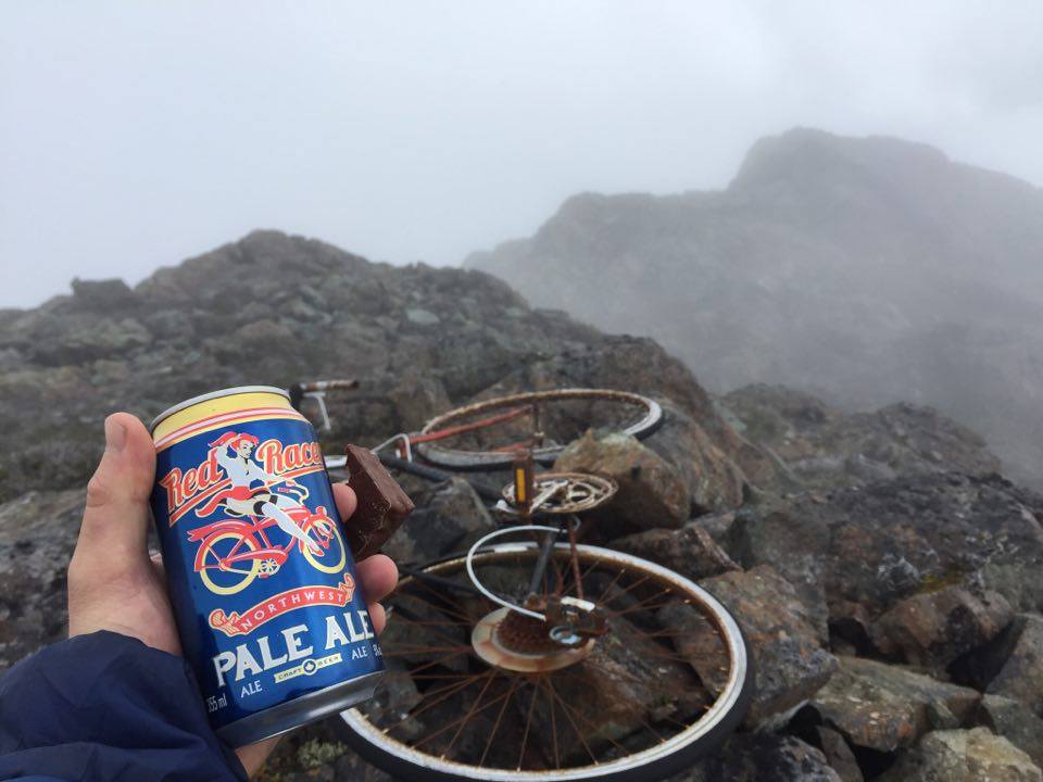
The infamous ten-speed bicycle on the summit of Mook Peak – Read Guthrie photo.
The south ridge of Mook Peak 2005 – Lindsay Elms photo.
No one knew why it was there or when it was taken up, but in an email from Port McNeill climber and caver Peter Curtis, he told me the story: “Well there was four of us wanting to climb Mook Peak, so we split into two groups and took different routes. The ‘other’ two guys were avid bikers, but also avid drinkers, and they had been drinking before the trip. They decided to go their own route; one carried the wheels while the other took the frame. It was something to do with one of the guy’s young nephews who was mentally challenged and wanted to ride a bike in the mountains … so they planned to tell him there was a bike up on Mook Peak for him. (Not that he would actually go up there, but he would have something to think about, I guess!) Anyway, they drank their way to the summit, met Stu Crabe and I there, and propped up the bike on an open slab. They were both pissed by then! We all made it down ok, thank God! I think it was in the late 90’s. Both guys had done some mountaineering and had climbed many local peaks. One was from Port Alice and the other from Port McNeill.”
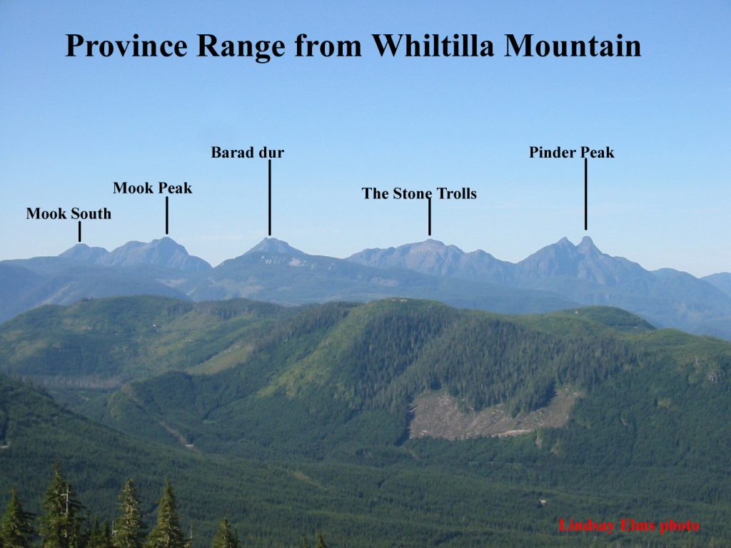
A view of the Province Range from Whiltilla Mountain in the Bonanza Range 2005 – Lindsay Elms photo.
The view from the summit of Pinder Peak looking down on Atluck Lake with Nimpkish Lake in the distance – Chauncey McEachern photo.
Looking up at Pinder Peak and Pinder Horn from the Apollo Main logging road 1999 – Sandy Briggs photo.
John Pratt, Lindsay Elms and John Damasche on the summit of Pinder Peak 1999 – Sandy Briggs photo.
The view of Pinder Peak from Pinder Horn 1999 – Sandy Briggs photo.
Pinder Peak (left) and The Stone Trolls from Barad-dûr 2000 – Sandy Briggs photo.
Barad-dûr from the summit of The Stone Trolls 2000 – Sandy Briggs photo.
The summit of Barad-dûr 2000 – Sandy Briggs photo.
Kaouk Peak (northwest of Zeballos) from the summit of Barad-dûr 2000 – Sandy Briggs photo.
City Women Climbs Mount Waddington
Reported in The Victoria Daily Times Thursday September 6, 1956. p.16.
A Victoria woman was a member of an Alpine Club of Canada party which in August, scaled Mount Waddington, a 13,200-foot peak, and the highest in B.C. She is Miss Sylvia Lash, 4078 Cedar Hill, school teacher, and member of a mountain climbing family. Her father, A.W. [Bill] Lash, chief engineer for the B.C. Power Commission, and brother Mallory, are well-known alpinists. The ascent of the mountain is the first successful attempt to scale the peak in 20 years. Mount Waddington, situated about 170 miles northwest of Vancouver above Knight Inlet. Miss Lash said food and equipment were dropped by a plane onto a glacier to assist the party climb the mountain. The party made the ascent from base camp in three days, reaching the top on August 13. The climbers, without sleeping bags, spent the night on an open ridge, before making a final assault on the mountain’s second highest peak, about 50 feet below the main summit, Miss Lash said. She modestly admitted that it was “somewhat cold and not too pleasant a night.” Miss Lash said the party was unable to climb the highest peak of the mountain because a large glacier with crevasses barred the way to the main summit. Two climbers tried an alternate route by attempting to scale the face of the mountain, she said, but had to give up due to the lack of equipment.
Highest Yet
“There was a great deal of ice and snow, and it was quite higher than anything I’ve climbed before,” she said. “On our return journey we left some food and equipment on the mountain.” Other members of the climbing party included Ulf and Adolf Bitterlich, well-known Port Alberni mountaineers; Sarka Spinova, Toronto; Philippe Delasalle, Montreal, and Earl Whipple, Boston. The last ascent was in July 1936, by two Vancouver members of the B.C. Mountaineering Club, Denver L. Gillen and William Dobson.
Big Peak Scaled by City Woman
Reported in The Daily Colonist Thursday September 6, 1956. p.15.
A Victoria woman, who has been mountain climbing for relaxation for seven years, was a member of the Alpine Club of Canada party which last month scaled a 13,200-foot peak of B.C.’s Mount Waddington, the first successful ascent in 20 years. Miss Sylvia Lash, 4078 Cedar Hill Road, modestly admitted last night that it was “an exceptional climb. There was a great deal of ice and snow and it was quite a bit higher than anything I’ve climbed before,” she said. A party of six members of the Alpine Club of Canada made the ascent in three days reaching the top August 13.
Highest In Canada
Mount Waddington, located some 170 miles northwest of Vancouver above Knight Inlet, is the highest peak in Canada outside the Yukon. Its main peak has never been climbed by Canadian, and is said to be one of the most difficult climbs in the world. The peak climbed last month is 60 feet below the main peak. “We camped on an island on Franklin Glacier three days after leaving Knight Inlet, said Miss Lash. “It took us four days to climb up and back to camp.”
Weather Perfect
Weather conditions were prefect for the ascent, she stated. Miss Lash, whose profession is now teaching school, is a member of a mountain-climbing family. Her father A.W. (Bill) Lash and her brother Mallory, are both keen alpinists. Miss Lash was graduated from UBC in 1952 with honors in English. In Miss Lash’s party was Ulf and Adolf Bitterlich, well known Port Alberni mountaineers; Sarka Spinkova; Philippe Delasalle, and Earle Whipple. The last ascent was in July 1936, by two Vancouver members of the B.C. Mountaineering Club, Denver Gillen and William Dobson.
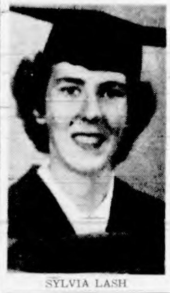
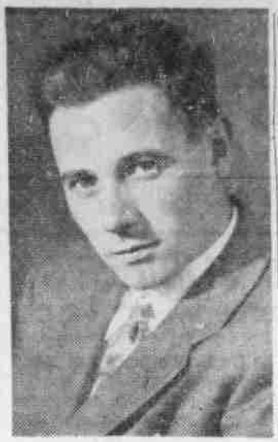
Sylvia Lash
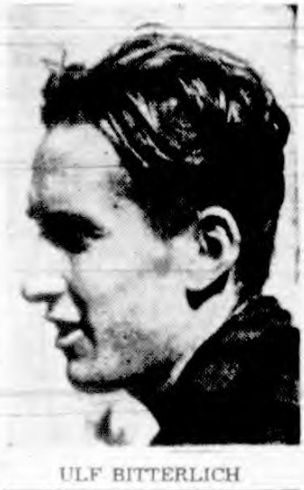
Ulf Bitterlich
1957
ACCVI executive:
Chairman – Noel Lax
Secretary – Margery Thomas
Events:
January – A very successful public showing of members’ colour slides was held at the Arts Centre in Victoria.
February – Two ski-trips to Mt. Baker unfortunately the last was somewhat marred by Margery Thomas suffering a fractured ankle.
April 14 – Warm spring weather brought a good turnout for a rock school on Mt. Tzouhalem.
April 22 – Three members made a ski descent of Green Mountain stating the run down was excellent but far too short.
Hkusam Mountain – was again climbed but the view was partly obscured by clouds. An interesting pitch on the ridge allowed us to brush up on our rock-climbing technique.
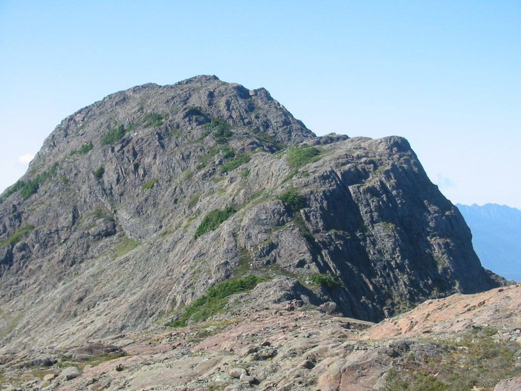
June – A scheduled club trip to Mt. Whymper was changed due to the closing of the logging roads because of fire hazard. Mt. DeCosmos was climbed instead in heavy rain and led by Patrick Guilbride.
A rock tower near the summit of Mt. DeCosmos, 1957. Pat Guilbride photo.
July 1 – A party crossed the backbone of Vancouver Island from Buttle Lake to Great Central Lake, some 30 miles by way of Flower Ridge and Mt. Septimus. Weather and visibility were mostly bad, but we did see some new country in our Strathcona Park.
July – Paddy Sherman and three others made a number of 1st ascents in the Duffey Lake area.
August – Franks Stapley, George Frazier and Terry Hanrahan climb Elkhorn Mtn. Possibly 3rd overall ascent.
August 24-September 1 – Six members ventured into the Comox Glacier area for a week-long camp with ascents made of Black Cat Mountain, the Comox Glacier, Argus Mountain, The Red Pillar, Mt. Celeste and Iceberg Peak (Rees Ridge).
October – Thanksgiving Weekend started off in a downpour but relented and gave us two fine days to climb an unnamed peak and Green Mountain for the second time this year.
Section members attended the ACC winter ski camp at Maligne Lake in March: Margery Thomas (still in ankle cast) and five others.
Section members who attended the ACC general summer camp at Moat Lake, Tonquin Valley July 21 to August 3: Geoffrey Capes, Rex Gibson, Ethne Gibson, Tom Hyslop, Mark Mitchell, Edith Maurice, Sylvia Lash, Margery Thomas, Harry Winstone.
Section members who passed away in 1957: Rex Gibson, Jennie (McCulloch) Longstaff, Robert Connell, Reginald Chave.
Mrs. Jennie Longstaff Succumbs At 77: Rites Wednesday
Reported in The Victoria Daily Times Saturday February 2, 1957. p.15.
Mrs. Jennie Longstaff, wife of Major F.V. Longstaff, died at her home, 50 King George Terrace Friday night at the age of 77. Mrs. Longstaff was formerly president of the B.C. Protestant Orphanage and treasurer of the Victoria Order of Nurses. She was also a member of the Alpine Club of Canada which she joined in 1913. Her husband is one of the few holders in Victoria of Queen Elizabeth II Coronation Medal, which was presented to him after the coronation in 1953. He also holds the King George VI Coronation Medal of 1937. Funeral service for Mrs. Longstaff will be held at the Christ Church Cathedral at 2 p.m. Wednesday.
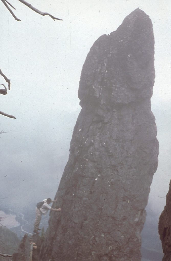
Island Trio Conquers Mt. Colonel Foster
Snow-lashed Climbers Scale 7,000-Foot Peak
Reported in The Daily Colonist Sunday August 4, 1957. p.30.
By G.E. Mortimore
Seven-thousand -foot Mount Colonel Foster in Strathcona Park, one of the four highest peaks on Vancouver Island, has been climbed for the first time. Dr. Ferris Neave, 57, fisheries biologist from Nanaimo, his brother Hugh Neave, 48, of 4305 Cedar Hill Road, Victoria, and Karl Ricker, 20-year-old university student from Nanaimo reached the summit in a snow-storm, July 31. Other climbing parties, including one from the Vancouver Island section of the Alpine Club of Canada, led by Bill Lash and Syd Watts, have scaled the mountain to one of it subordinate peaks [Southeast Peak]. But the Neave’s and Ricker believe they are the first to reach the absolute top. The climb was made in 13 hours—up and down—from a camp near the head of Butterwort Creek, tributary of the Elk River. Most of the climbing was done between and on the rock walls of a great gully which slashes the western face of the peak. The ascent featured slippery chimneys and overhanging boulders. At the head of the gully the climbers found themselves on a knife-edged ridge between two summits. The higher of these was reached by a short, but sensational, climb using small holds on the face of an airy buttress. The weather was poor throughout the climb. A snow-storm greeted the party on the summit [Southwest Peak]. The descent was made treacherous by streams of water pouring down the rock.
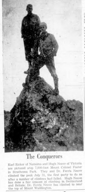
Karl Ricker of Nanaimo and Hugh Neave of Victoria are pictured atop 7,000-Foot Mount Colonel Foster in Strathcona Park. They and Dr. Ferris Neave climbed the peak July 31, the first party to do so after a number of climbers had failed. Hugh Neave has done a fair amount of climbing in Switzerland and Britain; Dr. Ferris Neave has climbed to near the top of Mount Waddington.
The First Ascent of Mt. Colonel Foster.
Reported in The Canadian Alpine Journal Volume 41, 1958. p.35-38.
By Ferris Neave
The larger mountains of Vancouver Island are seldom visited. Nevertheless, the three highest peaks—the Golden Hinde, Elkhorn Mountain, Victoria Peak—were first climbed many years ago. They have been assigned elevations over 7,000 feet. Whether a fourth summit can claim this latter distinction seems not to have been officially proclaimed, but the odds appear favourable. The aspirant, Mount Colonel Foster, resembles its three peers in the degree to which it stands hidden and remote from land and sea travel lanes, although within a few minutes’ flying time from busy coastal towns. Certainly, it is second to none of the trinity in the savage profusion of cliff and tower which garnishes its upper structure. The first real climbing effort on Colonel Foster seems to have been by topographic survey party, Alfred Slocomb and Jack Horbury in 1936 [Southeast Peak]. They reached one of the two or three culminations which are a little lower than the highest summit. In August 1954 a party from the Vancouver Island Section of the Alpine Club of Canada camped at the lake [Landslide Lake] on the east side of the mountain. After a number of exploratory sorties, a party comprising Bill Lash, Mallory Lash, Syd Watts and Patrick Guilbride reached a high point which stands a short distance south of the true summit, from which it is separated by a col. In 1955, Ulf and Adolph Bitterlich attempted to reach the summit by following a diagonal rake [Snowband route] on the East Face. They were turned back by the difficulties of the route. Thus, at the pre-season planning time of 1957 the highest point remained unreached and challenging. My brother Hugh and I, who meet rarely and correspond with the utmost reluctance, managed somehow to convey to each other the idea of a joint attempt. Karl Ricker brought to the plans the gusto of a younger generation and the advantage of a previous trip to the mountain. Originally scheduled for June, the expedition eventually took to the road on July 28th. The delay enabled us to note (but not to exhaust) the long succession of wet weeks which constituted the so-called summer of 1957. Earlier in the month, however, during the brief break in the cloud cover, I circled Mount Colonel Foster in a plane generously made available by Mr. Jack Beban of Nanaimo. I came back with a remembrance of a tarn at 4,000 feet on the west side of the mountain, a heather-clad ridge leading up to the base of the great rock walls, and a long couloir slashing the southwest face and reaching the skyline close to the highest summit. Reaching Drum Lakes over the private logging road on the morning of the 28th, we left the car, hoisted the inevitable loads and started up the Elk River valley before noon. The depressing factors of heavy packs, alert mosquitoes and (at least in my own case) the weight of inactive years, were balanced to some extent by the favourable traveling conditions afforded by this part of the route. The rise of the valley is gentle, the underbrush is not really obstructive and the local elk herd has had some success in trail-making. Furthermore, the rain which had attended most of the journey from Nanaimo had given place to an uncertain mixture of cloud and sun. Previous expeditions had followed the main Elk River valley past Elkhorn and had camped on the east side of Colonel Foster. The approach to which for better or worse our party was committed required a journey to the head of Butterwort Creek, which enters the Elk River from the southwest. Reaching the mount of this tributary in the afternoon, we deferred further action until the morrow. Butterwort Creek gave us rough treatment. Its lower course descends sharply in plunging waterfalls flanked by steep-faced bluffs. It took us four hours to master these and to push our way along the steep, brushy side of a narrow ravine above them. (On the return trip a somewhat easier line was discovered by keeping a little farther to the north of the stream.) After this the valley flattened out and the timber was interspersed with open marshy spots. Farther still, a vast area of bare rocks showed where a great slide from a face of Colonel Foster had engulfed stream and forest. The final test of the day was an exhausting 600-foot climb, characterized by steep pitches and obstructive undergrowth, to reach the bowl which was our selected campsite. We saw no sign of previous human visitors at the tarn, nor indeed at any point in the upper part of Butterwort valley. The weather remained variable, with the summit of our peak usually wrapped in cloud. Next morning (July 30th) we climbed the ridge above our tarn and, traversing along the base of the southwest buttresses, located and entered the couloir which we judged to be our most promising route toward the summit. The altitude here was probably about 5,500 feet. The lower part of the gully was filled with a steep core of snow. At the top of this section the couloir contracted into a chimney furnished with an overhead chockstone. Ambition faltered at this point under the influence of heavy cloud and squalls of snow. After a showery night the morning of the 31st brought a mixture of heavy, low-lying cloud banks and brighter intervals. The weather issue was still unresolved when at 1030 hr. we decided against further inaction. By 1300 hr. we were back in the couloir. It gave us good hard climbing for the next thousand feet or more of altitude gained. At several places the walls of our route closed in to form narrow vertical chimneys of challenging difficulty. Although the underlying rock was sound enough, loose debris cluttered all ledges and Hugh, our leader, had to deal circumspectly with numerous booby traps. The rock faces on either side offered no hope of alternative routes. However, our steep straight couloir eventually brought us to a notch in the dipping ridge which links the highest point of the mountain with a subsidiary summit to the south. The latter is the point reached by Lash’s party in 1954 [Southeast Peak]. In the direction of our goal, a few yards of knife-edged ridge led us to the base of a formidable rock face. Although not more than thirty feet high this pitch was sensationally exposed, offering unrestricted plunges on either side of our sharp ridge. Karl and I waited on good ledges while Hugh carefully worked his way up on small holds. Once above the critical obstacle, a few feet of easy climbing took us to the summit [Southwest Peak]. The latter could be accounted a museum piece, since it actually took the form of a tiny sharp-pointed pinnacle. The time of our arrival was 1645 hr. Throughout the climb we had been surrounded by cloud of varying intensity which had sprinkled us occasionally with rain or snow. Now the snow struck sharply during our half-hour stay at the summit. We turned to descend over rocks becoming unpleasantly wet. A rope sling placed at the top of the bad pitch gave Hugh some protection in his role of last man. Rain and snow continued as we worried our way down. The couloir gathered the trickling water into a rivulet and the chimneys became waterfalls. Pitches which had demanded hard climbing on the ascent were now desperately slippery and repulsive. Holds were hard to find and keep as fingers grew numb. We emerged soddenly from the gully as night fell. From a belatedly clear sky a quarter-moon helped to show the way for a time. Then it withdrew and we were left with flashlight and groping touch to probe the dark declivities that unrolled endlessly before us. Hugh sums up the opinions which we took home. “For the information of other aspirants to the Colonel’s rigged citadel we would suggest that the eastern approach requires mush less effort. There is easy packing all the way up the Elk valley to good camping at the small lake beneath the eastern face, with a relatively easy route to the subsidiary Lash summit. There is a distinct possibility of finding a reasonable route down the short, broken ridge to join with our route at the notch. For a fine day with a strong rock-climbing party the western couloir offers a magnificent direct approach to the summit, but under less propitious conditions the slippery chimney pitches, where there is no chance of evading the occasional missile, might dampen the joy of all but the confirmed Welsh gully addict.”
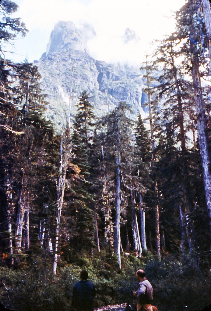
Hiking up Butterwort Creek on the way to Mt. Colonel Foster 1957 – Karl Ricker photo.
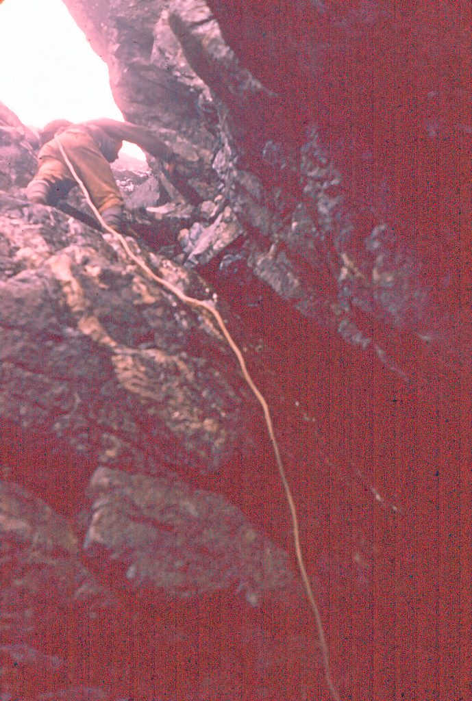
Climbing the gully on route to the Southwest summit of Mt. Colonel Foster 1957 – Karl Ricker photo.
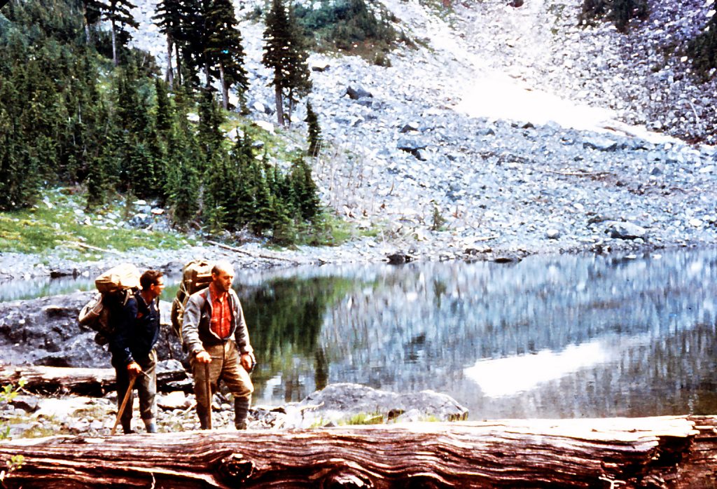
Hiking into Mt. Colonel Foster 1957 – Karl Ricker photo.
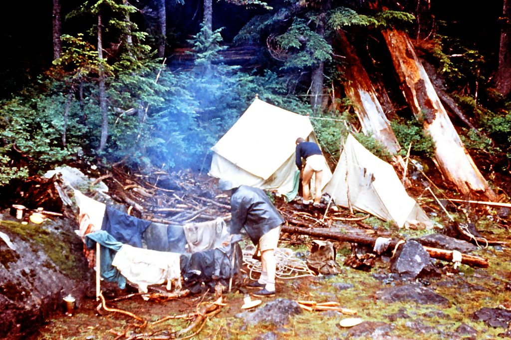
Camp below Mt. Colonel Foster 1957 – Karl Ricker photo.
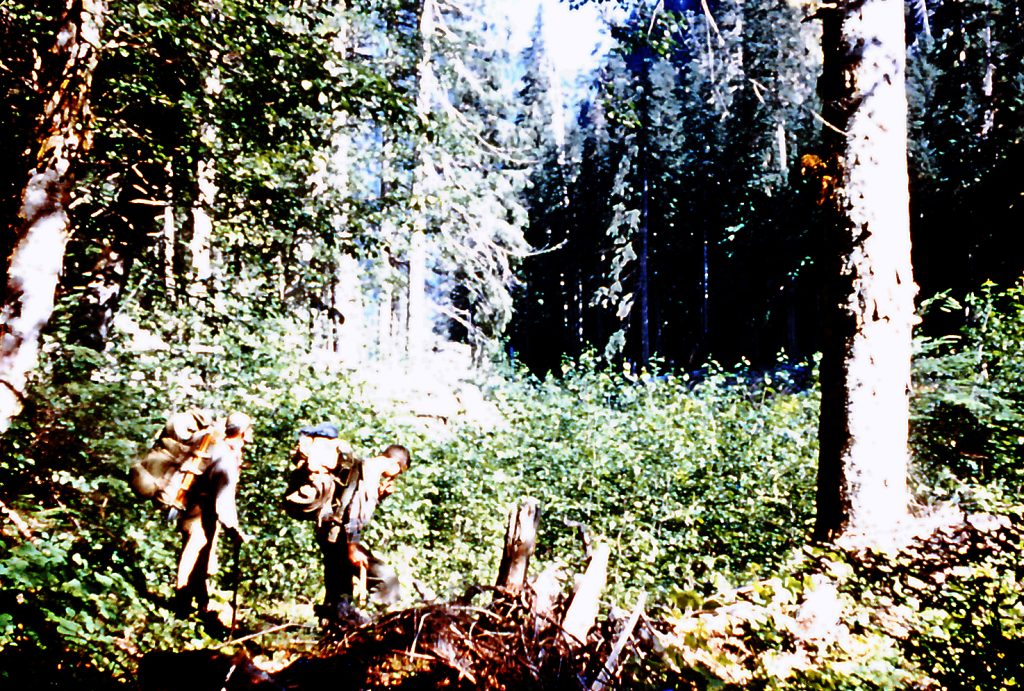
Hiking through the forest on the way to Mt. Colonel Foster 1957 – Karl Ricker photo.
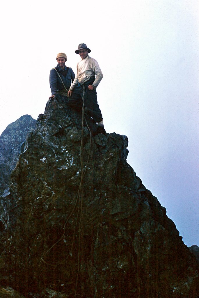
Karl Ricker and Hugh Neave on the Southwest summit of Mt. Colonel Foster 1957 – Karl Ricker photo.
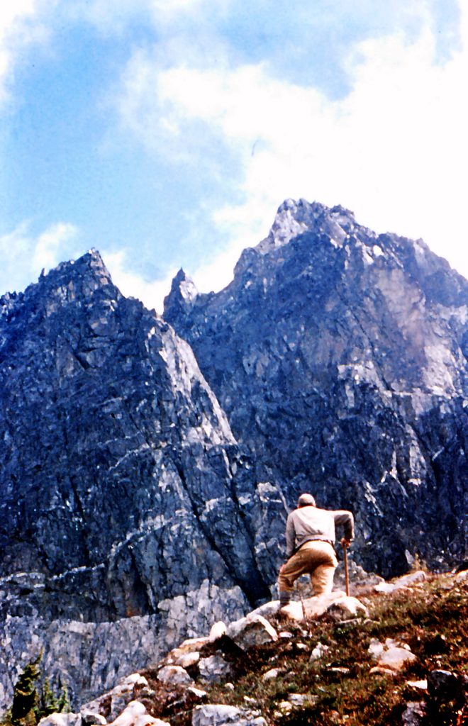
Mt. Colonel Foster 1957 – Karl Ricker photo.
Postscript:
By Lindsay Elms
On 5 February 2024 Josh Overdijk made the first winter ascent of the Southwest Couloir. “Yesterday I climbed the infamous Southwest Couloir on Mt. Colonel Foster. It was first climbed in the summer of 1957 by the Neave brothers and Karl Ricker in an attempt at making the first ascent of the mountain, this was unsuccessful as it turned out that the Southwest Peak was in fact not the highest point. None the less they deemed the route ‘a magnificent direct approach to the southwest summit’.”
Halfway up the Southwest Couloir looking towards the Southeast Peak of Mt. Colonel Foster – Josh Overdijk photo, 2024.
Looking up the Southwest Couloir towards the ridge connecting the Southeast and Southwest Peaks – Josh Overdijk photo, 2024.
Campbell River Men Scale Elkhorn
Reported in the Campbell River Mirror August, 1957.
Three Campbell River men have climbed Elkhorn Mountain in Strathcona Park, the second highest mountain in the park which has not been climbed since 1949. Frank Stapley, George Frazier and Terry Hanrahan [1937-2024] set out on Saturday and reached the summit of this 7,200-foot-high peak on Monday, part of the way they were roped. They found the climb was strenuous, for after the rain a film of ice formed on the rock, which made climbing difficult. This seemed to please these seasoned mountaineers. When Campbell River was shrouded in a misty fog, bright sunshine was shining on the mountain. These intrepid young men left a mark to let others know they had scaled the heights, the name previous to theirs was that of Bill Lash of the B.C. Power Commission engineer of Victoria, who is a well-known mountaineer. Frank Stapley has tried this mountain three times now. He is quite well known for his climbing prowess, while George Frazier, a fairly new comer from Scotland with old country climbing experience is a member of the Swiss Alpine and Scottish mountain climbing clubs. Terry Hanrahan is a novice but still wants to continue. The trio are talking about trying Victoria Peak now and then the Golden Hinde, which is the highest in the park.
Addendum:
By Lindsay Elms
This was possibly the third ascent of Elkhorn Mountain. The first was an Alpine Club of Canada party under the leadership of Arthur and Edward Wheeler in 1912, and the second by Charley Nash, Bill and Mallory Lash, and Geoffrey Capes in September 1949. There was an unsuccessful attempt in August 1936 by Brian Tobin, Cecil Frampton and Joe Andrews.
Hikers’ Trail Asked for Centennial Year
Reported in The Victoria Daily Times Friday August 9, 1957. p.15.
A 30-mile hikers’ and campers’ trail, through one of Vancouver Island’s most beautiful alpine areas, is proposed as a centennial project by Victoria outdoor men and mountaineers. The project, to be submitted to the B.C. Centennial Committee calls for the construction of a scenic trail from great Central Lake to Buttle Lake, with shelters for campers. The proposed trail takes in Della Falls, the highest in Canada which spills over a 1,500-foot precipice, milky-blue Beauty Lake, Cream Lake and Della Lake. It also skirts two spectacular peaks, Big Interior Mountain and Mount Septimus, each over 6,000 feet, and passes over Flower Ridge, an alpine plateau covered in summer with masses of Alpine blooms and shrubs. “The area is comparable to the Rockies,” said Ted Fairhurst, past president of the Outdoor Club of Victoria. “There are snow-covered peaks, glaciers, chasms and attractive lakes.” The project proposed by the Outdoor Club of Victoria and the Victoria section of the Alpine Club of Canada, is supported by all outdoor groups on Vancouver Island. A brief on the project is being prepared by Noel Lax, chairman of the local Alpine Club and Syd Watts, outing committee chairman of the Outdoor Club. The two men headed a party over the proposed trail in July. The plan calls for the construction of two shelters along the trail. Members of the clubs are prepared to construct the shelters if the provincial government will supply the lumber and materials. These would be dropped on the site next summer when the alpine heights are clear of snow. The route of the trail would start from Great Central Lake and would follow Drinkwater Creek to Della Falls. From there it would turn eastward passing a few lakes and gradually rising to “Flower Ridge,” which leads to Buttle Lake. The spectacular ridge is 4,000 feet in height and several miles long. It provides the hiker with one of the most beautiful views of Vancouver Island. Campers or hikers would have to go by boat to the start of the trail from Great Central Lake or Buttle Lake. There is a ferry service to the head of Great Central Lake at present. Victoria outdoor men said the area is ideal for fisherman, alpine climbers and campers who seek the open spaces and are not satisfied with the roadside parks of the provincial government. It would also prove a big attraction for the more adventurous U.S. campers and fishermen, they said.
Nature Lovers Want Shelters
Reported in The Daily Colonist Sunday August 11, 1957. p.12.
There’s a long trail awinding from Great Central Lake, near Alberni to Buttle Lake in Strathcona Park and Vancouver Island outdoor lovers want it developed as a centennial project. A brief on the project is being prepared for submission to the B.C. Centennial Committee by Noel Lax, chairman of the Victoria section of the Alpine Club of Canada and Syd Watts, outing committee chairman of the Outdoor Club. The 30-mile trail leads through some of the Island’s most beautiful alpine areas. From Great Central Lake it follows the Drinkwater Creek to Della Falls, the highest in Canada, east to Flower Ridge and on to Buttle Lake. On the way the trail passes Beauty Lake, Cream Lake and Della Lake and skirts Big Interior Mountain and Mount Septimus. The plan calls for two shelters to be built on the trial. Members of outdoor clubs are prepared to build the shelters if the provincial government will supply the materials.
Alpinists Delight
Reported in The Victoria Daily Times Saturday August 17, 1957. p.1.
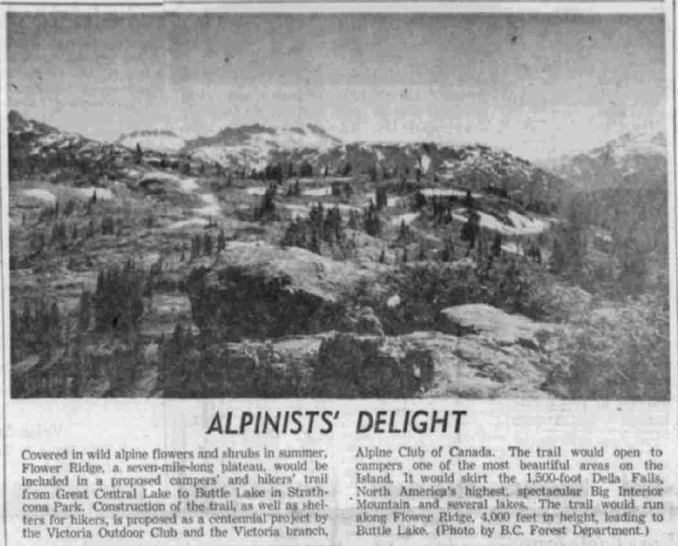
Covered in wild alpine flowers and shrubs In summer, Flower Ridge, a seven-mile-long plateau, would be included in a proposed campers’ and hikers’ trail from Great Central Lake to Buttle Lake in Strathcona Park. Construction of the trail, as well as shelters for hikers, is proposed as a centennial project by the Victoria Outdoor Club and the Victoria branch, Alpine Club of Canada. The trail would open to campers one of the most beautiful areas on the Island. It would skirt the 1,500-foot Della Falls, North America’s highest, spectacular Big Interior Mountain and several lakes. The trail would run along Flower Ridge, 4,000 feet in height, leading to Buttle Lake, (Photo by B.C. Forest Department.)
Famed Climber Dies on B.C. Peak
Major Rex Gibson Plunges to Death
Reported in The Daily Colonist Friday August 23, 1957. p.1.
Major Rex Gibson, famous Saanichton mountaineer who sometimes used to talk of “roping up for the last climb,” has been killed in his fourth attempt to scale an unclimbed northern B.C. peak. His body today is tied to a rock 500 feet up a gully that runs up a cliff on 9,000-foot Howson Peak, 40 miles east of Terrace. He apparently lay there for two days before he died following a Sunday mountain-climbing mishap. A falling rock had struck Major Gibson on the head and he fell, dragging two companions with him.
Climbers on Way
Six members of the B.C. Mountain Rescue Group are scheduled to fly to the scene today in an RCAF plane to try to retrieve the body and fly it out by helicopter. Waiting here at their Mount Newton Crossroads home last night were Mrs. Ethne Gibson and their four-year old daughter [Kathleen]. They were stunned on hearing, like the rest of the world, only last night of the mishap that had taken the life of the president of the Alpine Club of Canada and one of Canada’s foremost mountaineers. Major Gibson was in his middle 60’s.
In Hospital
The tale came out as two other mountaineers, who fell with him for 200 feet down the gully, reached hospital at Terrace last night. They are Dr. Sterling Hendricks of Silver Springs, Md., and Don Hubbard of the National Bureau of Standards, Washington, D.C. Hendricks has a broken arm and rib injuries and Hubbard a broken knee. They were brought out by two companions who had remained at a base camp, Dr. Alex C. Faberge of the University of Missouri and Alvin Peterson of Washington. Dr. Hendricks said the three were climbing on one rope, with Major Gibson in the lead, when a small rock from above hit the major on the head “and we all fell about 250 feet down the gully. I went to get help from the other two at our base camp, and Don stayed with Rex. Rex died there two days later before we could move him.” Major Gibson won the military Cross in the First World War and in the second taught mountaineering warfare to Canadian troops at Jasper, Alta. He has led many ascents and expeditions. Major Frederick Longstaff, 50 King George terrace, who joined the Alpine Club in 1911 and is still climbing at 78, said Major Gibson joined the club in 1930, coming from the English counterpart. “This was a real shock to me. He was a capable, industrious member of the club – this was his second year as president. He was a great stickler for safety in mountain climbing, too.”
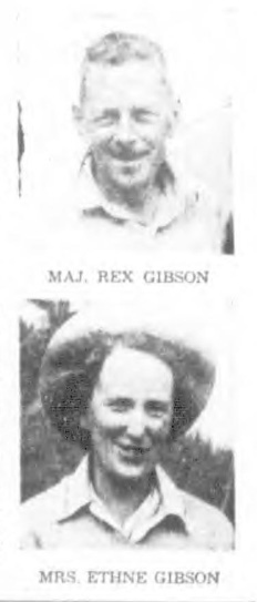
Maj. Rex Gibson, Mrs. Ethne Gibson
Climbers to Try for Body With ‘Copter
Reported in The Daily Colonist Saturday August 24, 1957. p.1.
A northern British Columbia coroner decided last night that the body of Major Rex Gibson, famous Saanichton mountaineer, will not have to remain lashed to a rock on the mountain peak where he died. Coroner Larry E. Pruden of Terrace, after many hours of study, authorized an attempt to be made to retrieve the body of Major Rex Gibson, president of the Alpine Club of Canada. It was expected six members of the B.C. Mountain Rescue Group at Vancouver would attempt the task today, working from a helicopter which could be set down within 600 feet of the body. Major Rex Gibson died on the rock, two days after falling 300 feet Sunday down the side of 9,000-foot Howson Peak, 40 miles east of terrace in the Coast Range. Mrs. Ethne Gibson said her husband often expressed the wish that no risk should be taken in bringing him out if he died on a mountain.
Climber Hung by Teeth in Bid to Save Major Gibson
Reported in The Victoria Daily Times Saturday August 24, 1957. p.1 & 15.
TERRACE, B.C.—Dr. Sterling Hendricks of Silver Springs, Md., worked his way literally by the skin of his teeth down a treacherous British Columbia mountain to fetch help for two injured companions. An hour before rescuers reached the two men at the 6,000-foot level of 9,000-foot Howson Peak in northern B.C., Major Rex Gibson, president of the Alpine Club of Canada, died from internal injuries. With Major Gibson of Saanichton, was Don Hubbard of Washington, D.C., a scientist with the U.S. National Bureau of Standards. Dr. Hendricks and Hubbard recovering in hospital in Terrace, told today of the ordeal on the mountain. “On the long climb down to camp for help I had to make my descents using only my one good arm and my teeth to hang on to the rope,” Dr. Henricks said. “In one place that would normally have taken me five minutes to get down, I required more than an hour. In a mountain accident where someone is injured, one person always stays with him while the other goes for help. Since Hubbard’s leg was broken, he obviously couldn’t go and it was up to me. Major Gibson was the most seriously hurt and couldn’t move. I had a broken shoulder. I knew I would have to return by the route we had come, and it was an unpleasant prospect. I descended to the end of the ridge where the other two injured men lay. Then I crossed a flat glacier at the foot of the ridge and reached the South Col of the mountain. This is a mixture of short rock cliffs and snow. I went down using the seat of my pants and my good right arm. I started around 11 a.m. and it was now approaching 10 p.m. and getting dark. I had to leave all my extra clothes with the other two men, so I curled up on a rock immobile for eight hours. It was terribly cold. The only clothing I had was what I was wearing. I got a little relief from the cold by breathing into my shirt. In the morning I still had another 1,000 feet to descend to the bottom of the col. Between me and the base, there were about 600 feet of snow slope. I couldn’t start immediately because the snow had frozen icy hard over-night and I would surely have slid to my death. When I thought the snow was soft enough, I sat down and wrapped the rock around me.”
Four Hours
“It took me about four hours to get down. Then I reached the base of the slope. There was still another four hours of hiking, but the worst obstacles had been passed. By this time my back was becoming painful so progress was slow. I finally reached the camp about 30 hours after the accident. Alvin Peterson of Washington and Dr. Alex Faberge of Austin, Texas, started back from our base camp toward the injured men within two hours. Gibson and Hubbard had food but no tent or sleeping bag. The danger of death by exposure was very great. Peterson and Faberge carried 60-pound packs, mostly rescue equipment. They reached the two men at approximately noon Tuesday, 50 hours after the accident. It was a sad blow to learn that Major Gibson had died only an hour before their arrival.”
Pitiful Yet Marvelous
Hubbard said the way Major Gibson died as pitiful, “yet it was marvelous in a way. He was delirious all-day Monday. In his delirium, he had daydreams and raved about them. They were the most delightful daydreams I ever heard. In his dreams, everything he wanted to happen, did happen. He was very happy. He thought we were rescued and safe in hospital. He continually kept congratulating the rescue team, which of course hadn’t arrived. I marveled at the way the human mind could conjure up a counter-reaction to our miserable circumstances. I don’t know what Dr. Hendricks told you about the climb down to camp,” Hubbard told a reporter, “but to me it’s one of the most outstanding things of all times. He made a climb with a broken shoulder that the average climber just wouldn’t attempt alone. I worried constantly about Major Gibson. He was securely lashed, but every time he flailed around, he would throw an arm over the precipice. If he had gone over, he would have dropped 15 feet then rolled another 300 feet at a 40-degree angle.” Major Gibson’s wife said her husband often asked that if he should be killed in attempts to climb the unscaled mountain—this was his fourth attempt—no one should endanger himself by trying to recover his body. RCMP officials are considering whether it would be possible to land a helicopter on a glacier to pick up the body.
Gibson to Stay on Peak in ‘Safer Resting Place’
Fellow-Climbers Plan Snow Grave
Reported in The Daily Colonist Tuesday August 27, 1957. p.5.
VANCOUVER—Major Rex Gibson will be buried in the snow, high on a ridge of Howson Peak in west central British Columbia. Major Gibson, 65, who was president of the Alpine Club of Canada, died last week when he fell 300 feet down the mountain with two other climbers, Dr. Sterling Hendricks of Silver Springs, Md., and Don Hubbard of Washington. The body was lashed to a rock on Howson Peak following the accident. Eric Brooks, honorary president of the Alpine Club of Canada, said here Sunday night that Major Gibson will be buried in the mountains. His widow, living in Saanichton, B.C., has said he often expressed the wish that no risk be taken in bringing out his body if he died while climbing. Brooks said he and four others may bury his body this week. The object is to give Major Gibson a “safer resting place than he has now.”
Early Day Climbers Named Waterloo Mountain
Reported in The Daily Colonist (The Islander Section) Sunday October 13, 1957. p 13.
Two of Vancouver Island’s early settlers, who explored much of the country, as well as the Gulf Islands, and sections of the mainland of B.C., were Hector MacPherson and William A. Robertson. It was these two who named Waterloo Mountain [1027m] in 1865, on the 50th anniversary of Napoleon’s shattering defeat at the hands of Marshal Blucher and his Prussian divisions, the Duke of Wellington and his British-Belgian-Dutch forces. In 1865 the memory of Napoleon was still fresh in the minds of British people, and it was on June 18 that MacPherson and Robertson reached the summit of the mountain, the same date that the French were routed at Waterloo. They thought it fitting that the crest should perpetuate the victory of British and allied arms. Waterloo Mountain is in the Koksilah Range and overlooks Grant Lake. Of the naming of the peak, Florence M. Draper writes: “The purpose of their climb I do not know unless it was just to spend a happy day in each other’s company, studying the geography of this island of ours. However, when Mr. MacPherson and Mr. Robertson reached the summit and looked around … they then and there decided to call the mountain Waterloo, in memory of that famous battle, and accordingly marked a tree with their own names. Later a proper marker was placed near the spot. “They also made a pact with each other that should they be alive on the 100th anniversary of the battle of Waterloo they would climb the mountain again. “Unfortunately, when that time came Mr. MacPherson had passed on and Mr. Robertson, then an old man in his 90’s, together with his son and daughter-in-law and friends from Victoria undertook the climb. But they used George Frayne’s pack horses [of Mill Bay] for part of the trip.”
Exploration of the Kokesailah River
Reported in The British Colonist Saturday August 5, 1865. p. 3.
From Mr. Hector McPherson who, with Mr. William Robertson, has been prospecting for gold since June 1st, on Kokesailah [Koksilah] River, Cowichan district, we learn the following particulars: The party ascended the river about 35 miles, prospecting all the way up and finding color everywhere. At a distance of 35-miles they were encouraged from the appearance of the stream to sink a shaft in the high bank, which they did to the depth of 12 feet, finding several colors. They were obliged, however, through the water coming in and the grub becoming scarce, to give up for the present. They intend, they say, to return at once with supplies and materials for rigging a temporary pump. The country is very rough, with occasional flats, heavily timbered. On the 18th June the party ascended a mountain near the head of the waters of the river, after four and a half hours hard climbing. It was named by the explorers Mount Waterloo. They discovered a remarkable lake in that vicinity, at an elevation of about 1,000 feet above the river, and from which a fine stream descended in a series of beautiful waterfalls. The party intends to go to the source of the river and prospect it thoroughly.
$1000 Centennial Trail Would Lead to Scenes Like This
Reported in The Daily Colonist Sunday October 27, 1957. p.17.
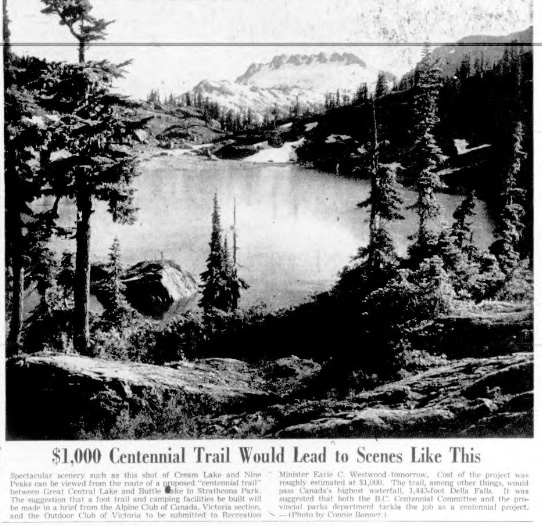
Spectacular scenery such as this shot of Cream Lake and Nine Peaks can be viewed from the route of a proposed “centennial trail” between Great Central Lake and Buttle Lake in Strathcona Park. The suggestion that a foot trail and camping facilities be built will be made in a brief from the Alpine Club of Canada, Victoria section, and the Outdoor Club of Victoria to be submitted to Recreation Minister Earle C. Westwood – tomorrow. Cost of the project was roughly estimated at $1,000. The trail, among other things, would pass Canada’s highest waterfall, 1,443-foot Della Falls. It was suggested that both the B.C. Centennial Committee and the provincial parks department tackle the job as a centennial project. — (Photo by Connie Bomner.)
Vandals Hit Hikers Cabin
Reported in the Alberni Valley Times Sunday October 27, 1957. p.7.
Rosseau Chalet, which for 14 years has provided shelter for hikers on Mt. Arrowsmith, has been vandalized, according to a report from Les Stewart. Mr. Stweart and Art Skipsey have taken on responsibility for care and maintenance of the cabin at the 3,200-foot level. Scouts and other groups of young people have used it and helped to carry in material and make repairs. Other adults, too, have contributed volunteer hours. Now the days of back-packing are over with extension of Macmillan Bloedel logging road into the area, but the easier access has resulted in new acts of vandalism. According to Mr. Stewart, a hole was hacked through the shake roof the volunteers had put on the Chalet, windows had been broken, while split cedar bunks, renewed after a previous attack by vandals, had been damaged.
Get A Key
He emphasized that people wishing to use the cabin are welcome to do so. Both he and Art Skipsey have keys which may be obtained on application. Guests should leave stove wood chopped for the next persons who seek shelter, said Mr. Stewart, pointing out the unwritten law of the woods.
Logging Road
According to the report, the Cameron Division logging road was routed around the cabin and it is the intention of the company to log to the 3,800-foot level. However, those who have an interest in keeping Rosseau Chalet as a haven for hikers are hoping that an area around the building and the six other cabins in the vicinity will be left unlogged. Building of the Chalet was started by Ralph Rosseau, well-known as a mountaineer. After his death in a mountain accident, it was turned over for the use of others interested in the outdoors. Through the years volunteer workers have made hundreds of trips up the trail carrying materials and equipment. A wood burning stove was packed up the steep hillside.
Trail Approval Opens Door to Splendor
Reported in The Daily Colonist Saturday November 2, 1957. p.7.
Recreation Minister Earle C. Westwood has approved plans for the construction of a foot trail and camping facilities through some of the most beautiful scenery on Vancouver Island. The trail, stretching from the head of Great Central Lake through to Buttle Lake, was suggested in a brief submitted by the Victoria section of the Alpine Club of Canada and the Outdoor Club of Victoria. The minister said his department would enter into agreement with the clubs whereby the actual construction work would be done by members with the government paying the cost. The brief estimated the cost at $1000. The work will be done next year, said Mr. Westwood, adding that location engineers in the department had been over the proposed route and had endorsed the plans. Spectacular scenery may be viewed from the trail route and among the most outstanding views is that of Canada’s highest waterfall, 1,443-foot Della Falls. Mr. Westwood praised the clubs for suggesting the proposal and said he concurred with the plans 100 per cent.
Cleric and Politician, Robert Connell Dies
Writer, Scholar, Humanist
Reported in The Daily Colonist Thursday November 14, 1957. p.2.
Funeral service for well-known Victoria churchman and B.C. politician, Archdeacon Robert Connell, 86, 1047 Chamberlain Street, who died yesterday, will be held in St. Luke’s Church at 1:15 p.m. Sunday. A scholar, writer, naturalist, politician and humanist, Archdeacon Connell had friends in all walks of life, and was an authority, writer and lecturer on a wide field of subjects. He was leader of the CCF in the B.C. legislature from 1933 to 1937. Born in England, he came to Canada as a young man and became identified with mission work in the Northwest territories. In 1897 he was sent to Innisfail, in the diocese of Calgary, and remained there until his transfer to B.C. in 1901. Then began his long connection, extending with a short break, right up to the time of his death, with the Anglican church on Vancouver Island. He served as rector of St. Luke’s until 1908, when he left for California for three years. Returning in 1911 to Victoria, he was appointed rector of St. Savior’s which he served until 1923. In the meantime he had been created rural dean in the southern deanery of the diocese, an office which he held from 1916 to 1923. Other positions he held in the same period were secretary of the provincial synod, diocesan clerical secretary, and secretary of the Anglican Theological College. A member of the CCF during its formative years, he was elected to the legislature and was CCF House leader between 1933 and 1937. He withdrew from politics after breaking with the CCF and forming his own party which was unsuccessful at the polls. In 1938, he was appointed by the city as hospital chaplain and in 1939 as canon-leader of Christ church Cathedral. His knowledge of botany, meteorology, and other branches of science became familiar to many readers. For a number of years, he was a columnist writer for the Sunday magazine section of The Daily Colonist. Archdeacon Connell is survived by his widow, Janie at home; three sons, R.H. Connell in Sooke, S.G. Connell at New Westminster, and J.H. Connell at Ottawa; five grandchildren and one great grandchild; two sisters and one brother.
1957 Victoria Section Climbs
Reported in The Canadian Alpine Journal Volume 41, 1958. p.76-78.
By Patrick Guilbride
This year we decided to try Strathcona Park again, as flying into Garibaldi last year was just too easy. We were not so heroic, however, as to outlaw an air-drop of supplies. This was organized locally, using PWA Norseman and home-made ‘chutes, for a very reasonable cost. My home (Alberni) is only about 30 miles from our objective and logging roads reach within 5 miles of The Red Pillar from here. But a recce from this side reminded my wife and I that Strathcona bush was just as we remembered it. We therefore decided to go by way of Courtenay and Comox Lake. We were ferried up the lake and to the end of the logging road through the kindness of the Comox Logging Company. There were six of us in the party: Elizabeth, myself, Bill Lash, Syd Watts, Keith Morton and Geoffrey Capes. We left the road at 5 p.m. on Saturday, August 24. Spirits were not too good at this time, rain was pouring down, the air-drop had not been possible that day, the first mile climbed 3,000 feet, and packs were heavy in spite of the hoped-for air-drop. The bush was not bad and we struggled upwards, making camp in the dark. Next morning was cloudless, but fog lay heavily in the valleys, particularly over the Sproat Lake base of PWA. We were therefore surprised to hear and see a plane climbing towards us. We heard the Norseman circling over the Comox Glacier and built up our fire for a smoke-signal. The plane came over our heads, wagging its wings in the pre-arranged signal for a successful drop. Another half hour of bush and we were on top of Kookjai Ridge, Alpine country at last; the ridge leading up, with a few dips, to the eastern end of the Comox Glacier. Lunch at Tatsno Lakes, then on to the top of Black Cat Mountain (elevation 5,300). Here camp was pitched beside a series of small pools, individual bathtubs. A beautiful clear night, with lights of Alberni, Courtenay, Comox and Powell River twinkling below. We climbed some fairly steep rocks next morning to the great, flat, mile-wide snowfield of the Comox Glacier. Here the air-drop was retrieved from the snow, two days’ food packed up, and the remainder cached in the rocks of the glacier summit at elevation 6,445 feet. Clouds were boiling up around us and rain started to fall as we arrived at the top of the Moving Glacier. We had been told of a “fairly easy” route down the cliffs to the saddle between Milla and Mirren Lakes, where we had planned to set up our headquarters. This route was not at all easy with packs, on wet rocks, and was exposed in places. Several hours were passed in 500 feet of descent, with approaching darkness forcing us to camp on a miserable ledge, dubbed “The Black Hole.” The Milla-Mirren Saddle was abandoned as a base-camp site, but Rees Ridge (6.488 feet) was climbed the next day. Another night was spent on the sloping rock-pile at the “Hole.” Wednesday we labored back to the top of the ridge and found a pleasant camp spot some 100 yards from the place were we had started down. The rest of this beautiful day was spent in making camp, reconnoitering a route around Argus Mountain to the Cliffe Glacier, and packing in the rest of the air-drop. Thursday morning Elizabeth, Syd, Bill and I set of for The Red Pillar (6,655 feet), Geoff and Keith choosing an easier day on the ridges. We passed below the cliffs of Argus Mountain on steep scree and descended a chimney to Cliffe Glacier. Skirting several crevasses and jumping a small ‘schrund we got on the firm red rock which gives the mountain its name. A very enjoyable climb to the summit—gullies, ledges, chimneys—some airy bits but not difficult. The top of this mountain is perfectly flat, a red gravel field 100 yards across. The next day Keith and Bill had to leave. They planned to hike out via a “short-cut” ridge and catch the Comox Logging “crummy” by 4:30 p.m. We learned later that they did not reach the road until 8:30 and walked nine miles to Comox Lake next day, on empty stomachs. Geoff, Syd, Elizabeth and I climbed Argus Mountain on this day—some steep pitches on loose rock but mostly a pleasant walk and scramble along the ridge. Geoff came in for some teasing here, about his pipe: “How did you expect to climb mountains when you get old, if you smoke that thing?” Geoff is now sixty-seven. The usual afternoon clouds and showers did not materialize and the views from Argus Mountain were superb. Two small ice-falls from Comox Glacier dropping over sheer rock 3,000 feet to Mirren Lake. Moving Glacier ending in a 50-foot ice cliff at Milla Lake, sending bergs crashing into the turquoise water. Cliffe Glacier curving in a two-mile sweep around Argus Mountain to Mount Harmston from its ice-fall on The Red Pillar. Tzela Lake nestling far below Cliffe Glacier, a perfect gem in its setting of meadows. So beautiful and so inaccessible though it is only seven miles from Oshinow lake, to which one can drive. North and west were the other peaks of Strathcona Park, some known and visited by us, others known by name only, many unnamed and seldom if ever climbed. Such is Strathcona Park and Strathcona bush. We were the only party to visit this area this year, indeed for several years. On Saturday we planned to climb Mount Harmston, but awoke to a steady drizzle so back to sleeping bags until noon. We crawled out then to eat a fabulous lunch and/or breakfast. One member’s intake was carefully noted: 1 bowl of prunes, 2 bowls of porridge, 11 sausages, 2 slices of fried bread, several slices of toast and honey, all washed down with large cups of tea. Still it drizzled, visibility 50 feet, so back into sleeping bags we went. A short sortie along the ridge to gather fire-wood was our exercise for the day, then another huge meal and back to bed. Due to our air-drop being planned for seven people and only six going we were over supplied with food and must do our best to eat it all. Sunday we broke camp and started back across Comox Glacier in a gathering storm, 50 m.p.h. gale across the snow-field, rain making rocks slippery on the descent. The weather soon improved, however, and we started down off Black Cat Mountain to the “Short Cut Ridge.” Short in distance, yes, but not so easy as the way we came in, especially since packs were now heavy with air-dropped gear and the ‘chutes themselves. Sunday night camp was by a small tarn, a beautiful spot for our last night above timberline. Monday—on down into the trees, to the road, where we cooked up a grand stew of all remaining food, while waiting for our transport.
Participants included Elizabeth and Pat Guilbride, Bill Lash, Syd Watts, Keith Morton, Geoffrey Capes.
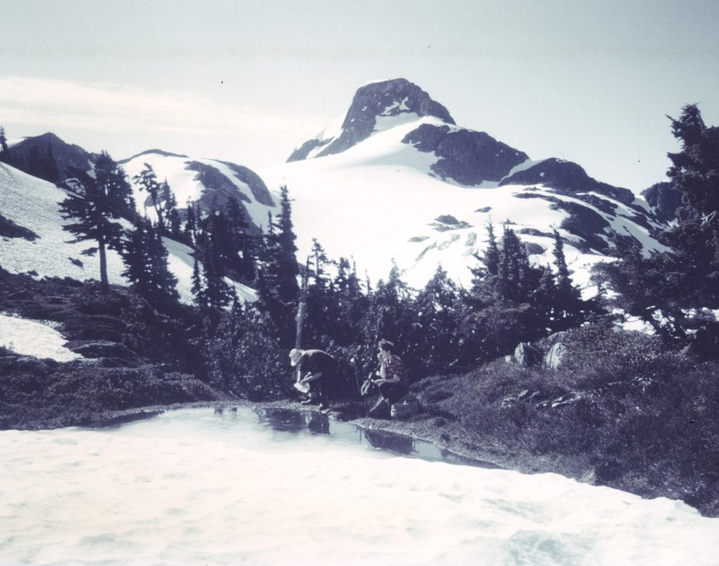
The Red Pillar – Syd Watts photo.
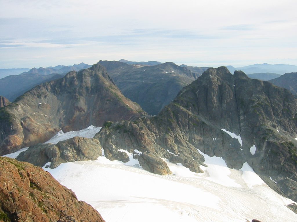
Mount Harmston and Argus Mountain from the summit of The Red Pillar – Lindsay Elms photo.
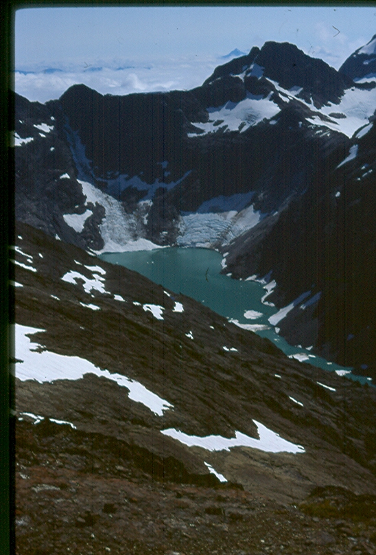
Milla Lake and Argus Mountain from near Iceberg Peak – Lindsay Elms photo.
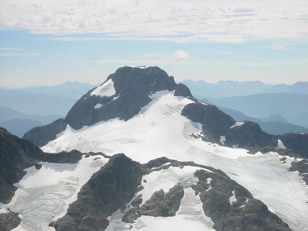
The Red Pillar from Mount Harmston – Lindsay Elms photo.
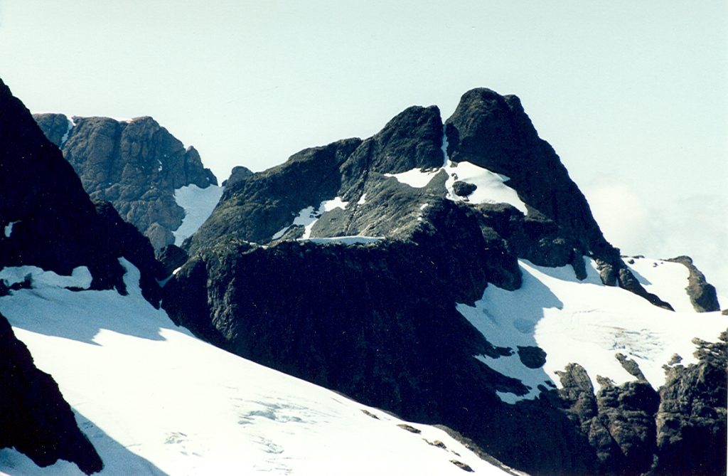
Argus Mountain from near the Comox Glacier – Lindsay Elms photo.
Mrs. Frederick V. Longstaff
Reported in The Canadian Alpine Journal Volume 41, 1958, p.115-116.
By Frederick Longstaff
Mrs. Frederick V. Longstaff, a member of the Alpine Club of Canada since 1912, passed to her rest on February 2, 1957, at her home “Seabank”, King George Terrace, Victoria. Mrs. Longstaff, whose maiden name was Jennie Long McCulloch, was the second daughter of Mr. and Mrs. W.F. McCulloch of Stratford, Ontario. The family moved to Victoria in 1885. Jennie McCulloch’s first visit to the Rocky Mountains was made, with her sister Nancy, in 1902. They stayed in the original log building of the Banff Springs Hotel. This was the first of several delightful holidays spent in the Banff area with the result that Jennie joined the Victoria section in 1912 and became its first secretary. At the annual camp in 1913 Jennie graduated on Mount Cathedral and later attended the pioneer camp at Mount Robson. She also attended the 1914 Yoho Camp. On one expedition during the war she unfortunately strained her heart from which she never fully recovered. In 1921 Jennie McCulloch and Frederick V. Longstaff were married in the old Christ Church Cathedral, Victoria. On their return from Europe the Longstaff’s made their home at “Seabank” on Gonzales Hill, Victoria, where the snow-capped Olympic Mountains can be seen all year, in many ways a reminder of the Rockies and Selkirks which meant so much to both of them. Even though Jennie Longstaff was unable to undertake strenuous climbing, following her heart injury, she was for many years able to accompany her husband to the mountains. Between the years of 1923 and 1938 they made frequent visits to many beauty spots of the Rockies which have since become so well known, Wapta Lake, Lake O’Hara, Bow Lake and Maligne Lake. In 1939 they returned once again to their favorite Wapta Lake, where they repeated the walks and rides of earlier days, and enjoyed the company of their mountain friends. This was to be their last visit to the mountains together as the doctor advised her against returning to higher altitudes. Thugh failing health made travel inadvisable, Jennie Longstaff retained her interest in Club activities and always attended the Victoria Section meetings. The exploits recounted and colored slides shown helped to bring back many happy memories of earlier days in the hills which she loved throughout her life.
Rex Gibson Memorial Climb
Reported in The Canadian Alpine Journal Volume 42, 1959, p.39-41.
By Bill Lash
As reported in the Journals of 1957 and 1958, exploratory climbing expeditions to the Howson range were led by the late Major E.R. Gibson in each of the years 1954 to 1957. Success in attempts to reach the summit of Howson Peak (9,600 ft.) the highest point in the range, was thwarted in 1956 by very bad weather, and in 1957 by the tragic death in which Rex lost his life. Last summer the executive decided that, as a mark of affection in gratitude for his outstanding services to mountaineering, a cairn should be erected in memory of Rex. Adolf Bitterlich, John Owen and the writer [Bill Lash] were asked to build a cairn which was to be on the south col of Howson Peak. To do this, on July 12th, 1958 the three of us flew from Terrace to Burnie Lake. After a night at Rex’s old campsite on the fan of Sandpiper Creek, we packed up Sandpiper Valley to establish a camp in flowery, but rather wet, meadows west of Sandpiper Lake. The possibility of a quick evacuation of this camp might be necessary in event of flooding, due to heavy rain, was recognized, but fortunately this need did not arise. The next morning we climbed the headwall of Sandpiper Valley arriving at the south col of Howson Peak in good time for lunch. Our plan was partially to build the cairn, make a concrete block to which a brass commemorating plaque could be attached, then while the concrete was setting, to study the south face of Howson Peak. Then we would go back to camp and return to the col the following day, bringing up supplies for a high level camp from which we hoped to make an attempt to reach the summit. The first part of the programme we caried out, but the second part, namely the attempt to climb Howson Peak from the south, we abandoned as the prospect did not seem to inviting. Examination of the south face of Howson Peak disclosed that even a moderate breeze was causing a steady stream of stones down the gullies. Accordingly in order to save time we decided to pass the night on the col while the concrete set, a rather cool proceeding as we had not brought sleeping bags and the night was cold and gusty. The following morning the concrete had set sufficiently to move the block into the cairn, which could now be completed. The col was typical of many Rex knew and loved, the view both east and west being extensive and of considerable grandeur. The plaque is on the easterly side of the cairn facing the rising sun, and bears the inscription:
In Memory of Rex Gibson
Born in England November 7th, 1892, who died on
Mt. Howson on August 20th, 1957, as a result of
a climbing accident during an attempted first
ascent. At the time of his death he was serving as
President of the Alpine Club of Canada. This
Cairn was built by members of the Club.
After completing the cairn we returned to our base camp. The steep glacier which was descended under such painful conditions by Sterling Hendricks the previous year was in a tricky condition, calling for crampons, but in places covered with snow which balled up the points. To counter the cold night on the col, the heat at the base camp was tropical. Nevertheless we had some rest and a refreshing dip in the glacial river inspired sufficient enthusiasm to start at about 6 p.m. up the long slope on the north side of the valley, the intention being to make a flying start the next morning for a reconnaissance and possibly attempt to climb Howson Peak from the north. A pleasant bivouac was made on the rocky ridge bounding the large easterly Howson glacier. On the following morning, Wednesday, an early start was made while the surface of the glacier was in excellent condition, the north col of Howson Peak being attended at 8 a.m. It may be recalled that the ascent of the last part of the glacier leading to the col was found impossible by Rex in 1957 due to incessant avalanches. Conditions in 1958 were quite different, the ice being hard and sound. The schrund was wide and open, but a fairly simple crossing was found over a rather shaky snow bridge. In the col we found a cairn, doubtless constructed by Rex in 1956. An attempt to climb Howson Peak, following this route, had been made during that year, but, due probably to deep snow, was abandoned. The general route along the ridge to the summit is evident from the glacier, the only obvious disadvantages being that it is rather long and involves crossing two steep towers separated by icy couloirs before the main ridge leading up the mountain can be attained. The first of these towers was crossed by going straight up and over the top, a good rock climb of no great difficulty. The second tower was more difficult. It involved cutting a few steps around the steep icy slope separating the towers, then working up a slender vertical crack perhaps 12 or 16 feet long in a very exposed position. While climbing this crack the leader is a considerable distance from a satisfactory belay point. No further difficulties were experienced on the second tower but this tower is separated from the main ridge by a long narrow ice arete. Crossing of this was facilitated by a small crevasse near its centre, from which it is possible to give at least moral support by the means of a belay using two 120-foot length ropes. From this crevasse the ice ridge sloped steeply upward involving step cutting to attain the rocky north ridge of Howson Peak. This ridge is of moderate steepness and offers a pleasant scramble to the summit. Howson Peak has two main peaks. The northerly one culminates in a snow cone and seemed a little higher than the south peak. However, the south peak was bare rock and a cairn was accordingly erected there. About an hour was occupied building the cairn and admiring the view, the weather being cloudless in all directions although with considerable smoke haze. The time of arrival at the summit was about 4 p.m., seven hours from the north col. The descent followed the same route as the ascent, a rappel assisting in the drop to the icy ridge separating the second tower from the ridge of the main peak. The col was reached about 10 p.m., the light being still quite good. A reasonably comfortable night was passed on a small rock hummock near the centre of the col. This climb was led throughout by Adolf and its success can be attributed to his leadership and good judgement, and to the exceptionally fine weather conditions. It could clearly be very different or impossible with wet rock or new snow. The next morning was clear and frosty and as there was no reason to make an early start the sun was permitted to soften the ice on the glacier so the descent could be made in comfort. After crossing the glacier several hours were spent admiring the magnificent view overlooking Sandpiper Valley and the peaks to the south before returning at a leisurely pace to camp. We had arranged for the plane to call us at Burnie Lake at3 p.m. Friday, so the following morning we broke camp. On the way down the valley, we stopped to tidy up the old camp at the south end of Sandpiper Lake which had been evacuated hurriedly following the accident in 1957. The plane arrived on time, and for this we found we owed special thanks to Hans Frank, P.W.A. agent of Terrace. All P.W.A. planes had been commandeered for forest fire service, and it was entirely due to his personal efforts that a trip was arranged to pick us up. Thus, on a warm sunny afternoon we left Howson Peak. During the past week our thoughts and talk had so often been of our friends and leader, Rex. How we wished he could have enjoyed this week’s summer weather and been with us to continue to search and find “the chief glories of the ancient mountains and the precious things of the last hills.” His monument we hope will long stand in the country he loved, even his spirit will endure in the lives of his many friends and fellow members of the Alpine Club.
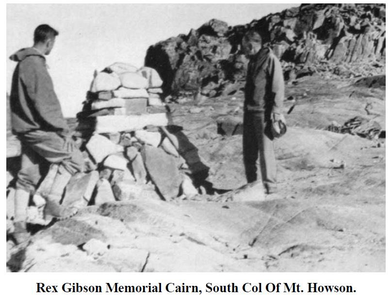
Rex Gibson Memorial Cairn, South Col Of Mt. Howson.
Evelyn Rex Gibson
1892-1957
Reported in The Canadian Alpine Journal Volume 41, 1958, p.111-114.
By R.C. Hind
The accident on Howson Peak on August 18, 1957, in which Rex Gibson was fatally injured, deprived the Club of one of its best known and most valued members. He had held many offices in the Section and Club executives and was serving his second term as President at the time of this death. Rex Gibson was born on November 7, 1892, at Hatfield Peveril in Essex and educated at Mowden Preparatory School and at Sherbourne School. At sixteen he went to work at a private bank in Paris, belonging to his family. This bank was later absorbed by Lloyds and after the war he served with the latter in Cologne and Antwerp. He spoke French and German fluently and was always happy to converse with the guides and others in these languages. He enlisted in the artillery in September, 1914, and received his commission in November, 1914. He saw action at Ypres, the Somme and Cambrai, and was appointed Staff Captain R.A. III Corps, in January, 1917. He was awarded the Military Cross and was three times mentioned in dispatches. He rejoined the army in February, 1941, with the Royal Canadian Artillery and was promoted to Major in 1944. During this period of service he was Canadian Military Representative with the U.S. Army Mt. McKinley expedition to test cold weather equipment in 1942; was instructor at the Little Yoho Military Camp 1943 when a number of members of the club gave instruction in mountaineering to an army group; and took part in the Lovat Scout training in Jasper Park in the winter of 1943/44. Rex came to Canada in July, 1926, and started farming at Winterburn near Edmonton, in 1927. Farming proved the ideal occupation for a mountaineer. There was little to do in winter and a long period in the summer between seeding and cutting, fortunately during the best climbing weeks, gave time to enjoy the climbing and exploration he loved so well. Prior to coming to Canada he made a few climbs in Switzerland, the major one being a winter ascent of the Jungfrau during a ski tour in January, 1925. Soon after arrival in Canada he became acquainted with the club through the Edmonton Section and joined in 1930. For the next eighteen years he was a most active member of that section, serving many terms as Chairman and in other executive capacities. The writer was a camp boy at the 1932 camp when he first met Rex. We made two climbs together that year, thus beginning a happy association of many years and many peaks. Rex was a very strong and fast climber in those days and few could keep up with him if he chose to hurry. Trying to do so, however, was the best training a beginner could have had, for in speed lies the essence of safety in mountaineering. We made many expeditions together during these golden years. The year 1936 stands out in memory when with Sterling Hendricks and the late John Southard we back packed to Mt. Clemenceau and climbed it before camp and later with Hendricks were successful on Mt. Robson. Rex’s record is probably unsurpassed by any amateur climber in Canada. He made over two hundred climbs, including many first ascents. A good number of the latter remain unclimbed since. Among the climbs he enjoyed most were Clemenceau and Robson mentioned above, Columbia and North Twin in 1937, Forbes and South Twin in 1938, his expedition to the Coast Range with Henry Hall and Hendricks in 1939 where several first ascents were made, including Tiedemann, 13,000 feet, and Bugaboo Spire in 1946. Of the latter his notebook relates that this is the best climb we have made together. Rex’s love for the mountains was more than a hobby; it became a passion which he was ever willing and eager to share with others. He was greatly interested in young people and for some years ran a Scout troop in Edmonton. He was instrumental in introducing many boys to the great hills and their secrets. His skill and both rock and ice and snow was great and he conducted innumerable schools at Club Camps and on private outings to pass on this knowledge to others. As a leader he was superlative, being careful and considerate. While able to climb very fast himself, he was patient with those who could not and suited his pace to theirs, trying at the time to show them how to improve. Many leaders in the Club today owe a large measure of their skill to his teaching. In ski mountaineering also rex was very active, being a pioneer, with the late A.A. McCoubrey, of winter climbing in Canada. First winter ascents of a number of peaks were made and many miles of mountain valley saw his ski trails. At the Club’s first Ski Camp at O’Hara, Rex and the writer spent two days taking in the perishables before camp, three round trips a day. After the death of McCoubrey organization of the Ski Camps fell to rex and for many years he arranged and ran these camps which were proven so popular. Rex was injured during the McKinley expedition and was discharged from the army with a pension. In June, 1948, he was married to Miss Ethne Gale whom the writer had the pleasure of taking her on her graduating climb in 1936. Rex left the farm and moved to Saanichton near Victoria. The Club extends to Mrs. Gibson and their daughter Kathleen, its deepest sympathy. Mountaineering was not his only interest. Rex was an enthusiastic sailor and fisherman. His home in Saanichton showed some evidences of his skill as a carpenter. With an axe he was an expert and many will remember his demonstrations of how to split fire-wood at numerous camps. He was keenly interested in astronomy, an interest he acquired from the late C.G. Wates. I can well recall sitting up for hours with Rex and Wates to see an eclipse of the moon which, due to some miscalculation, had occurred the night before. He was a deeply religious man and all who heard his sermons at camp services will have been impressed by his faith and sincerity. We have lost a man of many parts who will be sorely missed, especially by those who grew up in his shadow.
1958
ACCVI executive:
Chairman – Noel Lax
Secretary – Francis Tuckey
Events:
June – A party that includes Paddy Sherman climbs Mt. Fairweather.
July – Adolf Bitterlich climbs Howson Peak and erects a cairn to commemorate Rex Gibson.
August 9-15 – A party of three club members hiked from Forbidden Plateau Lodge to Great Central Lake.
August – A party that includes Ralph Hutchinson and Dick Culbert make a number of 1st ascents in the Kwoiek Area on the mainland.
September 29 – British mountaineer Joyce Dunsheath gave an illustrated talk on Moscow and the Caucasus Mountains to the ACC at the Pacific Club. She is the co-author of Mountains and Memsahibs: Abinger Himalayan Expedition.
Section members who attended the ACC general summer camp at the Mummery Glacier: Reginald Knott, Paul Martinson, Harry Winstone, Adolf Bitterlich, Roger Neave.
The Ski-Folk Pray for Snow
Reported in The Daily Colonist the Islander Section Sunday March 2, 1958, p8.
By Bee Lamprecht
Each winter, when city dwellers are casting doleful looks at the barometer and threatening skies, another group of Island residents is trying to will the heavens to send down a few feet of soft white powder snow. These people are skiers. When the first flakes sift down they’re in jubilation and rejoicing, and a gathering of skis, boots, poles and rucksacks together in readiness for a few months of Vancouver Island’s most exciting and exacting winter sport—the straight schuss down a hard-packed slope, the rhythmic series of brisk stem turns, the graceful linked succession of parallel swings, then the ride up the rope tow to begin it all over again. For most of them skiing is a week-end affair and there are three main areas on the Island where devotees of the sport can try out their skills and improve their technique. Furthest north is the Forbidden Plateau ski area. At the end of the 14-mile road from Courtenay is the Forbidden Plateau Ski Lodge which rents rooms and dormitory accommodation, offers dining room and coffee shop service, and maintains a ski shop for the rental of equipment. The beginners’ slopes in front of the Lodge are floodlit for night skiing. Five competition cups are owned by the club: men’s and women’s trophies in both downhill and slalom races, and another for combined races. From the Lodge to the timberline are beginners’ slopes of a gentle grade. At timberline there is a short rope tow and another longer one just beyond it owned and operated the Comox District Mountaineering Club. This organization was formed about 30 years ago, mainly to promote interest in hiking and adding skiing to its roster about 20 years ago. The CDMC as it is referred to, has about 50 active members who work and ski with the Fanny Dunkers Ski Club, a junior division made up of school-age children, about 50 all told. Each Saturday the Fanny Dunkers charter a bus up to the Forbidden Plateau Lodge, leaving Courtenay at 9 a.m. and returning at 6 p.m. The CDMC does the same on Sundays, and of course private cars of serious experts and starry-eyed novices add to the carnival spirit. The CDMC ski area extends from the Forbidden Plateau Lodge for about five miles up – which has as its highest terminus the top of Mt. Becher. Three cabins are located along the way, first at the lower ski tow, called Tow Inn, and used mainly as a coffee shop. At the 3,000-foot level nestles Jay Lodge and another 1,000 feet above that is the Mt. Becher cabin, both these chiefly used to accommodate overnight skiers. On Saturdays Herb Bradley, director of the Courtenay Recreational Association, looks after and instructs between 25 and 40 youngsters from the time the bus leaves Courtenay until it returns as the CDMC is most interested in promoting family skiing. In the fall of 1957, a calamity struck fear into the hearts of the club members. A slash fire, fanned by wind, got out of control and destroyed the lower tow, the Tow Inn cabin and several private cabins. Coming so late in the year it could have meant a complete lack of these facilities for the winter season, but the club members worked like Trojans to get that town in operation and the inn rebuilt and stocked with supplies and wood before snowfall. Local Courtenay firms assisted materially so the skiers at Forbidden Plateau were able to carry on without a break in their stride. A smaller club, but one just as enthusiastic, is the Nanaimo group skiing on Mt. Benson. Now nearly eight years old and 30 members strong, it has been headed by Bruno Clozza for the past three years, who is doing all he can to improve the club’s facilities. Four years ago, the rope tow was powered by the motor from a 1929 Chevrolet truck, now a ’49 Prefect engine in a proper tow shack transports the skiers up the 750-foot slope beside the club cabin. This slope has recently been bulldozed to clear it of stumps, the ever-threatened worry to a skier’s peace of mind. Even a small stump, just hidden under a thin covering a snow, can break a ski like a toothpick. The club has also bulldozed a mile-long trail from the cabin down to the parking lot, to give them a fast run, dropping 600 feet on the way. To tie in with the province’s anniversary a Centennial race was held on the slope. Generally, the ski season on Mt. Benson extents from the end of December to the middle of April and when the snow melts away from around the cabin in the spring, Nanaimo Ski Club members take to the higher grounds behind Mt. Benson . . . and talk of the day when the whole area could be opened up to bring the thrill of skiing to the coming crop of youngsters. Closest to Victoria is the Mt. Brenton area, inhabited on week-ends by the Sno Birds Ski Club. Now in its tenth year, the club averages a membership of 130, ranging from a few tiny beginners through teens, twenties and thirties up to one man in his sixties. This years president Barbara Davies, hopes to see a season so successful that the construction of a second tow can be started in the summer. As present the club owns and operates a 750-foot rope tow just outside the cabin which has been enlarged. Here, too, the main ski slope has been bulldozed to provide greater safety and better runs for members and visitors. Transportation, which is all private cars, currently takes skiers to within an easy half-hours hike to the cabin, but when the snow is deep on the ground the road is impassable, even by the jeep owned by one of the members, and it is necessary to climb on skis from the bottom of the first switchback up what is called the Short Cut, which lops many miles off the trek. Regular expert instruction, and controlled skiing is featured by the Sno Birds, with the result that interest runs high to see who can best master the tricky reverse-shoulder turns and controversial ‘vedein’ style – skiing’s answer to rock’n’roll, as it has been internationally termed. Depending on the snowfall Sno Birds can ski from sometime around Christmas to April. When too many patches of ground show through the tow slope Sno Birds climb up the slalom hill, higher on Mt. Brenton, or traverse up majestic Mt. Hall behind the cabin. From the top of Mt. Hall, with its sheer cliffs, intoxicating air and virgin valleys of snow, the whole panorama of sea, lakes and mountains is like a 360-degree post card in technicolor and the cares of the work day world fade into their proper perspective. Members of the Vancouver Island ski clubs play host to each other in the early spring when it’s time for races. Best times in slalom and downhill events are eagerly competed for, with prizes and trophies to commemorate the winners’ feats in most cases. The really keen members are fired with a true missionary zeal for conversion, so the toddlers of 1958 will be darting down the slopes in ten years’ time in a manner professional enough to satisfy the experts and exasperate their parents who aren’t quite as good.
Newly enlarged, a cabin in a magnificent setting on Mount Brenton, belonging to the Son-Birds Ski Club… Victorians enjoy the winter sport.
Here’s High Spot of Centennial Show
Reported in The Victoria Daily Times Thursday May 29, 1958. p.21.
The eight most rugged mountaineers will be picked from a dozen now under training for an assault on B.C.’s Everest. Theywil live for a month on ice-shattered Mount Fairweather, the highest peak in B.C., which towers 15,300 feet right on the Canadian-Alaska border 1,000 miles north of Vancouver. Members of the B.C. Mountaineering Club and the Vancouver section of the Alpine Club of Canada, will set out on its centennial committee sponsored hike June 14. Fairweather has never been scaled by Canadians. It has only been conquered once, in 1931, despite attempts by several famous mountaineers. The centennial team, led by Paddy Sherman, is using some equipment that helped Hillary and Tenzing beat Everest. And like Everest, Fairweather guards its summit jealously, with a giant ice-fall. Sherman hopes the victory in late June—but even then temperatures will be well below zero. The eight-man team will be selected after a full-scale trial on Mount Baker in two weeks.
Mt. Fairweather
B.C. Climbers Conquer Peak
Second Time in History
Reported in The Victoria Daily Times Saturday June 28, 1958. p.1.
VANCOUVER—A party of four climbers has conquered 15,300-foot Mount Fairweather, British Columbia’s highest mountain. They reached the summit at 9:45 p.m. Thursday [June 26]. Success of the climb, a B.C. centennial project was reported by George Kitson, amateur radio operator at northerly Lituya Bay. The mountain is situated in the boundary between B.C. and the Alaska panhandle. Only one of the four was identified: Fips Broda of West Vancouver. The original eight climbers split into two parties. The final ascent was made from camp 2 at 9,44 feet starting at 8:30 a.m. Members of the climbing team are Pau Binkert, Vancouver; Dave Blair, North Vancouver; Joe Hutton, North Vancouver; Dr. Denis Moore, Newton; Wally Romanes, Vancouver; Paddy Sherman, North Vancouver; Russ Yard, Dollarton, B.C. and Fips Broda.
Once Before
They are members of the Alpine Club of Canada. The mountain has been conquered only once before, in 1931 by a group of Americans. Before leaving Vancouver June 16 for the snow-shrouded peak, the alpinists agreed that conquest of the mountain was dependent on the weather. Mount Fairweather is one of the highest coastal mountains in the world, ice-clad from sea-level to summit. The successful climb in 1931 was a month-long struggle against the elements and failing human strength. The Americans, Dr. Terris Moore and the late Alan Carpe, carried all their climbing requirements on their backs, in a series of relays up the steep slopes, unlike the present expedition which established their base camps at regular intervals to the summit. The Canadians were supplied with necessities from the air. The Americans were isolated completely. Like Mount Everest, Fairweather guards its approaches with an icefall, a continually tottering chaos of steep ice like a frozen cataract. The Canadians had to overcome three big icefalls and their attendant maze of crevasses before being able to establish their 5,000-foot base camp.
Scenic Park Trail Ready Next Spring
Reported in The Victoria Daily Times Saturday July 5, 1958. p.31.
COURTENAY—A four-mile trail from Buttle Lake to Flower Ridge, in the heart of Strathcona Park mountain and alpine country, is nearing completion. Brushed out by Port Alberni mountaineer Ulf Bitterlich to a width of four feet, it starts at the mouth of Henshaw Creek, on the southeast shore of Buttle Lake, and winds at nothing more than 12 percent grade to the top of the 4,500foot ridge. The trail is a centennial project of the Victoria section of the Alpine Club of Canada and the Outdoor Club of Victoria, and is hoped to be the first of a network to include Della Falls and Forbidden Plateau. It will not be available for use until next spring, since the B.C. Power Commission is keeping Buttle Lake road closed because of fire danger and steady use of the road by logging trucks. Peaks within a six-mile radius of the ridge top are Mount Harmston, 6,500 feet; The Red Pillar, 6,665 feet; Mount Septimus, 6,400 feet; Big Interior Mountain, 6,107 feet, and Mount Myra, 5,922 feet. The Golden Hinde, highest mountain on Vancouver Island, is on the opposite side of Buttle Lake and 12 miles from Flower Ridge in a straight line.
Mt. Fairweather Conquerors on Way Home
Reported in The Victoria Daily Times Tuesday July 8, 1958. p.6.
VANCOUVER—A shortwave message received here Monday night from Lituya Bay near the B.C.-Alaska boarder said the conquerors of Mount Fairweather are expected to return to Vancouver Thursday. The message said an RCAF Canso will pick up the climbers Thursday morning. It is expected back the same day. Two four-man parties climbed the 15,300-foot mountain, the first on June 26. The second party scaled the peak three days later. It was the first time a Canadian expedition had conquered Fairweather, highest peak in B.C. The only previous successful climb was made in 1931 by two Americans.
Centennial Flag
The Canadians planted the B.C. Centennial flag atop the peak, to mark one of the high points of the province’s 100th birthday. Members of the first party were leader Fips Broda. Paul Binkert, Walter Romanes and Joe Hutton, all the Vancouver area. The second team was made up of Dr. Denis Moore of Newton, B.C., Russ Yard of Dollarton, B.C.; Dave Blair and Paddy Sherman, both of North Vancouver.
Fairweather Climb – First Pictures
Reported in The Province Wednesday July 9, 1958. p.1.
Russ Yard, Dave Blair and Denis Moore of the summit of Mt. Fairweather – Paddy Sherman photo.
Fips Broda, Paul Binkert and Joe Hutton planting the flag – Paddy Sherman photo.
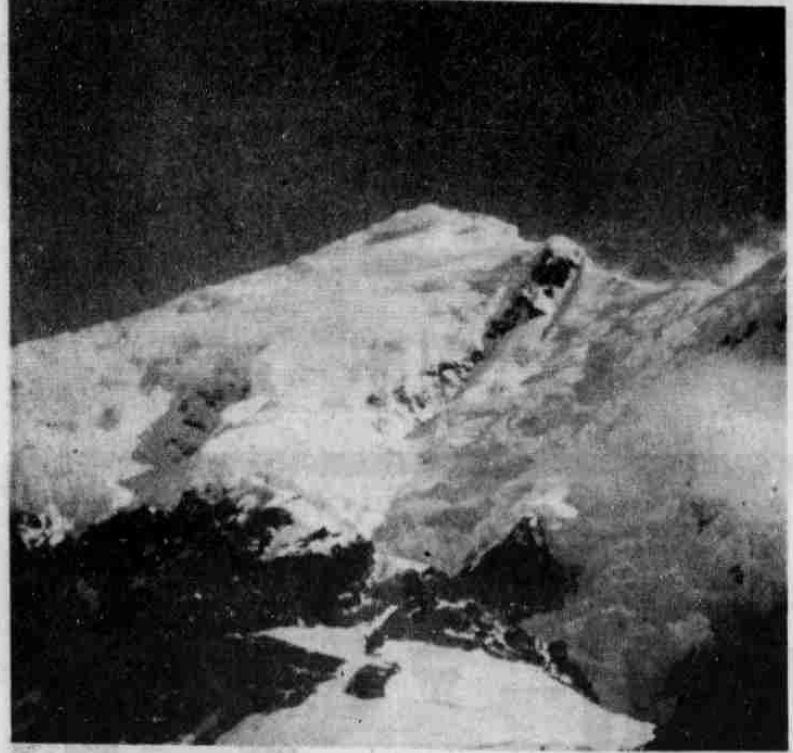
Mt. Fairweather – Paddy Sherman photo.
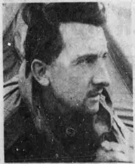
Paddy Sherman, leader of the expedition.
Wasn’t It Peaceful Up Mt. Fairweather?
Reported in The Province Tuesday July 15, 1958. p.28.
By Paddy Sherman
“Wasn’t it peaceful on Mt. Fairweather?” somebody asked me the other day. “Wasn’t it wonderful to be far from the noise of the big city?” We told her bluntly: “At times living in base camp was like trying to sleep in the middle of a railway freight yard.” That was one of the most impressive things for the eight climbers on Mt. Fairweather centennial expedition – the constant roar of avalanches. Just north of the base camp, which was hewn from a rock pile at the 4,250-foot level, was a mountain split for thousands of years by a giant gully. The rock cliff was disintegrating, and as we watched, the gully channeled hundreds of thousands of tons of boulders onto the glacier below. And with cracks like mortar fire, ice-cliffs would suddenly sag, and erupt in a flood over precipices. We saw one that fell over 3,000 feet though space before hitting a glacier. From our safe distance, the ice looked like a shower of soap flakes. But when we examined the debris, there was ice-blocks as big as a house. Avoiding places where such lethal falls occur is one of the arts of mountaineering, and the first party of four to reach the 15,300-foot summit on June 26 did a fine job of route finding. They were Paul Binkert, Fips Broda, Joe Hutton and Walter Romanes. The plan for scaling B.C.’s highest summit was simple: set up a high camp at about 9,000 feet, carrying heavy loads of food and equipment, then push on light the remaining 6,000 feet to the top. But carrying out the plan was not quite so simple. There was no trouble getting the supplies to our comfortable base camp, thanks to a precision para-drop by RCAF pilots Flight Lieutenant Don Hill and Ed Cameron, and para-expert Jake Dyck. This was above the first major ice-fall, a cataract of ice, with giant ice-blocks and pinnacles mimicking the Manhattan skyline. The second ice-fall was just above us, a tottering chaos of ice where blocks as high as down-town buildings constantly toppled with a roar audible for miles. We by-passed this, and reached the 5,000-foot level of Fairweather Glacier, where the real climbing begins. It sounds simple enough to say that the first party unravelled a way to a campsite at 9,300 feet. It took them about 10 hours of climbing over cliffs and glaciers, and finally they had to build a platform on which to put two small tents. When we reached there, the day they were climbing to the summit, we found it the most impressive spot in which we had ever seen tents pitched. It was just a mark on the mountain where the slope rested to regain its breath between a steep 450-foot ice-slope above, and a 3,000-foot plunge to the glacier below. It took us 10 hours to reach there, and we wondered all the way how uncomfortable it be with eight men in two two-man tents. Fortunately, we didn’t find out. As the second party, Dave Blair, Dr. Denis Moore, Russ Yard and I were getting breakfast at 3:15 a.m. on Friday, June 27, ice-chips began hitting the tents as the first party hacked its way down the ice-slope. They were all wildly excited. Said Fips: “What a mountain. The finest mountain I ever climbed. You think you are never going to get there. Wait till you reach the wall of green ice near the top!” It took them 19 hours to the summit, which they reached at 10 p.m. Fortunately, there is no darkness there at this time of the year. And even with their tracks to help us, it took the second party over 20 hours. The whole mountain was extremely steep snow and ice; often you could look between your knees thousands of vertical feet to the glacier below. There were knife-edged ridges of snow to negotiate, long slabs of green ice swept bare by the wind. And the altitude. Everybody went strongly to the 14,200-foot level, where we topped the southeast shoulder. There it became a continuous struggle to put one foot in front of the other, even on the flat. Going uphill was a constant effort—and in the middle of it we reached the Nose. This 150-foot wall of green ice was unavoidable, and the only way up was by hacking a stair-case in solid ice. It took us two hours, even making use of the first party’s steps. And even then it wasn’t over, though the altimeter showed 15,100 feet. It took another hour to stagger to the summit, which was surrounded by castellated ice towers. We reached there at 5:25 p.m., in a howling wind, with our boots frozen stiff. We spent just 10 minutes there, for the highest point in B.C. is no place to get enthusiastic about in an ice-laden wind. It was 1 a.m. when we swung stiffly down into our tents, and sat reflecting that it was much tougher climb than any of us had expected—and, we thought a very worthwhile mountaineering objective for this centennial year.
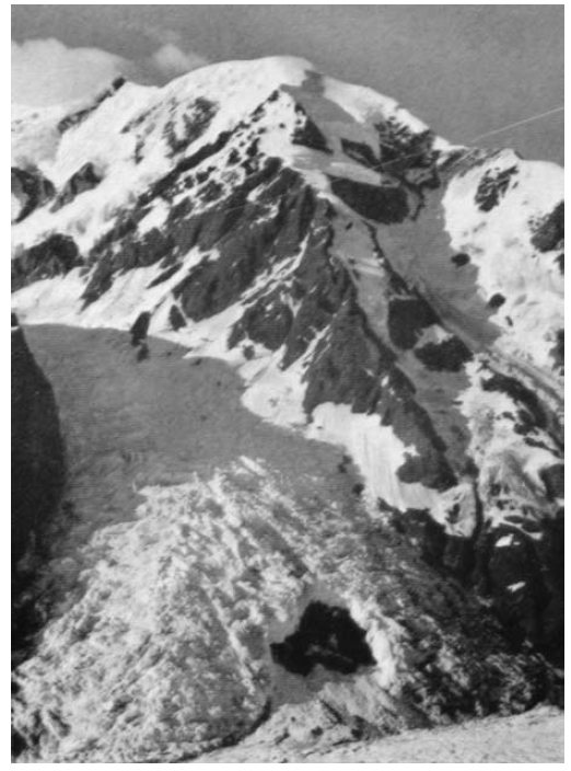
Mt. Fairweather – Fips Broda photo.
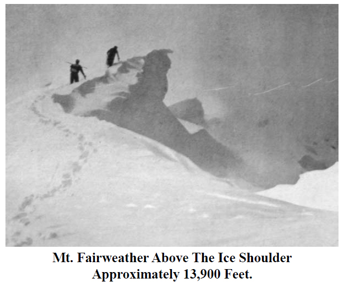
Above the ice shoulder on Mt. Fairweather – Fips Broda photo.
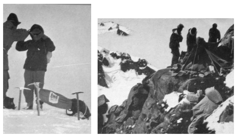
On the summit of Mt. Fairweather and Camp 2 – Fips Broda photo.
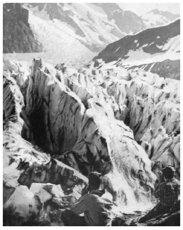
Above icefall on Mt. Fairweather – Fips Broda photo.
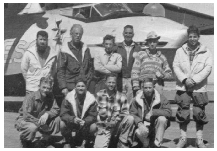
The Mt. Fairweather Team – Fips Broda photo.
Howson Climbed for First Time
In Memory of Rex Gibson
Reported in The Victoria Daily Times Monday July 21, 1958. p.3.
Howson Peak, 9,000-foot peak on which Major Rex Gibson of Saanichton, president of the Alpine Club of Canada, was killed last year, has been climbed for the first time—in memory of him. The ascent was made last week by an alpine party of three led by Bill Lash, former chairman of the Victoria section of the club. Others included German-born Adolf Bitterlich of Port Alberni, an experienced mountaineer who has taken part in several alpine rescues on Vancouver Island, and John Owen of Vancouver.
Erected Cairn
They erected a cairn on the south side of the mountain in memory of Major Gibson. The party then climbed to the summit of the mountain, located 30 miles east of Terrace. Major Gibson, one of Canada’s foremost mountain climbers, was killed last August in his fourth attempt to scale the then unclimbed northern B.C. peak. A falling rock struck Major Gibson on the head and he fell, dragging his two companions with him. His two companions, Dr. Sterling Hendricks of Silver Springs, Md., and Don Hubbard of the National Bureau of Standards, Washington, D.C., suffered injuries in the fall.
Alpinists Blaze Island Trail
Long Hike Spotlights Need for Access
Reported in The Daily Colonist Friday August 22, 1958, p12.
By David Francis
Three mountaineers last week tramped at least 40 miles across wild and inaccessible Strathcona Park on Vancouver Island. “We believe it is the first time that this route has been taken,” said Reginald Knott, 1059 Belmont, one of the three. The seven-day hike across several mountains and glaciers started at the Forbidden Plateau Lodge and ended at the west end of Great Central Lake where a trail leads to 1,443-foot Della Falls, one of the highest in the world. Syd Watts of Duncan, leader of the expedition, organized the trip to explore the feasibility of a trail across the 529,920-acre park. “The whole idea of the trip was to encourage the opening of the park for the general public’s benefit,” said Mr. Knott. At present Boy Scouts and other youth movements find it inaccessible, he said. Third member of the party was Frank Lindscheer of James Island. All three belong to the Victoria section of the Alpine Club of Canada. Because of the height of the trail picked by Mr. Watts—mainly about 6,000 feet—most of it could be marked only by stone cairns, Mr. Knott said. About three areas would require more extensive trail carving through forested areas. “The scenery is superb—it is wonderful,” Mr. Knott said. “It compares favorably with the Rockies for beauty, and there are more lakes.” He noted that though the peaks in the Rockies are higher, they rise from a high plateau, while the Island peaks rise from near sea level. The park is so wild that the mountaineers found the ptarmigan relatively unafraid. “We walked right up to within a foot of a family of four,” said Mr. Knott. “They just stayed there.” He added: “The park is one vast color of wild flowers, the pink and yellow primulas creating a vivid contrast against snow-covered peaks.” The trio, with 60-pound packs on their backs, left Forbidden Plateau Lodge August 9, walking along a good trail to a 6,000-foot ridge of Mount Albert Edward, about 800 feet from the top. The ridge ended in a sheer cliff, down which they lowered themselves and baggage on ropes, only to spot an easier route from the bottom. They circumvented Mount King George V, crossed a series of high bumps, seeing far below the blue lakes named Hope, Faith and Charity, and traversed Aureole snowfield onto Rees Ridge. Also visible was Ink Lake “looking very inky” and Milla Lake, a milky green tarn partially smothered with snow and ice from a glacier. The crew climbed 6,500-foot Argus Mountain, groping through mist which cleared just before walking onto Cliffe Glacier, revealing a monstrous mass of hanging ice, known as seracs, towering above them. Two other peaks, Mount Harmston and The Red Pillar, surround the glacier. After crossing the glacier, the party had to stumble down a moraine glacier-polished rock and into timber. A shortage of time to meet a boat Saturday at the head of Great Central Lake required the trio to cut behind Mount Septimus to the Della Falls trail, rather than heading to the alpine Flower Ridge as planned. Flower Ridge has been newly opened by a trail from Buttle Lake. The mountaineers hope that time will bring a trail across the route they reconnoitered as part of a network of trails through Strathcona Park.
Highest Peak Scaled in B.C. by Canadians
Reported in The Vancouver Province Monday August 25, 1958. p.1 & 2.
By Paddy Sherman
After 32 years of attempts, a Canadian climbing party has finally reached extremely difficult, ice-crusted peak of Mount Waddington, 13,260 feet, the highest mountain wholly in British Columbia. All five members of the party reached the towering summit spire August 15, completing the second major mountaineering event of the centennial year. In June, eight climbers reached the top of Mount Fairweather, 15,300 feet, which is officially the highest point in B.C., as the B.C.-Alaska border runs over the summit. The Waddington party consisted of Adolf Bitterlich (leader), Port Alberni; his brother Ulf, and John Owen, 8225 Laburnum, Vancouver, all members of the Alpine Club of Canada; Christian Schiel, Powell River, and Arno Meier, of Campbell River. The group almost fulfilled a grim prophecy made by the late Don Munday, pioneer climber who found the peak in 1926 and named it “Mystery Mountain.” He and his wife climbed the Northwest Peak, only 60 feet lower, but after numerous attempts on the main summit, said it was “impregnable,” and he feared climbers attracted by its danger would be killed there. As the successful party was climbing down the peak on August 16, all five slipped and fell about 200 feet down a steep, icy snow-slope. The fall occurred in complete darkness just after midnight, and in the confusion nobody knew for a time how the others fared. Two were injured, not seriously. Owen hurt a hand and wrist, and Adolf Bitterlich slashed open his forearm. Their ascent which began on August 7 when they flew to a tiny lake above the Homathko River, was the fourth. The others have been by top-flight U.S. climbers. Many Canadian attempts have failed. The first ascent was made in 1936, by Fritz Wiessner and William House, who later climbed in the Himalayas. Wiessner described Waddington as perhaps the most difficult mountain of its size in the world. Owen, 21, said Sunday that it took the party six days to pack supplies up the giant Tiedemann Glacier and establish a base camp at 10,500 feet on a snow saddle. “We were very lucky,” he said. “Below the camp was a crevasse 20 feet wide. There was only one small bridge in its whole length, about two feet wide. Fortunately, it was strong enough for us. And 15 minutes after we crossed a snow-slope, an avalanche came down right across our tracks. On unlucky August 13, while the rest of B.C. was scorching, about five inches of snow fell on our camp. It turned to rain later, and we were soaked. We just lay in pools of water in the tents and played ‘Twenty Questions’ all day to while away the hours.” On the next day, it was fine, and the party packed food supplies to a cache at 12,000 feet, where the vertical tower soars up from the glacier. The party was following the south-east ridge, where Vancouver climber Alex Dalgleish, 27, was killed in 1934, and it didn’t take them long to realize they faced a tough job. It took them 11 hours to scale the 1,000-foot summit cliffs, and another 8 hours to lower themselves down on ropes in the gathering dark. “The first 500 feet of the summit pinnacle was not too bad,” Owen said. “We had to move very slowly, as we could not rely of the rocks sticking out of the steep snow-slope. Then we reached a 250-foot gully. We took hours and hours on this. The whole of the bottom was coated with clear ice. Every time we rested, we had to hack out a platform to stand on. And often we had to chip ice off rock ledges before we could climb on them. All the time we were in a sunless gully, with an extremely strong wind blowing. Nobody was frostbitten, but every few minutes we had to kick our feet against the rock to get the circulation going again.” They were lucky here, he said, because of the long hot summer. “As it was, the wind was blowing off little pieces of ice from the rock and showering them onto us. Normally the ice-feathers here are feet long. There were two at the top standing 20 feet high. But most had melted off during the hot summer.” They reached the summit at 4:20 p.m., 12½ hours from camp, and stayed 30 minutes eating sardines, cheese and crackers. “People who climb for the view would have been disappointed,” Owen said. “There wasn’t one. We were just out of the cloud, but everything else was covered by thick cloud.” The climbers descended the entire 1,000 feet by rappelling—wrapping the rope around a rock, and lowering themselves down one at a time, then pulling the rope free afterwards. The last was the worst,” Owen said. “We joined together a 250-foot rope, and two of the 120 feet, and just went down into the darkness. It was after midnight, and Ulf went first, using a flashlight. We had to go down near-vertical rock, and an overhanging bulge of ice, and it was extremely eerie in the dark.” Not long after they got off the summit tower, the fall came. All five were on the only rope left—the others were left on the cliff until next day—and one climber tried to slide down a steep slope in a sitting position instead of using the morning’s steps. “Because it was dark, he bumped into another man, and in no time several people were sliding,” Owen said. “Adolf had his axe anchored in the snow at the top, but he was pulled off, and came down too. Fortunately, we finally came to a place where we could stop the slide. Hats, mittens and goggles were torn off and littered the slope. I did manage to climb back and retrieve a mitten, but I needn’t have bothered. Next day I put it on a rock to dry and a packrat carried it away.” However, the young climber summed up: “It was a lessen well learned.” They hiked back out to the lake in two days, and John flew out ahead of schedule because his father, University of B.C. athletics coach John Owen, was stricken with a serious heart attack.
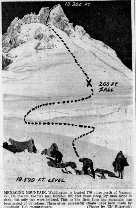
MENACING MOUNTAIN, Waddington is located 170 miles north of Vancouver. On descent, the five men tumbled 200 feet down steep, icy snow slope in dark, but only two were injured. This is the first time the mountain has been scaled by Canadians. Three other successful climbs have been made by top-flight U. S. Mountaineers. (Photos by Ulf Bitterlich)
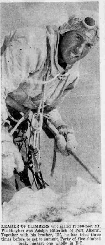
LEADER OF CLIMBERS who scaled 13,300-foot Mt. Waddington was Adolph Bitterlich of Port Alberni. Together with his brother, Ulf, he has tried three times before to get to summit. Party of five climbed peak. highest one wholly in B.C.
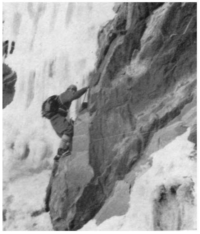
Ulf Bitterlich climbing on Mt. Waddington – Chris Shiel photo.
Moscow and Caucasus Talk
Reported in The Victoria Daily Times Monday September 29, 1958. p.17.
Mrs. Joyce Dunsheath, well-known British mountain climber, will give an illustrated address on Moscow and the Caucasus at a meeting of the Victoria section of the Alpine Club of Canada, tonight at 8 p.m. at the Pacific Club. It will be open to the public. Mrs. Dunsheath reached the summit of Mt. Elbrus, 18,481 feet, in the Russian Caucasus with two Russian climbers, and in 1956 led an expedition of British women to the Himalayas.
1959
ACCVI executive:
Chairman – Edward Goodall
Secretary – Francis Tuckey
Events:
March – The club’s annual banquet was held at ??? Fips Broda of Vancouver gave an illustrated talk on his climb of Mt. Fairweather.
April 19 – The club held a snow school on Green Mountain. It seems there was some snow in spite of the name.
May 24 – A large party attempted Hkusam Mountain but were rained off.
June 20 – Three ACCVI members joined a party of IMR to climb Klitsa Mountain.
July 11/12/13/14 – Combined trip of OCV. IMR and ACCVI members trip to Kookjai Ridge to attempt The Red Pillar via the Comox Glacier and Argus Mountain led by Syd Watts.
July – Ralph Hutchinson and others make 1st ascents in the Mt. Raleigh area on the mainland.
August 1 – One ACCVI member joined a combined IMR climb of Mt. Arrowsmith.
August – A party of six went in from Buttle Lake to climb the Golden Hinde. This was a seven-day expedition over rough country. An airdrop helped to lighten loads and everyone climbed the peak.
Section members who attended the ACC general summer camp at Bugaboo Creek July 19 to August 1: Frederick Crickard, Reginald Knott (1931 – 2004), Tom Hyslop, Fred and Edith Maurice, Eric Maurice, Dorothy Lash, Bill Lash.
Section members who passed away in 1959: Francis Tuckey, Harry Winstone, Adeline Baxter.
Rescue Official Rescued
Breaks Leg Skiing on Arrowsmith
Reported in The Victoria Daily Times Monday January 12, 1959. p.11.
PORT ALBERNI—Alberni Valley Rescue Squad went to the aid of one of its own members Sunday when Gordon Blake, club secretary, broke his left leg while skiing on Mount Washington. Twelve members of the rescue squad, and Dr. Richard Garner, climbed half way up the mountain to help Alberni Valley Ski Club members carry the 22-year-old skier down the mountain on a pack-board stretcher. Dr. Garner gave first aid treatment to Blake, who now is in West Coast General Hospital. His condition is good. From his hospital bed Sunday night, the young skier explained how the accident happened. “I was moving quite slowly at the time,” he said, “when my left ski suddenly caught a half-hidden tree stump, and twisted my leg. My friends made a stretcher and began carrying me down the steep slope of the mountain. They must have had a tough time getting me down, as the first half of the descent is extremely steep. A number of years ago I missed my footing on these slopes and fell 200 feet before coming to a stop by grabbing a tree.” It took the rescuers three- and one-half hours to carry Blake down the mountain.
Skiing Is Fun!
Reported in The Victoria Daily Times Saturday January 24, 1959. p.17.
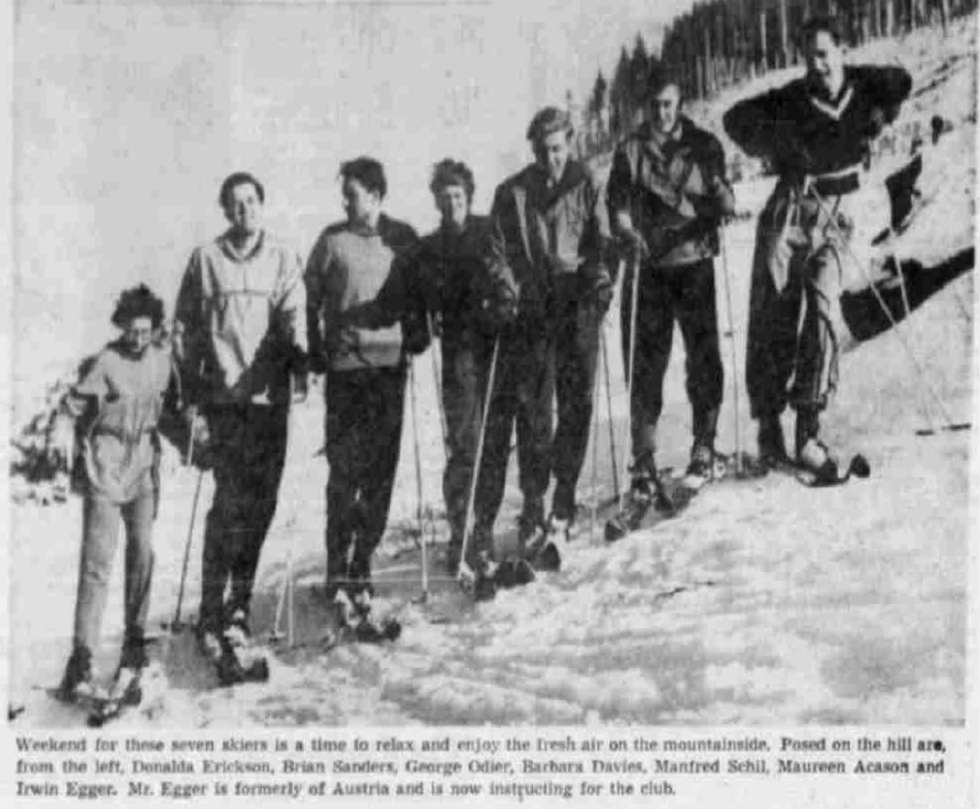
Weekend for these seven skiers is a time to relax and enjoy the fresh air on the mountainside. Posed on the hill are, from the left, Donalda Erickson, Brian Sanders, George Odier, Barbara Davies, Manfred Schil, Maureen Acason and Irwin Egger. Mr. Egger is formerly of Austria and is now instructing for the club.
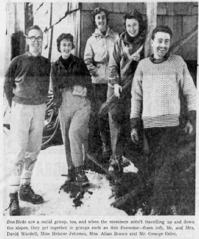
Sno-Birds are a social group, too, and when the members aren’t travelling up and down the slopes, they get together in groups such as this fivesome — from left, Mr and Mrs. David Wardell, Miss Heloise Johnson, Mrs. Allan Brawn and Mr. George Odier.
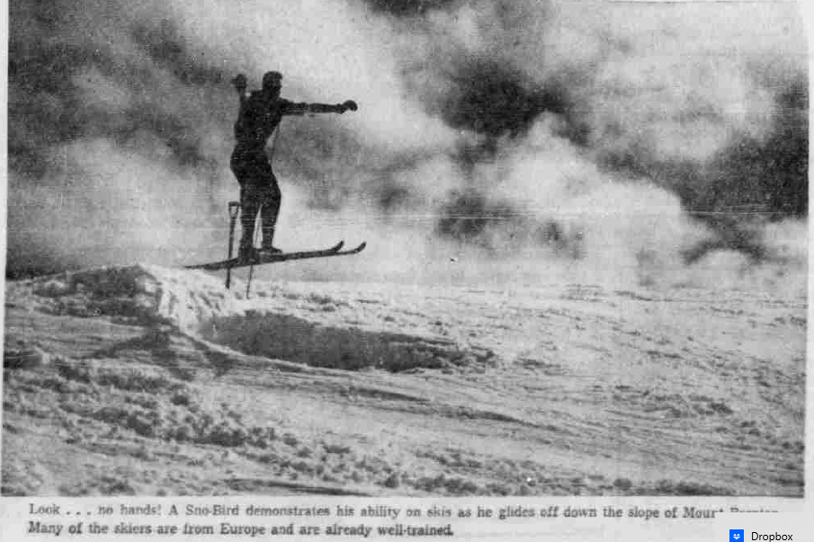
Look … no hands! A Sno-Bird demonstrates his ability on skis as he glides off down the slope of Mount Brenton. Many of the skiers are from Europe and are already well-trained.
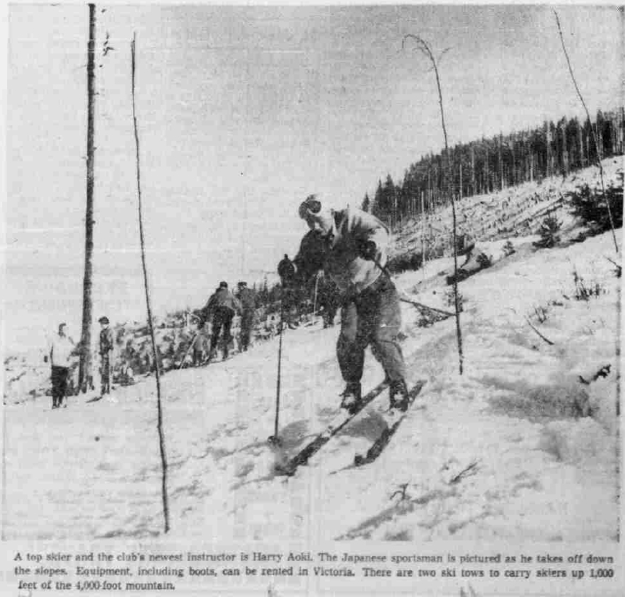
A top skier and the club’s newest instructor is Harty Aoki. The Japanese sportsman is pictured as he takes off down the slopes. Equipment, including boots, can be rented in Victoria. There are two ski tows to carry skiers up 1,000 feet of the 4,000-foot mountain.
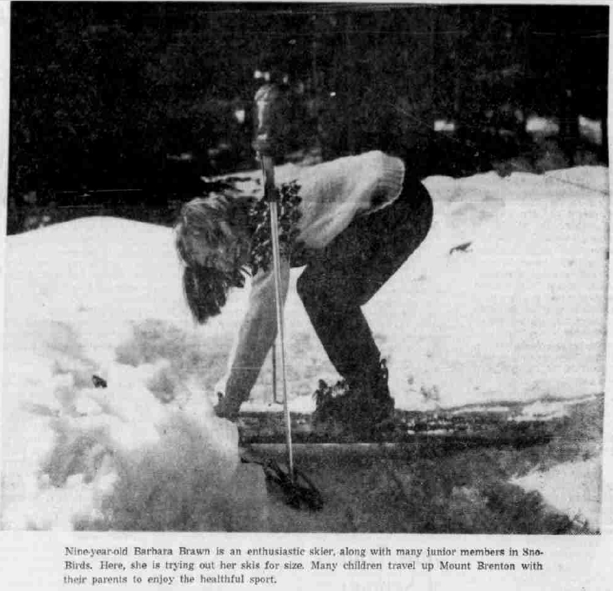
Nine-year-old Barbara Brawn is an enthusiastic skier, along with many junior members in Sno-Birds. Here, she is trying out her skis for size. Many children travel up Mount Brenton with their parents to enjoy the healthful sport. Photos by Jean Jacques Andre.
New Outdoor Group Elects Duncan Man
Reported in the Victoria Daily Times Monday May 23, 1959, p. 15.
CHEMAINUS—A new organization called the Island Mountain Ramblers has been formed to serve the need of outdoor enthusiasts. Named president of the new group at a recent meeting was Syd Watts, of Duncan, well-known as a hiker and climber, who has an expert knowledge of island mountains, trails and byways. Harry Winstone, of Crofton, an experienced mountaineer, was named secretary. Purpose of the club is to help people of all ages and both sexes to better enjoyment of the lesser-known beauties of mountains and valley.
Schedule
An attractive schedule of trips to various parts of the Island has been planned. Among places to be visited and explored are such attractions as Flower Ridge, in Strathcona Park; the Golden Hinde, in central Vancouver Island; Mt. Arrowsmith and Klitsa Mtn. Training and instruction in woodcraft, camping and mountaineering will be given. The schedule of outdoor trips will begin over the Easter weekend with a three-day trip to Mt. Arrowsmith.
Veteran Climber Killed
Victoria Men in Death Vigil
Reported in The Victoria Daily Times Tuesday July 14, 1959. p.1 & 2.
Courtenay – Inquest into the death Sunday of veteran mountain climber, Harry Winstone, 33, fatally injured when he slid more than 1,000 feet down the snow-covered slopes of Argus Mountain, will be held here Saturday. A coroner’s jury viewed the body Monday night. The body was removed by RCAF helicopter from Sea Island Rescue, Vancouver, after two Victoria men had maintained an all-night vigil at the 5,800-foot level. The helicopter also took out Paul Martinson, 1149 Oliver Street, Victoria, and Reginald Knott, 630 Foul Bay Road, Victoria, who had spent the night with the dead man on the cold, lonely heights. Winstone’s fatal fall occurred shortly after noon Sunday when he apparently tried to get out of the way of a falling boulder, lost his footing and fell down an 80-foot rock face before the long slide over the snow. It is believed he was knocked unconscious in the fall which caused his death later. He was a member of a five-man party led by Syd Watts, Duncan, attempting to scale The Red Pillar. Watts and John Weir, 630 Foul Bay Road, Victoria, started down the mountain to get help, making a 16-hour trek which brought them out at 5 a.m. Monday. They reached the cars where Arthur Burrows, Chemainus, and Ronald Paver, 2561 Cavendish Avenue, Victoria, were waiting. They contacted the RCMP and informed Air-Sea Rescue of the tragedy. Burrows said the climb started at 10 a.m. Saturday from the end of the Comox logging road. They arrived at the base camp on the 5,000-foot level at 7.30 p.m. and spent the night there. The final climb started at 5 a.m. Sunday and “we all agreed to start back at noon.” Burrows was forced to quit when his knee gave out so he headed back to base camp while the other eight continued on. On the glacier three more turned back, Weir, Paver and Keith Morton of Courtenay.
Tragedy
“They were about half-way up when the tragedy occurred,” Burrows said. “Syd Watts told us all that at the time they had started down the mountain to get help, Harry was alive. He was unconscious but was breathing. We were all broken up badly by the accident. Harry was an experienced and very cautious climber. In fact, we all were. He always took the greatest safety precautions when climbing anywhere.”
Not Roped
Burrows said the party was not roped together. “When we started out, we didn’t think it was necessary.” Knott, contacted in Victoria today, was still too disturbed to talk about his night on the mountain with his dying companion. The mountain’s victim was born in Vienna in 1926. A graduate of London University of Engineering, he came to Vancouver in 1957. He was employed at B.C. Forest Products Ltd. Crofton pulp mill as a professional mechanical engineer. A member of the Alpine Club of Canada and the Island Mountain Ramblers, he was also a member of the district council of Mt. Brenton Boy Scouts Association and chairman of the Crofton ratepayers Association, He is survived by his widow, Mary, a son Michael and a daughter Jennifer.
Last Rites
Funeral service will be held from All Saint’s Anglican Church, Westholme, Thursday at 2 p.m. Reverend Allan Peter Horsefield of Alberni, officiating. Cremation will follow at Royal Oak Burial Park, Saanich. Hirst Funeral Chapel Ltd. Duncan, is in charge of arrangements. The family has asked that no flowers be sent but that any donations be sent to Unitarian Service Committee, Ottawa.
‘Copter Recovers Climber’s Body
‘Para-Rescue’ Expert Lowered to Vancouver Island Fall Site
Reported in The Vancouver Sun Tuesday July 14, 1959. p.2.
COURTENAY—Body of a 33-year-old “veteran” mountaineer was recovered by helicopter Monday from Vancouver Island’s Forbidden Plateau. Harry Winstone, of Crofton, died four hours after he fell 8- feet down a rock face at the 6,500-foot level of Argus Mountain about noon Sunday and then slid another 1,000 feet on the snow. An inquest will be held here at 7:30 p.m. Saturday. Paul Martinson and Reginald Knott, Winstone’s two companions, stood a lonely 30-hour watch over his body until help arrived. They were also taken off the mountain by the RCAF rescue team from Vancouver.
Sunday Climb
Winstone, a father of two, was a member of a five-man team that was scaling Argus Mountain Sunday, intending to cut across Cliff Glacier to The Red Pillar Mountain, 6,663-foot peak 35 miles west of Courtneay. The two other members of the party, Syd Watts of Duncan and John Weir of Victoria, reached the base of the mountain where their cars were parked at 4 a.m. Monday. Within two hours the RCAF helicopter team from Sea Island was on its way to the scene. The rescuers picked up Knott and Martinson and returned later for Winstone. RCAF Corporal Jake Dyck, a “para-rescue” expert, was lowered by hoist from the Vertol twin-rotor aircraft to recover the body. Winstone was employed at the B.C. Forest Products Pulp plant at Crofton as a mechanical engineer. He is survived by his wife Mary—also an avid mountain climber—and their two children, Michael, 5, and Jennifer, 3.
Climber Dies on Icy Slope
Helicopter Brings Body Out
Reported in The Province Tuesday July 14, 1959. p.1.
COURTENAY—The body of a 33-year-old mountain climber, Harry Winstone of Crofton, who died after a fall Sunday from Argus Mountain, was plucked from the icy slope Monday afternoon by an RCAF helicopter. Two companions of the dead man hiked 25 miles into Comox Lake to get assistance, while two other climbers kept a lonely vigil on the mountain in the Forbidden Plateau are 25 miles from here. Winstone dropped 80 feet of the mountain at the 6,500-foot level, shortly after noon Sunday, and then slipped down 500 feet of shale and 1,000 feet of ice. He was unconscious when his companions reached him. They made him comfortable and secured him against further sliding. But he died four hours later. Meanwhile Syd Watts and John Weir had set out for assistance. Paul Martinson and Reginald Knott of Victoria stayed with Winstone. Burrows and Tavers staggered into Comox Lake at 4 a.m. Monday to report the tragedy. Early Monday a Vertol helicopter was dispatched from Sea Island by RCAF 121 communications and rescue unit to the scene of the accident. The helicopter picked up Martinson and Knott from the 6,500 -foot level and brought them to Comox RCAF base. In the helicopter were Flight Lieutenant P.T. Matthews, Flight Lieutenant E.L. Harris, Corporal Len Zadworny and Corporal Jake Dyck. The helicopter could not land, so Corporal Dyck was lowered by a hoist to reach the body, which was brought back to Comox. Originally 30 people started out on the week-end hiking and climbing trip in the Forbidden Plateau. A camp was set up at Kookjai at the 4,000-foot level and 21 climbers remained while the other nine traversed Cruikshank Canyon and set up camp. Eight climbers went on up the Comox Glacier and from there three returned and left five to cross two other glaciers en-route to The Red Pillar. An inquest will be held in Courtneay, but no date has been set.
Island Climb Ends in Death
Victorians Rescued
Reported in The Daily Colonist Tuesday July 14, 1959. p.1.
COURTENAY—An RCAF helicopter yesterday battled treacherous downdrafts in rugged country 25 miles west of here to bring out the body of a mountain climber fatally injured as he fell and slid more than 1,000 feet down snow-covered Argus Mountain. Dead is Harry Winstone, of Crofton, father of two. He was employed as a mechanical engineer by B.C. Forest Products. Earlier the rescue helicopter plucked two companions who maintained an all-night watch over his body at the 5,800-foot level on the mountain. Other members of the climbing party made a 16-hour trek covering more than half the distance over rugged country in darkness, to summon help.
Victoria Pair Saved
Brought out safely were Paul Martinson, 1149 Oliver, Victoria, and Reginald Knott, 630 Foul Bay Road, Victoria. They were taken to Comox air base near here by helicopter sent from 121 Rescue and Communication Squadron at Sea Island. Winstone was a member of a five-man party which planned to make an attempt on nearby Red Pillar Mountain. He apparently was attempting to get out of the way of a rock rolling down the mountain when he lost his footing. He fell about 80 feet down a rock face about noon Sunday and then slid 1,000 feet in the snow. Other members of the party said he was probably knocked unconscious as he started the fall and suffered injuries which caused his death several hours later. Martinson and Knott stayed with Winstone through the night while Syd Watts of Duncan, and John Weir, 630 Foul Bay Road, Victoria, started down the mountain. At the base camp near Tatsno Lake, they were joined by four other members of the group who had remained there. One of the group, Arthur Burrows of Chemainus, described the tragedy in these words: “It was awful—something we’ll never forget.” Jack Weir of Ladysmith, Ronald Paver of Victoria, and Keith Morton of Courtenay, turned back at the 6,400-foot mark. They returned to the base camp set up by Burrows. Five—all said to be experienced mountaineers—continued the climb. They were within200 yards of the top of Argus Mountain when the mishap occurred.
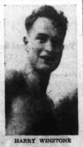
Harry Winstone
Probe Set Saturday into Climber’s Death
Reported in The Daily Colonist Wednesday July 15, 1959. p.12.
COURTENAY—Inquest into the death of veteran mountain climber Harry Winstone, 33, last Sunday in a fall near the summit of Argus Mountain will be held here Saturday. A coroner’s jury viewed the body Monday night. Winstone was employed at B.C. Forest Products Ltd. pulp mill at Crofton as a professional engineer. He was born in Vienna in 1926 and was a graduate in mechanical engineering from London University. He came to Vancouver in 1948 and to Crofton in 1957. He is survived by his widow Mary; a son Michael and a daughter Jennifer. Funeral service will be held from All Saint’s Anglican Church, Westholme, Thursday at 2 p.m. Reverend Allan Peter Horsefield will officiate. Cremation follows at Royal Oak, Saanich. Hirst Funeral Home, Duncan, is in charge of arrangements. The family has asked that no flowers be sent. Instead, any donations should be sent to Unitarian Service Committee, Ottawa.
Funeral for Climber Set for Thursday
Reported in The Vancouver Sun Wednesday July 15, 1959. p.28.
DUNCAN—The funeral for a mountain climber who died Sunday of injuries suffered in a fall on Argus Mountain in Strathcona Park will be held Thursday. Service for Harry Winstone, 33, an engineer at the Crofton Pulp Mill, will be conducted in All Saints Anglican Church, Westholme, at 2 p.m. Mr. Winstone was bornin Vienna, Austria. He graduated from London University of Engineering and came to Canada in 1948. For the past two years he had been mechanical engineer at the B.C. Forest Products pulp mill, Crofton. He was a member of the Alpine Club of Canada, the district council of Mt. Brenton Boy Scout Association and chairman of the Crofton Rate-payers’ Association. Mr. Winstone leaves his wife Mary; one son, Michael, and a daughter, Jennifer. At home.
Chemainus Man Dies in Mountain Fall
Reported in the Comox District Free Press Wednesday July 15, 1959. p.1.
The grim story of how two friends kept a night-long vigil with the body of a dead companion was told Monday, when an RCAF helicopter came out of the Forbidden Plateau area carrying two mountain climbers but leaving the corpse behind. The man, Harry Winstone, 33-year-old father of two children from Chemainus, died after sliding down a rock and snow slope Sunday when he was climbing with three companions. The men who stayed behind with their injured friend after Sunday’s mishap, Paul Martinson and Reginald Knott, Victoria reported that Mr. Winstone died about 5 p.m., four hours after he fell down the 1,000-foot slope on Argus Mountain. The RCAF helicopter went out after Syd Watts, Duncan and John Weir, Victoria, hiked out to bring the news of the accident. But the plane crew found Mr. Winstone was dead and a second trip was made Monday afternoon to recover the body. A party of 30 people from various Island points started out for a weekend’s climbing Saturday. Majority of the party decided to go further afield and a camp was set up on Kookjai Ridge. Nine of the party decided to climb The Red Pillar, a trip which called for crossing the glaciers. Art Burrows, Keith Morton and Ron Taver returned after climbing the Comox Glacier and five men, Winstone, Weir Watts, Knott and Martinson continued, crossing two glaciers to reach Argus Mountain where Mr. Winstone was the last man in the line. It was thought he must have had an attack of some sort or been struck by a falling rock. The other climbers felt that the locality was not difficult for the experienced climber Mr. Winstone was. Mr. Martinson and Mr. Knott made their friend comfortable and Mr. Watts and Mr. Weir headed back out to seek help. The pair became lost for a time on the Comox Glacier when the area became clouded over and they missed the trail and were delayed for nearly two hours. They continued until nearly midnight, as long as they could see, and then bunked down without food or sleeping bags and later resumed their trip and came out at Comox Lake about 4 a.m. Monday. They were met by Mr. Burrows and Mr. Taver who had earlier agreed on Comox Lake as a rendezvous. An inquest will be held Saturday.
Harry Winstone, Crofton, Dies in Mt. Argus Slide
Reported in The Cowichan Leader Thursday July 16, 1959. p.1.
Funeral services will be held today at 2 p.m. in All Saints Anglican Church, Westholme, for the late Harry Winstone, who died Sunday of injuries received in a fall while trying to climb Argus Mountain, Strathcona Provincial Park. Mr. Winstone was fatally injured shortly after noon Sunday when attempting to avoid a falling boulder, he lost his footing and plunged down an 80-foot rock face before sliding down more than 1,000 feet of the snow-covered slope of Argus Mountain. The body was removed Monday by RCAF helicopter from Sea-Island, Vancouver, after Pau Martinson and Reginald Knott, both of Victoria, maintained an all-night watch at the 5,800-foot level. Born at Vienna, Austria March 6, 1926, Mr. Winstone was a graduate of London University of Engineering. He came to Canada and Vancouver in December, 1948, and had been employed at the BCFP pulp mill at Crofton for the last two years as a mechanical engineer. Mr. Winstone was a member of the Alpine Club of Canada, on the district council for Mt. Brenton Boy Scouts Association and chairman of the Chemainus Rate Payers Association. He was an able writer and satire was not the least of his strength with pen. His letters to The Leader, answering critics of the smell of the Croton Mill, caused considerable merriment among readers throughout the district. A warm tribute to the value of Mr. Winstone as a member of the mill’s staff and his worth as a man was voiced Tuesday by D.H. Baker, manager of the Crofton Mill. “It was a great shock to all of us, he was very popular,” said Mr. Baker. “Mr. Winstone was a key man in the organization and he was very active in a number of his activities in the mill over and above his day-to-day duties. He was personally liked by all his associates and by all the men with whom he worked and with whom he came in contact. He took part in a lot of social affairs and was truly what one might call a community booster. Mr. Winstone was very interested in sporting events of different kinds. Needless to say he is going to be sorely missed by all of us. We regret very deeply this unfortunate accident which has deprived us of such an associate.” Survivors are his wife, Mary; one son Michael, and one daughter Jennifer, at home; an aunt in Austria.
Climber Alive 4 Hours After Mountain Fall
Reported in The Victoria Daily Times Wednesday July 20, 1959. p.8.
COURTENAY—Harry Winstone, 33, of Crofton, was alive for more than four hours after his fall down an 80-foot rock face and an additional 1,000-foot slide down snow-bound slopes of Argus Mountain near her July 12, a coroner’s jury here heard Saturday. He fell about 12:30 p.m. from the 6,400-foot level and died about 4:45 p.m. of skull fractures. No blame was attached to anyone in the climbing party. Two Victoria members of the group, Paul Martinson, 1149 Oliver, and Reginald Knott, 630 Foul Bay, spent the night with the dead man on the cold slope.
Skull Injury Killed Climber
Reported in The Vancouver Sun Tuesday July 21, 1959. p.38.
COURTENAY—A 33-year-old mountaineer died from a skull fracture sustained in a fall, a coroner’s jury decided. Harry Winstone, of Crofton, died July 12 “as a result of a falling rock and snow slope on Argus Mountain.” Winstone was one of a party of five attempting to scale the 6,500-foot mountain. No blame for his death was to be attached to any person, the jury decided.
None Saw Big Boulder Hit Climber
Reported in The Province Tuesday July 21, 1959. p.25.
COURTENAY—An inquest Monday failed to find the exact cause of the fall which killed climber Harry Winstone, 33, of Crofton, on Argus Mountain, July 12. One of the climbers in the party said he saw a boulder rolling down the slope towards Winstone and called “rock.”
Not Roped Together
Winstone apparently saw the boulder but nobody knew if it hit him or whether he lost his footing trying to dodge it. Member soft the party were not roped together as the spot where the accident happened is not considered hazardous. Winstone died four hours after he fell down the 80-foot rock face and 1,000 feet down the snow-covered slope.
Nobody Blamed
He died of skull fractures. The verdict was accidental death with no blame attached to anyone.
Two See Friend Fall to Death
Reported in the Comox District Free Press Wednesday July 22, 1959. p.1.
The story of how two men watched their companion fall 800 feet down a snow-covered mountain slope to his death was told to a coroner’s jury, here, Saturday. The jury enquiring into the death of Harry Winstone, of Chemainus, under coroner T.A. Menzies, heard four witnesses tell of the fatal climb up Argus Mountain, July 12, as part of a weekend hiking and climbing trip in the area. A medical report by Dr. H.L. Williams stated that Mr. Winstone died as a result of a fractured skull and hemorrhage. John Weir, Victoria, told the court that he was climbing the rocky slope just ahead of Mr. Winstone when he heard a rock tumbling down the hillside. He called the mountaineer’s customary “rock” warning and turned to see a cubic foot of rock heading towards his partner. Mr. Winstone saw the rock approach him and oved to avoid it. But the rock changed direction and headed straight for him. “I did not see it hit him,” Mr. Weir said, “I was looking down towards him and it was hard to judge because of the angle. He fell relaxed,” Mr. Weir declared. “There was no struggle. He had no proper equipment.” It was established that Mr. Winstone was an experienced climber and knew well how to stop himself from sliding out of control down a snow-slope. Paul Martinson, who started out with Mr. Winstone, Mr. Weir, Syd Watts and Reginald Knott, said that he stopped on a ridge en route to Argus Mountain and watched the progress of the others. He heard Mr. Weir’s cry and through binoculars, watched Mr. Winstone fall after the rock tumbled down. He said that Mr. Winstone “slumped in his tracks and turned over as he slid down.” Mr. Martinson said that he went down the ridge to where Mr. Winstone was lying and he was still breathing. Mr. Watts, leader of the quartet, stated that “Mr. Winstone slid about 30 feet over rock, 35 over rock and snow, and the rest of the 800 feet over snow. He should have been able to stop himself even without an ice axe,” he said. Mr. Knotty added little to the evidence, simply corroborating evidence of the other witnesses. Ben Hughes, who knows the area well, gave evidence on the type of terrain in the area. A verdict of accidental death was returned.
Mt. Argus Victim Brought Out by RCAF Helicopter
Reported in the ???? Wednesday July 22, 1959. p.1.
COURTENAY—The body of Harry Winstone of Crofton was brought from the 5,700-foot level of 6,500-foot Argus Mountain shortly before 3 p.m. yesterday by an RCAF Piasecki helicopter. The Chemainus BCFP pulp mill worker, father of two, was killed in a slide down the snowy slopes of the mountain as he and four companions enjoyed a weekend hike in Strathcona Park-Forbidden Plateau area as part of an expedition into the rugged interior of Vancouver Island. Rescue operations by RCAF at Station Comox began at 10 a.m. yesterday, and by 11 a.m. the helicopter was at the scene to pick up Paul Martinson and Reginald Knott of Victoria, who kept an all-night vigil with their fatally-injured companion. Two others in the party, Syd Watts of Duncan and John Weir of Victoria, hiked out 25 miles in an all-night walk to report the accident at 4 a.m., Monday. Winstone died 5 p.m. on Sunday afternoon after sliding down a shale embankment onto ice and snow for over 1,000 feet. He suffered head injuries and other multiple injuries in the fall, which occurred shortly after noon on Sunday. Later yesterday afternoon the RCAF sent their lightened helicopter back to the scene and the body was brought out to Comox. Coroner Tom Menzies and RCMP Sergeant William Morgan met the aircraft in Comox. An inquest will be held on Saturday at Courtenay.
68,000 Acres Added to Strathcona Park
Forbidden Plateau to be Included
Reported in The Daily Colonist Friday July 24, 1959. p.11.
By Alec Merriman
The provincial government recreation department will enter into negotiations within two weeks to add 68,000 acres to Vancouver Island’s Strathcona Park, The Daily Colonist learned yesterday. The new property sought would bring into the confines of the now 529,920-acre Class A provincial park all of Buttle Lake, part of new Upper Campbell Lake, more of the Elk River Valley, some 55,000 acres of Forbidden Plateau country, and the western corner of Great Central Lake. Property owners involved include the CPR through its E & N Railway land grants, the Elk River Timber Company which owns most of the non-park land around Buttle lake, and Canadian Collieries Ltd.
Wilderness Wonderland
Parks branch officials visualize a wilderness wonderland being made accessible by a series of hiking and riding trails throughout the park. Many of these trails will extend from creek delta campsites on Buttle Lake and extend to upland lakes, streams and alpine area of the Forbidden Plateau. Provincial parks branch reconnaissance experts will move into Strathcona Park area next week to start tallying the recreation attractions of the vast park. Much of Strathcona park has never been visited by man. Access to the enlarged park would be by car to Buttle Lake from Campbell River and the Forbidden Plateau from Courtenay and by boat to the head of Great Central Lake, but travel through the park would have to be by boat in the Buttle Lake area and by hiking or horseback through the rest of the park. A park official yesterday described the Forbidden Plateau area which it is sought to annex as an ideal camping area for walk-in trips of 10 or 12 miles. There is skiing there from November to May and excellent fishing in the mountain lakes and streams.
Shelters To Be Built
A long-range development plan would include establishment of camping sites where several trails would meet. At these areas shed shelters would be built from native material and rough toilet facilities would be provided. Ultimately there would be a hikers’ trail from Forbidden Plateau to Buttle Lake over rugged mountainous country. It is expected the pattern would develop that a party would drive from Courtneay to the Forbidden Plateau country, hike through the park to Buttle Lake and be met there by some one with a boat. Probably first full-scale development in the Strathcona Park area will be in the construction of camping sites and toilet facilities at various points along Buttle Lake. About 10 areas have already been cleared and grubbed by B.C. Power Commission according to the provisions of the water licence which gave them the right to dam Buttle Lake and raise the level of the water. It remains for the parks branch to develop them.
Several Unnamed Creeks
These sites are at Thelwood Creek at the head of the lake, Henshaw Creek, Ralph River, Phillips Creek, Marblerock Creek, Wolf River and deltas of several unnamed creeks on the east side of the park. Parks officials yesterday explained the reason there has been no development work yet at the end of the road to Buttle Lake is because that part of the lake is not yet included in Strathcona Park and the land is owned by Elk River Timber Company. Vacationers and fishermen are camping there by courtesy of the timber company, but that is part of the land the government hopes to annex to Strathcona. The park includes some of the few remaining stands of virgin timber, which should prove to be of tremendous interest to forest ecologists. It touches salt water at Herbert Inlet on the west coast. In recent years there have been demands to extend the boundaries of Strathcona park to include Long Beach and make it a truly ocean park also, but park officials point out this would be impractical because much of the area such a park would have to be cross has already been alienated from the Crown by forest management licences and other private developments. Strathcona is the oldest park in the province and was created by a special act March 1, 1911. Since then, it has become a Class A provincial park.
Climbers Plan Assault
Reported in The Daily Colonist Saturday August 8, 1959. p11.
The seldom-explored slopes and surrounding regions of the Golden Hinde in Strathcona Park will be climbed and studied soon by a 12-man expedition begin organized by the Victoria section of the Alpine Club of Canada. Highest peak on Vancouver Island, the jagged 7,219-foot mountain has been scaled only twice before. Led by veteran explorer and hiker Syd Watts of Duncan, the party will also include botanist Edward [Ted] Grieg of Royston and Robert Aherns of the B.C. Parks department.
Mystery Wreck, Skeletons Found
May Be Remains of U.S. Navy Plane
Reported in The Daily Colonist Tuesday August 25, 1959. p.1.
Wreckage of a “mystery” plane with “a possible” 11 skeletons was found at the 4,000-foot level of Mount McCreight [Mount Kitchener, Prince of Wales Range], 20 miles northwest of Campbell River. A ground search party from the R.C.A.F. Station Comox, in a brief radio report to an overhead plane, said the aircraft appeared to be a U.S. Navy Neptune.
Not Positive
The message said the total dead was not positive. The wreckage was first discovered by Corporal W.H. Glover of 409 Squadron at Comox, while he was on a fishing trip to Roberts Lake, R.C.A.F. rescue co-ordination headquarters said.
Return Today
R.C.A.F. spokesmen said there would be no positive identification of the plane until the ground party returned from the scene sometime today with serial number of the aircraft and other information. But the crash description sounded like a grisly twin of the find in September, 1951, when wreckage of a U.S. Navy training Neptune with 11 on board was found at the same 4,000-foot level on the same mountain.
Training Flight
The 1951 discovery was identified as the wreck of a twin-engined Neptune missing on a training flight December 23, 1950. Never reported found was a similar U.S. Navy aircraft said to have nine aboard, that vanished on another flight in November, 1948, in the same area. Party that brought out the remains of the 11 crash victims found in ’51 reported finding nothing but “wreckage and bones.” They said no personal effects, “not even dog tags,” were found. The remains found in that year were strewn over a 400-yard area on the steep mountainside. The search party said the aircraft apparently hit the mountain head on.


Remains of the crashed PV2 Neptune on Mt. Kitchener 2004 – Lindsay Elms photos.
Trail System Foreseen in Strathcona
Reported in The Daily Colonist Tuesday August 25, 1959. p.2.
Robert Ahrens, head of park planning for B.C. parks branch, is going back this fall to take another look at the “terrific” scenery in the heart of Strathcona Park. He returned to Victoria after an eight-day trip as a guest of the Alpine Club of Canada, Victoria section. The 11-man group successfully scaled the Golden Hinde, a 7,210-foot peak, the highest on Vancouver Island. He said the next trip would be an official one, part of the continuing program of reconnaissance carried out by the parks branch. Mr. Ahren said he foresees a “trail system” which will open the heart of rugged Strathcona Park to the general public.
Rugged Mountain First Recorded Ascent 1959
A letter from George Lepore to Sandy Briggs 1990
During the summer of 1959, I [George Lepore] became interested to climb the Rugged Mount at the south end of Woss Lake. In the middle of August with my friend Chuck Smitson, I made my first attempt. In the beginning we kept at the left end of the 45º wall. Stuck with a vertical climb, we came down and we went up half way through the 45º wall. We camped for the night. The next day we reached the glacier. The weather, already not too good was worsening, so we decided to give up. We came down through a miserable trek, in the dark with rain which was becoming quite heavy, trying to avoid also the tangle of the devil’s club. When finally we reached the lake I confronted my friend with some of my home made wine. It was supposed to be a few sips but, I think they were quite a few as my friend passed out and I was the only one in charge of our coming home. At the beginning of September (the best month for climbing) I tried again. Another friend (Robert Bissed) joined us. Friday night we crossed the lake, fished, swam and camped. Early in the morning we cut through bush following the creek, we crossed a windfall and began to climb that 45º wall. A beautiful walk on bare roc, no rope needed just by shoes adherence. We took our time enjoying the view, the interesting rock’s formation. We reached the glacier where we camped at the edge overlooking Woss Lake. Next morning we followed the left side of the glacier. (I believe the glacier is the crater of a big volcano with rocky edge all around and Rugged Peak the highest.) We went by a cairn of the Geological Survey of Canada and we began to climb on the left side. After an exposed crossing 3-4 degree of difficulty, we reached the peak before last [Schina d’Asino or Donkey’s Back]. We went down to the saddle resuming the climbing through beautiful vertical chimney, until the top, from there we had a magnificent view of the coastal range, west side of Vancouver Island and the other peaks of the island, like Victoria Peak, Elkhorn etc. Under our feet Woss Lake, Tahsis Inlet with the logging camp. We spent 1 hour to make a cairn and we started on our way back. An exhilarating slide down the glacier careful to avoid the crevasses, down the 45º wall, through the bush at the end. Again at the lake, we fished, swam and more home made wine. A perfect day!
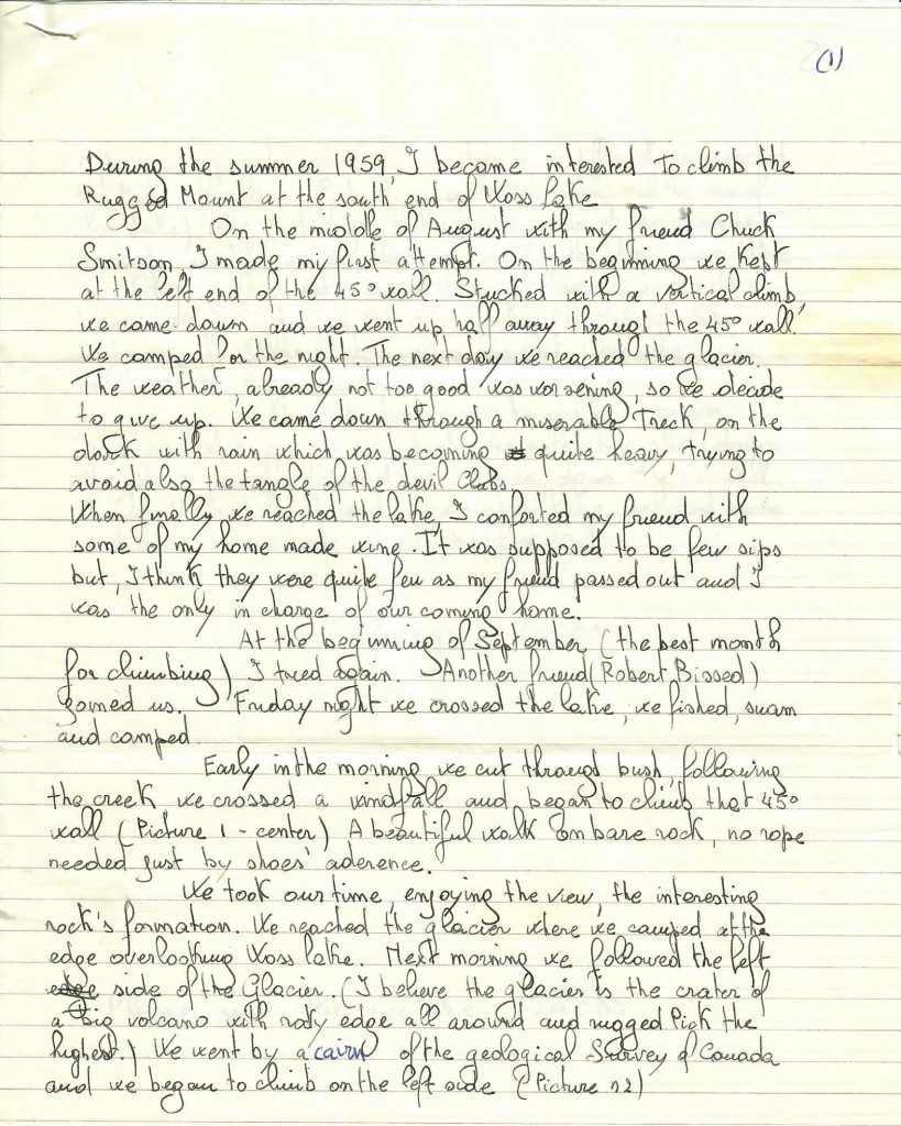
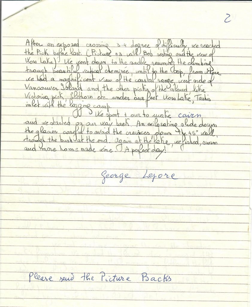
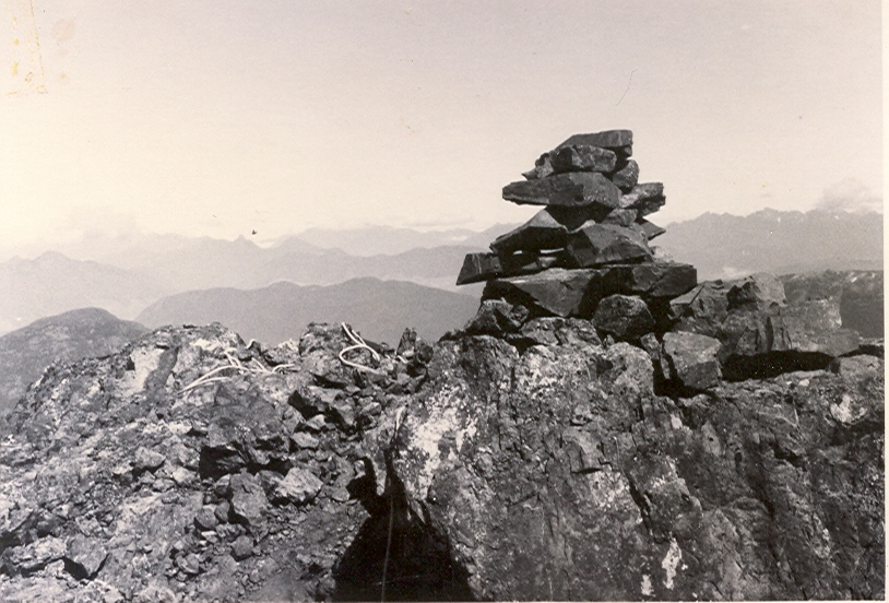
The cairn built on the summit of Rugged Mountain 1959 – George Lepore photo.
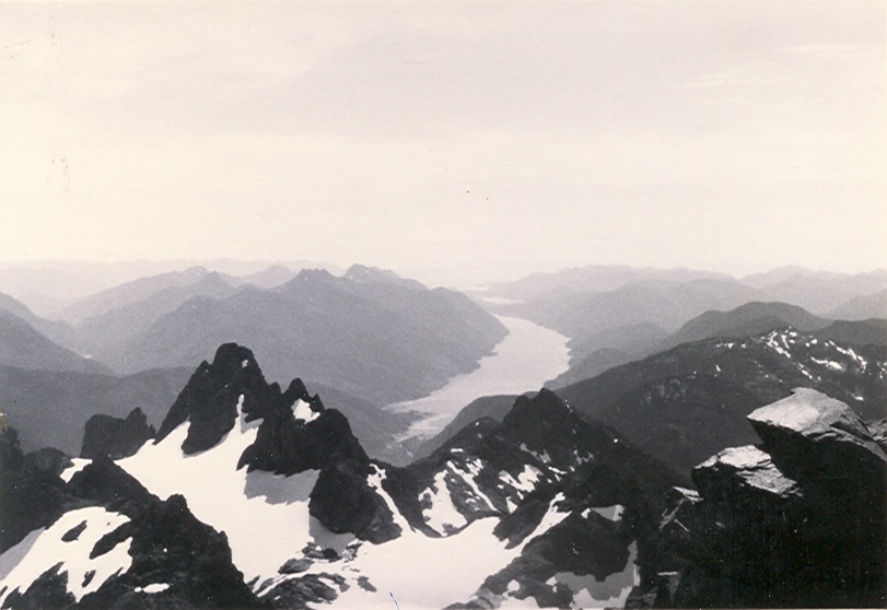
The view from the summit of Rugged Mountain looking towards the South Blade and Tahsis Inlet 1959 – George Lepore photo.
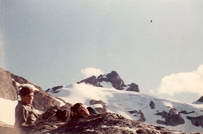
Chuck Smitson and Bob Bissed resting on their way to Rugged Mountain1959 – George Lepore photo.
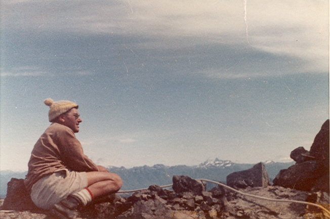
George Lepore on the summit of Rugged Mountain 1959 – George Lepore photo.
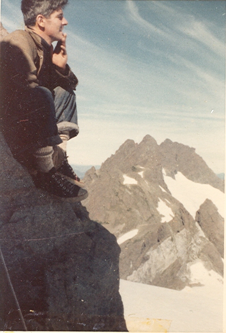
Chuck Smitson on the summit of Rugged Mountain with the Merlon Mountains behind 1959 – George Lepore photo.
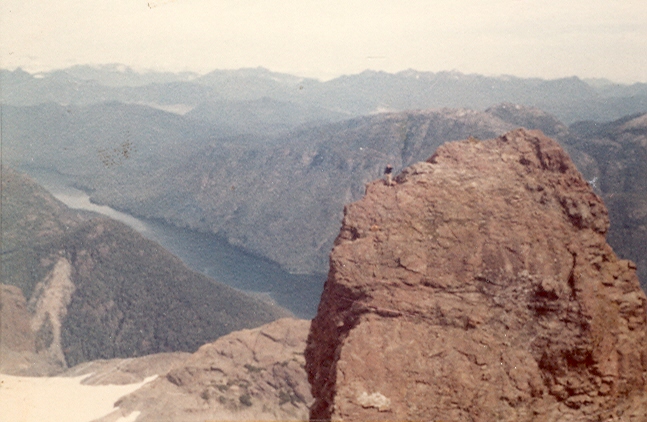
Bob Bissed on the Schina d’Asino (Donkey’s Back) with Woss Lake behind 1959 – George Lepore photo.
Tuckey Rite Today
Reported in The Daily Colonist Thursday September 10, 1959. p.28.
A well-known Saanich fruit farmer, Francis Edward Tuckey, 62, of 5084 Santa Clara, died Sunday [September 6] while visiting Olympic Hot Springs near Port Angeles, Wash. Mr. Tuckey was born in Tientsin, China, and came to Victoria in 1900. He was a fruit farmer in Saanich for many years, and was a member of the Alpine Club of Canada. Surviving are his wife Kathleen, at home; a son Richard Thomas; and three daughters, Mrs. R. (Brenda) Wagoner, of Victoria, Roslyn Jean Tuckey and Susan Janet Tuckey, both at home. Funeral services will be held at 1:30 p.m. today at St. Michael’s Church, with Rev. J. Rogers officiating. Cremation will follow. Arrangements were handled by Hayward’s funeral home.
Alpine Club of Canada
Reported in The Daily Colonist Wednesday November 18, 1959. p.25.
Edward Goodall was elected president of the Victoria section of the Alpine Club of Canada during the recent annual meeting. Honorary president is Dr. Mark Mitchell. Other officers included Paul Martinson secretary-treasurer, Mrs. Ethne Gibson, Bill Lash, Reginald Knott, Patrick Guilbride, Syd Watts, executive.
Copper Mine in The Sky ‘Promising”
Reported in The Victoria Daily Times Monday December 7, 1959. p.7.
VANCOUVER—A Vancouver Island copper deposit discovered more than 60 years ago on the rugged precipitous slopes of Big Interior Mountain, is being drilled for the first time. Key to the project, situated miles from the nearest roads on a mountain long-considered inaccessible for economic mining, was a helicopter. Toronto engineer Andrew Robertson and a group of associates now are drilling promising deposits after Mr. Robertson carried out initial exploration with the aid of climbing pitons. The helicopter was brought in to fly several tons of diamond drill equipment and 20 tons of supplies into the region. It is retained on charter to fly employees to and from work.
Snow-Capped
The peak of the 6,107-foot mountain, about 120 miles north of Victoria, is permanently capped with snow. The mineralized zone stretches from Della Lake at the 3,500-foot level to the top of the bluffs at the 4,500-foot level. Drilling operations under George Mills of Vancouver will continue until the end of the year when avalanche conditions make further work hazardous until spring. Robertson holds an option to purchase a group of eight claims on the mountain, including the four original claims staked back in 1899.
Accident on Mt. Argus
Reported in The Canadian Alpine Journal Volume 43, 1960. p.60-61.
By Paul Martinson
On July 12th, 1959, Harry Winstone, a member of the Alpine Club of Canada, died from injuries sustained in a fall on the side of Argus Mountain, a 6,500-foot mountain in Strathcona Park on Vancouver Island. He was in a party that started out to climb The Red Pillar which is located a small distance beyond Argus, forming part of the same ridge. Members of the Outdoor Club of Victoria, the Victoria section of the Alpine Club of Canada, and the Island Mountain Ramblers made up the party. Nine of a party of about twenty left Kookjai ridge at about 5:30 that Sunday morning. One person turned back to camp after a prior injury bothered him. The others hiked up onto the Comox Glacier and there three others turned back. This left a group of five; Syd Watts of Duncan, Harry Winstone of Crofton, and Reginald Knott, John Weir and myself, of Victoria. All of us but one were members of the Alpine Club of Canada. We “second-breakfasted” at the end of the Comox Glacier and moved further on the ridge. Just before reaching Argus, Syd, the leader, told us that because of the threatening weather he thought we should not attempt The Red Pillar. We concurred and we also agreed that Argus would make a pleasant climb to end the day. Because of the feathery feeling in my stomach, I decided to remain on the ridge just below Argus and watch them through my monocular. Light was becoming duller but a break showed in the clouds so we were quite sure the weather would not get too poor. The other four moved off and I made myself comfortable to watch their progress. The wind was quite cool and a wisp of fog was snaking its way up the valley from the sea toward and below us. The four moved together diagonally up the snow face of Argus and finally reached the bare rock on the upper part of the mountain. At first Harry had led the group but others had taken the lead when the rocks were reached. The distances climbed were about 800 feet on snow, 40 feet on rock and snow and 35 feet on the bare rocks up top. I suddenly heard a shout of “rock” from above and through my glass I saw a rock begin its clumsy way down the mountain. I said to myself at the time that it was a big one. I thought the shout was a routine one and promptly forgot about the rock. I shifted my gaze to the members of the party in time to see Harry slump off to his right and tumble down the mountain. There was no shout or exclamation from him. I watched him come down and come to rest against a rock outcropping at the base of Argus. I glissaded down to him and moved him to more comfortable ground. He was breathing but we were sure he did not regain consciousness. This probable coma saved him from feeling any pain. The others arrived and a hasty conference was held. We decided that Syd and John should return for help and Reg and I would remain with Harry. The accident occurred about 12:30 p.m. and Harry died abut 4:45 p.m. During that time we attempted to warm him with our coats and by making a fire with the heather available at the point. The fog had come in thickly and we could see no wood. The slope was too steep to venture out to look for any. We both had a great feeling of helplessness as we saw Harry become quieter and finally cease all motion. We said a prayer over his body and talked that evening and night of the pleasant summer the three of us had had at the Mummery Camp. Next morning the sun rose and all was clear. The RCAF Air-Sea Rescue helicopter arrived about 9:30 and after finding that nothing could be done for Harry, flew Reg and me back to Comox and returned for Harry in the afternoon. Because of the feeling we had for Harry Winstone and to serve as a remembrance of his climbing past we plan to return to the ridge below Argus Mountain in 1960 and build a stone cairn to his memory. His gray guitar and quick wit were often heard in camp and will long be remembered by many of us.
Adeline Baxter
Reported in The Canadian Alpine Journal Volume 43, 1960. p.103.
By D.E.M.
There will be few members of the Alpine Club of Canada today who knew Adeline Baxter in her climbing days, as it was half a century since she joined the club in 1909. Born at Newport on Tay in Scotland, in 1881, she came with her parents to Carmen, Manitoba, in 1891, where she attended school. Later she qualified as teacher and taught three years at Pilot Mound. In 1902 she went to Boston, maas. To the Museum of Fine Arts. There she won scholarships and remained six years, specializing in portrait painting. Her portraits of Scotty, who used to run the Cave & Basin Shop in Banff, is hung in the Banff Museum. 1909 found her on a holiday in Banff. So in love with the mountains was she, that she joined the Alpine Club at Lake O’Hara and climbed vigorously. In 1910 she was the first woman in the Canadian Alpine Club to lead a rope. On another trip several parties were caught in a blizzard—other parties wisely went home, but her rope led by Conrad Kain, made their objective. In 1913 she became Supervisor of Art in the Winnipeg Public Schools and in 1929 went to the same position in Victoria, where she died on April 4th, 1959. Unfortunately, Adeline Baxter injured her keen due to a fall on ice, and had to gibe up her climbing, but her love of mountains never left her, nor did her Scottish accent, nor her shrewd outlook on life and her sense of humour.
Francis Tuckey
Reported in The Canadian Alpine Journal Volume 43, 1960. p.105-106.
By J.E.M.B.
Francis Tuckey (1932), a name familiar to a generation of Vancouver Island alpinists preceding World War II, died on September 6, 1959, from a heart seizure during a family holiday in the Olympic Mountains. Although Francis spent most of his life in Victoria, and attended University School and Victoria High School before proceeding to the University of Toronto, he was born in the Far East. His parents, were both Irish, were living in North China at the time of his birth on May 20th, 1896. His father, a Civil Engineer by profession, was employed by the (Chinese) Imperial Government, being in charge of construction of the Tientsin Pu Chow Railway. These special circumstances meant that Francis, as a boy and a young man, had the most unusual opportunity for travel and adventures. He had seen bullets fly in the Boxer rebellion and had been back and forth from China to Ireland, travelled to Switzerland, Italy and New Zealand, where he and his sister Betty did some climbing in 1935. Returning to Victoria after completing his education, Francis felt the need of an outdoor life. He bought and cleared land at Royal Oak, Vancouver Island, and planted an orchard of sweet cherries. In 1937, he married Kathleen G. Martin, another ardent member of the local section. Although a dedicated farmer, he occasionally expressed regret that the seasonal demands of his cherry orchard conflicted with his Alpine Club interests, and curtailed his climbing activities so much. However, of the many expeditions undertaken by Francis on the Island, he probably would have given first place to that taken in 1936 for the exploration of a new area beyond “The Forbidden Plateau”, subsequently named “The Hidden Plateau”. This was a pioneering expedition, undertaken under the sponsorship of the Vancouver Island section of the ACC. It revealed to the world a hitherto unvisited hinterland of great scenic beauty, as great as, if no greater than, that of the Forbidden Plateau itself. The exploration of the party (which included “Boston” and Fred Maurice, Kathleen and Francis) again emphasized the fact that Vancouver Island has a most interesting hinterland to explore—a most interesting country to be opened up—for the mountaineer and for its tourist possibilities. Francis was a good outdoors man, reliable, even-tempered, humorous, with powers of intelligent observation, quiet resourcefulness and steady efficiency. He was a gentleman and a good companion. So rest his memory.
Harry Winstone
Reported in The Canadian Alpine Journal Volume 43, 1960. p.105-106.
By Ian Kay
Harry Winstone died on July 12th, 1959, from injuries received in a mountaineering accident on Vancouver Island. The accident brought to an untimely end a most promising career and came as a great shock to both his professional associates and his many friends in the climbing fraternity. Harry was born in Vienna in 1926 and fled to England with his mother twelve years later when their country was overrun by the Nazis. With characteristic zeal and diligence, he set about learning the language and customs of his new home, and did so with such success that few of his later associates were aware that English was not his native tongue. Working during the day to support his mother and himself, he attended evening classes at London University for seven years, obtaining his degree in engineering in 1948. In what little spare time such a regimen permitted he exercised his lifelong love of the outdoors through Scouting and Youth-Hostelling. Seeking better professional opportunities and to satisfy a long-felt desire to see the rivers and mountains of the explorers he had read about in history and poetry, he came to Canada shortly after his graduation. Before long he was exploring the mountains around Vancouver. He joined the Alpine Club of Canada in 1950, and members of the Vancouver Section, setting forth for their Mt. Seymour cabin and a weekend of skiing, could be sure that Harry would have broken trail and the stove blazing when they arrived. At about this time he made two trips to Black Tusk Meadows, one at Easter and the other in August. “If heaven is no more beautiful than this,” he said, “I shall be satisfied.” His ashes were scattered in this area last September through the efforts of some of his climbing companions. Harry’s work as an engineer took him to live in several B.C. communities but he maintained his keen interest in the outdoors wherever he went. Lack of climbing companions in such places was seldom more than a temporary handicap. In prince Rupert he trained three members of his Scout troop and took them on climbs of some unnamed summits along the Skeena River. Later while residing in Crofton he was largely instrumental in organizing the Island Mountain Ramblers. He was especially fascinated by the Indian cultures of the Skeena valley and soon became better informed on the history of the region than many of the natives. While living in Prince Rupert he made four attempts, one on skis, to reach some of the unclimbed summits of the Seven Sisters group near Hazelton. Harry also did much to establish the sport of ski mountaineering in Prince Rupert. To reach the slopes he located on Mt. Blaney involved a 20-mile drive and two-hour climb but his enthusiasm was so infectious that he was seldom without companions on his weekend ski expeditions. In 1955, he took part in an expedition by ACC members to hitherto unvisited mountains between the headwaters of Bridge and Lord Rivers. He also attended two summer camps, the Tonquin Valley camp in 1957 and the Mummery Camp the following year. Ascents of Mts. Simon and McDonnell from the Tonquin camp were vividly described in two brief articles from his pen that appeared in the 1958 Canadian Alpine Journal. The following summer he led the first ascent of two unnamed peaks south of Mt. Mummery. A strong and competent climber, he was however more interested in the exploratory rather than the gymnastic aspects of mountaineering. He was especially attracted to the “untrodden peaks and unfrequented valleys” now so rare in his native Europe. Those who shared camps or expeditions with him will recall the pleasures of campfires enlivened by his wide repertoire of songs and poems, and by his shrewd, witty and often pungently satirical dissertations on life in general. He was equally adept at recording his impressions of the mountain scene on film, and won several awards at Club and Section competitions. Closer to home his amazing versatility found outlets in Boy Scout work, community affairs, music and writing. He made a hobby of collecting and singing folk songs and two of his poems have appeared in Canadian Poetry magazines. Surviving him are his wife Mary, also a member of the Club, a son Michael and a daughter Jennifer.
The next five years: 1960 – 1964.
The History of ACCVI is a work in progress.