1935
ACCVI executive:
Chairman – Claude Harrison
Secretary – Kathleen Martin
Treasurer – Gordon Cameron
Outings – Claude Harrison
Executive Committee – Thomas Goodlake, William Dougan, Muriel Aylard, Robert McCaw, H.B. Jones.
Events:
January 27 – Club trip to Mt. Matheson.
February 24 – Club trip to Red Flag Mountain.
March 8 – Club trip to a mountain north of Twin Lakes.
March 21/22 – Week-end trip to the hut at the Lake of the Seven Hills.
March 27 – Club’s 30th annual banquet held at the Empress Hotel.
March 28 – Club trip to Mt. Helmcken.
March 24 – Club trip to Mt. Work via Fork and Fizzle Lakes.
April 6 – Club trip to Sooke River Canyon. Dinner at Sooke Harbor House.
April 20-22 – Weekend camp at Trap Mountain.
May – Club trip to Mt. Prevost.
June 1-3 – Club trip to Leech River district.
June 11/12 – Club trip to Humpback Hill [Mt. Wells].
June 15/16 – Club trip to Mt. Maxwell, Saltspring Island.
June 29 – July 14 – Club annual camp at the Lake of the Seven Hills.
August 10 – TBA Interior or West Coast trip.
September 14/15 – Overnight club trip to Mt. Tzouhalem.
September 29 – Half-day trip to Garibaldi Hill.
October 12/13 – Club trip to the Lake of the Seven Hills.
October 27 – Day-trip to Mt. Finlayson.
October 31 – Halloween party.
November 9/10/11 – Club trip to Trap Mountain.
November 24 – Day-trip to Bald Mountain.
December 4 – Club fall meeting to elect officers and slide show by Phyllis Munday on Mt. Waddington.
December 7 – Half-day trip to hill south of 17 Mile House, Sooke.
December 14/15 Camp at the Lake of the Seven Hills.
December 28 to January 1 – New year camp at the Lake of the Seven Hills.
Section members who attended the ACC general summer camp at Lake Magog: Ethne Gale, Mark Mitchell, Edith Wilcox, Miss Piggott, Rex Gibson.
Section members who attended the ACC general summer camp at Lake Magog: Ethne Gale, Mark Mitchell, Edith Wilcox, Eleanor “Nora” Piggott, Rex Gibson.
Section members who passed away in 1935: Frederick Godsal, Arthur Haynes, Charlotte Hadow.
Mountaineering Is Subject of Lecture
Reported in The Daily Colonist Wednesday January 16, 1935, p.9.
On Monday evening Captain Rex Gibson, a well-known member of the Alpine Club, gave an extremely interesting talk to the members of Brentwood College. His lecture dealt with mountaineering in the Jasper Park of the Rockies and was illustrated with many fine slides. Captain Gibson has the distinction of being among the first to climb several of the difficult peaks in that area. “That some people should enjoy climbing difficult mountains,” he told the boys, “is no more remarkable than that others should enjoy playing golf. Only,” he added, “don’t attempt a serious climb unless your heart and lungs are in good shape, and even then don’t go unless at least one member of your party is an experienced climber who knows the ropes.”
Alpine Club Group Climb Mount Matheson
Reported in The Daily Colonist Tuesday January 29, 1935, p.8.
Getting away to an early start on what was intended to be an energetic year’s work, a party of members of the Vancouver Island section of the Alpine Club of Canada on Sunday [January 27] climbed Mount Matheson, to the east of Sooke Harbor. There was a strong touch of Spring in the air, which contrasted strongly with the wintry weather of the last two weeks, and the Sooke Road and Gillespie Road were found to be practically undamaged by the recent floods. The climb was started from a point on Gillespie Road, near the duck traps, Sooke harbor, and the summit reached after nearly two hours of steady going. The summit of Mount Matheson, over 1,000 feet, commands a fine view of the higher Sooke Hills, and of the Strait of Juan de Fuca. It was once used by the Sooke Indians as a look-out post, whence their sentinels would give warning of the approach of an enemy. Return to Gillespie Road was made by 4:10 p.m., and members of the party were later entertained at Metchosin by the kindness of Charles E. Whitney-Griffiths. The club intends to make trips at regular intervals from now until Summer.
Charting The Channels
Climb Occasionally
Reported in The Daily Colonist Sunday February 10, 1935, p.25.
By F.M. Kelley
Mainly the work of the hydrographic survey party, as the name implies or designates, is confined to the water and immediate physical characteristics of the shores adjacent. Getting their feet wet in making landings is a frequent occurrence. It is more or less of a web-footed job; but occasionally members of a party wish they possessed pedal extremities like those of a mountain goat. It is found necessary in taking topography to sometimes take advantage of a favorable elevation for getting all-round photographs. Such a peak, visible from Nootka Sound, offered excellent prospects. This elevation known as Conuma Peak, is an outstanding landmark from the ocean on clear days, although twenty or more miles away, as it rises, apparently in single grandeur, from the hills surrounding it. The picture-taking party left the Pender one Sunday morning in one of the launches, and shortly after they started, a lone figure paddling a canoe was sighted. He was hailed aboard, and it was learned that he was an ex-Swiss mountain guide, Andy Morod, who logged, prospected and trapped on the West Coast. He was going to try to locate Muchalat Lake, where he intended to set out some trap lines, and get ready for the following Winter. With the ascent of the peak in sight and its details an unknown quantity, the party suggested that Morod accompany it. He would probably get the location of the lake from its summit they told him. He thought it an excellent suggestion, and took the lead when they left the launch. The party proceeded up the Conuma River valley, and on Monday reached the top of the peak, not without some difficulty, as the last 1,000 feet presented some hazards. At places, ropes had to be used. Morod doing the initial climbs. Conuma Peak is six miles from the head of Tlupana Arm and its top is about one hundred feet long by about forty feet wide. The party was evidently the first to see the wonderful panorama revealed from the summit; the mountains on the Mainland of BC, being visible; and before starting on the way down they piled up a small cairn of stones.
February 10, 1935
Alpine Club Outings Set for Season
Reported in The Daily Colonist Tuesday February 12, 1935, p.3.
J.S. Campbell, director of publicity, Dominion Parks, Ottawa, is featured as one of the special attractions in the Spring programme of the Vancouver Island section of the Alpine Club of Canada. Mr. Campbell will show moving pictures of mountaineering and nature study on Thursday, February 21, at the home of Miss Muriel Aylard, 625 Elliot Street. The remainder of the Spring programme consists chiefly of outings, in connection with some of which there will be dinner gatherings. The May and June outings programme has not yet been arranged, with the exception of the annual camp to be held at the Lake-of-the-Seven-Hills from Saturday, June 29, to Sunday, July 14. Fixtures until the end of April are as follows: Sunday, February 24, leaving the city 10 a.m., Mount Braden; Saturday, March 9, leaving city at 2 p.m., Cobble Hill (followed by dinner); Sunday, March 24, 10 a.m., Mount Work from Fork and Fizzle Lakes; Saturday, April 6, 2 p.m., Sooke River Canyon, dinner at Sooke Harbor House; Saturday to Monday, April 22 to 22, leaving city at 2 p.m. on the Saturday, Easter week-end camp at Trap Mountain.
Alpinists Have Busy Week-End
Reported in The Daily Colonist Tuesday February 12, 1935, p.5.
The Lake of the Seven Hills received a visit over the week-end from an enthusiastic group of members of the Vancouver Island section of the Alpine Club of Canada. One party made the ascent on horseback, while several other members crossed the hills from Goldstream Station. “The trip from Goldstream is an interesting experience,” one of the members reports. “The train arrives a few minutes after 10, and a start is made along the Sawyer Road. This is a pleasant winding track through the big timber, but unfortunately, being in the Goldstream watershed, it will probably be reduced in the near future to a mass of stumps and fallen logs. The road ends at mount Braden and the route lies over its southern shoulder. At this point the peaks of Ragged Mountain loom up large in the foreground and beyond them, three miles away, the tops of the Seven Hills come into view. The direction of these is noted on the compass before proceeding. In this confusing series of rocks and gullies which follows, the compass is a very necessary piece of equipment.
Sooke Hills
“After leaving Mount Braden, all signs of civilization cease and the traveler is in the heart of that beautiful territory known as the Sooke Hills, with its Douglas firs, rivulets and, of course, the inevitable salal, interspersed with large quantities of rock which supports mosses and pine trees. Part of the unspoiled area has been preserved to prosperity as the Sooke Mountain Park. The eastern boundary of the park is crossed about a mile before reaching the Lake of the Seven Hills.” A cheerful evening was spent sitting before the big fire in the main room of the hut, entertained by songs and story by different members. The next morning was spent oiling the sides of the building to preserve the planking. The lake was covered with a thin coating of ice, and ice-breaking from a canoe was one of the diversions of the week-end party, which returned to the city late on Sunday afternoon.
Mount Braden Is Object of Alpine Group
Reported in The Daily Colonist Tuesday February 26, 1935, p.7.
Mount Braden, in the Sooke Hills, was visited by members of the Vancouver Island section of the Alpine Club of Canada on Sunday [February 24]. The party, eleven in number, left the city by motor at 10 a.m., and started walking from a point on the Sawyer Road not far from Goldstream Station. The Sawyer and Blogg Roads were followed to the foot of the mountain. Destruction of timber on the Blogg Road is already under way, and as a logging railway is being built through the district, it will soon, in all probability, be a scene of desolation. For the time being, however, it is a fine stretch of forest and one of the nearest places to Victoria where the big Douglas firs can be seen from the road. Lunch was eaten near the summit, which commands a fine view of the surrounding country—the rocky peaks of the Sooke Hills and the Highland district, and the more wooded ones of the Malahat; also, the city and the Saanich peninsula, the Strait of Juan de Fuca, Haro Strait, and emerging from a bank of cloud on the horizon, the peak of Mount Baker. Most of the hills on southern Vancouver Island have rock faces, which offer fine opportunities for climbing, of any degree of difficulty which may be desired. The east side of Mount Braden is of this type, and was descended by the party, with the help of rope. The cars were reached at about 5 o’clock, and before returning home tea was enjoyed by the roadside. The next outing well be to Cobble Hill, on Saturday, March 9, at 2 p.m.
Founding of Group Marked
Alpine Club Here Holds Dinner in Conjunction with Other Branches
Reported in The Victoria Daily Times Wednesday March 27, 1935, p.10.
In conjunction with other branches of the organization throughout the Dominion, the annual dinner meeting of the Vancouver Island section of the Alpine Club of Canada was held yesterday in the Empress Hotel, presided over by Claude L. Harrison, president, with about thirty members, attending. Greetings to the local group were extended by Arthur O. Wheeler, national president, who is visiting in California, the Vancouver section and Stanley H. Mitchell, former secretary of the parent organization for many years. In his annual message, the national president recalled with pride the day on March 27, 1906, when the Alpine Club was formed in Winnipeg. It had made a name for itself in the pioneering and climbing history of Canada, he said. Reference was made to the splendid work of Alex. A. McCoubrey, editor of the Canadian Alpine Journal, for the valuable information which he had published in the magazine. He paid credit to Mr. and Mrs. Don Munday for their first attack on Mount Waddington, or Mystery Mountain, and was confident that it would be mastered. He reported the annual camp would be held this year at Mount Assiniboine, and hoped that as many local members as possible would avail themselves of the opportunity at attending the gathering. The toast to “The Alpine Club of Canada” was proposed by William H. Dougan, after the toast to “The King.” Gordon Cameron responded, and asked that greetings be sent to S.H. Mitchell, an old friend of the organization. The evening concluded with a programme of entertainment, including lantern slides of mountain scenery and a comic “Mickey House,” shown by Mr. Harrison. Included in the slides were scenes of Leechtown in its heyday as a mining centre on Vancouver Island. These, Mr. Harrison had made from old photographs, among which were pictures of a few of the thirty saloons reputed to have been in operation at that time. Mr. Harrison also showed some excellent color slides of scenes in the Sooke area, including the district surrounding the lake-of-the-Seven-Hills, where the club cam is located. Among those attending the dinner were: Mr. and Mrs. Claude L. Harrison, William H. Dougan, Gordon Cameron, H.B. Jones and Miss Stephanie Jones, Miss Erminie Bass, Mrs. Charlotte Hadow, Miss Audrey Hadow, Miss A.W. Emmerton, Miss Edith Wilcox, Mrs. George Dean, Mrs. Marshall, Mrs. Rober Healey-Kerr, Dr. Anne Norrington, Miss Edith Whaley, Colonel J.L. Howell, Francis Tuckey, Fred Maurice, Murray Cree, Charles Whitney-Griffiths, Colin H. Rutherford, Colonel Greer and Thomas Goodlake.
Alpine Club Carrying On Its Outings
Reported in The Daily Colonist Thursday May 23, 1935, p.11.
The Vancouver Island section of the Alpine Club of Canada has already commenced its Spring-Summer programme with trips to Trap Mountain, Duncan, and Mount Prevost during the current month. The next trip is to be a long week-end expedition into the Leech River district, beginning Saturday June 1, at 1 o’clock, when the party is to leave the city, and ending its return on Monday, June 3. Other scheduled trips for June, July and August are as follows: Tuesday and Wednesday, June 11 and 12, outing to Humpback Hill [Mt. Wells], leaving the city at 5:30 p.m. on the Tuesday and returning the following morning; Saturday and Sunday, June 15 and 16, Mount Maxwell, making camp at Burgoyne Bay for the night; June 29 to July 14, annual camp at the Lake of the Seven Hills, and on or about August 10, eight-day trip to some part of the Interior or West Coast section of the Island. In connection with the last-mentioned trip, which, it is expected will be somewhat strenuous because of the need of packing food and equipment, members have been asked to give notice by June 30 of their intention of going.
Mt. Prevost 1935 – Cecil Frampton photo.
Alpinists Exploring Leech Area
Reported in The Daily Colonist Sunday June 2, 1935, p.10.
By way of training for the more strenuous expedition that will be taken into country along the West Coast of the island later in this Summer, a party of seven members of the Vancouver Island section of the Alpine Club of Canada went out into the Upper Leech River country yesterday for a three-days’ trek. Traveling light, with the minimum of equipment as to blankets and camping outfit, the expedition planned to sleep in the open, with-out tents, in the initial hardening process. They left Victoria at 1:30 o’clock yesterday afternoon, and drove in over the Goldstream Road to the Sooke Lake district, from there starting off in the direction of the Upper Leech. The falls are about three and a half miles above Leechtown, and purposely very rough country is being taken. Under the guidance of Claude L. Harrison, the party includes Miss Edith Wilcox, Miss Stephanie Jones, Miss Morrison, Thomas Goodlake, Francis Tuckey and Fred Maurice.
Will Be a Rendezvous of Holiday Camp
Reported in The Daily Colonist Wednesday June 26, 1935, p.2.
The new hut of the Vancouver Island section of the Alpine Club of Canada, whose annual Summer camp will be held at the clubhouse, Lake of the Seven Hills, from Saturday June 29 to Sunday, July 14. These Summer camps have always been popular with members and their friends, and a large party will attend this year, judging by registrations to date. While the hut and surrounding campus on the shores of the lake are very comfortable headquarters for the two weeks’ outing, daily expeditions into the surrounding hills are part of the annual camp programme, not only providing enjoyable diversion but serving to harden the muscles and give a foretaste of the conditions that will be found by any who attend the annual camp of the parent club in the Rockies. There will be a few overnight trips to Mount Empress (2.187 feet), which commands a fine view of the whole southern end of Vancouver Island, and to some of the other higher hills in the district. There will be a bonfire every evening on Bonfire Island—this being an occasion when all camp guests gather informally to share their day’s experiences, join in community songs and play round-the-fire games.
June 26, 1935
Forbidden Plateau Trail Open Soon
Snow Going Very Fast Now
Reported in the Comox Argus Thursday June 27, 1935. p.8.
The road into the Forbidden Plateau by Dove Creek will be open on July 2nd. Mr. Eugene Croteau made his annual trip to discover when he can open his camp, last week, with Mr. Hamilton M. Laing. They found that the snow had gone fast in the past few weeks though the season is not as far forward as last year by at least two weeks. There is still a good deal of snow under the trees but out in the open the rock ridges are bare and the grass is showing in Paradise Meadows. They went all the way into Mr. Croteau’s camp on Croteau Lake and stayed there over night. All the snow is gone round the cabin and the ice has disappeared from the lake. The ridge in front of the cabin is gay with alpine flowers. Mr. E. Croteau is going in on Sunday [June 30] and the first visitors will make their way over the trail, it is expected, on July the second. As there has been so little rain the trail is in excellent condition. Quite a number of inquiries have been received already inquiring as to when the Dove Creek trail would be open and, if the weather holds fine there is prospect of an excellent season. Jack Murray [Murray Meadows in the Forbidden Plateau was named for him in the 1930’s] will be ready with his pack-trail for the second.
Alpine Club Camp In Sooke Hills
Reported in The Daily Colonist Sunday June 30, 1935, p.20.
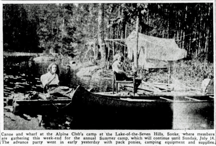
Canoe and wharf at the Alpine Club’s camp at the Lake-of-the-Seven Hills, Sooke; where members are gathering this week-end for the annual Summer Camp, which will continue until Sunday, July 14. The advance party went in early yesterday with pack ponies, camping equipment and supplies.
Forbidden Plateau Has Real Beauty
Reported in The Daily Colonist Sunday July 21, 1935, p.28.
One of the most outstanding attractions on Vancouver Island is the Forbidden Plateau, a beautiful stretch of untouched country which lies to the north of Courtenay and Comox. Walled in by a mountain range 3,000 feet high, this great tableland was practically unknown until twelve years ago. Indian medicine men had set it aside as a country taboo, the abode of evil spirits, and as such was shunned by the native tribes. Today it is known as one of the most wonderful vacation lands in the world.
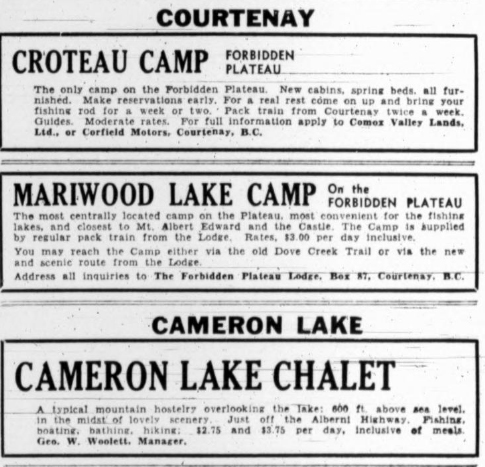
Newspaper ads for Croteau, Mariwood Lake and Cameron Lake Camps.
Mountain Climbers
Literally hundred of lovely lakes lie amid the ranges and natural meadows. Vast tracts are unencumbered by undergrowth, with red and white heather underfoot. For those keen on mountain climbing, there are peaks and summits as yet unconquered, while the fisherman finds ideal sport among the fighting trout which lie in the clear cold depths of the lakes. Horseback riding is popular way of exploring the miles of open country and all the while the visitor enjoys the invigorating air of an altitude as great as that of Colorado. The Forbidden Plateau is accessible by two trails. One, leading in via Bevan and Quartz Creek, consists of an old logging railway graded to become a motor road. At the head of this is the Forbidden Plateau Lodge, at an altitude of 2,000 feet, while Mariwood Camp, on the plateau proper, is connected with the lodge by pack train.
Pack Train
Another trail is constructed from Dove Creek, leading directly to Croteau’s Camp, a distance of twelve miles. The visitor is met by a pack train and saddle ponies are available for the journey in. This pack train is commanded by Jack Murray, an admitted expert at his work, whose life has been spent among horses. The train reaches the lip of the Plateau, passing lovely green timber on the ascent, skirting Mount Washington and Paradise Meadows, and three miles further on brings the traveler to Croteau Lake and Croteau’s Camp.
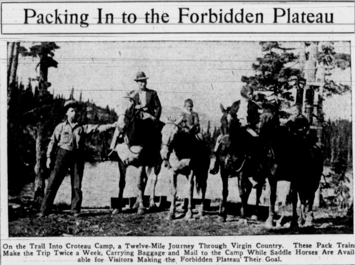
On the Trail Into Croteau Camp, a Twelve-Mile Journey Through Virgin Country. These Pack Trains Make the Trip Twice a Week, Carrying Baggage and Mail to the Camp While Saddle Horses Are Available for Visitors Making the Forbidden Plateau Their Goal.
Excursion To Forbidden Plateau
Reported in the Comox Argus Thursday August 29, 1935, p.8.
The first cheap excursion to the Forbidden Plateau went via Mt. Becher trail on Saturday [August 24]. They came up by bus from Victoria and were taken by the Campbell River bus over the road to the Lodge. There were over 20 in the party and after luncheon they left under the guidance of Mr. Clinton S. Wood for McKenzie Lake. They were welcomed by Tom Carey, slept under canvas and came back over the Mt. Becher trail to Mount Becher where they had luncheon. They had tea at the lodge and the bus called for them for their return trip to Victoria. Mr. C.S. Wood has blazed the trail to the Medicine Bowls on Brown’s River and is making no charge for those who use his road to visit that curiosity of water erosion. Another trip has been arranged early in September as the first was such a success.
At Croteau Camp
All Vancouver Island, Vancouver, Honolulu and many other places on the mainland were represented in the pages of the visitor’s book at Croteau’s Camp last week. Mr. and Mrs. Roy Brown of the Vancouver Province, who went in with Mr. Robert J. Filberg and his party not only saw many other places on the Forbidden Plateau, but went to the top of Mount Washington which gives an incomparable view of the whole district from Mount Albert Edward, and east.
Alpine Club Outings to Be Resumed
Reported in The Daily Colonist Thursday September 12, 1935, p.8.
The Vancouver Island section of the Alpine Club of Canada has already got away to a good start for the Autumn and Mid-Winter outings with a week-end camp at Sooke Mountain Park, for the marking of the boundary between the campsite and the surrounding property. Eleven further outings are already scheduled by the outings committee, being as follows: Saturday and Sunday, September 14 and 15, leaving city at 3:30 p.m. Saturday. Duncan, dinner, lecture and camp the night for ascent of Mount Tzouhalem, Sunday. Sunday, September 29, leaving the city at 2 p.m., Garibaldi Hill and district. Saturday to Monday camp, October 12 and 13, Lake of the Seven Hills. Sunday, October 27, leave city 10 a.m., Mt. Finlayson. Thursday, October 31, Halloween party. Saturday to Monday, November 9 to 11, leave city at 2 p.m., Armistice Day: week-end at Trap Mountain. Sunday, November 24, leave city at 10 a.m., Bald Mountain. Saturday, December 7, 2 p.m., hill south of Seventeen-Mile House, dinner at Sooke. Saturday to Sunday, December 14 and 15, camp at Lake of the Seven Hills. Saturday to Wednesday, December 28 to January 1. New Year camp, Lake of the Seven Hills. Sunday, January 26, 10 a.m., Mount Work.
Finding Names for Mountains
Reported in the Comox Argus Thursday September 26, 1935, p.1.
The Comox District Mountaineering Club in consultation with Mr. Norman Stewart of the Provincial Lands Department pored over maps of the Plateau and Glacier areas on Friday night [September 20] intent on giving some 70 features of this new country appropriate names. Mr. Stewart was on the land survey of the new country back of Courtenay and Cumberland last year and he detailed the features of the mountains that should be named. The little circle of climbers spent a busy hour and a half during which they suggested many of the names required. Selection was made firstly by descriptive aspect such as Circle [Circlet] Lake, secondly from the names of those who first climbed or found them, such as Kinney Glacier. The suggestions will be submitted to the Chief Geographer by Mr. Stewart.
Mortgage Burnt on Mount Becher
Mountaineering Club Entertains in High Altitude Cabin
Reported in the Comox Argus Thursday September 26, 1935, p.8.
Thirty members of the Comox Mountaineering Club saw the burning of the mortgage at the Mount Becher cabin on Sunday [September 22]. It was a merry occasion. Dick Idiens and Peggy Watt came up very early in the morning to prepare the twenty-five pounds of blueberries picked on a previous Sunday. They were served hot, individual style, with pastry and cream to all, with plenty over for the party of Victoria visitors, coffee and tea. The stoves roared and the coffee pot bubbled as Dick Idiens, president of the club, held the note and presently Peggy poked it in the stove. Dick called on Mr. Clinton S. Wood to say something about the history of the club. Mr. Wood told of the time when he and William “Bill” Douglas came up the trail and had to sleep out in the open. Then there was a meeting in Mr. Geoffrey Capes’ office with Colonel William W. Foster, a noted alpinist, and now chief of police in Vancouver. Colonel Foster advised them to form a club. It was formed and the cabin was built. Much of it was done by volunteer labor. But bit by bit it had been added to until now it was quite comfortable. Mr. Douglas added his comments to the story and Mayor Chas. Simms said how glad he was to be there and what a fine thing it was to have such a club for the young people. And that was all there was to the little ceremony.
Climbed To Top
The club was not too lucky in its weather. After a brilliant Saturday, Sunday broke dull. It did not actually rain but Mount Becher was always in the clouds. Most of the party climbed the other 800 feet to the top including his worship. Whilst the blueberries were being served a party of Victorians arrived on the search for fresh skiing grounds. They highly approved of Mount Becher and were grateful for the hospitality they received at the cabin. The road Mr. Wood has opened to his 2,000-foot altitude camp has made all the difference in the world to the club. Anyone can now drive half way up and hike into the cabin in an hour and a half over the present trail. Mr. Wood hopes to keep the road open all winter and it will be a great boon to hikers. It cuts out the long hike from Bevan to the second grade, a dreary walk of no interest in the logged off country. There never has been such a blueberry crop. On the higher slopes of Mount Becher the little bushes are thick with the berries with their delicious flavor of the high woods and the heather.
Water Colors of Forbidden Plateau
Lovely Sketches of Area on Exhibition on Saturday
Reported in the Comox Argus Thursday October 10, 1935, p.10.
The most fascinating pictorial representations of the Forbidden Plateau will be on view at the Courtenay Public School on Saturday [October 12]. They are by Mr. James Stuart Pearce, who has spent ten weeks this summer at Mr. Croteau’s, making these lovely sketches. Mr. Pearce writes of the sketches: “This series of watercolor sketches present the Forbidden Plateau as the artist saw it during his stay at the Croteau Camp, Croteau Lake, a stay of some two and a half months, from July to September. Having ideal weather, frequent excursions were made for the purpose of obtaining views on and off the trails. After obtaining such information as the Dominion Geological, Provincial Government Forestry, and the C.P.R. could provide the artist made Croteau Camp his base for his investigation of this country, and is of the opinion that no better choice could have been made. This central base is in the very heart of the finest scenery of the Plateau. The Croteau Camp is run by a kindly cultured and very efficient gentleman, Mr. Eugene Croteau, whose knowledge of this country cannot be surpassed. The altitude of Croteau Camp, 4,100 feet, and the position it occupies, makes it represent the hub of the wheel. Trails radiate from this centre to the most important points of interest. The clear air of this this country renders the colors and shadows more vivid than those of lower altitudes. On my arrival in July, purple heather, white heather and blue pentstemons were in bloom covering the ridge next to the lake to take the appearance of an elaborate carpet, below this ridge the Plateau stretches away on all sides with its series of rolling hills, meadows, lakes, canyons and mountains, appearing under different light conditions to complete the mirage effect suggested above. The light and shade changing so rapidly with the colors has the effect of a kaleidoscope on a grand scale. The mountains are not of great height, but the setting is unique. The canyons, particularly the Grand Canyon of the Cruikshank River, are superb. There are many points of interest in this vicinity to the geologist and to the botanist. I trust the sketches will give some idea of this extraordinary country.”
Had Numerous Friends Here
Mrs. C.J.B. Hadow Succumbs During Visit in England
Reported in The Daily Colonist Wednesday October 23, 1935, p.2.
A cablegram received yesterday by friends in Victoria, brought information of the death, in England, of Mrs. Charlotte J.B. Hadow, a well-known resident of the city, who passed away at Weston-Super-Mare, yesterday morning. Accompanied by her daughter, Miss Audrey Hadow, and her mother, Mrs. Marshall, Mrs. Hadow left here early last spring for an extended holiday trip in England and Europe. During August, while visiting her brother-in-law, Sir Raymond Hadow, at Coates House, Fifeshire, Scotland, she suffered a stroke. When sufficiently recovered to travel she went down to Weston-Super-Mare to stay with a cousin, Mrs. Orr-Ewing, and although apparently making a satisfactory convalescence she suffered a relapse.
Born In India
Born in India, Mrs. Hadow came to British Columbia with her parents while a young girl. After her marriage to Erland Hadow, a civil engineer, she lived in Revelstoke for a time. It was there he joined the Canadian Expeditionary Force and went overseas, being killed while flying in the fighting zone. Mrs. Hadow came to Victoria fourteen or fifteen years ago to live, and although of a quiet and unassuming nature she made a host of friends, being especially well-known and popular with the members of the local section of the Alpine Club of Canada, to which she gave enthusiastic and loyal support. She was one of the most active climbing members of the organization, attended most of their outings over a long period, took a great interest in promoting the clubhouse and camp project at its inception, and materially helped in carrying the undertaking through.
Many Interests
Another of her special interests was photography, a hobby which she pursued not only with enthusiasm, but with well-developed technical knowledge and artistry. On more than one occasion her work was singled out for special mention in The Colonist monthly snapshot competition. During her travels about France, Germany and Switzerland last Summer she took many snapshots which she intended making into slides to be shown to the Alpine Club members here on her return. Among these were some taken while climbing in the Alps. The family home in Victoria was in Linkleas Avenue.
Winter Sports On Mount Becher
Attempt To Promote Them Will Be Made This Year
Reported in the Comox Argus Thursday November 14, 1935, p.1.
A meeting of the Tourist Development Bureau of the Courtenay-Comox Board of Trade was held on Thursday night. The main object of the meeting was to give guidance to Mayor Chas. Simms as to what this end of the Island needed most in the way of development when the governing council meets next week. As a result, he will sponsor the Comox-Alberni road. A committee was also appointed to ask the Minister of Public Works about temporary repairs to the Bevan bridge. And there was a long discussion about winter sports on Mount Becher. The Mountaineering Club is to be asked to promote them this season.
Mountaineering
Reported in the Comox Argus Thursday November 14, 1935, p.2.
Seven members of the Mountaineering Club hiked up Mt. Becher last Saturday [November 9] afternoon to spend the week-end. They found the trail in fine conditions, but a bit slippery on some of the slopes. Saturday was a glorious day, the atmosphere being wonderfully clear. There was no snow at all at the cabin, but the small pond nearby was frozen over with a good surface of ice, and that evening the party skated on it—an unusual thing on Becher where the snow nearly always spoils the ice before it will bear. However, by morning it started to snow, with wind squalls from every point of the compass. Very fine snow fell all day, about two inches being on the ground at three in the afternoon. In the morning five of the party went over the top to skate on one of the small lakes on the south-western slope of Becher, and had good sport. In the afternoon, the snow stopping this pastime, a hockey game—a mixture of every kind of hockey known and unknown—caused a great deal of fun on the snow-covered ice near the cabin. Three of the party had to descend on Sunday, leaving about three. The snow followed them till half way down Wood’s road, there being about an inch and a half at Wood’s Lodge. However, the others, on coming down on Monday afternoon, left two feet at Becher Cabin, and found a foot at Wood’s Lodge, and a little at the third switch-back. The Mountaineering Cabin is in good shape now. It is well chinked and the bunks in the newer part are in fine shape. The Club welcomes anyone, but expect them to clean up and replace the wood they may have used before leaving. That is only common courtesy.
Names For Forbidden Plateau Places
Geographic Board Submits Its Recommendations
Reported in the Comox Argus Thursday November 28, 1935, p.1.
As the result of careful study by the Geographic Board of Canada of names for features in the Forbidden Plateau and Glacier area, 109 names have been recommended. Mr. Norman C. Stewart, has sent up a map showing these names to Mr. Dick Idiens, the president of the Comox District Mountaineering Club, and the latter has been submitting this map to various organizations in the district for their approval. He will send what comments he receives back with it. Major George Aitken sent Mr. N.C. Stewart to Courtenay to receive suggestions. The board has entered into the task with much zest and as a result the place names of the mountains back of Courtenay should be distinctive and worthy of these very beautiful regions. As far as possible descriptive names have been used; but where persons have been honored it is always with some local association.
Peak Magnet to Climbers
Mrs. Don Munday Explains to Alpinists Difficulties Scaling Mt. Waddington
Reported in The Victoria Daily Times Thursday December 5, 1935, p.4.
The inaccessible spire of Mount Waddington, or Mystery Mountain, holds a tremendous fascination for alpinists. It was described by Mrs. Phyllis Munday of North Vancouver before the Vancouver Island section of the Alpine Club of Canada at the Y.W.C.A. yesterday, as a magnet which challenged climbers to scale its precipitous sides. Mrs. Munday, who with her husband, Don Munday, and Henry Hall Jr. of Boston, with other noted alpinists, have several times attempted to scale Waddington’s peak without attaining their goal. On one of these attempts, Mrs. Munday, with her party, clung all one night to a precipitous ridge and were almost frozen when daylight came. Mrs. Munday intimated to the alpinists here yesterday evening that she would be a member of another party which would attempt to climb the park of Mystery Mountain next summer. She indicated three main drawbacks to alpinists who have attempted, or will in the future try to overcome, in the scaling of British Columbia’s hitherto inaccessible peak. These drawbacks, she said, are; steepness on the only route possible; the formation of ice plumes by wind, which are unsupported and afford no pick hold, and the “flat face” areas, which are considered impassable. The address will be illustrated by about 200 lantern slides. Election of officers of the Vancouver Island section of the Alpine Club of Canada resulted as follows: Claude L. Harrison, chairman; Miss Audrey Hadow, secretary-treasurer; Thomas Goodlake, treasurer; Miss Muriel Aylard, Miss Edith Wilcox, William H. Dougan and Fred Maurice, executive.
Alpine Club Greets Members
Reported in The Victoria Daily Times Thursday December 5, 1935, p11.
The Vancouver Island section of the Alpine Club of Canada has just published the Christmas number of its monthly bulletin entitled “The Ground Sheet.” Thomas Goodlake is the editor and Art Kerr is the publisher. Practically the whole of the front page has been contributed to extending greetings to the forty members. The activities of the last month are reviewed, and outings for December will include: Saturday, December 7, trip to hill south of Seventeen Mile Hill; Sunday, December 14-15, camp, Lake of the Seven Hills; Wednesday, December 28-January 1, New Year Camp, Lake of the Seven Hills. Miss I.L. Granger, secretary of the Vancouver section of the club, has extended an invitation to local members when visiting Vancouver to take part in expeditions, whether scheduled climbs or trips arranged by members in the nearby hills, or to their hut on Seymour Ridge during the skiing season.
Mountaineering
Reported in the Comox Argus Thursday December 30, 1935, p.1.
Vancouver skiers are inquiring about the sport her. They want to know what are the prospects on Mount Becher. The inquiry was referred to the Comox Mountaineering Club. Dick Idiens went up with a friend last Sunday [December 26] taking their skis. They struck snow on the top of the first hill above Anderson’s Cabin and went as far as Breakneck Hill where it was about three feet deep as nearly as they could judge. They found the surface ideal for the skis. The old snow had frozen over and there was about three inches of new snow on top.

Breakneck Hill, the final steep slope before reaching the CDMC cabin on Mt. Becher – Ruth Masters photo.
Mount Arrowsmith
In 1935 Cecil Frampton made six trips up Mount Arrowsmith with various people.
Looking up the Nose of Mt. Arrowsmith 1935 – Cecil Frampton photo.
Looking towards Jewel Lake and Mt. Arrowsmith August 1935 – Cecil Frampton photo.
The final peak of Mt. Arrowsmith 1935 – Cecil Frampton photo.
Two people on the summit of Mt. Arrowsmith Labor Day, September 1935 – Cecil Frampton photo.
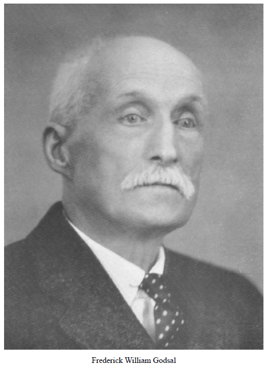
Frederick William Godsal
1853 – 1935
Reported in The Canadian Alpine Journal Volume 23, 1934/5. p.80-83.
By Arthur Wheeler and Stanley Mitchell
From the Governor-Generalship of Lord Tweedsmuir to that of the Marquess of Lorne seems a voyage to another world. Into the Canadian World came Frederick W. Godsal. As a boy at Eton he had been one of the delegation to offer the school’s wedding present to Princess Louise and in 1882 he came to Ottawa as guest of the new rulers at Rideau Hall. Born September 6, 1853, he was the son of the late Phillip William Godsal of Iscoyd Park in Shropshire. He was educated at Eton, Christ Church and Oxford, where he was a distinguished rowing man. Late rh tried coffee planting in Ceylon, but coffee was coming to its end in that country, and Canada opened its doors. It was the marquess of Lorne who persuaded him to venture to the western foothills, which seemed to him a wonderful cattle country. On his return from his western journey, he was entertained at luncheon by the Manitoba Club of Winnipeg and told the members how greatly he had been struck by the mountain country, and that an Alpine Club should be formed. Probably few knew the Marquess of Lorne was the first to suggest the creation of an Alpine Club of Canada. The Canadian Pacific Railway was not yet being in the west and travel had to be made through the United States to Fort Benton and thence on horseback into the country that is now the province of Alberta. Godsal stayed at Fort Macleod, where his lifelong friendship with Colonel Macleod and his family began, and took up land between the middle and south forks of the Old Man River, to which he gave the name Cowley. He well remembered the first appearance of a lawyer in the western country: what there was came from the United States. Canadian currency only came into use on arrival of the railway. As the country became more settled, Godsal acquired a 20,000-acre lease in the Pincher Creek district, fenced in 4000 acres and began to improve his stock. In 1883, he was largely instrumental in forming a stock association to guard the interests of the ranchers, which later became the Western Stock Association. He also introduced the Australian fence, now in general use. He was a life member of the Canadian Forestry Association. “Russian poplars were among the trees I grew at my ranch in Alberta, but have our experimental farms introduced elms from Experimental Farm, but not Turkestan one, I think.” Wrote Mr. Godsal to the Forestry Magazine. He elsewhere writes: Every tree and shrub was planted by my own hands.” And again” “Professor Macoun (late Dominion Naturalist and Botanist) used to be one of my guests at the ranch in the early days. Oh how much suffering and loss would have been spared since, if attention had been given to his statement to me, that the small sage growing among the bunch grass on our prairies indicated that we were in the arid belt. ‘It will only grow in an arid climate,’ said Professor Macoun. Some twenty years ago, he disposed of his holdings to the Doukhobor Colony and retired to Victoria, where he made his home. He often paid visits to the prairie and mountain country to see old friends and breathe the bracing air. He was an ardent lover of travel. When visiting New Zealand he made great friends with Sir James Hector, who was on his way to visit at Cowley when recalled by the illness of his son. He joined the Alpine Club of Canada in 1909 at its Annual Camp, held at Lake O’Hara, and always regretted he had not been an original member. He was a keen climber and a great lover of the mountains in all their aspects. One climb he liked to recall from the vermillion Camp, in 1912, he set out to climb what is now known as Mount Stanley (Mitchell), with J.D. Paterson, Stanley Mitchell and Godfried Feuz as guide. There was no difficulty and the party decided to traverse the mountain, returning by a long, rocky arete that looked interesting. Interesting it was. The rock was terribly rotten. Progress was necessarily of the slowest, and the glacier at the end was only reached in sufficient daylight to cross it in safety. Off the glacier in darkness was complete, the country was quite unknown and the party must stay where it was until dawn. Food had all been consumed, but there was plenty of water; far above tree line, there was no chance of a fire, but in summer dawn comes early in the mountains. Godsal was particularly interested in the mountain areas of the Livingston and High Rock ranges in Southern Alberta, in which he had frequently made explorations. Crowsnest Mountain and Pass held his special interest, and he was acquainted with and would relate on request the local, but erroneous, tradition that was supposed to apply to the mountain. James White, F.R.S.C., in his “Place names in the Southern Rockies” says: Crowsnest “does not commemorate the slaughter of Crow Indians by the Blackfeet when they got them in a corner or ‘nest,’ as set forth in local tradition, but merely by the nesting of crows near the base of the peak. Name first appeared on the Palliser Expedition map. In a map accompanying Palliser’s preliminary report (June 1859), it is named Lodge des Corbeaux.” He had a most kind heart and it was told that in his younger bachelor days he used to give delightful children’s parties and in his later days was most unselfish in visiting and cheering up his sick friends. For many years he was a strict vegetarian, and attributed his excellent health to that rule of life and to the regular exercise he took in walking, an exercise which he had a very great liking and continued almost to the end. He was a staunch churchman and enthusiastic about the British Israel movement. His ideals were high and he strove to carry them out. He will be greatly missed in the Annual Camps of the Club, of which he had so many happy memories. He passed away peacefully at his home in Victoria on Sunday, October 13, 1935. The Club extends its sympathy to his widow, living in Victoria, and his surviving brother, Major William C. Godsal of Haines Hall, Berkshire, England.
Frederick William Godsal.
Mrs. Charlotte J.B. Hadow
Reported in The Canadian Alpine Journal Volume 23, 1934/5. p.84.
By Fred Maurice
The Vancouver Island section reports with deep regret that Mrs. Charlotte J.B. Hadow passed away in England on the 22nd October, 1935. Mrs. Hadow was one of the early members and in addition to being a strong supporter of the local section she was one of the keenest and most successful photographers. Just prior to her departure for England, six months before her death, she made a gift of money to the section, which enabled us to line the inside, paint and complete the Hut. We were looking forward to her return to Victoria in November and the news of her death on the eve of her return journey leaves us with a sense of great loss. The section will remember Mrs. Hadow with affection and gratitude for her generous contributions to the hut at the Lake of the Seven hills.
1936
ACCVI executive:
Chairman – Claude Harrison
Vice-chairman – William Dougan
Secretary-treasurer – Audrey Hadow
Treasurer – Thomas Goodlake
Outings – Claude Harrison
Executive Committee –Robert McCaw, Edith Wilcox, Muriel Aylard, Fred Maurice, William Dougan
Events:
January 26 – Club trip to Mt. Work.
February 23 – Club trip to Redflag Mountain.
February – Week-end trip to the hut at the Lake of the Seven Hills.
March – Week-end trip to the hut at the Lake of the Seven Hills.
March 27 – Club’s 30th annual banquet held at the Empress Hotel.
April 10-13 – Easter week-end trip to the Lake of the Seven Hills.
June 6-7 – Club trip to Mt. Maxwell.
June 20/21 – Mystery Outing (Saturna Island).
August 22/23 – Club trip to Mt. Arrowsmith.
September – Club’s annual camp at the Lake of the Seven Hills.
October 25 – Club trip to Bluff Mountain.
Section members who attended the ACC general summer camp at the Fryatt Creek: Ethne Gale [graduated on Mt. Belanger], Rex Gibson, Mark Mitchell, Edith Wilcox, Eleanor “Nora” Piggott, Muriel Aylard, Aileen Aylard, Dorothea Hay.
History In the Hills
Reported in The Daily Colonist Sunday January 12, 1936, p.27.
By Robert Connell
Years ago a great Austrian geologist, Suess, published a book called ‘The Face of the Earth,’ and only the other day a pair of British authors gave us ‘The Face of Scotland.” And what I am trying to do in such of my articles as deal with the surface geology of our Island is to present various aspects of its face. It’s a good analogy, though like all analogies, not to be overworked. The human face is a record of life, of growth, development, change, experience, joy, suffering, struggle, ease; all that good or evil, or the mixture of both that the best of men and women have confessed, goes to make up the reaction between the man as he “stands at gaze,” a living soul, and the circumstances that meet him and mark him between the cradle and the grave. It has always been recognized that “care will make a face,” that “ill may a sad mind forge a merry face,” that “there’s no art to find the mind’s construction in the face,” even though in the crowd we may say with Wordsworth, “The face of every one that passes by me is a mystery.” So the earth bares on its face the record of its history, the scars and wrinkles, the shrunken places and the gaunt ridges, wrought by the external forces of Nature in Time upon her handiwork in the never-resting crust. Yet for thousands of years men, while they looked upon the earth’s face, saw it so superficially that they misread it, or at best saw only the aspect of their own day and had no inkling of its history. This is true of men generally, though there were scholars in ancient Greece who had given up the idea of a fixed and permanent earth with unchanging mountains, plains, rivers, lakes and seas, and who had the “knowledge of the conversion of the sea into land, and of land into sea again, as explaining the occurrence of marine shells in inland rocks; of the gradual reduction of hills to plains; of the scooping out of valleys by floods, and the carriage of the waste to the sea, and the gradual alteration in the earth’s surface by the formation of new land.” Nevertheless, there are many people who have never got as far as Pythagoras in their conceptions of the earth’s crust. Just as it is intellectually difficult, situated as we are, to think of the earth’s daily rotation on its axis, and the most natural thing in the world to think of the sun’s rising and descent as the reality of daylight and darkness, so it is almost as inevitable to think of mountains and valley gorges as the result of great and sudden catastrophes by which the earth’s crust has been thrust, torn and jagged, thousands of feet into the air or split asunder to amazing depths and widths. But a scientific consideration of the facts open to us show that while catastrophes do occur and have occurred, they are very limited in their extent and effects compared with the slow and almost imperceivable forces acting around us and over vast periods of time.
New Shores and Old
Taking Victoria as our point of view, we notice that for some miles around it as well as in the city itself the average level is not greatly above the sea. Much of it is irregular, but there are also areas that might almost be called plains, such as the broad valley extending from Shoal and Oak Bays towards Mount Tolmie, which, contracting between that hill and Oak Hill, again widens out towards Cordova Bay. It gradually rises to the north from just above sea level to 100 feet between the hills, or about 100 feet in three and a half miles. From Lansdowne Road to Gordon Head is another plain about three-quarters of a mile wide and from 100 to 200 feet high. These are easily accessible examples of the general broad sweeping valleys or plains that occur about us, all of which are of the nature of “raised beaches,” or sea bottoms elevated above sea level, shown by their fossil shells and their more or less stratified materials. The drainage of them by streams like Bowker Creek has only slightly altered their contours, and near the sea, especially where they stand higher above Dallas Road, the raised beach appearance is very striking. But while these comparatively low-lying areas represent a condition reached by the elevation of the sea bottom, there exists below them an older land surface with a more complicated history. In The Colonist of Sunday, December 8, last, there is an excellent photograph of the fine sweep of coastline west of Clover Point. Now at low tide, at the most distant part of the shore, just below the neck joining the old riffle-butts to the main coastline, a rocky shore appears which extends right round the Point to the Ross Bay side and reappears further west beyond the Park. The rocks above high water have the glacial drift resting upon them, and it is easy to see the newly exposed surfaces from which the clay has been removed by erosion. The outcroppings of the underlying rock is responsible for all the headlands around our shores, just as its absence, with the consequently unprotected position of the intervening cliffs, high and low, of loose or unconsolidated material is the reason for the numerous beaches along the shore. The rock appears offshore in the form of islets and rocky ledges, sometimes submerged, like Brotchie Ledge or the Glimpse Reefs between Holland and Finlayson Points, dangerous to navigation. Inland it is covered by the drift concept where it rises through it, as at Beacon Hill, the three hills to the east of which Gonzales is the central one, Government House Hill and Smith’s Hill.
Beyond The City
Beyond the city the most conspicuous of the rocky hills are, of course Mount Tolmie and particularly Mount Douglas, or Cedar Hill, to give it its old time-honored name. But there are many others of lesser height such as Christmas or Lake Hill, Oak Hill, Knockan Hill above Wilkinson Road, and the low hills on the Esquimalt Peninsula. Farther north, in Saanich, Lake and highland districts, are many rocky eminences of which Little Saanich Mountain (now unpicturesquely called Observatory Hill), Bear Hill, Mount Newton and Big Saanich Mountain (now called Mount Work), are the chief. All of these, rising above the level of the surrounding lowlands like islands above the sea, are what are known to geologists as “monadnocks,” [an isolated hill or ridge or erosion-resistant rock rising above a peneplain] from the name of the mountain of this character in the eastern States. They represent the higher portions of the old bedrock which before the glacial period had been worn down to sea level by the operation of the long-continued forces of atmosphere, heat, cold, chemical action, rain, rivers and probably the sea whose action may be seen in numerous wave-cut gullies along the present coast which pass under the covering of drift. Then in the Age of Ice the grinding and cutting, smoothing and polishing action of the moving ice-cap, with its abrasive armament of material, coarse and fine, derived from the rocks over which it passed or which fed it, still further modified the worn-down lowlands, with their monadnocks, by grooving, striating, scratching and polishing before their final smothering under the debris of the melting ice front.
The Ancient Plateau
Let us pass from our immediate neighborhood, with its shorelines on the framework of older ones and its lowlands doted with “islands” of ancient rock rising from an older lowland; and let us first look westward to where the skyline is cut by the long ridge of the Sooke and Goldstream Hills. The average height of this ridge above sea level is about 1,500 feet, and it is to be noted that only at the western end, where the shoulders of the more isolated heights like Buck Hill rise, is there any noticeable variation, and thus the summit of Empress Mountain, between six and seven hundred feet above the average elevation, but standing well back from the front hills, is seen as a rocky cone breaking the somewhat monotonous outline. If, now, you climb to the summit of Mount Braden, 1,533 feet, and look across the landscape north and west, you will see that you are standing on an elevated plateau of which there remains only the isolated mountain summits with occasional broad areas between. The summits are characterized by their comparative flatness, and not infrequently on them will be found shallow hollows in which water collects in the rainy season. This ancient plateau is cut by valleys older than the Ice Age, and these valleys reveal the secret of the manner in which the earth’s crust is worn away and the loftiest mountain ranges planed to sea level. If you have driven or, better, been driven over the road to Jordan River, you may have noticed on your right a long steep wall of rock notable for its height—2,000 feet at the east end, 2,900 at the west—and for its apparently unbroken top. Trap Mountain, its precipitous cliffs form one side of a V-shaped valley, separating it from a small isolated block. The flank towards the road and the sea is steep but hardly precipitous, though practically devoid of trees, so that its ascent is a real rock clamber. When the summit is reached it is found that the summit is broad and plateau-like, with wet, swampy hollows, where the beautiful blue gentian grows and where in the dry weather of late Summer the deer drinks from basins pawed by them in black peaty soil. Here we have a ten-mile-long section of the old worn-down land surface of the Sooke Hills, cut by cross valleys and sloping gently towards the southeast.
On Survey Mountain
Follow the Sooke River to where, at Leechtown, it receives from the East Wolf Creek and from the West Leech River. A few miles up the latter is the North Fork, and pursuing the trail up its east side you come to Survey Mountain, to the summit which the trail leads. Here over 3,000 feet high you look across the ancient plateau and see its forest clad irregularities lost in the general uniformity of level of the hill summits. Here and there a loftier one rises, corresponding to monadnocks already described, but particularly along the skyline is noticeable that what seems like a sea of hills resolves itself into a prairie-like contour. To use the words of Archibald Geikie in describing the similar phenomenon in the Scottish Highlands, “when you have followed the undulations from north to south, all around the horizon, does it not seem to you that the mountain-tops and ridges tend somehow to rise up to a general level, that, in short, there is not only on the great scale a marked similarity of contour about them, but a still more definite uniformity of average height?” And if, as the great geologist goes on to point out, you were to see the sea-fog creeping into the valleys and filling them with the average height, it would “stretch out as a white phantom sea, from which the highest eminence would rise up as little islets.”
The Wasting of The Rocks
This old worn-down land represented by the isolated ridges and broad hilltops has in turn been cut, as I pointed out before, by numerous valleys which have been cut by water through the various rocks of our end of the Island. Running water is the great final agent in the work of denuding or wearing down a land surface. But before its work becomes really effective, other agents have to be at work. The air supplies oxygen and carbonic acid gas, and these are dissolved in the rain water which penetrates the rocks by the innumerable cracks and fissures in them. They proceed to break down and decompose the rock. This work of reducing the solid matter of the earth’s crust to soil as the last stage is greatly assisted, too, by the changes of temperature, which causes expansion and contraction and thus breaks up the surface. Water freezing in cracks and crevices acts as a powerful wedge to shatter large masses. Various complex chemical changes take place in surface rocks particularly, which weaken them in their resistance. There thus accumulates on the surface a layer of soil differing in degree or fineness as it nears bedrock. In hot, moist countries like British Guiana this soil, when permeated with water, often flows slowly down slopes after the fashion of a glacier. Hence the movement is called “pseudo-glacial” or false glacial. Bedrock or residual soil is not often meet with on tis part of the Island, but I recall two places where it may easily be seen. One is a bank on the right-hand side of the Sooke Road just beyond the railway crossing at the head of the Sooke Basin, where a greenish basalt is in its upper part changed into a dark clayey soil. The other is on a steep hillside on the way to Durrance Lake, where an andesite is undergoing a similar change. All these processes are together described as the weathering of rocks, and one of the chief effects of glaciation is the removal of the products of weathering down to the hard rock surface, which is then scoured and grooved.
When Rain Falls
When rain falls on a weathered surface, the unabsorbed part begins forthwith to run off along the direction of such slope as there may be. All land surfaces have some slope, and this will usually correspond with the dip, or dominant slope of the rocks. In this way the first streams are likely to run against the “grain,” or strike, of the rocks, since that is always at right-angles to the dip. But as these streams deepen their courses and the valleys in which they run, they will begin to receive water from tributaries more or less at right-angles to them. Thus these secondary stream will tend to run along the strike or grain of the rock, and to them the line of least resistance will be more likely to coincide with the structural weaknesses found lengthways of folds such as great faults, shearing and crushing of the adjacent rocks, or the extended edges of bed of comparatively soft material. It is true there may be eventually no hard and fast lines in the direction of the river’s valley, and some rivers starting along the strike are found in the lower part of the course running across it, and vise versa. Thus the Goldstream, running east along the soft slaty and schisty Leech River rocks suddenly turns north and enters the sea by the south end of Finlayson Arm, which cuts across the strike of the various rock formations. The Goldstream, in its main course, occupies the western end of a great trench-like valley bounded on the south by the contact between the leech River rocks and the volcanic rocks of the Metchosin series, and is one of a number of paired streams in that valley. Thus beyond the Goldstream is Wolf Creek, running west to join at right-angles Sooke River, while on the other side comes from the west the Leech, whose west fork almost touches at the source Bear Creek, which runs in the opposite direction into Jordan River, which flows westward to receive Y Creek from the east, which again neighbors with its headwaters Loss Lake. The latter proceeds to the west and flows into the Straits of Juan de Fuca.
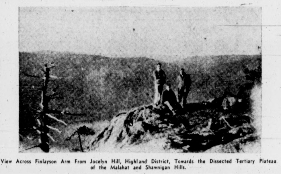
View Across Finlayson Arm From Jocelyn Hill, Highland District, Towards the Dissected Tertiary Plateau of the Malahat and Shawnigan Hills.
Plan Action to Save Grove
Government to Study Course to Preserve Cameron Lake Timber, Delegation Told
Reported in The Victoria Daily Times Wednesday January 29, 1936, p.1 & 2.
The battle of several years standing to save the fine stand of scenic timber at Cameron Lake, known as Cathedral Grove, from being felled by logging operations was renewed before Honorable Wells Gray, Minister of Lands, to-day by a delegation representing the Vancouver Island section of the Alpine Club of Canada. Claude L. Harrison, president of the Island branch, Charles Whitney-Griffiths, Major Colin H. Rutherford, Captain O. Cox, William H. Dougan and Fred Maurice, composed the delegation. They said they received a sympathetic hearing from the minister who promised to take the matter up with the cabinet right away. “What astounds us most,” said Mr. Harrison, “was the apparently small effort that has been previously to save this valuable scenic timber. The government, the delegation was told, had been unable to get any assurances from the owners of the timber, which is a crown grant that it would not be cut.” The alpinists discussed with the minister a suggested line of action for the government to save the stand. Either negotiations should be commenced for an exchange of other timber limits in the province, or the company would be asked to set a price on the grove with a view to possible purchase.
Natural Asset
The Alpine Club’s resolution was presented by Mr. Whitney-Griffiths. It stressed the value of the grove as a natural asset and urged the government “to take immediate steps they know to be necessary to have this grove brought under their control, so that it may remain permanently unspoiled for all time for the enjoyment of not only ourselves but all people from all parts of the world.” Mr. Whiteny-Griffiths said: “The loss of this grove to the tourist trade alone cannot be estimated and it is true Vancouver Island cannot well afford to lose this valuable attraction to visitors, as it is a big drawing card. No government in office can escape censure for neglecting to protect the public interests where this can be done without adding to the heavy financial burden. No other grove of timber in British Columbia has been so well advertised and a deep love and pride is aroused in all Canadians who visit this forest.”
West Coast Park
The delegation also presented a resolution urging the government to interest itself in the establishment of a national park on the West Coast of Vancouver Island. Mr. Gray, they said, promised to go fully into this proposal and indicated it would probably be the subject of negotiations with Ottawa this spring. The proposed park would be along the West Coast south of the Alberni Canal, to Port Renfrew, stated to contain “beautiful sandy beaches, picturesque rock formation and magnificent timber.” The larger part of the are ais crown lands, it was said.
Mount Arrowsmith is Suggested as a Climb
Reported in The Daily Colonist Saturday February 15, 1936, p.8.
Although not committing itself, the Vancouver Island section of the Alpine Club of Canada, through its official organ, The Ground Sheet [the section’s newsletter], shows a sympathetic attitude toward members’ requests that a trip be made this year to Mount Arrowsmith. “It is encouraging to hear a demand for an expedition on one of our island snow peaks. It should be this section’s first business in life to take the lead in opening up our splendid mountain and forest areas” the editor notes, adding that it was the Vancouver Island section, under Claude L. Harrison’s leadership, that entered the Forbidden Plateau in 1928 and paved the way for its now recognized importance as an island holiday resort, says the article. The outings list for the next two months is published in the same issue, including the following: Sunday. February 23, Redflag Mountain, leaving Bastion Square, 10 a.m.; a week-end in February and another in March, at the Hut, and the usual four days at Easter; one Saturday half-day trip and two Sundays.
Praise Given for Efforts
Reported in The Victoria Daily Times Saturday February 15, 1936, p.19.
Praise to the public service and publicity committee of the Vancouver Island section of the Alpine Club of Canada has been extended by Thomas Goodlake, editor in the February edition of The Ground Sheet, monthly publication of the club, for the fine effort made by them in attempting to secure the preservation of the Cameron Lake Cathedral Grove. A deputation from the Alpine Club headed by Charles E. Whitney-Griffiths interviewed Honorable Wells Gray, Minister of Lands, in this regard on January 29. Other past activities during the month of January are given in The Ground Sheet. Outings from February to Easter planned by the club are: February 24 at 10 a.m., Red Flag Mountain; March 8, 9:35 a.m. mountain north of Twin Lakes; March 21 and 22, camp at the Lake of the Seven Hills; March 28, 2 p.m., Mount Helmcken; April 10 and 13, Easter camp Lake of the Seven Hills. The summer camp of the club will be held as usual at the Lake of the Seven Hills, commencing either June 27 or July 1. The exact date will be given about April 1.
Winter Sports
Victoria Party Enjoy Trip to Mount Becher
Reported in the Comox Argus Thursday February 27, 1936, p.8.
Vancouver Island Coach line bus from Victoria brought 13 people to Mrs. Mary Wood’s lodge on Mount Becher for a week-end in the sunshine and snow. They arrived on Saturday after the fall of snow on Friday had influenced some of them to cancel the trip. The fresh snow, however, made skiing excellent. Mr. Clinton Wood has laid out a ski run from the edge of the timber to the lodge. If you can get round its curves and over its undulations without spilling you are an entered apprentice in the art. But in front of the Forbidden Plateau Lodge, he is planning a much longer and more ambitious slide. On this not only the tyros found a thrill. The visitors tried their skills with the skies. They were made very comfortable at the lodge by Mrs. Wood, and served with meals that would have been a credit to any holiday resort on the island, although everything had to be transported to the 2,000-foot level. On Sunday morning, most of the party with Len Rossiter as guide set out for Mount Becher, and spent most of the day in the snow on the slopes. They went back on the stage on Sunday night after a most happy day.
Plenty of Thrills
A local party—most of them skilled on the long blades, went up road. Some of them made the cabin at the top—others contented themselves with trying the runs at the lodge and going part way up the trail to Mount Becher. They had plenty of hard work and thrills. They were all the guests of Mrs. C.S. Wood for luncheon where a full course dinner from soup to ice cream was served. Coming back was for them, perhaps the high light of the trip. Four of the party did some fancy ski-joring behind Mr. Roger Schjelderup’s Ford truck. They came zooming down the grades at twenty miles on hour on skis towed by the car, with plenty of spills. The whole of the people at the lodge have become adept on skis. Not the least skillful is Gavin Wood, a youngster of six, who comes down both the little and big slides without a spill, managing his skis like a champion.
Mountaineering
Reported in the Comox Argus Thursday March 26, 1936, p.2.
Now the Puntledge Bridge [also known as Qwilt’s Bridge because of nearby Thomas Qwilt’s sawmill in Bevan] is closed to traffic, the old caterpillar grades have to be climbed again. Last Saturday [March 21] a party of four, Captain George H. Ash, Dick Idiens, Mia and Roger Schjelderup, started the climb at four in the afternoon. After a long, hard trip, made mainly on skis, they arrived at Becher Cabin at midnight—eight hours climbing, the majority of it in the dark. However, they were rewarded by a fine day of skiing on Sunday, the surface being in good condition. Misses Peggy Watt and Katherine Capes and Mr. Sid Williams went up on Sunday, the former on snowshoes and the latter two on skis. Sid had the misfortune to break one of his skis while on top of Becher.
Local Mountaineers Celebrate Founding of Parent Society
Vancouver Island Section of Alpine Club of Canada, at Annual Dinner, Receives Message from Founder and Honorary President
Reported in The Daily Colonist Saturday March 28, 1936, p.2.
Celebrating the thirtieth anniversary of the organization of the parent society, and following their usual custom of meeting on the same evening, as other local sections of the body throughout the Dominion, to hear the annual address of the honorary president and founder, Arthur O. Wheeler, the Vancouver Island section of the Alpine Club of Canada held its annual dinner at the Empress Hotel last evening [March 27]. With the chairman of the local section, Claude L. Harrison, in the chair, and more than thirty-five others, including some of the charter members of the section, present, the function was marked by the customary good fellowship. Mr. Harrison, in welcoming the guests, briefly touched on the past year’s activities, and announced that the usual camp would be held this Summer at the Lake of the Seven Hills, where members would have an opportunity to train for the more strenuous activities of climbing, with the main camp in the Rockies. The local section had been well represented at last year’s camp, in this connection special reference being made to the work of Miss Edith Wilcox and Fred Maurice.
Other Greetings
Among the greetings read, in addition to those from Mr. Wheeler and the honorary secretary of the parent society, Stanley H. Mitchell, was one from the president Andrew Sibbald, definitely announcing that the camp in the Rockies this Summer would be in the Mount Fryatt region. Miss Audrey Hadow, the secretary, read messages from the Edmonton, Calgary and Vancouver sections. The toast list was brief, Fred Maurice proposing and Lindley Crease responding to “The Alpine Club of Canada.” Mrs. McCaw, gave two warmly -appreciated vocal solos.
Founders Message
Mr. Wheeler’s address, read by Mr. Robert McCaw, was as usual, in reminiscent vein. He recalled that it was March 28, 1906, just thirty years ago, that a committee met in the Y.M.C.A. at Winnipeg to draft a constitution for an Alpine Club. He had, at the time, addressed the Canadian Club of Winnipeg at a luncheon and announced the club’s formation. During the afternoon a meeting was held to elect officers and discus a programme for the ensuing year, and that evening the inaugural dinner took place. This last event had given rise to the annual dinner held by various sections, when the “good comrades of the mountains” got together to review their experiences among the great peaks, and recall the faces that had meet around the camp-fire circles.
Sends Congratulations
In extending his congratulations and greetings, Mr. Wheeler particularly expressed regrets he was unable to be present at the Vancouver Island section dinner. The Mount Assiniboine camp last Summer, he recalled, was one of the happiest and most successful ever held by the parent club, and congratulations were expressed to the president, Andrew S. Sibbald, and to Major W.R. Tweedy, and other officers and helpers. He, also through the local section, conveyed greetings to the honorary secretary, Stanley H. Mitchell, who was at the inaugural meeting at Winnipeg in 1906, but was now laid aside by ill-health. Discussing the club programme for the coming Summer, Mr. Wheeler announced that the present proposal was to hold the camp in the vicinity of the Fryatt group of mountains near Jasper. This had many points in its favor. The construction of the scenic road through the range from Jasper to Lake Louise would, when finished, open up access to this area for exploration, so that members attending this year would be pioneering in country which was certain to be famous.
Everest Expedition
Hopes were expressed by the honorary president for the success of the Mount Everest expedition. Eventually, he was convinced, the great objective would be mastered. “I feel sure that tonight, in retrospect, we will see the mighty peaks and their icefalls rising from the fields of ice and snow; will hear the roar of the torrent as it foams down its steep boulder-blocked bed; will glimpse the sheen of the blue-green lakelets pictured with topsy-turvey reflections, and smell the aromatic smell of the spruce and the balsam,” concluded Mr. Wheeler in poetic vein.
Love of Nature
This year the Vancouver Island section also had a special message from the honorary secretary of the parent society, Stanley H. Mitchell, the gist of the message, read by Lindley Crease, being that the desire of true mountaineers was not the taking of foolish risks nor senseless rivalry, but the fascination of Nature, the lure of the mountains. “Canada is beginning to be mountain-conscious, to appreciate what the mountains mean,” wrote Mr. Mitchell. “The only way to do that is to stay among them for a sufficient period to absorb the mountain spirit. We justly laugh at people, who cross the continent from Halifax to Victoria in the train and say how they know Canada from shore to shore. Yet those who stay for a day at Banff and a day at Lake Louise and have ‘seen’ the Canadian Rockies are in the same category.”
Annual Club Dinner
Reported in The Daily Colonist Saturday March 28, 1936, p.8.
The annual dinner of the Vancouver Island section of the Alpine Club of Canada, held last evening in the Prince Albert dining-room at the Empress Hotel, was a most delightful function, the formal part of the programme, consisting of the reading of the annual messages from the honorary president of the parent society, Mr. Arthur O. Wheeler; Mr. Stanley H. Mitchell, honorary secretary; and brief speeches by the president Mr. Claude Harrison, and others, being followed by adjournment to the Queen Charlotte Room, where lantern slides of the Mount Fryatt area, sent by President Sibbald, were shown by Mr. Harrison. This was followed by court whist, the winners in which were as follows: ladies, Mrs. Chadwick; consolation, Mrs. George Dean; gentlemen, Mr. Francis Tuckey; consolation, Mr. Charles E. Whitney-Griffiths. Mrs. Claude Harrison presented the prizes. At dinner covers were laid for thirty-seven, round a table charmingly decked with narcissi and mauve stocks. The guests were Mr. and Mrs. Claude Harrison, Mr. and Mrs. Robert D. McCaw, Miss Audrey Hadow, Miss Stephanie Jones, Mr. and Mrs. George Dean, Mrs. Hugh Mackenzie, Miss W. Snape, Miss Ruth Lees, Dr. Anne Norrington, Miss Eileen McPherson, Mrs. Marshall, Miss Betty Tucker, Mr. Francis Tuckey, Miss Hilda Hinder, Mrs. Sylvia Holland, Miss Janet Bell, Mrs. F.G. Aldous, Mrs. A.W. [Hattie] McCurdy, Mrs. Chadwick. Miss Muriel Chadwick, Mrs. Preston, Mr. and Mrs. Arthur Kerr, Captain William Everall, and Messrs. William H. Dougan, Alec Gunning, Fred Maurice, W. Ostler, W. Dunbar, Charles E. Whitney-Griffiths, Lindley Crease K.C.; and W. McPhee. The committee responsible for the able carrying out of the arrangements consisted of Mrs. Harrison, Mr. and Mrs. McCaw, Miss Audrey Hadow, and Miss Stephanie Jones.
Mount Becher Will Be Busy
Reported in the Comox Argus Thursday April 9, 1936, p.5.
Interest in the Mount Becher slopes as a ski ground grows space. Nothing can stop it, not Bevan bridge not the condition of the road to the Lodge. This week-end has seen the Lodge very busy. Major [Rex] Gibson and his party and Major Lowe and his party, all of Cobble Hill, came up and spent several days at the Lodge and on Mount Becher. A party from Alberni came over and more are expected this week-end. Then there’s a bus excursion from Victoria this week-end, 20 places of which had been booked early this week. Mr. Clinton S. Wood has bought six horses belonging to Mr. Mezen of the Courtenay Riding School for summer work. He also announces that definite arrangements have been made to carry the road from the Lodge beyond the Look-out, which will bring it within easy reach of the first meadows and open country.
Skiing On Mt. Becher
Easter Holidays Saw Many in Snow Field
Reported in the Comox Argus Thursday April 16, 1936, p.4.
Despite the cloudy weather the Forbidden Plateau Lodge was full for the Easter holidays. The snow has all gone off the road now and round the Lodge, but in the timber it is still deep. Some of the party found their way to the Mountaineering Cabin and the top of Mount Becher, where they revelled in the skiing, but the majority went as far as the first meadows where there is quite a good ski run for beginners. A local party went up on Sunday [April 12] and came down on Monday. The cabin has been greatly improved, and is now quite warm and comfortable. But it was not good ski weather. It did not rain but the cabin and the slopes above it were in the clouds all the day. Some of the local skiers are waiting to try conclusions with the Hollyburners. Roger Schjelderup who is of Norse ancestry and was brought up on the blades in the interior, was watching a Vancouver youth perform. He almost made the run near the Lookout, but took a nose-dive at the bottom. Roger commented: “You almost made it.” The youth turned to him: “Don’t talk to me, boy, I’m a Hollyburner!” So now the local skiers want to see some more performers from Grouse Mountain and Hollyburn. Some are expected up this week for the upper slopes. The weather has been ideal since Monday. Bright skies to give clear views and just a touch of frost at night to make the run fast. This year the Mountaineering Club has in mind the cutting out of a slide behind the cabin. It would not take very much labor if done systematically, and there would then be a slide for toboggan and ski that would satisfy anyone without having to climb to the higher slopes.
Bevan Bridge is Now Open
Reported in the Comox Argus Thursday April 30, 1936, p.8.
Bevan Bridge is now officially open for cars while repairs are going on under the supervision of the Provincial Government. Some of the most enthusiastic skiers of the Mountaineering Club went up to the cabin on Sunday [April 26]. The snow has gone as far as the Lookout and above it the trail is frozen hard so that hikers not used to skis can get up to the top without floundering among the trees on the trail. The snow at the cabin has shrunken by half. On the top of Mount Becher, the ski runs are still good though in the middle of the day they are rather soft and wax is needed.
Highest Peak on Vancouver Island
According to Latest Survey This Is on ‘Rooster’s Comb’ Ridge South-West of Buttles Lake
Reported in the Comox Argus Thursday May 14, 1936. p.1 & 4.
In the topographical and subdivisions report of the Provincial Department of Lands, Mr. Norman C. Stewart makes the interesting announcement that “an unnamed peak near the headwaters of Wolf Creek, Strathcona Park, has an altitude greater than any other so far recorded on Vancouver Island. The range was named by Colonel Reginald Thompson who made the original survey of Strathcona Park “Rooster’s Comb” and it’s never been climbed. This is a statement, very interesting and little surprising to climbers and mountaineers on Vancouver Island. According to the old surveys Victoria Peak with an altitude of 7,848 was the highest with Elkhorn Mountain second, 7,240. According to the new reading the Rooster’s Comb is 7,215 feet but the other heights have been revised to come closer to the 7,000-foot mark. Mr. N.C. Stewart was the surveyor in charge mapping the Forbidden Plateau and Glacier areas. His report is very interesting to those who climb the mountains behind us. As a result of his survey and recommendations of local organizations, most of the prominent features of this little-known terrain have now been named. “The party consisting of William J. Moffat B.C.L.S., assistant; Alfred G. Slocomb, instrument man; and four men including a cook, was organized at Courtenay on July 3rd and 4th.
Mostly Mountains
“The area to be mapped was photographed by the Royal Canadian Air Force in 1931. We were instructed to obtain sufficient ground control to map the area at 1-mile scale, with contours at 100 feet intervals. We found area to consist of two main divisions: first, coastal plain 8 to 20 miles wide along the Strait of Georgia; and second, a hilly and mountainous area from the coastal plain to and beyond the westerly boundary of the area to be mapped. For control in the coastal plain we ran traverses, these being controlled at frequent intervals by triangulated points. In the mountainous section control was obtained by ground photography from triangulated vantage points. In both sections aneroid readings were used to supplement triangulation and photography for obtaining altitude. Our first work consisted of locating and erecting signals at points to control the traverses and to renew the signal on Mount Washington, this triangulation station being visible from most of the area. We established another pivot station on a hill north of the 50th parallel and not far from Forbes landing. This station which we called Forbes, is visible for many miles in every direction. Logging operations cleared off the south end of the hill, making it admirably suited for our purpose. Considerable work will be required, should this station be used for an extension of the triangulation northward. We also used the Forestry Lookout at Upper Campbell Lake as a triangulation station; from it we saw the cairns on Mount McBride and Elk Mountain, established by Leroy S. Cokely, and cairns of unknown origin on Elkhorn Mountain and Crown Mountain. After completion of preliminary work near the coast we moved from camp at Shelter Point to Upper Campbell Lake where control by phototopographical methods were commenced. From this place, two points on the 50th parallel were to the triangulation net—one near the 16-mile post and the other near the north-east corner of Strathcona Park. Moving to Buttles Lake, Mr. Moffat occupied McBride and Elk Stations, and established another south of the mouth of Phillips Creek, while Mr. Slocomb and I established a number of stations on the mountains extending from Upper Quinsam to vicinity of Alexandra Peak, returning via the headwaters of Iron Mine Creek to Upper Quinsam Lake where we joined Mr. Moffat. After a few days of work at Upper Quinsam Lake we moved to the Campbell River Road and thence to a camp near the mouth of the Oyster River, from which camp all the work on the flat area was completed, and “fly-camp” trips were made to Mount Washington, Quinsam Lake and Loon Lake. We also established control on the south end of Quadra Island, a small portion of which comes in the map sheet.
Land Of Many Streams
“The mapped area contains the drainage system of the Tsolum, Oyster, Quinsam and part of the Campbell River. As already mentioned, two distinct types of country are found—the coastal plains, very uniform in appearance but actually broken by minor ridges and depressions, and the hilly and mountainous section to the south and west. The mountains attain an altitude up to 7,000 feet; the higher one not entirely free of snow during the summer and on many there are glaciers. An outstanding feature of this area is the magnificent lakes, including Upper Campbell, Upper Quinsam, Wolf, and that gem of lakes, Buttle Lake. Logging operations have been carried on for many years in a big way, so that now most of the coastal plain is denuded of its forest wealth. The logged area covers approximately 150 square miles. Large stand of excellent merchantable timber, privately owned, still remain south and west of the logged area. Two companies are cutting this: the Elk River Timber is working in the vicinity of Gooseneck Lake, Campbell River and Quinsam Lake with headquarters at Echo Lake, and the Comox Logging is operating in the vicinity of Cariboo Creek and towards Loon Lake, with offices at headquarters.
Old Mining Works
“There was no prospecting in this area during the summer, but evidence of a mining activity of many years ago was seen in various places. Two claims on the north side of Upper Campbell Lake show mineralization, chiefly of copper, and indications of the same mineral were noted on Greenstone Creek about 3 miles north of Upper Campbell Lake. On the south-east side of Upper Quinsam, we saw Iron Hill, estimated to contain 1,700,000 tons of iron ore. Dr. Alexander Gunning, in his report suggests that the strip of country 3 to 4 miles wide extending from Upper Campbell Lake through Upper Quinsam and south-easterly to vicinity of Mount Albert Edward is worth prospecting. He also mentions an arsenic deposit near Wolf Lake.
Game Was Plentiful
“Game is plentiful, especially deer and blue grouse, the season being exceptionally good for the latter, for berries grew and ripened in profusion. Other varieties encountered were bear, cougar, beaver, ptarmigan, ducks and geese. Marmots were seen on Mount Washington. A few wolves have been reported in the area. However, this district is chiefly known for game-fishing: along the coast the salmon fishing is world famous and excellent catches of cut-throat trout were made at the mouth of the Oyster River. Large numbers of spawning salmon were seen in rivers, especially the Tsolum and Oyster. Dolly Varden, rainbow and cut-throat trout are plentiful in Buttle, Upper Campbell and Upper Quinsam Lakes. We noticed that Kamloops trout with which the Forbidden Plateau Lakes were stocked, are finding their way down-stream, some being seen in the tributaries of the Oyster River.
Roads and Trails
“The Island Highway extends through this map-sheet. It follows the shore-line closely from the Oyster River north to Campbell River. During the fall this highway from Merville to Shelter Point was surfaced. From Campbell River there is a good road to Echo Lake, but from Echo Lake to Upper Campbell Lake the road is not passable. Connecting Upper Campbell Lake and Buttle Lake there is a good horse trail. A trail connects Upper Quinsam Lake with Campbell River road and Gooseneck Lake. We re-blazed an old trail from the Buttle Lake Trail to Upper Quinsam Lake. There is a trail from Headquarters to Wolf Lake. The logged off portion of the coastal plain is interlaced with logging grades, mostly abandoned, except for the main lines of the operating companies. Some of the old grades are now used as roads. At Shelter Point, old grades have been connected so that one may drive inland about 8 miles.
Buttles Lake is Wonderful
“The chief development is in the Merville settlement and in the numerous farms along the coast. There is a general store and post-office at Merville, hotel and post-office at Oyster River, auto camps at Oyster River, Shelter Point, Forbes Landing and at Upper Campbell Lake. Although most of the easily accessible timber has been logged off, there still remains a great forest wealth and this will be the chief resource of the district for many years to come. Agriculture is next to forestry in value, and an extension in this may be expected. During the past two years Mennonites have located in the logged off lands in the vicinity of Black Creek and the Island Highway. We have noticed small areas of good soil in the depressions, and also a considerable area of wet meadow lands, which may possibly be drained and thus afford additional farm land. The expense of putting these lands in production will be great. The logged off lands provide good pasture for cattle and sheep; therefore, mixed farming is best for this district.
Can’t Get to Beauty Spots
“This portion of Vancouver Island has many features which are attractive and entertaining to sportsmen and other tourist, as already mentioned. The scenic attractions are great, but as yet not made sufficiently accessible. Along the coast there is a wonderful view of the straits and islands and snow-capped Coast Range. Elk Falls on the Campbell River are just outside the area. From the Forestry Look-out at Upper Campbell Lake you get a varied and wonderful view of the coast plain, the Coast Mountains including Mount Waddington, and behind you see the mountains of the Island from Mount Washington to Mount Victoria [Peak]. Buttle Lake and vicinity will make one of the finest natural playgrounds on Vancouver Island when made accessible, for it has fine beaches and camp sites, clear water, ideal for boating and swimming, very good fishing and scenery unsurpassed. Already there is a fine lodge at Upper Campbell Lake and another on Buttle Lake, both owned by citizens of the United States. During these past two seasons work it was found that an unnamed peak near the headwater of Wolf Creek in Strathcona park, has an altitude greater than any other so far recorded on Vancouver Island.”
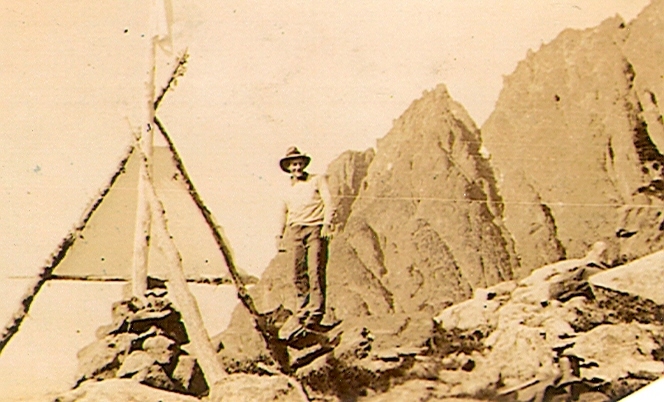
Jack Horbury standing beside a survey station in Strathcona Park 1936 – location unknown – Bill Bell photo.
Highest Peak on Island
Rooster’s Comb Will Be Very Difficult to Reach
Reported in the Comox Argus Thursday May 21, 1936. p.3.
Mountaineers throughout British Columbia will be greatly interested to learn that in all probability, the highest peak on the Island has yet to be climbed. This is according to the survey made by Mr. Norman C. Stewart and his party last year. Colonel Reginald Thompson who mapped some of Strathcona Park called it “The Rooster’s Comb” and while the name my not be very euphonious it is very descriptive. Looking to the west from Forbidden Plateau over the range of peaks there is seen a serrated edge away on the horizon. That is the Rooster’s Comb [The Golden Hinde] and one of its peaks is the highest on the Island according to the latest readings. There are a number of peaks about 7,000 feet in the centre of the Island—Victoria Peak, Elkhorn Mountain, Mount Albert Edward and others. Elkhorn Mountain and Victoria Peak were both given as higher than 7,215, the height of the Rooster’s Comb, but later readings don’t confirm this. The Rooster’s Comb is in very rough country. It is four miles south and 4.33 miles west of Mount McBride, and is near the headwaters of Wolf River, some 12 miles west of Buttles Lake. Wolf River runs into Buttles Lake and it might be approached from that side. From the east side, the Rooster’s Comb appears to be difficult—but no one has been very close to it, and the west may be easy of ascent. The lure of climbing for the first time the highest peak on Vancouver Island should attract a party into this unmapped part of Vancouver Island soon. Elkhorn could be climbed at the same time and the precedence of these two peaks settled, for there is only a few feet difference in the altitude of the crest of the two mountains. The provincial government is considering sending a party to complete the survey of Strathcona Park this year, but nothing definite has been decided.
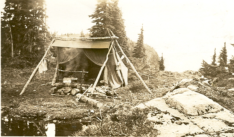
Survey Camp 1.
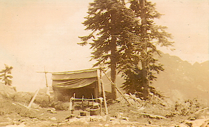
Survey Camp 2.
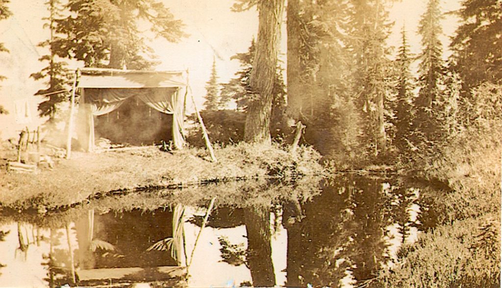
Survey Camp 3.
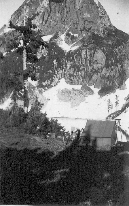
Sites of four different camps located in Strathcona Park and used by the government survey parties in the 1930’s.
Mountaineering
Reported in the Comox Argus Thursday May 28, 1936, p.2.
The first party this season to go right into the Forbidden Plateau consisted of seven members of the local Mountaineering Club. Mia and Roger Schjelderup and Tom Hughes went up the Dove Creek trail to Croteau’s Cabin on Saturday [May 23], taking ten hours. They went off the trail a short distance past Paradise Creek, and travelled by compass over the ridge. Very little snow was encountered till after Camp 6, and not a great deal until after Paradise Creek. What there was of it was very wet and it was going fats. The trail was in quite good shape, but rather wet in some places. At the cabin there was about three feet. Peggy Watt, Katherine Capes, Dick Idiens and Captain George H. Ash came in over Mount Becher, via McKenzie Lake to Croteau’s, and had quite a trip, taking twelve hours. They all had skis except Peggy Watt, but found the snow very wet. Len Rossiter went as far as Wood’s Cabin on McKenzie Lake Sunday evening, making a quick run to Croteau’s Monday morning. Some of the party skied to Brown’s Cabin, Circle [Circlet] Lake and the Cruikshank Canyon on Monday morning, returning to Croteau’s for lunch. They left for Becher at 1:30, and arrived at the Lodge at midnight. Peggy Watt and Tom Hughes returned over the Dove Creek Trail coming out in six hours. Many fresh tracks were seen on the Dove Creek Trail—cougar, bear and deer—some following the trial for miles. “Whiskey Jacks” turned up as soon as the cabin was inhabited.
Mountains in Sooke District
Reported in The Daily Colonist Sunday May 31, 1936, p.20.
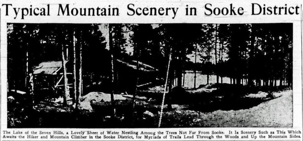
The Lake of the Seven Hills, a Lovely Sheet of Water Nestling Among the Trees Not Far From Sooke. It is Scenery Such as This Which Awaits the Hiker and Mountain Climber in the Sooke District, for Myriads of Trails Lead Through the Woods and Up the Mountain Sides.
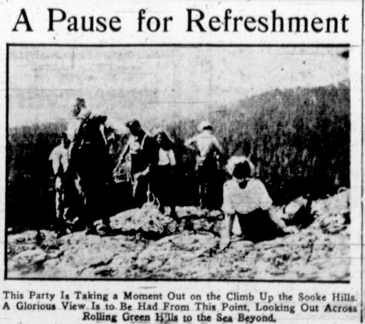
This Party Is Taking a Moment Out on a Climb Up the Sooke Hills. A Glorious View Is to Be Had From This Point, Looking Out Across Rolling Green Hills to the Sea Beyond.
Ski-Running on Mount Albert Edward
Members of Vancouver Club Will Try High Peak
Reported in the Comox Argus Thursday June 4, 1936, p.1.
For the first time the snow slopes of Mount Albert Edward, the giant of the Forbidden Plateau group will have the imprint of skis. It should be wonderful for the pastime. For a mile or more there is an even slope up the head of the 7,000-foot giant without a tree or any other projections to hinder their flight. The three skiers are members of the Vancouver Ski club. They are V. Mahar, A. Anderson and Gordon Keyes. They went up to the Forbidden Plateau Lodge on Monday and spent the night in Mount Becher cabin. They found the snow on Mount Becher sticky and going fast. On Tuesday they went down to McKenzie Lake and from there they propose to push on to Circle [Circlet] Lake for their assault on the big peak.
Mountaineering
Reported in the Comox Argus Thursday June 4, 1936, p.2.
Mountaineers on this side of the Beaufort Range will be interested to know that the first ascent of Mount Arrowsmith has been made this year. The West Coast Advocate tells the story. Eleven members of the Anglican Young People’s Association climbed Mount Arrowsmith over the holiday week-end. The scribe of the party describes the trip in his own words: “We left Alberni at 2:15 Saturday, making the trip to the trail head at Cameron Lake by 3:00 and reaching the cabin in four hours fifteen minutes. The entire party slept in the cabin the first night, being a little dubious of the cold at such altitude. Leaving the cabin next morning (Sunday) at 6:30 with excellent footing in the deep snow, we reached the base of the last peak where two members unfortunately considered the final climb too much for them. The remaining nine climbers reached the cairn a little over a mile above sea level at ten minutes to ten, three and one-half hours after leaving the cabin. The return journey was more leisurely with many of the hikers taking specimens or rock flowers, alpine lichens and moss back with them. The steep, snow-covered slopes made fine tobogganing (minus a toboggan) and saved considerable time on the return. In fact, several of the hikers climbed back up some of the slopes to have another slide. It is unfortunate that the people of Vancouver Island have not been able to take advantage of the excellent skiing to be had on the slopes of Arrowsmith at this time of the year. A little ptarmigan, mottled black and white in keeping with its environment, caused quite a diversion by its tameness, allowing us to approach so close that one of the party was able to take snapshots of it. Two other parties of four and six in number gained the cabin on Sunday and essayed the slopes of Mount Cokely, not having time to attempt Arrowsmith. On Sunday night after the ascent five of the party slept out of doors under the star-splattered sky, the remaining sleeping in the cabin again. All rose at 7:30 Monday morning, did justice to a hearty breakfast, and regrettably parted from our winter wonderland to return to the cars at Cameron Lake. A few of the hardier souls took advantage of the opportunity to go in for a swim. Everyone had an adequate dose of sunburn reflected by the glittering snow on the mountain slopes. We felt that we had spent two days in another world and were thrilled at having been amongst the first to reach Arrowsmith cairn in 1936.”
Mount Maxwell Object of Alpine Club
Reported in The Daily Colonist Thursday June 11, 1936, p.8.
Mount Maxwell, Saltspring Island, was the object of the party of six members of the Vancouver Island section of the Alpine Club of Canada last week-end [June 6/7]. The party left Victoria on Saturday morning. On arriving at Burgoyne Bay, camp was pitched and early Sunday morning in a drizzle that continued throughout the day, the ascent of the mountain was made via the chimney. Some good rope work was offered, and the outing was much enjoyed. Several members intend to going to the annual camp of the Alpine Club of Canada in the Rockies this summer, and are taking every opportunity to train for the strenuous work that will be available there. The Vancouver Island section plans to make the ascent of Mount Arrowsmith the week-end of August 22 and 23, and the annual camp at the Lake of Seven Hills will be the first week of September.
Mountaineering
Reported in the Comox Argus Thursday June 18, 1936, p.4.
When the Vancouver party of mountaineers embark upon their hazardous enterprise of scaling the glittering spire of Mystery Mountain, Bill Dobson will be in the lead. Bill Dobson was in Courtenay as a member of the Royal Bank of Canada staff in the years 1928-29. He was well-known on the tennis court and did some climbing in the Forbidden Plateau Range. Before he came to Courtenay, he was a member of the B.C. Alpine Club and when he went back to Vancouver, he became very active in its affairs. He is now president of the club and the moving spirit in the assault of Mount Waddington. In the hot days of July when climbers on the Forbidden Plateau look north to the great peak, they will have a personal interest in the venture. Mount Waddington is one of the few great peaks unconquered on the continent, and anyone who reaches the top of the pinnacle will have won a crown of glory.
Will Locate Rooster’s Comb
Highest Peak on Island Will Be Climbed this Year
Reported in the Comox Argus Thursday June 18, 1936, p.5.
Mr. Norman C. Stewart, who made the topographical survey for the provincial government of the Forbidden Plateau and Glacier region last year, is back again this year with a party to complete the work. He came up from Victoria this week with four Victoria men, and his total party will consist of eight people, one of whom will be Bill Bell. Mr. Stewart has already established his base camp.
Forbidden Plateau Lodge
Reported in The Daily Colonist Sunday June 21, 1936, p.20.
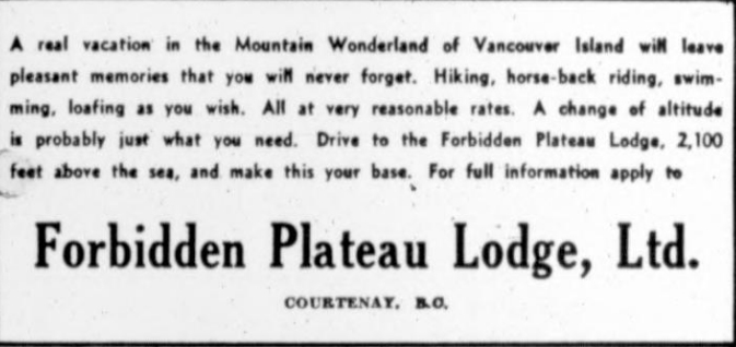
An ad for Forbidden Plateau Lodge, in Courtenay, B.C.
Alpine Club on Mystery Outing
Reported in The Daily Colonist Tuesday June 23, 1936, p.11.
A mystery outing was made by members of the Vancouver Island section of the Alpine Club of Canada over the week-end. Ignorant of its destination, the party left the city by motor at 2:30 p.m. Saturday and was guided by instructions from the outings committee of the section. Within an hour Swartz Bay was reached and a trip to Saltspring Island seemed to be indicated. Instead of boarding a ferry, however, the mountaineers, with their food and bedding, embarked on a launch, which headed in an easterly direction and, passing through a narrow passage between North and South Pender Islands, brought them to Lyall Harbor, Saturna Island. Here camp was made for the night and the evening was spent around a campfire on the beach.
Splendid View
On Sunday morning the party proceeded to Croker Point, on the west side of the island, the lofty cliffs making a climb of several hundred feet necessary in following the coastline. From Croker point ascent was made of the Brown Range, the highest hill on the island, 1,400 feet above Plumper Sound. High cliffs were encountered, as well as steep slopes of volcanic rock which offered scanty hand and foot holds to the climbers. At the summit a fine panorama lay at their feet, Victoria could be seen, as well as the San Juan Islands, the Olympics, the Sooke Hills, Saanich, Saltspring Island, North and South Pender Islands, and many smaller Gulf Islands. The destroyers Skeena and Vancouver could be seen steaming along Haro Strait, to the south. Lunch was consumed near the summit, and return to Lyall Harbor was made via the northeast side of the hill and a two-mile walk along the road. A cool sea voyage brought the party back to Swartz Bay in the gathering dusk after a pleasant and successful outing.
Forbidden Plateau Tour
Reported in The Daily Colonist Wednesday July 8, 1936, p.16.
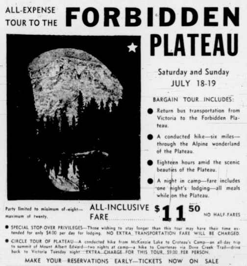
An ad for an ell-expense tour to the Forbidden Plateau, fare $11.50. No half fares.
Big Trout on Plateau
Parties Are Waiting for Set Fair Weather Before Making Ascent
Reported in the Comox Argus Thursday July 16, 1936, p.4.
Is this a record first for the Forbidden Plateau? Lloyd Morgan who is guiding for Mr. Eugene Croteau, caught a 31-inch trout weighing between 10 and 12 pounds in Isabelle Lake recently. The trails have been and are pretty wet into the Plateau, but by this time of the year a few days fine, hot weather would make a very big difference. While the lowlands have been drenched in showers the high pastures of the Plateau have been in cloud. There are quite a number of parties who are only waiting for clear weather to get into the upper air. This year a shelter has been arranged on Mount Albert Edward for those romantic and adventurous souls who want to see the sunrise and sunset from the high spot of the Island. Sleeping bags will be provided if the climber has not one of his own.
On Way to Alpine Camp
Reported in The Daily Colonist Sunday July 19, 1936, p.8.
Misses Muriel and Aileen Aylard and Dorothea Hay stopped at the Half Diamond Dude Ranch at Skookumchuck en-route to Jasper National Park for the annual Summer camp of the Canadian Alpine Club at Fryatt Creek.
Lake of the Seven Hills at Sooke
Reported in The Daily Colonist Sunday July 26, 1936, p.11.
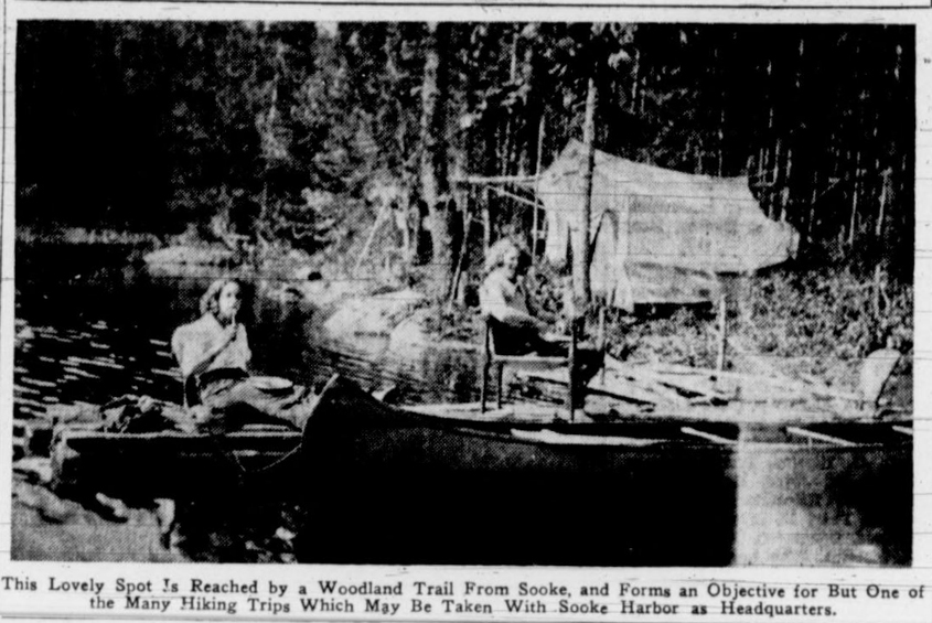
This Lovely Spot Is Reached by a Woodland Trail From Sooke, and Forms an Objective for But One of the Many Hiking Trips Which May Be Taken With Sooke Harbour as Headquarters.
Big Trout Caught in Croteau Lake
Reported in The Daily Colonist Sunday July 26, 1936, p.11.
Word has been received of a magnificent catch made on the Forbidden Plateau which must be the envy of every fisherman who reads. Lloyd Morgan, a guide attached to Croteau’s Camp, took a thirty-one-inch trout from Croteau’s Lake last week. The fish was taken on the fly and gave a hard battle before he was brought to the net. Fish are taking well in the many lakes on the Forbidden Plateau, and the clear, cold waters make them extremely lively, ready to fight to the last for their freedom and giving the fisherman a good chance to test his skill.
Mountain Lodges and Camps
Reported in The Daily Colonist Sunday July 26, 1936, p.11.
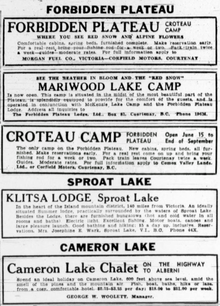
Five ads for various camps: Forbidden Plateau, Sproat Lake and Cameron Lake.
Victorians Do Well at Camp
Miss E. Gale and Dr. W.E.M. Mitchell Climb Mighty Peaks in The Rockies
Reported in The Victoria Daily Times Tuesday July 28, 1936, p.16.
JASPER, July 28—The Pacific Coast has more than a dozen climbers under canvas with the Alpine Club of Canada, now holding its thirty-first annual camp in the spectacular upper valley of Fryatt Creek some thirty-five miles southeast of here. Notable among the climbs made by coast members has been that of the youthful Miss Ethne Gale, Victoria, who was the first woman in camp to scale Mount Belanger (10,200 feet). It was a second ascent of the peak and the first by a woman climber. What made the record somewhat remarkable was that this was Miss Gale’s first Alpine Camp attendance and the peak is a graduating climb. One of the earliest ascents in the camp of rugged Mount Lowell (10,200 feet) was made by H.G. Peckham, Vancouver, and Dr. W.E. Mark Mitchell, Victoria. They spent one night on the mountain in an unsuccessful attempt and returned to conquer the summit two days later. Victoria members in camp include Misses Aileen and Muriel Aylard, Miss Dorothea Hay, Miss Edith Wilcox and Miss Eleanor “Nora” Piggott of Armstrong.
Mountaineering
Rooster’s Comb
Reported in the Comox Argus Thursday August 6, 1936, p.2.
Mount Waddington has been conquered, and Island climbers are now seeking to place a cairn on the highest spot on Vancouver Island, the Rooster’s Comb. If you look out from the Plateau to the west the horizon is bounded by a toothed range very well named the Rooster’s Comb. It is the highest spot in this range that Mr. W. Adrian B. Paul and Mr. Geoffrey B. Capes set out from Buttles Lake to climb. Very little is known about this peak. In his survey of the Plateau country last year, Mr. Norman Stewart found that this point was the highest on the Island. There are a number of peaks over seven thousand feet near and about Strathcona Park; his reading made this the highest. The mountain is set in very rough country. The climber shave gone to Buttles Lake and will go up the Wolf River to tis course. The east side of the Rooster’s Comb is reported to be very difficult, but it is very hard to make any estimate until much closer than any one has been yet. Mr. Paul has done much climbing in the Glacier and Plateau terrain. He was one of the party of three who first climbed the Red Pillar, and he has been on the crest of many other peaks in Strathcona Park. Mr. Capes was climbing in the country at the head of Comox Lake before the Forbidden Plateau was named. The pair left Sunday [August 2] morning and hope to come back via the Plateau if their plans don’t miscarry.
Trails Better to Plateau
Ideal Weather for Visit to Mountain Resort
Reported in the Comox Argus Thursday August 6, 1936, p.2.
Trails are drying up on the way to the Plateau and many parties are going in on foot and horseback. The weather conditions are ideal. In confirmation with the traditions of the British navy, H.M.S. Apollo had not more than dropped anchor before some of her officers were off to the high places on the Plateau. They stayed there some days. The registrants at Mr. Eugene Croteau’s Camp have come from: Little River; Comox; Victoria; Kamloops; Vancouver; Victoria; Duncan; Calgary; Crofton; Headquarters; Dove Creek; Saseemas; Courtenay; Hollyburn; Honolulu; Chicago; Seattle, Washington; Lynden, Washington; Wharton Mellon, Philadelphia; Carmel, California; and Hobe Sound, Florida.
Three Peaks of Rooster’s Comb
And All Look Hard to Climb; First Attempt on Highest Peak on Island
Reported in the Comox Argus Thursday August 13, 1936, p.1 & 6.
The first attempt on the Rooster’s Comb, the highest point on Vancouver Island, has been made. Messrs. W. Adrian B. Paul and Geoffrey B. Capes report it to be in difficult country and from face, at any rate, a very hard nut to crack. Before any serious attempt was made to climb it they think it would require the establishing of a base camp and three days to spy out the best method of reaching the top. The Rooster’s Comb is the highest of three peaks, connected by very steep and narrow approaches. Leaving here on Sunday, the pair of climbers reached Buttles Lake at night and camped on the beach at Wolf River. On Monday they followed the north side of the Wolf River to the North Fork. The going very bad, windfalls and thick hemlock bushes. Blueberries in profusion and mosquitoes in singing thousands. After lunch, they crossed the main river but found the going worse than ever. Some very large cedars and firs. Towards dark, after travelling twelve hours, reached the West Fork and camped.
Going Very Bad
On Tuesday they followed the river with hiking still very difficult, either thrusting through devil’s club and salal on the river bottom or climbing over windfalls on ridges. At noon they descended to a gravel bar on the river where they got the first glimpse of the Rooster’s Comb. They then climbed straight up from the river, every foot of it steep, and thickly covered with brush and windfalls. They finally emerged on to a vast fan-shaped rock and scree slide the bottom overgrown with scrub. A little stream ran down the middle and they made camp here. They could see from here the Comb, Mt. Colonel Foster and El Piveto Mountain. On Wednesday they began climbing in earnest. First up to the top of the first ridge by hanging on to cedar boughs, there being no foot holds. Ahead was another ridge up which they roped part of the way. From the top of the ridge the three Combs looked very forbidding, the second and third being partly hidden behind the first. The connecting ridge between the ridge they were on and the east comb was a knife edge of rock. The Combs as they saw them were thin sloping knife edges and to them, at any rate, impossible to climb. The mountain is circular starting with three foothills on the last of which they stood. Towering above them were the three Combs each slightly higher than the other; below a glacier and snow field, and a lake of vivid blue.
Three Days for Climb
They picked out a route to the higher comb but did not have time to try it. Probably not less than three days would be necessary to find the route. The mosquitoes never left them, not even on the highest points they reached. They returned to camp by a different route, parts of which were very steep and they had to rope. They moved camp to a field, through which ran a large, gurgling stream, taking its source from a snow field below the Combs, and flowing through a slide consisting of rocks as big as houses, the broken fragments of which appeared to consist of every variety of stone. Off to one side was a small meadow, yellow with flowers, and above a limestone mountain, the gentle sloping summit of which was smooth and bare as a sidewalk. As they walked homeward along the stream, it grew smaller and finally disappeared entirely into a round hole about twenty feet in diameter and eight feet deep.
Very Little Game
They returned to Buttles Lake by a different route. The outstanding impression of the country was absence of game—only one deer and martin, with some old elk and bear signs and a few deer tracks. They started home on Saturday morning following an old blazed trail from Buttles Lake almost to the source of the Ralph River. From the junction of Ralph River and Shepherd’s Creek for some miles the going was good. As the result of going over a very heavy bluff they had to do some stiff climbing. They finally climbed late in the evening to the slopes of Mount Albert Edward.
Climbing in Cloud and Rain
On Sunday it rained gently, and they were soon soaked to the skin. Passed mile post 115 of Strathcona Park. Had very difficult time climbing up slopes of Mount Albert Edward in wet brush, clouds and fog. For several hours they did not know where they were on Albert Edward, but finally got out of the scrub at the timber line and lit a fire and dried their clothes. It was cold in the fog with a chill wind blowing. They climbed to what they thought was the summit, only to find yet higher ground. Had glimpse of what they though was the cairn on the top through the fog, but it was quickly blotted out. However, they eventually arrived via the long scree slope at the top. Flowers were very beautiful. Once at the top they followed the usual trail down to Croteau’s Camp where they spent Sunday night, coming out on Monday. There are other local mountaineers who are determined to try their fortunes on Rooster’s Comb this fall if the weather holds good.
Dove Creek Trail is Now Dry
Alpine Party Gone into Strathcona Park; Arrivals at Croteau Lake
Reported in the Comox Argus Thursday August 20, 1936, p.6.
Mr. Eugene Croteau came down from the Plateau on Sunday [August 16] and reports the trail is now dry. Four members of the Alpine Club of Canada, Vancouver Island section, have gone in by Dove Creek for 10 days of climbing in Strathcona Park. Mr. Fred G Maurice is in charge of the party and other members are Miss Edith Wilcox, Miss Kathleen Martin and Mr. Francis E. Tuckey. They have gone over the top of Mount Albert Edward. Twelve Girl Guides from Saanichton in the charge of Miss Ethne Gale had the time of their lives on the Plateau for two days. Captain Alexander Ramsey, Mrs. Ramsey, Miss Jean Ramsey, Mr. D.C. Ellis and Miss Diane Whellams of Kaslo are camped at Circle [Circlet] Lake making sketches and doing some climbing. Recent arrivals at Croteau Lake have come from: Courtenay; Royston; Kamloops; Kaslo; Chilliwack; Duncan; Saanichton; Calgary; Parksville; Vancouver; Victoria; Comox; North Saanich; Discovery Island; Seattle, Washington and London, England.
Mount Albert Edward Popular Climb
Registrations at Croteau Lake
Reported in the Comox Argus Thursday August 27, 1936, p.1.
Recent registrations at Croteau camp on the Plateau included Mr. Hugh Savage, M.L.A. of Duncan, and Mr. J.W. Hough of Courtenay. Jack Hough has long had an ambition to climb Mount Albert Edward. He did on a hot day and left a lot of adipose tissue up there on the pink snow. Other registrants have come from: Saanichton; Royston; Duncan; Courtenay, Denman Island; Comox; Sandwick; Victoria; Vancouver; New Westminster; Richmond Beach, Washington and Pasadena, California.
Rare Ice Caves Found by Guide
Len Rossiter Discovers Freak Formation atop Mount Albert Edward
Reported in The Daily Colonist Friday August 28, 1936, p.1.
Ice caves were discovered for the first-time last week on Vancouver Island high on the shoulder of Mount Albert Edward, by Len Rossiter, widely-known guide, it was reported here last night by Clinton S. Wood, of the Forbidden Plateau Lodge. Mr. Wood said that Mr. Rossiter was with a party last week and while “just looking around,” found the caves. He was unable to say how many there were, but some had entrances eighteen feet high. Mr. Rossiter returned immediately to his base at Mariwood Lake Camp, which is conducted in connection with the lodge, and secured a camera to photograph the caves. Although Mr. Rossiter had been guiding on the mountain for more than six years, this was the first time he noticed the caves. Much publicity is given to the ice caves of several United States mountains, and they are noted as tourist attractions. However, this is the first time any have been discovered on Vancouver Island. Mr. Wood reported an exceptionally good season at the lodge. He said plans were now being made for a series of Winter sports at the Plateau.
Forbidden Plateau Has Gained Fame
Beautiful Area Near Comox Long Neglected by Man—Camps Established
Reported in The Daily Colonist Friday August 30, 1936, p.18.
The Forbidden Plateau, one of Vancouver Island’s most outstanding attractions, holds more then just passing interest, for it holds a unique place in the catalogue of beauty spots on the coast. Walled in by the mountain range, 5,000 feet high, this great tableland was a territory taboo too the Indians of the Coast for centuries. Only medicine men, tried and strong in the ways of magic, could hope to enter the region and emerge unscathed by the spirits supposed to haunt the meadows and hills. The first white men who came here could get no guide to accompany them into the Plateau, and save by occasional trapper or prospector, the Forbidden Plateau was unvisited. Only about twelve years ago were the possibilities it held as a playground recognized and the first camp established. From then until now the fame has spread until it is one of the best-known vacation lands in the country.
Mountain Climber
Literally hundred of lovely lakes lie amid the ranges and natural meadows. Vast tracts are unencumbered by undergrowth, with red and white heather underfoot. For those keen on mountain climbing, there are peaks and summits as yet unconquered, while the fisherman finds ideal sport among the fighting trout which lie in the clear cold depths of the lakes. Horseback riding is a popular way of exploring the miles of open country, and all the while the visitor enjoys the invigorating air of an altitude as great as that of Colorado. The Forbidden Plateau is accessible by two trails. One, leading in via Bevan and Quartz Creek, consists of an old logging railway grade to become a motor road. At the head of this is the Forbidden Plateau Lodge, at an altitude of 2,000 feet, while Mariwood Camp, on the Plateau proper, is connected with the Lodge by a pack trail.
Pack Train
Another trail is constructed from Dove Creek, leading directly to Croteau’s Camp, a distance of twelve miles. The visitor is met by a pack train, and saddle ponies are available for the journey in. The train reaches the top of the Plateau, passing lovely green timber on the ascent, skirting Mount Washington and Paradise Meadows, and three miles further on brings the traveller to Croteau Lake and Croteau’s Camp.
Ice Caves on Mount Albert Edward
Interesting Feature Found on Plateau
Reported in the Comox Argus Thursday September 3, 1936, p.6.
Len Rossiter who has been exploring the Forbidden Plateau area for the past six years, and is now attached to the Forbidden Plateau Lodge Ltd. has found some very impressive ice-caves on the brow of Mount Albert Edward that should prove a considerable tourist attraction in the years to come. Recent registrations at the Forbidden Platea Lodge are from: Phoenix, Arizona; Toronto; Medicine Hat; Santa Barbara, California; Plymouth, England; Palo Alto, California; Victoria; Montreal; Ottawa; Rockhampton, England; Cumberland; Parksville; Sidney; Nanaimo; Portland. Oregon; Vancouver; Honolulu; San Francisco, California; Pasadena, California; Washington D.C.; Dallas, Texas; Seattle, Washington; Spokane, Idaho and New York.
Alpine Club in Sooke Hills
Reported in The Daily Colonist Sunday September 6, 1936, p.10.
The Lake of the Seven Hills at Sooke, for the eighth year in succession is the scene of the annual camp of the Vancouver Island section of the Alpine Club of Canada. A party of members has been spending the week there making expeditions in the Sooke Mountain Park and on the section property, rock-climbing and bathing. The cooking this year as last is in charge of W. Davis, whose meals have become one of the great attractions of the camp. During the week-end the number of members and guests in the party will increase to about twenty-five, many of whom will undoubtedly enjoy the experience of a night on the summit of Empress Mountain, where from a height of 2,187 feet they can see the twinkling lights of Victoria.
Forbidden Plateau Region Has Been Mapped
Survey Branch Has Produced First Authoritative Map
Reported in the Comox Argus Thursday September 17, 1936, p.1.
The Department of Lands recently issued an excellent map, compiled by Mr. Norman C. Stewart and his party, of the Forbidden Plateau and Glacier areas. The map scale is two inches to the mile. It is the first authoritative map to be produced on the mountainous region behind Courtenay. Most of the features are named for the first time; others have been re-named in conformity with the plans of the Survey Branch acting in conjunction with local committees. It has been the endeavor of the branch always to have some good underlying reason for the name adopted. Thus, the big glacier (not the Comox) that can be seen from Comox is now known as the Cliffe Glacier in memory of Mrs. Florence Cliffe and the family she founded. A copy of the map has been mounted and now hangs in the Argus office.
L to R – William Moffat, Dan Harris, Alfred Slocomb, George Colwell, Jack Horbury, Norman Stewart.
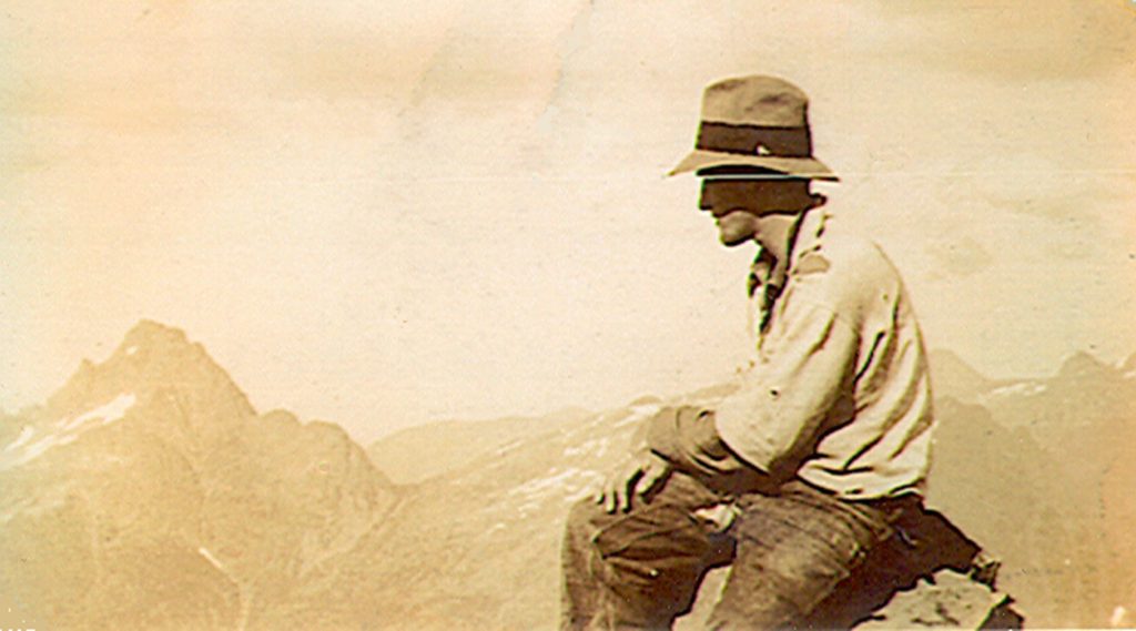
Jack Horbury on the Southeast Peak of Mt. Colonel Foster 1936.
Getting Ready for Skiing
Two Mile Slide Cut Out Near Lodge
Reported in the Comox Argus Thursday October 8, 1936, p.4.
Enthusiastic members of the Comox Mountaineering Club are going to aid Mr. Clinton S. Wood in making Mount Becher slopes more accessible for winter sports. For two days now under Dick Idiens, their president, they have been up the hill above Bevan with cross cut, axe and peeve cutting out a ski run. It should soon be possible to leave the cars at the seventh grade up to which the going should be good all winter, and then go up on skis by a short cut. Above the cabin Mr. Wood has cut a road that will take skiers up another mile providing a two-mile run with the hospitable lodge as the centre of the sports. At the club cabin on Mount Becher they have also been busy. They have finished shaking and chinking it. On Breakneck Hill they have cut out a few trees that were dangerous to ski-runners at the bottom. Also, on the cliffs above the cabin trees have been cut off a slide that may some day develop into a ski jump.
Alpine Club Sunday Hike Was Enjoyable
Reported in The Daily Colonist Tuesday October 27, 1936, p.8.
Bluff Mountain, west of Sooke River, was chosen by the Victoria branch of the Alpine Club for its hike last Sunday [October 25]. There was a good turn-out of members and the climb was led by Francis Tuckey. It was a delightful day for the hike, the weather being clear in the morning for the start, and before the mist enclosed the lower part of the mountain, a marvellous view of Young Lake and a smaller lake could be seen. Throughout the day’s climb, the members enjoyed warm sunny weather, and it was not until after sunset that they again descended into the mist. The lovely sunset was seen to advantage, the colors mingling with the white mist, resembling a foamy sea, which acted as a reflector. Some ropework was done on the return trip, and with the assistance of Claude L. Harrison and Fred Maurice, those less adept in rope work were able to participate.
Mountaineering
Reported in the Comox Argus Thursday November 26, 1936, p.2.
Climbers who have not been to the Mount Becher cabin for some months will find quite a change. Until the snow comes they will not see how much. But above the Lodge they will now find a woods road for a mile. A truck can get up it, but unless you have a lot of packing to do, it would be advisable to leave the car at the Lodge. This mile of road will make a wonderfully smooth ski run for beginners. At the end of the road, Mr. Wood has cut a new trail, which will take you by a shorter route to the upland meadows. It’s a brighter, lighter trail, and it brings you into Plateau country much quicker. At the cabin everything is snug for the winter. Mount Becher is clear of snow; its true there are patches of white on the great wall rising out of Boston Lake, but they are so small as to be indistinguishable from ice. Looking down into the Plateau proper from the pass, the great sweep of Mount Albert Edward right to the cairn is still reddish brown in color with just a curtain of snow hanging over the crater. The creeks are just running—no more. The steep hillside and crag just above the cabin have been cleared of trees for a ski and toboggan run. It looks too sheer to be safe without snow, but the snow will soften the contours greatly and the runway at the bottom of the slide on the pool side should slacken down the pace enough. It will give a thrill to the most jaded ski-er however, Len Rossiter and Mr. Clinton S. Wood are looking over the country between Brown’s River and Breakneck Hill for ski runs, and have found some very promising country. Last Sunday when Courtenay was clammy in the mist, the Lodge and all the upper country was in warm sunshine. Little Linda Williams went up to the trail to the cabin on her dad’s shoulders, and had a wonderful time. She’s two and a half years old and it was her first visit to the cabin her father has done so much to build and furnish. There’s a skin of ice on all the tarns and pools in the upper country, but not enough to bear. If it were to freeze a night or two without snow there would be some wonderful skating on Boston Lake and other ponds and lakes.
Claude L. Harrison Re-Elected Chairman of Island Alpinists
Annual Meeting of Local Section of Alpine Club of Canada Addressed By Founder, A.O. Wheeler, Who Extends His Congratulations on Its Work
Reported in The Daily Colonist Saturday December 5, 1936, p.5.
Claude L. Harrison was again re-elected chairman of the Vancouver Island section of the Alpine Club of Canada at the annual meeting held last evening at his home in Uplands. Fred G. Maurice was chosen secretary-treasurer, and William H. Dougan, Robert D. McCaw, Dr. W.E. Mark Mitchell and Miss Kathleen Martin make up the executive. In his report of the year’s activities of the club, Mr. Harrison told of the many climbs arranged during the year, and made special reference to the camp at the Lake of the Seven Hills. The club decided to approve the suggestion made by the founder and honorary president of the Alpine Club of Canada, Arthur O. Wheeler, to make the 1937 camp a reunion camp at Little Yoho Valley, in the Rockies. W.H. Dougan spoke briefly and told of the coming camp in the Rockies. Mr. Harrison gave singularly interesting entertainment by showing a series of Kodachrome “stills” and movies, in natural color photography, which created quite a sensation, the picture being among the first of their kind shown in Victoria. A.O. Wheeler, the guest speaker, reminded the members that the purpose of the local sections all through Canada was to keep up interest, exchange ideas, and to celebrate the anniversary of the foundation of the club by an annual dinner. He congratulated the Vancouver Island section on what it had done along these lines, and “for their fine work in arousing a deep love of nature in the great hills.” He also explained, in response to questions he had received, that the annual camps of the parent club were held in the main and Selkirk ranges of the Rockies, because these were most central to the majority of the members throughout Canada, furnished the most ideal climbing, scenery and interest in-respect of flowers and big game. In conclusion, he urged that members of the local section keep in mind the ideal training for the main annual camp and active membership therein. Supper was served at the conclusion of the business meeting by the social committee, under the convenorship of Miss Stephanie Jones.
Best Ski Runs on Pacific Coast
Vancouver Skiers Enthusiastic About Mount Becher
Reported in the Comox Argus Thursday December 10, 1936, p.1.
“The finest ski country on the Pacific Coast” is the way Gus Johnson and Eric Laurillard described the Mount Becher country after a visit there, accompanied by Mr. Clinton S. Wood last week. Mr. Johnson and Laurillard are two of Vancouver’s foremost skiers. In earnest of their opinions the two skiers left a letter with the Tourist bureau of the Courtenay-Comox Board of Trade. It read:
Dear Sirs:
We were glad to be able to come up to Courtenay to inspect the Forbidden Plateau. In regard to the ski country, we wish to say that we are amazed that the country has not been discovered before, for it is the finest we have seen. As Mr. Johnson and myself (E. Laurillard) have been either together or individually to every known ski country on the coast, such as Banff, Alberta, Leavenworth, Snoqualmie Pass, Mt. Hood and Ski Bowl, Portland, Rainer National Park, Mt. Baker and in B.C. Kimberley etc, etc, as competitive skiers. Mr. Johnson himself is Vancouver’s outstanding downhill and slalom skier, having beaten all Vancouver and American skiers in open and international competitions, except Hjalmar Hvam who is rated as the second best downhill and slalom skier in USA [after breaking his leg in 1937 Hvam came up with the idea of designing a ski binding that would release a boot in a fall. It was called the Saf-Ski, the world’s first ski safety binding.] As to myself I have no championship, but in my capacity as judge for the Canadian Ski Association have had to lay cut and examine ski race courses. We definitely state and will personally be responsible for the statement that “The Forbidden Plateau offers the finest ski country on the pacific Coast,” and anyone who disagrees with this idea will soon change his mind after coming here.
Tours Truly
Eric A. Laurillard
Gus Johnson
The Hidden Plateau
Exploring The Hinterland—A New Plateau Beyond the Forbidden Plateau—Ten Days in the Mountains of Vancouver Island
Reported in The Daily Colonist Sunday December 13, 1936, p.39.
By Fred Maurice
As the crow flies, it is close to well-oiled roads, seaside resorts and town—where Vancouver Island Coach Line buses rumble, tourists come and go, and where business lives with its daily grind. Here, just beyond the skyline rim, to the south and west of the Forbidden Plateau, lies a vast territory, unexplored except as far as the aerial survey is concerned. Here, lakes, glaciers and snow-capped mountains, bordered with yawning canyons, hold sway, calling only to the strenuous and venturesome. It is into this territory that four members of the Vancouver Island section of the Alpine Club of Canada journeyed last August. The object of the expedition was not only to bring back to the public something of our mountain heritage on this Island, but to explore an area shown on the recent aerial map lying to the south and west of Forbidden Plateau, resembling another plateau, cut-off from the main plateau by canyons and mountains: in fact, one might even say a hidden plateau.
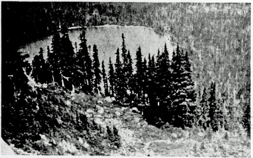
Looking down on Circlet Lake.
Arrival at Camp
Arriving at Croteau’s Camp, the party moved on across the Forbidden Plateau to Circle [Circlet] Lake. Leaving Circle Lake, the mountaineers then shouldered their equipment and commenced their work. Leaving Mount Frink, to the southwest of Mount Albert Edward, the party soon commenced breaking new ground, traveling firstly toward Cruikshank. The ascent of Cruikshank Head [Mount George V] was hard going and the rock work difficult and dangerous owing to a fine cold rain that had settled down on the mountains. Upon reaching the top, at an elevation of approximately 6,000 feet, the party finding the visibility poor, pitched camp for the day, in the hope that the weather would break on the morrow. The delay was timely, for the morning broke bright and clear, exposing a glorious view. Mountains surrounded the peak on all sides. Toward the south, stretching far away, a series of rock-tops of an interesting nature could be observed, while in the immediate valley some 1,500 feet below lay a chain of emerald lakes. Towards the west and south lay many snow-field, and towards the east great rock walls. From this point the party went southerly, and thence a short cut was attempted to avoid a circuitous route, for the purpose of ascending Line Mountain North [Peak 1931], which was successful. This route entailed a sharp descent into a valley of considerable depth, which was affected by descending a difficult chimney, necessitating careful rope work. From Line Mountain the party moved on toward the territory to be examined.
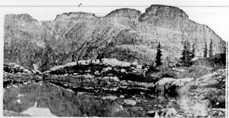
Line Mountain North – most likely Peak 1931.
In The Valley
It was on the fifth day the party reached the base of the valley [Siokum Creek] from which the ascent was made—some 1,100 feet. The first 700 feet was chimney work, the remainder a gradual rise [Siokum Peak] to the commencement of the new plateau area. Here the country changed and was a decided relief from the mountainous type already traversed. Up to this point the trip was a most interesting one from a mountaineer’s standpoint. Now over snowfields and small glaciers, now onto tops well above the tree line, where the primus gas stove was brought into use for cooking; now down into deep valleys, and up high rock sides entailing rope work; now an enforced camp of more than a day owing to a building fog. Fog is often encountered in the higher altitudes—it is the mountaineer’s enemy. Instruments, except the altitude meter, are, of course, useless, and to travel is dangerous; in fact, impossible. The party reached the new plateau area by the route originally planned, although owing to the fog they were a day or two late from the time originally judges. The new area is in the nature of a plateau and is divided from the Forbidden Plateau by a difficult country lying to the west and by the Cruikshank Canyon lying to the south. It is divided roughly into four general sections, distinguishable by the sudden, though comparatively small, change in altitude. The first consists of a range about a quarter of a mile wide, with a gentle rise of about a mile in length, treed with mountain hemlock and containing several small lakes.
Mountain Ranges
The second section is a much larger area running about three miles in an easterly direction, with a width varying from half a mile to a mile. This area contains innumerable ponds and stunted tree growth—mountain hemlock and yellow cedar. From this point the Dome Glacier [Comox Glacier] is visible, also Mount Becher, Strata Mountain and Mount Washington. Lying to the south and west, and leading directly from this part of the plateau to the main ridge, is a remarkable crossing of rock in the nature of—one may say—an elevated road. This road or pass is not more than 100 feet wide, with straight walls of rock going to a canyon below on each side some 1,000 feet down. The pass leads directly to the main mountain range. On this second division of the plateau, the party first encountered the ptarmigan, which was comparatively numerous. The flora was found to be the same brilliance as that usually found on parts of the Forbidden Plateau. As for the rock formation, it is rather remarkable—here and there several long ridges or strata of white rock standing out prominently from the country rock. The third section is approximately 500 feet lower than the second, and is a lake area containing many beautiful lakes, varying in size from about half a mile long to small ponds—many of them beautifully colored. This area is similar to the Forbidden Plateau, innumerable lakes, stunted forest growth—mountain hemlock, yellow cedar and juniper. Blueberries grow in abundance throughout the whole area.
Some Heavy Timber
The fourth section is also a comparatively large area [Carey Lakes], containing approximately two square miles. This area has a general elevation of about 3,800 feet, and is the most heavily treed part of the plateau. The general flora is very striking, as on the Forbidden Plateau, and the easterly slopes of Mount Arthur [Jutland Mountain]. The party, after spending several days on this plateau admiring its lovely scenery and examining the area generally, found it to be quite as beautiful and interesting as the Forbidden Plateau itself. The aerial map referred to was invaluable and generally accurate in most of its contours. The new area cannot be seen from the Forbidden Plateau and is so removed that one would hardly suspect such a type of country to exist among the sea of mountains lying to the south and west of the Forbidden Plateau. For this reason, it conveys to the mind of the party a “Hidden Plateau,” and they so named it. Leaving it, the party descended into the Cruikshank Canyon and thence to the Forbidden Plateau, returning again to Courtenay by the Mount Becher trail. The new area may be entered quite readily from the Forbidden Plateau southerly, crossing the Cruikshank Canyon, and thence up a climb of about 1,700 feet. The exploration of the party again emphasized the fact that Vancouver Island has a most interesting hinterland to explore—a most interesting country to be opened up—for the mountaineer and for its tourist possibilities.
Addendum
By Lindsay Elms, 2024
It appears the ten-day trip began by ascending the Dove Creek trail to Croteau Lake then Circlet Lake. The party then ascended towards Mount Albert Edward, cut across to Mount Frink and descended to the col between Mount Frink and Mount George V – which they called Cruikshank Head. The B.C. Land Surveyor Norman Stewart travelled this route in 1935 and at the end of the season submitted the name Mount George V to the B.C. Geographic Names Board in honor of King George V of England at the time of his Silver Jubilee in 1935. However, this was the first time a climbing party from the Alpine Club traversed the ridge south of Mount Albert Edward. On the night of the fourth day they camped on the summit of Mount George V and on day five travelled over Peak 1931 – which they called Line Mountain – and then followed the ridge over Peak 1909 and then down to the head of Siokum Creek probably camping at Siokum Lake (both the lake and creek were unnamed at the time). They continued from Siokum Lake up what is now called Siokum Peak and then on towards the Aureole Snowfield and Mount Celeste. It seems uncertain if they climbed onto the snowfield. They then turned east and travelled across the plateau of the Carey Lakes then down to the Cruikshank Creek. Easy travel following the creek took them up through the Cruikshank Canyon and brought them back onto the familiar trails leading to Mount Becher and Courtenay.
First Ski Party on Mount Becher
Reported in the Comox Argus Thursday December 17, 1936, p.2.
The first ski party went up to Mount Becher on Sunday [December 13] and had a very good time. They found about eight inches of snow at the Lodge, but were able to ski from that point to the top with occasional patches under the trees where it was speedier to go on foot. The snow was very sticky and it took the party five hours to make the top. From this it will be seen the going was hard. At the cabin they found plenty of wood and food, and it has been so well chinked and looked after this summer that it was almost too warm. Monday was spent on the snow slopes of Mount Becher. Trail making was difficult, but there were some fine runs on top. There are between four and five feet at the cabin and on the other slopes above. It will be better when there’s more snow and some runs now too precipitous will be then available. But there should be good skiing on Mount Becher from now till late spring.
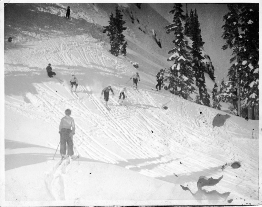
Skiing on the slopes above Mt. Becher cabin – Ruth Masters photo.
Skiing
Reported in the Comox Argus Thursday December 31, 1936, p.2.
A number of skiers spent their Sunday [December 27] on Mount Becher. Mr. Roger Schjelderup, who has been on skis in Norway, the Interior and Vancouver, says he never found better conditions. There was a thin crust on about four feet of soft snow and the runs on Mount Becher were ideal. Dick Idiens went with him to the top whilst the rest of the party stayed in and around the Cabin. The trees are encased in ice and snow and it is a veritable Hans Anderson fairyland. There was a big party at the lodge on Sunday. They found the weather perfect and skiing conditions all that could be desired. Some of them went out skiing in the moonlight. There are some very good nursery runs round the Lodge. On Monday, the soft wet snow took the pace out of the runs at the lower levels and the snow balled up the blades.
Surveying Strathcona Park 1936
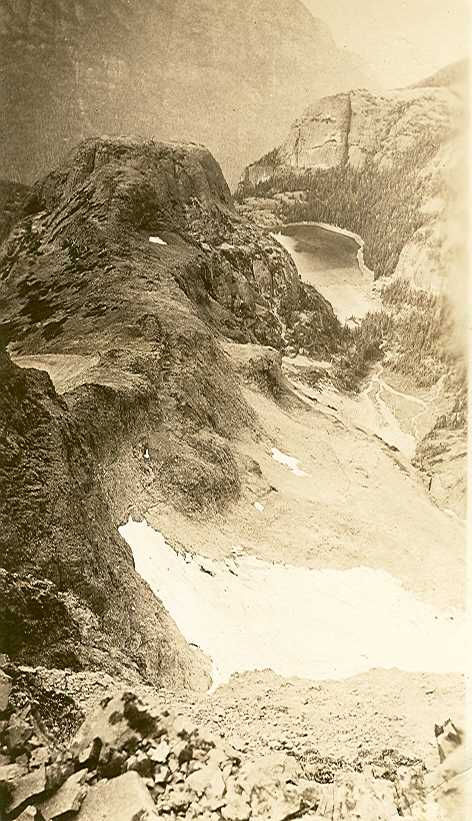
Looking down to a small lake on the northwest side of Mt. Filberg 1936 – Bill Bell photo.
Looking down to a small lake on the northwest side of Mt. Filberg 2021 – Rich Priebe photo.
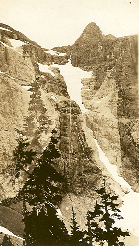
Mt. Cobb from Mt. Filberg 1936 – Bill Bell photo.
Mt. Cobb from Mt. Filberg 2021 – Rich Priebe photo.
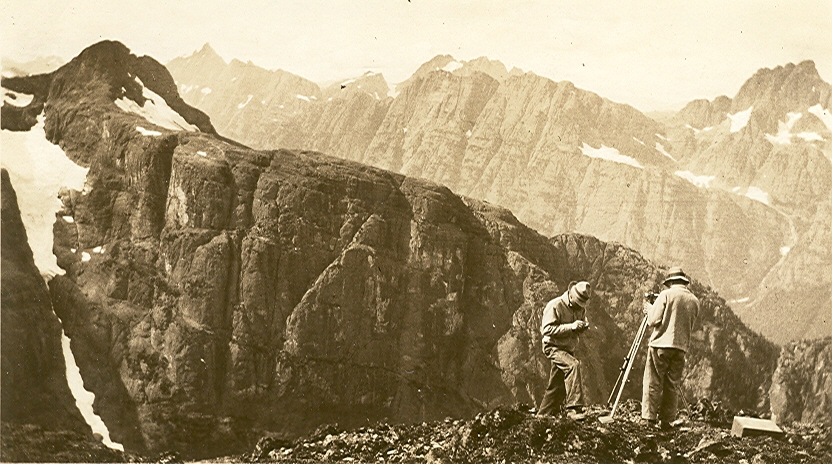
Looking at Mt. Cobb from the summit of Mt. Filberg 1936 – Bill Bell photo.
Looking at Mt. Cobb from the summit of Mt. Filberg 2021 – Barry Hansen photo.
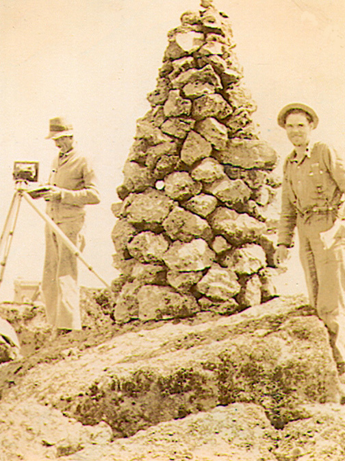
Bill Moffat (left) and George Colwell standing beside the cairn on the summit of Kings Peak 1936 – Bill Bell photo.
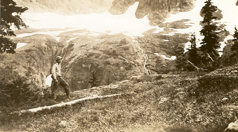
Bill Bell on Queens ridge looking onto the basin on Kings Peak 1936 – Bill Bell photo.
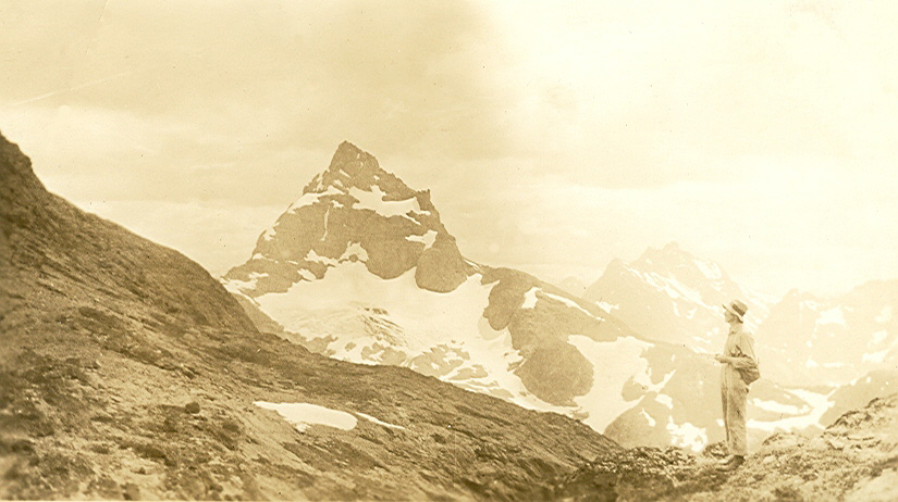
Bill Moffat on Kings Peak col looking at Elkhorn Mountain 1936 – Bill Bell photo.
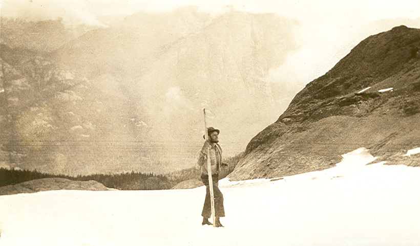
Bill Bell on the Kings Peak glacier 1936 – Bill Bell photo.
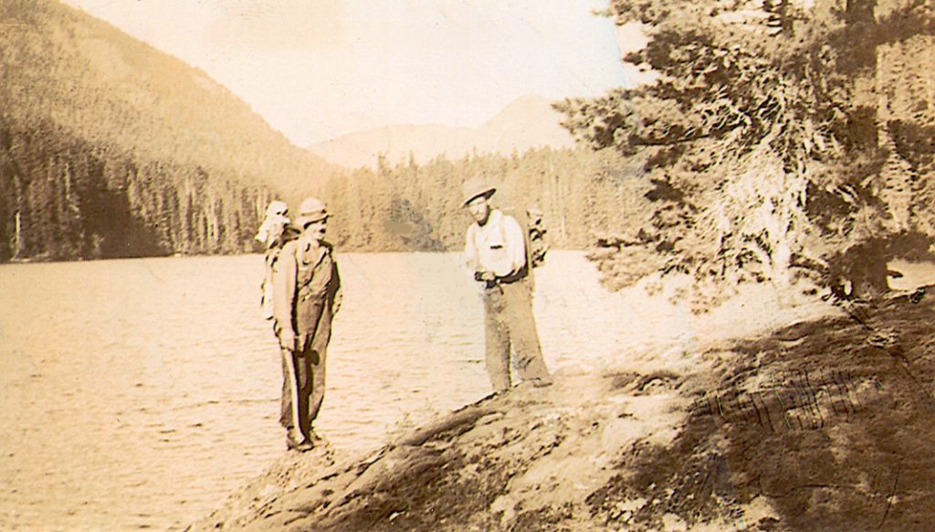
George Colwell and Bill Bell at Drum Lake before starting up Kings Peak 1936 – Bill Bell photo.
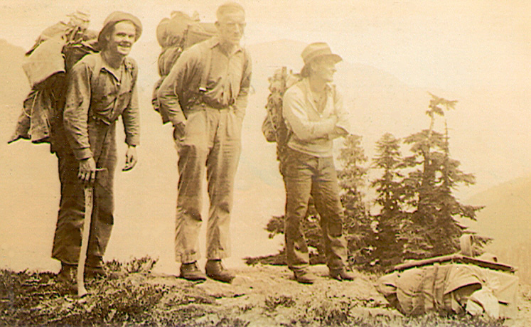
George Colwell, Bill Moffat and Jack Horbury on Queens Ridge Kings Peak 1936 – Bill Bell photo.
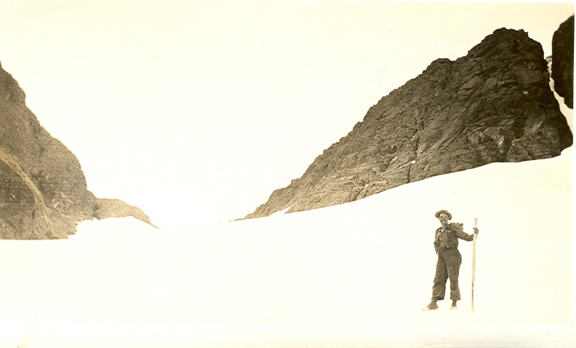
George Colwell on Kings Peak glacier 1936 – Bill Bell photo.
1937
ACCVI executive:
Chairman – Claude Harrison
Secretary/Treasurer – Fred Maurice
Outings – Francis Tuckey
Executive Committee – Mark Mitchell, William Dougan, Kathleen Martin, Robert McCaw
Events:
April 2 – Club’s 31st annual banquet held in the Princess Louise room at the Empress Hotel.
June 6 – Club trip to Musgrave Mountain on Salt Spring Island.
August 10 – Section members Fred Maurice and Edith Wilcox are married.
September 8 – Section members Francis Tuckey and Kathleen Martin are married.
October – Club trip to Jordan Meadows led by Francis Tuckey.
Section members who attended the ACC general summer camp at Yoho Valley: Mark Mitchell, Ethne Gale, Muriel Aylard, Aileen Aylard [graduated July 22 on Mt. Vice President], Nan Eaton [graduated July 22 on Mt. Vice President], Dorothea Hay, Edith Wilcox, Kathleen Martin [graduated July 26 on Mt. President], Betty Tuckey [climbed Mt. White], Francis Tuckey [climbed Mt. President].
Section members who passed away in 1937: Julie Henshaw.
New Years on Mount Becher
Cabins Were Crowded for Winter Sports
Reported in the Comox Argus Friday January 2, 1937. p.3.
Twenty-seven people slept in the cabins at Mount Becher on New Year’s night, or rather we should say cat-napped, for what with the excitement and the crowding, there was not much real sleep. The A.T.P. went up in the morning and got up in fine style: the A.Y.P.A.’s in the evening, and a rear guard got up on New Year’s morning. Jack Gregson and Tom Hughes came down to escort the A.Y.P.A.’s up and they were tired when they reached the top again. The second cabin is now more snug than the first for Sid William’s drum heater is a great improvement on the first and keeps the place really warm. About a foot of snow had fallen and hopes of a clear sky were shattered. Also, the new snow which had fallen made tobogganing like a snow plough. But with youth at the helm and plenty of high spirits lots of fun was obtained out of the rather adverse circumstances. Skills were also tried and Stuart Wood made the first ski jump with much enterprise. All but about six of the party came down on New Years Day. At the week-end Miss Helen Towler and some friends went up to the top. Heavy rain drenched them on the lower slopes and a miniature blizzard on the top, so that they had a strenuous time; nevertheless, they enjoyed the roughing of it.
‘Bob Davis Reveals’
Famous Reporter Talks of The Forbidden Plateau
Reported in the Comox Argus Thursday January 7, 1937. p.5.
When Bob Davis of the New York Sun was here he collected material for a number of articles on Vancouver Island, three of which the Comox Argus has permission to reproduce. They are copyrighted under the well-known column “Bob Davis Reveals.”
“Between Alexandra Peak, 6394, and Mount Albert Edward, 7,000, in the eastern side of the island, the ground slopes away to the east, forming a considerable tract of land made up of lakes, mountain streams, virgin forests and fertile meadows; a region more alpine in its general characteristics than exists in British Columbia, or for that matter, elsewhere on the North American continent. Its average elevation from the Straits of Georgia les than 15 miles distant, is about 4,000 feet.
A Haunted Land
“It appears on all existing maps as the Forbidden Plateau, a name handed down the Puntledge and Comox Indians among whom it was regarded as the place of evil, where sickness and red men’s wars brought about extermination. Long before white men invaded the region, it was taboo with its first inhabitants, and is still shunned as the abode of pestilence and ill fortune. About 30 years ago lumber barons wielding the merciless axe and soulless saw, swarmed up the mountain that fronts the haunted land and laid waste the ancient timber, leaving untouched the Forbidden Plateau, with its open spaces, lakes and streams, where timber was necessarily limited. Eventually its great beauty and value as a fish and game section attracted a Vancouver Island resident by the name of Clinton S. Wood, regarded by all as a visionary and a dreamer destined to fall in his Christian endeavor to put the Forbidden Plateau within the reach of nature lovers and sportsmen. Undaunted, Wood with the savings of a lifetime, acquired some acreage among the slash lands on the naked mountain, built a nine-mile road through the fallen timber and defiant boulders, to the rough habitation he constructed for his wife and children. That was back in 1925. The residents of Courtenay, situated in the rich valley along the Straits, and those as well who occupy Comox, one of the favored haunts of the Tyee salmon for three months of the year, watched the singles-handed pioneer work out his destiny on the slope which he intended sooner or later to make a highway into the plateau. “Perhaps the best way to present this pathfinder, who today has the satisfaction of escorting a steady procession of summer tourists over the trails that he has made across the mountain top into the matchless Forbidden Plateau, is to quote the stories he told me while seated on the front steps of his half-way house one evening while we watched the sun set in a flood of red and gold.
What Saved Mike Manson
“It wasn’t so long ago that this was a primitive country,” he said, “a land where unbelievable things happened. Old Mike Manson who lived to be over 80, told me of the time he was captured by the Indians and threatened with death. In his knapsack he had an insurance policy—fire, I think it was—covering a forest section. Mike, who talked Comox, spread the document out on the ground and invited his captors to have a look at the signature of ‘Queen Victoria, owner of Vancouver Island’, claims she has written and asked how the Comox people were getting along, and to let nothing happen to them. ‘Right there is her name’, said Mike, pointing to the red seal on the lower left hand corner. ‘And the first Indian that lays a hand on me will drop dead’. They sent Mike back to his cabin under an escort. I remember when Eric Duncan, not later than 1909, when invited to take a ride in an automobile, scratched his head, looked the car over carefully and said: No, I’m in a hurry.’ At 76 Eric came to this house to spend the night with me. At 5 a.m. I went to his room and found the bed empty. At 7 o’clock he returned and sat down to breakfast. ‘Woke up feelin’ brisk about half past four,’ he said, ‘and took myself a walk up to the snowline. Wrote my name on a piece of paper and set it on a rock with a pebble on it.’ I found the signature a week later. Eric had done nearly ten miles up and back that morning before breakfast.
The Red Snow
“Have you heard about the red snow of the Plateau? Well, it’s red alright and there is considerable of it. Some sort of algae, forming in irregular blotches, like blood that had run wild, as though something had been slaughtered. Scientific men have identified and authenticated the red snow. Another thing: Right from where we are seated I have seen through the clouds repeated flashes and heard deep thunder while a bright sun shone in a blue sky overhead. Why don’t you drop in on Cougar Smith, who lives just a mile or so out of Comox. He’ll have some hair-raising things.” I told Wood that the cougar man had given me an interview only the day before. “Did he tell you of the time his dog roped him in the presence of a bear? No? Well, it’s worth hearing. Smith, unarmed, was leading one of his hounds on a long leash, when Bruin came out on the trail. The hound, for some reason or other, lost his head and ran round in a circle making about six laps, binding Smith’s legs so that he couldn’t move. The bear stopped dead still, rose up on his hind legs, and walking up to within three feet of the hunter, let fly a loud cough, bolted into the timber. A small boy suddenly appeared on the verandah and later joined us on the steps. “If you are looking for a guide, Mister, I would like to show you where the trout are on the Plateau,” he said. “I’ll take you up and back, seven miles for a dollar.” “My son Gavin, aged 6,” said his father, “He knows the country in every direction. It is impossible to lose him. A Daniel Boone in the woods if ever there was one. He has cat’s eyes and can see in the dark. As sure on the trail as any man who ever trod one. I can’t explain his uncanny sense of orientation or his confidence in himself.”
Skiing Good at New Year
Several Parties Take Advantage of Good Snow Conditions
Reported in the Comox Argus Thursday January 7, 1937. p.5.
Skiing has been very good on Mount Becher for New Year. At the Lodge, Mrs. Mary Wood has been entertaining a number of parties who have been drawn to the district for the winter sports here. Most of them come from Victoria. The runs on Mount Becher cannot be beaten on the Pacific coast, and Mr. Clinton S. Wood is gradually making the trip there less arduous. For beginners there are less ambitious runs round the Lodge and on the new road just above it. The young people of the district are gradually taking up skiing and in a few years there should be a strong club here. Registered skiers at the Lodge over the recent holidays have come from Victoria, Montreal, Shawnigan Lake and Vancouver.
Skiing
Several Parties Up Despite Blocked Road
Reported in the Comox Argus Thursday January 14, 1937. p.1.
The young people have been having a lot of fun on Mission Hill on skis. Snow conditions on Mount Becher and the Lodge are excellent—when you can get there. The foot or so of snow which fell last Friday closed the road to the Lodge by car and is only being broken through today. That did not dissuade several enthusiastic parties from going up. Mr. Rex Gibson of Edmonton and Miss Ethne Gale, who brought a party of Girl Guides last year, and Miss Edith Wilcox who came up with the first party of Alpine Club climbers from Victoria, were not to be discouraged by any difficulties. They went up on skis from Bevan with 40 pounds on their backs. And the two girls had not been on skis before. Their ambitious intent was to go to Mount Albert Edward, but they got lost in the meadows above the Lookout and came back to the Lodge on Monday. They are on the Mount Becher slopes now. Mr. William Todd with his daughter Miss Teresa Todd and son Derek, skied up from Bevan on Monday to the Lodge. They were all experienced skiers and had a very fine time in the meadows above the Lookout and on Becher. Mr. Todd came down in a cutter, and the two young people, with Arthur Wood, skied down. More parties are expected up this week-end when the road will be in better condition. Cars, which have been held up at the Lodge since the big snow came, are going to break their way through today.
Ski-Running Is Very Popular
Sport On Mount Becher and Mission Hill Taken Up Eagerly
Reported in the Comox Argus Thursday January 28, 1937. p.1.
The skiers are having a wonderful time. The snow has come down from the hills to us in the valley, and the fields to the west of Mission Hill are alive with skiers and sleighs every night. It’s a fine sport and Courtenay is developing some enthusiastic youngsters who, with a little tuition, should make their mark. People will come anywhere and do anything for winter sports where the skiing is good. The Lodge on Mount Becher has been full for sometime with people. There is six feet of snow on the flank of Mount Becher now at the 2,000-foot level right up to the big veranda that overlooks the Comox Valley, and the skiing is better than it has ever been. Of course, there is trouble getting up there. Mr. Clinton Wood now has a tractor to which he hitches a sleigh, and he brings his guests from Bevan in that until cars can get through. That’s what will be done with the visitors who come up this week-end. People in Victoria and Vancouver Island are beginning to realize that within a short distance of a main road and a railway is the best skiing ground on the Pacific Coast. The trouble is to make it more accessible and that will be done as the demand for winter sports grows.
A Fine Carving
The pioneers in winter sports, the Comox Mountaineering Club, who own the cabin at the escarpment below the crest of Mount Becher, have been given a notable present. On view in the Argus newspaper office is a fine piece of carving by Mr. G.H. Paschke. Dick Idiens, the president of the club, went to Mr. Paschke with a slab of yellow cedar to put over the entrance to the cabin. How could it be lettered, he asked Mr. Paschke, whose hobby is wood carving, asked to be allowed to do it for the club. He carved “Comox Mountaineering Club” in raised letters and the rest of the sign represented Mount Albert Edward and Mount Regan. It is a piece of wood that would fine an honorable place in Jasper Park Lodge or Banff, and the club should treasure it. It will be taken up to the cabin probably this week-end. All over the district the fresh snow on Tuesday has made ski-running excellent.
Skiing
Reported in the Comox Argus Thursday February 11, 1937. p.6.
According to Dick Idiens skiing conditions were perfect on the top of Mount Becher last Sunday. He and Mr. Roger Schjelderup went all the way up on their skis and came all the way down to Bevan bridge. The snow on the top was perfect and the view superb. They came down from the cabin to the Lodge in one hour, and in another hour to Bevan bridge, which should be enough to satisfy anyone. This week-end if the flu spares enough to make the trip Mr. Clinton S. Wood is going to bring a sleigh to Bevan bridge behind his ‘cat’. There will be room for twenty skiers on the sleigh. Those who would like to go should get in touch with Dick Idiens or any member of the Comox Mountaineering Club. It will be a great opportunity for those who want to do a little skiing on Mount Becher but don’t relish their cars up the road.
By Stream and Mountain
Reported in The Daily Colonist (Sunday section) Sunday March 7, 1937, p.1.
By Brian A. Tobin
Rivaling the Rockies in grandeur and beauty if not in size, a practically unknown stream and mountain paradise within two hundred miles of Victoria awaits the attention of Vancouver Island hikers. It lies west of Buttle Lake and south of Upper Campbell Lake, within the Strathcona Park area: Topped by snow-clad 7,000-foot peaks, cut by sheer rocky valleys through which tumble icy green streams, the district about Mount Elkhorn [Elkhorn Mountain] has, until now, been visited only by timber and topographical survey parties or by an occasional inquisitive Nature lover. Here are peaks that will test the rock and rope enthusiast, streams and thickly wooded hillsides that will attract the sportsman, and panoramas that will delight the photographer. Not the least of the visitor’s enjoyments lies in the thrill of exploration, for most of the peaks are as yet unnamed, and accurate maps of the area are only now being made. It was late in August 1936 when Cecil Frampton, Joe Andrews and the writer [Brian Tobin] decided to make a five-day trip to the Elk River Valley, taking advantage of the long Labor Day week-end. Our jumping-off place was the terminus of the road at the mouth end of Upper Campbell Lake, which we reached by motor-cycle after an uneventful ride. From here we carried our belongings by packboard so that blankets, food supply and utensils were kept to a minimum.
Buttle Lake Trail
We started off on the recently improved Buttle Lake trail at five o’clock, and dusk, which comes early in the valley, found us about two miles above the point at which Campbell River enters Upper Campbell Lake. By dark we had made camp at the river’s edge and prepared supper. A young pointer mastiff with a dash of bloodhound which had followed us from the lake apparently decided to adopt us permanently, and we had the questionable pleasure of his company for the rest of the trip. The enormous pendant jowls and the astonishing activity of the salivary glands indicated but one obvious nickname. Henceforth, he was Drooler. Next morning the perfect weather still held. Leaving the trail we crossed the river by a huge log-jam and began a two-hour flight through the heavy undergrowth of the valley bottom. We were thankful that a comparatively dry year had left this ground in fairly good condition. Our objective was the new road grade of the Elk River Timber Company, which lies on the west side of the valley. This we reached and followed to the end of construction, then continued by the well-beaten trail up the Elk River. The cool shade beneath the alders was welcome after the exposure of the grade, and being by now more accustomed to the feel of the packboards we made good time.
Inroads Of Logging
Father up the valley the trail wound through lofty first-growth Douglas fir and cedar, through which we caught glimpses of the river on our left. It was not a pleasant thought that soon this magnificent stand would be completely wiped out in the progress of the logging road. At a dried watercourse we came across William J. Moffat with a photographic survey party returning from the peaks for which we were headed. The Provincial Topographic Survey last Summer commenced a more detailed study of this region by means of photographs taken from prominent peaks, although a general aerial survey was made several years ago. By one o’clock we arrived at an advance camp of the logging road on a gravelly beach of the river and ate lunch nearby. Four miles further on the trail crossed the river by a fallen tree and continued along the other bank. The growth here was mixed, more hemlock appearing, and the trees were not so large. The path was not as well defined as before, but the numerous blazes made the going easy.
On The South Fork
We arrived at the junction of the South Fork late in the afternoon and proceeded to the left up the tributary for half a mile. This brought us to Lady Falls about which we had been told at the camp. Tumbling out of the woods down a series of rocky steps, a rushing stream plunges fifty feet to the river below. The name is due to a rock formation in the likeness of a woman in trailing dress who leans forward into the foaming waters at the crest of the falls. A fine view of the falls is afforded from a bluff opposite. We returned slowly to the river junction, stopping to feast on the huckleberries which grow here in great profusion to the size of gooseberries. Even Drooler ate his share from the clustered branches. Wading the icy-cold river, shallow at the point, we established camp on a small island opposite the mouth of the South Fork. A hot supper sent us to our blankets well contented. Early on the morning of our third cloudless day we set out to attempt some climbing. We carried only lunches of bread and cheese, chocolate, shelled almonds and an apple, and what a relief it was to walk unburdened with packs! Lady Falls was quickly passed, beyond which a recently blazed trail took us on up the South Fork Valley. This lay roughly southeast and an hour and a half’s hiking brought us to a point where we determined to strike south from the trail and river and begin a gradual diagonal ascent of a long ridge which lay on our right across the stream. There seemed to be a bees’ nest almost every yard in this vicinity, and the disturbed inmates quickly added to the wounds that our legs, poorly protected by shorts and socks, had already received from the salal vines. However, we were glad of our choice of clothing when the climbing started. Avoiding the thorny devil’s club in the valley bottom, we began the steep ascent of the thickly wooded hillside, after a careful check on our landmarks. An hour of this, with occasional rests, brought us to a long gravel slide, up which we started to climb. The slope became steeper, forcing us to use our hands and knees in our progress. Rests were more frequent as wind and legs began to feel the strain. Occasionally when it seemed we could not take another step, someone would accidently rouse another bees’ nest and the ensuing wild scramble up the slope made us appear fresh as daisies. We had by then attained sufficient altitude to give us a better view of the range across the valley. Spurred to further efforts, we continued upwards to a rock chimney at the top of a gravel slope. This we ascended, and finally gained a knoll from which a very fine view of the mountain eastward and northward could be had. Turning from tis we dropped down a few feet to a divide and then climbed up over the shoulder of a long ridge to come suddenly upon a magnificent view of King’s Peak. We hurried south along the ridge to a better vantage point clear of the thinly scattered trees and halted in admiration of the scenery about us.
Seeing Mount Elkhorn
Our lookout was in the centre of a vast mountain panorama. To the west Mount Elkhorn towered to an altitude of 7,200 feet, over one thousand feet above us. North of it and joined by a tumbled ridge was the blunter summit of King’s Peak, only four hundred feet less in altitude. In crevices and on ledges large patches of snow still hung, accentuating the shadows of the sheer rock faces. Far southward, beyond mountain tops yet unnamed, appeared a snowy peak which we believed to be the Rooster’s Comb [The Golden Hinde], the highest on the Island. Eastward a 6,500 -foot range, heavily wooded on its lower slopes, hid Buttle Lake from our view. Three thousand feet below us the South Fork appeared a thin trickle down the centre of the valley. To the north lay other rugged masses. This was scenery on a grand scale. Having taken photographs and looked our fill, we proceeded further southward on an adjoining treeless ridge. There had been a few trees about us, though we seemed to be far above the timber line on the surrounding mountains. At the southern extremity of the ridge we were stopped by a sheer drop of fifty feet, which sloped into a three-thousand-foot chasm separating us from Mount Elkhorn. Even had time permitted, we could never have attacked the mountain from this side.
Clear Snow Water
Since breakfast we had had only nibbles of chocolate and nuts, so now finding a pool of clear snow water amongst the mossy rocks we paused for a meal and a rest. Grudgingly we fed the faithful Drooler from our small store of tediously carried food and heartily wished he were home where he belonged. Refreshed, we began the return journey descending eastward by a different route and then skirting the long mountain we had previously climbed. We crossed several slides similar to the one we had ascended, where roaring avalanches of rock and snow had smashed their way downward to the valley below, clearing everything from the path. Downhill through the trees was easy going, and we made good time back to the river. There we negotiated the bee zone safely and soon picked up the blazed trail at the point where we had left it. When we were still a mile from camp it became quite dark amongst the trees, and soon we had difficulty in following the blazes. “Now,” we told each other, “Drooler the bloodhound can guide us home. At last, he will earn his keep.”
Night In the Woods
But our friendly, homely playmate would do nothing but lay down on the trail and pretend to sleep. We saw it was impossible to proceed, and groping through the darkness we gathered a large pile of wood and soon had a good fire going. We thanked the Island’s equable climate for making it possible to spent a September night in the woods with some degree of comfort though dressed in only sweater and shorts. With the first light of day, we regained the trail and quickly reached camp at the island. A good meal and three hours’ sleep to augment the cat-naps of the night before prepared us for the return hike, and about one thirty we set out, and with a few rests made good time back to the south end of Upper Campbell Lake. There we camped on the logging road near the lake shore. Next morning we abandoned an optimistic plan to build a raft and accepted the offer of a ride down the lake in the Company’s launch. As we reached the centre of the lake we looked back. Southward over the low hills and seemingly close together from this angle rose the snow-splashed tops of Mount Elkhorn and King’s Peak. They stood out sharply against the clear blue sky and seemed to extend an invitation to return next year. Or was it a challenge? At any rate we’ll go back.
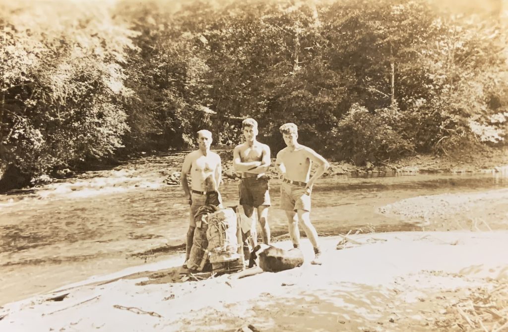
Brian Tobin, Cecil Frampton and Joe Andrews at the junction of Elk River and South Fork – Cecil Frampton photo.
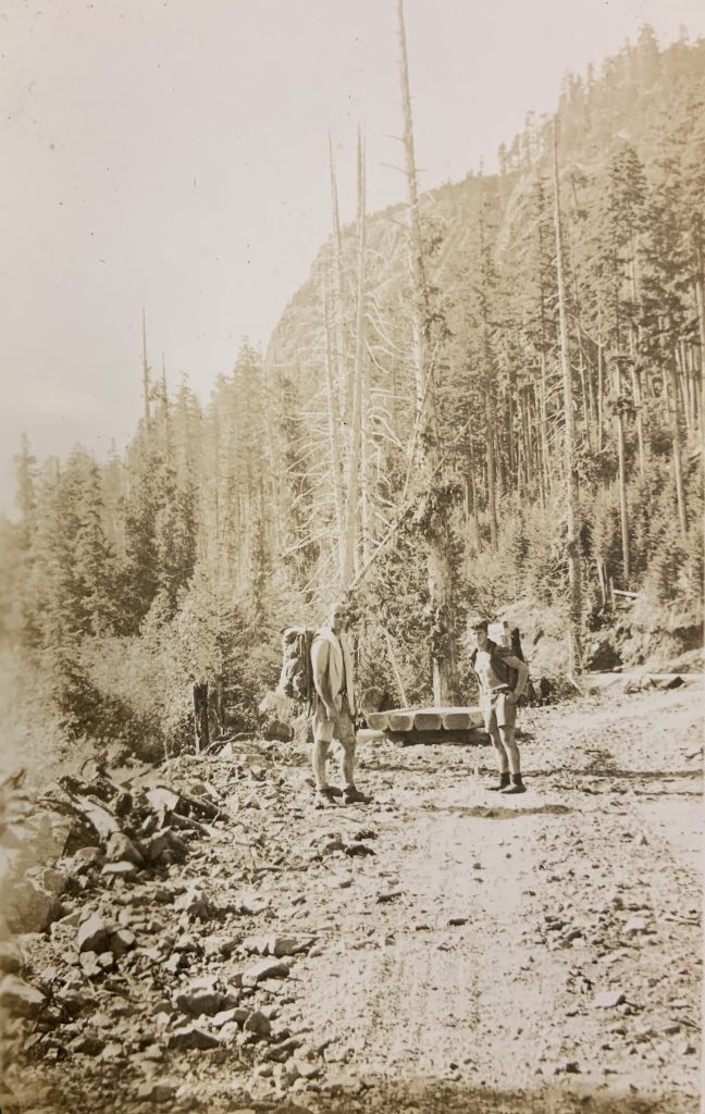
Brain Tobin and Joe Andrews walking the logging road – Cecil Frampton photo.
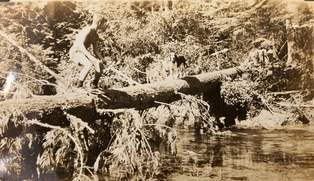
Brian Tobin and Drooler on a log crossing – Cecil Frampton photo.
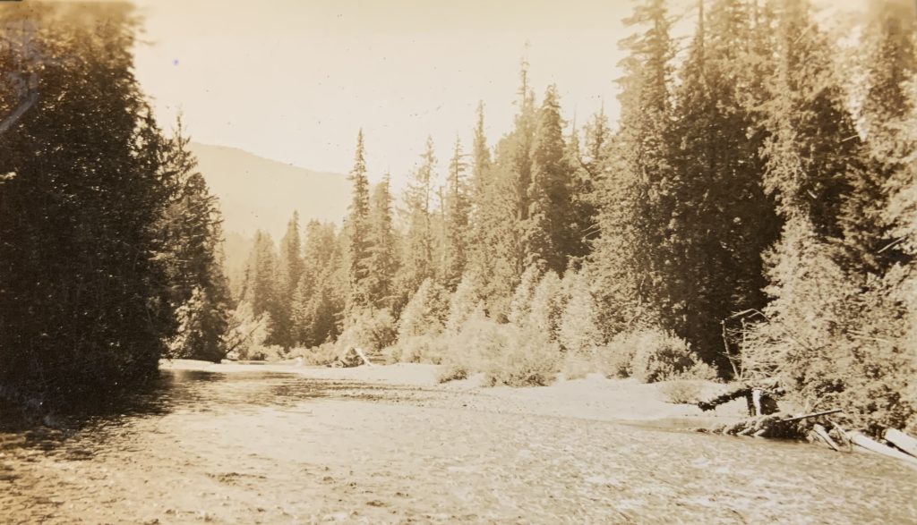
A sunny stretch on the Elk River – Cecil Frampton photo.
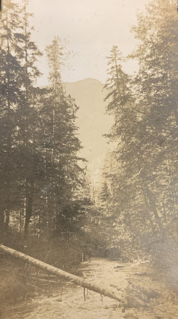
The Elk River – Cecil Frampton photo.
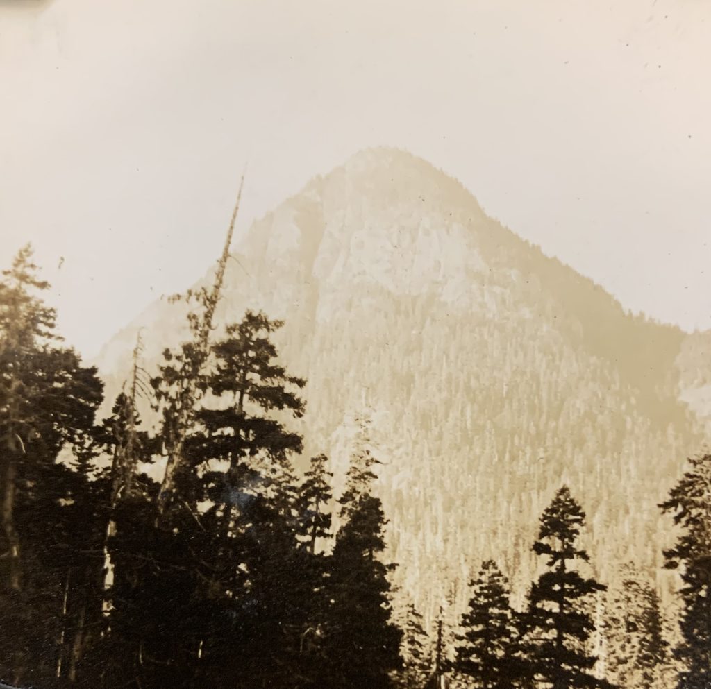
Foothill of Elkhorn Mountain – Cecil Frampton photo.
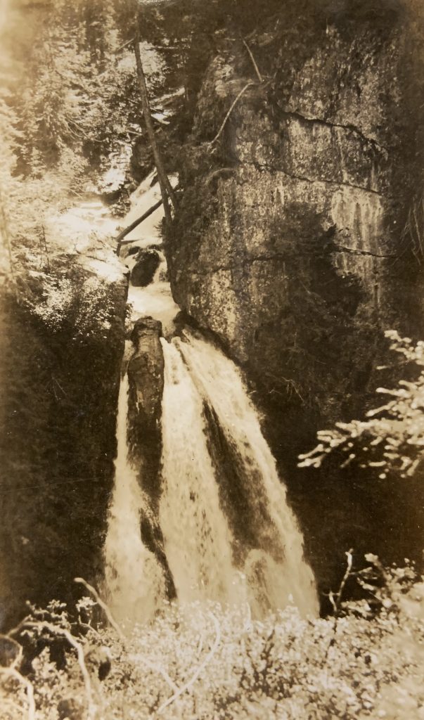
Lady Falls – Cecil Frampton photo.
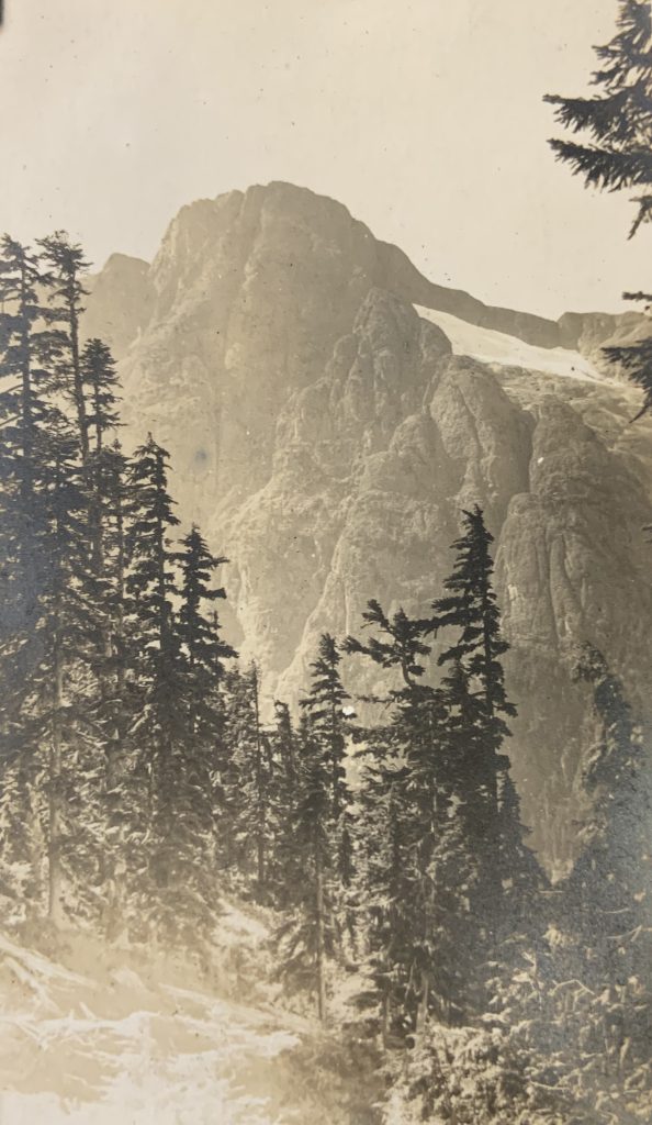
Kings Peak – Cecil Frampton photo.
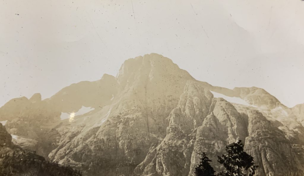
Kings Peak – Cecil Frampton photo.
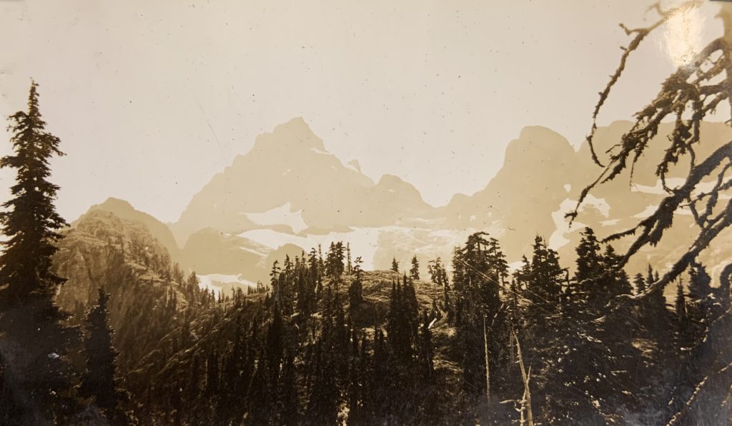
Elkhorn Mountain – Cecil Frampton photo.
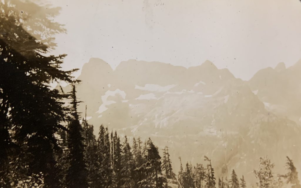
View of ridge between Kings Peak and Elkhorn – Cecil Frampton photo.
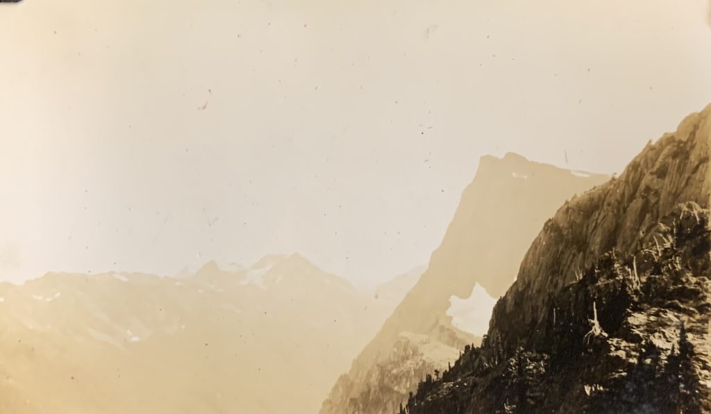
View of Elkhorn South – Cecil Frampton photo.
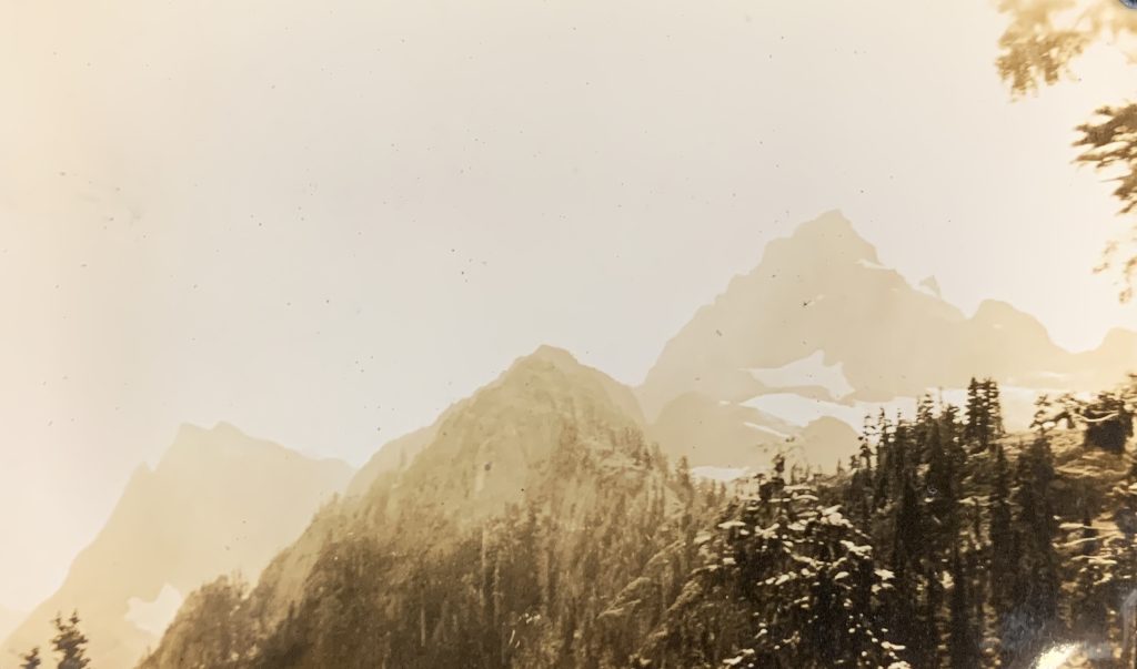
Elkhorn South and Elkhorn Mountain – Cecil Frampton photo.
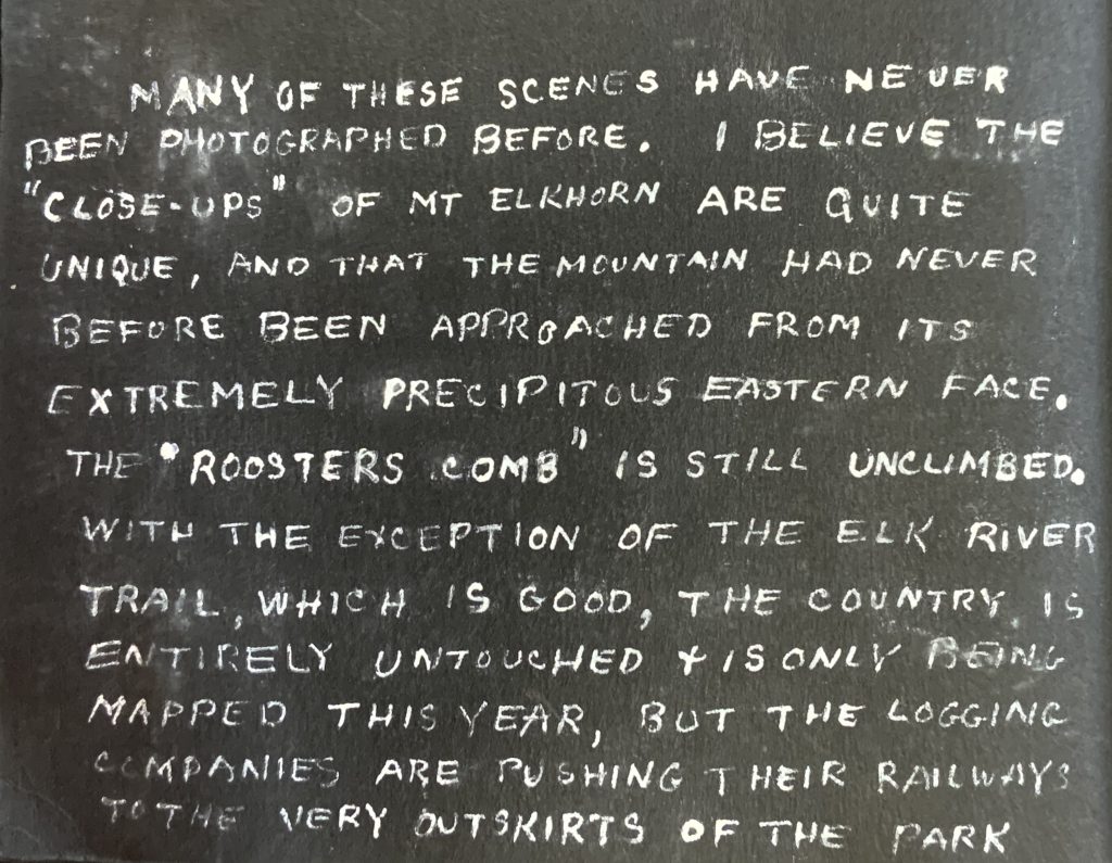
Note of the trip made by Cecil Frampton.
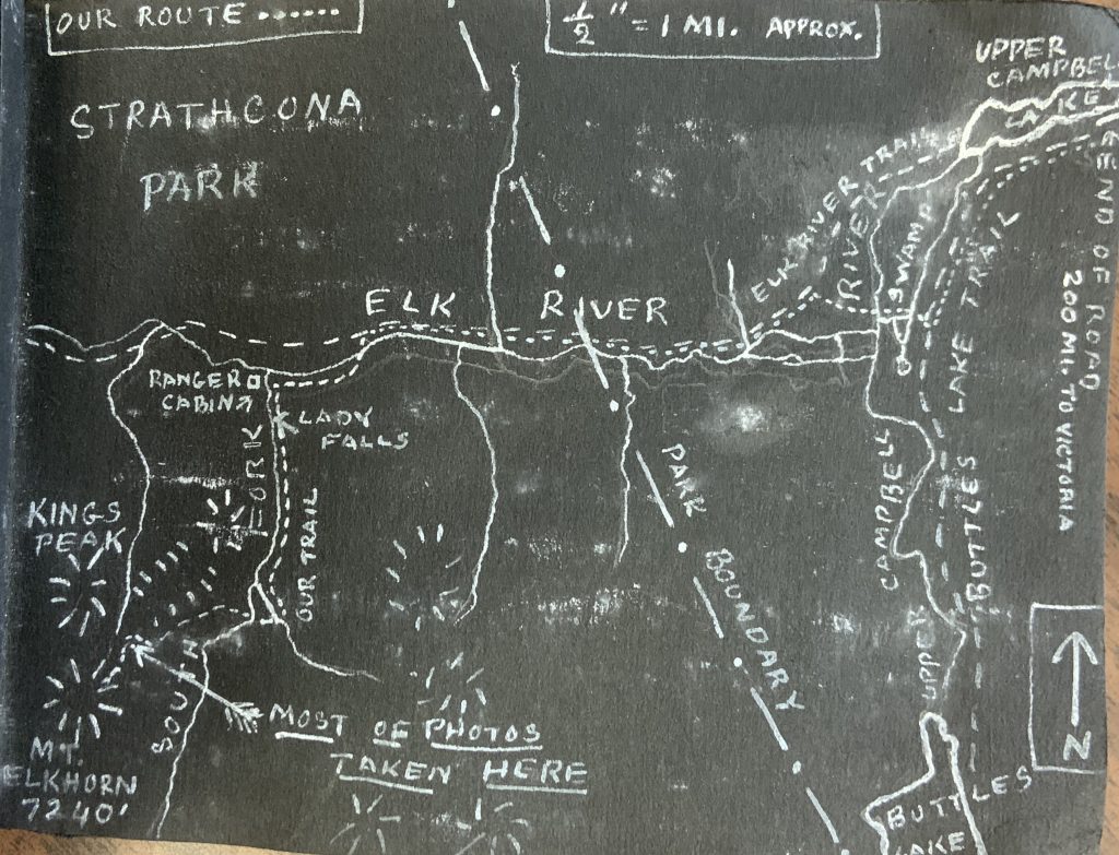
Map of the route drawn by Cecil Frampton.
Alberni Skiers on Mount Becher
Party Delighted with Sport
Reported in the Comox Argus Thursday March 11 1937. p.1.
A party of Port Alberni skiers headed by that veteran of the ski-trail, Chris Johnson, had a wonderful time on Mount Becher on Sunday. They came over from the West Coast on Sunday and went up with Sid Williams and Miss Katherine Capes in the morning. They drove as far as the third grade and ski-ed up to the Lodge. Chris was lost on the way up, but they found the veteran at the Lodge twenty minutes ahead of them. Other members of the party were Thor Jacobsen and Miss Margaret Wrotnowski. They had some good runs on the top of Mount Becher. On the way down, Mr. Jacobsen established a record by skiing from the cabin to the Lodge in half an hour. The whole party was delighted with Mount Becher, Mr. Jacobsen saying that he wished he could take the mountain over to Port Alberni.
Forbidden Plateau Offers Spring Skiing
Reported in The Daily Colonist Saturday March 20, 1937, p.5.
Spring skiing is now at its best on the Forbidden Plateau. Longer and brighter days permit more abbreviated costumes and that much-envied Alpine sun tan follows as a matter of course. An enthusiastic party of West Coasters from Port Alberni, Chris Johnson (a life member of the Hollyburn Pacific Ski Club), Margaret Wrotnowski, Ossie Simpson and Thor Jacobsen paid the Plateau a visit last week-end. The party left the Forbidden Plateau at 1:30 p.m., skied up Mount Becher and were back well before dark. Thor Jacobsen set a record of thirty minutes from the mountaineering club hut to the lodge. Plans to form a Forbidden Ski Club were discussed at length, the general idea being that any resident of Vancouver Island should be eligible to join the club, Later, it might be thought advisable to form branches in the larger centres.
Victoria Boy Falls to Death on Holiday Adventures
Hugh McKinnon Killed as Frantic Rescuers Endeavor to Reach Ledge on Mount Finlayson
Reported in The Daily Colonist Sunday March 28, 1937, p.1 & 2.
A Victoria boy in his teens was killed on Friday when he fell from a height while ascending in the spirit of holiday adventures. Hugh George McKinnon, age thirteen, of 3440 Saanich Road. The boy fell and rolled a distance, estimated by members of the search party to be at least 600 feet, after being trapped for over an hour on a narrow ledge. Hugh McKinnon’s death was the tragic sequel to a day in the open, which he had enjoyed in the company of several companions.
Climbed Mountain
The boys played on the Goldstream Flats during the afternoon, and later decided to climb Mount Finlayson, which on one side rises in a series of undulating slopes, and on the other is quite precipitous. Hugh, accompanied by “Toots” Garrett, Tom Hardy, Allan Lyncott and John Cameron had made the ascent, reached the mountain top about 5 o’clock, and started back to the base. Hugh decided to take a different route, and he called to his friends that he would meet them at the bottom of the descent. The rest of the boys reached their destination after approximately an hour and a half, but could find no trace of their friend. They immediately informed Mr. Cameron, and, in his company, they retraced their steps.
Find Boy Trapped
They finally came upon Hugh trapped upon a narrow ledge, which sloped towards a sharp drop of some 200 feet. He could neither climb up nor down, and was calling for help. They immediately sought aid from the camp of the Associated Engineers, located nearby, and returned with ropes. In endeavoring to work towards the boy, the party reached a blind ledge, and were forced to retrace their steps. They then attempted to reach Hugh from above. Mr. Cameron asked to have himself lowered over the precipice, but was dissuaded. The youngster renewed his pleas for assistance, telling his friends that he could not hold on much longer. As the party again made strenuous efforts to get below him, he screamed and fell from the ledge.
Dusk Hampers Search
Efforts to recover the body were hampered by the rapidly falling dusk. About 7:30 o’clock, Constables P.H. Brown and Frank Pomeroy, of the Provincial Police, arrived, and were met at the road by Reg Manner, of the Associated Engineers, whence he had come, after Hugh had fallen. They were joined by Gordon Ross, also of the staff of the Associated Engineers; H.J. Taylor, of the Imperial Oil Company, of the city, and Alfred Wright, a surveyor, employed by the Provincial Public Works Department. The party split into two, each carrying lamps and ropes. As they neared the spot where the boy was believed to have fallen, Constable Brown stumbled, and his lamp beam picked out a blood-stained leaf. Concentrating their search upon this point, they came across Hugh’s body, lying on a pile of loose shale, a few feet from another precipice, which dropped to Goldstream Flats below.
Just Missed Slide
The body was removed with difficulty by the constable and Mr. Taylor. No sooner had they taken the remains to firm ground, than another slide landslide carrying trees and dirt swept down the mountain side and over a seventy-five-foot bluff.
Rescuers Praised
Tribute to the work of Mr. Manner and Mr. Wright was paid by provincial police last night. “Had it not been for the fine efforts of these men, the body would not have been recovered,” officers said. “They knew the mountain, and worked until they were successful.”
Forbidden Plateau Guide Breaks Leg
Len Rossiter Had Misfortune on Mount Becher Ski-Run
Reported in the Comox Argus Thursday April 1, 1937. p.1.
The first serious accident occurred on the Mount Becher ski slopes last week. Len Rossiter, who is perhaps the best known of all the guides on the Plateau was coming at speed down the ski run below the lodge when he fell and broke his leg at the thigh. He was brought down to Courtenay and taken to St. Joseph’s Hospital where he will be for some time. There were 21 guests at the Lodge over Easter, most of them experienced skiers, and they had a glorious time on the Mount Becher slopes. On Good Friday the sun was hot on top. The view was superb. A Victoria ski-er had a camera for taking pictures in colors, and should get some fine shots. The snow was a bit sticky in the full glare of the sun, but only in the middle of the day; at night it was fast enough for anyone. Roy Denny and Oscar Kockott from Victoria, two well-known skiers who have made Mount Baker their objective on former Easters, came to mount Becher this year and found it exactly what they have been looking for. With their seal skin attachment for hill-climbing they made very fast time form the Lodge to the top, and were the envy of the other hill climbers. Miss Wardle, member of the B.C. Mountaineering Club of Vancouver brought up a party of four girls and they thoroughly enjoyed their day. Mount Becher is becoming more and more the rendezvous of experienced skiers who want to try new fields. Registrations at the Forbidden Plateau Lodge over the easter holidays included Mr. William C. Todd, Miss Teresa Todd and Derek Todd of Victoria, Mr. Roy Denny, Mr. Oscar Kockott, Allan J. Baker, Harry Bleasdale, Harry Mearns, Miss L. Newnham, Miss Victoria Gleason, Herbert Barnes, Miss Frances Smith, Mr. H. Stubbs, Miss Evelyn Duffield, Harold Dixon, Austin K. Wilson and Mr. W. Stanell of Victoria: Miss Nell Malott, Miss Margaret Bruce, Miss Peggy Bruce of Vancouver and Miss Grace C. Normand of Cupar, Fife, Scotland; Mr. Ernest Eve, Miss Nan Eve, Mr. Bob Knight and Mr. David Angus of Victoria. Snow conditions were excellent and skiing was enjoyed by every member of the party.
Bad Weather Foils Climbers
Snow Prevented Local Skiers from Climbing Mt. Albert Edward
Reported in the Comox Argus Thursday April 1, 1937. p.1.
Just bad luck—nothing else—robbed four local skiers of the thrill of climbing Mount Albert Edward in its winter mantle of snow. Dick Idiens, Roger Schjelderup, Captain George H. Ash and Miss Mia Schjelderup [Roger’s sister] made the attempt setting out on Sunday [March 28]. They went up Mount Becher and made reasonable time to Croteau’s cabin, arriving there between six and seven o’clock. Roger and Dick were an hour ahead of the other two, planning to get a meal ready for the later comers. But when the rearguard arrived, they were still digging. The cabin was completely covered in snow, many feet of it—and it took two hours to get inside to the warmth of the log cabin where so many happy parties have been held, and to get a meal. On Monday it snowed. Circle [Circlet] Lake was nearly reached but any climb was out of the question. Tuesday it was worse. Snow came down fast and one could not see more than 20 feet ahead. On Wednesday they came out through sun-shine, rain and snow. They made good time although the snow was soft most of the way. They left Croteau Lake at noon and arrived at the Lodge at six, after a stay of an hour and a half at Mount Becher cabin. They had a fine time, although they failed to reach their objective. This is the second time local skiers have attempted Mount Albert Edward under snow conditions, and twice they have been foiled by poor visibility.
Thirty-First Annual Alpine Dinner Remarkable Success
Vancouver Island Section Members’ Yearly Social Gathering at Empress Hotel Coincides With Similar Celebrations Throughout Canada
Reported in The Daily Colonist Saturday April 3, 1937, p.3.
Coinciding with similar celebrations by other local sections throughout the Dominion, the annual dinner of the Vancouver Island section of the Alpine Club of Canada was held last evening [April 2] in the Princess Louise private dinning room at the Empress Hotel. Speeches and extempore comments alike testified to the splendid spirit de corps which exists throughout the membership of the continent-wide organization which has now attained its thirty-first anniversary. Claude L. Harrison, chairman of the local section, presided, with Arthur O. Wheeler, the honorary president of the parent society, at the opposite end of the long table at which the guests were seated. The other speakers were William H. Dougan, who proposed the toast to the Alpine Club of Canada; Robert D. McCaw, who read a message of greetings from Stanley H. Mitchell, former secretary of the parent club, who for some time has been a patient in hospital here; Fred Maurice, section secretary, who read greetings from the Calgary and Vancouver sections; and Lindley Crease who extolled the adventurous spirit which he hoped would continue to imbue youth with the desire to climb the great hills.
Camp At Yoho
Much of the interest centred in the statement that the coming Summer camp in the Rockies would be in the Upper Yoho Valley. In making the announcement, Mr. Wheeler recalled that it was there, in 1906, just thirty-one years ago, that the first of all the Alpine Club camps had been held, and camps had since been held in the Yoho in 1909, 1914 and still later. This was one of the finest climbing centres in the main range, and from the standpoint of scenery, variety of mountain characteristics, snowfields, glaciers, icefalls, flower-clad alplands, waterfalls and lakes, could not be surpassed. The 1933 year book has shown the names of twenty-two of the original members, and it was hoped that the coming Summer camp would bring back most of these. Mr. Wheeler also referred to the great interest felt by the Alpine Club of Canada in the announcement that the Alpine Club of England would next year make an attempt on Mount Everest. Congratulations were extended to the conquerors of Nanda Devi, Noel E. Odell and Harold W. Tilman, the two men selected to attain the summit of this Himalayan peak, 25,600 feet; and to Fritz W. Wiessner and William “Bill” P. House, who made the first ascent of Mount Waddington.
Presidents Greetings
From Andrew Sibbald, president of the Alpine Club of Canada, a message of greeting was sent to last night’s gathering through Mr. Harrison, the latter endorsing the hope expressed by Mr. Sibbald that there would be a good representation of the local section at the main camp in the Rockies this year. In his toast to the Alpine Club of Canada, Mr. Dougan reminded members of the aims and objects of the organization, chief among which were the cultivation of a love of out-of-doors and the camaraderie and spirit of sportsmanship and adventure which this engenders. Among those to whom the club paid special tribute last evening were the honorary president, Mr. Wheeler: the chairman of the local section, C.L. Harrison, in whose honor the members stood and sang “For He’s a Jolly Good Fellow”; the secretary, Fred G.P. Maurice and Miss Stephanie Jones, respectively; and Mrs. Harrison, who was chiefly responsible for the attractive arrangement of the table. Robert D. McCaw took charge of the cheerful programme of community singing.
At Annual Dinner
Reported in The Daily Colonist Saturday April 3, 1937, p.8.
Covers were laid for the thirty-eight guests at the annual dinner of the Vancouver Island section of the Alpine Club of Canada, held last night [March 2] in the Princess Louise dinning room at the Empress Hotel. The long table was appropriately decked with bowls of daffodils alternating with bowls of erythronium (native lily) and grape hyacinth set in moss, this carrying out the club colors, white, green and blue. The guests included, in addition to Mr. Claude L. Harrison, chairman of the local section, and Mrs. Harrison, the honorary president, Mr. Arthur O. Wheeler, Mrs. Clara Wheeler, Dr. Anne Norrington, Mr. and Mrs. Robert D. McCaw, Mr. Lindley Crease, Mr. William H. Dougan, Mr. and Mrs. George Dean, Mrs. C. Marshall, Miss Audrey Hadow, Misses Kathleen and Vivian Mabel Martin, Mrs. Hubert Bevan, Miss Betty Tuckey, Mr. Francis Tuckey, Miss Dorothea Hay, Miss Brenda Stonham, Dr. Alexander Gunning, Miss Greta Hebden, Miss Freda Mary Wheadon [Freda worked as a Clerk-Stenographer for the Minister of Education along side Vivian Martin], Miss Aileen and Muriel Aylard, Mr. Charles Whitney-Griffiths, Miss Evelyn Carter, Mr. Henry Howard Wilcox, Miss Edith Howard Wilcox [lived in Uplands near Oak Bay], Miss Lois Muirhead, Miss Stephanie Jones, Miss Nan Eaton, Mr. Thomas Goodlake, Mr. Fred Maurice, Mr. Robert Day, Mr. William Ostler and Mr. Gordon Fraser.
Leave For Lake O’Hara
Reported in The Daily Colonist Saturday April 3, 1937. p.8.
Miss Edith Wilcox and Miss Ethne Gale left by the night boat for Vancouver last evening en route for Lake O’Hara where they will attend the annual meet of the Alpine Club of Canada Ski camp which opens on Sunday April 4 and continues until Thursday, April 15. The party will leave the train at Hector and hike in to the camp.
Skiing
Reported in the Comox Argus Thursday May 13, 1937. p.5.
The Skiers & Hiker, a magazine devoted to skiing, has a very laudatory article on the Forbidden Plateau as a ski playground. It says:
“The week-end of April 3rd and 4th will go down in local history as the date of the commencement of the first Ski Club on Vancouver Island. And it will mean the realization of the dreams of an oldtimer well known in Vancouver when skiing was in its early stages here. For the past two winters Chris Johnson, first Club Captain of the Hollyburn Pacific Ski Club many years ago, and now residing at Port Alberni, has been extremely enthusiastic about the possibilities of this region as a skiing centre. In addition to Chris, there have been other skiers from Port Alberni and from Courtenay, Royston, Nanaimo, Victoria and numerous other points on Vancouver Island. Having watched the growth of skiing during the past ten years in this part of the country, Chris has realized the necessity of proper instruction if people are to become really proficient in their skiing without wasting much time unnecessarily. Hence his desire to form a club—first to teach people of Vancouver Island how to ski correctly, and later, when they have become sufficiently proficient to organize competitions for them. This is the objective of the Forbidden Plateau Ski Club. Those who were present at the Lodge on the week-end of April 3rd and 4th signified their desire to organize a club, and it was decided to call together on May 24th week-end all those interested to formally bring the club into being.
Ideal Skiing Territory
The Forbidden Plateau is ideal skiing territory. On the border of the Plateau, reached by an easy motor road just 14 miles from Courtenay and 85 miles from Nanaimo, is Forbidden Plateau Lodge. This Lodge is run by Mr. Clinton S. Wood of Courtenay, is located at an altitude of 2,100 feet above sea level, and is surrounded by three or four feet of snow during the Winter, sometimes more. The road is kept open right to the Lodge by a caterpillar plow. The Lodge has all the conveniences the skier could hope for—electric light, always hot water for baths, extremely comfortable spring beds, a palatial lounge with huge fireplace, and excellent meals. The Forbidden Plateau itself provides miles and miles of every type of skiing imaginable. The first mile or so from the Lodge is a gentle climb through timber and a good ski trail. Another half mile or so of steeper climbing brings the skier into rolling meadowland, this part of the country being very similar to Hollyburn Ridge, Seymour and Mount Baker. About a mile and a half from the start of the meadowland, at the base of Mount Becher, is the cabin the Courtenay-Comox Mountaineering Club, at this time of the year buried in snow and only discernable by the three stove pipes extending above the surface. Mount Becher itself, the peak being about 4,800 feet above sea level provides skiing on long slopes very similar to those at Mount Baker. The snow is dry and usually wind packed, giving almost perfect skiing conditions. Further into the Plateau are miles of long slopes and meadowlands, culminating in Mount Albert Edward which rises to an altitude of 7,000 feet. The three-mile trip from Mount Becher back to the Lodge affords an excellent down-hill run.
Early Reach of Vancouver
Contrary to popular opinion, the Forbidden Plateau is within comparatively easy reach of Vancouver. The journey by boat to Nanaimo, thence by bus to Courtenay and by auto to the Lodge requires approximately six hours and by taking one’s own car it would be possible to cut an hour off this time. Plans are under way for Vancouver skiers to pay the Plateau a visit over the long May 24th week-end.
Russian Lady Well Known Here
Madame Olga Stavrakov was Remarkable Personality
Reported in the Comox Argus Thursday June 10, 1937. p.1 & 8.
Madame Olga Stavrakov, who was instantly killed by a car when she was riding her bicycle in Victoria last Friday [June 4], was well known to a number of people in Courtenay. Until she was hurt last year, she was a regular visitor to the Forbidden Plateau. She was a very remarkable personality. Eighty years of age she was a grand dame of the czarist nobility and knew all the notables of that glittering court. She was a woman of culture, and her family had liberal tendencies and by reason of that they were on several occasions under suspicion from the Czarist authorities. But they were definitely of the old regime. Mrs. Stavrakov could talk of those now far off times when she was playing her part in them so that the listener could she pictures of the brilliant spectacle before the Great War and the revolution that drove all the patricians into exile. She spoke without bitterness, and with a detachment that gave the impression of the narrator being rather an observer than a participant. Then came the revolution, when the old world fell about the ears of the Russians. Madame Stavrakov, like so many of the Russian nobility travelled much and when she was in Turkey when the war broke out and for sometime afterwards, but at the end of the war she found herself in Vladivostok with Wrangel.
Lost All Her Money
There she and her sons bought a ship and sailed it out of the Pacific port to San Francisco, where they sold it. With the wreck of their fortunes they came to British Columbia and invested what they had left there, but, alas unfortunately. And ever since the old lady has had to live with the utmost simplicity in her Victorian home. She accepted her fate with the utmost calm. Her innate courtesy and culture won her many friends among them the Dunsmuir family with whom she was intimate for many years. She was attracted by what she heard of the Forbidden Platea, and came north to see it. Although she was well over 70 when she first came, she refused to ride in over the trail. She had a small silk tent of her own device which weighed only a few pounds, and which she hung on a tree, and she slept where she found herself in the open. All she took with her was a sleeping bag made of paper. She made her stopping place at Croteau’s Camp, where she was a very well-known figure. She used to make sketches and visitors would meet the stately old figure walking alone on the trail. She always refused assistance. She was deeply attached to the Plateau and told Mr. Eugene Croteau that when her turn came, she would like to die there. “Just dig a hole where you find me,” she said, “and lay me there; I want no other grave.” Round the camp fire at night when she could be induced to come down from her own little tent, it was remarkable experience to hear her tell of the days of the Czars. Last year she was missed from the Plateau. She had her leg hurt in a bicycling accident and could not come. She was a great friend of Mr. and Mrs. Dundas. They used to meet her when she came out the trail at Dove Creek and take her to their home for the night before she left for Victoria.
Salt Spring Island Climb
Reported in The Victoria Daily Times Thursday June 10, 1937, p.12.
A party of members of the Victoria Alpine Club visited Salt Spring Island on Sunday [June 6]. Starting from the Burgoyne Bay they ascended Musgrave’s Mountain, descending to the Fulford Harborside.
To Join Camp
Reported in The Daily Colonist Friday July 16, 1937, p.8.
The Misses Muriel and Aileen Aylard, Miss Nan Eaton and Miss Dorothea Hay, who left earlier in the month for Banff, will join the annual camp of the Alpine Club of Canada in the Yoho Valley tomorrow. Miss Edith Wilcox, who also is attending the reunion camp, will leave this afternoon for the mountains.
Highest Island Peak Climbed for First Time
Rooster’s Comb Conquered by Courtenay Party on Thursday of Last Week
Reported in the Comox Argus Thursday July 29, 1937, p.1.
The honor goes to Sid Williams, Geoffrey Capes and Roger Schjelderup. The weather, which had been threatening and cloudy till that time became ideal—crystal clear. The three climbers were then at the five-thousand-foot camp of the Topographical Survey under charge of Mr. Norman C, Stewart, where they were hospitably entertained. The virgin peak hung above them, menacing in its aridity and sharpness of outline. It proved unexpectedly easy, and they went up the 2,220 feet in two and a half hours. The rope was used at one awkward rock ascent, but otherwise it was quite easy. The Rooster’s Comb is the very backbone of Vancouver Island. Many hundreds of people have seen it from the Forbidden Plateau as a serrated edge of snowy peak closing in the horizon. The party had a good pair of glasses and it was quite easy to see the open Pacific on which breakers could be seen to be pounding.
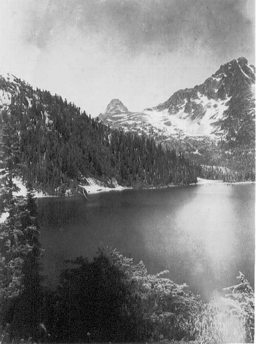
The Behinde and The Golden Hinde looking over Schjelderup Lake 1937.
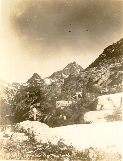
Surveyors camp on Mt. Burman Ridge 1937.
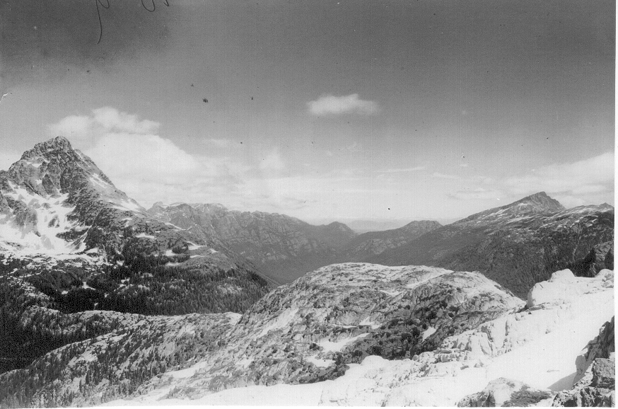
View of The Golden Hinde from Mt. Burman Ridge 1937.
Saw Open Pacific
Looking to all other points of the compass were the many peaks of Strathcona Park, the Glacier Region, and, further east, the Gulf of Georgia; on the far horizon the giant peaks of the coast. The party learnt while they were on their way in that there is a move in Victoria to change this name of the Rooster’s Comb to the Golden Hinde; and pledged themselves to oppose it. Since they are the first climbers of the peak their predilection should carry weight. They pointed out that this peak was first named when the first survey of the park [1913/14] was made and that its serrated edge does look like a comb. The preliminary work for the attack on the Roosters Comb was made by W. Adrian B. Paul and Geoffrey Capes last year. They had no guide then as to the best way to get to the base of the peak and they tried Wolfs River valley from Buttles Lake. It was unexpectedly hard going, and as their time was limited, they had to turn back when they got within sight of what looked like three peaks. In the meantime, Mr. Stewart had established his camps all the way from Buttles Lake high up on the peak, with the result that they had only to follow the blazes.
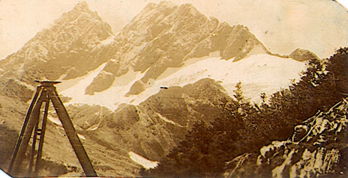
View of The Golden Hinde from the head of the Wolf River 1937.
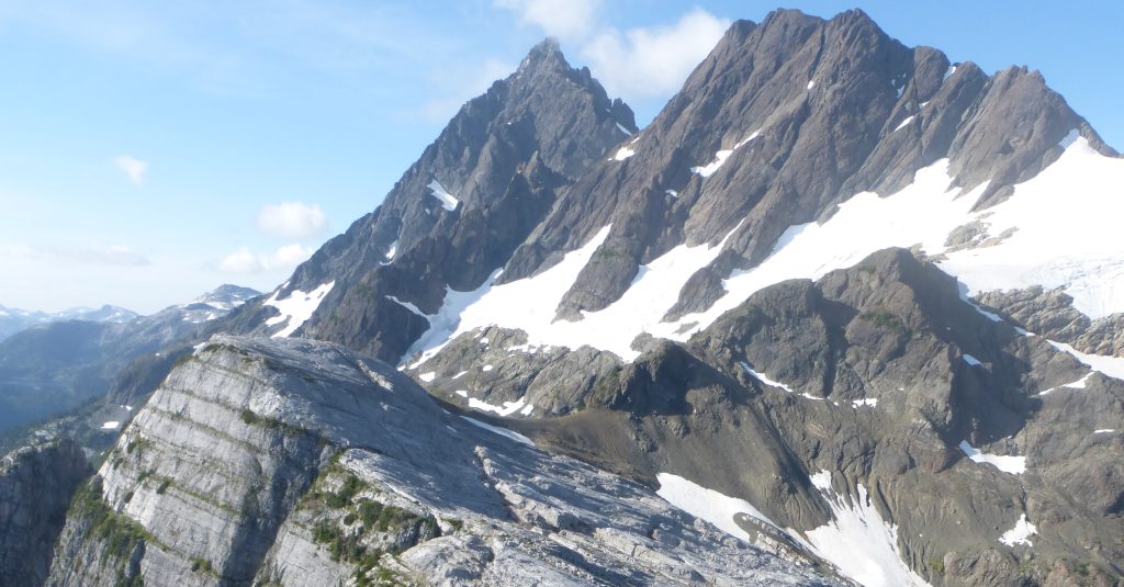
A similar view of The Golden Hinde taken in 2014 – Lindsay Elms photo.
Rowed Seven Miles
They left Courtenay on Sunday with 50-pound packs and camped on Sunday night on the shores of Buttles Lake beyond Wolf River. The next day they had to row seven miles up Buttles Lake to the first topographical camp at Phillips Creek. They left the base camp first thing Monday morning following Phillips Creek and the blazes of the surveyors. On Monday night they were still following Phillips Creek and camped at a height of three thousand feet. It had been good going. Looking for an open space to camp they left the blazed line and went down to the creek. So thick was the undergrowth it took them an hour and a quarter to make not much more than 100 yards. It was in the battle to get through this scrub with a big pack that Sid Williams lost his undershirt! Eventually they found their camp near a small stream and a snow patch. Unlike last year, there were very few mosquitoes. On Tuesday they had to climb to the head of the creek across the divide between the waters that flow to the Gulf of Georgia and those going to the open Pacific. Here were the sources of two rivers, the Burman flowing westwards and the Wolf to Buttles Lake. The two had their springs in a chain of lakes. The climbers had to lose altitude then to reach the third surveyors camp on a lake [Carter Lake] at an altitude of about 4,000 feet. Six of them spent the night in a small tent. They were enveloped in a thick mist. On Wednesday the mist was lifting.
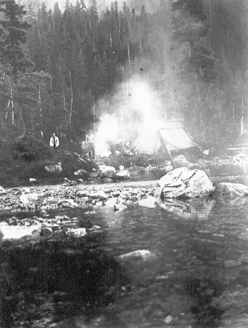
Surveyors camp at Carter Lake 1937.
Lake Was Still Frozen
They had to make their way past the source of the Burman River and Wolf River passing a lake which was still frozen. They walked along the bank of another lake [Schjelderup Lake], the source of the Wolf River, and had to descend 500 feet into the Wolf Valley to get on to one of the spurs of the Roosters Comb. This they followed up to the surveyors advanced camp at 5,000 feet, where they stopped over night. On Thursday the peak was climbed in perfect weather. There are several peaks in Strathcona Park of almost the same height as the Roosters Comb, the latter being only 20 feet higher than Victoria Peak. The descent was made to the advanced camp in an hour and a half, two members of the party glissading nearly a thousand feet on a snow slide. They broke ice to bathe in the lake and made their way back to the 4,000-foot camp where they stayed the night. On Friday they got within half an hour of Buttles Lake but lost the blazes in the darkness and had to camp out in the bush without benefit of water. When the light broke, they found their way to Buttles in short order. Here they were made very welcome at the base camp and were able to relax and rest, going fishing on Buttles and finding it all that it had been represented as an angler’s paradise. They came back home on Sunday not too played out after the long hike.
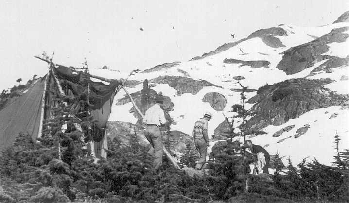
Surveyor’s basecamp below The Golden Hinde 1937.
Wild Flowers Were Gorgeous
The wild flowers from 3,000 feet up were a marvellous sight—a mosaic of bright colors. There was no vegetation whatever from 6,000 feet to the summit. The climbers met with the utmost kindness and courtesy from the surveyors all along the route. They stayed in their camps and found their blazes saved them much questing and prospecting for the best line to take. Without this help the peak might not have been gained—certainly not in as fast a time as it was.
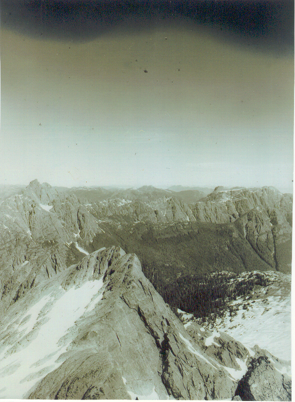
View from the summit of The Golden Hinde looking down on the Comb 1937.
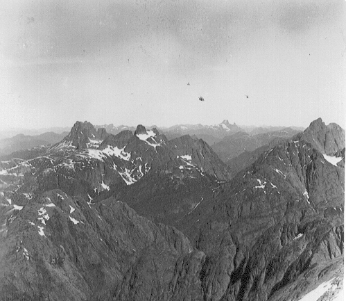
Mt. Colonel Foster left, Rambler Peak centre and Elkhorn Mountain right 1937.
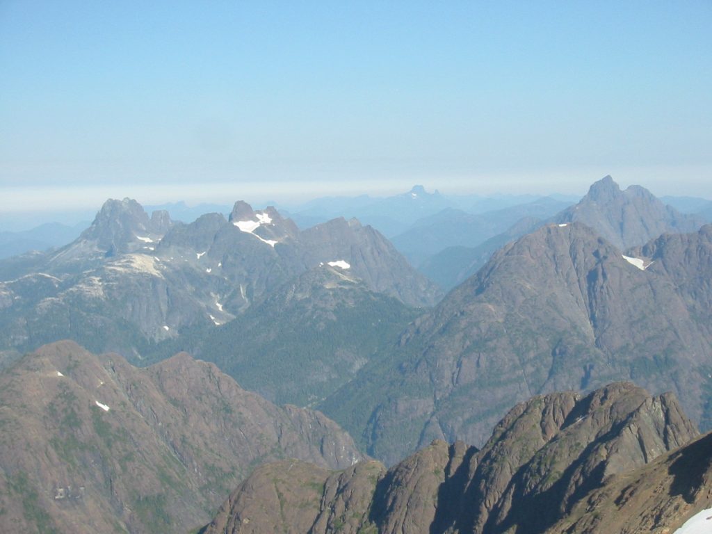
The same view from 2006 – Lindsay Elms photo.
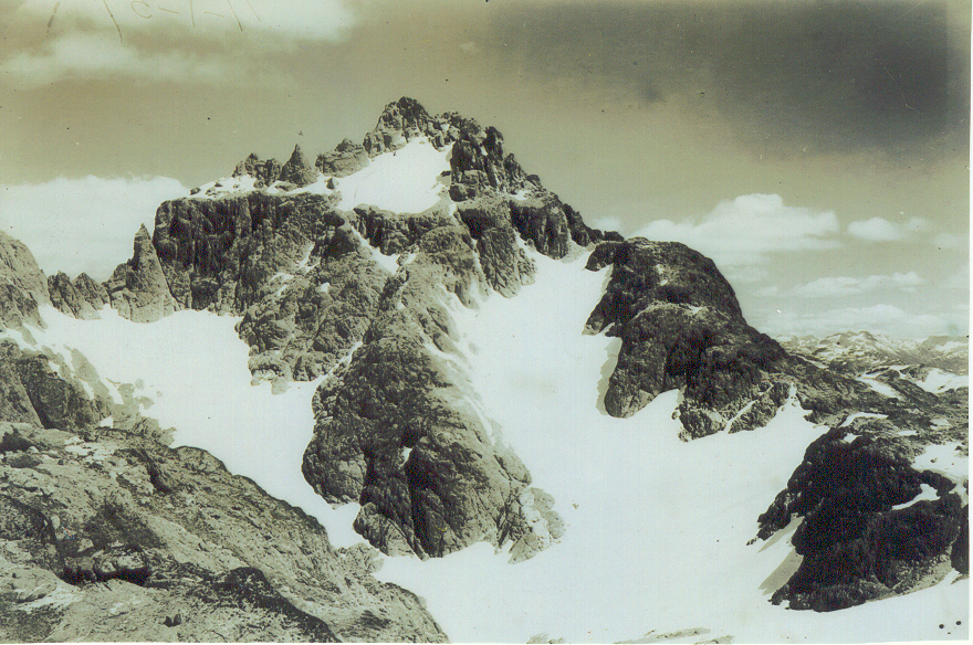
The West Face of The Golden Hinde 1937.
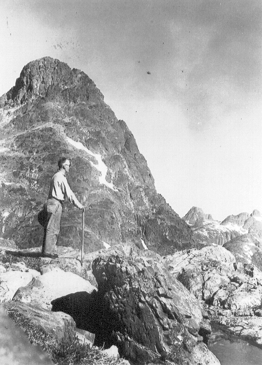
Norman Stewart standing in front of The Behinde 1937.
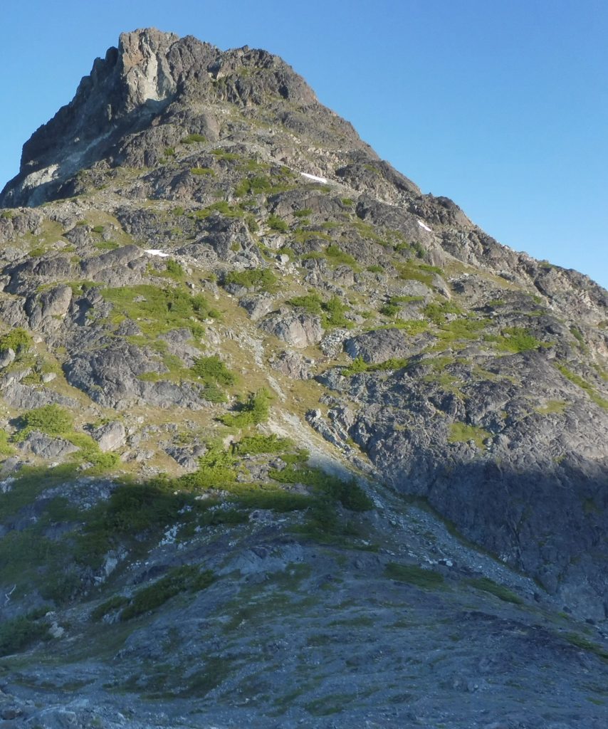
The Behinde 2016 – Lindsay Elms photo.
Ascent of the Rooster’s Comb
From the personal diary of Geoffrey Capes, Courtenay, July 18 – 25, 1937.
Sid Williams, Roger Schjelderup and myself left Courtenay about 7 a.m. on July 18, 1937, in Roger’s old Model T Ford truck. First, though, we had weighed our packs – Sid’s nearly sixty pounds, Roger’s about thirty-five and mine fifty pounds. Arriving at Sutherlands on Upper Campbell Lake we got a boat and rowed up the lake reaching the start of the trail to Buttle Lake at 11:30. On Buttle Lake we rowed to a beach two bays beyond Wolf River and camped at 8 p.m. We left next morning early in perfect weather: calm, with lifting clouds and sunshine. After about two hours’ row, we landed at Philips Creek and followed blazes up the creek. Soon we had to climb a steep ridge, but the going was good; not much underbrush, and few mosquitoes. We came across the surveyors’ Camp 2 across the river, six miles from Buttle Lake, where we made a two-hour halt for lunch. The going continued good, with a steady and easy ascent, now traveling more or less west. At 6:40 p.m. we met two of the survey party packers returning from Camp 3. At 7:30 p.m. we decided to descend to the creek for a suitable camp spot. All the way down, the ground was covered with windfalls, then we struck terrible thick bush along the creek. There was no gravel bar or any spot at all for camping. A few yards ahead on the other side was a large open space on the mountain slope, with patches of snow. Crossing the creek on a log we immediately struck terrible traveling – almost impenetrable bush interlaced with long, outward-growing alder branches, and no visibility. Sid finally climbed a small tree and we found a way out. It had taken two and a quarter hour to go no more than probably two hundred yards. We finally made camp at about 3000 feet on a heathery uneven slope alongside a brawling stream. A full moon lit up the country. Next morning, we descended to Phillips Creek, crossed and found the blazes without trouble, and at 10 a.m. emerged onto a small bluff. Hearing a shout, we saw through the glasses a man rapidly descending from the top of a 1000-foot pass ahead. Sid has a yell that can be heard for miles and for a time we had a yelling match. We went on, coming out towards the head of the valley with mountains on all sides. After crossing the creek on the remains of an enormous snow slide that covered it, we knew we had to go over the pass but had lost the survey markers, so waited for the man, who turned out to be one of the packers. He pointed the way, so we went on, crossed a rock slide and snow patch, then for four hundred feet, the blazes led us through brush and timber up a mountain side. We came out onto a wide gully of rock and snow. It was quite an arduous climb to the top of the pass, reached at 1 p.m. Below us the valley in which lay a string of lakes, the source of the Burman River, which empties into the West Coast. Here we lunched. On a mountain top [Mount Burman] across the valley we spotted two men, who turned out to be Alfred Slocomb and Robinson, surveyors. Just after 3 p.m. we started along the top for a short way, then made a steep descent through timber and brush for about five hundred feet to a lake [Carter Lake]. At the far end, staring by itself over a wooded ridge showed the “Rooster’s Comb”. At the other end we saw a tent which was the surveyors’ Camp 4. On the lake floated cakes of snow, broken off from the snow patches surrounding it. We followed along the shore to camp, where we met Slocomb and Robinson and made use of their fire for supper. Later in the evening we spotted a figure at the other end of the lake, who turned out to be Jones, assistant engineer for the City of Victoria. We had made space in the small tent for five of us; now we had to squeeze in six, where there was room only for three. It became very cold with fog all around us when we turned in. It rained in the night, but by morning showed signs of clearing. We left Camp 4 at 9 a.m., Mr. Jones accompanying us. A small lake just above the camp was still more than half covered with ice and snow. We topped the ridge and came down on a fairly large lake [Schjelderup Lake], the source of Wolf River. The clouds were lifting but the Rooster’s Comb would not clear. After waiting over an hour for a photo we did at least get a glimpse of the top. Our route lay around the left of the lake across three fairly large and steep snow patches, where a slip would have meant drowning. From the end of the lake, we looked down the length of the Wolf River valley. We descended steeply three hundred to four hundred feet, crossed over some flat ground, then had an uncomfortable traverse along a bush- and timber-covered mountainside. The route followed a short way up a small gully, which we left to emerge onto a ridge of the Rooster’s Comb in open country. Above to the right we could see the top camp of the survey party at about 5000 feet. Following the ridge tops we reached their Camp 5 about 4:30 where we found Norman Stewart, the head of the survey party, and his assistant, Dan Harris.
Dan Harris packing survey camp supplies 1937.
They informed us they had that day [July 21] climbed the Rooster’s Comb. Stewart offered us Harris as a guide for our attempt next day. July 22 dawned a perfect, cloudless morning with a film of ice on the little lake by the camp. Harris led off at 8 a.m. We crossed an easy slope, then a wide scree and snow field until we reached a rock face, where we roped, although there were foot and hand-holds. Next, we crossed a few-feet-wide steep snow patch and then had more rock climbing. About one hundred feet from the top, we discarded the rope and made our way over broken boulders to the summit reached at 10.35 a.m. The “Rooster’s Comb” [now officially the Golden Hinde] is 7219 feet, the highest point on Vancouver Island, and very nearly at its centre. We stayed on top for over an hour, examining the surroundings and photographing. We put our names in the small cairn that Stewart and Harris had built the day before. We could see some of the survey party on the big peak of this mountain, away from the three-peaked summit we were on. We reached camp at 1:15 p.m. Starting homewards at 3:15 p.m., we arrived at the meadow at the top of Wolf River valley just above the waterfall by 5;15 p.m. There were a few ducks on the lake just above the falls. Three of us got to Camp 4 about 7:15 p.m.; I dragged in some half an hour after. In full moon light we all squeezed into the little tent. The next morning, we spent en-route to the survey party base camp, which we reached after a forced halt over-night. The cook treated us royally with a whopping breakfast. The rest of the day was lazed away in eighty-two degrees temperature. On the morning of July 25, we started down the lake in perfect weather, with the cook at the engine. Arriving at the end of the lake at 11:15 a.m. we lunched, said good-bye to the hospitable cook, and started up the trail to Upper Campbell Lake. Seeing no boat at the cabin at 3:55 p.m. we of necessity continued on the trail, reaching Sutherlands at 5:15 p.m. As seen from the truck, the logged-off rolling country to Camp 8 was a purple mass of blossoming firewood. We had clutch trouble, but reached Courtenay by dark.
Island Members Graduate
Reported in The Daily Colonist Wednesday August 11, 1937, 6.
Five of the nine Vancouver Island section members of the Alpine Club of Canada made their graduating climbs during the annual camp of the parent club, held in the Yoho Valley recently. Miss Betty Tuckey graduated on Mount White, near Lake Louise, just before going to camp; Miss Kathleen Martin and Mr. Francis Tuckey graduated on Mount President and Miss Aileen Aylard and Miss Nan Eaton graduated on Mount Vice-President. Other Vancouver Island section members who attended the camp were Dr. W.E. Mark Mitchell, Miss Ethne Gale and Miss Edith Wilcox.
Fire Would Ruin Plateau
Reported in the Comox Argus Thursday August 19, 1937, p.3.
Fire Would Ruin Plateau
Better Weather for Tourists
Normal August Weather After Clouds and Showers
Reported in the Comox Argus Thursday August 19, 1937, p.6.
August washed its face and put on its summer garb on Wednesday after several weeks of dull weather and cloudy skies. Fishing still continues to be better than many years past. The visitor, who has not been able to get salmon at Comox or Little River has been unlucky. But its dank and dreary at the beaches; so that the clear sky of Wednesday was much welcomed. In the high hills there has been poor visibility. The Plateau itself has remained clear of cloud for the most part but only tantalizing glimpses could be obtained of Mount Albert Edward, the Castle Crag [Castlecrag Mountain] and the whole range of peaks beyond. It would have been futile and dangerous to climb them. It’s now better. The trails are muddier than usual at this time of year and those who go in should have stout footwear. To wear rubbers or suede is to invite foot trouble. There have also been some visitors who have slept on the trail without adequate protection.
Taking Foolish Chances
One man who had nothing under him but a ground sheet, had arthritis so badly when he got into camp that he could scarcely lift his arms. Thanks to the kind offices of a good Samaritan who befriended him, he got well enough to go out again, but his holiday was completely spoilt. The Forbidden Plateau is not a hospitable place for those who ignore the Scout motto of ‘Be prepared’. The trail from the Forbidden Plateau Lodge to McKenzie Lake and on to Mariwood Lake has been very busy indeed. No less than eight people went over it on Sunday night. Mr. Clinton Wood has comfortable cabins at both McKenzie and Mariwood Lake and they have been well patronized. Mr. Wood is contemplating additions to his Lodge to provide more accommodation for the skiing season and he is pushing his new road towards the meadows. His objective is a skiing lodge on the meadows where those who are not adept at the art can use nursery slopes and runs. The road from the Lodge to the meadows will also provide a fast and safe run down. Miss Olivia de Havilland, the movie star, paid a surprise visit to the Lodge last week. It was a preliminary visit and she may come again and go back into the hills.
In High Hills
In the high hills the flowers are gorgeous, but are now past their best. Below the 3,000-foot level the blueberries provide a toothsome tang for those who care to pick them on their way up, but they are not ripe yet on the Plateau where the season is very late. There have not been so many tourists in town and district for years. Only a small percentage of them take advantage of the reliable information freely offered at the bureau. It would save them some embarrassing mistakes and misadventures if they would. Tourists recorded at the Bureau are from: Victoria; Duncan; Vancouver; Tulare, California; San Dinas, California; Chilliwack; Nanaimo; Sayward; Vashon, Washington and San Diego, California.
Spring In the Meadows
Reported in the Comox Argus Thursday August 19, 1937, p.8.
By Preston L. Tait
(The following article has been written for the Comox Argus by Mr. Preston L. Tait, editor of the B.C. Mountaineering Club. He is spending the summer at Mr. Eugene Croteau’s Camp.)
Near the centre of the island at an altitude of 4,000 feet is one of the finest lake districts to be found anywhere. To reach it one travels by motor eight miles to Dove Creek to the foot of the government trail. This leads one through a delightful virgin forest of fir and pine, hemlock and cedar with many shrubs and small wild fruits. In many areas the ground is carpeted with club mosses and brightened by pure white flowers of the dwarf dogwood, later to be spotted with the scarlet patches of ripening fruit known as pigeon or bunch berries. The trail is crossed by several fresh water streams conveniently located along the way for the thirsty traveller. The walk or ride of 11 miles is made interesting by the many flowers nearby while the flower strewn meadows are most attractive and afford a pleasant change. On approaching the Plateau, one is enthralled by the large and interesting lakes passed, especially when one comes to Croteau Lake at the trail’s end where a most glorious view to castle Crag and Mt. Albert Edward unfolds itself to view. There, at sunset, when the clouds and mountains are reflected in the placid waters of the lake, is a scene which will long live in the memory. To the right and rising out of the lake. Mt. Elma (4,769 ft.) an easy half hours climb from Croteau Camp to the summit. From a nearby ridge, one sees in the east the Islands of the Straits with Savory Island and Powell River showing plainly in the distance. To the north Mt. Washington (5,215) standing above Paradise meadows. The country in all directions is dotted with beautiful deep blue lakes with scores of green mountain tarns scattered over the tree studded landscape.
Great Banks of Flowers
Paradise meadows at this time of the year is a treat to behold. On a recent trip the writer was more than surprised and pleased to find dodecatheon or shooting star growing in great profusion, so situated that they made long and winding rows of deep blue interspersed with the white of the marsh marigold as they grew in narrow dried up stream beds. The meadows were a picture with white, pale and deep blue violets, sweet scented, while one was thrilled to find in the moister parts the deeper shades of the butterwort or fly trap. The sweetest and daintiest flower of the plains was the dwarf laurel with an occasional speedwell to remind one of the forget-me-nots. In the drier areas were buttercups, and the mother of all flowers, and their sisters the more modest potentillas and nearby in moist depression were the sweet scent orchids or ladies tresses and the green stately Rhein orchid. Although usually growing on dry ground the Alpine Spirea were to be found scattered over the meadows. The low growing raspberry with its salmon-colored petals was a pleasant and attractive creature as it peered through the drying grasses. On the margin of the meadows the arctic raspberry and creeping blackberry with their snow-white flowers and the dainty star of the Trientalis, with tiny ovate leaves, displayed their daintiness in the brilliance of the noonday sunshine while in the background was displayed the shrubbery of the rhododendron with its creamy white bell-shaped flowers brightening the sombreness of the forest background. At one of the lakes were found the lacey white fringed bog-bean and a very sweet-scented yellow pond lily. On our return we climbed over a large rocky mound where low lying phlox, blue beard tongue, pink spring beauty, pussy toes and the dainty saxifrages were already blooming in gorgeous patches of brilliant colors. The return by the shore of Battleship Lake in the soft light of the setting sun out the finishing touches on a most pleasant and profitable day spent in God’s Garden in the great open spaces of his Creation. To sum up in the words of Harold Munro—”How beautiful they grow, above their styles and lanes and watery places, crowing the brink of silence everywhere.”
Preston Tait working at Croteau’s Camp 1939.
Climb to Forbidden Plateau
Registrations at Croteau’s Camp
Reported in the Comox Argus Thursday August 26, 1937, p.6.
The broken weather this year has not been much encouragement to hikers but many have gone up nevertheless. Whilst the high peaks have too often been mist-wreathed, the alpine flowers have been unusually lovely and profuse. Registrations at Croteau’s Camp this year have been from: Vancouver; Victoria: Esquimalt; Courtenay; Cowichan Bay; Duncan; Saanichton; Carmel, California; Qualicum Beach; Oxshott, Surrey, England; Comox; Chilliwack; Sandwick; Nanaimo; Zanzibar, South Africa; Chemainus; Cobble Hill and Chicago, Illinois.
Great Peaks Test Skill
Mountains in Hinterland of Vancouver Island Give Good Sport to Climber
Reported in The Daily Colonist Sunday August 29, 1937, p.19.
Many come to Vancouver Island with the aim of testing their skill as mountaineers against the numerous mighty peaks which rear their majestic heads above the hills and glaciers of the northern end of the Island. There is a wide choice of ascents, from those which come more nearly under the category of “hikes,” and which are scorned by the real mountaineers as a mere prelude to serious climbing, to those that test the skill and daring of the keenest addict to the sport. Some of the major peaks and their altitudes are listed below. Crown Mountain, 6,082 feet, thirteen miles northwest of Buttle Lake; Victoria Peak, the highest on Vancouver Island, reaches the altitude of 7,484 feet; second comes Elkhorn Mountain, 7,240 feet. Big Interior Mountain is close beside the head of Buttle Lake and Great Central Lake, 6,200 feet. Probably the greatest mass of glaciers is found directly between the city of Courtenay and Buttle Lake. The Dome [Comox Glacier], 6,100 feet, can be approached up the Cruikshank River. Further north is Mount Albert Edward, 7,000 feet, and beyond that comes Alexandra Peak, 6,349 feet. Mount Tom Taylor, west of Big Interior Mountain, has a big glacier, plainly visible from the head of the Tofino Arm, on the West Coast.
Merville Youth Killed on Buttle Lake Trail
Fatal Accident to James Scott Mitchell Whilst on Survey Party
Reported in the Comox Argus Thursday September 2, 1937, p.1.
It was with very great regret that the whole district, particularly Merville, heard of the death of a young fellow of Merville, James Scott Mitchell, while on a survey party near Buttles Lake. The accident happened on the Upper Thelwood Creek, five to six hours distance from Buttles Lake. It will never be known quite how the accident happened but from evidence at the inquest held on Tuesday at Campbell River, Mitchell who was a careful packer, came to the upper ford on Thelwood Creek. One had to pick one’s way carefully on the stones if one did not want to fall into the Creek and get wet, and Mitchell put down his pack weighing about 50 pounds to take a breather, and also to see the best way to cross. The supposition then is that he slipped on the rocks or fell from a tree that had been thrown across the creek, striking his head and fracturing his skull. Medical evidence showed that he received the injury to the head several hours before he died. He was probably unconscious from the time of the injury to his death.
Was Not Drowned
The body was then washed some quarter of a mile down stream before it was found by a fellow packer. The main camp of the British Columbia Topographical Survey is at Buttles Lake where Price Creek comes in. On Tuesday Mitchell, a six-foot youngster of quiet habits and a good bushman, left for the first camp on Thelwood Creek soon after noon. He was carrying a 50 lb pack and was sent in to relieve a young fellow who was coming out to go to school and who was at second camp. The trail to the first camp was well defined, beyond that only blazed. It was rough going.
Knew Trail Well
Young Mitchell had been over the trail 11 times before so knew it very well. He was in good condition as he had had a four days rest from packing before Tuesday. It is a four-hour pack to first camp which Mitchell would occupy alone on Tuesday night. On Wednesday he would go on his way following the blazes to second camp. The Thelwood creek empties into the Price about three miles from Buttles Lake and is a brawling little stream full of boulders. The blazed trail crosses the stream three times on its way from the first camp to the second camp. At one of these crossings (not the first) young Mitchell had laid down his pack because it was found against a stump at the side of the stream, and had made the fatal essay to cross. At the inquest on Tuesday of this week Dr. W. A. Richardson said, in giving evidence, that the cause of death was cerebral-hemorrhage from a blow on the mastoid gland behind the right ear, causing a fracture of the skull. He would think that he had received the blow some three or four hours before death occurred, during which time he was probably unconscious.
Found Body on Sand Bar
At the second camp, Dan S. Harris, another packer of the party, was waiting for Mitchell to come in. The camp had begun to run short of food and Mr. Alfred G. Slocomb sent Harris down to the main camp on Thursday. On Friday at the third crossing of the creek, he found Mitchell’s body on a sand bar. He went back to his camp as fast as he could and notified his superior, Mr. Slocomb, who sent the news to the outer world. On Saturday, Corporal McAlpine came in with a party he had organized to get out the body. The party consisted of Nick and Gerald Mitchell of Courtenay, N. Simpson of Campbell River, John Robson of Victoria, Wm. Sutherland of the Upper Campbell, L. Netherby and Cpl. McAlpine.
A Difficult Task
They had a very difficult task. They improvised a rude stretcher and placed the body on it then had to take it through the bush where no trail had been cut, in and out of creek beds, under and over logs the ten miles to Buttles Lake. It was then taken by launch to the lower end of the lake and by pack horse over the trail to the end of the highway. The distance in all to be traversed before it reached Campbell River was 70 miles. The party reached Campbell River with their sad burden on Monday night. On Tuesday afternoon the inquest was held at Campbell River by Dr. Hall, coroner. Evidence there was given by Dr. Richardson, Mr. Norman C. Stewart, Mr. Alfred G. Slocomb, Dan S. Harris and others. Mr. Edward E. Danby was the foreman of the jury. A verdict of accidental death was returned.
A Promising Pupil
The victim of the accident is the eldest son of Mr. Andrew Mitchell of Merville, a veteran of the Great War and other campaigns in the Imperial army. He was about a year old when his parents came to Merville soon after the war and took up land. He went to school at Tsolum and was one of the most promising pupils that the high school has ever passed through. All who employed him found him very trustworthy and of exceptional ability. Friends of himself and the family thought that he should go to University and young Mitchell was planning to go there. Last year he was in one of the Forestry Training Corps camps for young fellows, and this year he went out with the government survey party as a packer. He was considered a quiet, capable lad by his superior, Mr. Stewart. He leaves to mourn him his father and mother of Merville, two brothers, Andy and Robert, both of school age and a young sister.
The Funeral
The funeral will be held this afternoon at three o’clock from Sutton’s funeral parlors to the United Church at Sandwick, the Reverend Peter Henderson officiating.
Skiing Interest is Very Keen
Mountaineering Club Meeting Well Attended and Enthusiastic
Reported in the Comox Argus Thursday September 2, 1937, p.1.
The best attended and most vigorous meeting on record of the Comox Mountaineering Club was held at the City Hall on Tuesday [August 31] night. After the minutes of the last meeting were read, business proceed to the election of officers. Elected were:
President – Captain George H. Ash
Vice-president – Mr. W. Adrian B. Paul
Secretary – Miss Katherine Capes
Executive – Messrs. Dick Idiens, Sid Williams, Herbert Chandler and the Misses Peggy Watts and Mia Schjelderup.
Hon-president – Mr. Clinton S. Wood
Hon-vice-president – Mr. William Douglas
A vote of thanks was extended to Mr. Idiens and Mr. Williams for the fine work they had done in the last season. A feature of the meeting was the presence of new members. For their benefit it was decided to have an invitation hike to the cabin on Mt. Becher at the beginning of each club year, the first to be held next Sunday [September 5]. All interested should get in touch with the president Captain George Ash. There was a good deal of discussion about the damage that was done to the cabin this summer. The police will be asked what has to be done about the investigation they started to find the culprits.
Plans Were Discussed
This discussion led to plans for the forthcoming year, ideas for skiing being received with particular enthusiasm. It was suggested that the ski run slashed last year from the Lodge to the seventh grade, should be opened up for the rest of the way. A ski captain, Dick Idiens, was appointed, and will look after all matters related with that sport. Trips will be organized as soon as the snow is fit and all interested will be asked. On specified dates there will be junior hikes to which as many juniors as possible will be encouraged to attend. For the sake of convenience, a junior captain was elected, Roger Schjelderup being voted to the post.
Comox Glacier Was Hidden
But Courtenay Party Had Good Climb
Reported in the Comox Argus Thursday September 9, 1937, p.1.
Led by Mr. W. Adrian B. Paul, who knows the trail to the Comox Glacier very well, a party of Courtenay climbers left on Sunday for a three-day trip. Thanks to the kindness of members of the Comox Logging & Railway personnel at the end of Comox Lake they made good time on Comox and Trout Lakes. They slept at Hestor Lakes and got as far as Two-Tree Pass on Monday. Here the clouds were so low and the weather so thick that they turned back and spent the night at Hestor Lakes. The cloud lifted on Tuesday as they came out, and they got some splendid views of the Red Pillar, Argus Mountain and the Cliffe Glacier. There is no trail yet to the Glacier but the way is blazed. It was eight years ago when the first party from Courtenay led by Mr. Paul climbed the Comox Glacier.
Strathcona Park Is Surveyed
Most Beauty Spots Only Now Accessible to Good Hikers
Reported in the Comox Argus Thursday September 16, 1937, p.5.
The survey work that is going on under the care of Mr. William J. Moffat in the Buttles Lake area gives a picture of this part of the Island. Very little of this terrain is known to the general public. The work described is that done last year. “We were supplied with air photographs of the area; these were taken by the Royal Canadian Air Force in 1931. Owing the very mountainous nature of the terrain covered by this map-sheet, the ground control was obtained solely by triangulation and ground photography. The only means of access to this area is by the road to Upper Campbell Lake. From this lake there is a good trail to Buttle Lake, about 8 miles distant, and from Upper Campbell Lake there is also a good trail up the Elk River to Summit Lake [Crest Lake], and an old trail, which is hard to follow, leads from Summit Lake down the Gold River to Muchalat Arm on the west coast. After a short stay at Upper Campbell Lake we proceeded up the Elk River to the mount of the North Fork [Tlools Creek], where we established a cache camp at a trapper’s cabin. Reblazing the old trail up the North Fork, we fly camped to Crown and Flannigan Mountains. Then proceeding farther up the Elk River we established another camp at the crossing of the Elk River near Drum Lakes. From this camp as base many trips were made to the south, west and north, thus covering the westerly portion of the map-sheet, including the country around Mount Kings [Peak], Elkhorn Mountain, Mount Colonel Foster, Donner Lake, and northerly to the 50th parallel in vicinity of Gold Lake. We made ties to the survey of the west boundary of Strathcona Park, and to a triangulation on the Gold River made by Mr. William J.H. Holmes, B.C.L.S., in 1926. Returning in September to our cache at the mouth of the North Fork, Mr. Moffat’s party [including Bill Bell and George Colwell] proceeded up the South Branch of the Elk River, climbing the mountains to the east [Elkhorn South Mountain] of that stream. The other crew went to Buttle Lake and thence up the Wolf River as far as El Piveto Mountain. We joined forces again at Buttle Lake. After occupying two peaks west of Buttle Lake and making ties to surveyed lots along the lake we returned to Upper Campbell Lake, completing the field-work at the end of September.
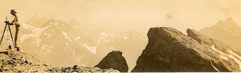
Survey station on the summit of Elkhorn South Mountain 1937.
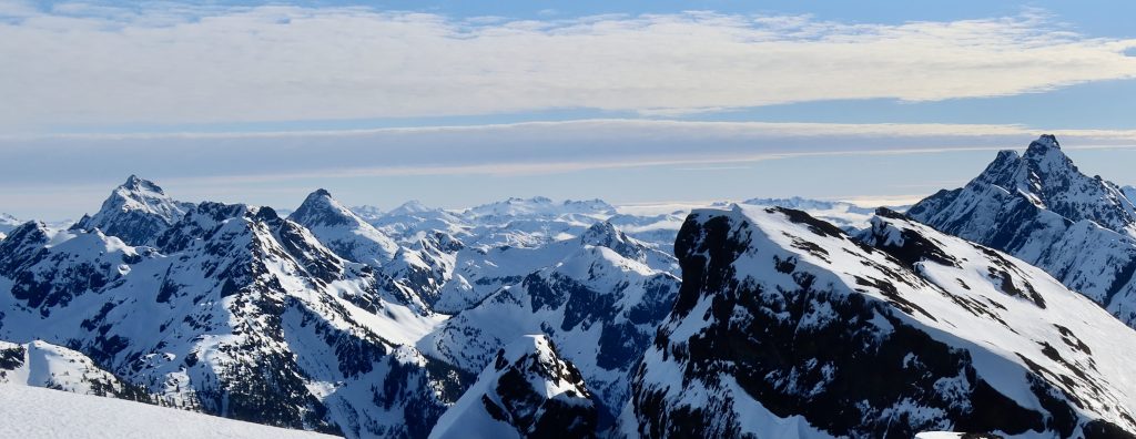
Similar view from the summit taken in February 2022 – Barry Hansen photo.
Very Mountainous Area
This map-sheet covers an extremely mountainous area. It is divided into two portions of varying aspect by the transverse valley containing the Elk River and the East Branch of the Gold River. To the north of this valley the mountains are lower, with flat tops, while to the south there are sharp jagged peaks, difficult of ascent, often rising sheer for several thousand feet. The highest mountain is Mount Elkhorn, 7,200 feet. Numerous small glaciers are found on northerly exposures. The main streams are the Campbell River out of Buttle Lake; the Elk River which joins the Campbell River in a swampy area south of Upper Campbell Lake; the branches of the Gold River which flow westerly; along the northerly boundary of the map-sheet there are branches of the Salmon River. There are many beautiful lakes; the largest are Buttle, Upper Campbell and Donner Lake. Crater Lake [Volcano Lake] is the largest of a great number of Alpine lakes. At the summit of the transverse valley are found the Drum Lakes and Summit Lake. The altitude of the summit of the pass is 1,100 feet, and as the gradient both east and west is gradual, this valley provides one of the best routes from the east coast to the west coast of Vancouver Island. The location of this pass is rather remarkable, for the highest mountains on the Island are found immediately to the south. The mountains to the south of the Elk River and west of Buttle Lake compare in rugged grandeur with those found elsewhere in British Columbia. Although the tops do not much exceed 7,200 feet, the valley-floors are low; hence on the mountain-sides are found those great walls and precipices that provide the scenic splendour and make the ascents so long and arduous.
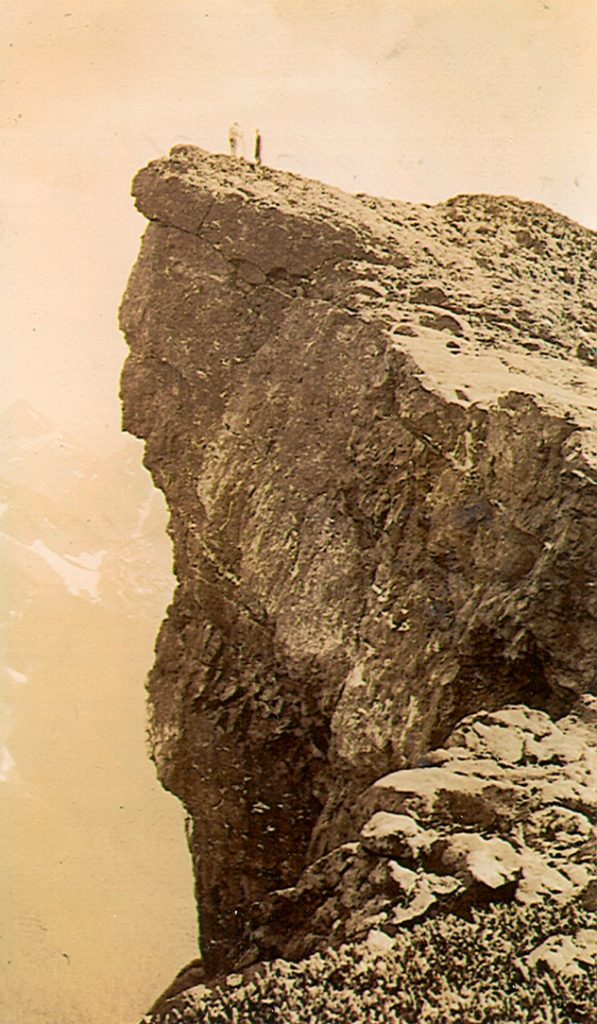
Surveyors on the summit of Elkhorn South Mountain 1937.
Timber To 3,000 Feet
All the valley-bottoms are heavily timbered; Douglas fir, red cedar, and hemlock predominate, but other varieties found include balsam, white pine, yellow cedar, cottonwood, alder, maple and yew trees. The merchantable timber grows to an approximate altitude of level becomes stunted timber-line being 3,000 feet. The forest-growth above that reached around 4,500 feet above sea level. Some huge Douglas fir were seen in the Elk River valley; one measured 28 feet in circumference. In the forest there is the usual coast undergrowth of huckleberry, devil’s club, and salal. Wild flowers are abundant, especially at timber-line. Along the shores of Buttle Lake dogwoods and arbutus grow profusely, adding greatly to the beauty of its shores. There is little known mineral wealth in this area. Two mineral claims have been Crown-granted on Upper Campbell Lake; a small shaft on one of these has copper indications. Another group of claims is located at Buttle Lake. We saw mineralized rock on tributaries of the Elk and Gold Rivers, but nothing of a striking nature. Many fossil-beds were found up the Wolf River and on the high ridge between the Wolf and the South Fork of the elk River. During the 1935 field season we saw iron deposits on Iron Hills south of Upper Quinsam Lake. Dr. Alexander H. Gunning, in his report, gives geological data covering his map-sheet. He suggests areas that should be prospected, the most likely of these being in the neighborhood of Upper Campbell Lake.
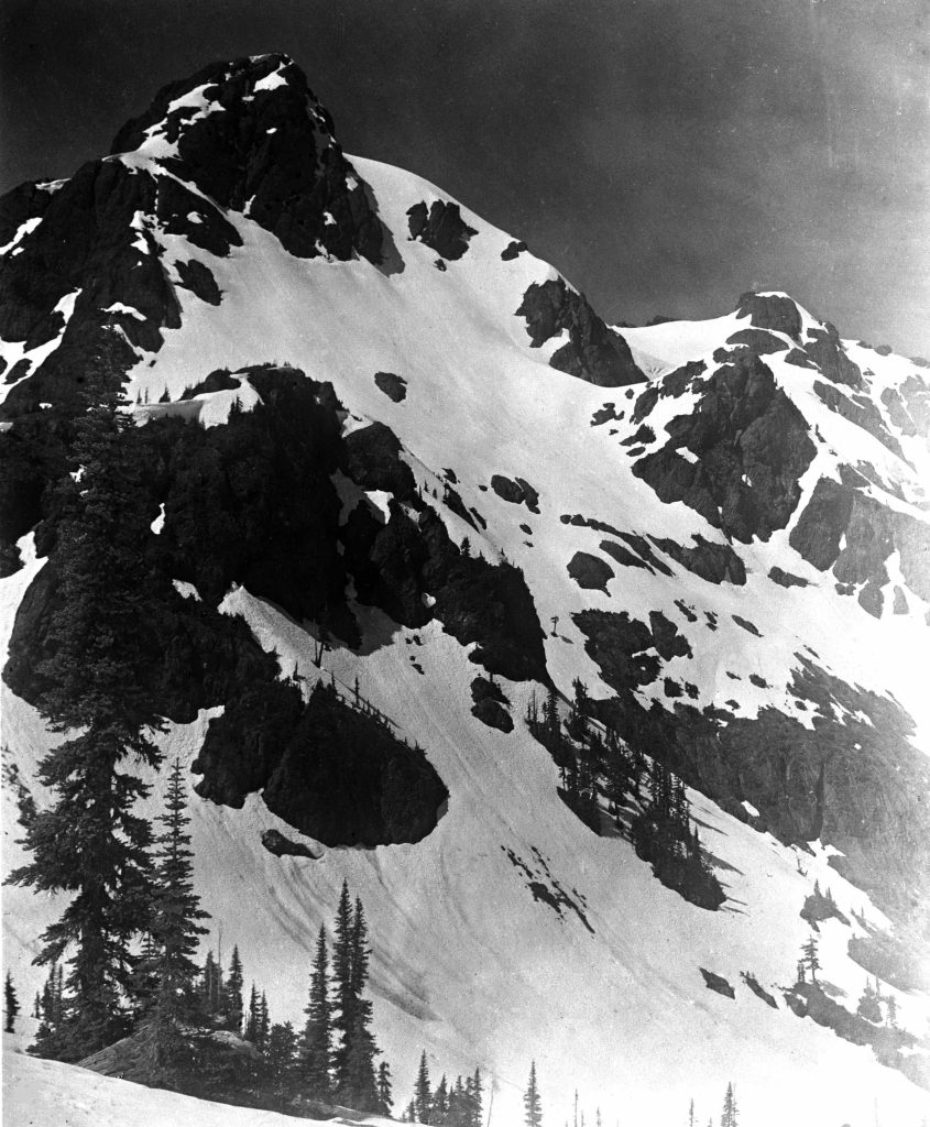
El Piveto Mountain at the head of Cervus Creek.
Not Much Game in Park
In Strathcona Park game is not plentiful at present, though it appears from the many well-defined game trails that, just a few years ago, there was an abundance. We saw black bear, deer, blue and willow grouse, and ptarmigan. There are a few elk in the Elk River watershed, for fresh tracks were seen. A cougar hunter bagged three cougars up the Elk valley shortly before our arrival in June. Wolves have been reported recently. Along the gravel-bars in the large streams we saw wild geese and ducks, and also signs of beaver on the river-banks. Mink, marten and squirrels are present, but not numerous. There are also many small birds such as robins, blue jays, etc. Trout fishing is very good in most of the larger streams and lakes, especially so in the Upper Campbell and Buttle Lakes and the Elk River. Dolly Varden, rainbow and cut-throat trout are the varieties found. We saw many large salmon in the East Fork of the Gold River. There is a notice scribed on a cedar tree at Summit Lake stating that some members of the survey party on the west boundary of Strathcona Park, in 1914, placed some fifty trout in Summit Lake. These have multiplied, for the lake is now well stocked.
Beauty Spots Now Accessible
Beyond the roads and trails already mentioned, the country is very difficult and consequently unattractive to the average person. Its beauty spots are now only accessible to the determined mountaineer, prospector or trapper. The Elk River Timber Company has completed a railway to the lower end of Upper Campbell Lake, and are now working on a grade up the Elk Valley this new grade being completed as far as the North Fork of the Elk River. There is very little development. At an auto camp at Upper Campbell Lake, boats for fishing may be had and saddle and pack horses for the Buttle Lake Trail. Also, boats are rented at Buttle Lake. There is a privately owned lodge at both Upper Campbell and Buttle Lakes. The chief natural resources are the forest wealth and the tourist possibilities, which can be expected when the scenic attractions and the fishing are made accessible. From the past season’s field-work it has been definitely established that a peak situation about 9 miles south of Mount Elkhorn [Mountain] is 20 feet higher than the latter, and is therefore the high point of Vancouver Island. Its altitude is 7,220 feet. This is the Rooster’s Comb climbed this year by a Courtenay party for the first time.
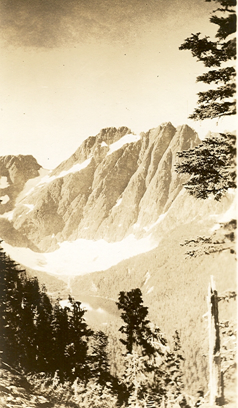
The East Face of Mount Colonel Foster from the slopes of Elkhorn South Mountain 1937.
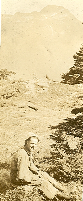
George Colwell in a meadow on Elkhorn South Mountain 1937.
Summer Skiing
Reported in The Daily Colonist Sunday September 19, 1937. p.3.
By Robert Hopkins and Allan Baker
The Forbidden Plateau is well-known as a hiker’s and fisherman’s paradise and needs no introduction. With its Indian legends it has a peculiar fascination all of its own. Situated within fifteen miles from Courtenay, its hundred square miles of alpine country have never really known human habitation. Now there are strategically situated three log cabins for hikers, which are open in the Summer and easily accessible by a well-worn trail. Two of these are right in the heart of the Plateau, Wood’s cabin at McKenzie Lake, and Croteau’s Camp at Croteau lake, which has a wonderful view through a pass of Mt. Albert Edward. Woods is rapidly putting the finishing touches on a log cabin at Mariwood Lake, which will of interest to many. With the fine Lodge, 2,000 feet high, approached by an excellent private road, Woods is in the position to offer really fine accommodation and has other plans in view, namely, a cabin below Moat Mountain. His will make possible a direct dash for mt. Albert Edward in the Winter season, as it be only a few hours from the peak. Formerly it had never proved feasible to make Albert Edward, tried many times. It had always proved unsuccessful, due to inclement weather conditions and the long distance.
On Mount Becher
From the peak of Mount Becher, only a few hours from the Lodge, a magnificent view of Mt. Albert Edward is afforded. It looms way up far over to the right and seems fairly close. Actually it is nearly two days away, approximately twenty-three miles off. On the May 24th week-end, skiing on the peak of Mt. Becher, we noticed the extraordinary amount of snow on Mt. Albert Edward, a solid expanse of white. It was a beautiful sight. A chap by the name of Dick Idiens, with us, regrettably mentioned the fact that no one so far had ever skied over to that point. That immediately convinced us that we would try, and that the end of June would be an excellent time. So approached the time and we made ready, June 26 seeing three optimists, namely Allan Baker, Vic Little and Bob Hopkins hit out for the Plateau, joined by Roger Schjelderup at Courtenay. We arrived at the Lodge at 8 p.m., had supper and changed clothes, and put on our light packs as we were certainly not going to take heavy stuff, there being grub all the way long. At 10 p.m. we pulled out for the Comox and District Mountaineering Club cabin, just below the peak of Mt. Becher, and arrived at one o’clock in the morning in a rather tired state.
To Croteau’s Camp
The next day we set out on another leg, to Croteau’s Camp, about twelve miles away. Skiing part of the way and walking the rest, as there’s a drop of 1,200 feet into McKenzie Lake, where we arrived at two in the afternoon, to have a welcomed lunch and rest. From there we made Croteau’s at 8 p.m., taking our time to take copious pictures of any alpine scenes that we might come across. All the way from Becher there is a continuous chain of lakes, with excellent fishing possibilities, although we were a little early in the season. It is without doubt one of the most magnificent mount-territories that one could hope to see. From Croteau’s the view of Mt. Albert Edward through Mt. Alma [Mount Elma] Pass was certainly a worthy reward for all the hard work getting there. On Monday came a real day, the ten-mile ski trip to Mt. Albert Edward. Dropping down a steep hill from Croteau’s onto a flat section of country with a depth of snow around three feet, we put the skis on. From there it was stiff cross-country work for some five or six miles, with myriads of lakes still covered with ice and snow. Looming up in front of us was, however, a steep climb, practically going up sheer for 1,000 feet. We somehow criss-crossed all the way up, and looking down from the top one visualises skiing down, or rather slaloming, and perhaps not that. It is the steepest course we ever saw, and if some of the trees were cut out, it would be a supreme test of slalom skill and control.
A Long Steep Climb
We then skied up another steep hill and emerged out in the open again. Mt. Albert Edward being only a few hours away, although it looked as if you could put it in your pocket, it was so close. Applying wax again, as there was along pull up the leg of Mt. Albert Edward, we jogged on and on, sometimes wondering just when we were ever going to get there. However, there were views to take our mind from such minute details, such as a 2,000-foot drop on one side if you approached too near, and sometimes it was necessary. The snow was solidly packed down about eight feet in depth, cracking a bit at the edges, making it risky to go too close. The view from the top is absolutely unrivalled. The visibility being perfect, it was possible to see for 400 miles in radius. The Comox Glacier, over to the left, with its perpetual snow, was particularly noticeable. Far over the northwest stretched the Mystery Mountain, Mt. Waddington, only conquered last Summer, and just below us was a vast stretch of lakes and snow. To see Mt. Alma [Elma], our base, we wondered just what time we would get back as it was then 5:30 p.m.
Forty Miles an Hour
So we started down, first putting on candle wax to give us sufficient speed, which we found was not necessary at all, it being quite fast enough. The snow was the finest Summer kind possible. Literally being able to turn on a dime, we found ourselves going down at around forty miles an hour. Reaching the beginning of the leg in something like five minutes, which had taken us a good hour or over to go up, we regretfully wished that it was possible to go up again, but time did not permit. However, Moat Mountain gave us a few worries. Taking it in tight turns we got down somehow, and from there it was simple work to reach Croteau’s Camp again, the entire day taking about twelve hours. From Croteau’s we vowed that others would know about this wonderful skiing country with its great possibilities, and hence this article. The next day we slowly wandered back to Wood’s Lodge, taking our time, and perpetually drinking out of the never-ending creeks. A bath and an excellent supper was the treat of the day, and congratulating Mr. Clinton Wood on the excellent work that he has done to make so many changes which are all to the hikers and skiers benefit, we left with the knowledge that the Forbidden Plateau will come to be a Mecca for skiers.
Best For Skiing
Skiing is a sport which has not as yet really come to be appreciated by the sports-minded on the Island, especially Victoria. Having skied on most of the well-known slopes on the Coast, such as Grouse Mountain, Mounts Hollyburn and Seymour in North Vancouver, and Mt. Baker and the Olympics in Washington, it is a safe comparison to say that Mt. Becher, on the Forbidden Plateau, is every bit as good, if not better. To further this enthusiasm over this king of sports, it would seem necessary to form ski-clubs and go right after members in a big way. This is perhaps the best way, as it forms a fine competitive spirit which is necessary to bring out the best in a skier. The distance to the Forbidden Plateau has probably been a drawback in the past, but with the considerable improvement on the Island Highway, time will be lessened to quite a degree. One can compare the distance from Vancouver to Mt. Baker as from Victoria to Courtenay. The difference is only forty-seven miles. Every Sunday car after car will pull out from Vancouver for Mt. Baker for some four or five hours of skiing and come back that night. A week-end trip to the Plateau is the logical idea. Leave here on Saturday afternoon at around 2 p.m. and arrive at the Lodge at approximately 6:30 p.m. Get up early on Sunday morning and hit out for Mt. Becher peak. There one can have at least four hours of excellent skiing and then a flying dash down to the Lodge for coffee and a rest. Leave for Victoria at around 5 p.m. and arrive at 10, making a grand week-end and very inexpensive, say around $4.
Aids To Comfort
With added facilities at the skier’s command, such as a radio and newspaper bulletin, giving all the latest news of road and snow conditions, to be put into effect this coming Winter, everything points to a really fine season. Also, there will be an excellent slalom trail cut from the Lodge to the top of the wooded section, making one of the finest tricky downhill runs anywhere on the Coast. Such is the type of country on Mt. Becher that even beginners can readily master the elementary turns and stops, and the more experienced skiers will find many wide-open fast runs which will tax his skills to the utmost. There will be records smashed this coming Winter, namely, the run from the peak of Mt. Becher to the Lodge, present time being forty minutes. This should be cut to twenty-five minutes. Those who do not wish to climb up to Mt. Becher can always enjoy themselves at the Lodge, where there are many nursery slopes cut out, and also some that are not nursery. It is said that the Lodge is quite the place to go during New Year hi-jinks, where skiers revel all night and morning, either doing divers things or endeavoring to ski from the moonlight and the floodlights from the Lodge or from their own mental apparitions.
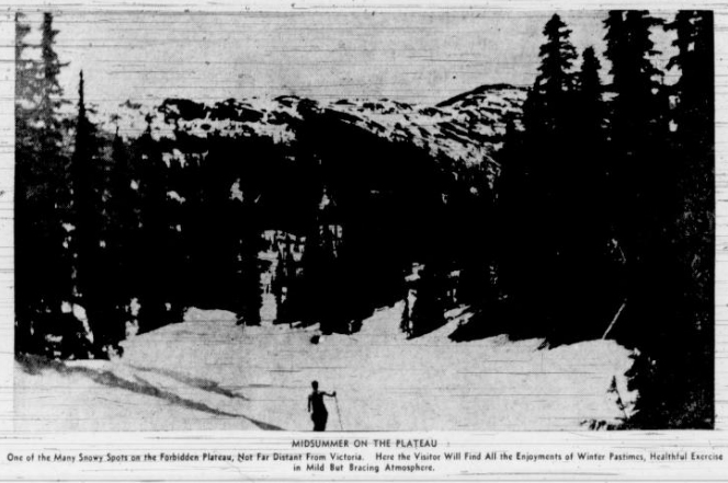
MIDSUMMER ON THE PLATEAU One of the Many Survey Spots on the Forbidden Plateau, Not Far Distant From Victoria. Here the Visitor Will Find All the Enjoyments of Water Pastimes, Healthful Exercise ie Mild But Bracing Atmosphere.
Skiing Up Mt. Albert Edward
Come Down from Peak At 40 Miles Per Hour
Reported in the Comox Argus Thursday September 23, 1937. p.2.
In a month or two when snows whiten the flanks of Mount Becher the skiers will be looking over their harness. They will find a considerable improvement in the facilities offered them. Mr. Clinton Wood has taken his road almost as far as Bald Rock on the steep rise above the lodge. His objective is the first meadows where he intends to build a ski cabin. Here there will be nursery slopes for beginners; others can make their way up to Mount Becher and the Forbidden Plateau beyond.
Jordan Meadows
Reported in The Daily Colonist Sunday October 24, 1937, p.4.
By Robert Connell
Across the hills in the Jordan Meadows are strung about the headwaters of the Jordan River, a number of tarns with one large one, Trout Lake. They are the exact counterparts of those found in the hilly moorland district of the British Isles. The brown peaty water runs through the sphagnum and wild-cranberry bogs and collects in the lakelets and then slips over the flat-bottomed basin in which they have collected, as full-grown mountain streams. The basin has been originally a valley of pre-glacial times, but has been deepened and its sides steepened by ice-action, and no doubt partially filled with drift. In an earlier stage of its post-glacial history it must have consisted of one or two large lakes which have disappeared under the growth of sphagnum and other bog plants, as well as material carried down from the hillsides. Outside the lakelets and pools, and the streams that connect them or issue from them, Jordan Meadows is, therefore, a combination of peat-moss and alluvial flats.
Full page article on Jordan Meadows, by Frank M. Kelley, from The Daily Colonist, Victoria, Sunday, July 25, 1943.
Officers Of the Alpine Club Are Elected
Reported in The Daily Colonist Friday December 3, 1937, p.7.
Mr. Claude L. Harrison was re-elected chairman of the Vancouver Island section of the Alpine Club of Canada, at the annual meeting held last night [December 2] at the home of Mr. and Mrs. Harrison, Uplands. Mr. Fred Maurice was re-elected secretary-treasurer, and other on the executive include Mr. William H. Dougan, Mrs. Kathleen Martin-Tuckey, Miss Ethne Gale and Mr. Allan Baker. Among the reports presented was that of the outings committee by Mr. Francis Tuckey, in which he specially mentioned the trips to Jordan Meadows and Mount Jewell as the outstanding climbs of the year. The photographic committee reported many entries had been sent by the local section to the Alpine Camp in the Rockies last Summer, and Mr. Charles Whitney-Griffiths suggested that the Vancouver Island section hold a photographic competition here, for which he offered to donate a prize. A letter from Mr. Arthur O. Wheeler, honorary president of the Alpine Club of Canada, was read, telling of the proposed site for the 1938 camp in the Rockies. After the meeting, refreshments were served and an informal evening enjoyed.
1938
ACCVI Executive:
Chairman – Claude Harrison
Secretary/Treasurer – Fred Maurice
Outings Committee – Francis Tuckey
Executive Committee – William Dougan, Ethne Gale, Kathleen Tuckey, Allan Baker
Events:
February 13 – Fred Maurice entertained section members at his home in Uplands.
March 26 – Club’s 32nd annual banquet held at Deep Cove Chalet.
Section members who attended the ACC general summer camp at Columbia Icefields: Mark Mitchell, Ethne Gale, Muriel Aylard, Aileen Aylard, Cherry Barstow [graduated July 21 on Mt. Athabaska], Brenda Stonham [graduated July 18 on “K2’], Jean McDonald [graduated July 18 on Mt. Columbia], Fred and Edith Maurice.
Ski Parties Out
Reported in the Comox Argus Thursday January 6, 1938, p.6.
Mount Becher slopes were busy with skiers at the New Year. Several large parties were entertained at the Forbidden Plateau Lodge. The weather was too mild for good skiing at the lower altitudes, but on the top of Mount Becher the snow was in excellent condition. A small party of members of the Comox District Mountaineering Club used the cabin and had a very delightful holiday on top. Two members of the club spent a night out in the open. They got lost on their way to the cabin on Friday. Search parties went out long before daylight on Saturday morning from the cabin and from the Lodge, and the two young climbers were found in a ravine in rough country near Brown’s River. They were none the worse for their experience.
Ski Tournament on Mount Becher
Vancouver Zone Ski Club Making Arrangements for March
Reported in the Comox Argus Thursday January 20, 1938, p.2.
Mount Becher is now on the air as a skiing field of the province. Snow conditions are reported on Fridays and Saturdays by C.B.R., Vancouver. There has been more snow on the higher levels and there must be eight feet at the cabin and on top. What is very urgently needed is the reblazing of the trail from the end of the road above the Forbidden Plateau Lodge to the Mountaineering Club’s cabin. The summer-time blazes are old and, at this time of the year, under the level of the snow. Two boys have been lost all night and several experienced climbers have lost a good deal of time getting off the trail when there has been fresh snow, and they have had to break trail in the dark. The Vancouver Zone Ski Club is busy with arrangements for a ski tournament on Mount Becher early in March. This would place Courtenay and Mount Becher definitely on the map as a ski centre. It is hoped that some of the men at the Medicine Bowls camp might be used to cut some ski trails on the lower slopes on that occasion.
Famous Climbers Here
Mr. and Mrs. Don Munday, famous climbers of Mystery Mountain and other peaks, have gone up into the Forbidden Plateau. They went up with Captain Rex Gibson of Edmonton and Miss Ethne Gale of Saanich. They are taking with them Dick Idiens as a guide and, if weather conditions are favorable, will try skiing on Mount Albert Edward. They drove up to the Forbidden Plateau lodge yesterday. They were the guests of Mr. Edward “Ted” and Mrs. Grieg of Royston on Tuesday night.
Defy Snows of Island Peak
Reported in The Victoria Daily Times Saturday January 29, 1938, p.1.
For the first time in the history of mountain climbing on Vancouver Island, Mount Albert Edward has been ascended during the winter. The mountain in the Forbidden Plateau, 6,868 feet high, was ascended by Mr. Don and Mrs. Don Munday, well-known Vancouver mountaineers; Miss Ethne Gale, Victoria, Captain Rex Gibson of Edmonton, Dick Idiens of Courtenay and the guide Len Rossiter of Comox. Starting from Croteau’s cabin on January 23, using skis, the group took five hours to reach the summit. The temperature recorded on the summit was 12 degrees Fahrenheit. The descent took three hours. Skiing conditions were excellent, the snow being powdery. The depth of the snow on the plateau was from 8 to 10 feet, but due to a strong west wind blowing, the snow on the mountainside was not that deep. Each member of the party is a member of the Alpine Club of Canada, with the exception of Dick Idiens and Len Rossiter. These two belong to the up-island mountaineering club.
Climbers Make Peak’s Summit
First Winter Ascent of Mount Albert Edward, Vancouver Island, Achieved
Reported in The Daily Colonist Sunday January 30, 1938, p.10.
A group of well-known Vancouver Island mountaineers last week-end made a successful ascent of Mount Albert Edward, 6,866 feet, one of the peaks in the Forbidden Plateau. It is understood it was the first time the mountain had been ascended during the Winter when entirely covered with snow. The party, composed of members of the Alpine Club of Canada, left Croteau’s Cabin on January 23 and made the summit in five hours. Using skis, they made the descent in three hours, finding the conditions nearly perfect, owing to the low temperature, 12 degrees Fahrenheit at the summit, and the depth of the snow, which averaged from eight to ten feet. The mountaineers were Don and Phyllis Munday, of Vancouver, who are among the best-known Canadian alpinists; Miss Ethne Gale, of Victoria; Captain Rex Gibson, of Edmonton; Dick Idiens, of Courtenay, and Len Rossiter, of Comox, who acted as guide.
Entertain Alpine Club
Reported in The Daily Colonist Tuesday February 15, 1938, p.8.
Mr. and Mrs. Fred Maurice, Uplands, entertained members of the Vancouver Island section of the Alpine Club of Canada to tea on Sunday afternoon [February 13]. Among those present were Mr. Francis and Mrs. Kathleen Tuckey, Mrs. J.H. Frank, Dr. Alec Gunning, the Misses F. and V. Wheadon, Miss Stephanie Jones, Miss Kathleen Greer, Miss Norma Pipe, Miss Peggy Frank, Mr. Allan Baker, Mr. Thomas Goodlake, Miss Bobbie Fisher and Miss Vivian Martin.
Munday Heads Forbidden Plateau Ski Party to Scale Snow-bound Mt. Albert Edward
Reported in the Victoria Daily Times Saturday February 19, 1938, p.20.
By Don Munday
“What pleasure can there be in winter on the Forbidden Plateau when spindrifts and icy winds make it forbidding and forbidden in earnest?” Doubtless people who have seen only the summer loveliness would ask some such question about a trip so bold-sounding as a winter crossing of the Forbidden Plateau to climb Mount Albert Edward, the highest mountain yet attempted on Vancouver Island, in winter. But mountains and snow and skis make a magical combination – sports writers have hardly guessed it, but skiers outnumber devotees of any other form of sport. Mount Albert Edward had been an objective of several unsuccessful attempts by members of the Comox District Mountaineering Club, under the leadership of Richard “Dick” Idiens. Miss Ethne M. Gale of Saanichton and Captain Rex Gibson of Edmonton had visited Mount Becher at the edge of the Forbidden Plateau with Mount Albert Edward in mind. My wife Phyliss and I appreciated an invitation to join them in a definite attempt on the mountain, although we had no delusions about January weather probabilities in the mountains. A story had been circulated that Miss Gale, Captain Gibson and Mrs. F. G. Maurice lost themselves on Mount Becher. No climbing associate of Gibson would believe it. But Eugene Croteau exacted a pledge that we take a local guide when he gave us the key to his cabin at Croteau Lake at 4,000 feet on the Plateau. Getting a guide to our liking took some time, so that night we went “to snore upon the hospitable floor” of Mr. and Mrs. Edward “Ted” Greig at Royston. Mr. and Mrs. Charles W. Sillence found a bed for two of us, so we tried to refrain from snoring. Next morning Len Rossiter, the experienced Forbidden Plateau guide, agreed to come along, although not quite recovered from a severe skiing injury. At the Forbidden Plateau Lodge, 2,100 feet, we met Mr. Clinton and Mrs. Mary Woods, and lunched above the clouds before buckling on skis and shouldering heavy packs for ascent to Mount Becher cabin of the Comox District Mountaineering Club. The club courteously permitted us to use it. Startling red light of a wintry sunset singled out peaks here and there along 200 miles of the Coast Mountains as we neared the cabin. My wife and I in particular thrilled to discover the wild color lingering long on mighty Mount Waddington “Mystery Mountain” while all else dimmed in twilight shadows which were entrancingly unusual but too prophetic of storm. Richard Idiens, we accused of bringing a blizzard on his heels when he joined us near midnight. But indoors the overfed stove made us toss all night with too much warmth. The cabins entrance looked like a grizzly’s lair hidden in a clump of storm-twisted trees. Any wise bear would have gone on hibernating in the morning, but we hoped to cross the Forbidden Plateau to Croteau’s cabin in spite of the storm. Though the local men said the steep slope to be climbed above the cabin had never been known to avalanche, we urged haste when we discovered a tendency to form “wind slab,” a treacherous type of snow which causes many of the fatal avalanches in the Alps. Swirling snow and the thin light confused heights and angles of the slopes as we descended the other side of Mount Becher. There were half-guessed precipices whose brows the wise skier shunned because a ski track might be all needed to release the tension on settling snow on convex slopes. Down in the woods we often sank thigh-deep in spite of skis. Packs handicapped us; we carried sleeping bags and food and equipment for a week. Crossing a vague valley, we climbed towards a pass beside Indian Head. The storm blotted out tracks behind us as if to fill us with fear of being unable to retreat. By the time we had wallowed down the side of Mount Drabble to the cabin at Lake Mackenzie all were more or less wet from snow melting on us. Rossiter and Idiens were not too confident of finding the way through the more difficult country ahead. Trail blazes were too low to mark the way in winter. Obviously, we could not reach Croteau’s before dark—if at all. January nights are very long to spend out of doors on a mountain top. So, we shoveled out the stovepipes and dried clothes, some on, some off. Idiens almost promised us trout for supper from the snow-buried lake, but he could not dig through the ice because of deep water above it. Dense clouds smothered the Plateau when we started the third morning. The map told us that ahead sprawled broad ridges, hummocky hollows, scores of meadows and lakes, all without an orderly drainage system. Our course would be too devious to make travel by compass really practicable. Only the winter traveler in the mountains knows how 10 feet of snow alters summer landmarks, but Rossiter displayed now—as throughout the trip—thorough knowledge of the Plateau as well as mountaineering instinct for the line demanding least outlay of energy. Pit ant-lions dig to engulf ants are crude traps compared with holes hidden from our eyes by a filling of six feet of fluffiest snow. If the luckless skier plunged in wrong end up, his pack held his shoulders down and his skis held his feet up. Onlookers usually grin and gibe while the buried contortionist detaches pack and skis to right himself – of course, in rare cases, lone skiers have suffocated in deep snow. We made it an invariable rule that all the members of the party must be accounted for at short intervals, no matter how easy the going. It must be admitted skiing is a bit more dangerous than ordinary mountain travel, but it is the pleasantest, as well as most practicable, means in winter. Once we found Panther Lake, we had a fairly straightforward climb to the pass at the upper end of Croteau Lake. Snow 10 feet deep buried the cabin. Idiens had worked out an effective way to move snow without a shovel – loose snow is tramped hard enough to be cut out in blocks with the end of skis. As the door opened outward, a shaft had to be dug all the way to the ground – an hour of chilling in-action for the non-diggers. At last, the tightly-swollen door was pried open and a shovel found to clear stovepipes. Then additional digging at the doorway revealed a shovel against the wall within six inches of the original pit! Rafters sagged alarmingly with the weight of snow on the roof. Idiens cheerfully assured us he had seen them much worse, but forgot that rafters, like humans, weaken with age and abuse, only faster. Tents, mattresses, bed springs and other summer camp equipment seemed to half fill the cabin. Shifting all this stuff to make sleeping space called for well-coordinated efforts. So did the reverse process in the morning. One man’s notion of comfort was to sleep atop nine mattresses and seven springs. My wife and I showed comparatively Spartan simplicity with only two mattresses each on the floor. We overslept. The first man peeked out and reported sunshine, but three and a half feet of snow drifted against the door. It had to be pried open with a peavey before he could squeeze out with a shovel. Not too hopefully we started in dwindling sunlight for Mount Albert Edward, the summit possibly eight miles away. Rossiter led us around the steep side of Mount Elma by a delightful route which felt as though downhill, either coming or going, because our speed down each dip carried us up the next rise. Dark storm clouds ahead wrestled from Mount Albert Edward. From Hairtrigger Ridge we swooped on hissing skis into the valley below Strata Mountain, and climbed around its base to the 800-foot shoulder of Mount Albert Edward, which we had been told might not be climbable in winter on skis. While gobbling sandwiches and cake in the pass above Circlet Lake we held a one-sided argument with ourselves as to the sense of struggling to the summit (still 2,600 feet) in storm and returning after dark, as against probably better weather and an early start on the morrow. We had to replenish the wood supply at Croteau’s cabin before we went home, so did it this afternoon. At dusk a local storm cloud still clung like a beast of prey to Albert Edward’s shoulders. From a pleasant skiing hill near the cabin, we sighted lights of Powell River twinkling in the violet void.
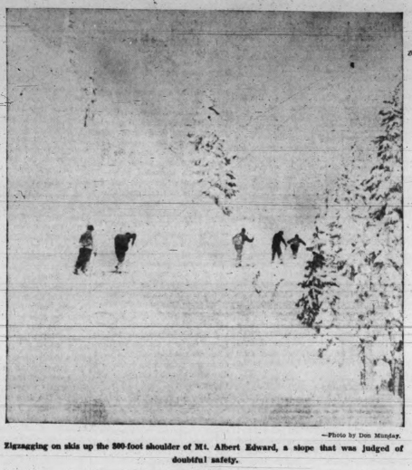
Zigzagging on skis up the 300-foot shoulder of Mt. Albert Edward, a slope that was judged of doubtful safety.
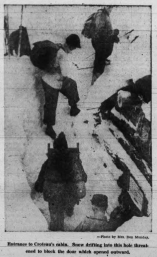
Entrance to Croteau’s cabin. Snow drifting into this hole threatened to block the door which opened outward.
Hardships of Winter Mountaineering on The Forbidden Plateau
Our evening meal always went from soup to nuts, and this night two of the party even emerged from the kitchen with pristine bloom restored by a bath. Wintry patches of frosty ski excited us as we started before sunrise January 23. The crest of Castle Mountain [Castlecrag] loomed in folds of clouds streaming stormily from Mount Albert Edward. Unconsolidated powder snow piled deeply against the great shoulder of the mountain. Our skis sent quantities pouring down, but the slope held. Still nearly 2,000 feet above us the summit peered briefly over the two-mile-long summit ridge. Shadows widened, clouds scudded across the Plateau; wind raged and snow poured blindingly across the ridge. Except when skis broke wind-scalloped ridges our tracks vanished as soon as made. When the deceptively long ridge heaved into the final pyramid it looked no more substantial than cloud. The snow-encrusted summit cairn appeared as cold as the outside of an igloo—20 degrees of frost and a gale soon chilled our interest in glimpses of the 4,000-foot gorge of upper Oyster River. In clear weather the winter view must be superb. Often while we rattled down the wind-clawed ridge the snow surface literally was indistinguishable beyond our ski tips. While this might suggest real risk of shooting off the edge of massive snow cornices overhanging the precipices above the northern glacier, actually a faint shadow of the abyss always outlined the brink in time. When we reached the cabin more than one complexion showed effects of wind and flying snow. Return to Becher cabin, made in a short day, began in light snowfall but ended stormily. Idiens hurried on down to Royston. A bright morning gave us a pleasant run in prefect snow till we reached the end of the road to Forbidden Plateau Lodge. Men from a forestry camp had just started clearing a ski run beside the road which the snowplough often makes unfit for skiing. At the lodge, Miss Gale’s car refused to start. Hairpin bends on the road below were nearly hair-raising as we swayed down in the wake of a towing car, but the driver’s skill saved us from damage. Although eventually other skiing areas will be made accessible, Vancouver Islanders are fortunate in having a road leading up so close to the Forbidden Plateau.
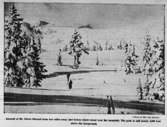
Summit of Mt. Albert Edward from two miles away just before storm swept over the mountain. The peak is still nearly 2,000 feet above the foreground.
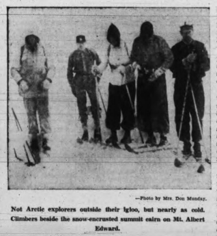
Not Arctic explorers outside their igloo, but nearly as cold. Climbers beside the snow-encrusted summit on Mt. Albert Edward.
Skiers Like Mount Becher
Big Parties Up at Week-End Getting Ready for Tournament
Reported in the Comox Argus Thursday February 28, 1938, p.1.
Several members of the Courtenay Board of Trade were the guests of Mr. Clinton S. Wood at the Forbidden Plateau Lodge on Sunday and in spite of the heavy rain, they enjoyed themselves thoroughly. They drove out to the first grade where they were met by the snowmobile and taken up in that novel conveyance in a fast clip to the lodge, where they were entertained and they inspected the Kandahar run, which comes into the tractor road just above the lodge and were impressed with its possibilities for skiing. The lodge was full of skiers last week-end. A party came over from Port Alberni and others down-island. Preparations are going forward for the ski tournament next month. One party has booked accommodations at the lodge for the event and more are coming. There is another crowd of skiers coming in this week-end. Their chief complaint is the condition of the road to Bevan; they say it takes them longer to come from Courtenay to Bevan than to go over private road to the lodge. Snow conditions are excellent. It is now possible to reach the fourth grade in cars. There is three or four feet at the lodge and eleven feet at Mount Becher cabin, where the slalom race will take place.
Much Interest in Ski Meet
Many Noted Performers Have Already Announced Intentions to Come
Reported in the Comox Argus Thursday March 3, 1938, p.8.
Bookings at the Forbidden Plateau Lodge for the ski tournament on 19 and 20 of March already assures a great interest in this, the first ski tournament on Vancouver Island. The Vancouver Ski Zone Committee representing the B.C. Amateur Ski Association is taking charge of the arrangements of the actual program. There will be races on Saturday and Sunday. On Saturday the slalom races will take place on the slopes of Mount Becher. The slalom race is a race between flags designed to show the skill of the performer. The events on Sunday will all be on the Kandahar course above the lodge on a course cut between trees and other natural objects. The events are as follows: Saturday, march 19, Mt. Becher, 2 p.m. Ladies Slalom and Open Men’s Slalom. Sunday March 20, 12:30 p.m., Ladies open downhill. Ladies downhill, Vancouver Island championship. 1:00 p.m. Men’s open downhill. Men’s Class B downhill, for mainland skiers only. Men’s downhill, V.I. champs.
Expert Skiers Will Perform
Fifteen From Vancouver Club at Tournament Next Week
Reported in the Comox Argus Thursday March 10, 1938, p.1.
Word has been received by Mr. Clinton S. Wood from Vancouver that five of the ski clubs there will send three of each of their most expert skiers to the ski tournament that is being held on Mount Becher at the end of next week. Saturday and Sunday. This will insure some first class performances. Among these experts will be Miss Gertrude Wepsala, Dominion champion of ladies for slalom and downhill racing. In addition to the races as first drawn up there will be a Forbidden Plateau championship, open to all skiers, making seven events in all. All the slalom races will be held on the slopes of Mount Becher, above the cabin of the mountaineering club. If snow conditions continue as they are now, spectators, who are not skiers, but are accustomed to hiking, should be able to get to the top to see the events on Saturday, since there is a crust that will carry a man with very little floundering. The Junior Chamber of Commerce of Victoria is supporting the events by giving twenty prizes and business firms in the Capitol city are giving cups for the championship.
Snow Perfect for Ski Meet
Two Feet of Fresh Snow Fell This Week
Reported in the Comox Argus Thursday March 17, 1938, p.1.
The snow that has fallen on the hills this week should make conditions excellent for the Forbidden Plateau Ski meet on Saturday and Sunday [March 19/20]. Two more feet fell at the Lodge and visitors can find plenty of good going right around the Lodge. For the slalom races on Mount Becher contestants and spectators will need skis or snow shoes to reach the cabin and the slopes above. The downhill races will finish close to the Lodge and they will be available to the public who drive up the road, which will be well broken by the week-end. Snow is down to about the fourth grade now. Skiers will begin to arrive for the meet tonight [Thursday]. Accommodation at the Lodge was exhausted some time ago.
Miss Wepsala Coming
The contestants are coming chiefly from Vancouver and Victoria, although a party of 25 is expected from Port Alberni where there is much enthusiasm for the chief winter sport. Miss Gertie Wepsala, the idol of ski fans of Vancouver, will be one of the party. Miss Wepsala won the Kandahar race on Grouse Mountain early this season and then went on to cop the western Canadian title at Princeton, and at Banff took the combined downhill and slalom crowns. Among the experts coming from Vancouver are Art Hullah and Chuck Gillespie of the Vancouver Ski Club, Gordon Harrington and Meta Scott of Grouse Mountain, Mickey Mitchell and Lou Davis of the Tyees, and Mr. and Mrs. George Bury, Gus Johnson, Druce Cook and Jack Pratt of the Hollyburn Pacific Club; Daisy Bourdon, Betty Swanson, Stan Body, Jack Lindsay, and Jack Taylor; and from Port Alberni: Thor Jacobsen, Paul Johansen Chris Johnson, Harry Motive, Tom Tysse. Alice McDermot.
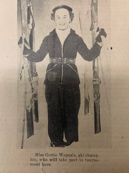
Miss Gertie Wepsala, ski champion, who will take part in tournament here.
Mainlanders Take Honors in Ski Meet
Win Championships at Forbidden Plateau’s Inaugural Race Meeting
Reported in The Daily Colonist Tuesday March 22, 1938 p.11.
Making their initial appearance at the Forbidden Plateau, British Columbia’s newest Winter playground, Vancouver skiers carried off the lion’s share of the trophies in the inaugural ski meet staged over the week-end. Approximately 100 skiers from the Mainland and Vancouver Island points attended the event and the success of the initial venture was very gratifying indeed to the sponsors. Gus Johnson, carrying the colors of the Hollyburn Pacific Ski Club, victor in Saturday’s slalom races, repeated his success on Sunday in the downhill events and was crowned the champion. Johnson covered the two-and-one-half-mile downhill course in 4:23 3.5 and shared with two other club members the first three places in the Forbidden Plateau championship event. Druce Cook was second and George Bury third. Twenty-two competitors faced the starter and went away at two-minute intervals. Tom Tysse, of Alberni, who placed fourteenth in the open downhill event, was awarded the Vancouver Island championship, Arthur Wood was second.
Women’s Events
The women’s downhill title went to Gertie Wepsala, with Daisy Bourdon second. Both skiers are members of the Hollyburn Pacific Ski Club. Held over a much shorter course than the open event, the Vancouver Island women’s title went to Jill Dunkerly, Courtenay. Mia Schjelderup, also from the Up-Island city, was second. Teresa Todd, Victoria, was third. In the “B” class downhill race for beginners, Don Combs, Vancouver, was first. Alf Baker, another Mainlander, was second. Prizes, including The Times Trophy, the Comox Logging Cup, the Coach Line Cup, the Province Cup, the Forbidden Plateau Cup, were presented at a luncheon in the Forbidden Plateau Lodge. Sunday’s events were witnessed by a delegation from the Victoria Junior Chamber of Commerce, sponsors of the meet in conjunction with the Comox and Courtenay Board of Trade and the Forbidden Plateau Lodge.
Results Follow:
Forbidden Plateau, Downhill, Ladies
1 Gertie Wepsala
2 Daisy Bourdon
3 Meta Scott
Time 5 minutes 6 2.5 seconds.
Forbidden Plateau, Downhill Men’s
1 Gus Johnson
2 Druce Cook
3 George Bury
Time 4 minutes 25 3.5 seconds
Other competitors: Lou Davis, Jack Lindsay, Jack Taylor, Konrad Liem, Howie Hammil, Stan Bodie, Steve Harrison, Art Coles, Sid Smith, Gordie Harrington, Tom Tysse, Arthur Wood, Roger Schjelderup, Dick Idiens, Charles McDermid.
Vancouver Island Championship, Ladies Downhill
1 Jill Dunkerly
2 Mia Schjelderup
3 Teresa Todd, Victoria.
Time, 2 minutes 45 4.5 seconds
Men’s Downhill
1 Tom Tysse, Alberni
2 Arthur Wood, Courtenay
3 Roger Schjelderup, Courtenay.
First Ski Meet on Vancouver Island
Great Success of Winter Sports Events on Mount Becher on Saturday and Sunday
Reported in the Comox Argus Thursday March 24, 1938, p.1 & 2.
The popularity of a winter play-ground devoted to skiing and other snow sports on Vancouver Island was demonstrated beyond doubt at the first ski-meet on the slopes of Mount Becher on Saturday and Sunday. Nature could scarcely have been kinder. Sufficient fresh snow had fallen to make the going all that could be desired and the road had been well ploughed out by Mr. Clinton S. Wood before the majority of the cars made the ascent to the Forbidden Plateau Lodge. The sun shone between the clouds and the whole of the magnificent panorama was sparkling in the winter scene. Whilst the majority of the skiers came from clubs in Vancouver, Victoria, Port Alberni and Courtenay showed a keen interest in winter sport and some devotees to take part in the races. Lindsay Loutet, chairman of the Vancouver Ski Zone Committee, and one of the judges of the meet, said the plateau was ideal for the one type of race they did not hold, a langlauf or cross-country event. The present island downhill course of two and one-half miles was a bit dangerous, he thought, and should be widened.
Jumps of 200 Feet
Mount Becher, Loutet said, was the only accessible place on the British Columbia coast, where ski jumps over 200 feet could be obtained. There was no jumping at the meet this year, due to the fact that a jump has not been built yet. Despite the depth of snow-it was 15 feet deep and the skiers had to burrow to the alpine cabin to brew some tea-Johnson swerved between the flags on the dizzy slalom course at 50 miles an hour. He made the two runs in 42 3.5 seconds. Konrad Liem, of Vancouver and another Scandinavian ace took the zig-zag run twice in 49 1.5 seconds. Stan Body of Vancouver, was the only non-Scandinavian to get to the first three. He placed second with a double run time of 46 1.5 seconds. There is no doubt that the event has been established on a permanent basis and that the Vancouver Island Ski Meet on the Forbidden Plateau will become one of the annual attractions of the ski calendar. The success of the event is without question due to the courage and organizing ability of Mr. C.S. Wood and the staff at the Forbidden Plateau Lodge, although it was much assisted by the Vancouver Ski Zone and the Victoria Chamber of Commerce. The latter were instrumental in raising most of the cups and the prizes for the various races and the former in giving their advice and experience in laying out the course and directing the events of last Saturday and Sunday.
Lodge Very Busy Place
Most of the contestants and visitors arrived on Friday night and the Lodge from that time forward was a very busy place, indeed. Fresh snow had fallen during the night and Mr. Wood and his ‘cat’ were kept busy ploughing the upper grades of the road. But by Saturday morning all was clear. Saturday morning was devoted to the slalom races. These were staged on the slopes of Mount Becher near the Mountaineering cabin. The officials of the Vancouver Ski Zone had selected as the course, the cliffs of the creek which flows just west of the cabin to Boston Lake. In the summer these are bare rock and the idea of ski-ing down them looks suicidal. The course was certainly at a grade of eighty to eighty-five degrees. The sight of the flying figures coming down this cliff side and making their turns round poles set for the course was something that thrilled the skiers, who had climbed up to see it, to the marrow. There is, of course, no race in the sense that the skiers must pass the winning post ahead of the rest; it is against time. But it was none the less spectacular for all that. There was at this season of the cabin, about twelve feet of snow, but a very busy place to take a rest and warm comfort nevertheless. The many improvements that have been made in it during the last year were appreciated.
Gus Johnson Champion
Gus Johnson, veteran skier of Vancouver, was the hero of both the slalom and the downhill races. He was back to his old form, apparently recovered from a sprain he had received some time ago. In both trials of the slalom, he made the descent and took the turns in 21 and two-fifths seconds. Steve Brodie came second with 20 and two-fifths seconds, and 22 and two-fifth seconds. The champion lady skier, Miss Gertie Wepsala, had the ill-luck to take a spill and came second to Miss Meta Scott. On Sunday the downhill events, whilst not as spectacular as the slalom, were accessible to the general public. The great interest taken in the events was demonstrated by the fact that when the races were in progress on Sunday there were eighty to ninety people on the snow and around the Lodge watching the contestants flash to the finishing point in front of the Lodge.
A Thrilling Course
The course was through the trees and natural obstacles above the Lodge. The brush and logs had been cut out, but there were plenty of obstacles of contour of ground and grade to make the course sufficiently thrilling for the most hardened skier. Gus Johnson was here, as at the slalom, master of the day. He made the two mile course in four minutes, twenty-five and three-fifths seconds, and came down the whole way without a mishap. He was the only contestant of the day that did so. In spite of this, however, Druce Cook was not many seconds behind him. The gallery at the Lodge gave them a rousing welcome.
Vancouver Swept the Board
Vancouver skiers, as was to be expected, swept the board. Victoria skiers have no snow fields of their own and consequently can hardly be expected to be as adapt. Vancouver took the first thirteen places in the men’s downhill. The Vancouver Cup, as Vancouver Island champion, went to Tom Tysee of Port Alberni with Art Wood of the Forbidden Plateau staff running him close. Dick Idiens of the Mountaineering Club had the misfortune to lose a pole on the way down and was behind Roger Schjelderup, who had not been on skis for some months previous to the race. The ladies’ course was shorter. For the open event, it was a mile and a half. Miss Wepsala won this with miss Daisy Bourdon second. The course for the Vancouver Island ladies cup was only a half mile. This was won by Miss Jill Dunkerly of the Lodge staff with Miss Mia Schjelderup of the Mountaineering Club in the second place.
(V) Vancouver; (C) Courtenay; (FP) Forbidden Plateau; (PA) Port Alberni and (Vic) Victoria.
The downhill events were as follows:
Forbidden Plateau Downhill (Men)
1 Gus Johnson, (V), 4 min., 25.6 sec.
2 Druce Cook, (V), 4 min., 39.4 sec.
3 George Bury, (V), 4 min., 44.6 sec.
4 Lou Davis, (V), 4 min., 46.2 sec.
5 Jack Lindsay, (V), 4 min., 50.2 sec.
6 Jack Taylor, (V), 4 min., 54.0 sec.
7 Konrad Liem, (V), 4 min., 59.4 sec.
8 Howie Hammil, (V), 5 min., 60.0 sec.
9 Stan Bodie, (V), 5 min., 0.14 sec.
10 Steve Harrison, (V), 5 min., 2.4 sec.
11 Art Coles, (V), 5 min., 15.4 sec.
12 Sid Smith, (V), 5 min., 18.8 sec.
13 Gordon Harrington, (V), 5 min., 34.2 sec.
14 Tom Tysse, (PA), 6 min., 5.4 sec.
15 Arthur Wood, (FP), 6 min., 11.4 sec.
16 Roger Schjelderup, (C), 6 min., 24.8 sec.
17 Dick Idiens, (C), 7 min., 1 sec.
18 Charles McDermid, (PA), 13 min., 1 sec.
Vancouver Island Downhill (Men)
1 Tom Tysse, (PA), 6 min., 5.4 sec.
2 Arthur Wood, (FP), 6 min., 11.4 sec.
3 Roger Schjelderup, (C), 6 min., 24.8 sec.
Forbidden Plateau Downhill (Women)
1 Gertie Wepsala, (V), 5 min., 6.4 sec.
2 Daisy Bourdon, (V), 5 min., 50.8 sec.
3 Meta Scott, (V), 6 min., 22.2 sec.
4 Betty Swanson, (V), 8 min., 19.8 sec.
Vancouver Island Downhill (Women)
1 Jill Dunkerly (FP), 2 min., 45.8 sec.
2 Mia Schjelderup (C), 2 min., 50.4 sec.
3 Teresa Todd, (Vic), 2 min., 50.6 sec.
4 Katherine Capes, (C), 3 min., 49.2 sec.
In the B class downhill race for beginners, Don Combs of Vancouver was first. Alf Baker, also of Vancouver, was second.
Prizes including the Times Trophy, the Comox Logging Cup, the Coach Lines Cup, the Province Cup, the Forbidden Plateau Lodge Cup, were presented at a luncheon in the Forbidden Plateau Lodge following the morning events.
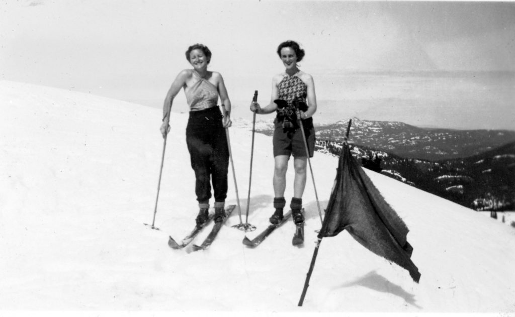
Mia Schjelderup and Katherine Capes skiing on Mt. Becher.
Slalom Races
Forbidden Plateau Championship (Women)
1 Meta Scott, Grouse Mountain Ski Club, 71 1.5 sec
2 Gertie Wepsala, Tyee Ski Runners
3 Betty Swanson, Hollyburn Pacific Ski Club
Forbidden Plateau Championship (Men)
1 Gus Johnson, Hollyburn Pacific Ski Club, 42 3.5 sec
2 Stan Bodie, Grouse Mountain Ski Club
3 Konrad Liem, Hollyburn Pacific Ski Club
Other competitors:
Art Coles, Tyee Ski Runners
Jack Lindsay, Vancouver Winter Sports Club
Steve Harrison, Hollyburn Pacific Ski Club
Sid Smith, Vancouver Ski Club
Druce Cook, Hollyburn Pacific Ski Club
Lou Davis, Tyee Ski Runners
Howie Hammil, Tyee Ski Runners
George Bury, Hollyburn Pacific Ski Club
Jack Taylor, Vancouver Winter Sports Club
Gordon Harrington, Grouse Mountain Ski Club
Arthur Wood, Courtenay
Alpine Club Celebrates Anniversary
Reported in The Daily Colonist Sunday March 27, 1938, p.12.
The thirty-second anniversary of the founding of the Alpine Club of Canada was observed last night [March 26] at the Chalet, Deep Cove [Sidney], by members of the Vancouver Island section, with a dinner, followed by the showing of appropriate moving pictures by Colonel Edward O. Wheeler, M.C., R.E.A.C. Greetings were received from other sections of the Alpine Club across Canada, which also took part in the annual celebrations. Addresses by Mr. Arthur O. Wheeler, honorary president and one of the founders of the Alpine Club of Canada, who at present is in California, and Mrs. Stanley H. Mitchell, honorary secretary of the parent society, were read by Mr. Claude L. Harrison, president of the Vancouver Island section. The toast to the King was proposed by Mr. Harrison, chairman for the evening, and Colonel Wheeler proposed the toast to the Alpine Club of Canada, to which Major W.R. Tweedie, Dominion secretary-treasurer, of Vancouver responded. The Alpine Summer camp at Yoho, fascinating scenes of the Southern Alps of New Zealand, and scenes taken in India, were included in Colonel Wheeler’s collection of moving pictures. He described the places and told many interesting incidents, being assisted in showing the pictures by Mr. Harrison. Spring flowers were used effectively on the tables, which were decorated in the colors of the Alpine Club: grey for the rocks, green for the forests and white for snow.
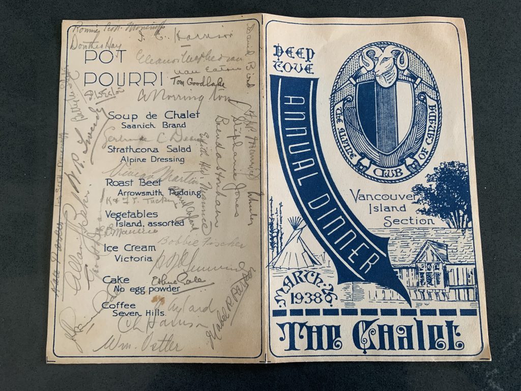
Banquet program, front.
Recognized signatures: Nan Eaton, Allan Baker, Claude Harrison, Ethne Gale, W.R. Tweedie, Dorothea Hay, David Bird, Brenda Stonham, Fred Maurice, Edith Maurice, Muriel Aylard, Kathleen and Francis Tuckey, Vivian Martin, Aileen Aylard, Mabel R. Parker, Kate Parker, Anne Norrington, Tom Goodlake, Lois Scott Moncrieff (Ethne Gale’s sister and wife of Ronald), Ronald Scott Moncrieff, Stephanie Jones, Bobbie Fischer, Arthur Wheeler, Edward Wheeler, William Ostler.
Banquet program, inside.
Climbed Mountain in Blizzard
Mr. and Mrs. Don Munday on Top of Mount Albert Edward on Skis
Reported in the Comox Argus Thursday April 9, 1938, p.5.
Mr. and Mrs. Don Munday, who went ski-ing on Mount Albert Edward last week with Captain Rex Gibson of Edmonton and Miss Ethne Gale of Saanichton with Len Rossiter and Dick Idiens as their guides, climbed on skis to the top of Mount Albert Edward returning to Courtenay on Tuesday. They had poor visibility and wild weather for their trip for the most part. The first night they went to Mount Becher where they stayed in the cabin. The next day they found the snow so yielding that sometimes they sank to their thighs on the skis and they stayed in the cabin at McKenzie Lake for the night. The next day they went through to Mr. Eugene Croteau’s cabin which was so snowed in that they dug their way down to the door and cleared it with some difficulty.
Soup-To-Nuts Dinner
Once inside with the fire roaring in the stove on which Croteau has cooked so many meals the party were soon snug and warm. Mrs. Phyllis Munday is a wonderful camp cook and they actually had a dinner of many courses from soup to nuts. No one who has not climbed in the winter will appreciate how good it tasted. The thermometer which they had taken once registered 73 degrees, and they had to take means to cool off. When they woke in the morning, they found that it had snowed another six inches or more in the night and blocked up the entrance again and they had trouble getting out. The next day they broke the trail to the foot of Mount Albert Edward and the next made the ascent to the top. They had no particular difficulty in getting on top of the ridge and the summit, but on the long ascent to the summit the wind was blowing so hard that it drove the snow into their eyes and made it impossible to see more than 50 feet. The surface of the snow was packed and hard as the roof of a house, but it was not possible to take any runs because they could not see where they were going far ahead, and the west wind was so strong that they had to dig in with their poles to make any progress. Mr. and Mrs. Munday, who are pioneers in mountaineering in B.C. enjoyed the comradeship of the trip very much and praised highly the skill with which their local guides took them through a country whose contours were rounded with snow and where all blazes were hidden.
Concentrate Survey Parties on Island
Topographical Mapping of Two-Thirds of Area to be Completed
Reported in The Victoria Daily Times Wednesday June 8, 1938, p.1.
Five of the six topographical survey parties sent out by the provincial government’s survey branch this year will work on Vancouver Island and by the end of the year approximately two-thirds of the island’s 13,000 square miles will be surveyed and contour-mapped, it was announced today by Honorable Wells Gray, Minister of Lands. If the present program is continued the entire island will be contour-mapped within the next three years. Approximately 50 men will be engaged in this summer’s work. The parties are now complete and will all be in the field within a week, survey-general Mr. F.C. Green said. Advance men who have gone out already in Strathcona park section report there is still four feet of snow on Mount Arrowsmith at 4,000 feet.
Strathcona Park
Norman C. Stewart will head the survey on the southwesterly portion of Strathcona park. This year’s work will complete the park survey. His party will also do the area west of the park, Muchalat, Shelter, Herbert Arms on the West Coast of the island. Two other parties will cover sections of the West Coast. Alan J. Campbell doing the area north of Nitinat Lake and River as far as the Alberni Canal, and George J. Jackson the part surrounding Barkley Sound and west of Alberni Canal. Robert D. McCaw will cover the headwaters of the Koksilah, Jordan, San Juan and Gordon Rivers. Air photographs of the western half of the Island between Barkley Sound and the south entrance of Nootka Sound will be taken by RCAF. These are used in conjunction with the ground surveys and photos under the photo-topographical system of mapping pioneered by the province.
Leaves For Alpine Camp
Reported in The Daily Colonist Sunday July 17, 1938, p.8.
Dr. W.E. Mark Mitchell, Granite Street, has left to spend two weeks at the Alpine Club’s Summer camp at the Columbia Icefields in the Canadian Rockies.
Leaves For Alpine Camp
Reported in The Daily Colonist Tuesday July 19, 1938, p.8.
Among the Victorians who have left to attend the annual camp of the Alpine Club of Canada being held in the Columbia Icefields, Canadian Rockies, are Miss Brenda Stonham, the Misses Muriel and Aileen Aylard, Mrs. Fred Maurice and Miss Ethne Gale.
Croteau Camp
Reported in The Daily Colonist Sunday July 17, 1938, p.16.
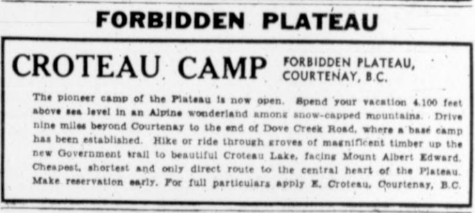
Croteau Camp (Forbidden Plateau) ad.
Many From B.C. at Alpine Camp
Reported in The Victoria Daily Times Wednesday July 20, 1938, p.16.
Among the climbers at the thirty-third annual camp of the Alpine Club of Canada, which opened here last week-end at the apex of the main Rockies Range, where the Columbia icefield spreads for 110 square miles at high elevation, are more than 40 western Canadians. From Vancouver Island are: Aileen Aylard, Muriel Aylard, Cherry Barstow, Ethne Gale, Dr. Irene Bastow Hudson, Brenda Stonham, Fred and Edith Maurice and Dr. Mark Mitchell.
Plateau Has Easy Access
Famous Forbidden Plateau Holds Attractions of Sport and Lovely Scenery
Reported in The Daily Colonist Sunday August 21, 1938, p.17.
Every holiday maker is in search of something different, some spot where it is possible to get right away from mundane surroundings. Nowhere is this possible in the same degree as a trip to the Forbidden Plateau, the glorious wonderland of scenic beauty which lies behind Courtenay and Comox. There are two ways of entering the plateau by trail, one via the Forbidden Plateau Lodge and one from Dove Creek. The Lodge trail goes over Mount Becher into Mariwood Lake. The Dove Creek trail leads to Croteau Lake. Pack horses and, if desired, guides are available and the journey is in itself a lovely trip. At an altitude of 1,400 feet the country changes to an aspect unknown elsewhere. Alpine flowers of every description are thick in the natural meadows. High above sea level the air is invigorating crystal clear and sweet with the scent of heather. There are lakes, literally hundreds of them, bordered by heather, red and white, and gnome cedars and cypresses. The whole is park-like free from undergrowth to hamper the progress or spoil the view.
Lovely Lakes
Lake Beautiful, where a perfect series of waterfalls joins an upper and a lower body of water; Moat Lake, cradled high in the side of a mountain, in the centre of the island a miniature lake; Emerald Lake, still deep and a glorious green; Circle [Circlet] Lake, so blue that it looks like a little piece of lost sky tucked in the fold of a hill, these and many others are waiting to be explored. There are other lakes as yet unnamed, so rugged and new is this great playground. The rivers are not large but swift and icy cold. They have been well-stocked with fish and good sport may be had. Rare alpine flowers are to be found and the plateau is a delight to the botanist. The amazing thing about the Forbidden Plateau is that it is so near and so easily reached. From Dove Creek by the trail to Croteau’s Camp or from the lodge at Mount Becher it is but a few hours’ hike or ride and you are in the heart of this lovely country, with all the joys of a woodland camping trip, yet with none of the drudgery of it.
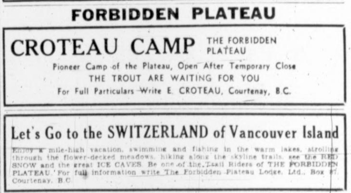
Croteau Camp and Forbidden Plateau Lodge ads.
Mountain Lake Has Volcanic Origin
Reported in The Daily Colonist Sunday August 28, 1938, p.34.
Mount Cokely, slightly less in height than Mount Arrowsmith, offers the same attractions to those interested in mountain climbing. Between the two peaks lies a lake of volcanic origin at a considerably lower elevation. Mount Arrowsmith is name after Aaron Arrowsmith and his nephew, John Arrowsmith, noted English cartographers. John Arrowsmith was one of the founders of the Royal Geographic Society. The mountain was named in 1853 by Captain George H. Richards, of the hydrological survey. The growth toward the summit varies from heavy fir, cedar and hemlock to scrub timber, while near the top there is nothing in parts but moss and heather.
Women on the Summit of Albert Edward
Reminiscences of Lillian Maud Emerson (nee Young) of Victoria.
August 1938 – I (Lillian Young) drove up to Courtenay from Victoria with a friend Eleanor Peden and met with Mia Schjelderup, May Hogben, and Effie Guthrie, a local teacher. We were planning a six-day hike up to the Forbidden Plateau. We took a load of supplies on our backs as well as a tent and headed to Croteau Lake where we pitched our tent. There we met the man who was in charge of a camp, a Mr. Preston Tait. He took us under his wing and acted as a guide on our hikes over the mountains. We climbed nearly all the mountains on the plateau, even climbing Mount Albert Edward, reaching up 8,000 feet. As we approached the peak it was all shale, and it meant stepping two feet forward and sliding one foot back. At the summit there was a cairn, so we all wrote our names on a paper and put it in a bottle at the base of the cairn. We returned to Courtenay just in time to catch our pre-arranged pick-up at the beginning of the Dove Creek trail.
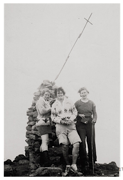
Lillian Young, May Hogben and unknown on the summit of Mt. Albert Edward 1938.
Four Days in The Beaufort Range
Recorded in the personal diaries of Geoffrey Gapes, Courtenay, 1938.
Sunday September 4 – Ruth Masters spent the night here. Katherine [Capes] had us all up by 4:30. Adrian Paul arrived and we breakfasted. Left home at 5:55 and drove to Grants Logging Road south of Fanny Bay, found the gate padlocked, woke up a lady who informed us there was no key, all we had to do was lift off the chain. We went 3 miles uphill until we arrived at a trestle bridge that Nell [Geoffrey’s wife] would not face after we left so we turned by a Donkey and left Nell to take the car back. Cut into logged off country. Struck a fire guard trail, the recent fire had just reached about here, then hit another old logging grade which provided good going until it became covered with a thick alder growth. The sun was shinning with some cloudiness. We looked across a valley to another grade higher than we were and it took us from 8:15 to 9:40 to reach this point over very old slash and windfalls and through some green timber. At 10:30 after a steep descent through fireweed the fluffy seeds of which got in one’s eyes, we reached a fairly big creek where we lunched. At 11:05 we followed the lefthand grade of a narrowing valley, logging had been done high up the mountains on east side, there was a tremendous amount of bad slash. We followed a grade which still had steel [railway tracks], two or three trestles had to be crossed and then the going had become too steep for a railway and a cab road took the place of its railroad. Near the end of this we decided to begin climbing and picking the most suitable route, we climbed up a steep ascent through the timber, in places it was almost too steep to climb on the dry soil. The sun had gone by then and odd clouds were drifting up the valley. At 1:50 we reached an easier slope and continued through woods upwards. A very gentle rain started which became heavier and it was not long before we were soaked. We had reached the normal summit surroundings, heather, rock and stunted timber. We had a view of the Coast and Denman Island where the sun still shone here and there. I got stuck on a small bluff in one place and was glad of Paul’s rope. We considered stopping but although there was plenty of water in the air, we found none on the ground but we stopped at 4 after a little search for the most suitable spot. There was a little puddle of rain water which Paul scooped up with a cup and we all had dug a hole in a dry pot hole and enough water seeped through for our wants. We built a huge fire, took off some of our clothing and dried it. Paul’s rope became a clothes line strung between 2 trees. Ruth interested us into taking honey with tea. The rain more or less ceased but the clouds were impenetrable. I wanted to go on but was in the minority so after getting wood for the night I turned into my sleeping bad under a tree. The others did the same later. It was about 6:30 and still light, but I figured the more rest the better.
Monday September 5 – Slept very well with wakeful intervals when I heard the rain pattering and it was raining when we rose. Visibility a hundred yards or so. The rained ceased at 6:55 and we moved off and by 7:20 reached one mountain top. We could see nothing except in one direction and that was just a glimpse of Sproat Lake. We could only estimate its height, anywhere between 4000 and 5000 feet, one or two of the peaks we climbed might have been a few hundred feet higher. There were odd snow patches here and there. We seemed to warm after descending the peak, quite a fair sized lake reposed on the mountaintop. By 9:30 we had come down some distance and the majority decided to have a meal by a little lake. It took a lot of hard blowing and a lot of searching for dry chips to get a fire going. We had no axe but Paul had a candle. We made a hearty meal and continued upwards about 10:30. I do not know how many actual summits we climbed on this trip but it was up and down all the time. More of a descent between some peaks than others. Some of them were only rock and stones, with no vegetation. There were a few grouse knocking about. At 11:45 we hit probably the most difficult descent of the trip, a very steep bluff. Katherine used the rope as a precaution. Another high peak loomed up through the fog so we descended quite a distance by a fairly large snowfield and rock slide with some rather fine precipice scenery. Owing to the fog it was impossible to take photos. We climbed back to the ridge having picked an easier route than climbing over the peak. We looked down on a small lake and several narrow water courses. After going a little way it began to rain. We sheltered under trees. It became heavier with some hail. Finally, Paul and I left our shelter to return to where the girls were. We decided to build a huge fire right against a tree, one of a clump where we were sheltered. It took a little time and lots of blowing, but the trunk of the tree produced an up-draught; suddenly the flames roared upwards at the identical moment there was a clap of thunder. We stayed there a long time, had some oxo. There was a thunder storm some distance away. Finally we went through the rain and fog and wind. On one mountain top we found a small cairn with a few smaller ones. We passed a very pretty fairly big lake, there were the remains of a bivouac by the edge. We hesitated whether to camp in some woods just above the lake, but decided to go on. About two the weather had no improved and there was little visibility so we camped in a small draw dividing two summits. There was no shelter whatever, but a very big log lay in a convenient position for lighting a fire. It again took some time to get one going, but in the end we had all the heat we wanted. We supped and turned in.
Tuesday September 6 – Both the girls sleeping bags got wet; the rain did not cease all night. The rain seeped through the zipper fastening on my bag, I used my trousers for a pillow ad they were soaked when I put them on; however, though the fog continued the rain had ceased and we got away at 6:30. At 7 we stood on the brink of a mountain gazing into a white fog in every direction; a strong wind blowing. Once by some caprice of the fog, we had a glimpse of the coast in one direction. We decided to wait. We went back to a more sheltered spot and built a fire and waited three hours then had a bite to eat, and decided to carry on finding our way by compass. Almost as soon as we started it began to rain and we ascended and descended peaks of varying heights, one or two quite high till after noon. We were soaked and the cold wind continued. We hoped every peak would be the last, and every descent we made we thought would continue, but always as we trudged another peak took gradual shape out of the mist. At last a much higher one than usual appeared and I suggested we make for the valley, but the others wanted to go on. There were a number of huge blue grouse on this mountain, probably feeding on the blue berries where were very plentiful and good. It was about one by the time we came down and to make Comox Lake by 4:30 meant we had to do something about it so we decided to descend. We worked our way from one step to another, until we were more or less below the bluffs, then =for several hundred feet we descended by means of a small rocky creek which of course gradually became bigger and we took to the woods alongside. There was little underbrush for a couple of thousand feet and we made very good speed, but the rain continued though we could not get any wetter. Finally we got to lower elevations. The down logs and brush became thicker, and the going was bad. We struck survey lines. Somewhere about 3 we struck the Alberni Comox Lake Trail and started homewards. We had come down so fast that my legs had become groggy, probably from my soaked trousers; every time I jumped from a log it felt as if my legs would give way. We heard a caterpillar tractor not far away, and to our surprise we emerged on to a road in the process of being made and about 3:45 to our surprise and also probably to the surprise of the inmates, we found a small logging camp consisting of 2 cedar shake buildings and 2 large tents. This turned out to be a road construction camp of 16 men belonging to the Alberni Pacific Lumber co. It was 4 o’clock and the men were having their supper. The foreman said we could eat afterwards. We stood around the cook store and the Chinese cook and Chinese dishwasher gave us a good meal. These two cooks gave up their beds in the cook house to the girls and Paul and I were given beds in one of the big sleeping tents. After I had got fairly well dried out I talked to one of the loggers until about dark when everyone turned in. We were even given a pillow with white pillow case and it was good to be under shelter with the rain pattering on the roof.
Wednesday September 7 – Up before 6. The men breakfasted about 5:30. After they had gone, we were given a logger’s breakfast. Stewed pears, porridge or other cereal, toast, 2 eggs, all the bacon we could eat, fried potatoes, waffles and syrup. It was a dull morning but fine. They told us it as 9 miles to the lake. My clothes were dampish, but that was no great discomfort after yesterday. We walked to the end of the grade, and watched the gas shovel at work. Then took to the woods until we reached the end of the work where the loggers were falling trees and clearing out the right of way. We had some difficulty in picking up the trail, but after finding it and shouted good bye to our logger friends we followed it. We had a little difficulty in picking it up where it crossed a creek. In a mile or two we came to the Comox Logging Slash, and were lucky enough to strike a cat road right away. The sky was clearing and it became sunny; at a halt we were able to discard sweaters for the first time in 2 days. We hit an old railroad grade. Saw one deer and one bunch of four. We came on the railroad and at the end of 3 hours arrived at the head of Comox Lake at 10:30. After some discussion decided to ask Blackburn to make a special trip instead of waiting till 5 when the loggers left work. We were able to make our arrangements by phone and got Nell to meet us. We were home by noon.
Wants Public Park Created
Claude L. Harrison Asks Society to Petition for West Coast Section
Reported in The Daily Colonist Thursday September 8, 1938, p.3.
A strong plea for the preservation of the natural beauties of Vancouver Island was made before a crowded meeting of the Victoria Horticultural Society in the City Hall last evening by Claude L. Harrison. The speaker showed slides, comparing many former virgin timber stands on the Island with the desolate wastelands that exist today. Mr. Harrison asked that the society petition the Provincial Government to set aside as a public park 250 square miles of territory on the West coast from Bamfield on the Alberni canal and with Sarita Lake as the eastern boundary down to Nitinat lake. “This country is worth its weight in gold to the public,” he said. He also urged that the society request the abolition of roadside logging. In accordance with the speaker’s remarks, a motion was passed that the executive draft a resolution on the above lines and present it for adoption at the next regular meeting. Mr. Harrison was assisted by Fred Maurice, who showed the pictures which illustrated the address.
Not Too Late
Adopting the stand that it was not too late to save some of the beauties of the island for posterity and the attraction of tourists, Mr. Harrison strongly recommended that the Government take action with regard to creating public parks. Seaside parks were also a necessity, the speaker pointed out, after making the statement that the beaches around Victoria did not belong to the public at all. He gave the famous California redwoods as an example of an area set aside for the enjoyment of the people. In attacking roadside logging operations, Mr. Harrison declared the support of every citizen was needed to curb this practice, which was leaving the roadside bare and unattractive. Mr. Harrison had many natural color photographs flashed on the screen depicting the small animal life of the Island. He mentioned the valuable part they played in the preservation of the forest. Many of the speaker’s photographs showed the vicinity of Thetis Lake and the Goldstream watershed, where timberlands had been destroyed. He warned his audience of the certainty of insect pests that followed in the wake of this wanton destruction, and added that only a fraction of this logged-off land was suitable for agriculture.
Old Volcanoes at Our Door
Reported in The Daily Colonist Sunday September 11, 1938, p.34.
By Robert Connell
Once upon a time I read an article by an American geologist in which he wrote of the lost volcanoes of one of the New England states. In a world where losing things is all too easy it would be expected that volcanoes would hardly drop out of sight, even temporarily. We look across Haro Strait to the majestic mass of Mt. Baker rising more than 10,000 feet above the sea or to more distant mount Mt. Rainier, with its height over 14,000 feet, and we wonder how it can possibly be that such towering mountains of lava and ash can ever lose their identity or disappear. Yet in 1883 occurred the great Krakatoa explosion that radically changed the bulk and the appearance of a volcanic island one, of whose cones was 2,623 feet high. Messrs. Lake and Rastall thus describe the occurrence in their “Text-book of Geology”: the eruption came to a climax in the form of four explosions of much greater magnitude. As a direct result of these, the whole of the northern and lower part of the island disappeared, with the exception of one little patch of rock in the middle about ten yards square, which is believed to have been originally a dyke or the plug of one of the small craters. Half of the kind of Rakata—the one referred to above—”was also blown away. About two-thirds of the original area of the island disappeared and over part of its former site a hollow was formed in places 1,000 feet deep.” This hollow was filled by the sea. Krakatoa is believed to have been originally 10,000 to 12,000 feet in height, but a great explosion at an early period had blown away this cone and left a great crater three or four miles in diameter, surrounded by a lofty rim.
Vanished Volcanoes
But the thirty-six-hour destruction of Krakatoa is a type of phenomenon comparatively rare. Most of the vanished volcanoes have suffered the slower work of erosion by atmospheric agencies or have been buried beneath later deposits of rock making material in the fluctuations of the earth’s crust. These in turn, have been in many instances eroded and the older structure once more revealed by the character of its materials. It was in this way that the geologist was able to read in the New England rocks the story of the ancient lava flows and ash beds though the volcanic form had utterly disappeared. Here, too, where our city and its suburbs stand, and where the countryside is dotted with homes and gardens and farms, and where the ancient forest stretches across the rock-ribbed hills and conceals all but the bolder outlines of the landscape, once flowed the boiling lava. “The solid earth whereon we tread. In tracts of fluent heat began.” Beneath the covering of clay, sand and gravel the bed-rock is of igneous origin and was once a molten magma. Much of it cooled below the outer surface, but no small part of it was poured out as lava or shot out into the air by explosions as the dust called volcanic ash, or tuff, falling into the sea to form sediments. The craters and the cones have disappeared, but the ejected material remains a silent but substantial witness to the instability of the earths crust. Gonzales Hill is one of the prominent features of the landscape where Victoria and Oak Bay districts meet at the cities southeast corner. It bears on it the Meteorological Station where the tremors of the earth’s crust are registered on the seismograph. On the eastern ridge rises the memorial cairn that commemorates the navigators whose exploration of the surrounding waters makes the early history of this part of the world. I am sorry that the stern historical criticism of our days refuses a place in the record of Juan de Fuca, otherwise Apostolos Valerianos, who is honored in the name of the entrance to our inland waters. It seems a pity to lose so romantic a figure: even as a myth he is a good myth. A few years ago, I wrote some verses about the old sailor and his voyage around Cape Flattery and far into the Mediterranean. They suppose, of course. Juan de Fuca to be a real person: and I give them as an introduction to more scientific matter about Gonzales Hill: To Apostolos Valerianos, commonly known as Juan de Fuca, who sailed from Mexico under instructions from the Viceroy in 1592, and first entered the Strait that bears his name.
Up the Strait of Juan de Fuca
Came a little ship a-sailing
With the flag Castillian flying at her main;
And a little old Greek sailor
From his place beside the railing
Saw the purple of the mountains o’er the forest of the plain.
Far to larboard dark blue ranges
In the morning mists unveiling
Gleamed like sapphires in a setting of some precious filagree;
And the vault of blue translucent
Heard the seabirds lonely wailing
While the snaky shags went skimming o’er the ruffled white-capped sea.
And behind the west wind whistled
With a merriment unfailing,
Till, when sunset shed its rose and gold from mountain-top to strand,
Behind some tree-crowned headland
As the light of day was paling,
They lay at anchor safely off the strange, mysterious land.
O they days and days they wandered,
All the labyrinth a-trailing,
As they sailed round screening capes and a hundred islands through;
While from bark-built Indian village
Came the savage men a-hailing,
In their throaty guttrals calling to the soft-voiced Spanish crew.
O Apostolos Valerian,
When thus you came a-sailing
In these veiled and sheltered waters in fifteen-ninety-two,
Did the seabirds catch you dreaming
As you listened to their wailing?
And if you dreamt, I wonder if you think your dreams came true.
Below Gonzales Hill
I went out to Gonzales Hill the other day with my friend Harry Bapty, not to see the cairn or meditate on Juan de Fuca, but to see the curious rock formation at the base of the hill on the Shoal Bay shore and along the waterfront of the Chinese Cemetery. In the first locality we found the tide low enough to allow us to examine the outcrop of black, slaty rock, which lies in thick beds just above the sand. Above is the main rock of Gonzales Hill, here of a yellowish colour, and we note that it comes up from below the black rock and sends into it tongues in which frequently lie pieces of the slate which have been broken off by it. It is evident that what we see is the invasion of a sedimentary rock by an igneous one, and it was at this particular place that I first learned the story of Gonzales Hill. But before we go into that, come with us to the Chinese Cemetery. Passing through the gate and past the gay flower-beds, we go down to the edge of the land. There below it’s like the rocks, the nearer ones retaining still in beautiful preservation the grooving’s, smoothing’s and scratches of the ice, especially where they have recently been stripped of their covering of drift. Here on the wave-worn terrace we have a wonderful display of the two types of rock, and are able still further to workout the relationship between them. We can see here the disruption of the slaty rock by the yellowish one in the dislocation of great masses in their thinning out and disappearance in the intruding rock. The softer character of the slaty rock has enabled the waves to excavate it more deeply and has thus led to a general lowering of the rock in its neighborhood.
Mineral Material
The light-coloured rock shows on its weathered surface a very fine banding, sometimes straight and sometimes rippling. This banding is the result of flowing in the molten rock, which has produced a parallel arrangement of the mineral material or a difference of density: a similar phenomenon is not infrequently to be seen in furnace slags when viewed under the microscope it is plain that the rock is not only of igneous origin but is a fine-grained lava, originally of a glassy nature. It contains a good deal of both porphyritic quartz as well as abundant feldspar and hornblende. In geological classification it ranks as a dacite or quartz-andesite, thus being related to the rock of which the Legislative Buildings and the new Dominion Bank are built, and which comes from Haddington Island, in Queen Charlotte Sound. The Gonzales Hill rock is, however, millions of years older, and is much altered. Among the sedimentary rocks associated with the dacite there are those composed of volcanic ash; the slaty beds contain that material at least in part. There also occur interesting siliceous nodules which under the microscope showed traces of marine protozoans, the simplest group of animals, found in great abundance in some of the deep-sea oozes. It is plain, therefore, that the Gonzales Hill rocks broke their way through beds of mud mingled with volcanic ash, the product of previous explosions, and it is interesting to observe, as one can easily do on the north, south and west sides, that the slaty beds encircled the hill. On the east there are is not at present any outcrop visible to my knowledge along the road, but there is on a cliff face at the west end of Shoal Bay. They are to be found in the brush-covered area across Foul Bay Road from the car terminal, on the cliffs above Sylvan Lane, by the roadside on Crescent Road, in the steep slope of King George Terrace, as well as on the northeast shore of Foul Bay and below the Chinese Cemetery. Even a casual examination of the Gonzales Hill rocks shows them to be radically different from anything in the district of larger Victoria. To find the equivalents we have to go some miles west, and this we did the other day, straight from our scramble over the Foul Bay and Chinese Cemetery rocks. We might have climbed the heights of Mt. Skirt, where we should have found to the summit beds of light-coloured rock in almost vertical position striking northwest, southeast, and consisting of volcanic ash, showing fragments of quartz and dacite lava, with flows of our friend, the dacite, occasionally interposed. They thus resemble very closely some of the Gonzales Hill rocks. We went on by the Island Highway, noticing the exposure of Leech River rocks, with their lustrous faces, and stopping just past the juncture with them to search for a bed of course volcanic ash, which has been somewhat lost in the road improvements of recent years. When I first came across it, many years ago, I thought it was a bit of grey sandstone, but the microscope showed its true character. In the final matrix are large angular pieces of feldspar and quartz and of slate. Of the latter the rock has pieces of various sizes visible to the naked eye, some of them an inch or two long, but all evidently the result of violent fracture, such as would result from an explosion, and quite devoid of any sign of wearing by water.
Mount Finlayson.
Along the foot of Mt. Finlayson, where it rises abruptly from the river flats, we looked for further confirmation of the relationship of the material of the great cliffs with that of Gonzales Hill. We had not time to climb up the south corner, where specimens are easily obtained, so we contented ourselves with what weathering and gravity supplied us with in the rude and confused debris half hidden in the thickets. Not wholly unlike that little party in Tennyson’s “Princess”: “We turned, we wound about the cliffs, the copses, out and in. Hammering and clinking, chattering stony names. Of shale and hornblende, rag and trap and tuff, Amygdaloid in trachyte:” which goes to show that poetry can be extracted from geology at its rawest. We found the same dark slaty rock with patches of yellowish white that probably represented some pure tuff or even a fragment of lava from some violent outburst. Here, as in Mount Skirt, the lava is represented not by massive rock like that of Gonzales Hill, but by thin flows and by their unusually microscopic pieces found in the tuffs. It suggests that the centre of volcanic activity may have been in our immediate neighborhood. It must be remembered, of course, that most of the original volcanic evidence has been removed by erosion during the vast period of intervening time, during which the lavas and tuffs were uplifted by invasion below. Much, too, may have been engulfed in this latter molten magma that is now exposed at the surface as the various types of diorite.
Malahat Volcanoes
The volcanics of Mts. Skirt and Finlayson and of the South end of Finlayson Arm have been named by Dr. Clapp the Malahat volcanics, since they partly occur in Malahat District. The volcanics of Gonzales Hill and the adjacent terrain ought, therefore, to bear the same name, for all the evidence points to their identity in nature and origin, despite their separation in space, and they may be described as “outliers” of the larger mass. This brings them into relation with the Leech River rocks, with which the Malahat ones are closely tied: so much so that it would appear that there has been some interfolding of the two, just as in gathering up the sheets of two newspapers in the table in rude folds we ought not to be surprised to find some of yesterday’s pages amongst those of today. That this mingling of the two exists is, I think, shown by the occurrence just beyond the crossing of the E. & N. by the old Sooke Lake Road of a bed of tuff in every respect like the coarser fragmental volcanics of Mts. Skirt and Finlayson.
Leech River Fault
We not only looked at this tuff bed, but went along the railway to see the great fault that bears the name of Leech River. It is to be seen in the valley of Waugh Creek, just above the railway and in the immediately adjacent cuttings. We clambered down into the streambed and discovered what I had never before seen the tunnel hewn in the rock by which the Waugh is led under the railway. It is referred to in Clapp, but so slightly that I had thought only of something like a culvert. We were up-stream among the great fallen boulders when, looking back, we saw the dark entrance to the right of the old cement dam. We soon stood beneath its ragged arch looking through the darkness to the distant openings sunny prospect. A few yards from the entrance it became too dark to see the way below. Outside, the stream bed was almost dry, and the little pools shallow and far apart, but within the long cavern we soon found water both plentiful and deep. We would have liked to examine the rocks of the sides and of the roof, but it was, of course, quite impossible in the darkness. Dr. Clapp gives full information about the fault, with particular reference to this place. He says that where the tunnel crosses it its width is about thirty or forty feet. He also points out that the fault surfaces are not “plains,” but gently undulating, as one can see just within the tunnel. This remarkable fault—which is well worth seeing, even if the tunnel part is omitted—is what is known as a “reverse” one, the older rocks of the Leech River series having been pushed over the younger Metchosin volcanics. Dr. Clapp, to whom we owe our knowledge of it, thanks to his careful study of it, says it is of great length, extending from Goldstream to the West Coast, about forty miles, and also apparently under the sea, probably just off the coast of Esquimalt and Victoria. For it reappears in the State of Washington, where it runs another fifty miles, or allowing fifty for its undersea portion, forty miles in all. I shall always recall the profound interest shown by Professors Collet and Bailey, two of the world’s greatest structural geologists, as they looked at this fault. Small compared with those that Collet sees in the Alps of his native Switzerland, or Bailey among the Wilds of the Western Highlands in islands of Scotland, it is just that knowledge of theirs that gives to such a spectacle as this at Goldstream its full significance is a bit of the earth’s history and a sign of the increasing travail of her frame. But …. “The sun grows broader towards his death,” and we must go.
Mount Arrowsmith from The Northeast
Reported in The Daily Colonist Sunday October 9, 1938, p.26.
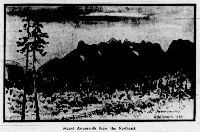
Mount Arrowsmith From the Northeast.
Comox Glacier
Ruth Masters joined a group from the Comox District Mountaineering Club to climb the Comox Glacier in 1938. The trip was led by Katherine’s father Geoffrey Capes and Adrian Paul. They motored up to Comox Lake then received a boat ride to the head of the lake. From there the party hiked up to the Comox Gap above Cougar Lake, climbed Kookjai Mountain and then followed the ridge up over Blackcat Mountain, through Lone Tree Pass and onto the glacier. This was the first of many trips Ruth was to make to the glacier throughout her life.
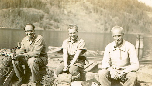
Adrian Paul, Ruth Masters and Geoffrey Capes ready to leave Comox Lake for the Comox Glacier 1938.
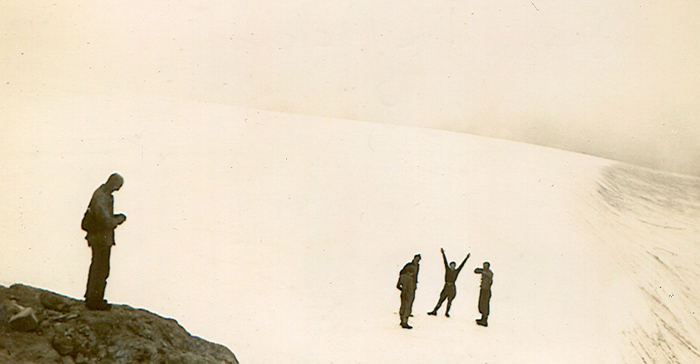
Ruth Masters waving her arms on the Comox Glacier 1938.
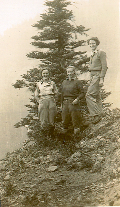
Katherine Capes, Ruth Masters and Margaret “Peggy” Sillence on route to the Comox Glacier 1938.
Surveyor Photos and Maps from Around Buttle Lake
Taken between 1935 and 1938
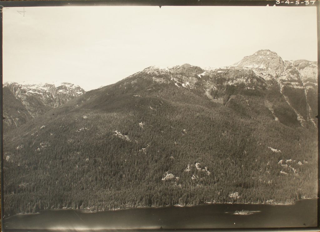
Looking towards Marble Peak.
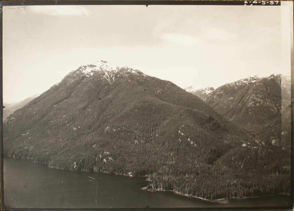
Looking towards Mt. Phillips.
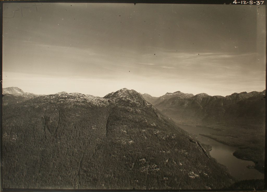
Mt. McBride (left) and Marble Peak from Mt. Phillips. Alexandra Peak in the distance.
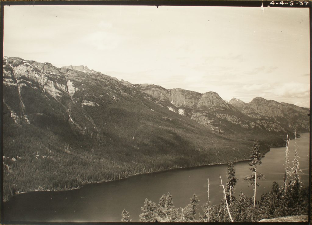
Looking up Buttle Lake. Mt. McBride to the left.
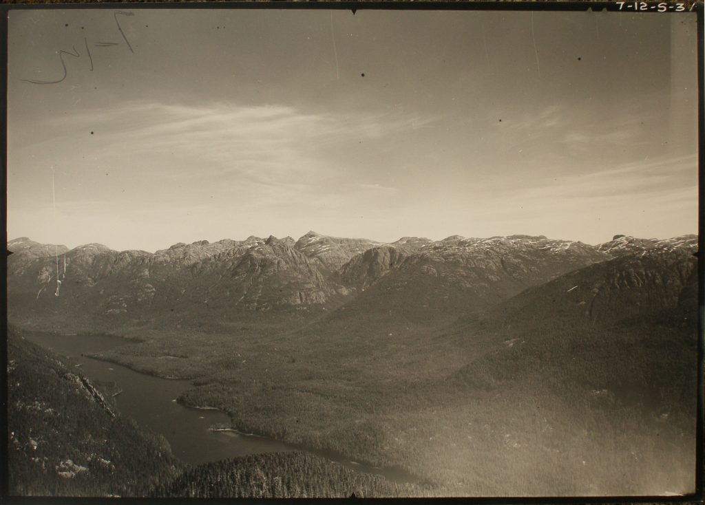
Looking across Buttle Lake from Mt. Phillips towards Mt. Albert Edward.
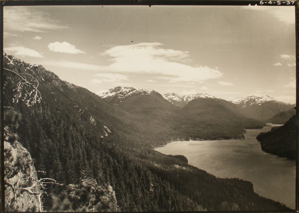
Looking down Buttle Lake towards Flower Ridge.
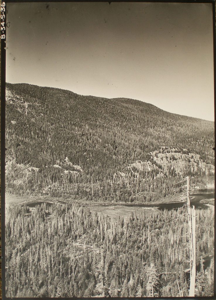
North end of Buttle Lake.
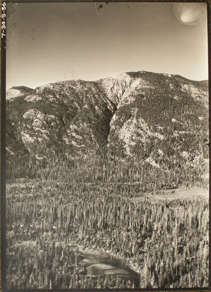
North end of Buttle Lake looking at Mt. Titus.
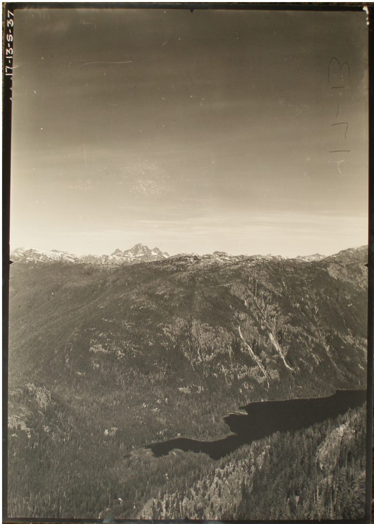
Looking down at south end of Buttle Lake. The Golden Hinde in the background.
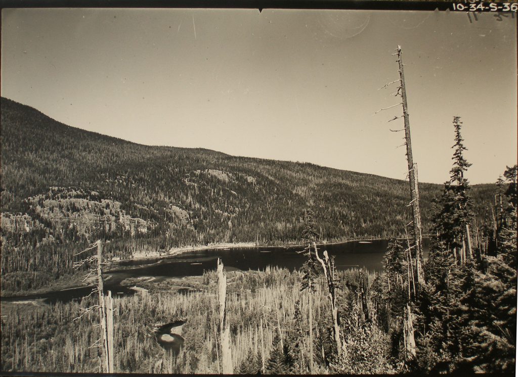
South end of Upper Campbell Lake.
Map showing site of survey stations along Buttle Lake.
Map showing site of survey stations along southern end of Buttle Lake.
Map showing site of survey stations along northern end of Buttle Lake and Upper Campbell Lake.
1939
ACCVI executive:
Chairman – Claude Harrison
Secretary/Treasurer – Fred Maurice
Outings Committee – William Dougan
Entertainment – Mrs. C.L. Harrison
Nature Study – Stephanie Jones
Membership – Vivian Martin
Hut and Property – Claude Harrison
News – Brenda Stonham
Photographic – Muriel Aylard
Executive Committee – Allan Baker, William Dougan, Stephanie Jones, Edith Maurice
Events:
January 6 – Club meeting at the home of Claude Harrison. Officers for the year elected.
March 12 – Club trip to Mt. Work.
March 25 – Club’s 33rd annual banquet held at the Empress Hotel.
March 28 – Phyllis Munday gave a talk to the Women’s Canadian Club at the Empress Hotel called “Mountaineering in the Canadian Rockies.”
April 2 – Club trip to Mt. Prevost saw twelve members climb the mountain.
April 7/8/9/10 – Club camp Easter Weekend at the Lake of the Seven Hills.
April 14 – Club social at the home of Claude Harrison in Uplands.
April 23 – Club trip to Mt. Jocelyn.
June 4 – Club trip to Mt. Tzouhalem.
June 17/18 – Club trip to Lost Creek via the West Coast Trail.
July 1-9 – Annual club camp at the Lake of the Seven Hills.
July 15/16 – Club trip to unnamed 4,500-foot peak near Lake Cowichan.
September 2/3/4 – Combined Vancouver and Vancouver Island section trip to Mt. Baker. Fred Leighton and Allan Baker graduated to active membership on this 10,000-foot peak.
September 2/3/4 – Club camp Labor Day weekend at the Lake of the Seven Hills, Sooke.
October 22 – Club trip to Mt. Finlayson.
November 24 – Club meeting at the home of Claude Harrison.
Section members who attended the ACC general summer Goodsirs Camp, July 15 – 29: Arthur Wheeler.
Section members who attended the Ski camp in the Little Yoho Valley March 23 – 31: Rex Gibson, Ferris Neave, Jean McDonald.
Section members who passed away in 1939: William Drewry, Arthur Hodgins.
Ideal Snow
Reported in the Comox Argus Thursday January 5, 1939. p.1.
Word from the Forbidden Plateau Lodge is that a foot of snow fell there yesterday and skiing is now ideal everywhere on Mount Becher. The ski run on Wood Mountain (where the Lookout Station is) is in excellent condition.
Again Heads Alpiners
Reported in The Victoria Daily Times Saturday January 7, 1939, p.10.
Claude L. Harrison was re-elected chairman of the Vancouver Island section of the Alpine Club of Canada at the annual meeting at his home in the Uplands last night. Other officers named were: Fred G.P. Maurice, secretary; William H. Dougan, Miss Stephanie Jones, Mrs. Edith Maurice and Allan J. Baker, executive committee; Mrs. C.L. Harrison, chairman entertainment committee; Miss Stephanie Jones, nature study; Mr. Harrison, Hut and property; Miss Brenda Stonham, news; Mr. Dougan, outings; Miss Vivian Martin, new membership; and Miss Muriel Aylard, photographic. Mr. Harrison showed pictures of life at the Lake of the Seven Hills camp from the date of its founding to the time of its destruction by fire, and also the work of building the new club-house. The evening was closed with the serving of refreshments by Mrs. Harrison.
Forty Skiers on Hill
Sport Is Now Becoming Very Popular
Reported in the Comox Argus Thursday January 12, 1939. p.5.
The snow this year has been exceptionally late so that there has been little skiing until last week. On Sunday a heavy fall of snow on Mount Becher enticed forty or more skiers to drag out their “boards” and cavort on practice slopes or unbroken hillsides according to their ability. The Mountaineering Club organized a ski hike and about eight carloads of members went up. Cliff Laver conducted the hike. About half of the party stayed to practice on the new runs at the Lookout while those with more experience pushed on to the Becher Cabin. The snow on top of the mountain was fast and dry and in the best of condition. A high north wind had whipped snow onto the trees in all manner of forms and many a cartoon face could be distinguished. On Friday afternoon three student skiers took up a friend to spend the weekend in Becher Cabin. Saturday night was a night of brilliant moonlight and until early Sunday morning they made snow fly in turns and spills. The story of that night’s doings will travel far for the friend Roger Schjelderup, Noel McPhee and Peter Hughes took up. Keith Roberts has to return soon to his ship, H.M.C.S. Laurent.
Local Skiers to Arrowsmith
Found Port Alberni Good Comrades. But It Was Long, Long Trail
Reported in the Comox Argus Thursday January 19, 1939. p.5.
While skiers are finding it sticky on the lower levels the powder snow on the top of Mount Becher is all at the most fastidious could wish for. The main interest last week-end was in the party of ten that went to Mount Arrowsmith at the invitation of the Port Alberni club. They were very glad they went because they found the Port Alberni crowd very fine people to meet; but they came back very much more satisfied with what they have got on Mount Becher. A party of ten from the Comox Mountaineering Club drove to Cameron Lake where they found the Port Alberni crowd waiting for them. The trail, before the war was built by the C.P.R. with the intention of making Mount Arrowsmith one of the scenic playgrounds of the west. They built a trail that followed easy grades through lovely scenery and a fine cabin under the brow of Mount Cokely—which is quite a distance from Mount Arrowsmith. Then came the war and the C.P.R. forgot all about their plans for Cameron Lake and Mount Arrowsmith. Nothing has been done on the trail since and the cabin has fallen into ruin. The party of hikers found it was a long, long way to Mount Cokely and the snow. They had a good time because they were in good company but to pack skis for four hours to get two hours skiing is rather out of proportion. When they got to the snow it was as fine as could be found on their own Mount Becher. They came back very satisfied with the good comrades they had met but they will be much more satisfied with their own ski runs in future. Meantime on Mount Becher and Mount Wood other local skiers were having a good time. Four of the Mountaineering club went up on Friday and came down on Sunday night. And for the first time they had all the skiing they wanted in almost ideal conditions. The slopes on the top sloping towards Comox Lake were wonderful. The interest in skiing locally is growing rapidly. In previous years there was a small band who used to go up to the cabin; but most of the expert skiers came from outside. Now it is the local skiers who are taking the road every week-end to the Lodge and to the slopes above.
Mt. Becher a Skier’s Paradise Beckons
Reported in the Comox Argus Thursday January 26, 1939. p.1.
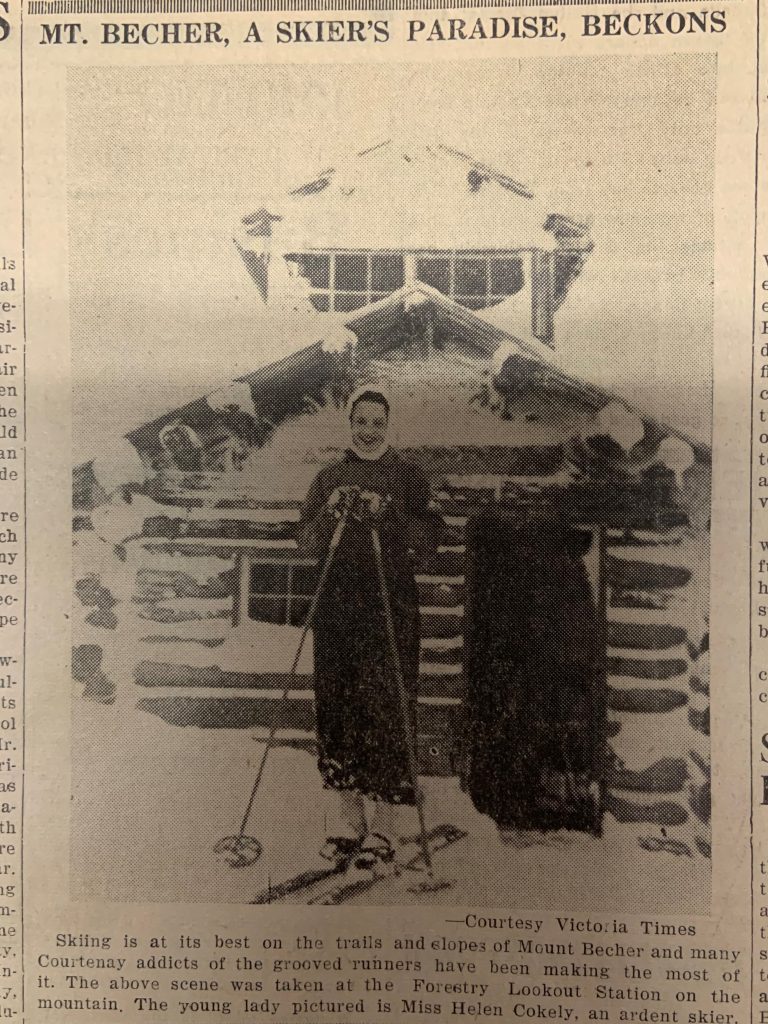
Mt. Becher, A Skier’s Paradise, Beckons.
“Bob Davis” Takes to Skis
Reported in the Comox Argus Thursday January 26, 1939. p.5.
Don Tyrell, sports writer and author of the Daily Province “Ski Heil” column, and Eric Laurillard of the Vancouver Ski and Sports Shop, were guests of Mr. Clinton Wood at Forbidden Plateau Lodge at the week-end. The object of their mission was to obtain pictures of the “Skiing dog” which has become well known for its antics on and off skis. This animal of the wire-haired terrier type is called after the columnist of the New York Sun, Bob Davis, and is one of the pups of “Mike”, the famous bar-tender dog of Bowser. It will be remembered that when Mr. Davis visited this part of the world he was much interested in “Mike” and, on his return, he brought fame to Bowser through his column and re-prints of the story in Reader’s Digest and other publications. Mr. Davis was presented with one of the pups, “Bob Davis”, which he passed on to Gavin Wood for training. “Bob Davis” rides horseback with the tourists in the summer, and now he has adopted skiing along with hundreds of others who are taking up this sport. He rides on the backs of the skis and on the shoulders of the skiers (both traveling up and down). More than fifty people from the surrounding district were on the mountain on Sunday taking their weekly exercise on skis and a large percentage of these were novices who had never tried this very popular sport before. Sloan’s Liniment sales must be going up by leaps and bounds.
Ski Club Formed
Reported in the Comox Argus Thursday February 2, 1939. p.3.
Ever since skiing became so popular no one has needed to be a crystal gazer to foretell the necessity of the Mountaineering Club meeting held in the Legion Hall last Monday [January 30] night. The hall was crowded with those who have been the club’s support for ten years and those who have just joined since skiing has come in. The meeting was called to discuss the advisability of changing the Mountaineering Club to a ski club. Skiing has become so popular in the last two years that its devotees now far outnumber those of mountaineering and some radical changes had to be made in the club to accommodate their needs. Before a tournament can be held again this year the ski authorities require that a ski club be entered in the Canadian Amateur Ski Association. It was first suggested that the club change its constitution to comply with the regulations laid down by the C.A.S.A. but that same constitution specifies that no changes can be made until the annual meeting in September. This brought matters to a deadlock and nothing could be done but fill in the application form, forward it and hope for the best. The Mountaineering Club meeting was adjourned but those present, as an independent body of skiers stayed to form a ski club. The executive of the Mountaineering Club was asked to act in the same capacity for the Forbidden Plateau Ski Club (the name adopted) with the addition of Desmond Prentice. This club will also submit an application for entry to the C.A.S.A. and, if accepted, the Mountaineering Club will so change its constitution in September that it will be able to amalgamate with the more recently formed club. Some thirty persons listed their names as members of the Forbidden Plateau Ski Club and many more will undoubtedly join as soon as the formation of the club is more generally known.
School Girls Enjoy Skiing
Thirty Students from Shawnigan Enjoy Sport
Reported in the Comox Argus Thursday March 2, 1939, p.4.
The Forbidden Plateau Lodge was a busy place at the week-end when thirty girls from Strathcona Lodge School, Shawnigan Lake, spent a delightful week-end there. The party was under Miss Helen Hobbs of Montreal, who is such a ski enthusiast that she had planned the trip. The party left the school early on Saturday in a special bus and smaller buses and cars were awaiting them at Courtenay to take them up to the Lodge, where they arrived in time to have a hasty luncheon before fitting on skis for practice in front of the Lodge. They skied all afternoon, then came in to a delightful dinner and afterwards enjoyed seeing moving pictures of skiing on Mount Becher. Then with flood light turned on they were out on the snow till nearly eleven o’clock. They got up to 6:30 breakfast so that they could get away for a ride to the Lookout at seven o’clock on snowmobile. They came back to the Lodge at one and were back at the school in good time on Sunday night after a very delightful holiday spent above the snowline. All the girls will take to their home’s vivid recollections of the accessibility and delights of skiing on Vancouver Island.
Perfect Snow
Reported in the Comox Argus Thursday March 9, 1939, p.6.
Skiers, who were out on the snow slopes of Mount Becher at the week-end were fortunate. Never this season was the snow so perfect. This applied everywhere, round the Lodge, at the Lookout on Mount Becher itself, on the trail down. Dick Idiens has set a fashion with his seal skin stops. He and the others who have tanned their own hides (the seals) have been able to take a straight line over the top of Breakneck Hill much to the envy of those less equipped companions. Those staying at the Lodge were from: Ireland, Courtenay, Victoria, Chemainus, Cobble Hill, Shawnigan and Duncan.
Alpine Club Enjoys Hike to Mt. Work
Reported in The Daily Colonist Tuesday March 14, 1939, p.8.
Fourteen enthusiasts of the Vancouver Island section of the Alpine Club of Canada climbed Mount Work on Sunday [March 12] from Heal’s Range. This was the second outing held in the 1939 season. Two weeks ago, sixteen members and friends spent the week-end at the section camp, Lake of the Seven Hills, 1,400 feet up, in the Sooke district. While at camp, several of the members hiked over the seven hills, after which the site is named, and they encountered several inches of snow and one or two flurries. On their return, they were greeted with a good lunch, prepared by those who had not gone on the trip. Later the whole party descended and drove back to town. Rain, which poured down during the drive out to Heal’s Range last Sunday, ceased as the members climbed into their boots and parkas. After about three hours’ hiking, with time out for photography and natural history observations, the summit was reached and picnic lunches enjoyed in a sunny spot. The homeward trip was accomplished in good time, the whole party being later entertained at a jolly dinner at the home of one of the members. The next hike will be March 26 to Mount Prevost, which will be followed by dinner at the Tzouhalem Hotel, Duncan. Those planning to attend are asked to communicate with Mr. William H. Dougan at G3268 or Mr. Fred G.P. Maurice at E7675. The annual dinner will be held at the Empress Hotel on Saturday, March 25, and members planning to attend are asked to give notice to the secretary by tomorrow.
Ski Pictures Much Enjoyed
Two Hours of Snow Scenes at Parish Hall
Reported in the Comox Argus Thursday March 16, 1939, p.6.
Another instance of the marked interest taken by Courtenay people is skiing was the excellent attendance of the skiing movies sponsored by the Comox District Mountaineering Club in the Parish Hall last Monday. Mr. Geo. Uchiyama kindly lent his projector for the evening and Sid Williams performed the difficult job of commentating as the films were new to him as to anyone in the audience. For a full two hours those present were thrilled by the world’s best jumpers and speed experts. The first reel dealt with skiers training for the Olympics, and brought the seriousness with which the most recent of winter sports is regarded by everyone. Jumping was pictured in detail and the famous jumping pair, the Rudd brothers showed how it should be done. The beautiful downhill running of Hannes Schneider and his pupils illustrated the grace and speed possible in skiing and the accurate turning while spraying the snow at forty m.p.h. or thereabouts made the local skiers sit up and gasp. But the most interesting reel to the majority of those present was that which dealt with three skiers on the Mt. Becher slopes. Mr. Clinton Wood was the photographer and some of his fine shots could have been placed in the pictures of Austrian ski runs without any detecting the difference. Proceeds will go towards expenses of the ski tournament to be here this year.
Vancouver Island Alpine Club Has Annual Dinner
Reported in The Daily Colonist Sunday March 26, 1939, p.10.
The thirty-third annual dinner of the Alpine Club of Canada was celebrated by the Vancouver Island Section at the Empress Hotel last night [March 25], when approximately forty members and friends attended, and after dinner enjoyed scenic pictures and later joined in the dancing at the Supper dance at the Crystal Ballroom. Mr. Claude. L. Harrison, president of the Vancouver Island Section, presided during the dinner and introduced two members of the Vancouver Island section who arrived yesterday afternoon, Mrs. Phyllis Munday and Miss Edith Henley. The toast to “The King” was proposed by Mr. Harrison and Mr. Francis Tuckey proposed the toast to the Alpine Club of Canada, which was responded by Mrs. Munday. Mr. William H. Dougan proposed the toast to the sister sections, and Mr. Allan Baker to Canada. Two addresses were read, one from Mr. Arthur O. Wheeler, founder of the Alpine Club, and the other by Mr. Stanley H. Mitchell, former secretary of the club. Mr. Wheeler’s address was read by Vancouver Island secretary, Mr. Fred Maurice, and Mr. Mitchell’s paper was presented by Miss Henley. Letters were read from all sections of the Alpine Club, among the outstanding being Calgary, Edmonton, Regina and Vancouver’s.
Pictures Shown
The dinner was served in the Princess Charlotte room, the table being effectively decorated with erythronium in moss, and cream tapers. After dinner, beautiful slides of the Alpine Summer camp for this year, Goodsirs camp, kindly donated by Mr. Waites, of the Edmonton section, were shown. The Goodsirs camp is situated at the base of the Goodsirs peaks near the head of Ice River Valley in Yoho National Park, and will be open from July 15 to 29. The main mountains include Mt. Chancelor, 10,761 feet; Mt. Vaux, 10,891 feet, and two towers of Mt. Goodsir. One is 11,585 feet high and the other 11,686 feet. The slides showing this beautiful country were thoroughly enjoyed by the members, especially those who are planning going to camp. Mr. Fred Maurice showed his pictures of the Forbidden Plateau at the conclusion of the Goodsirs camp pictures. Owing to the banquet last night, the hike arranged for today to Mt. Prevost has been postponed to next week.
Sun-Tan on Becher
Skiers Rushed the Season at Week-End
Reported in the Comox Argus Thursday March 30, 1939, p.1.
Skiing was poor on Mount Becher last week but some members of the local club got more of a sun-bath than they bargained for. A game of bridge on blankets in the sunshine on the Cabin roof was also a March novelty. The hot sun of the daytime had melted the snow so fast that there is none at the Lodge and it is dropping fast a little way up the hill; and on the top the surface is icy. But it is ideal for hikers who want to see what the country looks like under snow conditions. Preparations are now being advanced for the ski tournament on April 22nd. Unless there is another heavy fall of now (which is unlikely) it will have to be held right at the top of Mount Becher.
Ski Tournament Set for April 22
Reported in the Comox Argus Thursday March 30, 1939, p.4.
The Forbidden Plateau Ski tournament will be staged this year on April 22nd. Mr. Clinton S. Wood will be in personal charge of the local arrangements on the hill with the Forbidden Plateau Ski Club assisting him. There will be no road tolls on that day. The road to the Lodge is now clear and, if present conditions obtain there will be a sufficiently hard crust on the snow most of the way to the Cabin where the tournament will be held to be not too laborious for non-skiers. Of very great interest to local skiers is the announcement that Peter Vajda, the Swiss Instructor who trained the Canadian champs, will be on the Mount Becher slopes giving instruction from April 5th to 10th. This will be a magnificent opportunity for keen skiers to learn from the best instructor in Canada today.
Easter Camp Enjoyed by Alpine Club
Reported in The Daily Colonist Wednesday April 12, 1939, p.7.
The Easter Camp at the Lake of the Seven Hills was well patronized by members of the local branch of the Alpine Club of Canada, who took advantage of the four days of fine weather to do considerable climbing in the surrounding hills, as well as to organize work parties and nature study expeditions. A trip was made to the summit of Mount Empress before breakfast on Sunday to raise a smoke signal in conjunction with the Sunrise Service on Mount Tolmie, but it was unfortunately more or less obscured by mist. The next outing will be held on April 23, to Mount Jocelyn, which will be reached by boat from Stacey’s Camp on Finlayson Arm. Members and their friends are invited to attend the last of a series of social gatherings at the home of Mr. and Mrs. Claude L. Harrison, the Uplands, on Friday evening, April 14.
Skiers Had Fine Sun-Tan
Many Took Advantage of Holiday to Climb Becher Slopes
Reported in the Comox Argus Thursday April 13, 1939, p.1.
The many skiers who took their holidays on the slopes of Mount Becher or went further afield came back with a robust mild-summer sun-tan. The most adventurous were those who left the Mount Becher cabin on Saturday for Croteau Lake and Mount Albert Edward. They found the snow excellent all through the trail to Croteau Lake. The snow is not as deep at Croteau Lake as usual and they got down into the cabin in an hour with the aid of a shovel they found in a nearby tree. With Dick Idiens as a guide the trail was not hard to follow the snow not being deep enough to hide all the blazes. They found everything in good order in the cabin and were exceedingly comfortable. On Sunday they set out for Mount Albert Edward. They were lucky in finding the mountain clear of clouds and the sun shining brightly. It took them four and a half hours from the cabin to the top and they came down in an hour and a half. It was glorious to be able to ski on the open slopes away from all trees and other obstacles. They left the cabin at half past twelve and were back at the Forbidden Plateau Lodge early in the evening. The party consisted of Dick Idiens, Peter Hughes, Roger Schjelderup, Noel McPhee and Miss Mia Schjelderup. While Peter Vajda was detained down in Uncle Sam’s land, he sent up a very efficient substitute to take his place as instructor in Ted Bishop assisted by Eric Laurillard of the Vancouver Club. About twenty-five earnest pupils went out to Look-Out Mountain. They were all very pleased with the progress they made and they had a most delightful day in the sunshine.
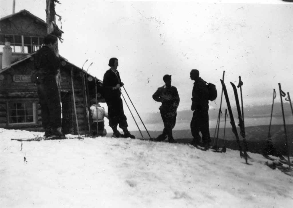
Skiers at the Look-Out on Mt. Becher 1939 – Ruth Masters photo.
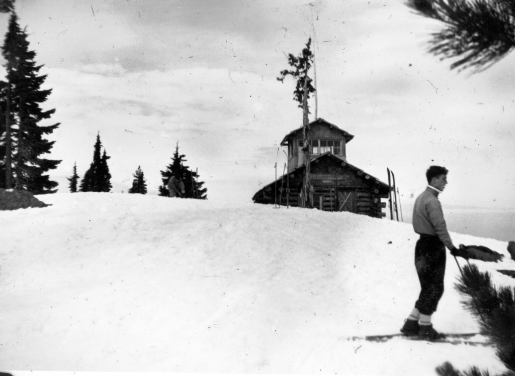
Skier outside the Look-Out on Mt. Becher 1939 – Ruth Masters photo.
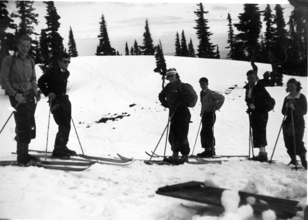
Skiers on the summit of Mt. Becher Easter 1939 – Ruth Masters photo.
Mountain Climbing Days Are Here
Reported in The Victoria Daily Times Saturday April 15, 1939, p.8.
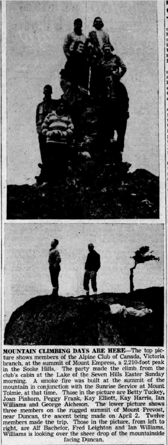
MOUNTAIN CLIMBING DAYS ARE HERE-The top picture shows members of the Alpine Club of Canada, Victoria branch, at the summit of Mount Empress, a 2,210-foot peak in the Sooke Hills. The party made the climb from the club’s cabin at the Lake of the Seven Hills Faster Sunday morning. A smoke fire was built at the summit of the mountain in conjunction with the Sunrise Service at Mount Tolmie, at that time. Those in the picture are Betty Tuckey, Joan Pinhorn, Pegey Frank, Kay Elliott, Kay Harris, lan Williams and George Aicheson. The lower picture shows three members on the rugged summit of Mount Prevost, near Duncan, the ascent being made on April 2. Twelve members made the trip. Those in the picture, from left to right, are Alf Bachelor, Fred Leighton and Ian Williams. Williams is looking over the sheer drop of the mountainside facing Duncan.
Ski Tournament on Mount Becher
Hon. Wells Gray Will Present Prizes to Winners
Reported in the Comox Argus Thursday April 20, 1939, p.1 & 5.
Courtenay business men have contributed generously to the prizes for the Forbidden Plateau Ski championship held this week on Mount Becher. The Honorable Wells Gray will be present on Sunday to present the prizes with Mr. E. Manning, Chief Forester, and it is hoped that the Hon. F.M. MacPherson, Minister of Public Works will also be there. From Vancouver Peter Vajda has announced that he will be one of the Vancouver ski stars to take part and it is hoped that Miss Gertie Wepsala, who won the ladies downhill last year, may also come. Port Alberni skiers will be here in strength. The local ski club has been selling tickets to help defray expenses and no road tax will be charged by the Forbidden Plateau Lodge Co. on the days of the meet. If there is any surplus after expenses are paid it will go to the local ski club. The slalom races will be held on Saturday and the downhill on Sunday. Those who went up to the cabin last Sunday [April 17] said the snow on the top of Mount Becher was in excellent condition for skiers. Spectators who do not ski are informed that the trail to the cabin from the Lodge should hold as there is a strong crust and it has been well beaten down. Holders of the trophies, won in March last year are: Courtenay-Comox Board of Trade Trophy, Men’s combined Downhill and Slalom, Forbidden Plateau open championship, Gus Johnson, Hollyburn Pacific Ski Club. Vancouver Daily Province Trophy, Men’s open Downhill, Forbidden Plateau championship, Gus Johnson. Victoria Times Trophy, men’s open Slalom, Forbidden Plateau championship, Gus Johnson. Forbidden Plateau Lodge Trophy, men’s Downhill, Forbidden Plateau championship, Tom Tysee, Port Alberni. Vancouver Island Coach Lines Trophy, Ladies open Downhill, Forbidden Plateau championship, Gertie Wepsala, Tyee Ski Runners. Comox Logging Trophy, Ladies open Slalom, Forbidden Plateau, Meta Scott, Grouse Mountain Ski Club. Victoria Junior Chamber of Commerce Trophy, Ladies Downhill, Vancouver Island championship, Jill Dunkerley, Forbidden Plateau. Forbidden Plateau championship events open to all amateur skiers. Vancouver Island championship events confined to amateur skiers, residents of Vancouver Island only.
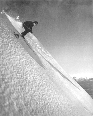
Peter Vajda trailblazing ski racer and coach.
Ski Stars Flash Down Mount Becher Slopes
Two Day Tournament on Plateau Saturday and Sunday
Reported in the Comox Argus Thursday April 27, 1939, p.1 & 8.
Those two reached the Mount Becher cabin on Friday and Saturday saw Gertie Wepsala, Canadian champion and Peter Vajda, famous Swiss ski instructor, flash down the cliff face near the cabin in the thrilling open downhill race. That was the big event of the day on Sunday when Honorable Wells Gray, Minister of Lands and other notables were present. Peter Vajda was not a competitor being a professional, but he came first over the course from the top of Mount Becher, gaining great speed on the Ninety Degree Hill. The ground falls gently to the edge of the cliff above the Cabin. The ravine at this point has been worn by a creek, which turns at almost a right angle to fall to Boston Lake. Coming at great speed the skiers had to make a stem turn to go down this cliff face. Peter made it without a spill. Miss Wepsala went down but recovered remarkably and sped on past the cabin. Miss Meta Scott, who won the event last year, was traveling even faster at this point but got out of her course and to avoid an exposed rock took a bad spill, which delayed her. However, she was unhurt. And it gives an idea of the control these top-notch skiers have over their blades that during the two days of the Plateau tournament there was not one incident. The open slaloms were held on Saturday. The open course was from the top of Mount Becher between flags down to the creek bed just west of the Cabin. Hamish Davidson won this as he did the lions share of the cups and awards. On his sweater he wore the word “Canada”, placed there when he was one of the team to represent Canada in the United States.
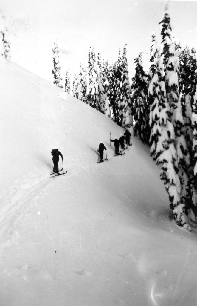
Skiers ascending Breakneck Hill on their way to Mt. Becher cabin – Ruth Masters photo.
Three Good Sportsmen
The arrangements were under the direction of the Vancouver Ski Zone and they went off with a click. The weather was all that could be desired. The snow was rather soft for the slaloms but quite fast enough for the downhill. There were not many non-skiers who went to the cabin but those who did make the ascent found the snow with a good crust and the going not at all difficult. One of the trio of good sportsmen to make the trip to the cabin was the Hon. Wells Gray, Minister of Lands. Mr. Victor Harrison, Mayor of Nanaimo, and Mr. Bill Mitchell, president of the Associated Boards of Trade of Vancouver Island. Mr. Gray went up in a pair of oxfords and showed that he had still the physique that earned his right to be one of the chief members of the famous Salmonbellies lacrosse team of New Westminster in its palmy days. The Island downhill finished at the top of the cliff above the Cabin. This is the first time that many of the young skiers of the local club have taken part in competitions and they certainly won their spurs. The Island slalom course was on top of Mount Becher. The snow was rather slow. The Cabin was a busy spot all of the two days. The ladies of the club served tea and it was greatly appreciated. Alberni skiers came over in strength and Tom Tysse won one of the principal events of the day.
Stars Make Movie
Those officiating for the Vancouver Ski Club were Lindsay Loutet and Eric Laurillard and arrangements went very smoothly. This week the Canadian star, Gertie Wepsala, Peter Vajda and Ted Bishop are staying at the Forbidden Plateau Lodge to make a movie which Bill Hudson, official photographer for the Vancouver Ski Zone is shooting. The Mount Becher slope has been selected as most favorable for the exhibition of a technical ski movie embracing the many phases of the difficult art. Something new will be the pictures of the wings, which the stars are using. These contrivances will enable the skiers to actually take off from the snow and will enable them to sail through the air with ease for some distance and at will. The prizes were presented on Sunday afternoon, after tea was served by the management of the Forbidden Plateau Lodge.
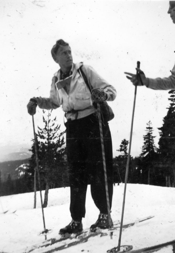
Forbidden Plateau ski instructor Ted Bishop skiing Mt. Becher 1939 – Ruth Masters photo.
The Prize Giving
The Minister of Lands, the Hon. Wells Gray, presented the trophies and prizes assisted by Mrs. W.T. Straith of Victoria. As president of the Courtenay-Comox Board of Trade Mr. Wm. Rickson was in the chair and briefly introduced the speakers. He called upon Mr. W.T. Straith M.L.A. of Victoria. Mr. Straith said he was grateful to Mr. Clinton and Mrs. Mary Wood for making skiing popular in the winter and the Forbidden Plateau in the summer. Mr. Victor Harrison, Mayor of Nanaimo, said Nanaimo was very much interested in the Plateau as it was the only skiing ground on the Island. He was quite sure it would receive much patronage if facilities were provided to reach it. People were now glad to go to the Mainland for their skiing and across the line: and they would be eager to come to the Plateau. He paid tribute to the spirit and courage of Mr. Wood without whom there would have been no skiing and no road. Mr. W.W.R. Mitchell of Nanaimo and president of the A.B.T.V.I. spoke of the unique advantages of the Plateau. It was necessary that their natural playgrounds should be developed now that so much of the natural wealth of the Island was being destroyed. The Hon. Wells Gray referred to the fact that he had played most games in his day and attached great importance to them in the education training of the boys and girls of the province. The forestry branch had recently taken over not only the care of the forests, but also their recreational activities of the beauty spots that had been developed. As they were selling timber land now they were reserving from logging the timber on the sides of the road and in other ways preserving the beauty of the countryside. He had a great sympathy with skiers. They wanted them to tell them where the best ski grounds were and help direct their development. The government was willing to get behind any sport particularly this winter sport that was spreading so rapidly all over the continent. The ski grounds would bring back in revenue what was spent on them he believed. Mr. Dick Idiens, president of the Comox Mountaineering Club, paid a tribute to the three men, who had climbed to the Cabin to watch the skiing, Messrs. Wells Gray, Harrison and Mitchell. The winners and awards of the meet were as follows:
Forbidden Plateau Championship
Men’s Slalom
in seconds
1 Hamish Davidson 83 4/5
2 Howie Hamill 88 1/5
3 George Bury 90 2/5
4 Arthur Wood 113 1/5
5 Roger Schjelderup 126 2/5
6 Robert Gibson 237 4/5
Ladies Slalom
1 Gertie Wepsala 91 4/5
2 Meta Scott 139 4/5
Men’s Downhill
1 Hamish Davidson 2:54
2 Howie Hamill 3:08:2
3 George Bury 3:13:2
4 Thor Jabobsen 3:53
5 Tom Tysse 4:03
6 Paul Johansen 4:09:2
7 Don Stewart 4:21:2
Ladies Downhill
1 Gertie Wepsala 3:55:2
2 Meta Scott 4:21:2
Combined
Men Hamish Davidson
Women Gertie Wepsala
Special Mainland B Events Slalom
1 Alf Staley 56:3
2 Miles Howlett 1:03:3
3 James Gardiner 1:50:3
Downhill
1 Alf Staley 1:15:8
2 James Gardiner 1:26
3 Mile Howlett 1:38:2
Vancouver Island Championships Men’s Slalom
1 Arthur Wood 25 4/5
2 Thor Jacobsen 26 3/5
3 Dick Idiens 28
4 Paul Johansen 30 1/5
5 Cliff Laver 34
6 Roger Schjelderup 35
7 Robert Gibson 41 3/4
Vancouver Island Championships Ladies Slalom
1 Mia Schjelderup 37
2 Ruth Masters 47 3/5
3 Helen Cokely 52 3/5
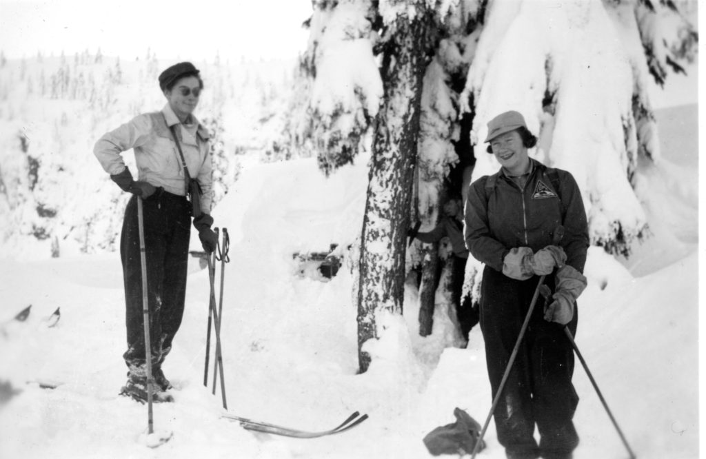
Ruth Masters and Mia Schjelderup skiing on Mt. Becher 1941 – Ruth Masters photo.
Men’s Downhill
1 Tom Tysse 1:05:2
2 Arthur Wood 1:13:6
3 Thor Jacobsen 1:21:8
4 Noel McPhee 1:24:7
5 Roger Schjelderup 1:25:2
6 Cliff Laver 1:31:8
7 Paul Johansen 1:32:1
8 Robert Gibson 1:38:2
9 Dick Idiens 1:43:6
10 Sid Williams 1:57
11 Peter Hughes 1:57:2
Ladies Downhill
1 Mia Schjelderup 2:01:6
2 Helen Cokely 2:52:2
Combined
Mens Arthur Wood
Ladies Mia Schjelderup
Club Championship Men’s Downhill
1 Arthur Wood 1:13:6
2 Cliff Laver 1:31:8
3 Robert Gibson 1:38:2
Club Championship Ladies Downhill
1 Mia Schjelderup
2 Helen Cokely
3 Ruth Masters
Hamish Davidson, Forbidden Plateau combined open championship. Forbidden Plateau open Slalom, men: Hamish Davidson won the cup and the first prize, a blanket donated by Arthur Hitchen. Howie Hamill, second, won a fountain pen given by Dr. Peter L. Straith. George Bury, third, won a belt, given by Dr. Moore. Forbidden Plateau downhill, men’s open: Hamish Davidson won the cup and a clock given by Courtenay Hardware. Howie Hamill, second, won a knife, given by Bill Douglas. George Bury, third, won a knapsack, given by Riverside Hotel. Forbidden Plateau open Slalom, ladies: Gertrude Wepsala won the cup and an umbrella, given by Mrs. E.M.E. Wallis. Meta Scott came second winning a box of chocolates given by Kay’s Confectionery. Forbidden Plateau open downhill, ladies: Gertrude Wepsala won the cup and a vase given by Tarbell’s. Meta Scott came second winning a bed lamp given by Booth’s. Vancouver Island downhill, men’s: Tom Tysse, Alberni, won the cup and a billfold, given by Cooke’s Drug store. Arthur Wood, second, won a shirt, given by Bill Rickson. Thor Jacobsen, Alberni, third, won a tie, given by Cooke’s Meat Market. Vancouver Island, downhill, ladies: Mia Schjelderup won the Simms cup, and purse given by Jean Burns. Helen Cokely, second, won a purse, given by Charles W. Sillence. Ruth Masters, third, won a cup and saucer, given by R.H. Francis. Forbidden Plateau Club, downhill, men’s: Arthur Wood, first prize, travel case, Langs’ Ltd. Cliff Laver, second prize, given by Central Builder’s Supply. Robert Gibson, third prize, given by Hurford and Shaw. Mainland B. class Slalom: Alf Staley, first, ski mitts given by Comox Creamery. Vancouver Island Slalom Ladies, Mia Schjelderup, cup, given by Simms & Son and first prize, writing paper by Glacier. Ruth Masters, second, vase, by F.C. Pierce. Helen Cokely, third, perfume by L.A. Becker. Vancouver Island Slalom men’s: Arthur Wood, Laver’s Trophy and pen set given by Peter Straith. Thor Jacobsen, Alberni, second, pin set by Corfields. Dick Idiens, third, two pair socks, by Searle’s.
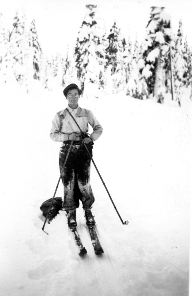
Ruth Masters skiing on Mt. Becher.
Best Ski Slopes on Continent
Ski Champions Are Thrilled with The Forbidden Plateau
Reported in the Comox Argus Thursday May 4, 1939, p.1.
After exploring the slopes of the Forbidden Plateau between Lake Beautiful and Circlet Lake three leading exponents of skiing in Canada have given their considered verdict of its possibilities as a winter playground.
“It’s the best skiing ground I’ve seen on the American continent. It’s the nearest thing I’ve seen to Switzerland. The best spring skiing I’ve ever seen.”—Peter Vajda, Swiss Ski professional
“It’s the best I’ve ever seen. Sun Valley in Idaho cannot compare with it.”—Gertie Wepsala, Canadian Champion.
“From a scenic point of view, it is as impressive as anything I’ve seen in the Rockies.”—Ted Bishop, noted mountaineer of Vancouver.
And when they had come to these conclusions, they had not climbed Mount Albert Edward and seen the welter of peaks to the west in Strathcona Park.
A Skiing Romance
Following the ski tournament on Mount Becher, one of the peaks on the rim of the Forbidden Plateau, Peter Vajda, Gertie Wepsala and Ted Bishop were so delighted with the possibilities of skiing here that they made arrangements to come back immediately. This last week they left for Forbidden Plateau Lodge with Mr. Clinton S. Wood, Len Rossiter and other guides for Mariwood camp. With skies reminiscent of the Mediterranean and a hot sun in the day time conditions were ideal for movie picture taking, which was the chief object of the expedition. The thousand and one lakes of the Plateau set in its meadows—at this time of the year still under six feet of snow—was just what a cameraman yearns for as a setting. There is a romance, a story. The mile long slope of Mount Albert Edward (altitude 7,000 feet) provides a thrilling ski race for handsome Peter and Gertie. The waterfalls of Lake Beautiful a delightful setting for a love scene—wait till you see it. The skiing party took their time to get into Lake Mariwood—eleven hours from the Forbidden Plateau Lodge and they were not packing the loads either. Ask some of our local huskies what they can make it in from the Cabin! But they are there not for endurance tests but pictures. To Peter Vajda, Miss Gertie Wepsala attributes much of her success as the champion of Canada since he taught her the game. She is a Vancouver born girl of Finnish parentage. Ted Bishop is not only a skilful skier but a mountaineer. He has climbed 35 peaks in the Rockies, and therefore, his opinion of the beauty of the Plateau is worth something. The sun is so hot on the alpine meadows of the Plateau that Miss Wepsala is burnt as dark as a gypsy—a fine sun-tan acquired in a very few days. They are trying all sorts of fancy gadgets for their action shots: sails, barrel staves for skis, many novelties.
Plateau Is Just Like the Alps
Swiss Expert Finds Sub-Alpine Vancouver Island Very Like His Native Land
Reported in the Comox Argus Thursday May 18, 1939, p.2.
Fully bearing out the first enthusiasm of the Vajda-Wepsala party of the Forbidden Plateau as a winter play-ground is a letter from Ted Bishop, one of the party. The three skiers are still up there with their headquarters at Lake Mariwood. They found their ideal downhill run on the long slope of Castle Crag [Castlecrag Mountain] to Moat Lake and down into the Cruikshank Canyon at its upper end. Peter had been so busy with the slopes in the Plateau that he has had no time to explore the more rugged contours of the mountains to the west. But so far to him the Plateau is a pocket Switzerland. Mr. Bishop’s letter follows: “After spending seven days here looking for ski slopes, Peter had enthusiastically expressed the opinion that here is the first country he has seen on the continent that in any degree resembles Switzerland. The main reason for this is the miles of varying slopes either open or covered with widely separated trees. Already he has six downhill runs sufficient to comply with F.I.S. standards which demand among other things, a vertical drop of 2,500 feet or more. This state of affairs cannot be duplicated anywhere else he has visited in Canada, except possibly Revelstoke. Although the mountains in the area are in main as impressive as in many of the better parts of the Canadian Rockies, the country gives a kinder impression.
Pleasant Valleys and Kindly Heights
The heights are rugged but the lakes and meadows give a generously soft appearance to the landscape. It is this factor which gives such a marked resemblance to the Alps, but in the valley, the heavy timber, particularly in the areas that have been burned over, gives a somewhat “fearsome” impression. These pleasant valleys are what give Peter that home-like feeling. Interesting from the point of view of exploration is the fact that the picture is being ‘shot’ on slopes that have never been skied on before. This is important, since a survey of the ski possibilities of the area is being made at the same time as the movie. Judging from the results so far, the report turned in on completion of the survey will be extremely favourable. If the Vajda enthusiasm keeps up as at present he will undoubtedly brand the area as one of the best potential ski grounds in the North American continent.
Cameron Lake
Reported in The Daily Colonist Sunday May 14, 1939, p.17.
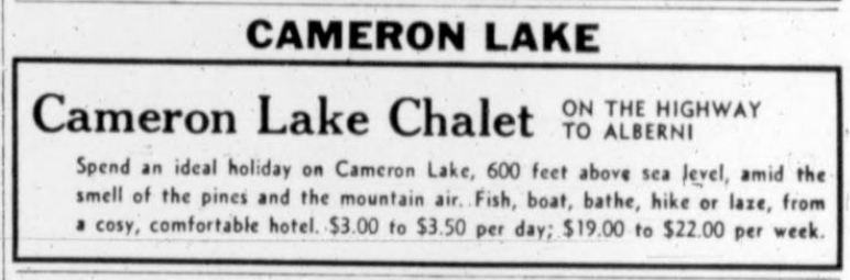
Cameron Lake Chalet ad.
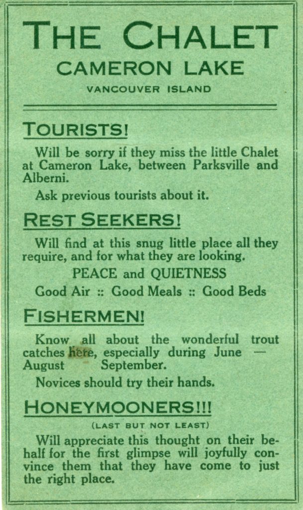
Cameron Lake Chalet ad.
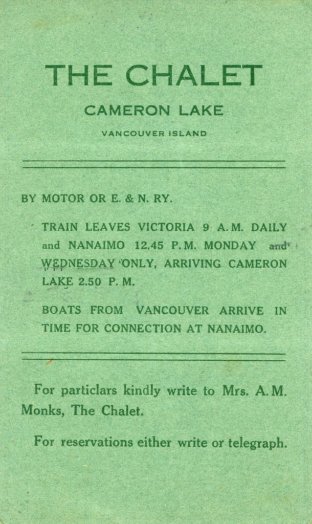
Cameron Lake Chalet ad.
The Forbidden Plateau
A Hundred Square Miles of Alpine Flowers
Reported in The Daily Colonist Sunday May 28, 1939, p.2.
Many thousands of people spend their holidays each Summer on Vancouver Island. They come from all parts of the United States, Canada, Honolulu, Shanghai and Great Britain. If you talk to any of these visitors, they will be eager to tell you all about the Island. The trout fishing, the rivers, the lakes, the great forests, the waterfalls and the mountains. And while their stories will interest and lure you, they will in reality only tell about a very small part of the Island, at the most a third, for that is the only part accessible to the tourist. The rest of the Island has been a land unknown except to a few surveyors, prospectors and trappers. Now the holidaymaker can adventure into a part of the terra-incognito for trails have been blazed into a great tableland in the centre of the Island, long known to the Indians as the Forbidden Plateau. The Plateau lies at the foot of the Island spinal range west of Courtenay and is 147 miles north of Victoria, the two cities being connected by the Island Highway. There is also an excellent stage coach and rail connection for those without cars.
The Two Trails
When Courtenay is reached you have the choice of two trails into the Plateau. The older one started from Dove Creek, which is some ten miles by road from Courtenay. One drove from Courtenay to trail head at Dove Creek, parked one’s car then took horses of hiked into the Plateau—a distance of some fifteen miles. The trail leads up hill and down dale through the forest, rising at one place to an elevation of nearly 6,000 feet and then dropping again onto the Plateau at Mount Elma at an elevation of 4,000 feet. At the lake at the foot of Mount Elma is Croteau’s Camp. Horses, if required for this trail, can be arranged in Courtenay. Incidentally, Croteau’s Camp is about a mile and a half from the highest part of the Cruikshank Canyon and some four or five miles from Mount Albert Edward, on which the red snow is found. The trail takes from six to seven hours from end to end. The other trail known as the Mount Becher Trail, goes in from Bevan. If the trail is to be taken, one drives up the public highway from Courtenay to Bevan—some seven miles—and then drives up a safe mountain road some nine miles to an elevation of 2,000 feet, where the Forbidden Plateau Lodge is situated. From this point horses are taken if required, up onto the Plateau, a distance of about two miles. If one wishes to go cross the highest part of Cruikshank Canyon or Mount Albert Edward, one follows the trail across from Mount Becher, over the Plateau and then on to the canyon, a distance of some ten miles. Along the trail, only seven miles from the Lodge, is McKenzie Lake Camp, four miles from the Mariwood. At both of these camps ideally situated in the Alpine Meadows and both of which are under the management of the Lodge, the visitor can fish, hike and at the same time enjoy comforts of comfortable beds and good fresh food.
Snowy Mountains
The Forbidden Plateau, one hundred square miles in extent, with an elevation of more than 4,000 feet, is bounded on the southwest and north by mountains which are snow-crowned at all seasons. Some of these rises to more than 7,000 feet in height and offer excellent sport for the mountaineers; others can be scaled with comparative ease, while still others can be walked up. From the summits gorgeous panoramic views of snow-crowned mountains, green valleys and blue sea are obtained. One of the outstanding features of the Forbidden Plateau is the fact that one can camp beside and bathe in warm-water lakes, and within half an hour can be up in fields of perpetual snow. And reminder, I am talking about the Plateau in July and August. And while I am speaking of snowfields, I want to mention that it is up on the Forbidden Plateau that you see the unique phenomenon, red snow. Yes, red snow, the rich crimson due to a form of plant life. Personally, I do not know of any other place where this can be seen. Due to its high elevation and because the soft Summer breezes blowing over the Plateau come in from the Pacific over many miles of fir forest and heather, a visit to the great alpine meadows puts new life and zip into the tired traveller. People, especially from the south and inland, feel its effects almost Immediately. Mountain air does not agree with everyone, but I have yet to meet the man or woman who did not feel better after a camping trip in the Forbidden Plateau. The Plateau is a rolling tableland broken by hundreds of warm-water lakes varying in size from one to three or four hundred acres, great stretches of alpine meadow covered heather, crimson-leafed huckleberry, with yellow, white and purple edelweiss, pentstemon, gentians, valerians, phlox, ranunculus and rhododendrons, and lightly timbered Indian country. There is nothing tame or tamed about the Forbidden Plateau. It is a bit of the earth just as the Creator left it.
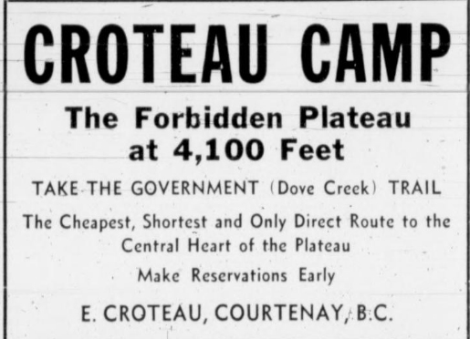
Croteau Camp ad.
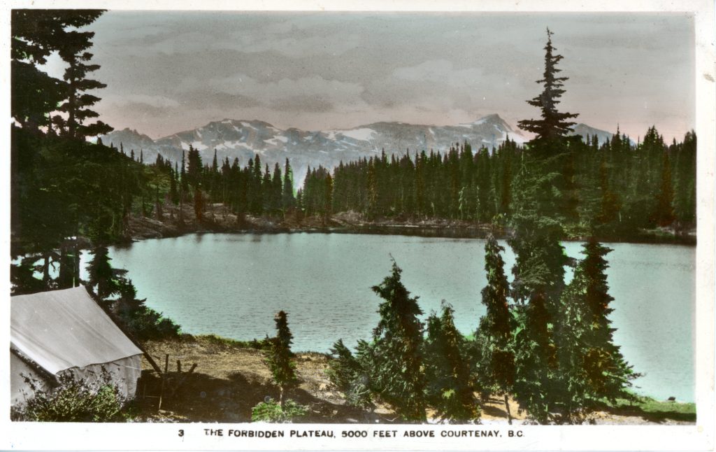
Old postcard of Croteau Lake 1939.
Postcard of Croteau Lake 1939.
Visited Duncan
Reported in The Daily Colonist Tuesday June 6, 1939, p.8.
In place of the scheduled trip to Mount Maxwell, Saltspring Island, eleven members of the Vancouver Island section of the Alpine Club of Canada drove to Duncan on Sunday morning to climb Mount Tzouhalem. The day was most successful in spite of the rain. The next outing will be to Lost Creek, via the West Coast Trail, and will take place on the week-end of June 17 and 18. Members planning to attend are asked to notify the secretary in good time.
By Rickshaw to Plateau
But It Couldn’t Be Done—Red Snow Was Procured, However.
Reported in the Comox Argus Thursday June 29, 1939, p.1.
The staff of the Forbidden Plateau Lodge is ingenious in transporting guests up and down the trail by snow-mobile, caterpillar tractor, or horse, but they were stumped the other day when a lady from Sydney, Australia, turned up and demanded to be taken up to the Plateau in a rickshaw! Given a little time for construction of a rickshaw and the mobilization of a gang of coolies, perhaps it could have been done. But not pronto. The lady saw it per car. While the lady was disappointed about her rickshaw ride, she did get her “red snow”. The only reliable place for this curious phenomenon of nature is on the breast of Mount Albert Edward, but this year the little insects had strayed down to Mount Becher. A sample of snow was brought down in a thermos bottle and all was well.
From Many Lands
The lady from the Antipodes was the vanguard of the tourist invasion that is beginning to roll into and through Courtenay. They come from all over Canada, the States and England. A notable visitor was Captain J. Patrick of the S.S. Empress of Russia. Their chief inquires are for the Plateau and Campbell River fishing. News from the Plateau is that all the snow has gone on the rails. Mr. Eugene Croteau and his assistant Mr. Preston Tait, have gone up the Dove Creek trail to prepare for their guests. Their first big party will be on July 9th when the Natural History Society is going up for their annual visit. Miss Gertie Wepsala and Peter Vajda, Canadian ski experts, came out last week after a seven week stay at Mariwood Lodge where they had been making a film with Ted Bishop. They have been in there since April 26th. The first week of their stay was ideal blue skies and powder snow. But a dripping June found Mount Albert Edward in cloud and storm, waiting for good weather. For some days it blew so hard they could not risk a fire, and they had to live on raw oatmeal and canned stuff. And it was so cold they had to stay in their sleeping bags all day. Finally, they gave up the idea of finishing their pictures this year and will either come back again next fall or will finish it at Banff or some other ski ground. But they have not lost their enthusiasm for the Plateau as a ski ground.
Glorious Scenery Has Made Plateau Noted Playground
Area Once Taboo to Indians Becomes Famous Breathtaking Beauty—Natured Meadows and Magnificent Lakes are Found Among Towering Mountain peaks
Reported in The Daily Colonist Sunday July 2, 1939, p.24.
No mention of the beauties of Vancouver Island can be made without reference to The Forbidden Plateau. There are lovely spots in plenty along the coast but none can equal this unique area for breath-taking grandeur. The Forbidden Plateau high above Courtenay and Comox, from which districts it is reached, is a stretch of country totally different from any other in the area, and from this it got its name. The Indians of the coast looked upon the Plateau as the bode of evil spirits and as such, it was shunned. It is only in the past fifteen years that trails have been opened to the visitor. Now the fame of this attraction has spread from coast to coast across the continent.
Many Lakes
Walled in by a mountain range 5,000 feet high this vast tableland holds literally hundreds of lovely lakes, nestling among the natural meadows. Great tracts are unencumbered by undergrowth, and the springy red and white heather is underfoot. The lakes have been stocked with trout, and the fisherman will find ideal sport among the fighting fish that lie in the clear cold depths of the lakes. The mountaineer will find a country made for his hobby, for there is every type of work to challenge his skill, from easy ascents to peaks and summits that are as yet unconquered. Perhaps the most practical way to explore the wonders of the Forbidden Plateau is by packhorse, and all the while the visitor enjoys invigorating air of an altitude that is as great as that of Colorado.
Alpine Flowers
The naturalist will find the Plateau a never-ending delight, with the most gorgeous wild alpine flowers in profusion. From December to June skiing and Winter sports are popular. The description of this place might give the impression that it is miles back in the hinterland, difficult of access. The Plateau is, in point of fact, easily reached. Two trails are opened. One is constructed from Dove Creek, reached by a good motor road from Courtenay through Bevan. Here the visitor is met by saddle and pack ponies and taken direct to Croteau’s Camp in the heart of the Plateau. It is only a distance of twelve miles and many prefer to make the journey on foot. Croteau’s Camp offers first-rate accommodation, and the appetite, whetted by keen air, is catered to by the delicious meals served in the log dinning hall.
Croteau Camp
The alternate route into the Plateau is reached by fourteen miles of excellent highway from Courtenay, where, at the head of the road and at an altitude of 2,100 feet, stands The Forbidden Plateau Lodge. This modern and up-to-date hostel is ideally situated, and commands a glorious view across the Comox Valley to the gulf beyond. From here ponies and guides are available to follow the trail into the Plateau, where two camps are established, McKenzie Lake Camp and Mariwood Lake Camp, five and a half miles farther on.
Forbidden Plateau Ads
Reported in The Daily Colonist Sunday July 9, 1939, p.24.
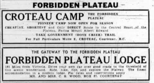
Alpine Club Camp
Reported in The Daily Colonist Wednesday July 12, 1939, p.7.
The annual Summer camp at the Lake of the Seven Hills by the Vancouver Island section of the Alpine Club of Canada from July 1 to 9. Twenty-five members and guests registered during the first week-end. Advantage was taken of the fine weather to enjoy swimming, boating and climbing. It is proposed to make a four-day trip to Shaw Creek and Mount Hooper in the Lake Cowichan district at the end of August. Particulars may be obtained from Mr. Allan Baker G7810.
Unnamed Peak is Climbed by Club
Reported in The Daily Colonist Tuesday July 18, 1939, p.7.
During the week-end an unscheduled trip was made by members of the Vancouver Island section of the Alpine Club of Canada to Lake Cowichan to climb a 4,500-foot unnamed peak lying some seven miles from Youbou, along the trail to Ladysmith. After conquering the steep face, the climbers viewed a magnificent panorama of mountains, with the Chemainus Valley spread out below. Many interesting Alpine flowers, including two species of gentian, mountain phlox, purple and white heather. Red snow was found in the snow field near the summit.
Scientists Visit The Plateau
Vancouver Natural History Society Spent Week There
Reported in the Comox Argus Thursday July 20, 1939, p.3.
Above the clouds, which were pouring rain on the lowlands for the most of last week, 25 members of the Vancouver Natural History Society are spending a week climbing and collecting specimens of the Forbidden Plateau. That is, for most of the week. Friday was as wet a day as it was in Courtenay. The society holds a camp every year in the mountains. This is the first time it has been on Vancouver Island. Mr. Preston L. Tait, a member of the society induced them to come to the Plateau this year. They arrived by special bus from Nanaimo on Sunday, going straight through to the end of Dove Creek trail, where the pack train was awaiting them. They went up the same day, arriving in good time for dinner at Croteau’s camp. Till Wednesday the weather was excellent. Some of the party climbed Mount Albert Edward, where the snow is still deep, and all were busy collecting specimen’s botanical and geological. They came down on Sunday over a trail which Friday’s rain had made deep in mud. A special bus took them back to Nanaimo and Vancouver. Under the leadership of J.J. Plommer, the following were in the party: Miss Burroughs, Mrs. Sieburth, Miss Jean Bostock, Miss Ethel Bell, Miss Bloomer, Miss E. Bauld, Miss M. Bain, Miss N. Bain, Miss B.N. Allan, Miss Bramley, Miss Peters, Miss Maud Allen, Messrs. William Clark, Norman Clark, A.A. Scott, Dr. D.H. Williams, P.G. Taylor, A. Bloomer, P.H. Hole, Theo Wink, H.V. Cox, A.H. Bain, P.L. Tait and Ernest Schwantje. Color photographs of the incomparable vistas were taken by William Clark. Mr. Schwantje took many observations of the habits and variations of known varieties of flora, some of which he found in quantities beyond his expectations. The Saxifragas were abundant and the fields of “Shooting Star” striking. Some fifteen or twenty varieties of orchids, including coral root and calypso were flourishing, in various stages of growth. Moss heather, false heather (white) and juniper and Alpine fir, moss campion, deer cabbage, western wall-flower and Alpine marsh marigolds abounded. Mr. Schwantje, who is on the botanical staff of the University of British Columbia, said the spring had hardly begun in some places and the height of the Summer season on the heights would not be reached for a month or so. Much “red snow” was encountered and, said Miss Sieburth. “It tastes like ordinary snow”. The phenomenon is attributed to the presence in the snow of a fine red lichen. Much insect life and little or no animal life was observed at this time. A limited amount of game, including Ptarmigan, was seen. In some of the lakes, fish “sown” there by the government are spawning. They are Kamloop trout. The party, which had its headquarters at Croteau Camp, enjoyed good weather most of the time, with good visibility for the magnificent mountain scenery.
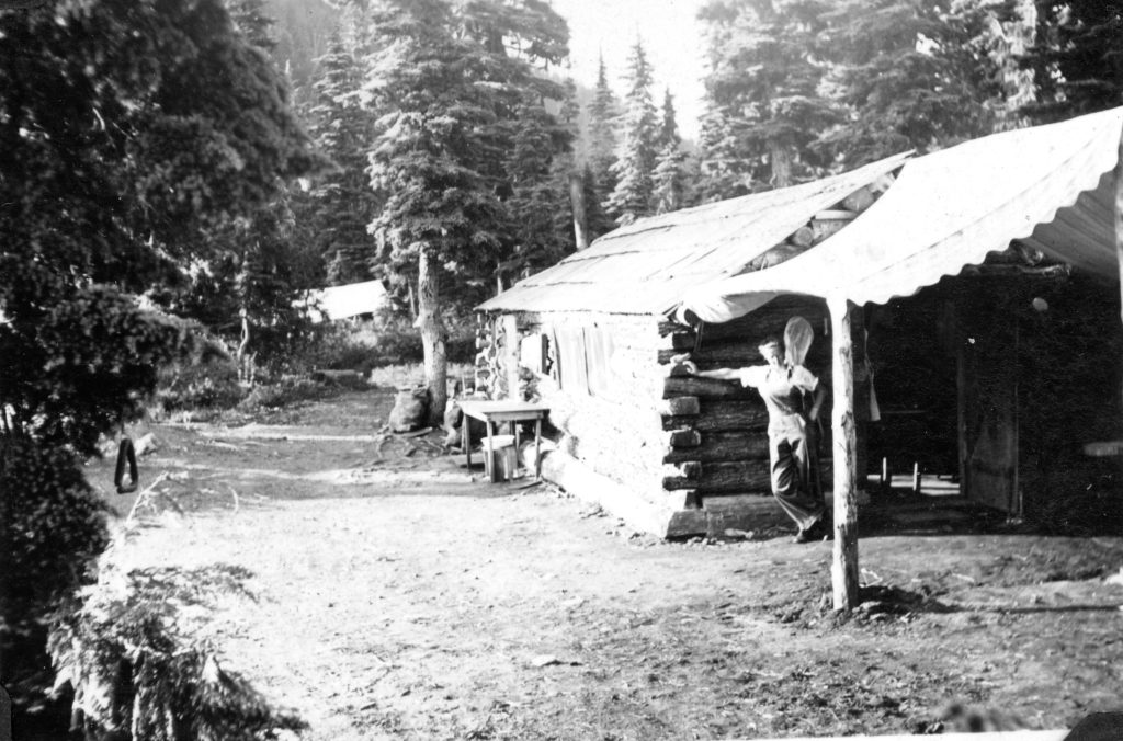
Croteau’s Camp 1939 – Ruth Masters photo.

Croteau’s Camp 1939 – Ruth Masters photo.
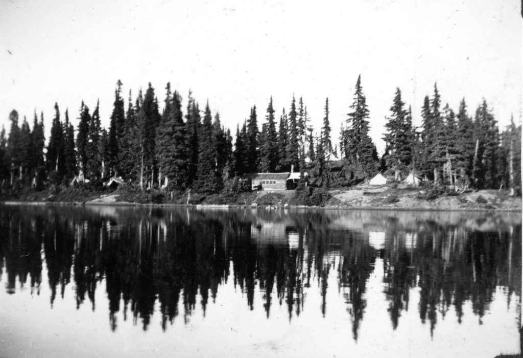
Looking across Croteau Lake to Croteau’s Camp 1939 – Ruth Masters photo.
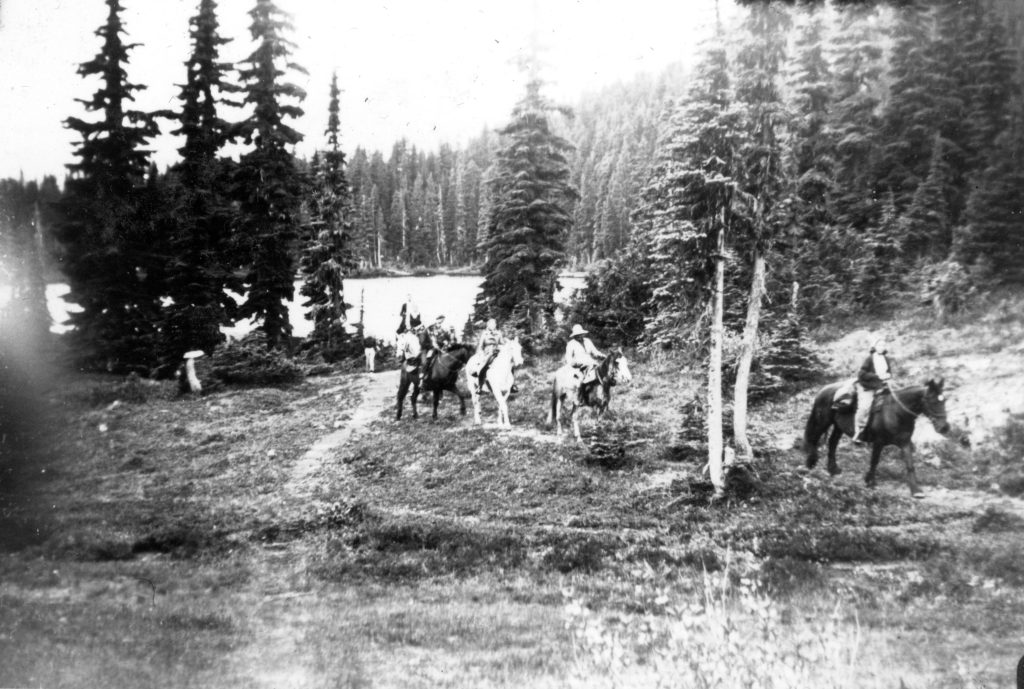
Mr. Payne’s packhorses leaving Croteau Camp 1939 – Ruth Masters photo.

Ruth Masters on the summit of Mt. Albert Edward 1939 – Ruth Masters photo.
Two women (unknown), Adrian Paul, Eugene Croteau and his dog Plateau at Croteau’s Camp 1939 – Ruth Masters photos.
The Golden Hinde
Reported in the Comox Argus Thursday August 10, 1939, p.2.
The highest mountain on Vancouver Island has been named by the Geographical Board of Canada, the Golden Hinde, after the ship in which Sir Francis Drake sailed. This is the mountain first climbed in 1937, which was called when it was first ascended because of tis physical characteristics, The Rooster’s Comb. It is claimed that Drake came so far north that he could see the snowy peaks of Vancouver Island: and therefore, the peak has been named in his honor. Colonel Robert P. Bishop, who was at Merville in the early days of the settlement, has just had reprinted by the British Columbia Historical Quarterly a pamphlet on “Drake’s Course in the North Pacific”. It quotes authorities for the famous voyage, some contending that The Golden Hinde reached 48 degrees north latitude. Mr. Bishop thinks that “the bad bay” the Golden Hinde put into was on the west coast of Vancouver Island and not what is now the coast of Washington.
Sunset over The Golden Hinde and The Comb.
Well Known People on Plateau
Reported in the Comox Argus Thursday August 10, 1939, p.5.
Attracted by the fame of the Forbidden Plateau there are a number of well-known people who are exploring its fresh charms. Among these is Mr. Rhys Williams, a well-known journalist of London. He has been staying with Mr. D.R. Macdonald at Comox for a time. Mr. Williams is the editor of a book on Russia and the Soviets, written after several years study in Russia. Last year he spent in Spain and saw many horrors that occurred there. He is staying at Mariwood Camp with his son. Dr. Blackman, formerly of Stanford University is deriving much pleasure from fishing on the Plateau, particularly at McKenzie Lake, Mr. Spence Thomas is another visitor to the Forbidden Plateau Lodge and camps. He is the head of the Wolverhampton Steel Mills in England. He has been on the Plateau for a week.
Plateau Is Shut Off
Forestry Order Prevents All Travel in Woods
Reported in the Comox Argus Thursday August 24, 1939, p.1.
Until all travel in the bush had been forbidden by the closure, fishing had been excellent on the Plateau, particularly McKenzie Lake. Going into the Plateau from the Forbidden Plateau Lodge there is no longer any need to go over the Mount Becher Pass; it is now possible to miss this steep climb by a new trail on the east side of Mount Becher, coming out at Slingshot Meadows. Work was proceeding with a small Forestry party on this trail to still further improve it, but it has now been suspended because all travel and all work in the bush is forbidden.
Mount Baker Scaled by Victoria Group
Reported in The Victoria Daily Times Thursday September 7, 1939, p.8.
Four members of the Vancouver Island section of the Alpine Club of Canada joined with seven members of the Vancouver section to make an ascent of Mount Baker over the Labor Day weekend. Eric Brooks of Vancouver led the party, which was divided into three ropes. The route taken was up the Roosevelt glacier on the northwest side. The Victoria party [included Allan Baker and Fred Leighton] traveled to Glacier via Sidney and Anacortes on Saturday morning, from where they hiked nine miles to the Mount Baker Mountaineering Club cabin at Kulshan, at a level of 5,000 feet. On summit the summit, at 10,750, was reached after an eight an a-half-hour trek. Low-lying clouds obscured the bases of the surrounding mountains, but their peaks formed an impressive sight. Mount Baker is classed as a graduating climb for those wishing to become active members of the Alpine Club of Canada. Several other members of the Vancouver Island section spent the week-end at the club cabin in the Sooke Hills. Outings list for the club’s winter activities will be out soon, and it is hoped that members and friends will turn out well in the coming season. Information can be obtained from the secretary Fred Maurice, G2101.
Search Party to Sooke Hills
Reported in The Victoria Daily Times Monday September 11, 1939, p.13.
A search party from the Victoria section of the Alpine Club of Canada covered a wide area of the Sooke Hills yesterday looking for a group of eight who reported themselves lost in a message written on a card atop one of the hills. The searchers, summoned by a member of the club who found the card, ran across the lost party’s tracks after extensive search, only to find the group had wandered back to known territory and was no longer in danger.
Mountaineers Elect Officers
Mr. H. Chandler is President this Season
Reported in the Comox Argus Thursday September 21, 1939, p.1.
At a well-attended meeting of the Mountaineering Club, at the City Hall on Thursday [September 14] evening, Mr. Dick Idiens, vice-president, gave a comprehensive resume of the club’s activities during the past season. Apart from hikes and skiing, the club had sponsored a series of lectures during the Winter, moving pictures had been shown, and extensive improvements to the cabin were carried out. Plans were made for the season’s activities, which are to include a hike for Courtenay School children. When the election of officers took place, Mr. Herbert Chandler, Sandwick, was elected president, succeeding Mr. W. Adrian B. Paul. Other officers are Sid Williams, vice-president, Miss Lilian Young, treasurer, Sid Williams, ski-captain, and M. Stelling, A.L. Cornish, Ruth Masters, Dick Idiens, and Noel McPhee executive.
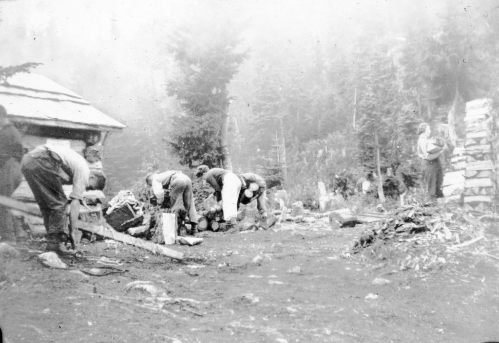
A work party at the Becher cabin 1939.
Alpine Club Has Good Day
Reported in The Daily Colonist Thursday October 26, 1939, p.8.
Members of the Vancouver Island section of the Alpine Club of Canada drove on Sunday to Goldstream Flats and from there made an ascent of the face of Mount Finlayson, A fine view was had from the summit both of Finlayson Arm and surrounding country, and of Victoria itself. The descent was made via Mount Skirt to Langford Lake. The party was joined later by several other members at dinner at the Scenic View Lookout on the Malahat.
Alpine Club
Reported in The Daily Colonist Sunday November 19, 1939, p.8.
The annual meeting of the Vancouver Island section of the Alpine Club of Canada will be held next Friday [November 24] at 8 p.m., at the home of Mr. and Mrs. Claude L. Harrison, Shore Road, Uplands.
Over The Hills and Far Away
Reported in The Daily Colonist Sunday December 31, 1939, p.28.
By Robert Connell
I was tramping over the treeless slopes of the Sooke Hills one day some years ago. The ground was rough and stony between the ledges of rock, and I had to keep my eyes watchful over my feet. Suddenly with the greatest distinction I was back on an upland sheepwalking in Scotland, where, as a boy, I had wandered among crags and moorland heather. The sensation was as real as any other, though it lasted only a few seconds I suppose. Perhaps this kind of experience, which, no doubt, many others have had, is akin to the one sometimes described in the words: “I felt I had been there before.”
Above The Lowly
But affection for the hills is not altogether a mater of survival of childhood impressions. Other elements assert themselves and even overshadow the primary feelings. Thus love of the wide prospect afforded by an elevated point, “the grand terraqueous spectacle from centre to circumference unveiled,” as Wordsworth called it, is one of the great attractions of hill-climbing and of mountaineering. On a clear day Mount Douglas [today also known as Pkols] affords a wonderful panorama, still more wonderful if the ascent is made just before sunset when storm clouds reflect the last rays in may-colored splendor. Even Mount Tolmie, comparatively low as it is, displays fine views, though by no means so striking. Mount Skirt affords a delightful picture of Victoria and Esquimalt with their harbors. From points on the Sooke Hills just above the highway the waters of Sooke Basin, harbor and bay with their encircling hills and jutting peninsulas are beautifully displayed. The summit of Mount Shepherd displays a fine view of the highlands up Sooke River and the Leech. Conspicuous among the hills is Survey Mountain, rising above the North Fork. From the summit of the latter again the eye takes in the great trench occupied by the Leech, Bear Creek, the Jordan, Y Creek and Loss Creek. It is not, however, always the highest points that afford the finest views. Some hills are so situated that the foreground is comparatively uninteresting and is not compensated by the distant scenery.
From Mount Jocelyn
Everyone is familiar with the striking views of Finlayson Arm from the Island Highway. Not so many, however, know the spectacle from the other side. There the long wall of rock that stretches from Mount Finlayson to Jocelyn Hill rises from 1,000 feet to nearly 1,400 above the waters of the arm. Actually, Mount Jocelyn is higher than Mount Finlayson, though the latter’s isolated form gives it an aspect of greater altitude. A fine view is obtained from Mount Jocelyn, whose summit is reached from the Highland district road, but not by car. It is possible though to get another fine view from the ridge by an old road that leads almost to the top of the ridge, ending in a cabin. I first stumbled across this in following old trails, one of which took me into a deserted farmhouse, whence I wandered by swamp and bush till I came out on a road again near the cabin mentioned. From here a steepish walk brought me in a few minutes to one of the most delightful of resting places with the dark see-lock lying far below like a strip of silk. While the north-facing wall is by no means perpendicular it is uncommonly steep, enough so to make the whole spectacle a very impressive one. The prospect from Jocelyn includes the pass by which the railway cross over from the arm to Shawnigan Lake, and to the geologically-minded it is not hard to picture in the imagination the body of ice that filled the basin in which the lake lies. At first a part of the general ice-cap that entered and filled the arm, it then was detached from it as the great break-up proceeded through the years, and finally, steadily decreasing, it left behind it on the pass, as seen particularly about Malahat station, a rough, irregular, boulder moraine.
Among Craggy Rocks
The scenery of the hilltops is all the better appreciated because of the exercise required to reach the vantage points. The particular kind of exercise found in hill-climbing calls into exercise all parts of the body; I mean of course, such hill-climbing as involves more or less clambering over and up and down craggy rocks, not necessarily requiring the skills of the mountaineer, but demanding at times the use of fingers as well as toes. A nice sharp piece of work of this kind invigorates the brain and clears away mental fog, and altogether puts one in the most desirable state for surveying the scenery from the top. If you are weary, as you probably are, you prop yourself against one of the lichened blocks of stone that Nature has blasted in her way from the parent mass, and if you are hot, as is also very probable, you will be glad of the protection afforded from the cool wind that almost invariably freshens these exposed summits. Sometimes you are compelled to seek the protection of a thicket of manzanita, or you may discover a ledge so situated that it combines both shelter and outlook. But, however and wherever you may adjust yourself, be sure the blood that tingles through your system will have stirred your sensibilities as well as sharpened your sight. So that the hill rambler who seeks first for invigorating exercise in his adventures will find a bonus in his heightened enjoyment of our charming highland scenery.
A Familiar Hill
A familiar hill to illustrate our thesis is Mount Finlayson with its height of 1,342 feet. So conspicuous is it, though its form is hardly elegant, that an old nautical name for it was “Leading Peak.” Towards Goldstream Flats it presents a very steep face, broken, however, by somewhat diagonal ledges bearing scattered trees. Two or three disasters have happened to climber on this face. Perhaps the commonest way of ascent is from the north, starting from the Highland district crossroad where it swings down to the flats. By this way you pass through thick forest without actual climbing, but the landscape is hidden by the trees. My favorite way of going up is on the opposite or south side. Where the road through the park takes a turn at right angles to pass below the cliffs, a logging rod runs steeply uphill. Follow it to the top of the first ascent and then swing to the left up a steep hillside where a rude trail is to be found. Then follow up a mountain creek on the side where you find yourself till you see the cliffs above on the left with steep slopes lightly covered with trees. Make your way across the creek to these slopes and follow along the cliff-foot upward till you come to irregular step-like rocks. The way to the summit lies over them and the climber will be well repaid. It is not, however, to be taken as you would a walk in Beacon Hill Park, or even Goldstream Park. The high heel of a lady’s shoe I picked up on these rocks one day tells significantly how it ought not to be done. There is just enough exercise on this little climb to be exhilarating and to enable one to enjoy to the full the experience expressed in Wordsworth’s phrase: “The power of hills is on thee.”
Little Lace Fern
If the rambler in the hills is in any degree a botanist, he has a further source of joy in his encounters with the rocks. He may, if he is fortunate, see in some tiny cleft of the Mount Finlayson cliffs the little lace fern, Cheilanthes gracillima, whose greyish green fronds suggest at once a plant of dry places. On the Island it is peculiar to this mountain and to Maple Mountain, but it extends from Western Montana through the mountains to Nevada and to the neighborhood of Yosemite Park, California. In the Sooke Hills you find a different flora. Empress Mountain boasts the creeping Menzies’ pentstemon with its large purplish flowers. On the lower hills you come across Bongard’s saxifrage with its bulblets among the flowering branches vying with the seeds for the propagation of the species. It is most commonly found on exposed ledges thinly covered with soil. In the Cattle Hills grows that handsome mountain plant, Luina hypoleuca; it has no English name. Its stems and lower surfaces of the leaves are covered with silvery-white hairs. The upper sides of the leaves are bright green. The flattish topped clusters exhibit creamy-white flower heads. Henry well calls it a “beautiful mountain plant,” and it is particularly fine growing against the great walls above the Sooke Highway. The Sooke Hills are peculiarly rich in such ferns as the Oregon woodsia, the maidenhair spleenwort, the parsley-fern and the cliff-brake or Indian’s dream. In the valley we may come across not only maidenhair, the oak-fern, the wood-fern and the lady-fern, but in a solitary locality the Sierra wood-fern. On the open slopes of the hills on each side of the Sooke River is to be found about the end of May the rare Githopsis specularoides, a tiny annual campanula with deep blue flowers. And there are other rare and interesting plants to be found by the keen sighted.
Look For Scenery
Scenery is greatly enhanced in interest by some familiarity with the geological structure and history of the countryside. Even an otherwise prosaic landscape takes on a new and often fascinating interest when the story of its making is known to us even partially. A few suggestions as to what to look for in our scenery may therefore be of interest and use to those who wish to understand the countryside with its hills and valleys. Probably one of the first things noticed when we look towards either the Sooke or Goldstream Hills is that they have a comparatively even skyline. Now, if instead of looking at them from a lower point and at a distance, we take our stand on one of the hills from which we have a good view, Mount Shepherd or Bluff Mountain or Empress Mountain, the eye will hardly fail to notice that here, too, there is still a certain uniformity of height, so that the hills may be said to resemble the waves of the sea. Here and there a hill higher than the general average may stand out, and when such a height is isolated and conspicuous above the common level it is called by geologists a “monadnock” after a well-known New England mountain of this type. The term describes an isolated mountain or hill rising above a worn-down land surface, a “peneplain” or “almost a plain.” Hills of this type are very common about Victoria. Mount Douglas is a conspicuous example almost at our doors. Monadnocks owe their existence as such to the fact that weathering and erosion process have worn away and removed the surrounding rock surface, and left these individuals upstanding either by reason of the superior hardness of the rock of which they are composed, or because the river systems of the country have in some way failed to exert their cutting influence upon them. It is plain that on our side of the Sooke and Goldstream Hills the worn-down plain lies low as compared with that which we find when we look across those hills. They, in turn, represent an old worn-down surface, cut by river valleys, some of which run along the strike or grain of the country, while others cross the strike. These valleys represent the cutting power of flowing water, and how great that is we see when we cross some of them from crown to crown of the enclosing sides. The lower plains about Victoria and Saanich or along the Jordan River Road have been worn down by the sea, and we can see behind them the walls of rock against which in by-gone days the sea broke.
The Glacier’s Mark
Another interesting feature is that the elevated peneplain that begins with the hills of Goldstream and Sooke gradually slopes upwards as we pass into the interior of the Island, so that while monadnocks there may be no higher above sea level. But as we get further up the Island we reach heights which bear a new character, for the rocks of which they are composed are bold, pinnacled and turreted, completely different from the smoother hills that lie around them. These like Mount Arrowsmith are the heights that stood out above the great ice-sheet, and were not eroded by it though they bear the marks of their own local glaciers. The ice-cap’s influence is very well seen from the steamer’s deck as we pass along the Island’s northeast shore. Then we can see the long hog-back ridges worn smooth by the southward riding ice, and behind them the heights that represent the unglaciated surface above the 4,000 feet or so of glacial ice.
Volcanic Rocks
In the Sooke Hills one of the most interesting features is the volcanic character of the rocks. Everywhere are to be found beds of volcanic debris from the finest dust to a coarse angular agglomeration of pieces ranging in diameter from a foot or two down to a fraction of an inch, all consolidated to rock and all the result of volcanic explosions. Still more abundant are the massive beds of lava plied one on top of the other and so resembling remotely beds of water-laid sediment. These again are cut by lava-filled fissures in size from a quarter of an inch to several feet. Here, too, are to be seen the celebrated pillow-lavas which show that much of the lava was poured into the sea; this is verified by the presence among these curious rocks of sediments containing marine animals. Then in places, sometimes on the hills as about Ragged Mountain and sometimes on the valley sides, we come across rocks with a granite-like structure and occasionally true granites, all of which were forced at a later date into the lavas from the molten body. And then finally, almost everywhere we come across the traces of the ice in markings such as scratches, grooves and polishings, and of the deposits dropped from it or carried off from it by water when melting sets in. The erratic boulders of our hills would alone be a study for many an expedition. There is a vast deal of interest in the hills that has scarcely as yet been scratched. No wonder so many of us for this reason, or that, or for a combination of reasons, love the hills of Vancouver Island.
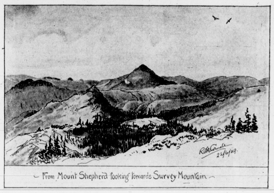
From Mount Shepherd looking towards Survey Mountain.
William S. Drewry
Reported in The Canadian Alpine Journal Volume 27, 1939. p.101-103.
By Arthur Wheeler
William S. Drewry, D.L.S. and B.C.L.S., was an Active member of the Alpine Club of Canada from 1912 to 1922. By early topographical surveys of the Main and Selkirk Ranges of the Canadian Rocky Mountains he did much pioneering exploration. In 1887 Edouard Deville, LL.D., F.R.S.C., then Surveyor General of Canada, inaugurated a topographical survey of the Main Range and in 1889 applied to it he photo-topographical methods of Colonel Aime Laussedat, who was elected an Honorary member of the Club in 1907. It is difficult to disassociate the names of W.S. Drewry and J.J. McArthur in this work. Drewry conducted the main control triangulation up the Bow River valley and over the Great Divide to the Beaverfoot River. McArthur carried on topographical work. This was extended a considerable distance on either side and a series of fine contour maps published. The survey was discontinued at the close of the 1892 season, Drewry and McArthur having been transferred to similar work on the Alaska-Yukon Boundary survey. During their survey McArthur made the first ascent of Mount Stephen; Drewry of many other peaks required as station points for his triangulation. In 1891 Drewry made a reconnaissance survey in the Selkirks to select suitable stations within the area bounded by the Columbia, beaver and Spillimacheen Rivers. Of this he wrote: “Before returning to the Columbia valley I made an exploratory trip across Bald Mountain to the slopes of the beaver valley. From a coign of vantage on the mountain a view of solemn grandeur was obtained. I must confess that the feeling of awe and impotence which this spectacle inspired will long remain with one. Facing us and extending to our right was the dark mass of Mt. Sir Donald, rising 10,625 feet above the sea, with five miles of almost sheer cliffs 3,000 feet high. To our left and west of the Beaver River, for more than twenty miles, peak after peak towered aloft, surpassing 10,000 feet, but one and all from top to base were clad in glacier and snow. Not a living thing was visible and the sense of desolation and awful loneliness was over-powering. Nowhere else in the mountains have I seen immense masses of glaciers and icefields, and I believe that but little of the area in which these lie has yet been trodden by man.” In 1893 Drewry was employed by the British Columbia Government to carry on similar topographical work in the Kootenay mining district which he did until 1895, covering an area of 600 square miles. Since then, Mr. Drewry lived in Victoria, B.C. and did much survey work for the British Columbia Government, until his death in 1939.
1940
The Next Five Years: 1940 – 1944