1911 | 1912 | 1913 | 1914 | 1915 | 1916 | 1917 | 1918 | 1919
1910
The Story of a Pilgrimage to Conuma
Reported in the Daily Colonist Sunday September 25, 1910, p.6 & 7.
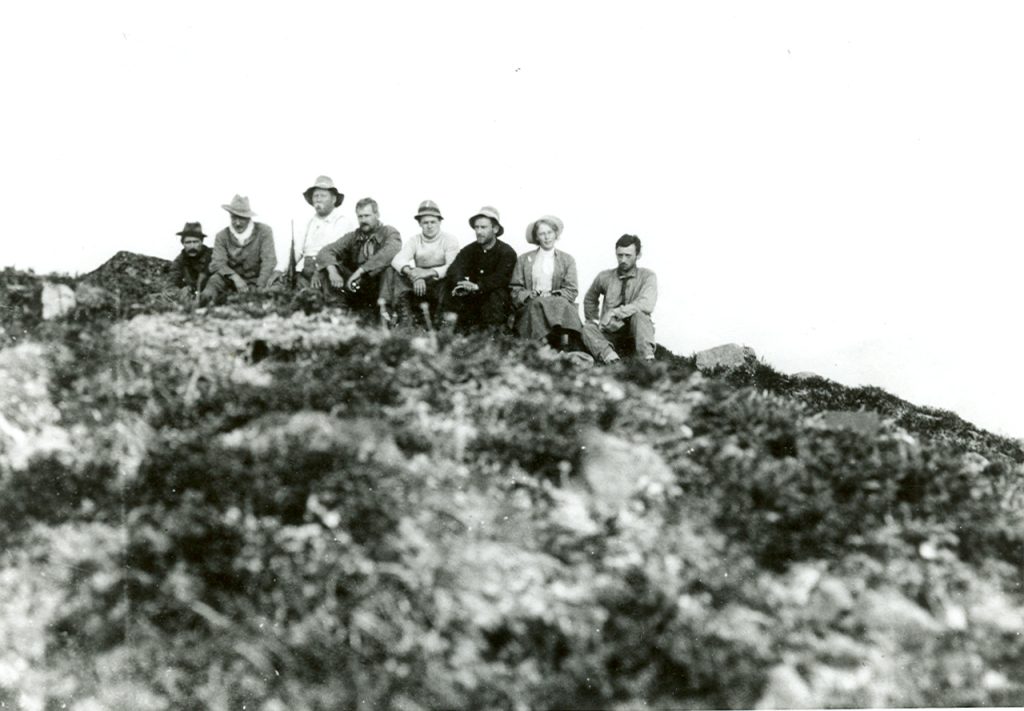
Mr. Arthur W. McCurdy, President of the Natural History Society, strongly advocates the broadening of the work of that useful organization, so as to embrace subjects not usually considered as coming within the domain of natural history. The Society has already extended its investigations into other fields, but Mr. McCurdy has opened what is a somewhat new and almost illimitable field, in which its members can do useful and interesting work. During the summer he spent several weeks in the country bordering on Nootka Sound, his primary object being to make the ascent of Conuma Peak, one of the most striking mountains on the West Coast of Vancouver Island, and around which some interesting legends are centered. He read a paper before the Society on his return, which was profusely illustrated by lantern slides from photographs taken by himself. A number of these are reproduced herewith. Mr. McCurdy began his paper thus:
“A monument ten times as high as the Great Pyramid;
A King’s Tomb;
The Ancient River of Gold;
A Wilderness of Snow, Ice, Forest, Precipice, Mountain and River.
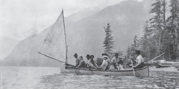
Such were a few of the headings of my programme on leaving Victoria for Nootka on the West Coast of Vancouver Island, on July 7, 1910. I will not at this time describe the wild and interesting scenery of the West Coast more than to say that Clayoquot surpasses Barkley Sound in interest and beauty, and the Nootka Sound excels them both. I will stop, however, to show you a photograph of a convoy of very small Indian boys in their six-foot dugout canoes as they came off from the Presbyterian mission with the freight boat at Ahousaht.” Nootka Sound is about halfway between the north and south ends of Vancouver Island. The early navigators regarded it as the most accessible of all the harbors on the Northwest Coast, and there was a time when it played a very important part in international politics. It is worth mentioning that Green, in his “History of the English People,” referring to the troubles between Great Britain and Spain over Nootka, says that this harbor is located in California. Mr. McCurdy says: “You are all more or less familiar with descriptions of Nootka by [James] Cook, [George]Vancouver, [John] Jewitt and others. At the beginning of last century Nootka was the only port of consequence north of Monterey, and figured more than once prominently in diplomatic correspondence. From 1785 to 1787, not including the operations of Meares from Nootka, Dixon reports 5,800 sea-otter skins sold in China at an average price of $30 each. Mr. Swan reports a total $48,500 during the four years 1799-1802, representing approximately a million and a half of dollars. “More than once,” says Sturgis, “I have known a capital of $40,000 employed in a northwest voyage yield a return exceeding $150,000. In one instance an outfit not exceeding $50,000 gave a gross return of $284,000.” Following the traders came the naturalists, who first broke ground in Northwest America at Nootka, and named specimens of plants and animals for that locality. There are, for instance, a Haliotis Nutkaensis (ear shell), a Rubus Natkanus (raspberry), and a Chamaecyparis Nootkatesis (nootka cypress). [These names are recorded in the book The Adventures of John Jewitt: The Only Survivor of the Crew of the Ship Boston.] Such was the importance of Nootka, which was the centre of trade and commerce for the whole of the Northwest Coast of America a hundred years ago. In those days there was a large population of Indians on the Sound, whereas today there is only a small settlement at Friendly Cove. Nootka also may be reckoned among the largest and safest harbors of the world. It has a wide, clean approach from the ocean, and is protected from ocean storms by Bligh Island, behind which lies a harbor of calm water, extending to the east for 32 miles, to the west 20 miles, and to the north for 15 miles, excluding the large basin of which Bligh Island is the centre. The great harbor is deep and navigable for the largest ships, and is free from rocks and sand bars. Nootka has the most striking approach from the ocean of any harbor I have ever seen. The great peaks are signals which may be sighted by the mariner while still many miles at sea.
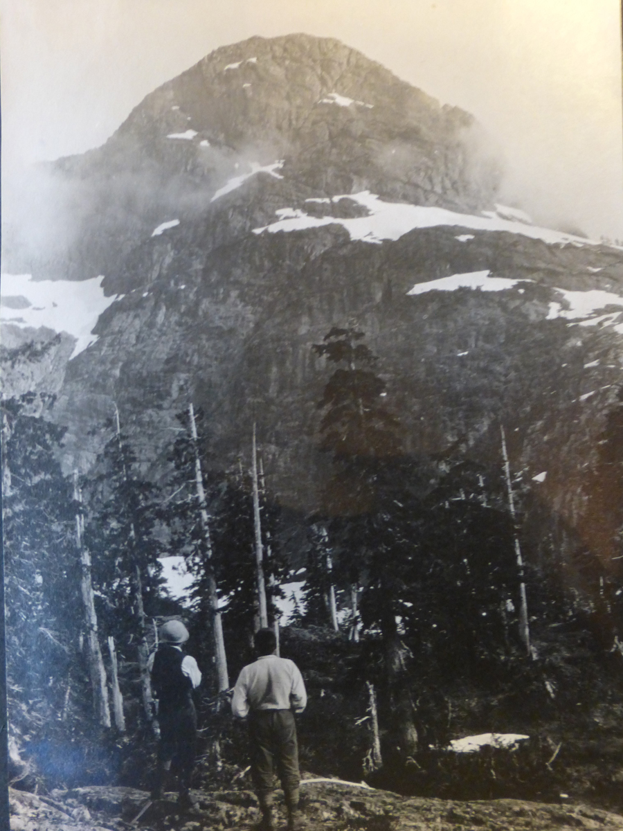
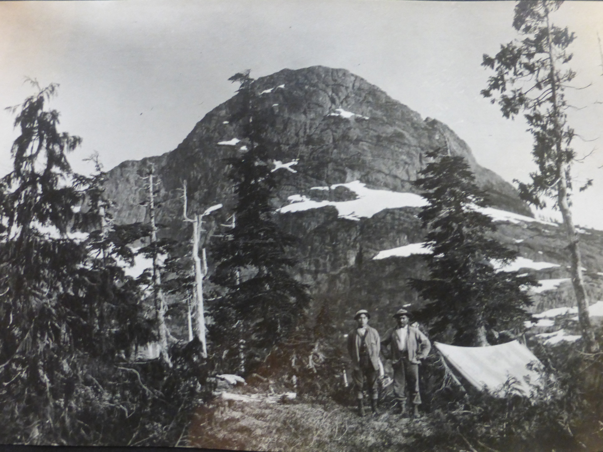
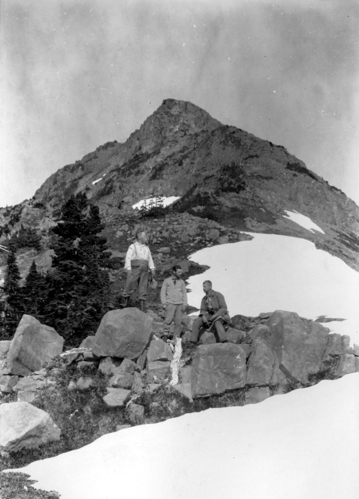
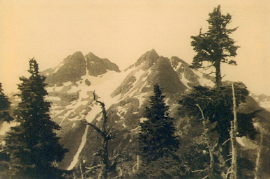
Conuma Peak
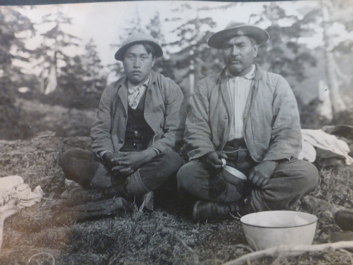
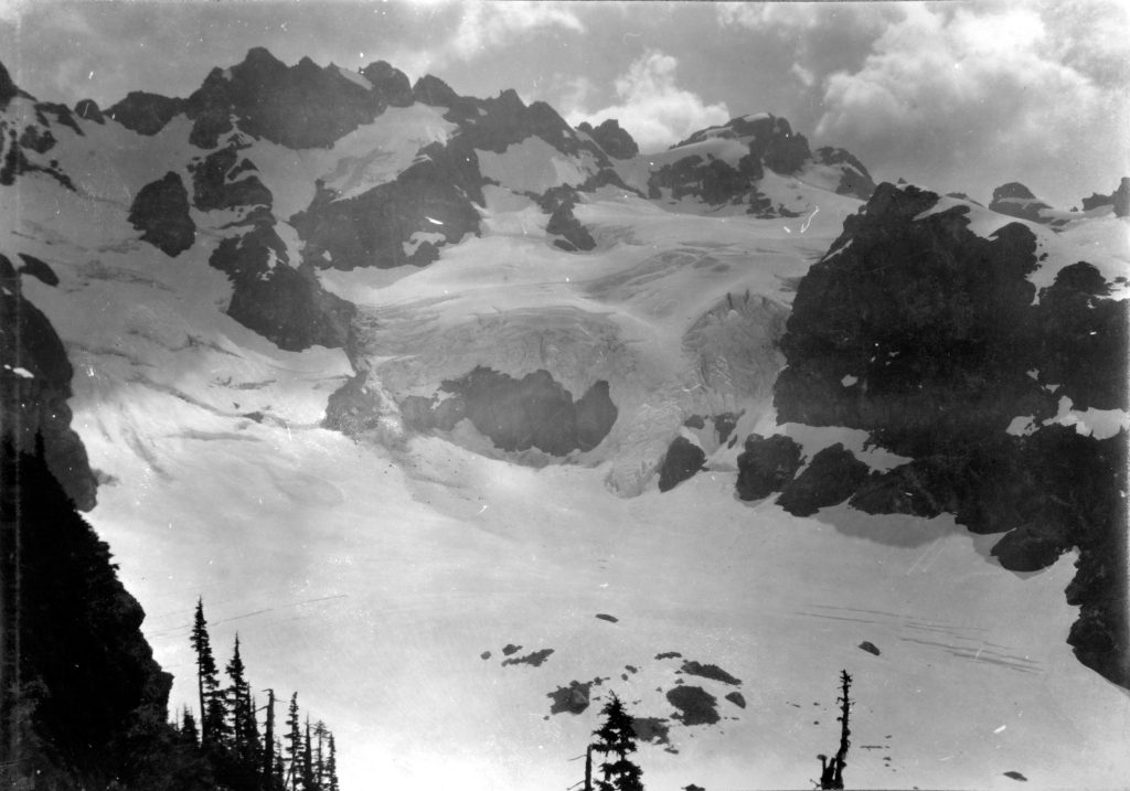
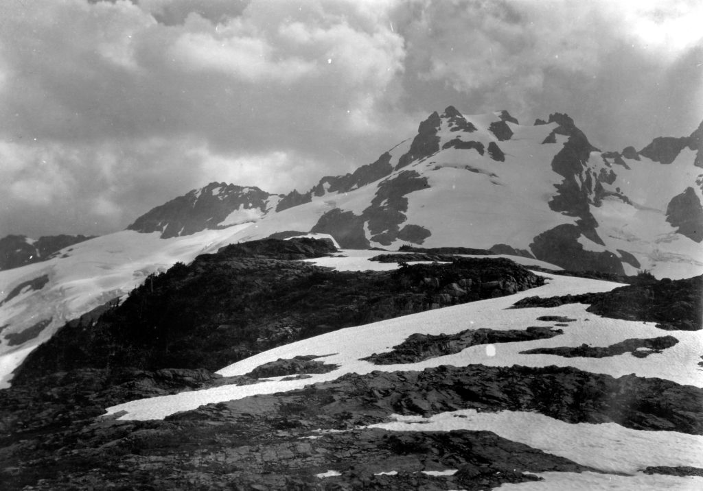
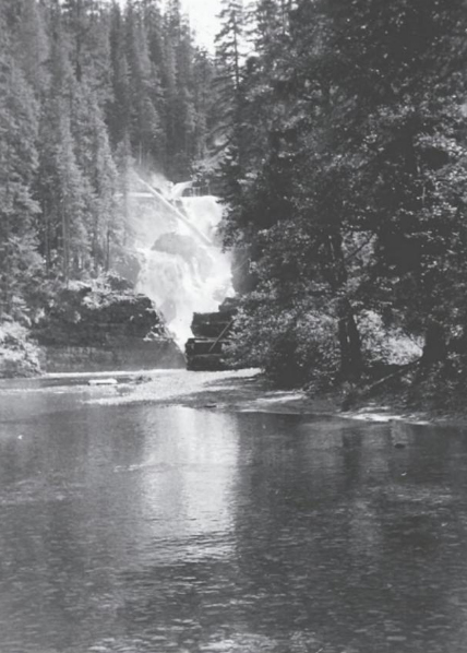
The central and most conspicuous peak is Conuma, in which in the cave near the top, legend places the tomb of the greatest of the West Coast Indian chiefs, King Maquinna. Legend also states that in olden times a River of Gold ran down the ravine from the cave. The view of the approach to the sound was sketched from the Admiralty chart at a distance of seven miles from the coast, showing the elevation of Nootka Cone to be 1,619 feet, and Conuma Peak, which was distant 35 miles from the observer, to be 4,889 feet.” The above brief reference to Nootka will lead many persons to join in the expression of the hope that Mr. McCurdy will make the harbor itself a subject for description at length and full illustration on some future occasion. His account of his brief trip around the Sound was as follow: “We dropped anchor for a few minutes at Friendly Cove, where I secured three Indians for our expedition, and then went on to the marble quarries, where we made our headquarters with Mr. George A. Rawlinson and his family [Rawlinson was the agent for the Nootka Marble Quarries LTD of Victoria]. For two days we explored the Sound in a small launch, and visited the Lagoon, which has a reversible waterfall similar to that of the Gorge at Victoria, and is exceedingly picturesque. Some distance from the Lagoon, on the other side of the Sound, we found a small harbor admirably adapted for an anchorage for small yachts, and a delightful resort for picnic parties. At this time of year, one is almost sure of catching some of the tyee or king salmon amid scenery which under every condition of light and shade, is always beautiful. The Kleeptee Peninsula is an almost unknown territory, with Head Bay on the west, Muchalat Arm on the south, Gold River on the east, and Conuma Peak on the north. The first expedition was planned to enter this peninsula at the mouth of the Kleeptee River, to explore towards Gold River, and if possible, to reach Conuma Peak before returning.
The Kleeptee River
The Kleeptee River runs through a granite formation, and has on each side throughout its entire length, mountains from 2,500 to 3,500 feet high. The width of the valley varies from one quarter of a mile to one mile, and is about six miles in length. There are three small falls on the river flowing over ledges of granite, and the water is clear and cold. Our first stop was at noon between the first and second falls, and while our cook was preparing lunch, our three Indian packers went in for a swim. The temperature of the stream was 45 deg. F. At our next stop for lunch the Indians again went in for a swim, and I was hurriedly called to come and see the school of trout following them about the pool. We camped on the shore of a lake not far from the source of the river, which we afterwards found to flow from a bed of snow and ice high up on a mountain side. From the lake three of our party returned to further explore the Sound and meet us at the end of six days near the mouth of Gold River.
The Neesack River
Crossing the lake on a raft we landed at a beaver dam and descended into the valley of the Neesack [Nesook]. At the shore of this river, where it abruptly turns to enter the Sound near the entrance of Head Bay, we found four excavations under the overhanging bank, made, the Indians said, by bear, who could here lie in wait for salmon as the passed up the stream, fish them out, and eat them at their leisure. A mile up the river a branch flows into the Neesack from the valley to the south. We proceeded along the main stream, however, to the divide separating the Neesack from the Gold River valley, and found that the Neesack also has its source in snow and ice. We ascended a dome-shaped mountain 2,700 feet high from which we had a glorious panorama in all directions. Conuma Peak to the north had not that spire-like form which we saw from Friendly Cove, but was shaped more like a huge wedge pushed up through the granite. In the west and northwest the snow fields and high peaks of the range running north from Head bay; to the east of Conuma, but much further north, Victoria Peak, 7,484 feet; to the east Crown Mountain, 6,082 feet; to the southeast the great snow fields and peaks flanking the National Park at Buttles Lake; and to the south and southwest the valleys of the Kleeptee and the Neesack, up which we had come – all were in plain view from the summit of this mountain. As we ascended the mountain, we found pink, white and dark red heather in full bloom at 2,000 feet. There was much snow in the hollows on the side of this mountain, and many small pools of water, with a small lake here and there. In one of these a bear was having a bath just before we came up. Instead of going round through Gold River country, we turned southeast down a stream which enters the Sound about four miles west of Gold River. The Indians made unsuccessful attempts to catch the large salmon which were trying to leap over one of the small falls of the river.” Nothing daunted by his lack of success in this direction, Mr. McCurdy decided to attack the mountain from another direction, and what follows is the first description ever given by a white man of this part of Vancouver Island, and Mr. McCurdy has doubtless the honor of being the first white man to set foot upon this notable peak. “Failing to reach Conuma from the south, I planned a second expedition to pass through Head Bay, ascend the Mowatcha [Moutcha] River, and reach Conuma from the north. At the left of the illustration and about a mile from the shore is located the Dunsmuir iron mine. The river is on the right behind Separation Saddle. The valley of the Mowatcha River is from a quarter of a mile to half a mile in width, and for three miles is comparatively level and wooded.
Mountains Burned
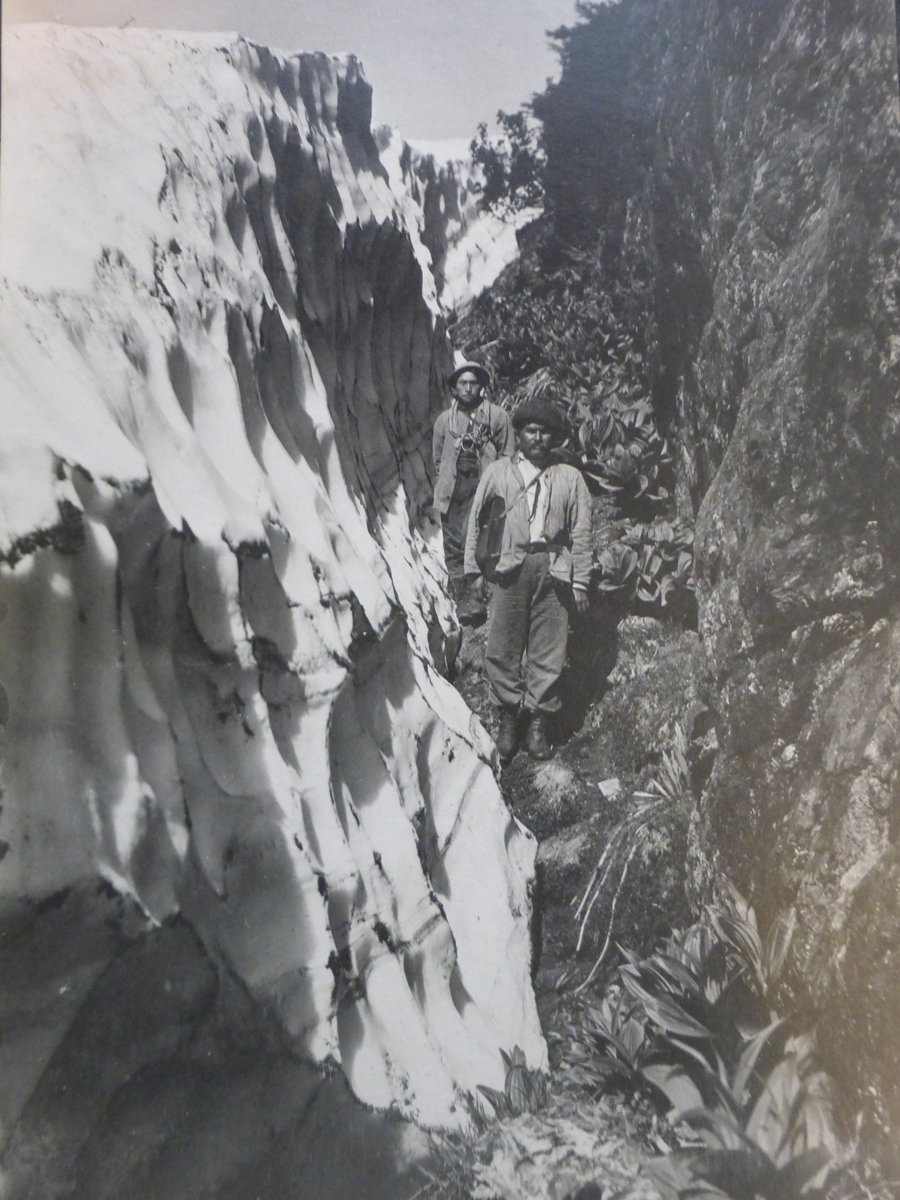
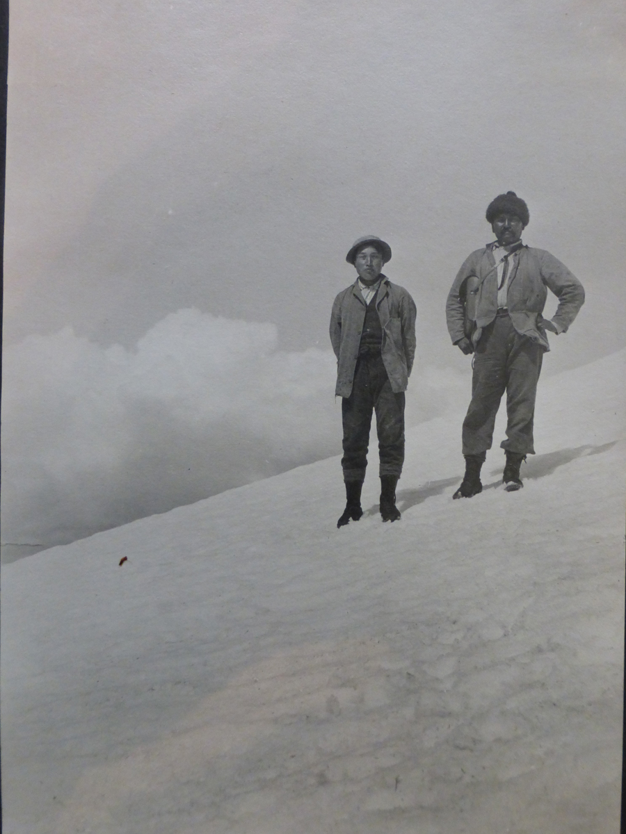
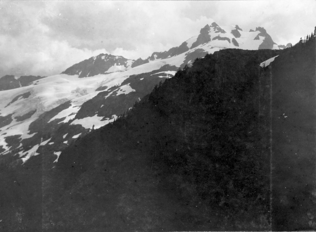
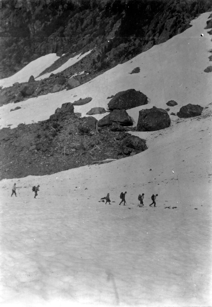
The mountains to the north and south rising to an elevation of 3,000 feet, were burned over many years ago by an Indian, who said, “Now the white man will no longer come to disturb our fish and game.” He intended to burn up all the timber of the Sound with his end in view, but before completing his plan of wholesale destruction, he was confirmed by authorities on a charge of insanity. This burning of the timber has no doubt kept explorers out of this region, for above canoe navigation we saw no axe marks or other indications of any having been through this district. We left out canoe at the mouth of a canyon, and proceeded over the burnt district, where fallen timber, small bushes, and bracken impeded our progress greatly. In some places the banks of the canyon were two hundred feet high, all solid rock, with not a vestige of soil anywhere. Before the fire the whole region had been covered with magnificent trees. How they could grow to such a size on such a bed of solid rock is one of the marvels of this country. Here at a distance of about four miles we had a glimpse of Conuma for several days, as fog came in from the ocean in the afternoon. The next morning bushes were wet and the traveling very disagreeable although no rain had fallen. We did not start until noon. At the head of the canyon, which I estimated to be about two miles in length, we found the river so congested that Sampson was able to jump across, but neither Dominick nor I cared to risk a leap over such a deep and boiling chasm, and a tree was felled to make the crossing. Above the gorge the river is about 100 feet width and a foot deep, running through a narrow, level valley, a corner of which was burned over in grand conflagration. There was no discoloration in the water of the river, no insipid taste – it was clear and cold, with a temperature of 45 deg. F. The bed of the stream was covered with small granite mixed with bluish stones characteristic of the dykes of the country, which are mineralized to a greater or lesser extent. We camped at the riverside not far from its junction with the “Ancient River of Gold from the Brow of Conuma.” During the next day our progress was slow owing to dense fog. Suddenly at an elevation of 1,300 feet Conuma flashed through the fog as if suspended in the sky almost above us and immediately disappeared. But this flash showed us its location, concerning which we had been somewhat in doubt. The picture revealed was of a great white horse hung up in the sky on a hard grey background. The “white horse” afterwards proved to be a great white snow field on the side of the mountain. The momentary impression made upon my mind was first, the nearness of the mountain, second, its great height, and third, the precipitous character of the cone. At an elevation of 2,050 feet, we again found white, pink and red heather. We reached the plateau on the north shoulder of the mountain at an elevation of 3,000 feet on Sunday at noon, and found between us and the cone a field of snow filling a great hollow in the mountain side about half by a quarter of a mile in area. Here the Mowatcha has its source, making a complete semi-circle of about four miles around the shoulder of the mountain to our camp No. 12. During the afternoon we caught occasional glimpses of the cone through the driving fog, but did not care to advance further until the fog had completely disappeared. Entering one of the pools of this plateau for a bath, I was surprised to see many small sticks about one and a half inches long and a quarter of an inch-thick approaching from every quarter of the pool. Upon breaking one of these in two I found that the wood had been excavated and its place was filled by a grub about an inch long.
A River of Gold
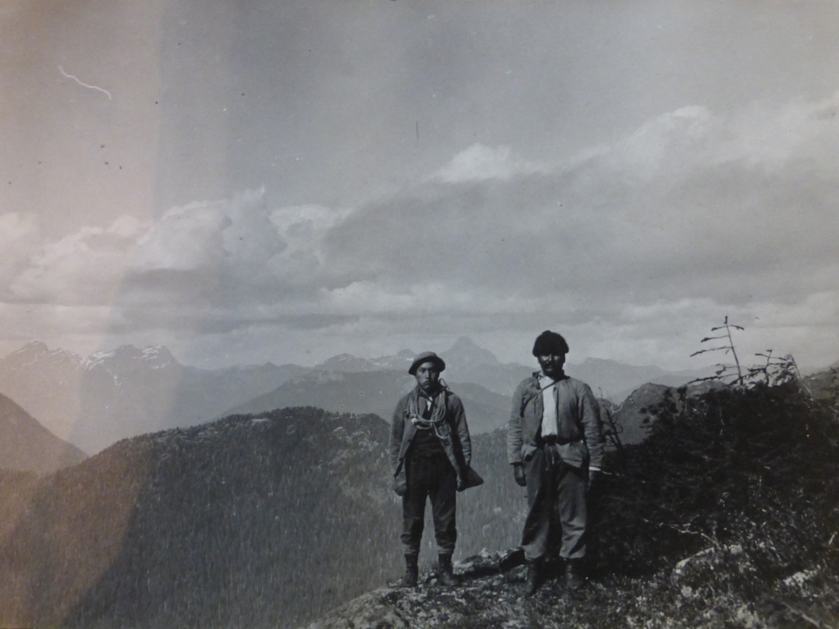
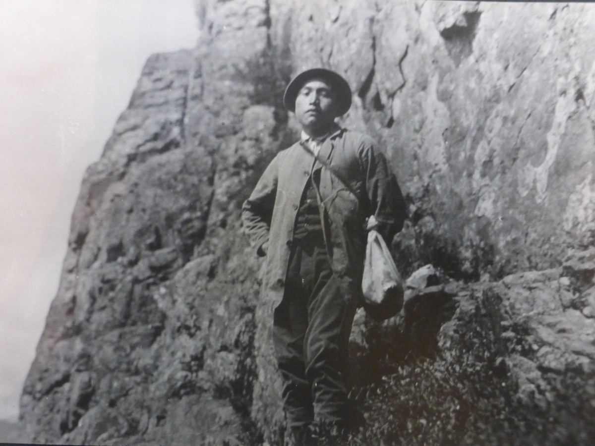
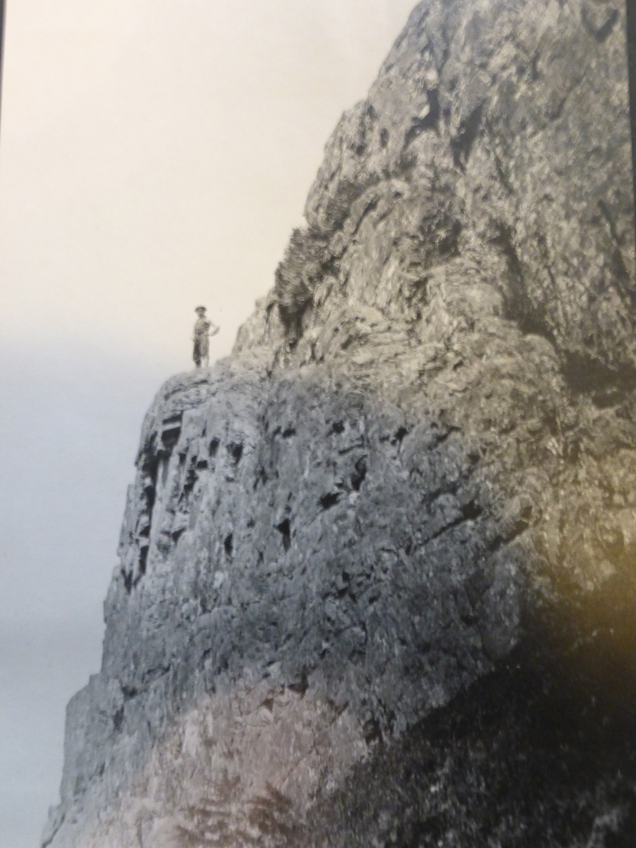
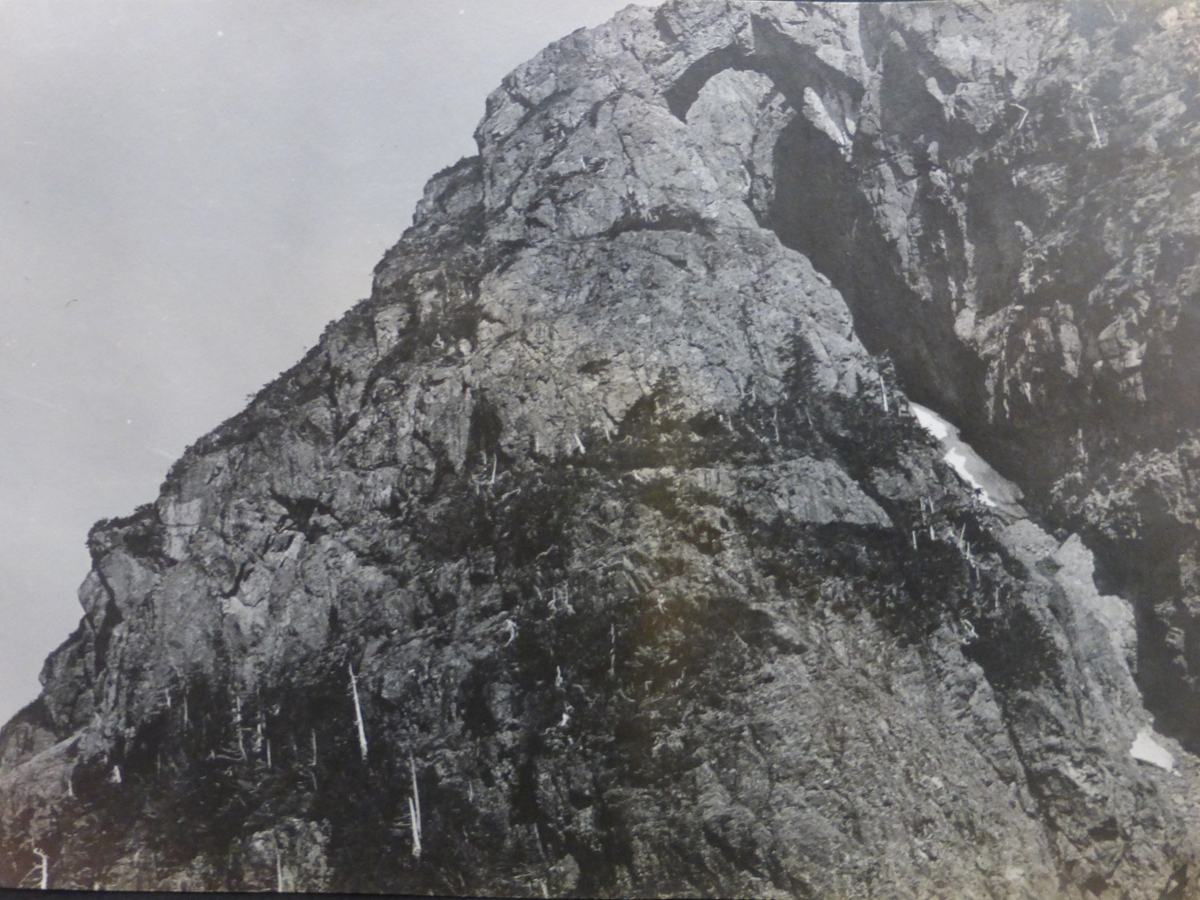
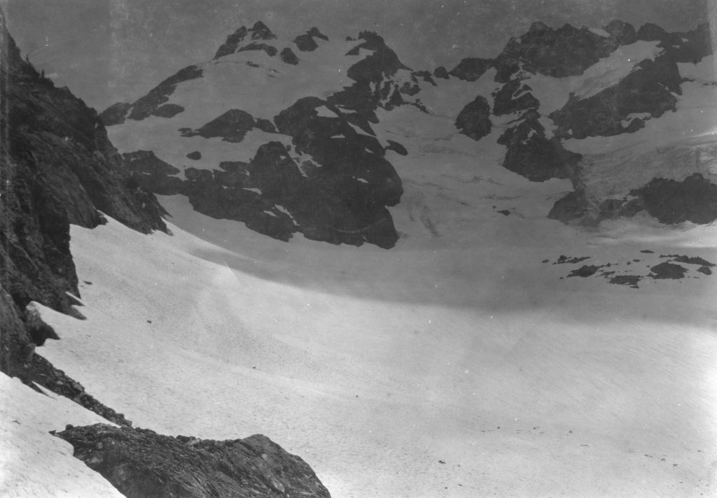
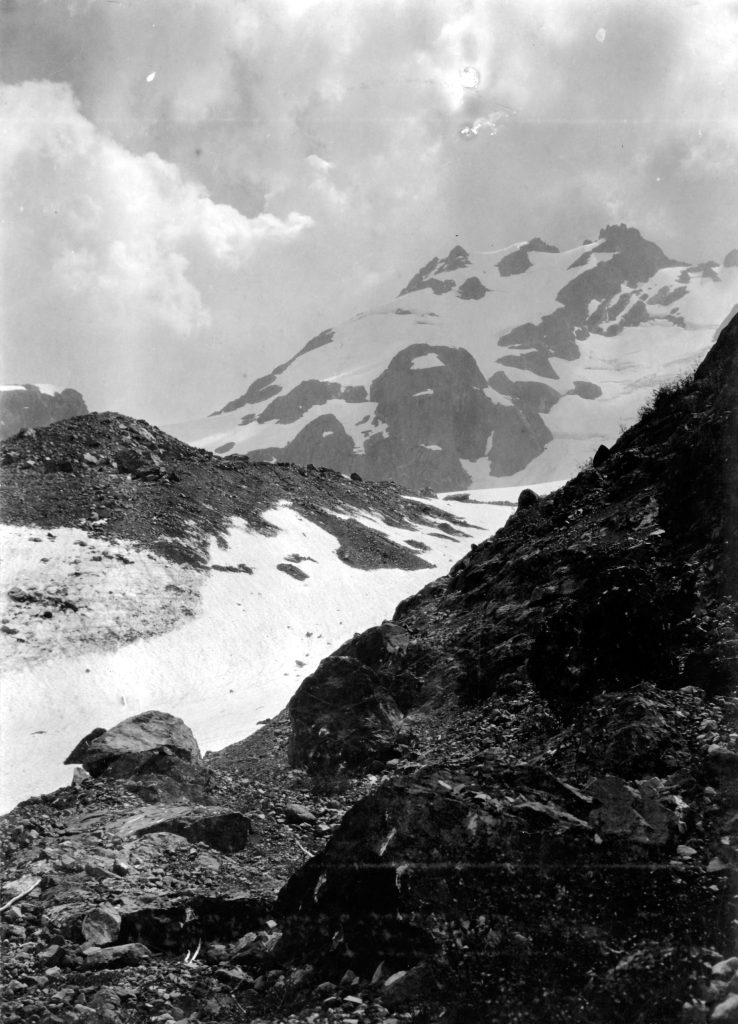
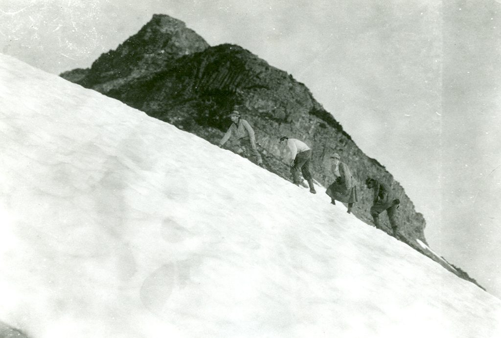
Next morning, we started for the cone and arrived at the ravine down which in ancient times, legend says, flowed “A River of Gold.” In the bottom of the ravine lay a solid bed of ice instead of a bed of solid gold, and looking up the ravine through a stone arch, I could see the opposite wall of the crater in the brow of the peak. This crater contains ice to an unknown depth. I could not see the “King’s Tomb,” although there could not be more a fitting place for it, and it may well be there. I had not the necessary equipment to provide for a descent into the ravine or into the crater, and further exploration of these two most interesting places had to be deferred to a future time. While I was taking photographs of the arch and ravine on the edge of which I was held by a small rope in the hands of Dominick, Sampson had taken off his shoes and socks and had scaled the peak. We could hear him shouting “Fine, fine!” He was gone for three quarters of an hour, and in the meantime, I took photographs of the surrounding panorama. Neither Dominick nor I would attempt it, for it was approximately 900 feet high. He brought back two samples of rock from the top and reported the crater to be seventy feet wide and one hundred and fifty feet deep: the natural bridge or arch to be twenty feet long, ten feet wide, and fifteen feet thick. He had been all over the mountain which he described as a wedge-shaped, about 25 feet wide and a quarter of a mile long, with a knife-edge at the back. “No way of getting up than by which he had come. The view from the top was fine – Gold River, the Sound, high mountains and snow all around.” As we stood on an elevation of 4,075 feet, the top of the cone rises above the ravine 889 feet. Truly Conuma Peak is a fit monument of a great king. On our return we again passed through the valley between the great snow field and the base of the cone, where plants grow with tropical luxuriance, and on emerging from this valley on the snow again, we bade au-revoir to Conuma for this year.
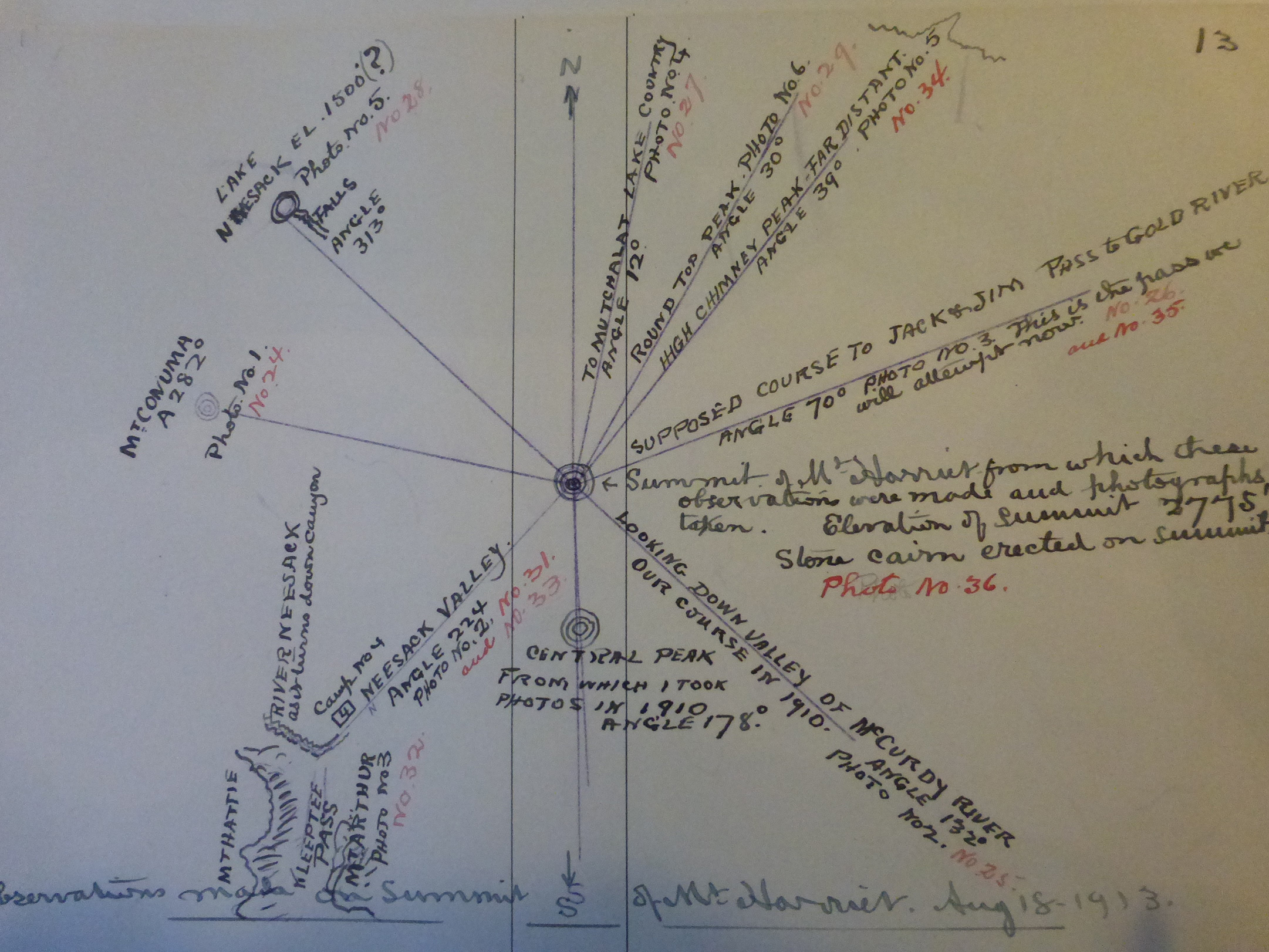
Observations made from the summit of Mt. Harriet Aug 18, 1913.
All McCurdy photographs and rights for use courtesy of Jane Shapley.
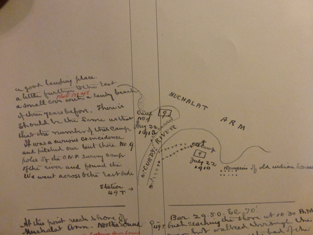
Notes from expedition 1913
McCurdy 3
McCurdy 4
McCurdy 5
McCurdy 6
McCurdy 7
McCurdy 8
McCurdy 9
McCurdy 10
McCurdy 11
McCurdy 12
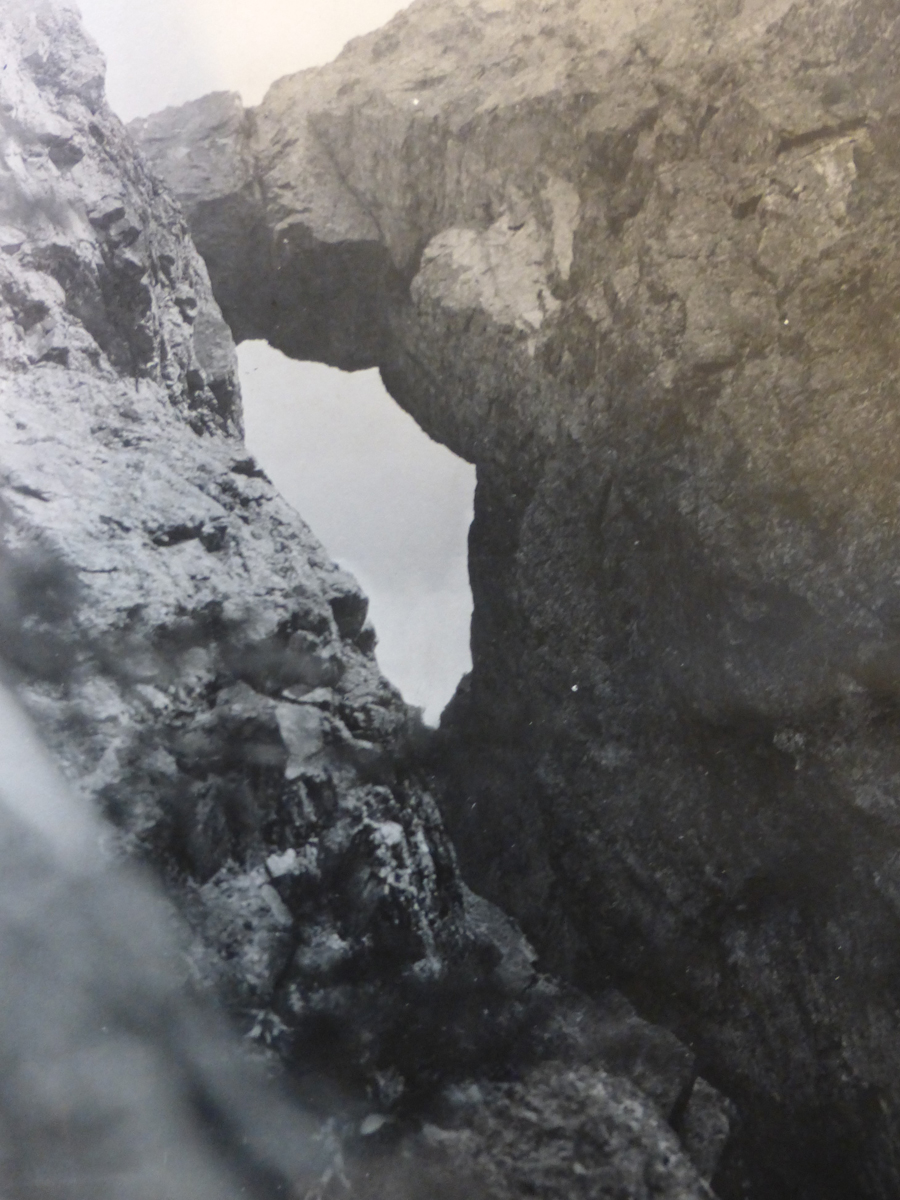
McCurdy 14. The Conuma Arch.
McCurdy 15. The Conuma Arch.
McCurdy 16
McCurdy 21
McCurdy 28
McCurdy 36
All McCurdy photographs and rights for use courtesy of Jane Shapley.
British Columbia’s National Park in The Vancouver Island Alps
Reported in The Daily Colonist Sunday Magazine section October 23, 1910, p.13, 14 and 16.
1910 Map
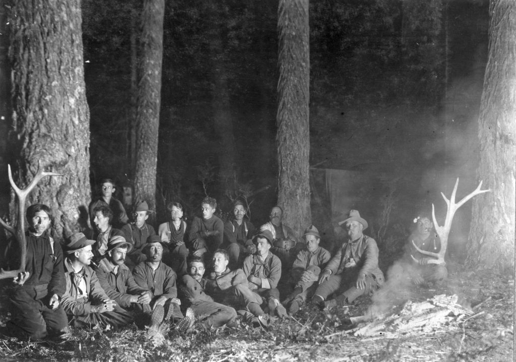
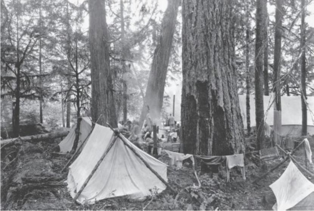
Ellison expedition sitting around campfire 1910.
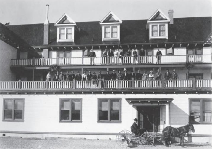
The Ellison Expedition at the Willows Hotel, Campbell River.
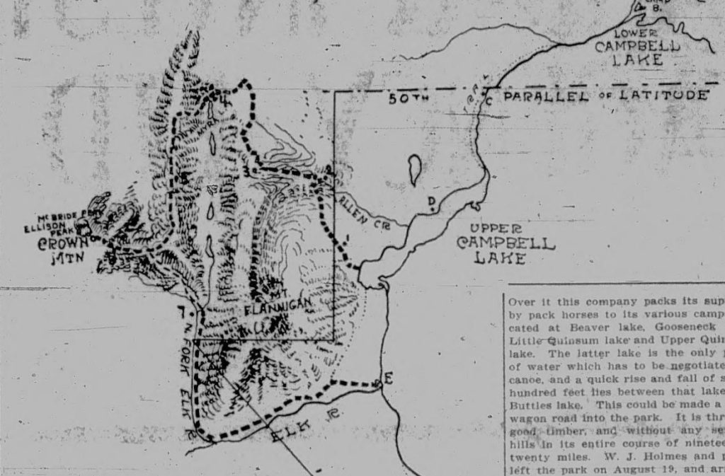
The special report of the exploratory expedition to Buttles Lake and the new Provincial Park in the alpine heart of Vancouver Island, made during the past summer under the personal capacity of the then Chief Commissioner of Public Lands, Honorable Price Ellison, was laid before the Executive Council at its last sitting, and is herewith reproduced, with the accompanying detail reports of Colonel William J.H. Holmes and Deputy Timber Inspector Charles F. Haslam. It is anticipated that action will be taken in the framing of the estimates for the January session of Parliament, towards providing for the construction of trails and roads facilitating communication with the park, and also for a restoration to the Crown of the timber surrounding the Park and now under license, as well as for the future conservation of such timber and special regulations for the protection of the game and fishes in the park reserve. The investigations made by Hon. Mr. Ellison and his assistants and associates have disclosed many new and interesting facts in connection with the little known wonderland of the Vancouver Island Alps, one of which is that there exist in all probability other and higher peaks than Crown Mountain, in the vicinity of the new park, to tempt the skill, the daring and the endurance of new generations of mountaineers; while another is that the Park boundaries extend for fully seven miles further, northerly, than had previously supposed. The park is described by Colonel William J.H. Holmes, P.L.S., who made a careful triangulation survey of the Buttles Lake and the surrounding area, as in the shape of a right-angled triangle with its northwesterly apex some few miles to the south of the fiftieth parallel, and about 26 miles from the East Coast of the Island. It then follows the boundary line of the Esquimalt & Nanaimo railway reserve for about 44 miles southeasterly, then turning due west until met by a perpendicular dropped from the northwest apex. This enclosed area contains between 270 and 300 square miles of mountains, glaciers, lakes and river. Buttles Lake itself is eighteen and a half miles in length, and (at a maximum) one mile wide, the shores and the hillsides lightly covered with fir and cedar, gradually giving place to steeply pointed masses of rock towering to heights from 4,000 to 5,000 feet, covered on their northern faces with perpetual snows. To the east of the Lake, the Albert Edward and Alexandria range dominate the scene. “The view from Crown Mountain,” says Hon. Mr. Ellison’s report, “is a glorious one of Victoria Peaks, dominating all the surrounding country. One of these King George Peak, rises for 3,000 feet with sheer walls on all sides, and the whole leaning over to the North—almost beneath—fed by the living snows of Crown Mountain, is an unfathomed emerald-green lake entirely shut in on three sides by the horseshoe conformation of Crown Mountain. This lake being the source of the Adam River which winds away to the North through a deeply-indented forest landscape, until it disappears behind a long range of mountains in the middle distance. In the far range, crowing this range, appear the snow-covered mountains of the mainland, between Knight and Bute Inlet. To the East, through a gap between Myra [Mt. Evelyn] and Flannigan mountains, a long valley opens out containing Lower Campbell Lake and the seaboard around Cape Mudge. To the South, the eye meets the never-ending succession of peaks and glaciers stretching to the horizon. There call can be no doubt, in the opinion of Hon. Mr. Ellison and the professional members of the party, that Mount Flannigan heretofore been mistaken for Crown Mountain—also that the maximum altitude of the Vancouver Island Alps will someday be found to exceed, rather than fall below 8,000 feet. The aneroids carried on the summer trip were for measurements only up to 5,000 feet, and consequently were useless for scientific computations after this elevation was passed. Throughout the entire country of the Provincial Park, signs of the Wapiti (Great American Elk), of black bear and common red deer were numerous. One large bear fell to the riddle of Hon. Ellison during the climb of Crown Mountain. A fair proportion of grouse and ptarmigan is reported, while the trout fishing in incomparable everywhere. At no place were any sign of aboriginal residence or visitation encountered, the Interior of Vancouver Island in its northern reaches having been shunned from time immemorial by the native races, either through superstitious fear of the “massache ikta”—the evil spirit of the red man—or, a more common practical explanation because the Coast Indian cares not to venture far from his canoe, and has in him no germ of the enthusiasm of the mountaineer.
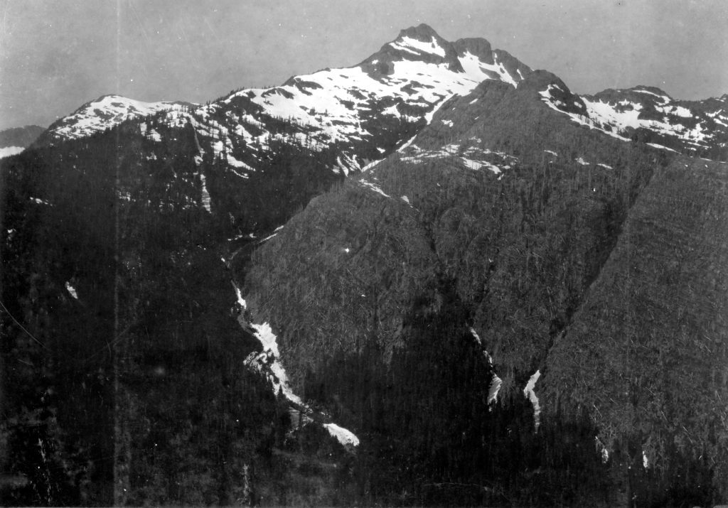
View of Crown Mountain from near Mt. Flannigan 1910.
Victoria, B.C.
October 8, 1910
To the Hon. Richard McBride L.L.B.K.G, Premier, and Members of the Executive Council
Gentlemen:
I beg to report re-the Provincial Park on Vancouver Island as follows; Owing to the great increase in population and industrial enterprises all over the world, many countries have considered it necessary within the last decade to set aside as reserves large or small tracts of country in order that the present and future generations may have these enclosures as recreations grounds and view the grandeurs of nature in an unaltered form, these reserves at the same time to act as game preserves, and thereby prevent the total extinction of the different species of animals. Countries that have not as yet actually formed these reserves in name, have, on the other hand, made such stringent regulations concerning industrial enterprises within the boundaries of their natural scenery, that one may call these district reserves. Taking Switzerland as an example: this confederation is practically one large reserve for the sue of tourists. A large tract of land set apart as a reserve, or otherwise protected, is by no means a dead loss to the country from a commercial standpoint, so long as it contains scenery worthy of the name, as it not only attracts people from the surrounding country, but thousands and thousands of tourists to flock to it annually, thereby providing occupation for a large number, and besides leaving a large amount of money in the country. In 1876, Dr. S. Stopel reckons the total receipts coming into Switzerland from foreign visitors at something like $24,000,000 annually. To give an idea how this amount has increased: In 1880 there were about 1,002 inns built for visitors, containing 58,137 beds, of an estimated value of 320,000,000 francs. In 1894 the number had risen to 1,683, with 88,634 beds, with a capital value of 519,000,000 francs. In 1899 the number of inns had increased to 1896, with 104,876 beds with capital value of 550,000,000 francs. Almost every little mountain village now calls itself a health resort or open air cure. Not to mention that large tracts of country which were isolated before on account of bad communications, have been opened up by railways and splendid roads, which would, except for the tourist, have never been feasible, on account of the great cost. The influx of foreign visitors into Switzerland had become such an important factor to the country that in 1903 the government took over four out of five main lines of railway within the confederation, at the enormous cost of 1,000,000,000 francs, in order to better regulate the enormous summer and winter traffic caused by the influx of tourists on these lines and at the time to standardize and make complete the system of rebates on fares, and of advertising employed by the railways. Now all over Europe, in every little post office and railway station, one finds large placards pointing out the beauties and advantages of Switzerland as a health resort and beauty spot. The railways now issue return fares at remarkably low prices. I think I am right in saying that the Provincial Park on Vancouver Island meets all these requirements.
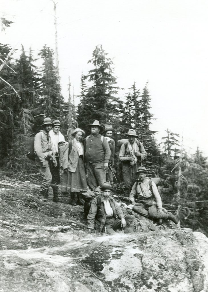
Expedition members hiking in to Crown Mountain 1910.
Position And Scenery
As one travels northwest through Vancouver Island, the country becomes more and more rugged and mountainous, from where the Alberni Canal cuts into the heart of the island and for about one hundred miles northwest, the central portion of the Island consists of a series of mountains covered by glaciers and eternal snow, and deeply intersected by valleys running in all directions. It is within this region that the park is situated in the shape of a right-angled triangle, with its northwesterly apex some few miles to the south of the fiftieth parallel, and about twenty-six miles from the east coast of the island. It then follows the boundary of the Esquimalt & Nanaimo Railway Grant for about forty-four miles in a southeasterly direction and from there turns due west until met by a perpendicular dropped from the northwestern apex. This enclosed area contains between two hundred and seventy and three hundred square miles of mountains, glaciers, rivers and lakes. This district is divided by nature into three portions, by the deep and narrow valley of the Campbell River with its tributary, the Elk River. The main valley containing Buttles Lake, enters the park on its northeastern boundary line about twenty-five miles from the southeastern angle and continues in a southerly direction, as a broad sheet of water for about fifteen miles, where it splits up into smaller valleys, gradually rising and losing themselves in the mountains to the south. Buttles Lake is eighteen and a half miles long and one mile in width and is one of the prettiest spots imaginable, the shores and the hillsides being covered with timber, which gradually gives place to rugged and steeply pointed masses of rock towering in many places from four to five thousand feet above the lake, and covered on their northern faces by perpetual snow. To the east of the lake the Albert Edward Range and Alexandria Range dominate the country. These mountains rise from the lake in steep bluffs and interspersed with ravines, down which flow small creeks, in many places having vertical falls or many hundred feet. These two ranges form a natural boundary to the northeast. Towards the south of Buttles Lake they fall considerably until they meet the valleys and foothills which again form the northern boundaries of the range known as Nine Peaks [called Laing’s Neck Range in 1896 by William Bolton]. This range, with its glaciers, two and three hundred feet thick, lies a few miles without the park boundaries. To the west of Buttles Lake, and bounded on the north by the Elk River, the mountains are steeper and more rugged and split by one or two very deep valleys, which however, soon lose themselves in this complexity of mountain peaks. This western division contains the highest peaks within the park and perhaps on the whole island. Where the Elk River cuts into them, off towards the north, the precipices are often from two to three hundred feet in height. Towards the centre of this district there is a magnificent range (unnamed) with three peaks towering above the surrounding country and shutting out the view to the south even from the summit of Crown Mountain. Wolf River valley half way down the lake, appears to have its source somewhere near the peaks. At the southwestern extremity of Buttles Lake, Myra Creek enters the lake after falling over a series of cascades approaching something like four hundred feet in height. The northern group of mountains culminating in Crown Mountain, are bounded on the south by Elk Valley and to the east by Mount Flannigan [William Holmes surveyed the mountain in 1910 but gave no source of the origin of the name and it was officially adopted in 1949] and Mount Myra [Mt. Evelyn as identified by William Holmes but no source of the origin on the name. Also officially adopted in 1949], which rise around the Upper Campbell Lake. The view from Crown Mountain well repays a long journey in itself. To the northwest is a glorious view of the Victoria Peaks, dominating the surrounding country. One of these, King George Peak, rises for perhaps three thousand feet with sheer walls on all sides and the whole leaning over towards the north at an alarming angle. To the north, near at hand, and fed by the snowfields of Crown Mountain, there is a deep emerald lake entirely shut in on three sides by the horseshoe formation of Crown Mountain. The lake is the source of the Adam River, which winds away to the north through a deeply indented forest landscape until it disappears behind the long range of mountains in the middle distance. In the far distance crowning this range, one sees the snow-covered mountains of the mainland, between Knight and Bute Inlet. To the east, through a gap between Myra [Mt. Evelyn] and Flannigan mountains, a long valley opens out, containing the Lower Campbell Lake and the sea-board around Cape Mudge. To the south the eye meets a never-ending series of peaks and glaciers stretching to the horizon and too innumerable to describe or specify. The southern face of Crown Mountain drops in a series of precipices into the deep which has its origin in this range. The northern face is less steep, but covered with perpetual snow fields. The reserve is an ideal spot for people desirous of mountaineering, as once within the park they have the choice of an unlimited number of peaks upon which to exercise their skill.
Climate
The climate from a tourist’s standpoint, must be nearly ideal, as the valleys are cold even in the middle of summer; with a morning and an evening breeze blowing along the lake. In winter the park should form an ideal spot for people desirous of taking skiing and snow-shoeing, as any number of fine trips could be taken. There is ample snow all through the winter owing to the park’s height above the sea, yest the weather is fairly constant. The lakes and rivers are well stocked with fish, and there are quite a number of elk in certain portions of the park.
Accessibility
The easiest mode of access at present is by the Campbell River route—first by wagon road to McIvor Lake and then through a short slough connecting it with Campbell River. At low water this slough is difficult for boats: from this point a wagon road would be required up to Buttles Lake, as at present there are quite a few log jams between the lower and upper Campbell Lakes. People wishing to enter the park from the north which they can do by keeping to the north of Mount Flannigan and entering the park between the latter and Mount Myra [Mt. Evelyn], from which point Crown Mountain is accessible; then by keeping down the north fork of the Elk River, they could at its junction with the Elk either turn west and travel through the western mountains coming out at Wolf River, or by turning East from the Campbell River within a few miles of Buttles lake. The second alternative is by trail which runs directly to Buttles Lake, from a point two miles above the Lower Campbell Lake. Third, by putting a road in to Buttles Lake from Campbell River townsite. This latter road would at the same time open up a large tract of country, heavily timbered and perhaps to a large extend fertile, along the valley of the Campbell River, which is broad all along here. There is no doubt that within a very short time hotels will spring up on both the upper and lower Campbell Lakes, as the fishing is excellent. From the south, the park may be harder to get at, as the entrance from Great Central Lake via the Nine Peaks Divide and Lake Margaret presents considerable difficulties owing to the pass being some 4,500 feet above Great Central Lake and a large number of snowslides coming down into the valley beyond. But there is a chance that by continuing the road for about eight miles from the mouth of Great Central Lake an easy source might be found up the Ash River, passing Deep [Oshinow] Lake and coming out about three miles from the top of Buttles Lake. If this is feasible, people desirous of doing some walking could leave the road at Great Central Lake and continue over Nine Peaks Pass [Price Pass] and down Price Creek to Buttles Lake. On the way they would see some of the finest scenery possible. By putting in good roads and hotels, or allowing only competent people to build good hotels at suitable intervals within the park and fixing the charges or transportation along the roads, there is no doubt but that Provincial Park will become one of the greatest attractions of the Pacific Coast. In conclusion I beg to state that I consider the acquisition of this park important, as it will be such an important asset, available alike from Western Mainland points and from Vancouver Island, when the necessary means of entering the park are provided. I beg to append herewith copies of the supplementary reports of Mr. William Holmes; Charles F. Haslam and A. Lionel Hudson on the standing timber within the park limits, as well as official accounts of the whole exploration trip. I have the honor to be Sir, your obedient servant.
(Signed) Price Ellison
Chief Commissioner of Lands
The expedition main camp on Campbell River.
The government exploratory survey of the provincial park under the direct supervision of the chief commissioner of lands, left Victoria on Tuesday, July 5, 1910. The intention was to enter the park by way of the Campbell River on the east coast, and after passing through as much of the area set aside as possible, to return by way of Alberni. Besides the chief commissioner’s party, the following were added in their official capacities: William. J.H. Holmes, B.C.L.S.; Charles F. Haslam, deputy timber inspector; and W.F. Loveland, divisional fire warden. At Vancouver two serviceable Peterborough canoes were secured, and the party arrived at the mouth of the Campbell River on July 7. Here others were added, among them being Hugh H.N. Bacon, as guide, and three Indians for canoe work. The full equipment numbered twenty-three, one being a lady, Miss Myra King Ellison. At Campbell River there is a commodious, new and modernly equipped hotel, which has caused more tourists than ever before to seek this famous spot for sport with Tyee salmon, and which undoubtedly will prove a decided boon to those who in the future desire to enter or come out from the park via the Campbell River. Finding it impossible to go up the river for the first seven miles owning to the many rapid and the Great Falls [Elk Falls], we were obliged to take the wagon road to McIvor Lake, which is both a feeder of, and at times fed by this river, about seven miles distant from the Willows Hotel.
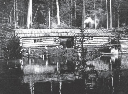
Lord Bacon’s cabin on the Campbell Lake.
Lower Campbell River
Flowing out of the Lower Campbell Lake, the river runs for half a mile in a smooth but swift stream; then, with a swift urn, a long rapid is met. Just above this the waters of McIvor Lake enter through a slough. We endeavored, successfully, despite the dense brush, to see what was below the long rapid, and found a fall of about 30 feet, then more rapids; then a fall of 12 to 15 feet; then collecting itself, the river rushes toward the supreme leap of 120 feet, and after passing through a long canyon makes its way to the sea, with more rapids and swift water. Up this stream come the salmon, reaching almost to the Great Falls, and excellent black bear hunting is procurable during the months of September and October, when these animals come in great numbers along the banks to secure fish.
McIvor Lake
This lake at present is a very useful method of reaching the upper waters of the Campbell. It is of regular shape, 525 feet above sea level. Trout were caught by us in it in large numbers. The wagon road ending at its head, we canoed over to its feet, where a trail has been cut five-eighths of a mile along the banks of the slough to where the river is reached. At times this slough is unnavigable and the channel is at all time tortuous and of very irregular depth.
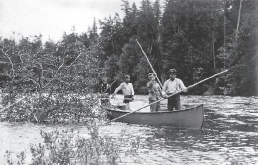
Canoeing on Campbell River.
Lower Campbell Lake
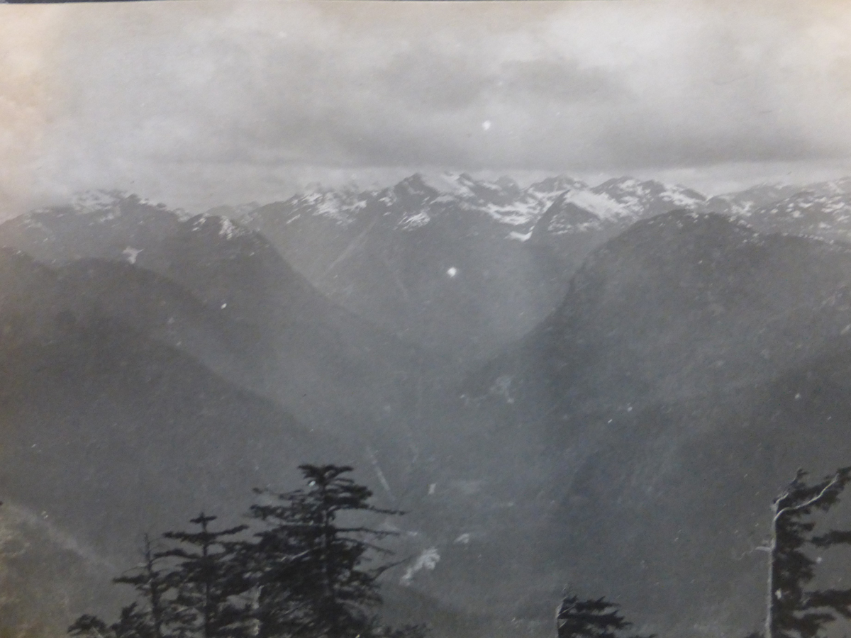
Leaving the river behind, we entered the Lower Campbell Lake, which is six miles long and of good breadth throughout. Here, on a clear day, such as we enjoyed, a magnificent view of snow-clad mountains is obtained at its head and on its west side. Indeed, the mountains which we afterwards found reaching down at their base to the waters of Buttles Lake, as well as those that feed both Comox and Great Central Lakes, rise grandly before the traveller and foretell the beauties which lie in store for him. Brown Mountain, with its double dome, Victoria Peak, and King George Peak, Mount Flannigan and Mount Bacon [Elk Mountain] all tower up ahead and help to make the lake one of the beauty spots of the Island. There is a good-sized island (King Island) two thirds of the way up, and Snake Island at its head, where one of our camps was made. Here excellent trout fishing was had.
Middle Campbell River
The river is navigable from the head of the lower lake for nearly two miles and is a broad stream, full of fish. Opposite the commencement of the Quinsam Trail the first rapid is met, and after this we found hard poling, with a little later only practically an empty canoe possible to make an ascent in. We made camp above the fourth rapid, having to put supplies on shore a mile below and pack them over the fair trail. From this camp we were obliged to pack ahead for 4½ miles over rough trail before reaching still water, which is only found close to the foot of Upper Campbell Lake. The canoes were taken up the stream one by one, by Bacon, Haslam and the Indians. Above our “river camp” the river rushes through a canyon; then the “big drop” is met. Everything had to be taken out of the canoes which had to be “lined” up, the men up to their waists in water. Above this fall, which is not so sudden as long, there are seven rapids before “The Devil’s Dream” is reached. Here a hard fight awaits the canoe man., but once above it the upper lake is shortly reached. The trial was much improved towards the end of our packing owing to work done on it by Mr. King.
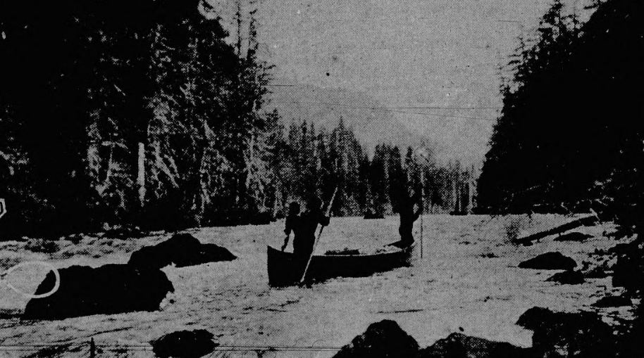
Poling on Campbell River.
Upper Campbell Lake
Upper Campbell Lake is 4½ miles in length, being broader at its head than towards its foot. It has not the picturesque beauty of the lower lake, but Mount Flannigan and Mount Bacon stand out very clearly and thoroughly command a head. Bacon has a permanent camp here on the east side of the lake, near the foot. Excellent trout fishing was obtained here. One of the lakes we navigated we found the wind is a matter either of much help or much hindrance. It is very variable and treacherous. It was from the head of this lake that we made our start to reach Crown Mountain, the apex of the park, and of which trip a special report is added.
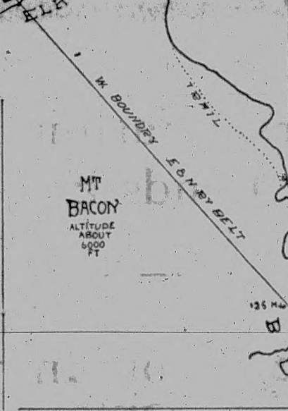
Map showing Mt. Bacon which is now Elk Mountain.
Elk River
At the head of Upper Campbell Lake there pours in the Upper Campbell River and also the water of the Elk River. This latter forms a delta possessing seven mouths, and in conjunction with the Campbell River and its log jams, causes a wide stretch of land to be a maze of channels and sloughs the home of beavers and a hopeless tangle to get out of except for those who know it well. Owing to the log jams on the Campbell River, we were obliged to canoe our supplies up to the slough of Elk River, taking the channel which landed us in the Elk River valley, full of fallen timber but free from water. Thence we packed two miles up the valley till we got beyond the slough and reached camp on the main Elk River.
Upper Campbell River
We found, on attempting to take the canoes up this part of the river, many difficulties, commencing with a bad jam packed on both sides of an island in the midst of the stream. Here we cut a path for the canoes across the island. Two more but slighter jams were next met with, and then we encountered the big jam, evidently the work of years. It is at least 120 yards long and, forming where the river is naturally narrow, has forced the river back until it forms a V. It is impossible to get a canoe along the sides of this stream as the timber is dense and the undergrowth impassible. We cleared a path over the top of the jam and hauled the canoes carefully over. After passing the Elk River where it pours in through one of its mouths into the Campbell, we found swift water navigable for loaded canoes for some three miles, after which the trail had to be taken to Buttles Lake, the last portion of this trail being blazed and cut by our party; as, after leaving another of Bacon’s permanent camps, the trail shortly ceased. There are several rapids between Elk River and Buttles Lake, but the three in chief are of some magnitude and require careful handling to surmount.
Ways To Buttles Lake
There are two ways to reach this lake, both having their start via McIvor Lake. 1. The Quinsam Trail, which from the start on the Middle Campbell River to its outlet at the foot of Buttles lake, is a trip of 19 to 20 miles, and can be made in two days. Of this trail more particulars follow in this report. 2. The river route. This, which took us over three weeks would not have been selected but for the reason the commissioner desired to see the difficulties and what could and should be done to remove them. There is no doubt but that many of them can be surmounted, and the time occupied in the ascent greatly shortened. With careful work done there would be a great attraction to tourists in going down the river, shooting the rapids and the lesser falls.
Buttles Lake
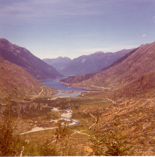
We made camp at the foot and from thence we moved back and forth about the lake. The special report of the surveyor deals with the general contour, length, size and tributary streams of this splendid sheet of water. The scenery is magnificent; the water of the rivers and streams teem with trout; the possibilities for the mountaineer, the photographer and the artist are endless; whilst those who seek the pleasure of camp life will find at the mouth of every stream the most ideal spot with life-giving waters flowing past their tents. The lake is exceedingly tortuous in its shape. Towards the head are numerous waterfalls, and the west side falling thousands of feet. At our visit the amount of water was naturally small, but in the spring and rainy season they must have great volume as the paths they have cut clearly evidences. The rivers and streams are none of great length, starting from a range back of that which belongs to the lake. The foliage and undergrowth is very dense about them, and each one requires a separate expedition of several days duration to reach its source, high up midst the glaciers and snow. At the head of the lake two river pour in the head waters of the Campbell River, which is thus 70 miles in length. On the west side is Myra Creek, which juts before it reaches the lake takes a prolonged leap, forming a very beautiful waterfall and a pool which was the delight of the anglers of the party. Here a cool and delightful camp was made. On the east side of the head, Price Creek flows in, and this stream was followed by the chief commissioner to its head (12 miles) on his way out to Great Central Lake and Alberni. The main streams which feed the lakes are: 1. One the west side: Wolf River, Phillips Creek, Marble Creek and Myra Creek. 2. On the east side: Creek (unnamed), Shepherd Creek and Price Creek The line of the park crosses Buttles Lake diagonally, within a mile of Wolf River and the post marking the provincial government and E. & N. railway property was readily discovered close to the edge of the lake beneath a precipitous bluff, and was in excellent preservation. Here the party touched the park from its side looking up Wolf River, it was easy to be seen that right across the park was wildly mountainous land, tier upon tier of mountains rising up one behind another, till the statement of maps giving ranges hereabouts running to 8,000 feet was easily credible. It is here that the highest mountain of the Island will eventually be discovered. The lake was fairly high, the lowest water being during the months of April and October, i.e., before the snow begins seriously to melt and before the autumn rains really commence. During the months of January, February and March the lake is frozen, but the ice is very rough, owing to the winds and snowfall. Even in the months of August there were still patches of snow to be seen clinging to the mountain sides below 1,000 feet, and before 2,000 feet was reached the party was in the regular and ever present snow line.
Canoeing down Buttle Lake.
The Trail to Great Central Lake
Prior to leaving Victoria the surveyor general proposed to have a trail blazed and cut from the head of Great Central Lake to the head of Buttles lake, ready for the chief commissioner and party to come out by. There has been for some years a trail from the former lake leading nine miles to the Drinkwater line, situated below Della Lake in the Big Interior Range. It was hoped that this might be extended over the summit at about 4,800 feet, and then work down to Buttles Lake. This, however, has not been the course adopted by those entrusted with the work, but in preference a course was taken leaving Drinkwater trail some 1½ miles from its start and bending many miles to the east, crossing the summit of another range over an exceedingly difficult country, glaciers, snowbanks and rockslides being met with, and towards the end, in Price Creek valley, through a network of Devil’s club. This trail was carefully chained and the distance is 19½ miles. The chief and his party left Buttles Lake on Monday, August 8, and despite a very steep ascent without any cessation, reached the Summit by Wednesday, the 10th, from which a grand view presented itself of the south end of the park. Here a sea of mountains and crags, glaciers on all sides, lakes of ice, snowbanks crumbling beneath the summer sun, a wild tangle of rocks and streams rushing down in any and all directions. By the Crown Mountain ascent the park has been surveyed from its southerly point. From north to south, from east to west, is but a mass of mountains, whilst in the middle of this wild chaos lies Buttles Lake, a gem in a glorious setting. On Thursday, the 11th August, Great Central Lake was reached, where the boats awaited the party. Alberni was reached by wagon on the 12th, and Victoria by train via Nanaimo, on the 13th. There is a possibility of a way in via Great Central Lake, which will overcome the present difficulties of this route. The park being so much in the centre of the Island, the best way to reach it, coming or going will depend on the tourists upon considerations such as ease, avoidance of danger, and scenic beauty. In the latter there is, but little to choose between any route that has been or may be made. There is of necessity danger in the ascent of the river, and there is undoubtedly grave danger in the trail just made via Great Central Lake. But from the summit there appears to be an opening from about the centre of Great Central Lake, via Comox Lake, and down Shepherd Creek which should prove, with good work done, a wagon road leading the tourist to about the centre of Buttles Lake.
The Misthorns and Price Pass 1910.
The Misthorns (left) and Mt. Rosseau (right) 1910..
View of the Misthorns from near Green Lake 1910.
Hiking across the glacier near Green Lake 1910.
A view of Mt. Rosseau 1910.

Hiking across the glacier above Green Lake 1910.
On Price Pass looking at Margaret Peak (left) and the Misthorns (right) 1910.
LtoR – Misthorns, Mt. Rosseau and Mt. Septimus 2010 – Lindsay Elms photo.
The Quinsam Trail
The party which remained on the lake to complete its survey, returned to Victoria over the Quinsam Trail and the Lower Campbell Lake and river to The Willows at its mouth, whence they had started. They found this trail a most admirable piece of work, done by the British American Trading company. Over it this company packs its supplies by pack horse to its various camps located at Beaver Lake, Gooseneck Lake, Little Quinsam Lake and Upper Quinsam Lake. The latter lake is the only piece of water which has to be negotiated by canoe, and a quick rise and fall of seven hundred feet lies between the lake and Buttles Lake. This could be made a good wagon road into the park. It is through good timber, and without any serious hills in its entire course of nineteen or twenty miles. W. J. Holmes and party left the park on August 19, and arrived in Victoria on August 25.
Crown Mountain
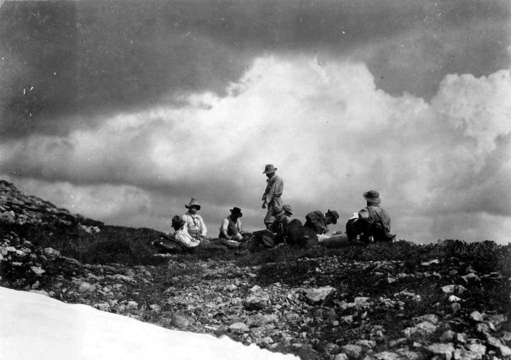
In order to determine the exact location of Crown Mountain and see the provincial park from the summit of its apex, the chief commissioner, accompanied by his daughter and a party of seven men, W.J. Holmes, P.L.S., acting as guide, left Bacon’s camp on Upper Campbell Lake on Friday, July 22, with supplies cut down to the barest necessaries for ten days. It is impossible to reach the Crown in a direct line from the upper lake, and two ways presented themselves: 1. To work around Mount Flannigan and getting well north of its Crown, to attempt to gain the back of some ridge or hogs back which would lead to the peaks of the mountain, or, 2. To work around by way of Elk River and approach it from the west side. The former course was selected. It proved to be an exceedingly difficult piece of mountaineering, the ridges between the Hart and the goal being many, and some of them very precipitous, the fallen timber at great height covering many acres with dense undergrowth a frequent obstruction. It took nine days to accomplish, and the distance travelled was twenty and three-quarter miles, the daily distance being here given, to show the difficulty of travel:
First day—Three-quarters of a mile in a straight line.
Second day—Three miles.
Third day—Two miles.
Fourth day—Two miles.
Fifth day—Rest.
Sixth day—Two miles.
Seventh day—Two and a half miles.
Eighth day—One and a half miles.
Ninth day—Seven miles.
The course taken started from near the head of the Upper Campbell Lake. Climbing a ridge the party worked northwest, making a camp in a narrow valley. Again northwest, crossing the northerly spur of Mount Flannigan, then dropping into Allan Creek valley, which is shut in by steep cliffs. Then westerly going up the north side of Allan Creek, working along the edge of the bluff. Camp was made overlooking a small lake at the head of the north fork of Allan Creek, then turning north dropped into the headwaters of Adam River (which claims to be a tributary of the Salmon River.) Still going north crossed the fiftieth parallel and camped at the foot of Myra Lake—full of trout—about three miles north of Crown Mountain. The travelling this day was so heavy owing to windfalls and precipitous paths that a rest had to be called for the day. Starting again the party now went west, climbing to the ridge whence they travelled south, keeping on the ridge and camping near a snow pond. Holding the same direction, the party now swung to the southwest and appeared to be true east of the Summit. Held the same course to within half a mile of the domes, when camp was made as it was too late to attempt the final climb and return. Soon after the start the aneroid failed to respond, hence the height could not be given of the Summit, which was reached by going up a bank of snow with here and there clear rock. Ptarmigan were about, but the view, while fair, was much marred by the smoke of many forest fires. The irregular formation of the mass of mountains was very evident. A cairn was built and a record deposited, the Union Jack being hoisted on Ellison Peak. A second peak, some eight hundred feet away, was named McBride Peak. The descent was sudden, sharp and dangerous. Deer trails were used where possible and human ladders had at times to be called into play. The course was east making for the north fork of Elk River; camp was made in the valley of this fork. Them working down the fork, the party reached the main stream and after a long day’s struggle in the bottom lands with fallen timber and Devil’s club reached the main camp on Elk River during the evening. The rise and fall called forth may best be seen by the flowing—the height is in feet:
First day—640, 1940, 1670.
Second day—1670, 2810, 2010.
Third day—2010, 2910, 3240.
Fourth day—3240, 3140, 3750, 4250, 1510.
Fifth day—1510.
Sixth day—1510, 3810, 3540, 3850, 3730.
Seventh day—3730, 4800, 4380, 4800, 4220, 4840.
Eighth day—4840 (Summit aneroid failed.)
Ninth day—1000 to camp at 800.
There can be no doubt but that Mount Flannigan has for years been taken for Crown Mountain, and that the apex of the Provincial Park reaches a good seven miles farther north than was supposed.
Sir:—I beg to submit herewith a map of part of the territory traversed by you in making your exploratory trip into Buttles Lake, via Campbell Lakes and River, in July and August of this year. It will be noted that the country shown on the map extends only from the upper end of Lower Campbell Lake to a little south of the south end of Buttles Lake. As I did not accompany you on your trio out to Alberni and over the pass at the head of Price Creek through Great Central Lake any information obtained during that part of the trip, and which I might have shown on the map, would be only repetition of that already supplied by other. I have shown Buttles Lake in its true shape from information obtained by me in making triangulation survey of the whole lake lying outside of the E. & N. railway belt, and I have given particular attention to that part of the map wherein I have endeavored to illustrate your memorable trip to the summit of Crown Mountain. I have shown the route followed to and from, and have marked out different camps. All aneroid altitudes are given and I have shown as correctly as possible the main topographical features of the country traversed, the mountains and valleys, lakes, streams, etc. With respect to your trip to the summit of Crown Mountain, on which I had the pleasure and privilege of accompanying you, I beg to submit the following data noted by me en route:
Friday, 22nd July, 1910—Left Main Camp on Upper Campbell Lake about noon, the members of the party being Hon. Price Ellison, Miss Myra Ellison, Messrs. Harry McClure Johnson, Lionel Hudson, James Hasworth, Charles Haslam, Frank Ward, Jim “Scotty” Twaddle and myself. We travelled in a canoe to a point near the southwest corner of the lake. At this point we left the canoe, and having our packs on our backs commenced to climb; within the first one-third mile we climbed 1,200 feet to the top of a hog-back or ridge, then swinging to a northwesterly direction, we travelled about ten or fifteen chains dropping 170 feet to the small stream, and here made camp. Aneroid readings: Upper Campbell Lake, 640; summit of hogback, 1,840; camp 670.
Saturday, 23rd, July 1910—Left camp about 7:30 a.m. and, travelling in a northwesterly direction along the sidehill and through most continuous heavy down timbe or windfall, we struck the survey line marking the west boundary of the E. & N. railway belt, about one-quarter mile south of the three-mile post. To this point we travelled this day, about one and a quarter mile, and climbed 1,110 feet. We then travelled due north along the survey line half a mile to the top of the southern slope of the valley of Allen Creek; then continued in the same direction, climbing down a steep hillside 850 feet to Allen Creek; where it crosses the above-mentioned boundary line, and here we prepared our camp for the night. Distance travelled about 2½ miles. Aneroid readings: Three-mile post on W. boundary E. & N. railway belt, 2780; camp at crossing of Allen Creek, 1,960.
Sunday, 24th July 1910—Travelled in a direction a little north of west, gradually climbing the mountain side of the north slope of Allen Creek. We stopped for lunch at an altitude of 2,910, having climbed about 950 feet and travelled a distance of about 1¼ miles over continuous windfall, most difficult travelling. During the afternoon we continued our tramp and made camp at an altitude of 3,260. From this camp we had our first unobstructed view of Crown Mountain, lying about five miles away in a direction S. 38 degrees West magnetic. A deep valley with precipitous sides lay between us and the mountain, and it appeared to be necessary for us to travel from here in a northerly direction so as to try and work around the head of the valley. We travelled during the day about two miles and climbed 1,300 feet.
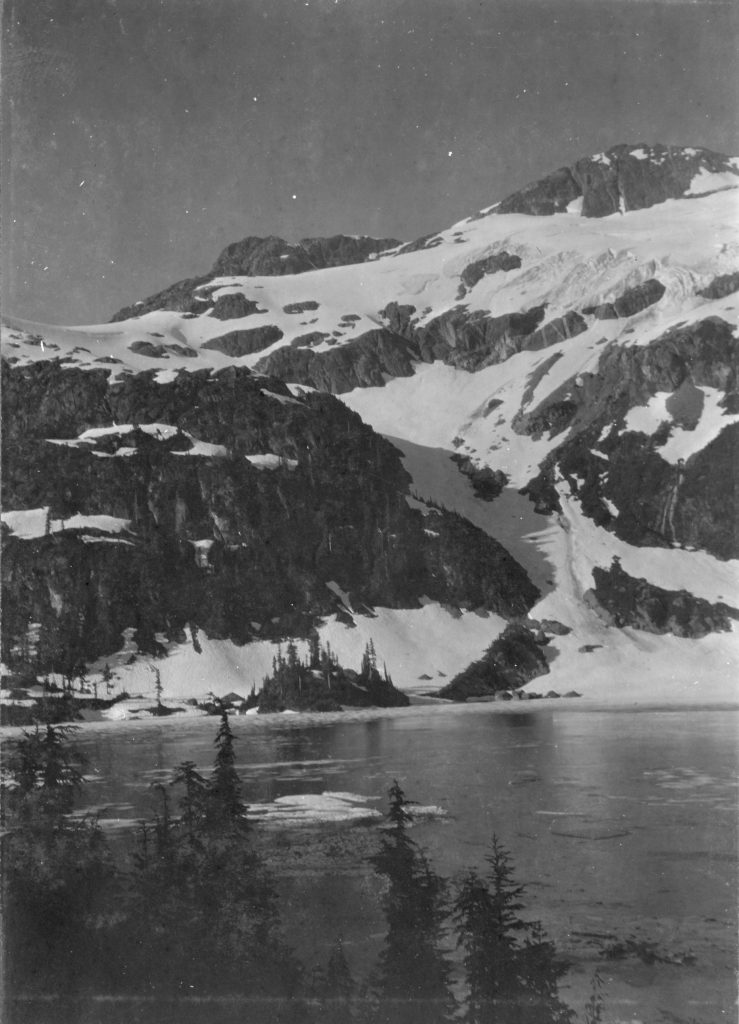
Monday, 25th July 1910—Got packed up and away this morning about 7:30 started out by having to climb straight up the mountain. Looking for a possible place to cross a box canyon, about 100 feet deep, which lay directly across our route. We were with difficulty and considerable danger, able to get across about 500 feet in elevation above camp, and then worked our way northwesterly around the mountain side, keeping about level. About three-quarters of a mile from camp and at an altitude of 3,860, we arrived at the point where we could clearly see the nature of the valley which lay between us and our objective; it appeared to be about two miles wide and 2,500 feet deep. A series of four small lakes lay below us, two of which drained southward into Elk River, the other two northward in Salmon River. The sides of the valley appear to be of a continuous like or precipices, hundreds of feet high. We found it impossible to descend into the valley at this point, and it looked to be equally impossible to get to the other side, even if we had been able to get down, but it looked easier about a mile further north; so looking for a place to get down into the valley, we travelled north, at the same time being forced to climb to the summit of the mountain (altitude 4,250). After travelling one and a half miles in this direction we came to a place where it seemed possible to get down so commenced to descend in a westerly direction. We gradually reached the bottom, but it had taken us the whole afternoon, so dangerous and difficult had been our way. We made camp near the north end of a small lake at an altitude of 1,490 feet, having this day travelled about four miles and climbed up 1,000 feet and down 2,760 feet.
Tuesday, 26th July, 1910—Rested in camp this day. I spent the morning fishing in the lake, which I found to be teeming with trout. The only outfit available was a fly on a cast twelve inches long and a piece of string, with no reel. I cut a rod in the woods about six feet long. With this primitive outfit I caught just 101 trout before noon, and then stopped because I did not want to catch more than we could use. The largest weighed about one pound, and averaged about one-fourth of a pound. I had no doubt but that there were much larger fish in the lake, but of course I could not expect to catch them with the outfit I had. We spent the afternoon drying and smoking the fish, so that we could carry them with us, our food supply being a matter for serious consideration by this time. This lake was named Myra, in honor of Miss Ellison, who is undoubtedly the first of her sex to have penetrated these wilds.
Wednesday, 27th July, 1910This morning we commenced out climb of the mountain on the west, and after a perilous ascent reached the summit about 1 p.m., having climbed 2,320 feet. Altitude, 3810. We ourselves to be on a long ridge running north and south; to the west lay another valley about two miles long and about 200 feet deep, through which running north was stream carrying the waters from the northern glaciers of Crown Mountain into the Salmon River. It appeared to us that about three and a half miles south a spur of Crown Mountain extended out eastward to meet the ridge we were on, so we continued travelling south, keeping on top. This ridge is by no means level along the top, but it is a series of small mountains and hills. During the afternoon we fell to altitude 3,540, then rose to 3,850 and again fell to 3,740, at a point about one-half a mile from where we lunched. Here we made camp near a small lake or pond formed of melting snow. This day we travelled a distance of about two and a half miles and climbed about 2,630 feet and down 390 feet.
Approaching Ellison Peak, Crown Mountain.
Thursday, 28th July, 1910—Continued travelling south along the ridge. A distance of one-half a mile from camp we had risen to altitude 4,800, then one-quarter a mile further had fallen to altitude 4,380, then at the end of another quarter mile had risen again to 4800. Here we began to swing to the west, more directly towards Crown Mountain, and we were exactly true east of the mountain at about one and a half miles away. One mile further we fell to altitude 4,220 and this is the last sag in the ridge. Here we travelled due west. We then commenced to climb the next spur of the mountain proper, and after about one-quarter mile further travelling, made camp for the night at altitude 4,840. Here we were surrounded by snow, which, when melted, was our only water supply. We had travelled this day about three miles, and had climbed 2,110 feet and down 1,000 feet.
Myra Ellison approaching the summit of Crown Mountain 1910.
Expedition members sitting on the summit of Ellison Peak, Crown Mountain.
Myra Ellison on the summit of Crown Mountain 1910.
Friday, 29th July, 1910—Got up at daybreak and commenced the last climb, working our way up the eastern spur. When we got within about 300 feet of the summit we came to inaccessible cliffs, which we were obliged to seek a new route. We turned to our right and crossed a glacier about 200 yards wide to what we might call the northern spur; this is a sharp ridge falling away on both sides precipitously; the west side is particularly bad. Climbing up this spur we succeeded in getting on top. This was all extremely dangerous work, for we had no ropes and a false set at any time would have been almost certain death. Having reached the summit (time about 8 a.m.) mutual congratulations were extended, and we built a cairn of stones about three feet high, in which we deposited in a brass tube an historical record of our ascent. There are two main peaks of this mountain, about 1,000 feet apart, and both are exactly the same height. We were on the eastern peak, which we named Ellison Peak, the other peak, lying about magnetic west of us, we named McBride Peak. The aneroid barometer which we were carrying was made to register altitudes up to 5,000 feet only, so it was useless here, but I may mention that the admiralty chart gives the altitude of Crown Mountain to be 6,082 feet. We got back to our camp ground on the night before about 11 a.m. and at once started on our return journey to our main camp, which during our absence had been moved to the mouth of the Elk River, or where it empties into the Campbell. You, Sir, decided to attempt a direct descent into the north fork of Elk River [Tlools Creek], and to then follow the watercourse out to the camp but as there was some doubt as to the difficulties which lay ahead and as we were very short of food it was decided that Mr. Hudson and I should return to Myra Lake camp to pick up some personal effects as well as some food which had been cached there, and then come south through the valley of the four lakes, and so down the north fork of the Elk. If you party had been delayed for any reason, Mr. Hudson and I would have caught up to you with food. Mr. Hudson and I reached Myra Lake camp on the evening of the 29th and got into the main camp at the mouth of the Elk River on the evening of the 31st. We found that you had arrived the evening of the 30th and that you had camped the night of the 29th on the north fork of the Elk River, at the foot of Crown Mountain. On the 30th your party travelled about nine miles, the first six miles of which were through some of the roughest country for travelling that is possible to imagine down timber and windfalls and swampy land full of Devil’s club, but for the last three miles there is a fair trail which was followed. To those acquainted with the country it may seem that we took a very roundabout route to get to Crown Mountain, but it must be remembered that it was an entirely unexplored piece of territory; none of us knew more than the approximate position of the mountain, and it was necessary to get on high ground as soon as possible so as to locate its position, and having got on top it was necessary to make a long detour north to get across the valley of Myra Lake. If we had attempted to go in the way we came out, we would not have got there at all, as the valleys are so deep and narrow that it is impossible to see the tops of the mountains from the bottom, and we would have been lost as far as Crown Mountain is concerned. In making the trip in to the mountain and back we travelled in all about 28 miles, and climbed a total of 10,620 feet and down again. As to the general nature of the country about Crown Mountain and about Mount Bacon [Elk Mountain], and the other mountains to the south, I can only describe it by saying that the mountains are rougher and much more inaccessible than any I have ever seen in the Selkirks, where the mountains rise to an altitude of 12,000 feet. On August 3 we moved our main camp up to Buttles Lake and on the 6th I commenced a triangulation survey of all that part of the lake lying outside of the E. & N. railway belt; this survey I completed on August17. Buttles Lake is 18½ miles long; its greatest width being a little less than one mile, the direction of its length is approximately north and south. Mountains rise precipitously on both sides of the lake to an altitude of about 6,00 feet, broken in the West by four valleys, viz.: those of Wolf River, Phillips Creek, Marble Creek and Myra Creek. This range of mountains on the East is unbroken except near the south end of the lake, where enter Shepherd Creek and another stream, unnamed. Price Creek enters at the head or south end of the lake, directly from the south. Numerous small streams flow into the lake on both the East and the West some of which are seen on the mountainside as beautiful waterfalls, the water dropping from a height of several hundred feet and scattering into mist on the face of the precipitous bluffs. The falls of Myra Creek (named in honor of Miss Myra Ellison) are particularly beautiful. As the river approaches the lake it drops away rapidly in a series of falls, each thirty to forty feet high. I did not go far up the river, so I do not know what distance back the falls reach, or the total height; they can’t be seen from the lake proper, but a boat may be rowed up to the pool at the foot of the lower cataract, which is about one-quarter mile from the lake. Splendid trout fishing is to be had anywhere in the lake, but particularly at the mouth of streams. The pool at the foot of Myra Creek Falls I found to be full of fish, and at the end of half-an-hour’s casting I felt ashamed of myself for having caught so many. Several glaciers overlooking the lake, that on the south side of Wolf River being particularly prominent it is perhaps a mile long and half a mile wide.
I have the honor to be, sir,
Your obedient servant,
(Signed) William J. Holmes, B.C.L.S.
Victoria, B.C., August, 15, 1910.
The Hon. Price Ellison, chief commissioner of lands, Victoria, B.C.
Sir—We beg to report re the standing timber within the Provincial Park limits on Vancouver Island as follows:
Topography:—Above the Upper Campbell Lake the valley of the Campbell River lies North and South, and at a point two and a half miles above this lake it is joined by its largest tributary, the Elk River, coming in from the West. At six or seven miles from the above-mentioned lake, the valley widens out forming Buttles Lake, a body of water about twenty miles long and from one-half mile to a mile and a half in width. This lake is fed by many short rivers and creeks, the most important of which are: Prince [Price] River and tributaries, Myra Creek, an unnamed river, which enters the lake about four miles from its head on the East side, and Wolf River. The elevation of this lake is between 800 and 900 feet above sea level. Buttles Lake is enclosed by very steep and precipitous mountains ranging up to 6,000 and 7,000 feet in elevation, and giving practically no level ground with the exception of a stretch of lower country at the Southwest portion of the lake, and the more or less narrow valley of the Price River. The valley of Myra Creek enters the lake near the Southeast extremity. This valley at a point a few hundred yards from the mouth of the river, has a very steep ascent, forming ledges over which the river falls in a series of beautiful cataracts, totaling perhaps 400 feet. Beyond this point the valley widens and is comparatively flat. The Southeastern portion of the lake has several rivulets running into it. The valleys of these are less precipitous than the valleys coming down from the North and central portions. These valleys are bounded by undulating hills that could be logged without serious difficulty. Wolf River valley, at its entrance to the lake, is about a mile wide, but contracts very considerably a short distance up and then enters a very mountainous country and is apparently very narrow and steep. There are several other narrow and steep valleys running down to the lake, but they are son contracted and short that they have little or no value from a timber standpoint. The valley of the Elk River, within the park, is a broad, flat valley, from one to two miles in breadth, but is bounded by very precipitous mountains on either hand. The course of the river is very unstable and continually changing, and also the lower flats, are, during floods most probably partly under water. At a point about five miles from the junction with the Campbell River the valley splits into two portions, running North and South. The Northern valley rises steadily for some miles and again forks, one branch joining from the Northwest and losing itself in the complexity of the mountains above the Southwest of Crown Mountain. The other fork [Tlools Creek] continues North for some miles. This valley forms a very low watershed between the Elk and one of the Adam River forks.
Myra Falls.
Sitting on Price Pass at the head of Price Creek 1910.
Margaret Lake on the south side of Price Pass.
Timber:—We have divided the timber into three main districts. (A.) Timber accessible from Buttles Lake. (B.) Timber coming to the Elk River. (C.) Timber coming to the Great Central Lake. (A.) Generally the timber belt is the district confined to a strip from one-quarter to three-quarters of a mile in breadth skirting the lake and rising rapidly towards the summits and in most places badly cut up steep, rocky bluffs and ravines. But at the Southern end of the lake, on the East side, this belt widens to a mile or more with less steep ground. 1. The timber around the lake is chiefly fir, interspersed with a small portion of cedar, hemlock and balsam. This fir is good merchantable timber, ranging in size from ten to sixty inches, but generally not large. It contains a certain amount of heart rot and is, on the whole, growing slowly. The cedar, hemlock and balsam, on the other hand are fairly sound, of fair quality and in many places growing rapidly. The timber is remarkably free from windfall. The timber is long near the shore, but decreases as the ground rises. If situated on like ground near salt water, this timber would be considered a fair logging proposition at the present time. 2. Price Creek Timber:—The valley at the mouth is about one and one-half miles wide, but, on account of the numerous sloughs, the river takes up quite a considerable portion of the valley. On the sidehills there is some first-class fir of large dimension.
Looking down to the mouth of Price Creek at Buttle Lake after being logged 1972.
About two miles from the mouth of the valley it divides into two forks and the Southeast fork contracts very considerably, the sidehills are steep, the timber smaller and the proportion of hemlock increases. 3. Myra Creek:—Above the falls there is a considerable timber belt, with a probable width of sixty chains and stretching some considerable distance to the westward. The timber is large—principally fir of good quality, standing on ground comfortably flat and easy to log. In the “A” district there are at present twenty licenses, of which 12 adjoin the lake. Four are on the Price Creek and four on Myra Creek.
Timber On Elk River Outside of The E. & N. Belt
1 The timber on the flats of this valley is probably more than 50 per cent cedar, big dimension and good quality; the fir is large and clear, but contains a certain amount of rot. The north fork of the valley in contracted but contains good timber, while on the side hills the ground is too steep and rocky to support much timber. There is a large amount of windfall around the upper portion.
2 Headwaters of Allen Creek: The timber belt is narrow, consisting of fir, red and yellow cedar, balsam and hemlock. The proportion of fir is smaller here than elsewhere. The yellow cedar is not very large, but of fair size and good quality. The whole district of this river was very seriously damaged a few years ago by heavy windstorms, which have destroyed large portions of the timber areas and damaged a lot of the standing timber.
3 Headwaters of the Adam River: The timber belt is confined to the lower levels of the sidehills, as the bottoms of the valleys are taken up by lakes and marshes. Nearly all of the timber is fir, medium size, quality and length, but likewise badly damaged. In the “B” district, owing to the park boundaries being not yet definitely defined, it is impossible to say the exact number of licenses in this area. However, we feel safe in saying that there are at least fourteen limits. “C” timber drawing to Great Central Lake are three limits within this area.
Accessibility
The only accessible approach to “A” and “B” districts is by way of the Campbell River valley. This river at the present time is absolutely impractical for floating and driving, owing to the large number of sloughs, log jams, rapids, falls and rocks. As an instance we wish to point out that between the Lower Campbell Lake and the sea, there are five falls, the largest of which has a sheer drop of one hundred and twenty-four feet in a canyon. Also, on account of the floods and the fact that the lakes do not have any appreciable tendency to regulate the volume of water in the river. The only way of getting the timber out would be by railway and this would need to be not less than thirty miles in length from the mouth of the Campbell River. On account of the very limited time spent in this timber we are unable to give even an approximate estimate as to the amount of standing timber. A thorough cruise might even fail to substantiate some of the statements made in this report.
We have the honor to be, sir,
Your obedient servants.
(Signed) Chas. S. Haslam, A. Lionel Hudson.
Surveyor’s photo of Crown Mountain 1930’s.
Crown Mountain
(Ascended, Friday, July 29, 1910, by Hon. Price Ellison, Miss Myra K. Ellison, Mr. Harry McClure Johnson, Colonel William J.H. Holmes, Messrs. Frank Ward, James Hasworth, James D. Twaddle, Charles F. Haslam and A. Lionel Hudson.)
By Reverend William W. Bolton
Yon mountain Crown of fair Vancouver Isle.
Whose domes no foot hath trod,
Whose outlook is o’er ocean wide,
O’er vales and hills and racing tide-
Men strive to master thee.
Through forest, stream and rock-faced heights,
They plod their weary way.
Their aim to plant the Union Jack
Despite the climb and heavy pack, Upon the noble Crown.
They win. What matters now the weariness
The blow-downs and the falls!
The honor theirs which none can take
Their witness left which none can shake
Save snow and maddened storm.
A maid amongst them. Light of feet,
With nerves as strong as steel
How could men halt or hearts give in
Her gallant deed all praise doth win,
True daughter of her Race.
The Passing of a Well-Known Figure
Michael King, Pioneer Timber Cruiser and Merchant Passed Away Sunday at Jubilee Hospital
Reported in the Victoria Daily Colonist December 20, 1910.
One of the most widely acquainted and generally respected of Victoria’s pioneers, Michael King [Kings Peak was eventually named in his honour], passed away at the Jubilee Hospital on Sunday morning after an illness of several weeks. A typical westerner, possessing a passion for the wilds, business acumen which enabled him to turn to commercial advantage the knowledge he secured in his travels and a heart as expansive as the territory he roamed “Mike” King was loved by his intimate friends and held in the highest esteem by his acquaintances. Until the pain which Mr. King suffered in his later days made retirement to the hospital and medical treatment absolutely imperative, he led his usual active life. The story of what brought about his fatal illness is strikingly characteristic of the man. In the spring of this year, he took the steamer Tees to Tatchu Point, near Nootka Sound, in order to supplement some coal measures which he owned at the time. Having looked after the work he found that the vessel on which he had taken passage out was unable to call for him on the return because of rough weather and rather than wait, he decided to walk across the island and catch a south bound steamer from the east.
The Fatal Accident
En route Mr. King slipped while walking across a moss-covered log and fell some thirty feet down a rocky cliff. He sustained serious injuries. His ankle was twisted and there was a pain in his side besides bruises. The woodsman brushed aside the incident as a mere trifle. Picking himself up, he limped over miles of the roughest kind of trail to Buttle Lake. While attempting to construct a rude raft to cross the lake, Mr. King was found by “Lord” Bacon, a trapper who was operating in the vicinity. Mr. Bacon placed the injured man in his canoe and paddled to the lower end of the lake and then down the turbulent Upper Campbell River to a lodge occupied at times by trappers. “He was in a sorry plight when he reached my cabin,” said Bacon. “He was hungry, lame and ill, his clothes were torn his gun was bent and broken, and altogether presented a very melancholy appearance. I tried to get him to stay in my cabin a few days until I could get help to take him out. This he refused, saying that he was feeling fine and could easily do the remaining thirty miles to the settlement, so, packing a bit of lunch in his handkerchief and using his heavy, but useless rifle as a cane the poor old fellow hobbled out in the brush alone and made for home. The man was certainly in no condition to be in the woods at all, and had it been anybody in the country except ‘Mike’ King, whose strength, courage and woodcraft were so well known to me, I would never have trusted him outside the door.” In due course Mr. King got to Victoria. He told his family and friends of the occurrence, but made light of it and until August went about his business here as actively as ever. During the month mentioned he started for the east, visiting Montreal, New York and Chicago. While away he began to suffer and en route home endured much. On his arrival he was sent to hospital and never left alive. The examination to which he was subjected showed that several ribs had been broken as a result of his accident months before and that these had knitted together in a haphazard fashion. But there were other internal hurts which through the want of attention became fatally serious. The physique which had been rendered impervious to hardships through constant outdoor life was laid low because of neglect of what had seemed but a trifling episode.
His Coming
Mr. King was sixty-two years of age and was born in Grand Rapids, Michigan. Not much is known here of his earlier career except that it was spent in the woods for the most part, he occupying a position in connection with one of the prominent lumber concerns of that centre. Thirty-five years ago the lure of the West attracted and he came to British Columbia making his home in Victoria. From that date this city was his head-quarters. He was fonder of the provincial capital than of any other community but the greater part of his time was spent abroad. Both his business and his inclinations called him away on trips of exploration. How many times he travelled through the valleys of Vancouver Island, climbed the loftiest of her mountains, and followed her rivers and streams from their outlet to their almost inaccessible sources it would be difficult to say, but of this there can be no contradiction – Mike King ranked among the most thoroughly posted men in the West with regard to the native resources of this section of British Columbia. One of the earliest associations in this district was Mr. Lewis Casey, with whom he entered into partnership in the timber business soon after his arrival from the east. They secured timber limits in the Salmon and the Campbell Rivers, at Comox and on Read Island, and for years took out logs which were sold to the Sayward and Chemainus mills. Later a firm comprising Messrs. Walkley, King and Casey, made a tender and secured the contract from Victoria for the installation of otter beds at Elk Lake. When the discovery of gold in the Klondyke occurred, Mr. King’s adventurous spirit would not permit him to keep entirely out of the excitement. Shrewdly calculating that his lumberman’s knowledge might be turned to some account in the north in supplying the needs of the thousands who were flocking through this city on their way to the gold fields, Mr. King went to the centre of things to investigate. The result of the trip was the establishment on Lake Bennett of a sawmill which turned out scows for the use of the people en route down the Yukon and which, incidentally, was probably one of the best paying propositions in that country at that time, with the possible exception of a few of the best placer mines.
His Life in Mexico
Returning to Victoria, as he invariably did after a period of wandering, he went south to Mexico. For five years he remained in that turbulent republic, investing in mines, in lands and other propositions that recommended themselves to him. The result was that he accumulated considerable “legal tender.” Before coming north he took what he had made in the country and put it all back in a ranch, six hundred thousand acres in extent, several of his friends joining him in the enterprise. This immense tract of land Mr. King often used to refer to as something particularly choice. The agricultural sections he said had native grass as high and thick enough to completely hide the Mexican mule. There were one hundred thousand acres of splendid timber. Once more Mr. King took passage for his British Columbia home and he hadn’t been here long before he was the centre of activities. He owned property at Campbell River and realizing that the time would soon arrive when the power which might easily be generated by the falls of that stream would be useful, he formed a company for the exploration of that asset. He didn’t live to see his scheme perfected. He also owned timber limits and coal measures, to the development of all which he was giving his personal attention, the trip on which he met with his fatal accident being, as stated, in connection with one of these enterprises. Besides being an indefatigable worker, a shrewd though generous business man, and one of the most expert timber cruisers in the northwest, Mr. King was a prince of entertainers. He was fond of stories of personal experiences, many of which were demonstrations of the truth of the adage that truth is stranger than fiction. Naturally, in his wandering in British Columbia, he had come in personal touch with the Indians, was able to discourse fluently in their patois, and his intimate knowledge of their character enabled him to pilot himself safely through many a tight corner. His favorite exclamation: “By the Lovely Dove” is passport to the good fellowship of foresters from Mexico to Alaska. Mr. King leaves to mourn his loses a widow and two children, a daughter and son. The funeral will take place tomorrow afternoon from the residence, Caledonia Avenue.
Mike King
1911
Events:
December 19 – The Vancouver Island section of the Alpine Club of Canada was formalized as the newest branch at a meeting at the Alexandra Club in Victoria. William Foster was elected chairman and Fred Helm secretary.
Section members who attended the ACC general summer camp at Sherbrooke Lake: John Forde, Arthur and Clara Wheeler, William Foster (Mt. Daly July 27), Anne Norrington (Mt. Daly July 27), Mr. and Mrs. James White (Mt. Daly July 27), Albert MacCarthy (Mt. Daly July 28).
ACCVI History Begins
In the winter of 1911/1912, Arthur Wheeler, president of the Alpine Club of Canada, William Foster and other prominent Victoria mountaineers founded the Vancouver Island section of the Alpine Club of Canada to help fund and organize an expedition into the newly sanctioned Strathcona Provincial Park. The expedition was well documented and reports can be read in the Canadian Alpine Journal, but future development of the local section was poorly documented for many years. Who chaired the section and the years they lead, and the trips and climbs undertaken by its members were unrecorded except in early Island newspapers such as the Daily Colonist, the Comox Argus and the Port Alberni News. Through these old newspaper clippings, I have been able to establish a rough outline of the club’s activities over the years and the roles of people on the executive, although it is far from complete. However, additional information was found in the magazine Rod and Gun in Canada. W.J. Taylor, the magazine editor was at the founding meeting in Winnipeg in 1906 and published numerous articles and section news (including Vancouver Island) regularly until 1920.
Following are transcripts of the newspaper articles found and, in a few cases, accounts written in personal diaries. Although the Vancouver Island section started out small (<30 members), we will see through the years how it has grown to be one of the prominent sections of the Alpine Club of Canada.
Lindsay Elms, Section Historian, 2022
Events:
December 19 – ACC members on Vancouver Island met in Victoria and organized a local committee for the furtherance of the work of the Alpine Club of Canada.
Defining Eastern Boundary of B.C.
Hon. W.R. Ross Commissions Director of Alpine Club To Mark Off Line Between Provinces
Reported in the Daily Colonist Friday, April 28, 1911, p.3.
It’s the general impression among everyday business people that the alpine clubs of the world represent a too-arduous, too dangerous and too exciting form of a sport, and that their members are suffering from an advantaged stage of suicidal mania. England’s Alpine Club is the parent organization, having been in existence for the past fifty years. Soon after its initiation Ruskin wrote the following stricture: “Even the Alps themselves which your own poets used to love so reverently, you look upon as soap poles in a bear garden, which you set yourselves to climb and slide down again with shrieks of delight.” But later he retracted and made the amend honorably by joining the club and becoming one of its most enthusiastic supporters. The Alpine Club of Canada, though but five years old, believes that there are other ways to usefulness than merely providing mountain climbing for its members. It was announced at the club’s fifth anniversary celebrations held at Toronto, Winnipeg, Calgary and New York that an expedition would this summer be conducted to Yellowhead Pass, Mount Robson and the Jasper Park region, for the purpose of mapping that Alpine district and presenting it to the world at large through the medium of the Alpine Club. This seems to be a highly practical form of usefulness. The expedition will be in charge of the director of the Club, Arthur O. Wheeler, who is a specialist in mapping mountain areas by means of photography, and who has already mapped the Rockies and the Selkirks along the line of the Canadian Pacific Railway for the Dominion government. The expedition is a strictly Alpine Club one. The assistant topographer will be Rev. George Kinney, the conqueror of Mount Robson; the club’s official photographer Byron Harmon of Banff and the Austrian guide, Conrad Kain will also be attached. The outfitting and transport of the party will be in the charge of Donald Phillips, of Edmonton, who shared with Kinney the triumph of the first ascent of Mount Robson. Also, proper persons to deal with the geology, botany and zoology of the area surveyed will be attached to the expedition. One object of the expedition is to ascertain the possibilities for the annual camp of the Alpine Club in the vicinity of Mount Robson in 1912. It is expected that by then all-rail communication will be established with the pass. Of recent years a number of explorers have visited it, all of whom have spoken in glowing terms of its Alpine splendours. Among there are Dr. Arthur P. Coleman, president of the club, Rev. George B. Kinney and Dr. Norman Collie, Arnold L. Mumm, and Leopold S. Amery, of the English Alpine Club. Messrs. Mumm and Collie will visit the region this year for the third consecutive time in succession. If is the photographs brought back by these gentlemen are to be believed – and photographs do not lie – there is a region of peaks, passes, snowfields, icefalls and glacial rivers that will equal, if not surpass, any region contiguous to the line of the C.P.R. Canada is indeed singularly blessed to possess two transcontinental railroads that run through such wholly unsurpassed Alpine scenic grandeur. The character of the mountain scenery is totally distinct along each line so that visiting tourists will do well to come and go by different routes. No two mountain ranges of the world are similar in characteristics, and the same is true of their component parts.
Provincial Boundaries
The director of the Alpine Club has been commissioned by Hon. W.R. Ross, the minister of lands for British Columbia, to establish and mark the boundary between the provinces of British Columbia and Alberta and the Dominion government is collaborating with the Alpine Club and rendering tangible support. It speaks well for the progressiveness and utility of the club that it is ahead of the times and will be the first to map the region systematically, and to bring its scenic features to note in a form that can readily be grasped by travelling public. The club’s policy from the beginning has been a progressive one. It has established connections in many parts of the world and has done much to bring to the general notice not only the Canadian mountain ranges, but Canada itself. No other alpine club is operated on the same plain, and that mountaineers and explorers of world fame become life members of the Canadian Club. The annual camp for this year will be held in the main range of the Rockies at Sherbrooke Lake, along the line of the C.P.R. It has been whispered that the club has only been awaiting railway facilities to hold a camp in the Windermere district, not far from Earl Grey’s camp at Toby Creek. The Windermere district presents another interesting and beautiful region of totally different characteristics. It is two hundred miles from Yellowhead Pass, as the crow flies, and between an ocean of peaks, many of which have not yet been even seen. The possibilities for the Alpine Club are great. It ought to be supported, not only by several governments of Canada, but by all public-spirited Canadians.
New Trail for Tourists
Reported in the Victoria Daily Colonist Wednesday August 9, 1911, p.6.
Tourists on Vancouver Island will soon have a new mountain Mecca in the wild grandeur and romantic beauty of the country around Mount Arrowsmith. Mr. H.E. Beasley, the chief superintendent of the E. & N. Railway, told the Colonist yesterday that engineers are at present out in the Cameron Lake district locating a route for the projected “trail” from there to the summit of Mount Arrowsmith, Meanwhile, construction is proceeding rapidly on the new Chalet, which the E. & N. is building at the foot of Cameron Lake. From the new hotel to Mount Arrowsmith, will make a beautiful trip of about 15 miles. Though the route of the proposed “trail” has not yet been fixed it is possible that part of the distance will lie along the old Cowichan Trail. The Chalet is to be completed and opened by the end of October, so that within five hours journey of Victoria, tourists will soon be able to make a new and magnificent mountain climb from Cameron Lake Chalet up Mount Arrowsmith, in ideal surroundings.
Alpine Club of Canada
Reported in The Daily Colonist Wednesday December 13, 1911, p.14.
A meeting of the Vancouver Island members of the Alpine Club of Canada will be held in the committee room of the Alexandra Club at 8:30 on the evening of Tuesday December 19, with the object of forming a local committee to attend to the affairs of the club on the island. The membership has grown so rapidly here that it is found necessary to have a special committee. Such committees already exist and do good work in Vancouver, Calgary, Winnipeg, Toronto, New York, and London, England. Through the courtesy of The Alpine Club of England, the father of all mountaineering club’s the Canadian club’s English committee holds its meeting in the Alpine Club House, London.
Branch of Alpine Club for The Island
Mr. Wheeler Sketches History of The Alpine Club of Canada and Its Work
Reported in The Daily Colonist Wednesday December 20, 1911, p.7.
Vancouver Island now has a local branch of the Alpine Club of Canada under the name of the Victoria Local Committee, whose work will be to exploit the scenery and the Island generally and its great possibilities for climbing. In Strathcona Park alone there are, said Mr. Arthur O. Wheeler, the president of the club, 276 square miles and several mountains 6,000 feet and over in elevation. At the meeting held last night at the Alexandra Club, Mr. William W. Foster was elected chairman and Mr. Fred Helm the secretary with a committee of six ladies and gentlemen to act as local executive. Mr. Wheeler gave a short history of the Alpine Club of Canada. Started in 1906 in Winnipeg with a membership of sixty, it now has 663 on its rolls with local centres in Australia, Italy, Austria, England and the United States besides all those in eight of the nine provinces of Canada. Its membership includes many of the most famous names in the annals of climbing, and it corresponds with a large number of clubs devoted to this pastime in all parts of the globe. This past summer had seen a new departure in their organization of the expedition to Jasper Park in the course of which six to eight thousand square miles were explored and the natural history section, composed of Americans, discovered three new birds and four new mammals. The Dominion government had given them two acres at Lake O’Hara, where they proposed putting up a hut to be the nucleus of a camping ground. This was an excellent centre for many good climbs. Mr. Foster sketched his recent trip with Mr. John Forde into the Windermere district and hoped that a branch road of the great transcontinental highway would be constructed to penetrate that locality. He expressed to the club the appreciation of the government of the work the club was doing and of their hearty co-operation wherever possible in aid of it. Mr. Forde assured the audience that the chairman in his remarks had been most truthful (laughter) and went on to speak of the grandeur of the scenery up the Toby Creek; of mountains over 10,000 feet high that awaited them, and of the three waterfalls in the Wells pass, the middle one of which came pouring through a twenty-foot canyon to fall 500 feet sheer down, and of the upper fall which is actually one thousand feet in height. Mr. Forde’s brief remarks brought home most vividly to his hearers the immensity and the magnificence of the new worlds that await conquest among the mountains and glaciers between Lake O’Hara and the Windermere valley. The next meeting of the Victoria branch will be held on the third Tuesday in January when the committee will present draft rules for this local committee.
1912
ACCVI Executive:
Chairman – William Foster
Secretary – Fred Helm
Executive Committee – Six members (women and men)
Events:
January 16 – The first regular monthly meeting of the Vancouver Island section of the ACC. John Howard Chapman showed lantern slides of climbing from the Selkirks to Banff.
February 15 – Club meeting at the Alexandra Club.
February – Vancouver Island section of ACC receives $1000 from BC Government (see The Daily Colonist Friday, 10 February, 1911 p.2.)
March 29 – Vancouver Island Section’s 1st annual banquet at Glenshiel Inn.
May 14 – Club meeting at the Alexandra Club. Guest speaker Edward Mohun.
August 16 – 26 – Alpine Club of Canada expedition to Elkhorn Mountain.
December 10 – The first winter meeting of the section at the Alexandra Club with 35 in attendance.
December 17 – Arthur Wheeler and Jennie McCulloch attend a meeting of the Vancouver section of the ACC.
Section members who attended the ACC general summer camp at Vermillion Pass: Arthur Wheeler, Frederick Longstaff, William Foster.
Storm Mountain
[One of the graduating climbs at the Vermillion Camp 1912]
By Norman Howard
Rising majestic in silence and grandeur—
Stern and forbidding the mountain appears.
High o’er the forest clad valley rising—
Patiently waiting and watching the years.
Dripping with coolness and smiling in sunshine,
Sweet with the air of an eternal morn;
Far from the city your lost health awaits you
Up on the summit of beautiful Storm.
Climb you ten thousand feet up from the valley—
Over the timber line climb and away,
Over the rocks that are slowly dissolving—
Up where eternal snows cover the way.
Look, on those vistas that ever wait you—
Glories that seldom before have been seen,
Where Nature has furrowed a garden of mountains—
And spared the clear lake to sleep on in its dream.
Vales of Eternity, hills that are changing,
Mountains that power of the Godhead have known;
Lost in our wonder we feel that our nature
Has something eternal and fair of its own!
Programme Of Alpine Climber
Prepare For the Coming Summer’s Outings
Reported in The Victoria Daily Times Friday February 16, 1912. p.11.
The Alpine Club met last night at the Alexandra Club to discuss plans for the ensuing year’s work, and to hear the address given by the director, Arthur O. Wheeler, who described the position of the camp which is to be taken by the club in July and August this year. This will be on the motor road which is being constructed by the government at the present time through the Vermillion and Beaverfoot Ranges in the heart of the main Rockies. The camp will be on the bank of the Vermillion River at the summit of Vermillion Pas, and will be an excellent position from which to get numerous climbs. The location is surrounded by mountains, every one of which will entitle the climbers to graduation as active members of the club. The scenic advantages of the place are also unrivaled, and trips can be taken up Prospector’s Valley into the largest snowfield of the region, lying concealed by the surrounding ten peaks. Good fishing can be obtained in the lakes and the streams, and the position altogether sounds very fascinating as a headquarters for the camp. The annual dinner arrangements were also announced, this is to take place at “Glenshiel” on March 29, the anniversary of the organizing of the club. Captain Frederick Longstaff, a member of the club who has distinguished himself through his climbs in the Himalayas called the attention of the members to the mountains on the Island, which although not answering the requirements of the club—viz., that they be glacier-hung and rise two thousand five hundred feet above the timber line—are, nevertheless, relatively as high from a climber’s point of criticism as many of the peaks in the higher ranges which are approached from such an elevation to start with. Many of the climbs, it will be remembered, start from a camp which is situated, to begin with, about a mile above sea level. There was a comparatively good attendance of members at last night’s meeting. The Victoria branch has only been formed six weeks, and has really been composed of the thirty members or thereabouts who already belong to the society. The object of these members in forming themselves into a local executive was for the purpose of having occasional lectures and discussing the objects of the club and its proposed work. It would be an error to assume that the club has no object other than climbing, as it embraces such a wide range of aims as the promotion of scientific study and the exploration of Canadian alpine and glacial regions; the cultivation of art, which no doubt has been one of the inducements for the amateur photographer to join their ranks; the preservation of the natural beauties of the mountains, and of their fauna and flora, etc, etc. The club house at Banff, which stands some distance back from and overlooking the C.P.R. hotel, is open all summer, and affords those members with leisure and opportunity to have a delightful holiday camping in the heart of the mountains. The building has a large assembly room, office, kitchen, etc., on the ground floor, and a library and smoking room upstairs. The sleeping accommodation is in tents which are dotted about the hill nearby, and a big dinning tent adjoins the club house. During the ten-days camping trip, which, for the convenience of the teachers and other professional members usually takes place in the latter part of July and the first week in August, the club house is closed, as the staff of servants is carried off to camp and members usually all accompany the party to participate in the climbing expeditions. The first camp occupied by the club was in the Yoho Valley, and on that occasion, there were about one hundred and twenty-five members who shared the exhilarating enjoyments of climbing peaks during the day, and sitting about the camp fires at night regaling each other with their experiences. In 1910 the British Scientific Association were the guests of the club during the ten days of the camping trip, at which time there were nearly two hundred in the small village of tents. The climbers started off on their strenuous trips early in the morning, before sunrise, so that they can reach and cross the snow plains—where any such are encountered—before the surface has grown too soft to be easily traversed. Mrs. Clara Wheeler has gone for several years to the headquarters at Banff in the capacity of chaperone, but has found the elevation so trying that she has decided to discontinue this in future. Many of the photographs of the various camping parties show groups of happy people and numerous white tents dotted about the site of the encampment, or chains of climbers, roped together in the orthodox manner of all who take up the pastime in its more difficult sense, groping their way over dangerous looking cliffs and around beetling crags. Mr. Wheeler, who addressed the society last evening, is about to start for the east, where he will visit the different committees in Toronto, New York and London, England, and those further west at Winnipeg, Calgary and Vancouver. A result of the work of the Alpine Club of Canada, although perhaps not one of its recognized objects, is to advertise the beauties and resources of this province, as the membership is composed of Australians, Americans, Europeans, and even men from India, many of whom come from long distances every year to join the camping parties and share in magnificent climbs which the rugged Canadian Rockies afford them.
Alpine Club Banquet
Reported in The Victoria Daily Times Wednesday March 27, 1912. p.19.
What promises to be a most enjoyable occasion will be the annual banquet of the Victoria branch of the Alpine Club of Canada which will be held at Glenshiel Inn on Friday night at 8:30. Among the guests will be several members of the Alpine Club in Vancouver, and the Honorable Thomas Taylor, who will respond to the toast, “The Province of British Columbia.” Other toasts will be “The Alpine Club of Canada,” to which officers of the society will respond, and “The Visitors.” A short musical programme will be given, but the greater part of the evening will be to the illustrated lecture which will be given by the president, Arthur O. Wheeler, who will speak on the subject of Mount Robson and the Alpine country within a radius of one hundred miles of this point.
Annual Dinner of Alpine Club
Mountain Climbers Wax Enthusiastic
Reported in The Victoria Daily Times Saturday March 30, 1912. p.12.
The initial annual dinner of the Victoria section of the Alpine Club of Canada held last evening at the Glenshiel Inn, judging by the enthusiasm of the members, is but the first of an even more brilliant character. The big dining room at the Inn was filled with ardent mountain-climbers and their friends, and the delightful menu served to the guests was but one of many enjoyable features of this altogether delightful function. William W. Foster, chairman of the Vancouver Island section, filling the office of chairman of the proceedings with great tact and characteristic consideration for the guests. Several very interesting and entertaining addresses were given in connection with the various toasts, the first of which was loyal one of “The King.” Following this, “The Province of British Columbia,” proposed by Gray Donald, chief hydrographer of the Water Service Department, and was responded to by the Honorable Thomas Taylor and John. G.C. Wood, M.P.P., for Alberni. The minister spoke optimistically of the future of British Columbia, and called attention to its leading position among the provinces of the Dominion both as regards revenue and expenditure. He made complimentary reference to the work done by the Alpine Club of Canada in assisting in development of the province and added that it had his hearty good wishes for success, and in time to come he hoped to meet the members again, not only at the banqueting table but at some of their camps in the mountains. John G.C. Wood called attention to Vancouver Island and its advantages as a camping ground for the club—particularly the more northern region in the vicinity of Strathcona Park—a position replete with mountainous elements of interest to the climber and scientist. The chairman William W. Foster, who proposed “The Alpine Club of Canada,” spoke appreciably of the infectious enthusiasm of the director, Arthur O. Wheeler, to whom the club owed its inception, and who had since carried on the work with so much ability and energy; also Mr. Paterson, whom so much of the success of last year’s camp was due; and to Mr. Stanley Mitchell, secretary of the Canadian Alpine Club who had taken such practical interest in the welfare if the members at the various camps which had been held. The scientific and exploration work accomplished by the club had been, he said, considerable. Perhaps, however, the most reaching benefit was the lasting impression made upon strangers who joined the camps and saw for the first time the beauties and resources of the province. This form of advertisement which could not be gain-said. The Canadian Pacific Railway had not been the last among those who recognized the great advertising work being affected by the club and had assisted the organization in more ways than one. In referring to the various scheme put forward for the development of the province by the Alpine Club would, he felt sure, take no second place in assisting any measures along these lines. Arthur Wheeler, in responding, outlined the history of the club, starting with its birth in Winnipeg six years ago, and tracing its expansion through it various stages as it gradually spread its membership from ocean to ocean. Mr. Wheeler emphasized the necessity of obedience to the disciplinary rules which were so emphatically set forth as being essential to the safety and mutual happiness of the camp life. The publication of circulars containing the rules about the amount and nature of the clothing which members should carry with them into camp, was for the explicit purpose of enforcing a uniform rule, and the various members were supposed to read this carefully. In 1907, when he had been a guest of the English Alpine Club in London, he had a dim hope that something of the same nature might be held some day in Canada, and he was glad to be participating in such an event, as by such a medium the club members would be brought together oftener, and in their ultimate object of mountain climbing would be brought intimately into touch with the primeval forces of nature. Mr. Mitchell spoke humorously of the various experiences of the club, in vicissitudes and its rejoicings, referring to the rapid growth which had taken place since the first enrollment of member, and the inquiries which came from distant countries. At some length the speaker referred to the value of government support in the national park schemes, and said that if Canada would spend as much on the development of their natural advantages in this respect as the United States had done, there would be nothing in the world to equal the attractions which we could offer to visitors in our Canadian Rockies. The final toast, “Our Guests,” was proposed by Fred Helm, secretary of the Victoria branch of the club, and responded to by Miss Ethel Bruce and Mr. Ethelbert Scholefield. At the conclusion of the speeches the room was darkened, and A.O. Wheeler gave a very interesting lecture, illustrated with stereoptician views, about Mount Robson and the surrounding country. The slides were of unique interest, and gave some wonderful pictures of the guides and some of the climbers, one or two showing sheer faces of rock, where foothold seemed hardly possible, being negotiated by the guide and his followers. The souvenir menu cards were unique in that each one showed a different view of the mountains, provided by Mr. John Haward Chapman.
Those attending the first banquets of the section include: Arthur and Clara Wheeler, William Foster, Thomas Taylor, Miss Ethel Bruce, Ethelbert Scholefield, Gray Donald, Stanley Mitchell, Mr. Paterson, John Cory Wood, T. Kirkpatrick, Fred and Ernestina Helm, Dr. and Mrs. Lewis Hall, Miss L. Whelan, Miss F.G. Kenny, Joshua Umbach, Miss Dora Tyas, Alan Morkill, Mr. and Mrs. John Howard Chapman, William Dougan, Mr. and Mrs. James White, Miss Wilkinson, Frederick Longstaff, Horace Westmorland, William Drewry, George Dawson, Mr. E.S. McKay, Mr. and Mrs. Daniel Reid, Miss Jennie McCulloch, and Miss Nancy McCulloch.
Alpine Club Notes
The Organization of a Vancouver Island Committee
Reported in Rod and Gun in Canada Vol. XIII, No. 10, March 1912. p.1210 – 1212.
The Canadian Alpine Club continues its vigorous growth. Already the work of management has become so onerous that it has been necessary to organize local committees in Vancouver, Calgary, Winnipeg, Toronto, New York and London, England. On Tuesday, December nineteenth the members on Vancouver Island met in Victoria and organized a local committee for the furtherance of the work of the Club. The Chairman is Mr. William W. Foster, the Deputy Minister of Public Works for British Columbia and the Secretary, whom all information can be obtained is Mr. Fred Helm, Box 1129, Victoria. In the course of the proceedings the Chairman read a letter from the Hon. Price Ellison, Minister of Agriculture for British Columbia, expressing most cordial appreciation of the excellent publicity work the Club is doing and calling the attention of local members to the mountain glories of Strathcona Park. As soon as an expedition can be arranged there is no doubt that a party of Club members will spend more time in what is known to be a most fascinating region. Probably this can be managed in the early summer. At the request of the Chairman, the Director, Mr. Arthur O. Wheeler, gave a short summary of the history and growth of the Club which was organized with sixty-seven members in March 1906. It has now six hundred and sixty-three members. These may be scattered through eight of the nine Canadian Provinces in eighty-eight towns and villages; in nine of the United States, (forty towns); twenty-four towns in England; three in Scotland and three in Ireland. Also in South Africa, Australia, Italy, Austria, Newfoundland, etc. The oldest and most distinguished of Alpine Clubs, that of England, has no less than twenty-one of its members on the list of the Canadian Club—men of acknowledged standing. The Club Journal goes to clubs and learned societies all over the world, including Japan. The above facts give an idea of the wide spreading influence of this Canadian Association. The Island members will meet every month during the winter, and less often during the summer, to discuss matters concerning the Club and the mountain regions of Canada. Papers will be read and addresses given; thus the interest will be maintained. During the evening Mr. William Foster and Mr. John P. Forde gave a most interesting account of a journey made the past summer through the Vermillion and Sinclair Passes to the Kootenay country. It is practically decided that the Provincial Governments of Alberta and British Columbia will continue the present motor road from Calgary to Banff, along this route to join the inter-provincial road which is intended to make from one coast of Canada to the other. This “great white way” as Mr. Foster called it will at least realize a dream of Sir John A. Macdonald’s. The gift of great men is the power to make more ordinary folk turn their dreams into future realities. Several members called their attention to the too little-known beauties of the Upper Columbia Valley and its tributary districts, the Spillimacheen, Toby Creek, the Wells Pass and many other lovely alpine neighborhood, not difficult of access, but little appreciated. The large and successful meeting closed with much enthusiasm for future work and for the Club
The First Meeting of Vancouver Island Members
On the evening of the sixteenth of January, the Vancouver Island members of the Alpine Club of Canada held the first of their regular monthly meetings in Victoria. It was well attended as several members brought guests interested in the work of the Club to hear the accounts and see the pictures of different expeditions among the mountains. The Chairman Mr. William W. Foster, Deputy Minister of Public Works, after such business as was before the meeting has been transacted, gave a most interesting account of a strenuous trip made by himself and some friends in the summer of 1908 by way of Lake O’Hara and Opabin pass down the Prospector’s Valley to Kaufmann Lake, and on to the big snowfield which lies at the back of the Ten Peaks. The first part of the trip was well known to many present, though more ice was found on Lake McArthur than is usual in summer. A storm set in on Opabin Pass and the party camped for the night in the exiguous shelter of the slender monolith known as the Eagle’s Eyrie, from the curious eagle-shaped rock which is perched on its summit. The original plan of the party had been to cross the Wenkchemna Pass, but in the storm the route was missed, and the party proceeded down the valley. Kaufmann Lake was described as one of the most beautiful of the many lakes which are the distinguishing glory of the Canadian Rockies, Here too was a land of plenty. The food the party brought with them had been consumed, and on the shore of the lake one fool-hen was killed after sundry attempts with a revolver. Thence the snowfield at the back of the Ten Peaks was reached and magnificent views of Moraine Lake Valley, Mt. Temple, Mt. Pinnacle and Mt. Aberdeen were obtained. Time and a lack of supplies necessitated a speedy departure, and there was no chance of making any ascents which abound in that attractive region. The return journey was made by the same route. Mr. John Howard Chapman then showed an interesting selection of his many lantern views of mountain landscapes and climbing incidents extending from the western Selkirks to Banff, the summer home of the Club. Mr. Arthur Wheeler, to whom, of course, these were all familiar as household words, described and commented on the scenes as they passed, and those present who did not know the mountain country, began faintly to realize what treasures Canada processes. At the close of the meeting several new applications for membership were put in.
Strathcona Park
Reported in the Daily Colonist Friday, January 19, 1912, p.10.
Sir, With reference to your editorial in this morning’s issue, might I be accorded sufficient space to correct a very general misunderstanding which exists as to the location of approaches to the beautiful country now known as Strathcona Park, and which there is probably no one much better acquainted than myself. In press notices of the park mention is so invariably made of Buttle Lake and Campbell River that the fact of a great part of the surrounding mountains being more easy of access by another route seems almost unknown to the general public. Buttle Lake empties into Campbell River, and Great Central Lake emptying into Stamp River, both drain the same mountainous region, the head of Buttle Lake lying some 14 miles northwesterly from the head of Great Central Lake; but, whereas a journey to Buttle Lake via Campbell River is as yet an expedition entailing very considerable labor in addition to expenditure beyond the means of the average holiday-maker even in these times of prosperity, the trip to Great Central Lake can be made from Victoria, between breakfast and dinner, by railroad to Alberni, and thence by automobile road, 11 miles, all through beautiful scenery. There are launches and boats for hire on the lake, and from the head of it a well-worn pack trail to the Big Interior mines and another across the mountains between the two lakes. This latter trail was blazed by myself as a guide for Mr. Price Ellison and his party when he completed his exploration of Strathcona Park and returned to Victoria by way of Alberni. These trails give access to dozens of peaks, which rivalling the Swiss Alps and our mainland in grandeur and beauty, lie as one might say, almost at out doorsteps, their magnificence unseen and unknown, their wealth of glaciers, snowfields, lakes, streams and flowers undreamed of by the residents in our cities. I understand there is a prospect of the Canadian Alpine Club making a camp this summer for the purpose of exploring some of the peaks, the majority of which, near to us though they are, have as yet been neither ascended nor named.
CHAS S. ROBERTS
Mount Arrowsmith: An Island Asset
Reported in The Daily Colonist Sunday Magazine, Sunday February 11, 1912, p.1 & 2.
If one were to go into the fastnesses of Vancouver Island and find a great deposit of coal or rich ore, the discovery would be hailed as a real achievement of tremendous benefit to this section of British Columbia, and as another big addition to its assets. By the same process of reasoning, when one considers the benefits accruing from tourist travel, it will have to be admitted that the “discovery” of Mount Arrowsmith is also a great achievement, and that it will prove an asset of incalculable value. Not that the big mountain has only now been “discovered,” using this word in its literal sense, for that is not the case, but it is correct to say now that it has been brought within the realm of practical assets, though potentially, of course, it has been that for ages. It will hardly be denied that that thing which of itself will have the effect of attracting in ever increasing numbers tourists and travelers from all over the world, is an asset of prime importance—and now that the C.P.R. has arranged that Mount Arrowsmith shall be made easily accessible to the most fastidious traveler who may be seeking scenic grandeur, the significance and importance of this fact will be apparent. When the trails now in the course of construction shall have been completed it will be possible to reach the highest peaks 6,000 feet above sea level by horseback, without dismounting. Roughly speaking, Mount Arrowsmith is about seven miles south of the east end of Cameron Lake. Its location can be fixed pretty well by consulting the outline map which is given amongst the illustrations. Cameron Lake is 600 feet above sea level and thus, to reach the top of the mountain, represents a sheer climb of 5,400 feet. This information is on authority of Mr. Clarence Hoard, who last September was instructed by the E. & N. Railway Company to survey a line for a pack trail to the mountain leading from the station at Cameron Lake, which goes to within easy reach of the summit. Shelter stations will be built at various points along the trail. The work started by Mr. Hoard last year will be finished almost immediately, and very shortly the wonderful view from the peaks of Arrowsmith will “be within reach of all.” The panorama which opens to the vision from the top of the mountain is said to be one of bewildering magnificence. To the south, looking in the direction of Victoria, there stretches a sea of mountains, with the Straits of San Juan de Fuca in the dim distance; to the east looking towards Vancouver, on a clear day, the smoke of the metropolis of British Columbia can be discerned, while in the foreground, glistening in the gulf is an archipelago, Texada, Hornby, Denman and Lasqueti Islands. Turning a little to the north the mountain climber would be able to make out Comox. Directly to the north are a group of lakes nestling amidst the mountains—Sproat and Great Central and Loon. To the west lies Alberni Canal, a number of small nameless lakes and the headwaters of the Englishman’s River and China Creek. One of the striking features of the series of splendid views is that observed on turning directly west one sees, almost at one’s feet, as it were, sheer downwards of 4,000 feet, a tiny lake set in the hills as a gem. At times the lake looks quite black, so great is the distance and so effectually is it shaded from the sun by the surrounding mountains. Mr. Hoard says that the district abounds in game, which is sure to attract large numbers of sportsmen. Deer are especially plentiful, and these are said to be much better specimens than those obtained on lower levels. In addition to the main trail, Mr. Hoard and party blazed a foot trail from the west basin leading down the mountain on the west slope connecting with the Cowichan trail and thence Summit Station. Those who desire to do so can make the round trip from Cameron Lake over the top of the mountain and out to the Summit Station in one day. That the E. & N. Railway Company intends making elaborate preparations to render accessible the varied attractions of the interior of Vancouver Island is seen from the fact that it has filed plans for an extension of its line from Port Alberni to Sproat and Great Central Lakes. It is expected that construction of this branch will be proceeded with during the current season. The line will penetrate a country of considerable picturesqueness, abounding in both furred and feathered game, and will make accessible and contributary to traffic very considerable areas of timber and agricultural land. While no announcement has been made upon this phase of the matter, it is generally understood that the intentions of the Company is to continue this branch at the earliest date, by way of a pass now being sought by the Company’s surveyors in the field, on to the new Provincial Park at Buttle Lake. There is possibly also that connection will naturally be made somewhere in this locality with the Company’s main line up the east coast of the north end of the Island, construction of which is now being arranged for as far as Duncan Bay. Both Sproat and Great Central Lakes are well known as among the most delightful sections of British Columbia for summer residence, their scenic, hunting and fishing attractions being of the highest order. Already all favorable cottage sites at Sproat Lake have been taken up, the majority by well to do Vancouverites.
The Alpine Club of Canada
Reported in the Daily Colonist Wednesday February 14, 1912, p.10.
The Victoria committee has arranged for a meeting of the above club on Thursday, February 15, 8 p.m., at the Alexandra Club café to hear Mr. Arthur O. Wheeler, the club director, describe the proposed arrangements for the camp this summer in the Rocky Mountains. Visitors can be introduced to the meeting by members. The Hon. Secretary Mr. F. [Fred] Helm, P.O. Box 1129, will give full information to intending members.
Mountain Climbers Hold First Banquet
Victoria Section of Canadian Alpine Club Foregather For First Annual Reunion—Evident Proved Successful
Reported in the Daily Colonist Sunday March 31, 1912, p.11.
The Victoria section of the Canadian Alpine Club held its first annual banquet on Friday evening [March 29] at the Glenshiel Inn, Douglas Street, and proved a thorough success. The dining hall of the inn was thronged with members of the club and friends, full justice being done to the menu. Mr. W. [William] W. Foster, chairman of the Vancouver Island section of the club, presided. Various toasts were proposed, and in connection therewith several interesting addresses were delivered, while some of the speakers indulged in reminiscences, Hon. Thomas Taylor responding to the toast to “The Province of British Columbia,” and Mr. J. [John] G. Cory Wood, M.P.P. elect for Alberni, speaking at length. Hon. Mr. Taylor enthusiastically spoke of the great future of British Columbia, and pointed to its commanding position among the provinces of the Dominion. He eulogized the work done by the Alpine Club of Canada in furthering the development of the province, and expressed his hearty good wishes for the success of the club and the hope that the present occasion would be one at which he would have the pleasure at meeting the members. Mr. Wood referred to the advantages of Vancouver Island as an outing place for the club, and referred especially to the northern portion of the island to Strathcona Park, which he declared to be unrivalled in any part of the world in point of interest to the alpinist. The chairman, Mr. W.W. Foster, who proposed the toasts to the “Alpine Club of Canada,” congratulated the director of the club, Mr. A. [Arthur] O. Wheeler, to whose enthusiasm he ascribed the organization of the club and the success which has been achieved by it. Mr. Wheeler spoke at length, outlining the growth of the club and setting forth in emphatic manner the necessity of rules for the safety and mutual happiness of the members. Mr. [Stanley] Mitchell also spoke briefly, reciting the vicissitudes and rejoicings of the club members and referring to the value of government support of the various national park schemes, pointing to the advantage which would accrue if Canada would spend more money on the development of such parks. Other speakers were heard, after which Mr. Wheeler gave an illustrated lecture on Mount Robson and the surrounding country, the slides indicating the interesting nature of the country and its extreme picturesqueness. The guests of the evening were: Hon. Thomas Taylor, Mr. T. Kirkpatrick, Mr. J.G. Cory Wood, M.P.P.; Mr. Fred Helm, Mrs. Ernestina Helm. Mr. W.W. Foster, Dr. Lewis Hall, Mrs. Hall, Miss L. Whelan, Miss F.G. Kenny, Mr. S. [Stanley] H. Mitchell, Mr. A.O. Wheeler, Mrs. [Clara] Wheeler, Mr. [Joshua] Umbach, Miss Dora Tyas, Mr. A. [Alan] Morkill, Mr. J. [John] Howard Chapman, Mrs. Chapman, Mr. W [William] H. Dougan, Mr. [James] White, Mrs. White, Miss Wilkinson, Captain [Frederick] Longstaff, Mr. [Horace] Westmorland, Mr. W. [William] S. Drewry, Mr. G. [George] H. Dawson, Mr. E.S. McKay, Mr. E.[Ethelbert] O.S. Scholefield, Mr. Gray Donald [he owned Gray Donald Engineering Co. Ltd. of Victoria and was on the Board of Trade for Public Works and Railways in the 1910’s], Mr. and Mrs. Daniel C. Reid [Daniel Reid was the president of the Island Investment Co. and B.C. Interior Land and Improvement Co. and his wife a noted soloist], Mr. and Mrs. Reid, Miss E. [Ethel] Bruce, Miss J. [Jennie] L. McCulloch, and Miss N.G. McCulloch. A miniature ice axe served the chairman as a gavel for “silentium.” Mrs. Reid entertained most acceptably the party with several charming selections. The souvenir programmes depicting scenes famous among British Columbia mountain scenery were provided by Mr. J. Howard Chapman, and formed a unique memento of the first annual dinner of the island section of the club.
Alpine Club
Reported in the Daily Colonist Wednesday May 15, 1912, p.6.
The members of the Victoria branch of the Alpine Club who attended the last meeting of the season last night [May 14] at the Alexandra club, enjoyed the treat of listening to the personal reminiscences of Mr. E. [Edward] Mohun, one of the oldest pioneers of the provinces, and the engineer in charge of the first survey parties sent out by the Canadian Pacific Railway. Mr. Mohun, who as a boy, can remember 70 years ago, seeing H.M. Queen Victoria and the prince consort walking on Brighton Esplanade, came out to the province first in 1862. Since that date he has surveyed much of this island, the south of Queen Charlotte Island and also most of the railroads on the mainland.
Memories of a Pioneer
Mr. Mohun’s Reminiscences Given to His Fellow-Members of The Alpine Club
Reported in the Daily Colonist Friday May 17, 1912, p.4.
Mr. Edward Mohun’s reminiscences, which formed the subject of a paper read at the last meeting of the Alpine Club this week, brought out very clearly the immensity of the task penetrating the trackless wilds of that province some half century ago, when transcontinental railways were unthought of and would never have come into being but for the exertions of pioneers of perseverance and powers of endurance. Forty years ago he recalls a shooting expedition with Lord Charles Beresford, then a middy on H.M.S. Howe, in the Comox district. In 1886, the Queen Charlotte Island offered him a share in her throne and warriors coupled, of course, with her own hand, but Mr. Mohun’s diplomacy was equal to the occasion and tempering his refusal (it was leap year, by the way) with presents of plug tobacco and soap, he effected a graceful retreat. In 1871, he was divisional engineer of the survey party of the C.P.R. which planted the first post of the road at Sicamous and penetrated the Eagle’s Pass. Speaking of the difficulties that met these pioneer parties, Mr. Mohun said he often wondered how they ever managed to make their way through miles of devil’s-brush and swamp, but though their journeys were no picnics, there was never any difficulty in getting men and the right sort too. They might not have been saints but they were magnificent workers and tolerated no shirking on the part of a comrade. He traced the movements of the party up to the Three Mile Lake, Griffin Lake, and on to Big Eddy camp, where permanent log huts were erected at the end of September preparatory to passing the winter there. It was time to get some better shelter than tents. There was already three feet of snow on the ground and the temperature was down to zero. Later on, fifteen feet of snow fell and the mercury was frozen for three weeks, but, according to their estimate, there must have been in the neighborhood of 80 degrees of frost. Fortunately, blizzards were rare, and some exploration of Columbia was possible, while the long evenings were enlivened by minstrel concerts with instruments manufactured out of bacon skin and tin cans. In April the ice began to break up in the river, and there came a messenger with orders to the party to abandon that survey and to conduct one to the Yellowhead Pass. The party spent a short holiday at Kamloops, and then, early in May, took the trail again with fifty pack horses and mules to carry supplies. Passing the magnificent Mount Robson, at the fork of the Fraser River, they reached Summit in October and immediately set out on the return journey, getting back to Kamloops without the loss of a man. In fact, Mr. Mohun is able to record that in thirty years’ surveying he never lost a man at any time, and his camp at Big Eddy was the only one that escaped scurvy that year, though they never had fresh meat for six months. The lecturer, on sitting down, received a hearty round of applause and a vote of thanks, moved by Mr. A. [Arthur] O. Wheeler, who corroborated all that had been said as to the extraordinary difficulties these pioneer surveyors had had to overcome. The business of the meeting consisted in making preliminary arrangements for the expedition which, it is hoped, will be undertaken to Strathcona Park after the annual camp at the Alpine Club in Vermillion Pass this summer. This expedition, it is hoped, will attract the attention of the outside world to the alpine district of the park, and a warning was addressed to members that on this initial expedition it will be advisable for any to attempt it who are not prepared to share the considerable amount of work and hardships inseparable from the penetration of a new district. Finally, it was left to the committee of the Victoria branch, acting in conjunction with Messrs. Wheeler, and [James] White, to make the necessary arrangements, as the expedition will be under the auspices of this branch of the Alpine Club.
Strathcona Park
Reported in the Daily Colonist Sunday May 19, 1912, p.4.
Sir – My attention has been drawn to a report of some remarks by the president of the Alpine Club at a meeting of the Vancouver Island branch of that institution. He herein says persons visiting the park “must be prepared to share the considerable amount of work and hardships inseparable from the penetration of the new district.” Some three months ago you accorded me the favor of space in your columns, when I endeavored to demonstrate that so far as the southern portion of the park was concerned the difficulties and hardships to be encountered were very small or non-existent. Allowing for a divergence of opinion between the individuals as to what constitutes hardship, Mr. [Arthur] Wheeler seems inclined to exaggerate the difficulties of the country with which he is possibly, imperfectly acquainted. For myself, I have spent a very considerable portion of the years 1908-9-10 and 1911 in Strathcona Park and its immediate environs, and do not consider the Alpine Club justified in scaring visitors away by stories of imaginary difficulties. For the benefit of intending visitors may I now, therefore, call attention to the following facts? The train to Alberni leaves Victoria at 9 a.m., arriving about 4 o’clock. Several excellent hotels exist in the Alberni’s. Great Central Lake is distant eleven miles by road, and automobiles and other vehicles with reliable drivers, may be hired. At the road end of the lake an enterprising citizen, Mr. Joseph Drinkwater, has good accommodation [called the Ark Hotel] for guests, together with boats and launches, and is both willing and able to convey parties to the head of the lake, the trip taking about four hours. At the lake head is a good camp ground, and the southern boundary of the park is but a few miles distant. Should the government accept the services offered them, there will during the present season be a good bridle trail to the head of Buttle Lake, mounting by comparatively easy gradients to the open ridges above the timber line, whence the eye may feast upon the marvelous beauties of the island mountains. Half-way between the two lakes and just south of Mount Albert Edward, which lies on the opposite side of the head waters of Ash River and reaches an elevation of 7300 feet, rather more than 1000 feet higher than the celebrated Crown Mountain, is the most beautiful situation it has ever been my lot to encamp upon, and where the Canadian Alpine Club might emulate the example of their European progenitor by erecting a shelter cabin. With the advent of the trail, an active man should be able to make the journey between the lakes in a day, thought, with shelter provided, the number of travelers who could pass without pausing a day or two in the midst of so much beauty would be few. Even as the route now is, I have traversed the distance, carrying a pack consisting of blankets, instruments and cooking gear in a day and a half, which seems fairly conclusive evidence that, with comparatively little aid, anything that could be called hardship would be eliminated. Holiday-makers in general are fairly content to view mountain peaks from a position of security and ease, as can be seen from a consideration of the number of visitors who contribute to the welfare of the citizens of the Swiss republic: but for those who wish to climb there are plenty of opportunities. Early arrivals can be explorers and have mountain peaks named after them. A really energetic week-ender from Victoria might even accomplish the feat, though, with a view to avoiding the misfortune of ascending more than a mile high to find an empty bottle, an immediate visit would be advisable. Those Alpine climbers, however, who perversely insist upon undergoing unnecessary hardship and discomfort, visiting the mountains by devious by-ways of the north, may be able to derive solace during their privations from the knowledge that in a day they can descend upon Great Central Lake and find ease and hospitable entertainment there or in the Alberni’s.
Chas L. Roberts
P.O. Box 938, Victoria.
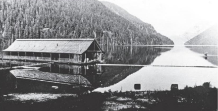
Joe Drinkwater’s Ark Hotel on Great Central Lake.
Joseph Drinkwater
Miss Mollison Takes Chalet
Reported in the Vancouver Province Thursday June 27, 1912, p.29.
Mr. R. [Richard] Marpole, chief executive assistant of the C.P.R., announced today that the company’s chalet hotel at Cameron Lake, on the Alberni branch, has been leased to Miss Jean Mollison of this city [Vancouver]. Miss Mollison has had a wide hotel experience, and for several seasons conducted the Lake Louise Chalet in the Rockies. Mr. Marpole added that the company recently completed the building of a pony trail from the new hotel to the summit of Mount Arrowsmith, from which a view can be had of the island coasts and mainland. The Chalet is already being well patronized, and if business continues to increase as the same rate, a larger hotel will be built next year.
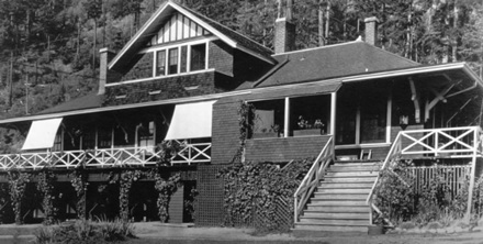
The Chalet at Cameron Lake 1919
Cameron Lake Chalet notice
Leaves for Banff
Reported in the Daily Colonist Tuesday July 9, 1912, p.14.
Captain Frederick V. Longstaff, F.R.G.S., Corps of Guides, left Victoria last night for Banff to help organize the annual camp of the Alpine Club of Canada at Vermillion Pass.
Alpine Club in Strathcona Park
Noted Body Of Scientists and Mountain Climbers Are Going In On August 16 Accompanied By. Mr. W.W. Foster
Reported in the Daily Colonist Wednesday July 31, 1912, p.7.
In Strathcona Park this province possesses a pleasure ground which is unequalled for beauty and attractiveness from the point of view of all classes of visitors. It is as yet in the earliest stages of its development but all who have seen it are unsparing in their praise of it. A notable body of visitors is now planning a survey of it from the scientific side. The Alpine Club of Canada, which numbers among its membership many distinguished Americans, is making its annual camp in the Rockies, and on the invitation of the British Columbia members of the club will come to Vancouver Island to spend some time in the park The Alpinists will gather at Campbell River on August 16 and enter the park. One of them will be Mr. J.D. Patterson, Woodstock, vice-president of the Alpine Club. Several eminent geologists and botanists will be in the party and it is Mr. [William] Foster’s desire to secure some advice from them in their particular lines which will be of value in the developing of the great playground. Some days will be spent in a thorough tour of the place, and there is no doubt that glowing descriptions of lakes, mountain and stream will be carried back east, to the greater fame of Strathcona Park.
Alpine Club in Camp
Reported in the Daily Colonist Thursday August 1, 1912, p.6.
Mr. W. [William] Foster, deputy minister of public works, has gone to Vermillion Pass to attend the annual camp of the Alpine Club of Canada. Following the stay there a number of the members will visit Strathcona Park under the guidance of Mr. Foster.
Alpine Club camp
Reported in The Victoria Daily Times Wednesday August 14, 1912. p.5.
Members of the Alpine Club of Canada are going into Strathcona Park on Thursday next under the guidance of the Deputy Minister of Lands, William W. Foster. The club will have as its guests a party of American scientists who will be made acquainted with the wonders of the park by the deputy minister.
Mountain Climbers Return
Reported in the Daily Colonist Friday August 30, 1912, p.7.
The party representing the Alpine Club of Canada who recently left on a tour of Strathcona park, have returned well pleased with their outing. In the party were Mr. [John] Howard Chapman, government photographer, Victoria; Miss M. [Margaret] Cowell, nurse, Victoria; Mr. F. Elworthy, secretary of the Board of Trade, Victoria; Mr. H. [Herbert] Otto Frind, traveler, Vancouver; Mr. D. [David] A. Gillies, lumberman, Ottawa; Mr. A.R. Hart, hardware traveler, Calgary; Miss J. [Jennie] L. McCulloch, King’s Printer’s Office, Victoria; Mr. and Mrs. A. [Albert] H. MacCarthy, New York; Mrs. Robert MacIntosh, Saskatoon, Sask.; Doctor Mary Potter, New York; Rev. J. [James] R. Robertson, Nanaimo, B.C.; Mr. F. [Francis] A. Robertson, Western Finance Company, Victoria; Mr. A. [Arthur] O. Wheeler, Sidney, B.C.; Mr. L. [Lionel] C. Wilson, merchant, Calgary; Mr. J. [John] G. Cory Wood, M.P.P., Alberni, B.C.; Prof. J. [James] M. Macoun, C.M.G., Dominion government, Ottawa; Mr. W. [William]. W. Foster, deputy minister of public works, Victoria; Col. R. [Reginald] H. Thompson, commissioner Strathcona Park.
Strathcona Park
Reported in the Daily Colonist Wednesday September 4, 1912, p.4.
The members of the Alpine Club, who have returned from their visit to Strathcona Park, unanimously bear testimony to the very great attractiveness of this resort. There is no doubt at all about its becoming veery popular, even more so, indeed, than has been anticipated. The variety of scenery is very great, the combination of mountain peaks, lakes, rivers, waterfalls and forests being something that beggars description. There is no difficulty in reaching Buttle lake from Campbell River, and by next summer many of the chief points of interests ought to be easily accessible. We judge from what visitors say, that it will be some time before the whole park can be reached without a little roughing it. The mountain peaks will always call for a good deal of vigorous climbing, and we do not suppose anyone would desire anything else. One advantage of the park is that it is all on a relatively moderate level and consequently the temperature is not likely to rule as low as it would in parks in the midst of the Rocky Mountains. At the same time the mountain climbing is quite as formidable as it is in higher altitudes. To start from an altitude of a few hundred feet and ascend a peak more than seven thousand feet high may be a much more formidable undertaking than to start from an elevation of four thousand feet and go up to ten thousand. Strathcona Park is going to prove a very valuable asset to the province, and of course especially so to Victoria and Vancouver Island.
Scenic Grandeur of Strathcona Park
Reported in the Daily Colonist Sunday September 8, 1912, p.7.
The local branch of the Alpine Club of Canada recently made an interesting trip to Strathcona par. Rev. J. [James] R. Robertson, who accompanied the party, in an interesting account of the outing, says: The journey into the head of Strathcona par, a distance of between 40 and 50 miles, was covered in two days by road, pack tail and canoe up the general course of the Campbell Rivers and lakes and the Elk River to Drum Lake, where we were less than 20 miles from the slat water of the Pacific. The trails are remarkably good. The Campbell lakes and rivers are always fascinating, the woods always stately and often grand in their majesty, and the wineberry, blueberry, salmonberry and cranberry are ever luscious and refreshing, while animal life seems scarce, and hunting is, therefore, not extensive, the fishing is good in all the lakes and rivers, and Miss [Jennie] McCulloch, of Victoria, succeeded in catching a 44-pound tyee salmon at the mouth of the Campbell River, and in the Campbell Lake the single trolling line caught half a dozen trout in about half a dozen minutes. As the party journeyed on for those two days their surprise was great that on Vancouver Island within 25 miles of Nootka—the first place discovered of the whole of the British Columbia some 125 years ago— there was still such a vast region of terra incognito.
Canadian Matterhorn
Probably the chief feature of the expedition was the climbing of a formidable mountain peak hitherto unclimbed and unnamed. Commissioner Reginald Thomson speaks of it as the Canadian Matterhorn, and doubts were entertained as to whether it would be possible to make the ascent. On Monday a special party was sent out to examine the mountain and determine a route whereby the summit might be attacked. This party returned at night, and reported in favor of making the attempt. Consequently, on Tuesday morning nine strong men started off with provisions for three days each man packing on his back 25 or 35 pounds. The party was made up of the following nine persons: Mr. A. [Arthur] O. Wheeler, director; Mr. Edward. O. Wheeler, guide; Mr. D. [David] A. Gillies, Mr. A.R. Hart, Mr. Herbert O. Find, Mr. A. [Albert] H. MacCarthy, Rev. J. R. Robertson, Mr. F. [Francis] A. Robertson and Mr. L. [Lionel] C. Wilson. Following up the Elk River three miles from Drum Lake, the climbers turned to the left and southwards up a mountain stream, which soon became a torrent. After hours of this course a great succession of water falls was found coming from the snows and the glaciers of the mountain we were attacking. These falls were tumbling down from mighty ramparts a thousand feet above, and giving forth the perpetual sound of deep thunder for many miles around.
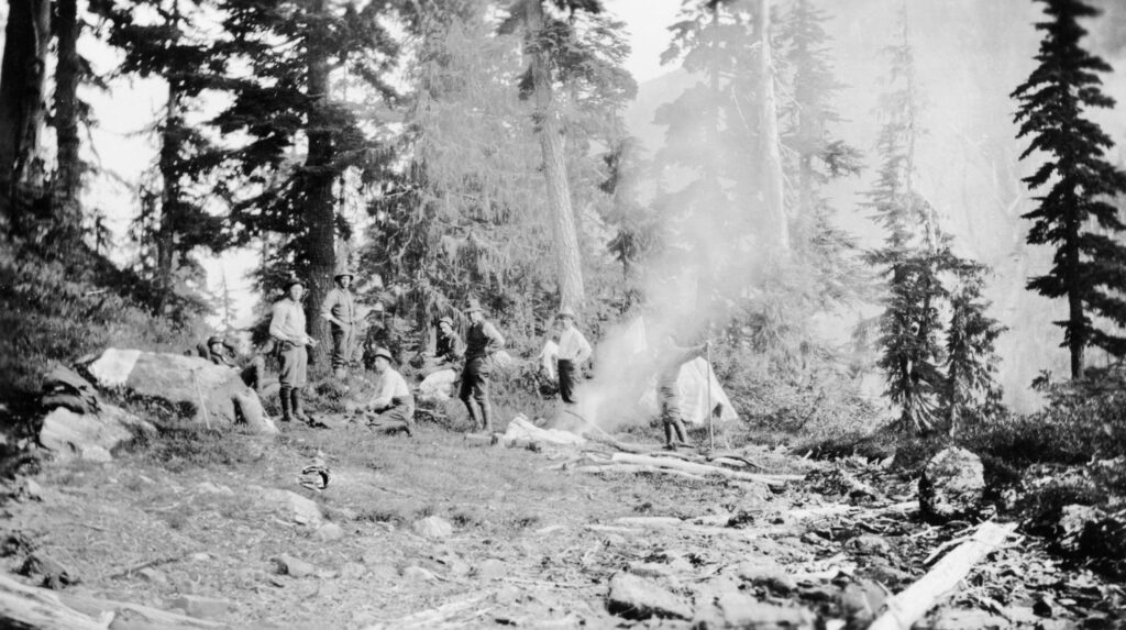
ACC Strathcona Camp 1912
Difficulties Encountered
This first day’s journey was very difficult by reason of the great windfalls, the slipping rocks in the torrents, the devil’s club and the many chimneys that had to be scaled. At midnight above the ramparts of the falls and on the margin of timber line a delightful camping spot was found, and after building the camp fire and eagerly devouring the pork and beans, the nine strong me rolled themselves each in his blanket and laid their weary limbs down to rest and sleep under the open sky at an altitude of about 4,600 feet.
Dangerous Climb
On the following morning as their eyes were opened the first sight to behold was the defiant mound before us with its walls, pinnacles, ledges and towering summit that has never felt the human touch. It was a formidable sight, daring and defiant in its aspects. Yet whatever each one thought, no one confessed a qualm of fear. A good breakfast was enjoyed, the provisions were cached and the nine strong men started for the summit. Soon the trees and alpine glades were passed, the great rock shoulders were rounded, some snow fields and glacial slopes were crossed, and lo! We were upon the rocks. Precipitous walls were scaled, chimneys were overcome, ramparts were brought under our feet and pinnacles were rounded. Oh! It was glorious. We were making love to the virgin mound, and the mound that at first defied our approach was being won by human touch. The virgin rock was not false, but true, and both peasant and mountaineer smiled in mutual joy when the ledges, corners, cracks and edges gave firm hold to the grasp of fingers and toes. Twice only a rope was used to overcome chimneys, and at 2 p.m. the whole party stood victorious on the virgin peak with aneroid registering well over 7,000 feet altitude, higher by a thousand feet than was known of any mountain on Vancouver Island. Arriving at the summit, three cheers were given for the Alpine Club of Canada, for the guide who had led so steadily and carefully to the summit, and the director of the Alpine Club. The ceremony of christening the mountain was performed by Director A.O. Wheeler, giving the name of “Mount Elkhorn,” and a cairn five feet high was built, within which was placed a tin can containing the names of the nine strong men. An hour was spent resting and viewing the surrounding hills, valleys, lakes and streams, after which the descent was begun by the same general course back to the cache, where another night was spent, sleeping under the open sky, and on the third day the party reached camp at 5 p.m. with a few bruises, aches and pains, but all well satisfied with the trip.
The Alpine Club of Canada in Strathcona Park
Reported in the Daily Colonist Sunday Supplement October 6, 1912, p.1, 2 & 5.
It was a wild ride that! The director and other members were detained by the closing of the big camp at Vermillion Pass. Our main party had started from Vancouver the night before by the steamer Venture, and our endeavor now was to overtake it before it left Campbell River—160 miles—by nightfall. We had left Sidney at 7 a.m., reached Victoria in forty minutes, and we leaped down in front of the Empress portico, we became aware that two powerful motors were chug-chugging under a full head of gas, while the chauffeurs sat with their hands on the levers ready for an immediate start. The chairman of the local branch, Mr. W. [William] W. Foster, had arranged matters to enable us to make good our lost time. He was now standing on the steps to meet us, and remarked in his quiet voice, “I think you had better move on at once, as there is little time to lose.” To our intense disappointment, we found he could not accompany us. He had hurt his hand at Vermillion camp, where he had been to represent the British Columba Government, and was now in the doctor’s care, threatened with blood poisoning, and could not join us until later. In five minutes we were off. We started in steady rain, which continued all day. The clouds were low over the Malahat, and we drove along narrow ledges through ethereal forests, where ghostly trees were wrapped in shrouds of mist. Now and then, openings in the clouds disclosed the sullen waters of Saanich arm in the depths below. The horn sounded weird in the fog, as we rounded sharp corners at a speed somewhat great for so narrow a path; but there was little fear of meeting other drivers at that early hour on so stormy a morning. All day long we fled through the driving drove and drove it along at the full pressure. It had a big load, and frequently bumped the axles, when the occupants made for the roof. A moment’s stop in Duncan, lunch in Chemainus, a slow up to pass through Ladysmith and a few minutes in Nanaimo to replenish the gasoline supply. Up to this point we had traveled over an excellent trunk road, known as the Island Highway. We now followed the Canadian Highway as far as Parksville, where we again turned northward.
Excellent Road
A word about these highways. They are excellent roads for motor travel, and are gradually being extended into the wildest recesses of the interior. It is impossible to lose one’s way, for very legible signboards are at every crossing, and mile posts are found throughout. The public works department is to be congratulated upon the splendid work it is doing in thus opening up the recesses of the Island. The large amount of motor traveling of that big touring car, as its engines rattle, bang, crash; swaying from side to side, skidding round corners, missing telegraph posts, whirling across bridges, scattering chickens, ducks and other live stock right and left, sending sheets of water flying from the pools. Through villages, past farm houses, in dense forests, along wild sea coast, now high above the water, now nearly at its level. Always there was a feeling that we fled—that someone, or something, pursued, the horn booming as we flew around corners or approached sharp curves. Imagine the pulse. The quick access made possible is very evident in the busy villages, and the flourishing road houses met in rapid succession, where, under ordinary conditions matters would have remained in status quo for many years to come. There is no doubt the highly finished product in motors of the present day is a strong competitor with the railway as a means of advancing civilization; and the policy of the British Columbia Government in building these excellent roads through the magnificent scenic regions of the province will be the means of distributing much wealth, and opening up tourist and other industries that could not otherwise have been brought into play. We reached Union Bay at 6:45, and, as Campbell River was still forty miles distant, and the road required daylight travel, we decided to stay the night. The next day the rain had let up, and it cleared before noon. The road was more primitive, and we soon got into trouble. First, one machine stuck in soft mud, and then the other, but both were got out successfully. We now entered a five or six mile stretch of forest jungle, not unlike that seen in Stanley Park in Vancouver. The road here was little wider than the motor. We raced through, twisting, turning, and worming, dodging tree stems and doubling corners. It was a fine bit of steering, and but for the narrow track, which made it possible, we might as well have been going directly through the bush. It certainly was grand; immense trees of Douglas fir and cedar, eight to twelve feet in diameter, bearded with sweeping festoons of moss, their stems decorated by ferns and clusters of the scarlet bunch berry; dense undergrowth everywhere. Amidst which the tall devil’s club shot its fine, tropical-looking leaves high in the air. In the midst of this luxuriant growth, a secluded bridge crossed Oyster River. We stopped a few minutes to watch the hundreds of salmon crowding up the stream, then on again through the forest. Less than a mile from Campbell River came our Waterloo: bang, snap, rattle, off flew a steer ring, and the tire gently subsided. Another was quickly replaced, but it was found the steering gear had gone wrong, and the machine was no longer under control. Some of us walked, while the machine was brought in by hand-steering of the front wheels.
Objects Of Expedition
And now to explain how an Alpine Club party came to make an expedition and what its objects were. During the course of the Winter meetings of the Vancouver Island branch the possibility of a party going in to explore the Alpine attractions of Strathcona Park had been discussed. The difficulties and the cost of transportation in this gloriously wild, but as yet, almost inaccessible district, had proved the chief obstacle. Much discussion ensued, the difficulties looming larger as the details developed. However, the chairman of the local branch of the club Mr. W.W. Foster, the very popular deputy minister of public works for the province, bade us not be discouraged, and intimated that assistance by the government might be obtained, an expert opinion of the Alpine features of the park being desired. As a result of negotiations, it was decided that transportation and other facilities would be furnished to a party limited to twenty, at a cost within the means of those taking part. Without such assistance it would have been impossible for us, and I now wish to tender the thanks of the Alpine Club to Sir Richard McBride and the members of his cabinet for providing an opportunity that I feel sure will have a beneficial effect in placing before the public of Canada and other centres of the world the attractions of one of the most delightful scenic parks of the entire Dominion. A park that abounds in all the attributes of Nature in its primeval condition: giant forests; sunlit lakes miles in extent, bounded by bold rock shapes and overshadowed by snowy peaks reflected in their placid waters; rushing torrents with deep pools, where trout float lazily among submerged branches; timbered valleys leading to deep gorges, above which are snow-flecked passes beneath noble peaks rising in ragged ridges and steep spires; lace falls leaping from pure white glaciers; and tiny lakelets of blue and green that sparkle like jewels set in velvet, or else lie above the timber-line in brown rock basins with the winter snows reaching to their very margin; the whole awaiting only access by well-built roads and pony trails for the many thousands to whom the fearful grind of modern civilization renders such opportunities a vital necessity.
Party Of Sixteen
The Alpine Club party numbered sixteen. It was accompanied by Mr. J. [John] G. Cory Wood, the Member of Parliament for Alberni district. On reaching Campbell River, we found ourselves in the hands of Mr. R. [Reginald] H. Thomson, park commissioner, who had been requested by the government to look after the party; and well he did it. I have heard Mr. Thomson say that there were hitches in his arrangements, but, if so, they were not apparent. To us everything went along like well-oiled machinery. There were no delays and we were on the move. The food, to old campers such as we were, was a continued feast, and to his principal chef—Jones—I take off my hat as a king among camp cooks. I have learned since that the tremendous appetite of the Alpine party was the cause of serious shortage when it had left. I can quite believe it, and appreciate the perfect and unselfish hospitality that allowed no indication of such a possibility to appear while we were present, in a tract of country where food supplies are brought in with great difficulty and at the expense of much arduous labour. We wish to express publicly our sincere thanks to Mr. Thomson, to his chief assistants and to his staff for the very able, courteous and delightful manner in which one and all contributed to the business we had in hand. Mr. Thomson, himself, was not only a guide, philosopher and friend to us, he was more—a father to us—in his wise forethought for all possible contingencies, and the great fund of instruction which he always readily placed at our disposal. We found that in conjunction with the railway company now locating a line through the Park, pony trails had been pushed forward for our use, and the ease with which we were able to travel to and fro showed contrast in a marked degree with the difficulties encountered by the Hon. Price Ellison two years before. Space will not allow me to record here all the features of the Park, and it is only my intention to deal with the Alpine aspect at the present time, but as soon as the material has been in shape the Alpine club will issue a bulletin dealing fully with the expedition.
Travel By Wagon
From Campbell River travel was by wagon and on foot seven miles to McIvor Lake; across the lake by a twenty-foot canoe; then three-quarters of a mile by trail to Lower Campbell Lake. Arrived here the Forbes and Honour Transportation Company conveyed the party by motor launch and canoe to the head of the lake and some distance up the river to a point known as the British American Timber Company’s Landing, in all nine miles. Lower Campbell Lake showed a bright sunny sheet of water surrounded by low timbered hills. It is seven miles long and from one to one and a half wide. About the centre a small island near the northern margin breaks the monotony and gives a delightfully picturesque effect. It is not difficult to picture the lake shores dotted with red-roofed cottages and to see canoes and sailing skiffs gliding over the sunlit waters, when it shall have become the summer home of wanderers from the cities of Vancouver Island and elsewhere. From the B.A.T. Landing eight miles of excellent pony trails led to Upper Campbell Lake and another mile by canoe to Warnick’s Camp, twenty-seven miles from Campbell River; pretty fine connection for a day’s travel through such difficult country. Next day by motor-canoe five miles to the head of Upper Campbell Lake, another charming little sheet surrounded also by timbered hills, now rising more massively. In the distance, beyond the head of the lake, a striking sharp peak rose in mid-air with a small glacier flowing down its northeastern slopes. This Mr. Thomson spoke of as the Matterhorn of Strathcona Park, and he dared the Alpine club to make its ascent. We replied: “Lead us within striking distance.” The answer was: “I will.” Following a slough at the southwest corner of the lake for a mile we came to a landing from which a most excellent trail led first through a low cedar flat, thickly covered by dense windfall; some of the logs cut through for the passage of the trail rose in thickness above the height of man and showed rings of annual growth that must have given them an age of much more than a thousand years; then along the hillside and, leaving the flat, into as magnificent a fir and cedar forest as can be found anywhere. At the point where the cedar flat is located the sides of the valley of Upper Campbell River are of steep bluffs and benches forming a sort of wide box canyon. Mr. Thomson explained that this canyon was likely responsible for the heavy windfall of cedar timber. The hot air from the enclosed space rises vertically and is replaced by a fierce rush of cold air down the side of the canyon, which has doubtless blown down most of the trees. This physical phenomenon is known as a “Woolly” from the effect it has on a water surface. The cedar flat is some miles northeast of the confines of the park. It was pointed out how useful it might be made when cleared as a holding ground for elk, deer, buffalo or other animals of that nature that might eventually be placed within the park. Mr. Thomson stated that, in his opinion, the boundary should be extended to embrace the extreme southerly end of Upper Campbell Lake, and the mouths of Campbell and Elk Rivers, and showed us a rock bluff on the south shore from which he thought the boundary line should be drawn. The expediency of converting the cedar flat into a grazing ground is well in the future, but there is no question but that it would be a very valuable adjunct to have direct access from Upper Campbell Lake to within the confines of the park, and such access would be a very important factor in facilitating the travel to and in it.
Magnificent Forest
As stated above, the day’s tramp led through some eight miles of magnificent forest—so magnificent that I have no hesitation in saying that a motor road leading amidst its depths would alone be a sufficient attraction to make a visit to the park worthwhile. I have never before seen so unique an area of timber. Groups of fir and cedar grew to twelve or more feet in diameter, enormous, isolated trees were here and there, and so dense was the shade they cast that undergrowth was sparse and the ground open and mossy. Huge devil’s club reared their wonderful fan-shaped leaves ten feet into the air, and the sun, glinting through the openings, created fairy glades that looked most like a scene from Wonderland. To the illusion was added a weird collection of toadstools: some red, some blue, some brown, some white, all shades quaint and odd, quite in keeping with the eerie surroundings. Three miles out the trail struck the river bank and then followed it more or less closely for the rest of the way. About four miles from the landing the sides of the valley close together in rocky bluffs. From that on the north side a very fine view showed up the Elk Valley. The stream flowed at our feet almost perpendicularly below. Mr. Thomson suggested that, failing the possibility of establishing a boundary as previously indicated, this natural gateway would form an excellent portal for the park. I am of the opinion, however, that a boundary as first outlined would be a very much more important and useful delimitation, provided, of course, it were possible for the government to secure the additional area involved. A mile further on we crossed the northeastern boundary of the park—the line run by William ralph in 1892 from the mouth of Muir Creek to the crest of Crown Mountain. A large wooden post parked :134½ Miles” is close to the trail. The post was new, the original one, which lay half-rotted on the ground, having been replaced by order of the Hon. Price Ellison, at the time of his exploration. We crossed the north branch of the Elk River up which the way lies to Crown Mountain, then crossed the main stream to the south side, and finally crossing the south branch, came to Lewis’ Camp, where the divided parties reunited and all spent the night.
Strathcona “Matterhorn”
Early next morning a party of four Alpine men, with packs on their backs, struck up the valley a distance of five miles, bent on a reconnaissance to ascertain the best means of reaching the Strathcona Matterhorn. Mr. J. [James] M. Macoun, assistant Dominion naturalist, was here camped close to Drum Lake, a delightful little double lake of bright blue, nestling in a hollow of the valley, surrounded by bold, steep heights rising in more or less timbered rock ledges. It was the intention to move the entire party to this spot later in the day. Meanwhile the advance guard climbed to 3800 feet on the long timbered ridge between the Elk Valley and that of Drum Lake, to where a bare rock point formed a natural observatory. Almost opposite, across the Elk River, rose the Strathcona Matterhorn. It looked a nice rock peak rising above a small, well-crevassed glacier. Through the glasses the ice looked very clean and no moraines were apparent, so it was thought the rock must be good and solid, which proved to be the case. At the head of the Elk Valley stood another fine rock peak with a very jagged ridge [Mount Colonel Foster]. It looked enticing, but the gauntlet had been thrown down, and it was decided to attempt the Matterhorn peak. By the way, Mt. Assiniboine, some twenty miles southeast from Banff, is generally known as the Canadian Matterhorn, so it was necessary to find a more suitable name for the peak in question. As it stood close to the head of the Elk Valley and rose sharply, seen from our point of view, we decided to recommend to the Geographic Board that it be known in the future as “Elkhorn.” Some distance below the glacier the stream from it broke over a ledge and presented twin falls of great height that would undoubtedly prove very striking upon closer acquaintance; a steep watercourse below the falls, reaching to the Elk River, showed an obvious line of ascent. Having sized up the route, it was decided that only those who could carry their bedding and three days’ provisions could go. Mr. Thomson had said that it would take us three days, and then we could not get there, so it was up to us to make good.
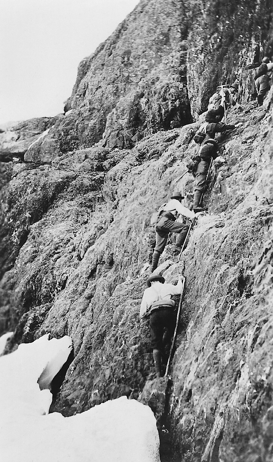
Climbers ascending Elkhorn Mountain 1912. Herbert Frind photo
With Rope And Ice Axe
The following morning at 8:30, nine, all men, pulled out with their packs on their backs, rope and ice axe. Macoun, who has wonderful foresight, had decided some days before that it would be the peak of our selection, and had blazed a good line of travel up the Elk Valley for three miles, which helped us greatly. Arrived at the watercourse, difficulties began. In the distance it had looked quite simple. It was now found to be blocked by huge boulders and criss-crossed in every direction by fallen tree trunks of no light proportion. A rock canyon with vertical sides soon forced us to take the hill slope, very steep and densely littered by fallen tree trunks, the result of a recent bush fire. The sun beat down and the packs grew leaden. On we toiled, perspiration oozing from every pore. Wilson remarked in his quaint way: “I don’t see much difference between this and work.” “You’ll find out when pay day comes,” retorted Hart. At 1:20 p.m. we had made 1400 feet and stopped for lunch and a rest, altitude above sea level 2400 feet. From now on we kept to the watercourse and were soon in the blessed shade of the green timber and directly below the falls. They are very fine, of the kind known as “lace” falls, and leap in two broken drops from 800 to 1000 feet. We tried the precipitous ledge over which they fell, but were forced to the right into a smaller watercourse leading to a high saddle. A traverse to the left above steep cliffs brought the party at 7:55 p.m. to a broad open ledge, carpeted with pink heath and whiter heather at an altitude of 4660 feet. Wood and water were plentiful and camp was made, each rolling up in his blanket under the stars where his fancy pleased, having first partaken of a glorious supper. The roar of the falls furnished a soothing lullaby, which gradually grew fainter, then ceased, and it was to-morrow, with a faint alpenglow illuminating our peak.
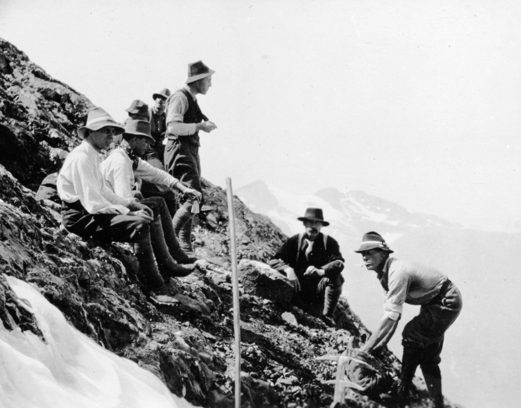
Climbers taking a break during the 1912 ascent of Elkhorn Mountain by ACC. Herbert Frind photo
Alpine Flowers
Oh, what joy to climb without those leaden packs; our feet had wings. The rocks were hard and sound. Ridge followed ridge, always rising. Alpine flowers grew in the grassy patches. In the south and west, peak on peak showed clear, with snowfields and small glaciers between. Near the head of the Elk Valley a small circular lake, some eighty acres in extent, showed like a jewel, a rich sap green in colour. Down a steep rock face, across a snow-crested col, 300 feet of a grand rock climb, a traverse below an extended bed of snow, lunch, step-cutting, up a steep ice slope, a tiny delightful little chimney, a final stretch up broken rock, and at 2:10 p.m. we stood on the summit. The barometer showed an altitude of 7250 feet. Three cheers and a tiger for the Alpine Club of Canada; three cheers and a tiger for our leader, my son; three cheers and a tiger for the new Alpine fields, as yet unconquered that lay before us. The contents of an emergency brandy flask served to christen the peak “Elkhorn”; we wrote a statement of the climb and, in order of seniority, each signed it; the statement was placed in a carefully sealed tin tube, which, in turn, was placed in a stoneman erected on the highest point, and conquest was formally recorded on behalf of the Alpine Club. Southeast lay a deep trough of which we could not see the bottom. In this it was assumed lay Buttles [Buttle] Lake. Near its head was a high peak with snowfield and glacier on the northern side. The peak was later seen from the lake to stand out prominently on the south side of Wolf Creek. Most of the snow-clad area seemed to lie in the southwest quadrant. I counted fifteen fine peaks, of which several seemed higher than that on which we stood. This section will furnish good exploration and climbing, when means of access are available. The atmosphere was heavy with bush fire smoke, and, miles away, a little west of north, two peaks of Crown Mountain showed dimly. To the east and west, long timbered ridges separated a maze of valleys filled with dense forest growth. Six sheets of water were in view, three of which were of large dimensions. One to the northeast was undoubtedly Upper Campbell Lake, another to the northwest Muchalat Lake, one close by, to the west, probably Doners [Donner] Lake, and, quite a distance beyond it, a little further south, the end of Muchalat Arm. The other two were the lakelet at the head of Elk Valley [Landslide Lake and Foster/Berg Lake] and just above the timber line, across a deep valley to the east, another sky blue lakelet. In addition, small highly coloured ponds were seen glistening amidst the trees in nearby valleys. As in the larger parks of the main range of the Rockies, these gloriously colored lakes are one of the principal features and attractions. In the case of the larger ones, such as Buttles Lake, they resemble inland lochs, where bold rock promontories indent the shore line, where tributary glacier-fed torrents form delta fans, and splendid primeval forests line the shores with a setting of deep green, and clumps and single trees rest on the precipitous cliffs and sharp, knife-edge crags, the wonder being how they ever gained a root-hold. At early morn and late eve, when the winds have died down and the silver-tipped wavelets have ceased to chase one another, the clear, glassy surface reflects a world of wonders upside down, and it is hard to say where land and water meet.
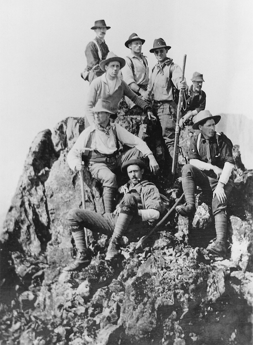
Members of the ACC on the summit of Elkhorn Mountain 1912. Herbert Frind photo
Of Tremendous Value
Judging by the position we occupied with regard to Crown Mountain, I should say that a considerable portion of the alpine area in view lay within the confines of the park, and is worthy of close attention as an attractive feature. It is a matter for serious consideration as to whether it would not be wise to extend also the park boundaries on this side, so as to include more of the alpine area. To those who have studied the wide distribution of snow-capped, glacier-lined peaks throughout the wonderful Province of British Columbia, it may not be a surprise to find a similar area as this fertile island which forms the most western portion of it; and yet it was only the exploratory expedition of the Hon. Price Ellison, and his enthusiastic report of it to the Provincial House of Parliament that has opened our eyes wide to its tremendous value as a scenic resource. A few apparent facts came forcibly to our notice: The peaks seemed to be formed of rocks of volcanic origin; the rocks are igneous and, judging by our experience on Elkhorn, will supply climbing of the very best kind, where hand and footholds are safe and sure, and excellent chimneys, loved of all good climbers for the test of prowess they afford, are many; the whole formation seems to have been subjected to severer glacial action in a long ago age; there are few, if any, alplands, or high mountain meadows, such as are found in the main range, and consequently the profuse alpine flora is missing; where in the main range these alps would be, deep water-worn gorges are found at the base of the peaks; the mountain goat is not seen on the crags and the solitudes are unbroken by the shrill resounding whistle of the hoary marmot or whistler. It is likely that both are absent for obvious reasons, and that both would thrive if imported to the mountain regions of the Island, thereby adding greatly to their interest for Nature lovers, to whom the live wild animals of the heights are a source of joy. Mountaineers detest long stretches of windfall and extended travel through forests of semi-tropical luxuriance. They like to begin at the Alplands that border the bases of the rock peaks. It would therefore, be necessary to provide good trails for ponies and for walking, in order to get near where comfortable, well-kept shelters would have to be provided for visitors to stay a while sojourning amidst the snow-clad peaks. A good trail up the Elk Valley, leading to the pass at its extreme head, would make an excellent beginning, and would open up an alpine area of considerable extent. It is a country of forests, and there is little if any natural horse feed. All such would have to be imported and would undoubtedly make the use of ponies difficult and costly as compared with the other sections of mountain areas of the Province. A return by the party was now made to the south end of Upper Campbell Lake, from which a tramp of eight miles over a splendidly built trial brought us to the north end of Buttles Lake. From this point a motor skiff and towed canoe took the party twenty miles down the lake to Robins Camp, where a splendid supper and camp fire had been provided. At the camp fire most hearty resolutions of appreciation and thanks were passed to the Provincial government, to our absent chairman, Deputy Minister Foster, whose skillful guiding hand had been most apparent throughout, and last, but by no means least, to Mr. R.H. Thomson for his paternal care and great executive ability in the conduct of the expedition, and to all his staff of fine fellows, not forgetting the camp chefs, for their cheerful and unselfish labors on our behalf. All were voted jolly good fellows and there was none there to deny it. A return was made by moonlight, five remaining, who were about to proceed over the Price Pass, and so to return home by way of Alberni.
Vistas Of Snowy Peaks
Buttles Lake is extremely beautiful, chiefly on account of its bold setting and the striking rock promontories that constitute its irregular shore line. The numerous streams that flow into it from the south and west provide splendid vistas of snowy peaks. Unfortunately, as the park boundaries now stand, the northern end, which is very beautiful from a scenic point of view, lies without. A readjustment of the boundaries as indicated above would remedy this. It would seem to be very desirable that the entire lake should lie within the park. It abounds in fish, and excellent trout of a fair size can readily be caught at the mouths of the various streams. Good fishing also is had throughout the length of Campbell River, and in several lakes to which it expands. The supply should be carefully protected, and suitable measures, such as local hatcheries, established to maintain it. If this is done successfully the fishing alone will always prove a good drawing card when suitable hotels are provided to take care of the many disciples of Isaac Walton that would flock to the region. The party of five who remained to go over the Price Pass were Mr. J.G. Cory Wood, M.P.P., Captain [Albert] and Mrs. [Bess] MacCarthy, Mr. H. [Herbert] O. Frind and the writer. They were accompanied by Mr. Ben Lewis of Mr. Thomson’s staff as guide and a packer named Paul, a man who though he carried a fearful load over fearful places was never content unless he could secure part of everyone else’s load. I cannot now describe this route in detail. We carried everything on our backs and slept under trees for five nights, through one of which it poured rain. At its best Robert’s blazed track, made for the Hon. Price Ellison, was not an easy one. Two years of growth in this moist region had obliterated all except the blazes on the trees, and it was difficult to follow. It traversed the steep slopes of the valley of Price Creek to its head, and on the third day at noon we reached the summit of the Pass. On the north side the snow came right down to our path, and high ragged peaks lined with hanging glaciers bordered on the west. A rocky col studded with tiny pools formed the divide, and the view would have been a glorious one had it not been blotted out by a belt of clouds. From the ridge to our right one sharp tooth rose clear above the encircling mists and upon it we conferred the name of “Misthorn.” A thousand feet below the pass lay a glorious lake of rich indigo blue. We descended to its shores, not without difficulty, and camped upon its further margin. The traverse of its shore necessitated the crossing of a deep gorge spanned by a thin snow bridge, requiring the use of the rope to provide safety in crossing. It is locally known as Summit [Margaret] Lake. There are thousands of summit lakes. This was a gem of the first water, so we suggested the name of “Gemaqua” lake for it. The south boundary of the park crosses Price Creek, not far from its junction with Buttles Lake. It would be a valuable adjunct to extend the boundary southward to the pass, and, if possible, to include this very beautiful lake. A pony trail can readily be made from Buttles Lake to the summit, and such a trail would give access to some splendid alpine climbing on the ridge of high, snow-clad peaks confining the pass on the west, and also to the lake and its very beautiful surroundings.
ACC Strathcona Camp 1912
Homewood Bound
The next night we reached Deep [Oshinow] Lake and, as we broke from the forest on its shores, we saw a raft approaching, propelled by two skilled woodsmen, who cheerily answered our joyful shouts. Telegrams send by that wonderful Mr. Thomson to Alberni had produced this instantaneous connection. The raft took the entire party across the lake, and an afternoon’s tramp to Elsie Lake, where the woodsmen had a full supply of undreamed of luxuries to supplement a larder reduced to slapjacks, bacon and tea. Elsie Lake was negotiated by canoe and a tramp through the forest of two miles brought us to the Alberni and Comox Lake trail. Six miles of excellent walking and the trail debouched on a graded road, fourteen miles from Alberni. And here, Oh joy! was a stage awaiting us, drawn by a team of powerful horses. No more would we carry those everlasting packs. But that was not all; familiar faces smiled at us, welcoming hands clasped ours. Had not that ubiquitous Mr. Foster met the return party at Campbell River, with his motor, and had he not brought a number of the old party across to Alberni to greet us, and had he not motored twice a day for the past two days to this very spot to be sure to be there when we should appear from the forest? A few miles drive in the wagon and then the chug-chug of a motor, and some of us were quickly transferred and whisked into civilization in time to partake of a sumptuous lunch at a long table completely surrounded by the smiling well-known faces of our comrades of the camp fire. At the foot of the table sat our genial, smiling chairman; and, as he bowed me to the head of the table, he raised his glass and said, “Here’s to you, Mr. Director.” Strathcona Park, whatever may be said for or against its development, or its boundaries, is a splendid possession, and a wise and safe reserve for the great future that lies ahead of Vancouver Island.
Playground of the Province
Beauties Of Strathcona Park Are More Wonderful the Further Survey and Exploration Proceeds
Reported in the Daily Colonist Saturday October 19, 1912, p.1 & 18.
That Strathcona Park, the great playground of the province, which the world is invited to enjoy, surpasses all anticipations as a centre of attraction for the nature-lover is the word brought back by Mr. W. [William] W. Foster, the deputy minister of public works, who has just returned from an official tour through the park with Mr. R. [Reginald] H. Thomson, the expert engineer in charge of the works there. Mr. Foster was an enthusiast over Strathcona Park before he left Victoria ten days ago. Now, however, he is more enthusiastic than ever. Like the pathfinders of old, he found that half had not been told of the beauties of the area of 300 square miles which has, by the wisdom of the provincial government, been set aside as a national heritage for all time to come. Motoring to Campbell River, Mr. Foster proceeded up the Elk River to Summit Lake, down Buttles Lake and out to Alberni. From Elk Lake surveys have been made and trails constructed as far as the Drum Lakes, a series of three lakes which could be easily made into one great waterway, which would make an ideal location for a summer chalet, and gives admirable opportunities for camping grounds.
Towering Peaks
The lakes are surrounded by many mountains, including several peaks of from 6000 to 8000 feet in height. Still further up the valley is Summit Lake, the headwaters of Gold River flowing into Nootka Sound. Here the party climbed one of the mountains and had a magnificent view, extending from Nootka Sound, on the Pacific, clear across the Island and over the straits to Bute Inlet and the chain of mountains on the mainland, thus observing a panorama which is unequalled on the Pacific Coast, and probably has no peer in America. Proceeding up the Elk River, the breeding ground of the elk, traces of which were found on every side, Mr. Foster reports the existence of a real sportsman’s paradise, game and fish of all kinds being found in abundance. Then the party struck Buttle’s Lake, a magnificent body of water, the shores of which are steep cliffs developing into mountains, which come right down to the water’s edge. Views of the mountains with snow-clad peaks and glimpses of perpetual glaciers are on every side. At the lower end of the lake is Myra Mountain and Myra Glacier, as well as Myra Falls, formed by the river, which has its source in the glacier.
Magnificent Glaciers
From Buttle’s Lake, and ascending the summit, 4,000 feet in height, two magnificent glaciers are passed, one of them four or five miles long and some two miles wide. On the Alberni side, and just below the Summit, is Lake Margaret, a beautiful stretch of Alpine water, with the glaciers overhanging, and in some cases actually coming into, the waters of the lake. The descent on the southern side to Alberni is through the elk lands covered with heath and all kinds of berry plants, until the timber line is reached, which timber extends to Great Central Lake. “The trip reveals at every mile some heretofore unknown form of natural beauty,” said Mr. Foster. “It is all virgin territory heretofore uncharted and unknown. Up the Elk River we found some of the largest timber on the Island. Many of the fir and cedar trees are ten to fifteen feet in diameter, and the preservation forever of these splendid specimens of timber will be a great feature in the attractions of the park. On the shores of Buttle’s Lake we came across a real curiosity in the shape of a canoe cut out of the trees in the vicinity some forty or fifty years ago. There is no record of who the builder of the canoe was; but there it is, with two pair of paddles and two oars alongside, ready for use, although covered with moss and buried in the forest growth of years. It would be interesting to know who built the canoe and also why it was never used.”
Topographical Survey Made
Speaking of the operations this year in Strathcona Park, Mr. Foster said that a complete topographical survey has been made of the park itself and of the country adjacent, as well as the making of a contour map of the park and the surrounding country. The road from Campbell River to Buttle’s Lake has been surveyed, and good progress made upon its construction, whilst there has been exploration and complete mapping of all the streams, lakes and mountains in the vicinity of Buttle’s Lake. “One of the features of the country here is the presence of a mountain of pure white correline marble, which is most striking and stands out in the landscape for miles around, especially when the sun shines upon its surface. One result of the trip,” continued Mr. Foster, “has been the shattering of the delusion that Crown Mountain is the highest peak in the interior. As a matter of fact, it is nothing of the sort. It has been described by previous map makers, probably because it could be seen from the shore, and has, therefore, been taken as a pointer; but when on a peak, in the vicinity of Elk Lake one day, we counted twenty peaks which were all from 1000 to 2000 feet higher than Crown Mountain.”
Exceeds All Expectations
“The whole park is much more magnificent than I believed. The snowclad mountains, with their glaciers rising as they do directly from sea level, are much more striking than are similar peaks in the Rockies or the Selkirks, and with their altitude of from 7000 to 8000 feet, direct from the sea level, are much grander than similar peaks in the interior. Mr. Thomson will come to the city early next week and then he will present our report to the minister upon the season’s work and our recommendations for future development. This latter will, we hope, include proposals for taking care of visitors. All we need do is take a party of picked people in there and we will then secure for Vancouver Island the greatest advertisement of the great national park which it is possible to imagine, and convince the world that we have right here on the Island the playground of the Pacific, with attractions in the way of fish and game and mountain climbing unequalled in the world. We are going to make Strathcona Park known to the world in the season of 1913, and when we do we will have a rush of tourists here which will surpass all expectations.”
Alpine Clubs Are Becoming Popular
Victoria, Vancouver and Revelstoke Have Organizations—British Columbia Mountaineering Club Is Gazetted
Reported in The Daily Colonist Saturday December 14, 1912, p.16.
Largely as a result of the activities of the Alpine Club of Canada and its enthusiastic members, who are becoming the best advertisers of British Columbia’s great assets in mountain scenic charm, local mountaineering and alpine clubs are being formed, or have already been organized in various parts of the Province, Revelstoke displaying especial activity in this connection, while Victoria also has now an active company of alpinists forming a section of the Canadian Alpine Club with preparations now in hand for a particularly active season during the coming year. Vancouver also has organized its lovers of mountain, glacier and forest, the current issue of the official Gazette officially chronicling the birth of the British Columbia Mountaineering Club, with headquarters at the big Mainland city. Its objects are specifically defined as: The exploration of the mountains, valleys and ice-fields of British Columbia and study of their natural features; the preservation of the beauties of the mountains through protective legislation, and the promotion of such scientific, artistic and recreative pursuits as will secure these objects. Mr. W.J. Gray is President of the new club and Mr. G. Jarrett, Secretary-Treasurer, their fellow officers being Messrs. F. Perry and C. Chapman, Vice-Presidents; Mr. P.J. Park, Assistant Secretary; Mr. J. Porter, Editor; Mr. W. Taylor, Librarian, and Mr. W.J. Gray, Director, with Miss E. Fowler, Miss M. Wickshire, Miss E. Carr, Mr. E. Burn and Mr. C. Heaney.
A Glimpse of the Rockies
By Lilla Dunlop Nease
In the stillness of the morning, in the glory of the dawning,
Like a playful sprite from mistland fleeing from its shadows gray;
In manner most decorous, there suddenly looms before us
All the dazzling snowy peaks in beauteous array.
And those mighty mounds eternal with their majestic supernal
Are calling for our homage and their calling we okay.
From age to age enduring, with subtle, sweet alluring,
They woo us from the foothills to climb the dizzy height,
And a fancied absolution, freeing us from earth’s pollution
Thrills us as we dwell awhile within the mystic light.
Till silently descending, strange visions still attending
We lose ourselves in holy dreams of Glory Infinite.
1913
ACCVI Executive:
Chairman – William Foster
Vice-Chairman – William Drewry
Secretary – Jennie McCulloch
Events:
January 21 – Club’s regular monthly meeting. Two papers read, one by Horace Westmorland on the mountains of Cumberland, England and the Dolomites, and the other by Alan Morkill describing climbs at the head of Howe Sound.
January 27 – Arthur Wheeler gives a talk to the Natural History Society on “Canada’s Mountain Wonderland.” ACCVI members invited.
February 13 – Arthur Wheeler to give talk to the B.C. Superintendents on the “Alpine Areas of Strathcona Park.” John Howard Chapman operated the lantern slides.
February 18 – At the club’s meeting Francis Kermode, Curator of the B.C. Provincial Museum, lectured on the alpine birds and animals of B.C., illustrating his lecture with lantern slides.
March 27 – Club’s 7th annual banquet at Empress Hotel.
June 28 – Club trip to Mt. Arrowsmith.
July 31 – William Foster along with Conrad Kain and Albert MacCarthy climb Mt. Robson.
December 17 – Club holds its annual meeting at the Alexandra Club and elects officers.
Section members who attended the ACC general summer camp at Cathedral Mountain: Arthur Wheeler, Clara Wheeler, Ethel Bruce, Jennie McCulloch (Cathedral Mountain – 19 July), Mr. and Mrs. G.P. Napier (Cathedral Mountain – 17 July), Alan Campbell (Pope’s Peak – 23 July). Cathedral Mountain was a peak that when climbed qualified for Active Membership of the ACC.
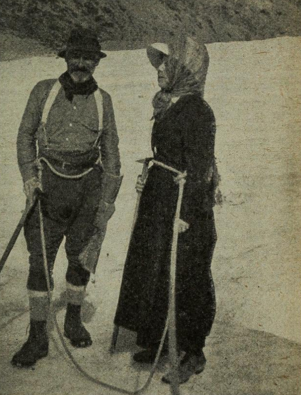
Arthur and Clara Wheeler at an Alpine Club camp.
When Mr. C.A. Richardson prepared the camp he did not forget that man is not always a monkey. Sometimes man likes to come off his perch and sit down for a while to think. Now, the most aggravating thing about mountaineering is that the more one wants to think, the less one can. High crags inspire high thoughts, but demand minds concentrated on hands and feet. Let your mind soar on a steep ice slope, and you’ll understand my meaning when you come to. Mr. Richardson looked after all that by preparing a good camp fire and some logs for people to sit on and think. There were some queer thoughts indulged in. You should have seen Odaray blush in the evening sunlight when a hardy individual recited:
There was a young man from Tarentum
Who bit his teeth till he bent ‘em
When asked what it cost
For his teeth he had lost
He said, “I don’t know I just rent ‘em.”
“Alpinism is the noblest of all the sports that is given to human beings to enjoy. I trust that for many, many years this thriving and vigorous organization will continue to exist and do its splendid work.” Arthur Wheeler at the end of his speech at the general camp.
Section members who attended the Robson Camp: Arthur Wheeler (ACC Life Members), William Foster, Stanley Mitchell, Jennie McCulloch, John Howard Chapman, Horace Westmorland, Miss L. Whelan (Annual Members).
The Alpine Club of Canada
The Strathcona Park Expedition
Reported in Rod and Gun in Canada Vol. XIV, No. 8, January 1913. p.846 – 850.
At the close of the camp at Vermillion Pass the Director, Mr. Arthur O. Wheeler, conducted an expedition into Strathcona park on Vancouver Island and subsequently wrote an enthusiastic account of the experience for the Victoria “Colonist.” The Alpine Club party numbered sixteen, of whom several were ladies. The party was accompanied by Mr. John G. Cory Wood, the member of Parliament for the Alberni District. To the great disappointment of all, Mr. William W. Foster, deputy minister of Public Works and chairman of the Victoria Committee of the Alpine Club—as a result of whose negotiations on their behalf the party were assisted by the government of British Columbia in the matter of transportation and other facilities—on account of an injury to his hand received while at the summer camp, was unable to accompany the party as had been intended. From Campbell River, travel was by wagon and on foot, by canoe and trail to Lower Campbell Lake, from whence the party were conveyed by motor launch and canoe to the head of the lake and some distance up the river to a point known as the British American Timber Co’s Landing. From this point eight miles of excellent pony trail led to Upper Campbell Lake and another mile by canoe to Warnick’s Camp—twenty-seven miles from Campbell River and all in a single day’s travel. To Mr. Reginald H. Thomson, park commissioner, who had been requested by the Government to look after the party, Mr. Arthur Wheeler attributed the fact that everything during the progress of this trip went like well-oiled machinery. The following day five miles by motor canoe brought the party to the head of Upper Campbell Lake. Beyond the head of the lake the party beheld a striking sharp peak which rose in mid-air and which was referred to by Mr. Thomson as the Matterhorn of Strathcona Park, of which he dared the Alpine Club to make an ascent. Following the trail indicated by Mr. Thomson the party came upon logs cut through for the passage of this trail that rose in thickness above the height of a man and showed rings of annual growth that told their age to be more than a thousand years. This day’s tramp led through some eight miles of magnificent forest; “so magnificent,” says Mr. Wheeler “that I have no hesitation in saying that a motor road leading amidst its depth would alone be sufficient attraction to make a visit to the park worthwhile. I have never before seen so unique an area of timber. Groups of fir and cedar grew to twelve feet or more in diameter; enormous isolated trees were here and there. And so dense was the shade they cast that undergrowth was sparse and the ground open and mossy. Huge devil’s club reared their wonderful fan-shaped leaves ten feet in the air and the sun, glinting through the openings creating fairy glades that looked most like a scene from Wonderland. To the illusion was added a weird collection of toadstools; some red, some blue, some brown, some white, all shades quaint and odd, quite in keeping with their eerie surroundings. Early next morning a party of four Alpine men with packs on their backs struck up the valley, a distance of five miles bent on making a reconnaissance to ascertain the best means of reaching the Strathcona Matterhorn. This advanced guard climbed to a height of 3,800 feet (from here it must be remembered they climb from sea level) where they inspected the peak with field glasses and pronounced it a nice rock peak rising above a small well crevassed glacier. As Mt. Assiniboine, southeast of Banff, is generally known as the Canadian Matterhorn it was necessary to select a new name for this peak and it was decided to recommend to the geographical board that it be known as “Elkhorn.” Having sized up the route it was decided that only those who could carry their own bedding and provisions for three days could go, and the following morning at 8.30, nine, all men, pulled out with packs on their backs, rope and ice axe, Lieut. Edward O. Wheeler leading. It was a hard climb that followed until they reached the bare rock for their way was blocked by huge boulders and crisscrossed by fallen tree trunks of no light proportions. A rock canyon with vertical sides soon forced them to take the hill slope which was very steep and densely littered with by fallen tree trunks, the result of a forest fire. The sun beat down and the packs grew leaden but on they toiled. Mr. Lionel C. Wilson remarked: “I don’t see much difference between this and work.” “You’ll find out when payday comes,” retorted Mr. A.R. Hart The upper part of the climb was interesting and included 300 feet of a grand rock climb, a traverse below an extended bed of snow, step cutting up an ice slope, a tiny snowfield, another 300 feet of rock climbing, a delightful little chimney, a final stretch up broken rock and at 2.10 p.m. the summit, at an altitude of 7,250 feet. Then there were three cheers and a tiger given for the Alpine Club, for the leader Edward Wheeler and the New Alpine fields still unconquered that lay before them. From where the party stood Mr. Wheeler counted fifteen peaks of which several seemed to be higher than the one they were on. This section it is said will furnish good exploration and climbing when means of access are available. Six sheets of water were in view, three of which were of large dimensions. One to the northeast was undoubtedly Upper Campbell Lake, another to the northwest Muchalat Lake, one close by, to the west, probably Donners Lake and quite a distance beyond it, a little further south, at the end of Muchalat Arm. The other two were the lakelet [Landslide Lake] at the head of Elk valley and just above timber line, across a deep valley to the east, another sky blue lakelet. In addition, small highly colored ponds were seen glistening amidst the trees in nearby valleys. These gloriously colored lakes are one of the principal features and attractions of the park. Mr. Wheeler commented upon the tremendous value of the territory in Strathcona Park as a scenic resource. There are peaks there which will supply climbing in the very best kind where handholds and footholds are safe and sure and where excellent chimneys, beloved of all good climbers for the excellent test of prowess they afford, are many. Good trails for pony and for walking will need to be provided in order to get near where comfortable well-kept shelters would have to be provided for visitors to stay while sojourning amidst the snow peaks. The return trip included a visit to Buttles Lake which lies in a deep trough southeast of Elkhorn Mountain and which can’t be seen from its summit. Buttles Lake is described as extremely beautiful; the numerous streams that flow into it from the south and west provide splendid vistas of snowy peaks. The lake abounds in fish and excellent trout of a fair size can readily be caught at the mouth of the rivers and streams. Good fishing is also to be had throughout the length of the Campbell River and in several lakes to which it expands. At Buttles lake the party separated, five remaining to go over the Price Pass and return by way of Alberni. This party included Mr. John Wood, M.P.P., Captain and Mrs. Albert MacCarthy, Herbert O. Frind and the Director. They were accompanied by Mr. Ben Lewis of Mr. Thomson’s staff, as guide and a packer. Everything was caried on their backs and they slept for five nights under the trees, during one of which it poured rain. The track which had been blazed for the Hon. Price Ellison two years before was not an easy one at the best and on the third day at noon the summit of the pass was reached. High ragged peaks lined with hanging glaciers bordered the pass on the west. A rocky column studded with tiny pools formed the divide. What would have been a glorious view was unfortunately blotted out by a belt of clouds. From the ridge to their right one sharp tooth rose clear above the encircling mists and upon it was conferred the name of “Misthorn.” One thousand feet below they came upon a lake of indigo blue known locally as Summit Lake. This gem of the first water they christened “Gemaqua.” [Probably the lake now known as Green Lake.] Until two years ago when the Hon. Price Ellison made an expedition into this territory no one knew that in the interior of Vancouver Island there existed a region of snowfields and glaciers and blue lakes and tropical forests such as that revealed to the Alpine Club whose trip Mr. Wheeler so graphically describes. Upon receipt of Mr. Ellison’s report on his expedition the Government of British Columbia immediately reserved the area as a park. Mr. Wheeler now advises the extension of this area. Doubtless the expert opinion which he has been able to give as a result of the opportunity afforded by this trip will have a beneficial effect in bringing to the attention of Canadians as well as the people of other countries the attractions of what is one the most delightful of scenic parks in the whole Dominion.
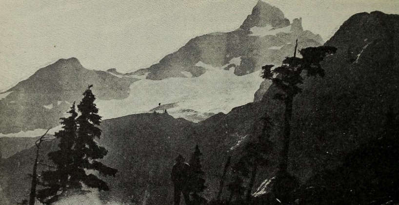
Elkhorn from the fly camp at timberline – H.O. Frind photo.
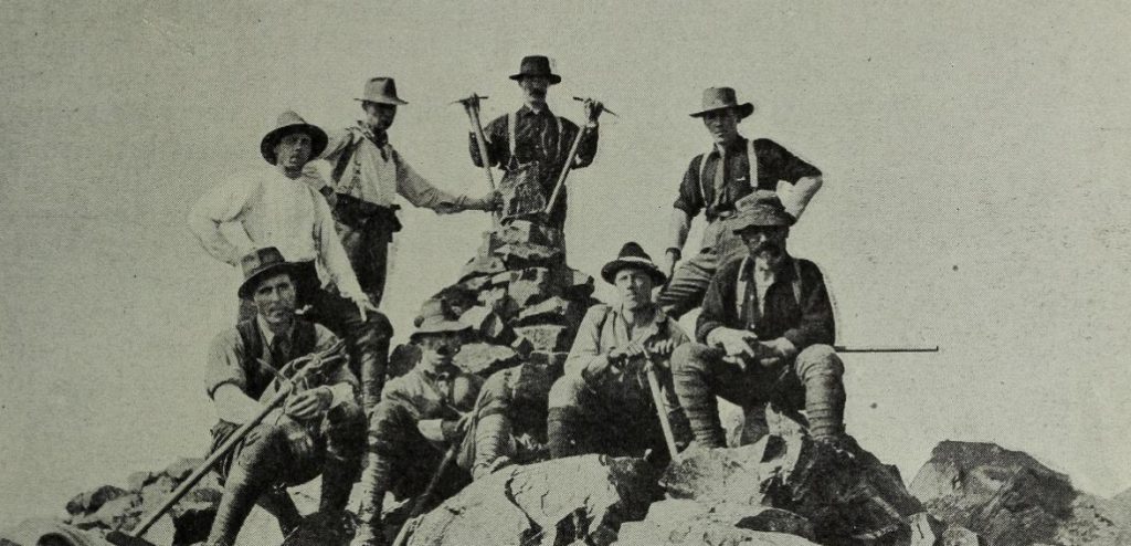
The party that climbed Elkhorn, at the summit – H.O. Frind photo.
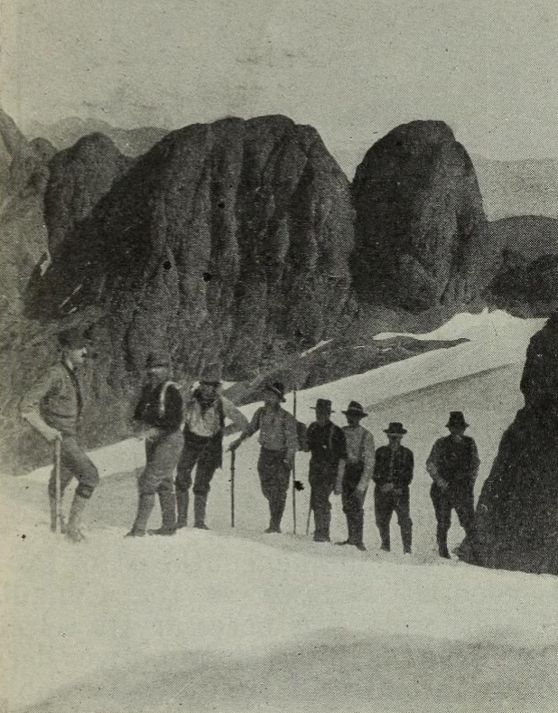
Crossing the snowfields on the way up Elkhorn – H.O. Frind photo.
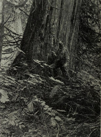
Among the big cedars in Strathcona Park – H.O. Frind photo.
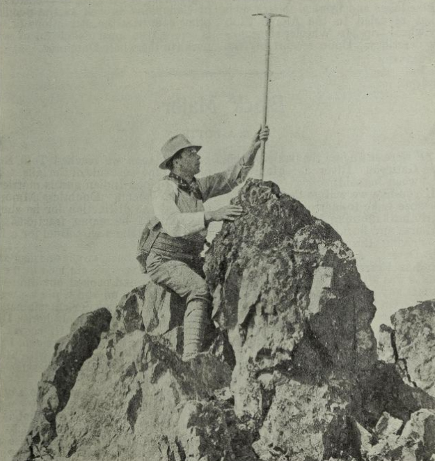
The summit of Elkhorn: Where’s Wilson? – H.O. Frind photo.
Strathcona Park
Reported in The Daily Colonist Saturday January 18, 1913, p.5.
“And not only has Vancouver Island considerable areas of good farming land as well as its recognized wealth of timber, but we have also here one of the most beautiful and attractive natural parks in Western America—Strathcona Park. I should like to direct your attention, sir, for a few moments to the great parks in the United States—for instance, Yellowstone, Rainier, Glacier and Yosemite. These have a combined area aggregating 6,796 square miles, while on this side we only have Banff, 166 square miles, and Strathcona, approximately 500 square miles. This is to say, we have at present only 766 square miles against 6,796, and only 500 square miles of these in British Columbia. The state of Washington has spent $350,000 in roads leading to Rainier Park. During the past year nine thousand visitors entered this park, and it is estimated that these people left in the state some $500,000 in this one year. Now in Strathcona Park we have all that Rainier has to offer and a great deal more. We have all the features of attraction found in the various parks of the other side—a series of most beautiful lakes, an interminable succession of glaciers and snowfields, a large number of waterfalls, some of remarkable beauty. We have show timber—abnormally large firs and cedars in numbers that cannot be duplicated anywhere. We have game fishing that must satisfy the keenest sportsman. The mountain peaks are easy of access, and will give the alpinist every class of climbing that his heart desires.”
Illustrated Lecture on Strathcona Park
Reported in the Daily Colonist Tuesday January 21, 1913, p.17.
Mr. Arthur O. Wheeler, president of the Alpine Club of Canada, will give an illustrated lecture on the “Alpine Areas of Strathcona Park,” to the B.C. Superintendents in Victoria on the evening of Thursday February 14 and will be followed by an address on Strathcona Park development by Mr. Reginald H. Thomson, the Government engineer in-charge of the project.
Described Climbs in Cumbrian Mountains
Members of Alpine Club Says Attractive Diversion May Be Found There
Reported in The Victoria Daily Times Thursday January 23, 1913. p.15.
William W. Foster, chairman of the local branch of the Alpine Club of Canada, presided at the meeting of the society held on Tuesday evening at the Alexandra Club, also introducing the speakers of the evening. The first of these was Mr. Alan Morkill, who described his climb, one of the first recorded up Mt. Garibaldi, which is one of the most difficult climbs in the Coast Range. The speaker illustrated his talk with some limelight views which showed some of the difficulties which the climber had to surmount while completing the ascent, and also showed some specimens of the flora found on the mountain. The second of the evening was the paper on “Rock Climbing,” read by Mr. Horace Westmorland, who in justifying the popularity of this particular branch of mountaineering, gave a very entertaining description of some of the difficult ascents to be found in the Cumbria Mountains. Although the altitude of these mountains was something less than 4,000 feet in the highest parts, rock climbing of the highest order might be found for the diversion of the climber, some of the better-known cliffs rising to a height of 600 feet, the way being made interesting and difficult to negotiate through the familiar gullies, chimneys, clefts and noses which diversify them in character. The oldest and most popular of the climbs was that known as the “North Climb” of the Pillar Rock, this, in addition to the magnificent climb itself, affording a wonderful a wonderful view of the Emmerdale valley. Another splendid climb was that up Napes Needle, on Great Gable Mountain, from the summit of which—though but three people could find footing simultaneously on the narrow point—a splendid view of the Napes Ridges and Eagles Nest Arete, itself a very fine climb, could be obtained. Other splendid climbs in the same district were mentioned, the speaker concluding his paper, however, with a description of a climbing holiday in the Austrian Tyrol, an account of which had been published in his school magazine on his return. This story of his climb in the Dolomites, read by Mr. Westmorland from the school magazine proved one of the most entertaining parts of his talk, the ascent of the Kleine Zinne, being described so ‘vividly’ that the audience could almost see the dizzy heights of the summit. Like the previous speakers, Mr. Westmorland amplified his description by showing a number of views of the peak described. Mr. William Foster during he evening showed a number of views of Strathcona park, which was entered last autumn by some members of the Alpine Club. A number of pictures of the beautiful Lake O’Hara, where the club camp is to be held next summer, were also exhibited. The proceedings concluded in a social manner by the serving of refreshments. The next club meeting, which will be on Tuesday evening, February 18, will probably be featured by a paper by Mrs. Julia Henshaw, the well-known botanist, who will describe the flora of Strathcona park as analyzed by her last summer when she went with the party there.
Alpine Club’s Meeting
Reported in The Victoria Daily Times Saturday January 25, 1913. p.18.
To the Editor—On page 15 of this evening’s (23rd) paper is a description of a meeting of the Vancouver Island branch of the Alpine Club of Canada on Tuesday evening. I wish to make a correction. It was Mr. John Howard Chapman who show and described the views of Strathcoan Park, Lake O’Hara in the Rockies, and other places on Vancouver Island. We also had to thank Mr. Chapman for lending and working his lantern for the whole evening.
Frederick V. Longstaff, F.R.G.S. Captain
January 23, 1913.
Canada’s Mountain Wonderland Shown
Director of Alpine Club Gives Interesting Lecture Before Natural History Society of British Columbia
Reported in the Daily Colonist Wednesday January 29, 1913, p.3.
Mr. Arthur O. Wheeler, director of the Alpine Club of Canada, gave an address to the Natural History Society on Monday [January 27] evening on “Canada’s Mountain Wonderland” the mountain ranges of British Columbia. He described the original formation of ranges and the process of sculpture by which these have been cut into the towering peaks we now see, the dazzling snowfields, the wild gorges with their impetuous foaming torrents, the lovely lakes and among them the grassy tracts with their profusion of brilliant alpine flowers, which will delight the beholder and repay them for the long journey hither from Europe. As to how the mountains were formed, he said that the inner mass of the earth shrank, leaving the crust outside too large for it. The pressure of the Pacific Ocean was too great to be sustained by the unsupported crust, which crumpled under the pressure, the first folds to be formed being the Coast Range and the Selkirks, and later another great settling threw up the Rocky Mountains. These folds or crumples are made up of sedimentary rocks pushed inward from the sea shore, for the mountain ranges have not been thrown up hot, from the centre of the earth by volcanoes as is often mistakenly supposed. The ridge, folds or crumples lie in lines from northwest to southeast and have a precipitous face inland to the northeast. At this precipitous face the strata have been broken across by the formation of what called faults; one is well seen in Banff. Then when these ridges or ranges are formed Nature at once begins to cut them down “weathering” them on a huge scale by rain, wind and snow till they are cut through by ravines and valleys and the remaining portions are left as magnificent pyramids, castles or pinnacles, the mountains we so admire. Evidently the greatest agency in erosion is water, particularly frozen water, in snow. Snow piling itself up (50 feet has fallen in a year in the Selkirks) keeps on crushing and crushing the lower layers till they fuse into ice, which under this great pressure becomes plastic and flows now becoming a glacier, always downward, and with this great pressure behind it, and the extra help it gets from stones, rocks and boulders it has broken off and is carrying with it scores out and always widens its channel, from which a ravine becomes a valley, isolating its parent peak ever more and more. Mr. Wheeler showed some wonderful pictures, taken at high altitudes where there are violent winds and quantities of snow. As it is driven against the rocks it sticks to them and forms wreaths outside them in very insecure positions; these are called cornices, look safe and tempting, have no support below and may lure the mountaineer to trust them, and they fall him to his destruction. A very steep glacier from Mount Robson was shown 5000 feet high, with a turquoise-blue lake at the bottom of it. Cloudy days suit climbing best at these high altitudes (Mount Robson is 13,000 feet), for then the surface is hard and there are fewer avalanches. When Mr. Wheeler was climbing Mount Robson with three other men, they were resting at a point but decided to move a little further on, and in five minutes after they saw an avalanche sweep over their previous halt, which shocked them, for, as the guide, who alone spoke, said: “We should have been killed.” As a glacier in its descent falls over a ridge, which in a water-river would have meant a waterfall, the upper ice cracks and gapes, forming a crevasse, and the ice on a glacier, cracked and strained, arranges itself in pinnacles, columns and fantastic shapes. They are on a huge scale. Yet when a visiting lady saw them at Glacier and was asked about it, she said she did not think very much of that. She thought the C.P.R. should have spent its advertising money to better advantage then it cutting the ice into shapes like those. Running water has done something in the sculpture of the district as in the gorges of the Selkirks, where the river runs underground threw crystalline, limestone or marble for a mile through caves that are quite dark but brilliant with their white interior when lighted up. Here travelling in the dark is quite impossible. Mr. Wheeler did his exploring with a bicycle lamp, but once he and his guide crossed a log bridge together they were dropped into the water, their lights were extinguished. They could not get out in the dark and their matches were wet. By drawing the edge of a knife over the match head, however, they managed to light one and won back to the world. Pictures were shown of Lake Moline [Maligne], Ottara [?], Louise and the others, of the gorges of the Yoho, of pinnacles among the conglomerates, and the Eagle’s Eyrie, and the society was so delighted with the lecture that they stood up to emphasize the strength of the vote of thanks they passed to Mr. Wheeler for coming to address them on so fascinating a subject. In his reply he emphasized the publicity the Alpine Club of Canada gave to the Province, bringing here every year great climbers from foreign lands, besides giving cheap holidays in its camps to some of the best workers in the Province.
Alpine Club Notes
Reported in Rod and Gun in Canada Vol. XIV, No. 9, February 1913. p.940.
The first meeting for the winter session of the Vancouver Island Section of the Alpine Club was held at the Alexandra Club, Victoria, on December 10th. An attendance of 35 showed that the interest in the Club was unabated. Mr. William W. Foster, Deputy Minister of Public Works, was in the chair and called on the local secretary [Fred Helm] to read his report of the last season’s work and also the statement of accounts, both of which were found to be highly satisfactory. The next item of business was the election of officers for the ensuing year. Mr. Foster was re-elected Chairman with enthusiasm. Miss Jennie L. McCulloch (912 Linden Ave., Victoria) was elected Local Secretary and Mr. William S. Drewry was elected Vice-Chairman. The Committee was re-elected as a whole. Mr. Arthur O. Wheeler, the Director of the Club, gave a concise account of the Club’s work during the past season and called attention to the steady and vigorous growth in membership. Mr. Foster, in introducing Miss Jennie L. McCulloch, who read a paper of the expedition made by the Club in Strathcona park, Vancouver Island, said that owing to the reports and results of the Club’s work, the British Columbia Government had decided to enlarge the boundaries of the park very considerably, so as to include all the more attractive points. Miss McCulloch’s account of her experiences was bright and charming, showing that keen appreciation of the open-air life which is so strong in Club Members. Mr. Hebert O. Frind of Vancouver read a paper giving an account of part of the expedition which Miss McCulloch had not seen. Mr. Wheeler read Mr. Edward O. Wheeler’s account of the first ascent of Elkhorn Mountain by nine members of the Club and Mr. John G. Cory Wood, M.P.P. for Alberni, gave interesting details of his experience at various times in the park. Refreshments were served and a most successful evening came to a pleasant conclusion.
Alpine Club Notes
Reported in Rod and Gun in Canada Vol. XIV, No. 10, March 1913. p.1126.
At a regular monthly meeting of the Vancouver Island branch held in Victoria on January 21st two papers were read, one by Mr. Horace Westmorland on rock climbing in the mountains of Cumberland, England and also in the Dolomites, illustrated by photographs by the Abraham brothers of Keswick with whom Mr. Westmorland climbed. The second paper was read by Mr. Alan Morkill and described climbs in the mountain country at the head of Howe Sound. This paper was accompanied by some very fine photographic slides of the country. Mr. John Howard Chapman showed varied slides, mostly colored, of mountain scenery, the majority being of Strathcona Park.
Alpine Club Camp
Reported in The Victoria Daily Times Wednesday March 5, 1913. p.13.
The members of the Alpine Club of Canada are making arrangements for a camp on Mount Robson this year, and applications from the members who wish to participate in the trip next June are being received by Miss Jennie McCulloch, the secretary here. The number of those who will be allowed to join the party is necessarily limited, but it is expected that of the eight hundred members, about eighty will be in the Rockies this summer.
Alpine Club Holds Its Annual Banquet
Interesting Speeches Upon Provincial Development are Made by Hon. Dr. Young and Mr. W.W. Foster
Reported in The Daily Colonist Friday March 28, 1913, p.7.
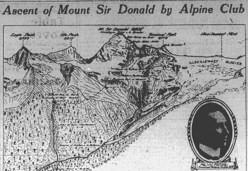
Illustration of Mount Sir Donald
The menu card—to which the above drawing fails to do even approximate justice—was in itself a work of art and very distinctive originality. The idea originated in the fertile brain of Mr. W. [William] W. Foster, his artistic collaborator being Mrs. G.P. Napier, by whom each card was painted in watercolors. The route of the diners through the various courses, it will be noted, is identically that followed by the first conquerors of Mount Sir Donald, in the Selkirks, by Messrs. Huber and Suizer, in 1890. More than this it will be noted that the start is made (as is requisite in all Alpine Club ascents) at 4 a.m., a first rest-halt for light refreshment being made at the first prescribed halt in the Sir Donald climb. The fish brings the climbers to the origin of the Illecillewaet River, and the entrees to the verglas—the binder between the ice and the native rock. Then on, over the scree to the massif, and on and on and up and up, until the crown of the monarch is gained, and duly honored in the champagne cup, a short halt being appropriately called ere the descent and dispersal for coffee at Terminal Peak. The menu is adorned with the Alpine Club colors, and with strict official correctness, inscribed with punctilious exactitude “Route Map No. 2” (this being the second annual pre-gathering of the club.)—Empress Edition.
Interesting Speeches Upon Provincial Development Are Made by Hon. Dr. Young and Mr. W.W. Foster
The scenic beauties of Vancouver Island and the Province of British Columbia generally featured in a series of interesting speeches delivered last night [March 27] at the annual banquet of the Victoria section of the Alpine Club of Canada, held in the Empress Hotel. The chair was occupied by Mr. W. [William] W. Foster Deputy Minister of Public Works, and he was supported by the Hon. Dr. [Henry] Young, Minister of Education, Mr. [John] Cory Wood, M.P.P. for Alberni, and Mr. R. [Reginald] Thomson, the engineer employed by the Province in connection with the laying of Strathcona Park. The function was attended by about fifty people and proved to be most enjoyable. The Province of British Columbia was the leading toast of the evening, and the proposal fell to Mr. C. Wood, M.P.P. for Alberni, who declared that the alpine features of the country were unsurpassed anywhere in the world. At the present time their beauty was known to only a limited few but as time wore on there was no reason in the world why the people who annually went to Switzerland in search of fresh air and the healthy exercise of mountaineering should not come to this part of Canada, where he was sure they could obtain more for their time and money than was to be offered in any other country. Hon. Dr. Young, responding to the toast, thought that the Province was even now coming into its own. During the past twelve years he had been greatly interested in the Province and had taken some part in its development and yet he felt sure that in 1913 they were only beginning their official life. In former years they could transact the business of the Government in a very few hours but today the office of cabinet minister was no sinecure. The country was growing rapidly and with the growth came interesting responsibilities, and he was happy to know, he said, that the development was not unequal. It was taking place all over the country, from Atlin to the Delta and from Victoria to the Kootenay country.
Live In Rich Country
“We live in a rich country. It is an empire in itself, and we do not realize yet the enormous potentialities it possesses in its natural resources. In time to come British Columbia will support millions of people. So far, its development has been along the line of least resistance. I mean by that that the population has followed the lines of transportation. That course will continue to be followed and in years to come with the many branch lines that must inevitably be constructed this Province will be opened by an immense multitude of people. But just how rapidly we are growing is scarcely appreciated, I think. Just consider that in ten years we have all our debts, and that in addition to that we have today a cash balance of eight million dollars is in the bank. Our credit stands higher today than that of any other province in the Dominion, and one of the chief reasons is that we had the foresight to establish a sinking fund to meet our bonded in debtedness. The Alpine Club of Canada” was proposed by Mr. W.W. Foster, who stated that since the inauguration of the club astonishing progress had been made. At the start a good many people had expressed their diffidence on the subject of the ultimate success of the club, but today they were assured. He reminded his hearers that the club was not a local institution, and that it did not exist for the attainment of one single object. “It has a large mission. It has a scientific side, which I am sure, is appreciated by at least its membership, as well as a pleasure-seeking side, which is, of course, obvious,” he said. “In its essence and meaning the club is a provincial and national asset, inasmuch as it is devoted to the capitalization of the scenery of the country. The fact that a great asset does exist to the possession of our wonderful scenery has come very prominently to the front in recent years. We realize that it can be made revenue producing and it is one of our objects to bring that idea to fruition. There are two important considerations in that work. They are the publicity and transportation. The club is doing an excellent work in regard to publicity, and I think that the work the various transportation companies in conjunction with the Provincial Government, will finally result in the creation of the necessary conditions.
Demands Are Enormous
“It has been said by some that we are not making use of our scenic asset; that we are not encouraging the people of the older countries to come here and see what we have in this part of the world, but in that connection I think it I wise to remember that the demands of a growing Province like this are so enormous that we must move carefully. Considerable money is being spent by the Provincial Government upon roads in the Province this year, and when it is considered that these appropriations have been made in spite of the heavy concessions that have to be made in other directions, it will, I think, be admitted that the progress being made is admirable. As a club, we are greatly interested in the road question, because it is impossible for the people who come here to get to the real beauty spots.” He referred briefly to what is being done in the two provincial parks, the Strathcona Park and Mount Robson Park. Mr. A. [Arthur] O. Wheeler submitted a report of the work of the past year, which he showed the club to be in a more prosperous condition than ever. The membership is now 800. Mr. R.H. Thomson spoke briefly about the wonders of the Strathcona Park. He advised caution in regard to the development of the resorts, and said that until they had accomplished what they had in hand it was idle to discuss other possible reserve grounds of beauty. Mr. S. [Stanley] H. Mitchell proposed the toast of the guests, which was responded to by Mrs. J. [Julia] Henshaw. The menu, a charming work of Mr. Foster’s, represented the climb of Mount Sir Donald, the various stages being landmarked with the several courses.
Alpine Club Holds Its Annual Banquet
Guests Make Reference to Provincial Scenery a National Asset.
Reported in The Victoria Daily Times Friday March 28, 1913. p.10.
“The ascent of Mt. Sir Donald,” as announced on the map-menu of the seventh annual dinner of the Victoria section of the Alpine Club of Canada, proved a most delightful occasion for both members and guests, the event taking place in the private dinning room at the Empress Hotel last evening, and being followed by a number of interesting addresses from prominent members of the organization and their guests. About forty guests were present, and a charming scheme of decorations was effected with vases of crimson carnations on the tables, and great pots of spirea place about the room, while the place cards and menus were decorated with the club colors of silver, green and white. Willam W. Foster, president of the local branch of the organization, acted as chairman and toastmaster, while among the prominent members of the Alpine Club of Canada, present were Arthur O. Wheeler, director and founder of the organization; Stanley H. Micthell, secretary-treasurer; and Mrs. Julia Henshaw, vice-president of the Vancouver branch of the society. Among the guests were the Honorable Dr. Young, minister of education; and John G. Cory Wood, M.P.P., for Alberni; and Reginald H. Thomson. Messages of regret at their inability to be present were went by His Honor the Lieutenant-Governor, the Premier, the Attorney-General and the Honorable Thomas Taylor.
Toast To the Province
The first toast of the evening following that of “The King,” was that of “The Province of British Columbia.” John G.C. Wood in proposing which referred to the beauties of British Columbia’s scenery, which, he said, surpassed those of any other province in the Dominion. The Alpine features of Strathcona park were as fine as anywhere on the continent, and without needing to go even so far afield the Alpinist would find some magnificent climbing and wonderful scenery at Mt. Arrowsmith—a more local effort of which he would like to se attempted by the members of the club. Dr. Young, in responding to the toast, said that although not actually a member of the club he considered that he had long ago fully qualified for this through his tours about the mountains in the various parts of the province. The remark made by Mr. Wood that the province was coming into its own was only partly true: a cabinet minister’s work today was no sinecure; the country was forging ahead at an incredible pace, and the work of development was not being confined to any one section or to any one of the country’s resources. William W. Foster, in the absence of Mr. Merkle, proposed the toast “The Alpine Club of Canada,” paying tribute of praise to the energy the director, Mr. Wheeler, to whom so much of the success and esprit de corps of the organization had been due. The club was doing much to capitalize the scenery of the country. The scenery should be made revenue-producing, and it was one of the objects of the Alpine Club to emphasize that fact.
Scenery Should Be Exploited
Switzerland, France, New Zealand and other countries had derived annually enormous revenues through exploiting their scenery; why could we not do the same. Director A.O. Wheler, responding to the toast, gave an interesting resume of work done during the past year by the club, speaking with the sincerity of a true lover of the hills of the great beauty of the Canadian mountains. In reviewing the position of the club, Mr. Wheeler called attention to the steady growth in membership which now stood at nearly 800, one of the ten honorary members of the organization being Dr. Charles Walcott, secretary to the Smithsonian Institute, recently elected to fill the vacancy caused by the death of the late Edward Whymper. Sympathetic reference was made to the death during the past year of Dr. Arthur Benson, and Lister Pim, both of Dublin, who were guests at the 1909 camp at Lake O’Hara. The Banff Club house was referred to as being the strongest visible evidence of the Alpine Club of Canada, and would have to be maintained whether it paid or not. Arrangements were being made for the building of a new dining-room to replace the tent house addition, and two more tent houses would be added to the accommodation there. The late Edward Whymper had left a legacy of fifty pounds with which it was proposed to erect a memorial in the form of a drinking fountain at the Banff house.
1913 Programme
After reviewing the camp work at Vermillion Pass and Strathcona Park camps last summer, Mr. Wheeler proceed to outline the 1913 programme. The Banff Club house would be opened on June 15, and would be kept open until the middle of September. A new departure would be inaugurated in the holding of two camps at widely distant points, one of which would be at Lake O’Hara Valley, from July 15 to July 26, and the other at Robson Pass from July 28 to August 9. Both sites were magnificent, and would afford some splendid climbs
More Truly National
In conclusion Mr. Wheeler emphasized the statement that he would like to see mountain parks of Canada made more truly nation, and made into real recreation grounds for the men and women of the Dominion rather than as earning media for those corporations that have large financial interests in them. Other toasts during the evening included that of “Our Guests and the Ladies,” proposed by Mr. Stanley Mitchell, who spoke appreciatively of the presence of Mrs. Julia Henshaw, better known as a botanist, perhaps, than as an alpinist. Mrs. Henshaw, who was greeted with hearty applause, responded, expressing her appreciation of the hospitality extended to her as one of the guests. The final toast of the evening was that to the Press, proposed by W.W. Foster, and responded to by Miss Ethel Bruce and Mr. Churchill. A programme of songs was given at intervals during the evening, among those taking part being Mr. Horace Westmorland, who sand “Sons of Araby,” and an Irish song; Miss Jean Mollison and Miss. D.E. Campbell, a number of charming Scotch songs and Miss Bruce, Mrs. A Lawder making a sympathetic accompanist. The proceeding concluded shortly after midnight with “Auld Lang Syne,” and the national Anthem, followed by three cheers for the chairman.
Victoria Peak—Most Lofty Mountain of The Island Wonderland
Reported in The Daily Colonist (Sunday Magazine) Sunday March 30, 1913, p.1 & 2.
Front page of the Daily Colonist Sunday Magazine, March 30, 1913
On the first page is presented what is believed to be the first near photograph ever take—it unquestionably can have no superior—of that monarch of the Vancouver Island Alps, Victoria Peak, so far as is known the most lofty mountain on the Island wonderland. The artist-photographer is Mr. Henry Schupp, C.E., who has just returned from a season afield in the territory of which Victoria Peak is the dominant feature, its snowy crest rising 7,484 feet in clear air. The locality upon which this giant mount looks serenely down lies to the north of Campbell River and of Crown Mountain, and therefore outside even of the extended boundaries of Strathcona Park. Crown mountain was for years improperly accorded rank as the most lofty mountain on Vancouver Island. Exploration and investigations of recent date, largely in connection with the survey and development of Strathcona Park under Col. R. [Reginald] H. Thomson, have fully proven this distinction undeserved, however, and geographers and surveyors now agree as to the pre-eminence among its fellows of Victoria Peak—so far as altitudes on the island have as yet been determined—its summit rising above sea level seven thousand four hundred and eighty-four feet. Its serious rivals in the Island Alpine territory at present explored include Mount Albert Edward, 6,968 feet, and Mount Alexandra [Peak], 6,394 feet, whereas Crown Mountain is credited with but 106 feet superiority over Mount Arrowsmith, the joint pride and joy of the rival Alberni’s and the distinctive feature of their superb scenic setting. Not only is Victoria Peak the monarch of the Island mountains in point of altitude, but it presents, according to Mr. Schupp and others who have invaded its environs, the maximum of difficulty to the adventurous climber, with its precipitous and even overhanging heights, its giant chimneys, vast crevasses and everlasting snows. During the trip, too, Mr. Schupp had the misfortune to all but sever a toe, while hastily wielding a double-bitted axe during the formalities of making camp. There was no hope of saving the toe, so Mr. Schupp completed the amputation with a pocket knife, gave the stump a woodsman’s rude attention—and even went on with his work afield. Such is the mettle of the engineer on frontier duty.
Visited Mount Arrowsmith
Reported in The Victoria Daily Times Tuesday May 13, 1913. p.2.
Ad for “New Map of Alberni and Mount Arrowsmith” by Captain Longstaff. $5.00
Pictures Future of Strathcona Park
R.H. Thomson, Provincial Engineer, In Lecture at Vancouver, Describes Its Marvelous Beauties
Reported in The Daily Colonist Sunday June 11, 1913, p.17.
“Switzerland annually receives millions in revenue from her mountain scenery and I see no reason why we should not do so within the next few years,” said Col. R. [Reginald] H. Thomson, Provincial Engineer of Strathcona Park, during the course of a lecture at Vancouver, on Friday evening. There was, he added, everything in the island area that would appeal to the mountain climber. There were peaks of great height, crevasses, glaciers and “Chimneys,” a narrow opening in the rock in which mountain climbers delight. Strathcona Park, he said, would be made a place to which tourist the world over would be attracted. Camping places along the sides of the many lakes would be improved and put into proper condition. The large number of small lakes just west of the Beaufort Range of mountains, said the lecturer, would be surrounded with camping settlements. Here children would be able to play close to nature, while all kinds of outdoor sports could be indulged in. The land would be piped, thus assuring the campers of an adequate water supply and of pure quality. The beaches about these lakes would furnish admirable places for bathing and swimming, he declared, while boating, canoeing and other aquatic sports would be fostered by the tranquil stretches of water which reflect the mountains close by. It is proposed of the Government, said Col. Thomson, to preserve all the curiosities of nature that would be found. Beaver dams and the work of the animals would be kept intact, so that people might see the real work of these creatures. The big trees which are in some cases over thirteen feet in diameter, would be left standing and proper supervision exercised to see that they were protected. Employees of Strathcona Park, he added, are now experimenting with flowers from the Himalaya Mountains to see if the same shrubs and roots can be grown in this Province. The flora in the park would, he thought, equal that about Mount Rainier to the south. Nowhere could the wishes of the Alpine climber be better satisfied than in Strathcona Park, he said in conclusion. The lecture was illustrated with nearly fifty remarkably clear stereopticon views, which had been taken for the most part by Col. Thomson on his trips of exploration through that wonderland on Vancouver Island.
Victoria Climbers to Scale Arrowsmith
Party Of Alpine Club Members Organize Trip For July 1—Twenty Individuals Comprise Mountaineering Outfit
Reported in the Daily Colonist Wednesday June 18, 1913, p.2.
The Victoria branch of the Alpine Club of Canada has arranged to take a party of twenty upon a climbing expedition, the objective being the scaling of Mount Arrowsmith, the beautiful and inviting earth and rock mound, that decorates the Alberni district. The party will leave the city on July 1, and it is calculated that three days’ effort will be represented in the climb. The trip has been organized by the club in order that the peculiarities of Mount Arrowsmith may be thoroughly explored. It is a very fine peak, rising to a height of nearly 6,000 feet, and comprising of many beautiful features. From the summit it is possible to obtain splendid and unique views of the Pacific to the westward and of the Mainland on the east side. It is remarkably akin in general features to some of the leading mountains on the mainland in that it is scored by glaciers and flanked by very fine snow fields. It is expected that as a result of this trip a large number of people will be introduced to visit this region, a feat which is now all the more alluring since the C.P.R. has constructed and opened a trail connecting the mountain top with Cameron Lake. Mr. W. [William] W. Foster, together with Messrs. [Alan] Morkill and [Horace] Westmoreland, the three officers of the club, will be in charge of the expedition and will each take a rope.
Climb Mount Arrowsmith
Reported in the Daily Colonist Friday June 27, 1913, p.6.
Tomorrow [June 28] some twenty members of the Victoria Branch of the Alpine Club of Canada will start out on a week-end climb of Mount Arrowsmith.
Alpine Club to Climb
Reported in The Victoria Daily Times Friday June 27, 1913. p.5.
The Victoria branch of the Alpine Club of Canada will spend the week-end in making the climb of Mount Arrowsmith. The majority of the members will leave for the Chalet on Cameron Lake tomorrow afternoon, while several other will leave the city on Sunday morning by motor. Camp will be reached on Sunday evening, and the ascent made during Monday. On Tuesday morning camp will be broken, and the climbers will return to town.
Ascend Mount Arrowsmith
Reported in The Victoria Daily Times Monday June 30, 1913. p.5.
Weather permitting the members of the Alpine Club of Canada will today make their scheduled ascent of Mount Arrowsmith. A large party of club members motored from the city yesterday morning to Cameron Lake, where a start was to be made from this morning. It was expected that the round trip would be made in the day, the climbers returning to the lake chalet in the evening and returning to Victoria tomorrow. The ascent and descent was to be held under the directions of William W. Foster, Deputy Minister of Works.
Climbing Arrowsmith
Reported in The Daily Colonist Tuesday July 1, 1913, p.6.
During the week-end a party of the Alpine Club of Canada members for Victoria have been making an ascent of Mount Arrowsmith under the guidance of Mr. William W. Foster, Deputy Minister of Public Works. On the Sunday the party left the city in motor cars for Cameron Lake, from which point the ascent was commenced. If all goes well, and the mountain has fallen before the aggression, the members of the party are expected to return to the city sometime today. Considerable interest was taken in the attempt, for, Mount Arrowsmith is not regarded as impregnable, or even dangerous, it offers a variety of hazards which require no little fortitude and endurance.
Leaving for Alpine Camp
Reported in the Daily Colonist Friday July 18, 1913, p.8.
Miss L. Whelan is leaving town this morning for the Mainland en route to Edmonton. While away she will join the Alpine Club and will climb Mount Robson. She expects to return to Victoria in about five weeks’ time. Miss Ethel Bruce who will also join the mountaineering expedition to Lake O’Hara, is leaving town tomorrow morning, and returning in about ten days.
Ascend The White Horn
Party Of Canadian Alpine Climbers Succeed In Reaching Summit Of Mountain
Reported in the Daily Colonist Sunday August 6, 1913, p.1.
Mount Robson, B.C., Aug. 5—On the same day as Mr. C. [Conrad] Kain, with his party of Canadian Alpine Club climbers, were returning victorious from the ascent of Robson Peak, Mr. Walter Schauffelberger was leading a party of three up White Horn, 11,101 feet, the highest peak in the White Horn range. The party included Mr. C.B. Sissons, Toronto; Mr. H. [Horace] Westmorland, Victoria, and Mr. B.S. Darling, Vancouver, and the climbers made the round trip, bivouac to bivouac, in 16½ hours. The only previous ascent was made by Mr. Kain, the guide who piloted the party to the conquering of Mount Robson, and who reached the summit of White Horn alone in 1911. Today’s party found the cairn built by Mr. Kain, on the topmost height, and within it a record enclosed in a match box, which read: “Konrad Kain, guide, Vienna, Austria, climbed in storm, August, 1911.” The party brought this record back to camp.
Mountaineering On Vancouver Island—Climbing Arrowsmith
Reported in the Daily Colonist (Sunday Magazine) Sunday August 10, 1913, p.1.
That the call of the everlasting hills is being heard and answered each year in Western Canada by an increasing number of clean-living lovers of Nature’s majesty and the mountaineering each year is becoming more popular in British Columbia are evidenced very significantly by the fact that the Alpine Club of Canada is this Summer holding two important camps in the eternal Rockies. The first, at Lake O’Hara, near Field, opened on the 15th of last month, continuing until the 25th. The second at Mount Robson, is still in progress, having opened last Monday and being programmed to continue until the 9th of this present month. This camp at Mount Robson marks the official opening of the park, which was formerly created by legislation of last session and the Provincial Government is being ably and popularly represented thereat by Deputy Minister of Public Works, Mr. W [William] W. Foster, with whom are a score or more enthusiastic Alpinists of Victoria and Vancouver. Representative mountaineers and travelers from the United States, Great Britain, the Continent, New Zealand and even the distant Himalayas are collaborating with their Canadian brethren to assure the complete success of this first camp in the Mount Robson section of the Rockies. The site selected for this season’s camps unfold panoramas of the most spectacular grandeurs of the Continental range and the programmes have been arranged with very special care. On Vancouver Island the opening up and development of Strathcona park is certain to give an immense impetus to mountaineering and the promotion of tourist interest in this portion of the province. The heart of the Island Alps abounds in every allurement to the lover of wilderness and its high places—gigantic, snow-crested peaks; magnificent glaciers; superb lakes; tumultuous torrents; incomparable beautiful waterfalls; primeval forest; rare treasures of mountain flora. When roads are completed giving access from the north and south, hotel and camping conveniences are arranged, this great playground of the people promises to be the strongest magnet on the Pacific Coast for the attraction of the lover of mountains. Outside the park boundaries there are also numerous magnificent peaks, usually isolate and difficult to scale—of which Victoria, some fifteen miles northwest of Crown Mountain, in the north, and Arrowsmith, in the south, are fine examples. Of Arrowsmith, the most lofty peak in the southern half of Vancouver Island, a magnificent view is obtained from the Island Highway between Nanaimo and Parksville, and of course from Alberni—the position of mountain as a background to the twin cities of Alberni being most picturesque. To reach Arrowsmith either by train or motor, Cameron Lake, upon the eastern shore of which a charming tourist chalet has been erected, is used as a base; whilst from the chalet a good trail seven miles in length takes the mountaineer almost to the base of the mountain itself, and at this point, too, a hut has been erected, to enable those who do not care for a seven mile walk before and after climbing, to have shelter overnight in case of inclement weather. Mount Arrowsmith has truly Alpine characteristics which, taken in conjunction with its accessibility, will ensure its popularity as it becomes better known. Whilst officials of the Dominion Government Surveys established a cairn upon No. 3 Peak, and the north peak has also been climbed upon several occasions by private parties, little information has up to date been available which could be used as a guide to lovers of the mountains making enquiry about Arrowsmith, and it was to obtain such data for the Club’s records—which are always available to the general public—as well as to provide an outing for the Vancouver Island section of the Alpine Club of Canada, that the recent expedition was undertaken. A party of twenty, including Miss L.A. De Beck, official representative from Vancouver, assembled at Cameron Lake chalet on the 29th ult., and found that, chiefly through the instrumentality of Mr. J. [John] G. Cory Wood, M.P.P., a member of the Club, everything had been arranged for an immediate start. The trip up the trail, following most of the way a stream which has its source in the snowfield area of Arrowsmith, giving as it usually does magnificent views across the valley to the seashore thence over the Island-studded sea to the Mainland, was unfortunately marred by a steady downpour of rain and clouds obscuring the views that would otherwise have been possible. However, around a fire at the hut, which had been supplemented for the occasion with a couple of tents, such troubles were soon forgotten, and interest centered in arrangements for the following day. Thirteen signified their intention of climbing; whilst the others under the guidance of the botanists of the party explored the woods of the vicinity. Contrary to what is sometimes expected good fortune smiled upon the thirteen and a fine day rewarded their determination to climb, “rain or shine.” Leaving the hut at an elevation of 4,220 feet in the early morning, short stretches of snow-slope and rock brought the party to the summit of a ridge from which could be seen across a valley containing a small ice-covered lake, the objective mountain, a snow ridge connecting the mountain proper with the point of which the party stood. Four distinct peaks give Arrowsmith a very commanding appearance, and it was decided to ascend the two highest—the centre ones. Roping into three parties, under the leadership respectively of Messrs. W.W. Foster, H. [Horace] Westmoreland and A. [Alan] B. Morkill, an ascent was made across the snowfield and then up the “Col” between peaks one and two. At 10:30, the party reaching the summit of No. 2 Peak, the aneroid reading showed an elevation of 5,750 feet. From this point one of the party crossed down to Peak 1, and then, all following the Arete south, made the main peak about thirty minutes later, the aneroid giving 5,800 feet. Through breaks in the clouds, magnificent views were obtained westward across Alberni and the Canal, winding like a ribbon from the western Coast line to the centre of the Island, north to Great Central Lake and thence across the Straits to the Mainland. A light lunch and then descent, two parties taking the steep snow “Col,” whilst the third essayed a rather interesting chimney to the snowfields below, then glissading down slopes whenever possible, a rapid return was made to the hut and on to the chalet where the whole party reunited. The usual camp fire being out of the question, the members gathered around a log fire in the chalet, compared experiences, exhibited specimens, and at an informal meeting decided that although the mountains of Vancouver Island have not the actual altitude of those in the Rockies and Selkirks, after allowing the initial elevation of the latter they made a most favorable comparison as regards Alpine characteristics, and that there is on the Island a limitless field for expeditions of the character of the one they had just proved so enjoyable.
Was Second Party at Top of Robson
Splendid Achievement Accomplished by W.W. Foster, Albert MacCarthy and Conrad Kain
Reported in The Victoria Daily Times Wednesday August 20, 1913. p.10 & 13.
The story how the fifty odd members of the Alpine Club of Canada made their way into camp at Mount Robson, the highest peak of the Canadian Rockies, of their varied experiences there, and more particularly of the brave attempts (in one instance successful) to scale the huge mountain of repelling rock and ice, is one of the most interesting in the annals of the organization. The splendid personality of guide and climber alike was once more proved, and the rugged stubborn spirit which has made mankind in the whole the conqueror of his environment was shown on its highest form to those who scaled the frowning cliffs in the face of fearful odds. Mount Robson was first viewed by the party on Sunday, July 27, from the railway station of that name on the Fraser River, when, in the full light of a calm and sunny sabbath morning the club alighted from the train at a point opposite the Grand Forks Valley and looking straight up the pass into the face of the red-ribbed, glacier-girdled peak climbed three years ago for the first time in the history of white man. The day was still, almost sultry, and the great irregular pyramid of snow and ice looked singularly fascinating through the glimmering heated air which reflected uncomfortably from rock and roadway. The first camp was pitched just two miles from the station, the long defile of hardy mountaineering men and women, carrying ice axes, alpenstocks, and with their packs strung in workman like fashion across their shoulders, creating quite a little sensation as it passed through a railway construction camp where the men were lazily passing away the long idle Sabbath. Dust rose in clouds as the party bore up hill, vanishing presently in the low bushes as they took the short cut into the base camp pitched just two miles up the Grand Forks River.
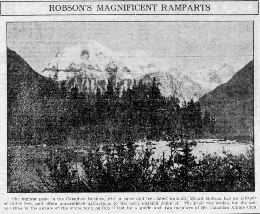
The highest peak in the Canadian Rockies, with a snow and Ice-ribbed summit, Mount Robson has an altitude of 13,100 feet, and offers unparalleled attractions to the more Intrepid Alpinist. The peak was scaled for the second time in the annals of the white man, on July 31 last, by a guide and two members of the Canadian Alpine Club.
Keen To March
Many who joined the Mount Robson camp had previously attended Lake O’Hara camp, and were in fine form for climbing, so that the first day’s enforced idleness in view of the climbing projects before them proved somewhat chafing; the members, however, spent the time investigating the nearby country and ascending a hill which gave a look down into the valley to be traversed the following day. Luggage was also carefully re-packed and reduced to the smallest possible weight, most of the campers keeping well within the forty pounds permitted each as the limit to be carried by the pack ponies. Next morning camp was early astir about 7 o’clock, everyone having breakfasted and got well on the way up the Grand Forks trail toward the Mount Robson camp proper, 16 miles distant. It was a picturesque and hopeful band who filed out through the aspen woods towards the land of their desire, the ladies as well as the men carrying their ruck-sacks on their backs, and provided therein with lunches and changes of clothes. The fair sunshine of the day before had vanished, and its place was taken by heavy mist and a steady fine rain. The trail, however, was good and the spirit of the mountaineer was equal to surmounting any such trivial thing as the elements. The whole party consisting of fifty-three members, twenty-one of whom were ladies and the remainder men. The first part of the journey was through light aspen forest and birchwood, from that the pathway later plunging deep into a lovely forest cedar. The route was a steady ascent, and it was not until luncheon time that the climbers paused for any length of time, their courage having been called on in a smaller measure on several occasions when the Grand Forks or some of its icy-watered branches had to be forded.
Guide Conducts Ladies
Conrad Kain, the plucky Austrian guide who afterwards added to his laurels by an exhibition of much greater bravery and resourcefulness, led a large detachment of the ladies, and showed great thoughtfulness in helping them to avoid the worst parts of the road. At one point he led his followers up the hillside to avoid a broad river flat which would otherwise have had to be waded across, conducting the trampers over the bridge at a point made historic by his own accident there on a previous occasion when he narrowly escaped drowning. The Chinamen, of whom there were several engaged as cooks and assistants about camp, were less fortunate at this point, and had a rather bad time of it wading the stream at the point further down. At Lake Kinney, five miles from the camp left in the morning, the party took a momentary rest and compared notes on their respective degrees of wetness, considerable laughter following a review of the travel-stained marchers. The beautiful blue-green lake, with its square-cut shoreline and fringe of cedar forest, was much admired, the prospect of Mount Robson, of which should have added to the beauty of the picture, being almost entirely veiled by the heavy trailing clouds which wrapped it round. To the north Mount Whitehorn showed up well, and prospective climbers, as they trudged along in the rain, speculated on ways and routes of negotiating the summit.
Stopped For Lunch
Just before entering the Valley of a Thousand Falls a halt was called, a camp fire being lighted, and the wet and hungry climbers unrolling their lunch bags and feasting on the simple fare as if it had been a splendid banquet. The occasion was taken as an opportunity for drying-out, and the journey was resumed under considerably more comfortable circumstances, the inner man as well as the outer refreshed by the rest and food. The Vally of a Thousand falls proved somewhat of a disappointment owing to the character of the day. The myriad spear-like or foamy-crested falls, which tumbled over the sides of the great cliff-walls of the valley lost much of their rumored beauty by the absolute absence of sunshine, and the vale was austere and gloomy and the depressing rather than, as it sometimes appears, a cool and quiet haven on a hot mountain day. Not far beyond the valley the leaders of the procession came within view of the famous Emperor Falls, with the headlong tumble of waters which makes such a magnificent sight. From the head of the giant waterfall to a single flat, less than a mile distant down the valley, the river drops 1,600 feet, many grand and magnificent water falls helping to make up the total of this great drop in the mountain torrent.
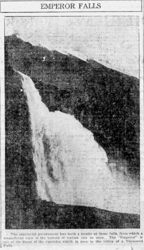
Emperor Falls
The provincial government has built a trestle at these falls, from which a magnificent view of the torrent of waters can be seen. The “Emperor” is one of the finest of the cascades which is seen in the valley of a Thousand Falls.
Berg Lake Reached
Continuing onward the party passed through a pretty open meadow such as might be found in some of peaceful valleys of the lowlands, shortly afterwards the observant leaders announced that Berg Lake was in sight. This news acted as a stimulus as it was known that camp, dry clothes and supper would be found at the other end. There were still some miles to walk, but the knowledge of the whereabouts of their destination, and a standard of measurement for striking off the remaining distance, assisted wonderfully in impelling the tired climbers forward to their goal. At this point of the journey, and while passing Berg Lake just immediately opposite the Tumbling Glacier, on the other side of the water, a huge weight of ice, part of the great mass which flowed down the opposite mountain side, broke away from the main glacier and fell into the lake, the big lips of icy water momentarily closing round it as it sank into the deeps below. A great wave, then a succession of waves, broke from the point where it fell and travelled across the bosom of the lake, breaking into a ripple-like surf just at the feet of the watchers and nearly half a mile distant from the seat of the disturbance. It seemed almost more than a coincidence that so rare an occurrence should take place just at the right moment for the accidental spectators to witness as they passed. Although the Berg Lake bore every evidence of its right to the title, being strewn almost from end to end with floating bergs of ice, the country on the trailside was beautiful with flowers, Indian paintbrush, wild aster and mountain heliotrope carpeting every open glade and meadow-land in a sweet riot of color. After circling the side of Berg Lake, which is two miles in length and 5,506 feet in altitude, the travellers tired, but growing more elate as the main camp was approached, came to the mile-long gravel flats, crossed and recrossed and netted over with almost frigid glacial streams. The thought of a chilly tumble in the waters was sufficient to nimble weary feet, and stream after stream was jumped with a dexterity worthy of a runner just newly socked.
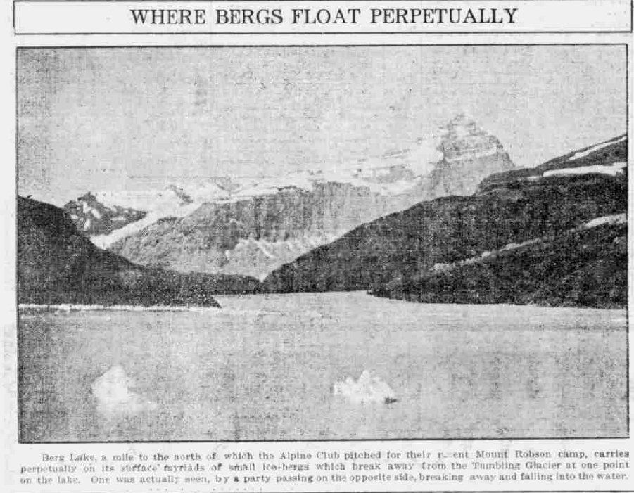
Where Bergs Float Perpetually
Berg Lake, a mile to the north of which the Alpine Club pitched for their recent Mount Robson camp, carries perpetually on its surface myriads of small ice-bergs which break away from the Tumbling Glacier at one point on the lake. One was actually seen, by a party passing on the opposite side, breaking away and falling into the water.
Camp Reached
At last, with indescribable joy, the white tents of the camp were reached, the hardier and swifter marchers already disburdened of their packs and busy preparing such luxuries as the camp could provide in the way of warmth, food and shelter for those who followed. This is one of the admirable characteristics of the camper. Rugged and hardy by nature, in man and woman alike, there is a splendid chivalry which makes for the highest camaraderie, the strong always ready to help the less strong without demanding either a claim to superiority or a right to condescension. Crackling fires, the welcome whiff of coffee and fried bacon, the whinnying of horses as the girths were unfastened and the lightening from pack-bags told them their day’s work was done; all the cheerful busy din of the camp so welcome to the ears of the weary mountaineer, gave the most cordial of greetings to the little detachments as they arrived closely one after another at the tented bivouac which was to be campers’ home for the next week.
Camping Ground Ideal
The pitch was proclaimed by one and all to be the most ideal spot ever chosen by the camp directors, a broad open flat, studded over with the many white tents, and threaded across by the mountain river which is such an essential commodity in a properly located camp, forming the camp site. The river flowed immediately at back of the fly-tent where the climber met at mealtimes and compared notes of the days’ events, either past or pending, the babble of the waters forming a pleasant and appropriate accompaniment to the conversation. Tired as they were after the long 16-mile ascent to camp, made between early morning and sunset, the travellers were soon restored to the best of spirits, and the evening camp fire which concluded the eventual day was attended by everyone—barring the Chinamen. These four in number, arrived two hours after the last of the club members trailed into camp, the Orientals being temporarily exhausted by the unwonted exercise, and all thoroughly disgusted with the whole business. Excited to a pitch rather in a Celestial, they were chattering in their voluble eastern manner under the stress of their feelings as they halted their way into camp, one of them expressing his views very forcibly when greeted by the director. “Lobson too high; everybody clazy.” Which, being interpreted, meant that he considered Robson too high and everybody crazy. Evidently the prospect of dwelling in the neighborhood of such maniacs as they considered the Alpinists to be perturbed their dragon-haunted souls for the remainder of the night, many of the lighter sleepers being kept awake by the excited jabber which they kept up until a late hour.
Robson Climbed
Although only a few climbers even attempt Mount Robson, the scaling of the great ice-crowned, rock-girt peak was the central topic of discussion. Originally it had been planned that two parties should make the attempt, but this idea was given up in favor of sending up but one at first under the guidance of Conrad Kain, the Austrian guide. The two chosen for the climb were William W. Foster, Deputy Minister of Public Works, and Captain Albert H. MacCarthy, of New Jersey, who with the guide, left the main camp on Wednesday afternoon, having spent the whole of Tuesday in resting and taking a few preliminary observations. They carried with them only clothing which they wore, their blankets, and some small rations of food, making straight for their bivouac grounds at Extinguisher Rock, at the head of Robson Glacier, and at an altitude of 6,500 feet, this leaving the climbers with the prospect of a total further 6,600 feet to climb before the summit of Robson could be reached the following day. They thought of failure never occurred to them, and with the simple fare with which they provided themselves the following morning when, leaving blankets and any other extraneous possessions behind them, they commenced at 4 a.m. to carry out their pathway to the summit of the defiant peak. Two ham sandwiches and two jam sandwiches apiece formed the total food supply which the trio had taken out from the main camp, this in itself being modest proof of the optimism with which they started upon their task.
Tells Of Great Climb
The following, which is Mr. Foster’s own account of the long climb, tells explicitly of the character of the climb which they ploddingly, and often laboriously, accomplished between early dawn and 5 o’clock in the afternoon, when they enjoyed a proud moment surveying the surrounding country from the summit of Mount Robson: “We left the main camp on July 30, and made a temporary camp in the moraine at the side of Robson Glacier,” said Mr. Foster in describing the first part of their journey. “Knowing that the climb would be a long and difficult one we decided to travel with as little equipment a possible, and cached practically everything in the temporary camp. Starting at daybreak, 4:15 a.m., we crossed the upper end of the glacier, ascending the outlying peak named “The Dome,” on account of its peculiar shape, and from its snow-covered top reached the bergschrund, which took some time to cross on account of its dangerous character. From the bergschrund it was a case of constantly cutting steps on the ice-covered wall chosen for the ascent, the wall being the southeast portion of the mountain; in one place 105 steps were cut on a 65-degree slope. At 12:30 the arete, which from the valley below appears to be part of and connected with the summit itself, was reached. It has an elevation of 10,500 feet, but we found when standing on it that the real climb had only just commenced, as looking westward the summit of Robson, a mass of gleaming snow and ice, was seen for the first time. The arete, worn down by exposure to a knife-like edge, could not be followed, and another attempt had to be made a little lower down on the south side of the mountain, the ice-domes being reached shortly afterward, although the peak itself had disappeared. A very strong cold wind sprang up and added to the discomfort of the climb about this time. To proceed further steps were cut in the great masses of clear green ice at the summit, and it took from 12:30 until 5:15 continually cutting steps and mounting upwards to reach the summit. Almost all the time we were in drifting ice and snow, which with the cutting cold wind, froze on our faces and hands and made the last part of the ascent most uncomfortable.”
Summit Reached
“Fortunately, however, the clouds cleared away during the last thirty minutes, and from the summit of Mount Robson a perfect view was obtained for seventy-five or more miles in every direction, showing an incomparable panorama of peaks, snow-field and glaciers, which from our superior altitude, appeared just like frozen waves on a lake, with little white crests wherever a line of snow-crowned peaks appeared. We had no field-glasses with us, these having been discarded in favor of the scheme of travelling light, but we appreciated what we saw, and had plenty to look at for the few minutes we remained on the summit. The return journey was commenced at 5:30 and Conrad Kain, the guide by whose energy and fortitude the step-cutting and other problems of the ascent had been surmounted, decided that it was not safe to return by the southwest slope, which we had taken in coming up, as during the day many avalanches had descended and carried away the steps that had been cut by us in the earlier day. It was therefore decided to traverse the mountain and go down the west face, steps being cut in the ice down to a hanging glacier, thence, owing to rapidly approaching darkness, to a shelf of rock cut out of the line of avalanches, on which we arranged to pass the night. The ledge was very narrow, and tying ourselves together to prevent accidents in the event of any of us becoming unduly restless in our sleep and rolling off, we passed the night in safety, although the roar of the avalanches as they crashed on to the glacier, the cold which we experienced owing to lack of blankets or any shelter, and the unyielding nature of our beds, did not conduce to comfort.”
Interesting Climbing
“However, the weather on the whole was good, and in the morning an early start was made. The southwest slope from the hanging glacier was practically all rock work, and ledge after ledge had to be descended by means of chimneys or whatever foot and handholds could be obtained. At 12 o’clock it was possible to unrope, shortly afterwards Kinney Lake being reached, and at 4:30 the main camp being made once ore, the party having made a complete detour of the mountain.”
Ovation At Camp
Those few who chanced to be in camp when the heroic climbers stumbled back to civilization once more sent up a cheer which could be heard through all the valley, and those anywhere within hearing came hurrying back to welcome the home-comers, who were supping on hot soup after their long fast. Hot baths and a short rest restored them to almost normal health, and at the camp-fire rallying that evening the three were the heroes of the hour. Two evenings later every member of the camp being present to hear the story of the great achievement, Mr. Foster narrated the particulars of the climb to a big circle of breathes listeners, all ardent climbers themselves, who thoroughly appreciated the arduous and strenuous character of the terrific climb so modestly appraised by those who had accompanied it. So intimately was the route described, and so accurately the various landmarks noted by the three men took their lives in their hands when making the perilous ascent, that future climbers will have a record by which to lessen the difficulties of the route. Despite this, however, there is little fear that Mount Robson will ever prove to be anything less than the giant peak of the Canadian Rockies, and it will still remain in the lonely achievement for the few accomplished and unusually rugged Alpinists rather than the resort of the tourist. Mount Robson park is full of things more appealing to the sight-seer, even more appealing to the average climber, and the great carved and ice-guarded dome of the great peak will remain sacred for all the time to feet of only the most intrepid and defiant of men. A second expedition, well-primed with information as to the route, and led by the same guide who had conducted the party of three of which Mr. Foster was a member, went out the following week with the intention of making Robson. Unfavoring elements, however, were their unhappy portion, and a snowstorm drove the party home before the summit was made.
An Attractive Country
Parties left daily for climbs in other parts of the district, Whitehorn, Resplendent and Rearguard forming interesting minor trips which were undertaken. The whole country is full of interesting geological features, while Alplands, glorious with flowers of the brightest colors, and spring-like in the mid-summer of their high altitudes, are the delight of the lover of botany and scenic beauties. On the Saturday evening following the expedition described by Mr. Foster, Dr. Walcott, at the camp fire rally, gave an interesting geological history of the mountain, and paid a tribute to the excellent map prepared by Director Wheeler for the Alpine Journal, in which the topographical features of the district are so well shown. Detachments of the campers left with their packers about the middle of the following week, and the camp disbanded just two weeks from the time of pitching, having been proclaimed by everyone who attended it to be the finest in the history of the Alpine Club.
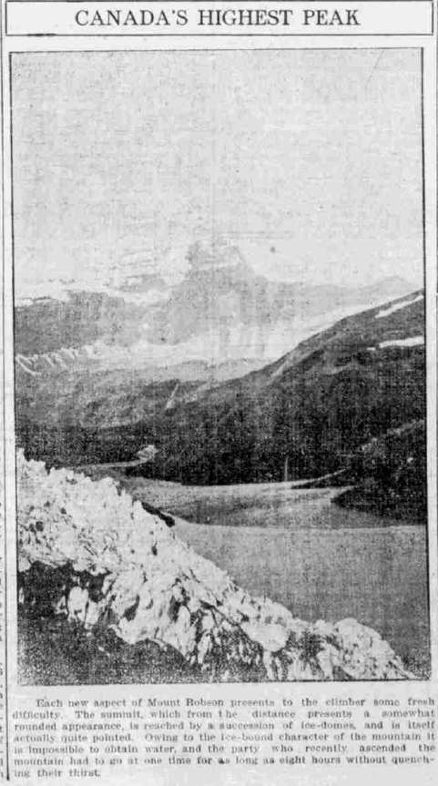
Canada’s Highest Peak
Each new aspect of Mount Robson presents to the climber some fresh difficulty. The summit, which from the distance present a somewhat rounded appearance, is reached by a succession of ice-domes, and is itself actually quite pointed. Owing to the ice-bound character of the mountain it is impossible to obtain water, and the party who recently ascended the mountain had to go at one time for as long as eight hours without quenching their thirst.
British Capital in Island Mine
Earl Of Denbigh and Party Take Up Ptarmigan On Bear Mountain—Quarter Of Million Dollars Figure In Deal
Reported in the Daily Colonist Tuesday September 16, 1913, p.14.
One of the best testimonials that the mineral worth of Vancouver Island has received gratuitously came with the announcement from Rudolph Feilding, the 9th Earl of Denbigh, who arrived in the city yesterday with Sir James Sivewright, Major Frank Johnson and Lady Marjorie Feilding, daughter of the Earl, that they have purchased the Ptarmigan Mine located on Bear Mountain on the West Coast, north of the Alberni canal, have already developed the property to the point of making it accessible and are now on the eve of placing the producing plant in operation. The Ptarmigan Mine is a copper-gold proposition, and the sale of it to the above-mentioned party involved the passing of about a quarter of a million dollars. The money has been subscribed by the few members of the party, and there will be no public issue of stock or anything of that nature. On the face of it, the transaction has the genuine ring that mining operations in this Province demand, and the fact that the enterprise is of a purely private character, and has been advanced so far without publicity or boastfulness of any description, may be taken as additional indications of the intrinsic worth of the proposition. Bear Mountain rises up to a height of something like 6,000 feet and the mining property is located near the summit. Bear Creek [Bedwell River] is the natural waterway that leads to the property, and already the small but influential syndicate has erected a pier or landing there so that when the mine is in operation, a consummation which is expected to develop about July of next year, there will be no difficulty about shipping the ore, which, by the way, will go to Ladysmith to be treated by the smelter of the Tyee Company.
South African Experience
All the members of the party, which include Mr. Hebert G. Latilla, Mr. H.H. Sutherland, Mr. H.F. Hunter, and Mr. J. [John] D. McLeod, are going up to have a look at the property today. They leave on the morning train for Port Alberni, and expect to return on Thursday. Realizing the difficulties of visiting the Ptarmigan on a time schedule, the Earl and his companions have charted the Queen City to go round the Island and bring them back from Bear Creek when they have completed their investigation. With the exception of the Earl and his daughter, the party of visitors consists of men who have had varied experiences in South Africa, the wonderful land of mining, and their advent in British Columbia on such a substantial mission cannot fail to carry significance. Sir James Sivewright, a Scotsman, is one of the best-known men at Cape Town. In his earlier days-he is now retired-he was a colleague of the great Cecil Rhodes, and gossip credits him with being the executive brain that carried to a successful issue many of the wonderful accomplishments of South Africa. He was a member of the second Government of Rhodes, in the capacity of commissioner of crown lands, and prior to that he occupied the onerous position at that time of being general manager of South African telegraphs. He was in that troublous country during the first Boer war, and his name is a household word throughout the great land that is now marching forward with the other Imperial units of the crown. In conjunction with Sir Henry William Preece, he compiled a standard book on telegraphy, which is regarded as an excellent authority today. Major Frank Johnson and Mr. Herbert Latilla are also well known at the Cape. Mr. Sutherland and Mr. J.D. McLeod represent the vendors of the property, and are accompanying the others. Mr. J. [John] G. Cory Wood, M.P.P. for Alberni, came down to the capital to meet the party, and is traveling with them today on the visit of inspection. An interesting talk on the scheme was given The Colonist last night by Major Johnson. “We have been working on this proposition for about a year,” he said, “and now we are very nearly ready to start producing ore. We have not made any noise about our intentions, because in the first place, that is not our way, and in the second place, there is no occasion for us to say anything. There are only a few of us in the mine, and as we do not want any more, and do not want any public subscription of stock, publicity was of no use to us. We expected to be actually producing ore this month, or next month at the latest, but we miscalculated on our difficulties in cutting a road through the bush. The landing is some miles from the base of the mountain, and while we have made splendid progress with the construction of our wagon road, we have some three miles to do. That will take a month or two, and the winter is coming on rapidly. I think it advisable to state that we will be producing by next July. That is certain, and there is no use giving out anything that is not so.”
Aerial Tramway
“Our aerial gear is at the base of the mountain now, and when we get there tomorrow, we will look into the matter of its erection. Of course, that has already been arranged for, and the work is going ahead, but we will be on the spot this time to see the first move in this direction. The placing of the gear in position will take some time, because five thousand feet is a considerable height. I may say that we purchased the aerial gear for this purpose from the Tyee Company, and I understand that it is in perfect shape. We intend to have it all fixed up as soon as possible after the winter weather ceases, and thereafter we will be in a position to produce ore. In that connection I may state that it is our present intention to ship the ore to Ladysmith, where we have an arrangement with the Tyee Company’s smelter. Just what this mining development will mean to Vancouver Island I cannot say, but I suppose it will be for good. The plant we have installed in the mine has a capacity of 1,000 tons of ore a day, whereas the smelter at Ladysmith is only capable of handling 700 tons a day. However, that may be remedied in time. Of the ore itself it may not be necessary to speak, but I affirm that it is of high grade. My brother, who is a prominent engineer of South Africa and who has visited a number of mines in Canada, came out here at our instigation and looked the thing over. We did not know exactly what to do about it, but his report was so enthusiastic that we decided to raise the money ourselves. He is out here now, and will stay with the property until it reaches the producing stage.”
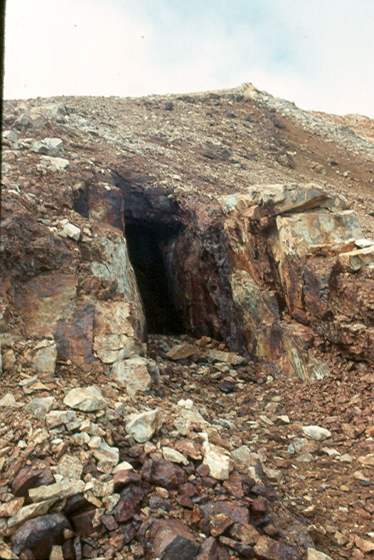
One of the several mine adits near the summit of Big Interior Mountain (1993) – Lindsay Elms photo.
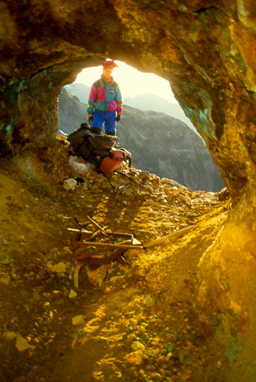
Looking out the adit used as a blacksmiths shop (1993) – Lindsay Elms photo.
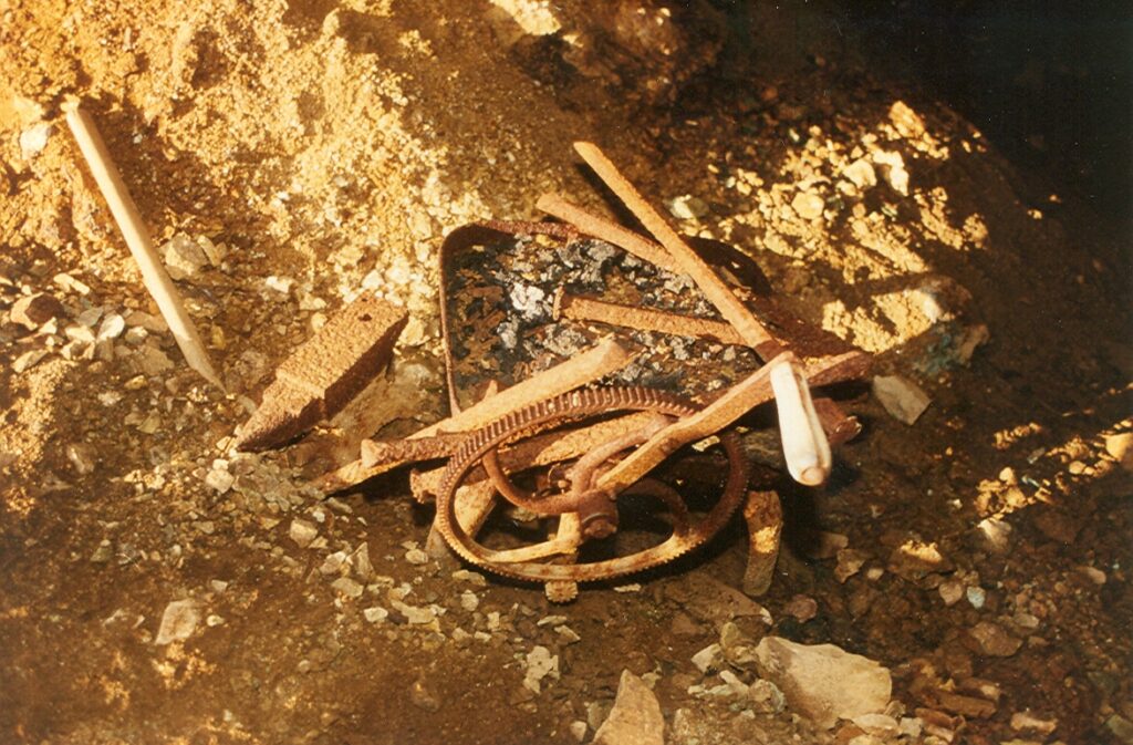
An old anvil and forge-blower in the blacksmith’s adit (1993) – Lindsay Elms photo.
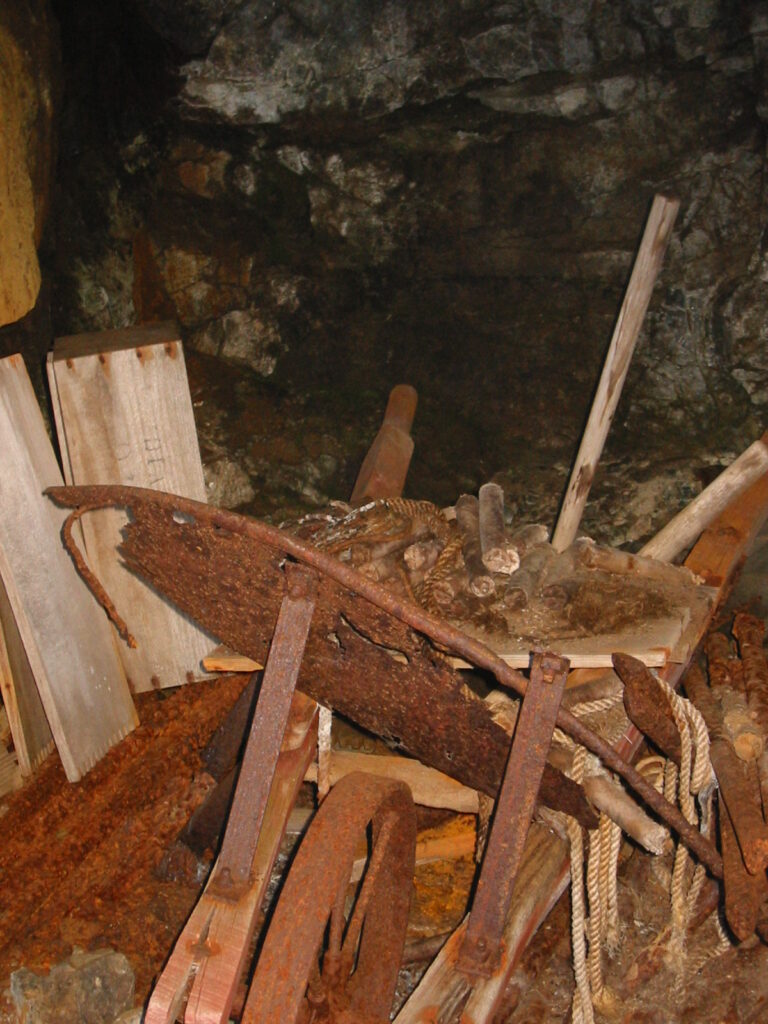
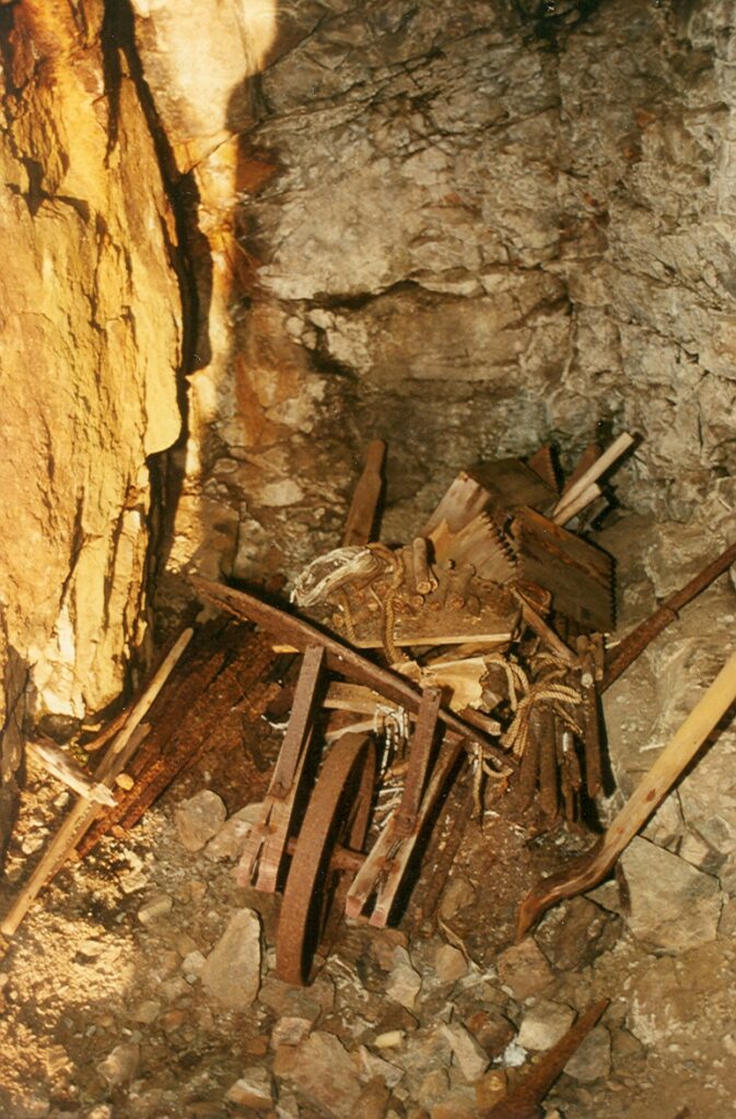
A wheelbarrow containing fuse wire and dynamite sticks in a storage adit on Big Interior Mountain (1993) – Lindsay Elms photo.
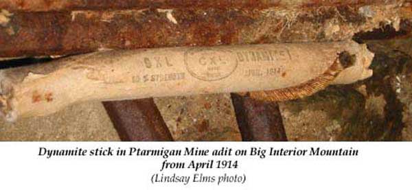
A dynamite stick in Ptarmigan Mine adit on Big Interior Mountain from April 1914 (1993) – Lindsay Elms photo.
Daring Exploits on Island Mountain Means Big Boom in District Mining
Sir James Sivewright Suspended Over Precipice—Lady Marjorie Feilding First Women to Conquer Peak
Reported in the Daily Colonist Thursday September 25, 1913, p.11.
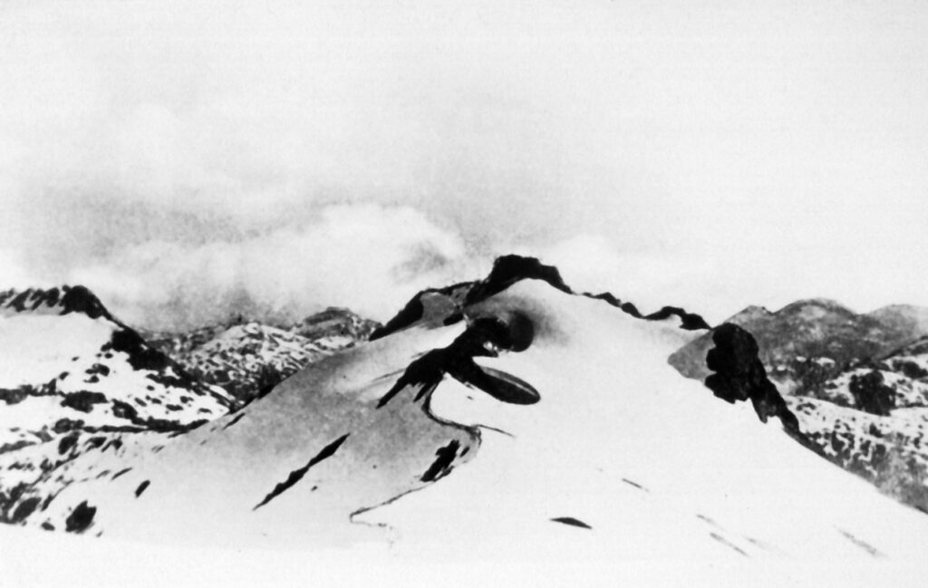
From near the summit of Bear Mountain (Big Interior Mountain) looking towards Nine Peaks on the left and the summit known as “Marjorie’s Load” in the centre 1910 – Joseph Clegg photo.
Yet another small chapter in the history of Vancouver Island was closed yesterday with the return of the Earl of Denbigh and party from the Ptarmigan Mine property on Bear Mountain [Big Interior Mountain], which is located up Bear Creek [Bedwell River] from Clayoquot Sound. Every member of the party returned fit and well, but the memory of the trip will live long with most of them, for, to say the least, it proved the toughest proposition, probably of their lives. Sir James Sivewright, a colleague of Cecil Rhodes, in the upbuilding of South Africa, nearly meet his death, and is now enjoying the rare privilege of life after being suspended in mid-air over a precipice of over two hundred feet. Lady Marjorie Feilding, the twenty-one-year-old daughter of the Earl, placed a new peak on the physical feature map of the Island by christening one of the minor spires of the Great Interior dome by the name of “Marjorie’s Load,” and would have given still more trouble to the King’s Printer along this line but for the fact that the champagne, with which the ceremonies were to be performed, could not be pledged from the vessel on account of the blizzard they encountered. However, Lady Marjorie enjoys the glory of being the first woman to climb the Great Interior Mountain, and it is not likely that her feat will be duplicated in a hurry, as all the members of the party declare that while the view from the top was incomparable the travail of getting there is terrible. Major Frank Johnson, another South African who is interested in the Ptarmigan proposition, states that he never enjoyed himself so much, never worked so hard, and never felt better. Speaking to The Colonist last night on the subject of the trip to the mountain, he said that the feature of it was the great performance in climbing of Sir James Sivewright. “Just think of it,” he said, “he is seventy-seven if he is a day, and yet was first at the top, some six thousand odd feet in the air. And he was very nearly lost to us, too. Climbing the mountain at this season of the year is a tremendous task, and how he and Lady Marjorie managed it I do not know, but there they both were at the finish, fresh and smiling, and ready to do anything to help the others. In making one nasty turn on the rope Sir James was swung from his footing over a sheer precipice, and was dangling there for what seemed an interminable time. I was below him, and I saw him swing against the rock with a bang, and I thought it was all over with him. When he gained the landing below some thirty minutes later, I was amazed to see the old gentleman away ahead again as blithely as ever.” Sir James, while making little of the accident, admitted that his ribs and legs suffered from the impact against the rocks. He was all praise, however, for Lady Marjorie, and speedily forgot his own ills in admiration of her exploits. The Earl of Denbigh, in common with the others, expressed his entire satisfaction with the mining property and they all expect to demonstrate the validity of their faith during next year. The aerial gear is now on the ground, and the work of erecting it will be undertaken this winter. In the event of the weather being not too hard it is expected to have it completed by the spring, when the other plant for the mine operations will be installed. In connection with the aerial gear it is interesting to note that an arrangement is being made whereby the brake power of the aerial apparatus will be used to generate motive power for the air compressors to be used in the mine. The Earl, Lady Marjorie and Major Johnson leave today for the easy and home. They expect, however, to return to British Columbia in the spring of next year to visit the mine when production commences. J. [John] G. Cory Wood, M.P.P. for Alberni, who accompanied the Earl of Denbigh and his party to Bear Mountain to inspect the Ptarmigan Mine Property is of the opinion that the interest of the earl and his friends in the West Coast of Vancouver Island, as exemplified in the mining proposition, is a good thing for the Island, and for the whole Province. Mr. Wood stated that he was personally satisfied that the mine property would work out excellently. “And if it does,” he proceeded, “it will be a great thing for the West Coast. At this present time, when things are somewhat dull, the operation of a mineral mine on Vancouver Island will enliven interest in this part of the country, and at the same time contribute largely to the prosperity of the people. The Ptarmigan Mine has been purchased by the Earl of Denbigh and his friends without public subscription of any kind, and its success-which I am taking for granted-is bound to result in similar propositions in the future. “Once the mine is operating, which will be some time next year, the smelter at Ladysmith will resume operations, and it is quite possible that another smelter will have to be constructed to cope with the product of the mine. The earl and his friends are interested in the Tyee smelter at Ladysmith, and are of course depending upon it in connection with their proposition. The material taken from the mine will be shipped direct to Ladysmith, and the product handled there for shipment outside.” Speaking more generally of the visitors to the West Coast, Mr. Wood expressed the opinion that nothing better could have been conceived to advertise the resources of the Island. “Not unnaturally, it has resulted in one or two pleasant side issues. For instance, the name Bear River is going to be changed to that of Denbigh, in honor of the earl and his mining scheme, and one or two of the minor mountain peaks have been christened in commemoration of the trip.”
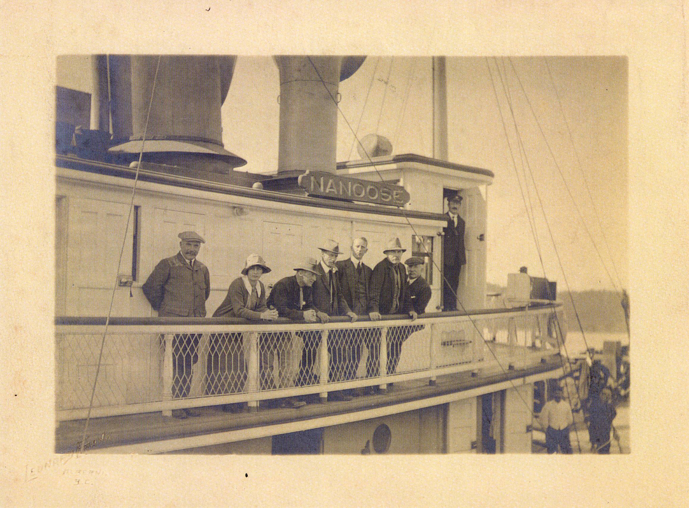
The steamer Nanoose with the members of the Big Interior Mountain expedition on-board.
Investment Means Much to Island
Mr. J.G.C. Wood, M.P.P., Thinks Operation Of Ptarmigan Mine Will Result In Much Benefit.
Reported in The Daily Colonist Friday September 26, 1913, p.7.
Mr. J. [John] G.C. Wood, M.P.P. for Alberni, who accompanied the Earl of Denbigh and his party to Bear Mountain [Big Interior Mountain] to inspect the Ptarmigan Mine property, is of the opinion that the interest of the earl and his friends in the West Coast of Vancouver Island, as exemplified in the mining proposition, is a good thing for the Island, and for the whole Province. In speaking to the Colonist on this subject last night Mr. Wood stated that he was personally satisfied that the mine property would work out excellently. “And if it does,” he proceeded, “it will be a great thing for the West Coast. At this present time, when things are somewhat dull, the operation of a mineral mine on Vancouver Island will enliven interest in this part of the country, and at the same time contribute largely to the prosperity of the people. The Ptarmigan Mine has been purchased by the Earl of Denbigh and his friends without public subscription of any kind, and its success—which I am taking for granted—is bound to result in similar propositions in the future. Once the mine is operating, which will be sometime next year, the smelter at Ladysmith will resume operations, and it is quite possible that another smelter will have to be constructed to cope with the product of the mine. The earl and his friends are interested in the Tyee smelter in Ladysmith, and are of course depending upon it in connection with their mining proposition. The material taken from the mine will be shipped direct to Ladysmith, and the product handled there for shipment outside.” Speaking more generally of the trip of the visitors to the West Coast, Mr. Wood expressed the opinion that nothing better could have been conceived to advertise the resources of the Island. “Not unnaturally, it has resulted in one or two pleasant side issues. For instance, the name Bear River is going to be changed to that of Denbigh, in honor of the earl and his mining scheme, and one or two minor mountain peaks have been christened in commemoration of the trip.”
Addendum by Lindsay Elms:
In 1864, some of Victoria’s most influential citizens met to form a committee: the Vancouver Island Exploring Committee. Western Canada was in the grips of a fever with significant finds of gold on the Fraser River and in the isolated Cariboo Mountains. These businessmen wanted to know what the interior of the island had to offer in the way of mineral wealth. Funds were made available and Dr. Robert Brown was given command of the first exploring party. He explored the east coast around Comox Lake and the southern parts of the island and it was along the Leech River near Victoria that gold was found. Prospectors rushed to the area to secure the richest piece of real estate, while business men set up stores and hotels to accommodate the rapid influx. However, with prior work commitments to Kew Gardens, Brown was unable to command the expedition in 1865 so he recommended John Buttle led the trip. Speed was essential as the summer was fast approaching and the party had to be organized. Supplies were accumulated and the other members were chosen, seven in total including Buttle. The party comprised of Thomas Forgie, a Royal Engineer like Buttle who worked on the North American Boundary Commission until his discharge in 1862 and then as a miner on the Columbia gold-fields for two years; Magin Hancock, an ex-Cariboo miner; Francis McCausland, an old Australian miner; Thomas Laughton, an interpreter; and two native guides Tomo Antonie and Timothy O’Brien. It was obvious from the men’s occupations that there was a strong inclination towards mineral exploration, but all these men were well versed in the outdoors and were capable of carrying out the exploration of the area that was required of them. On 19 June 1865, the Navy’s H.M.S. Forward, left Esquimalt and two days later landed Buttle’s party in Clayoquot Sound. For the next five weeks Buttle and his men explored the various arms and inlets of Clayoquot Sound. On July 28 they were found camping two miles up the Bear River. At this point the Bear River forks and the party split into two: Buttle with McCausland, Antoine and two other natives who joined the expedition from the village of Oinimitis at the head of Bedwell Sound, explored the right branch (Ursus River), while Hancock and the rest proceeded up the left branch (Bedwell River). Both parties took with them ten days provisions. When the two parties reunited Magin Hancock reported that his party had found gold in payable quantities. Reports of gold were printed in Victoria’s newspaper and soon prospectors were chartering all sorts of maritime crafts to rush to the Bear River in the hope of being the first to strike it rich. However, they were very quickly disillusioned. The miners complained long and loud saying Hancock and Forgie were “irresponsible” and Buttle “wasn’t fit to command the cook’s galley”. They believed they had been hoaxed and the government was to blame for allowing the reports to be published. Criticized for the Bear River fiasco Buttle moved to California. Although not rich, there was small amounts of gold in the gravel and fifteen Chinese prospectors moved into the Bear River and eked out a living washing for placer gold for a number of years. However, according to provincial assayer Herbert Carmichael they “suddenly left in a body, having been driven away, it is said, by superstitious fears engendered by the sudden death of one of their number.” In 1896, Christian Frank was prospecting on Bear River with several associates and staked ten hydraulic leases since there was plenty of water. Also, during the 1890’s prospectors were searching the mountains surrounding the Bear River and a number of claims were staked. There was a trail from the mouth of the Bear River at the head of Bedwell Sound, which in the late 1890’s became known as Port Hughes after Captain William O. Hughes, a sealing trader and master of a coastal steamer who was working out of Victoria at the time. The trail led to the Seattle, New York, Castle, Galena, Corona and Belvedere claims. The Corona group reported lucrative assays running from $18 to $200 in gold per ton. In the summer of 1899, Moses McGregor built a fourteen-room hotel with a post office and stable for horses. Moses McGregor was born near Loch Lomond in Scotland and came to Toronto as a young man. He left that city for Victoria when news of the rich gold strikes reached the east. After trying his luck in the Yukon, he eventually returned to Victoria. He told many thrilling yarns of his experience in the Klondyke and knew many of the personalities who made history on the “Trail of Ninety-Eight.” He was also an intimate friend of author Jack London. Moses McGregor passed away in 1933 (see Colorful Life Ends in Death in The Daily Colonist Sunday January 28, 1934, p.6.). It is unknown how long the hotel at Port Hughes operated but it doesn’t appear very long. In 1899, Joe Drinkwater visited the Bear River and hiked over the top of Big Interior Mountain and down to Della Lake and eventually out Drinkwater Creek to Great Central Lake. He staked a copper claim (Ptarmigan) near the summit of Big Interior Mountain and gold claims (Big Interior and Della) near Della Lake. In 1912, the Ptarmigan claims were bought by a group of British/South African investors and in September 1913, a party of ten including the investors established a camp at the mouth of the Bear River. They then climbed the mountain, inspected the site and descended via Della Falls and Drinkwater creek. This would indicate that, even then, Port Hughes had failed. Seven weeks after development work began in 1914 the outbreak of the First World War prompted every employee to enlist and operations were suspended. In this brief period six tunnels had been started on the Ptarmigan claims, a further mile and a quarter of road completed through difficult terrain, and a large bridge built across the Bear River. The main obstacle, despite the exceptional value of the copper ore, was its inaccessibility. In 1919, the Ptarmigan Mines chief engineer, Harry Johnson returned from active service and made a flying visit to the mine site. Because it had been left without even a caretaker most of the equipment was badly rusted or ruined, including the tramway which had been salvaged from the Tyee Mine at Mount Sicker. Also, one and a half tons of explosive had been left exposed to the elements. It wasn’t until 1926 when the Ptarmigan claims, still under the direction of the Earl of Denbigh, refinanced and prepared to start operations again, but it never produced at the level anticipated due to its remote location and heavy winter snow. In 1928 some work on the Ptarmigan claim was in progress and the annual mining report indicated “that (it) is favorable for extensive development.” By 1930, the annual mines report noted that the wagon road from Bedwell Sound was impassable. Others in this region had also experienced misfortune. Located on the southwest slopes of Big Interior Mountain above You Creek, one of the largest tributaries of the Bedwell River, is a group of four mining claims known as Ex, Ten, You, Eight, and collectively called the You Group. This group was first located in 1912 by Ptarmigan Mines Ltd. The four claims are located between 1,800 and 2,200 feet in elevation, and the gold-bearing quartz vein is in a three-foot shear in granodiorite which is the predominant rock on the lower forested slopes of the mountain. This is quite different from the conspicuous thick limestone cap found on the summit of Big Interior Mountain where the copper rich Ptarmigan Mine is located. In 1921 the You Group owner J.B. Woodworth of Vancouver, hired William M. Brewer a mining engineer to visit the claims. Brewer wrote the following description of the property:
The fissure is exposed in a narrow gulch, the effects of erosion, for a vertical height of about 500 feet above the trail, where an adit is driven along a strike of the vein in a northeasterly direction. Owing to the quantity of water flowing down the gulch no close examination could be made of the vein above the adit on the trail. The fissure, with similar filling, has been traced down the mountain side a distance of 500 feet below the trail, where it has been exposed in open-cuts.
That same year (1921) the claims became Crown Grants. In a report to the Minister of Mines in 1922 it was stated that “facilities for milling and concentrating could hardly be excelled, for the reason that Bedwell River can be developed to furnish all the water-power necessary to drive all machinery, as well as for concentrating purposes.” Unfortunately, the spring of 1922 was a heavy snowfall season which hampered Woodworth’s efforts. His camp cabin was also destroyed by fire about the time he was ready to build the small quartz-mill he had packed onto the property. By 1923 the small homemade cyanide mill was installed and operational, however, no figures on its production were made available but remains suggest a capacity of five to ten tons per day. In 1932, J.B. Woodworth returned with a small crew, and worked for a couple of months rebuilding the old camp, reconditioning the mill and driving an adit-drift 337 feet into the vein. Test runs showed that recoveries could be made by concentrating and cyaniding the ore and it was estimated that sufficient tonnage was available to make the property a profitable producer. Further samples were taken but by 1933 it was realized that the lack of transportation facilities was going to handicap the mine’s production and it eventually was abandoned. Like many of the remote sites up the Bedwell River and adjacent streams it was abandoned and left to become a ghost town.
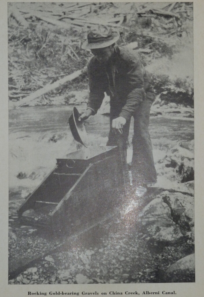
Placer Mining
Visited Mount Arrowsmith
Reported in The Victoria Daily Times Monday October 13, 1913. p.5.
Captain Frederick V. Longstaff recently returned from a visit to Mount Arrowsmith, in the neighborhood of which he spent a fortnight taking observations and photographs. From the “Hump” he took some very fine views of the Island across the Strathcona Park country.
The following two articles, although at the turn of the century and before interest in the Ptarmigan Mine on Big Interior Mountain, give an interesting insight to activities at the mouth of the Bedwell River and on mineral claims further up the valley.
Back from the West Coast
Reported in the Victoria Daily Colonist Wednesday December 13, 1899, p.5.
Among the passengers on the Queen City from the West Coast recently was Moses McGregor, who has recently erected a fine hotel at Port Hughes. The hotel is now ready for the reception of guests, and during the few days which it has been opened has done a good business. Mr. McGregor has great faith in the future of the West Coast. Several strikes of great importance have recently been made on properties in the Bear River district, and the Coast is overrun with American mining speculators looking for “good things.”
Island Alpinists Hold Annual Meeting
W.W. Foster, M.P.P., Re-Elected Chairman; Year’s Work Discussed
Reported in The Victoria Daily Times Thursday December 16, 1913. p.18.
It was with the heartiest unanimity that the Island section of the Alpine Club of Canada, at its annual meeting last evening in the Alexandra room, re-elected William W. Foster, M.P.P., to the chairmanship of the branch, other officers being elected as follows: Vice-chairman, Alan B. Morkill; secretary-treasurer, Miss Jennie L. McCulloch. The committee appointed are: Miss Nancy G. McCulloch, Miss Margaret Cowell, Horace Westmorland, William S. Drewry and Robert D. McCaw. In the absence of the chairman W.W. Foster, Arthur O. Wheeler, director of the Alpine Club of Canada, presided and gave an interesting report of the work of the club during the past year. There are now, he pointed out, 800 members in all, and the season just past had been in every respect the best experienced by the organization. The Lake O’Hara camp had been attended by 195 of the members, this being the largest camp in the history of the club. The Robson camp was a great success, and the achievement of the party of three which made a complete ascent of the peak had been recorded among the greatest fears of the club annals. Referring to the work done on the Interprovincial Boundary, the director said that this would lead to great development of interest in Alpine features, and went on to describe the Simpson Pass and Assiniboine country, where, he hoped, the club would hold a camp in 1915. This country he had gone to survey immediately on leaving Robson camp, and of all the beautiful Alpine tracts that he had seen in the Rockies there was nothing to compare with it. Simpson Pass was accessible from Banff, by way of Healy Creek, and was open alp-land in a trough about two miles wide. In the neighborhood were the pyramidal Pharoah Peaks, Egypt Lake, Scarab Lake, Mummery Lake, Shadow Lake and other beautiful spots. From Simpson Pass they carried their survey along the Great Divide until they reached Assiniboine, the position and height of which had at last been definitely fixed, while a magnificent glacial amphitheater had been found on the east side of this. In the neighborhood were many lakes, and taken all together he had soon no place to surpass it as a site for a camp. Later he hoped to give an illustrated address of the Assiniboine country. Referring to the progress of other sections of the club, Mr. Wheeler said that a grant of $500, given to the Alberta section, had insured the opening up of a club house. In Edmonton a section had recently been formed. Interesting climbs were being made from time to time by members of the club, H.F.S. Lambert, A.C.C., of the International Boundary surveys, had reported a climb up Mount Natazhat [Alaska], which had an altitude of 13,426, and their record climb had been to an altitude of 16,000. From another member of the club came a report of a climb up Mt. Stephen, this having taken 21 hours to accomplish. In congratulating the chairman of the Island section on his recent election to the provincial parliament, the director pointed out that the number of parliamentary members was steadily increasing. There was a representative of the club in the Dominion senate, a member in the Dominion house, an active member in the Ontario parliament, in Alberta three representatives in parliament, in British Columbia two, in the British parliament one and nine representatives in all the various parliaments of the Empire. The secretary in making her report for the year pointed out that the membership of the island section had increased from 23 to 51 during the twelve months just past, and pronounced the finances to be in a very satisfactory condition. Special reference was made to a successful climb organized by the local section for July 1, when a party of fifteen made the ascent of Mt. Arrowsmith. During the evening there was some debate on the subject of a programme for the club meetings during the next few months, and although no definite plans were drawn up it was decided to have illustrated lectures by some of the leading alpinists of the local or any other section of the club. Votes of thanks were passed in behalf of the energetic secretary, Miss Jennie McCulloch, and director Wheeler, who had so capably filled the chair, while, on motion of Mr. James J. White, of Sidney, the secretary was instructed to extend to Mr. Foster, in behalf of the meeting, the congratulations of the society on his election to parliament.
The Famous New York Group
Reported in the Victoria Daily Colonist Sunday January 20, 1901, p.8.
The property to which we next refer is one of which, although not yet quite advanced to the shipping stage, great things are expected. It is known as the New York group, and is situated at Port Hughes, at the head of Bedwell Sound, West Coast of Vancouver Island. It consists of seven claims and is held by the British Pacific Gold Property Company, of this city. For the information of the public generally, it may not be amiss to give a few details as to this company and its operations. It was organized some three years ago, and comprises in its board of directors some of the leading citizens of Victoria and of Eastern Canada. During this time it has been quietly working without making any attempt at “booming” either its properties or itself. Organized, as it has been, with the object of producing dividends for its shareholders, not by any undue inflation of its interests or any species of stock market manipulation, but by the processes of legitimate mining only, it has endeavored assiduously to acquire such properties as would, under careful management, expeditiously bring about the desired end. It fitted out prospectors and sent them into different parts of the province. It employed confidential agents in promising mining sections, and by this and other means it acquired, after careful selection, a large number of properties, the last secured being the New York group above referred to. All the indications of this property from the first pointed to the fact that in securing it the company was most fortunate, and further exploitation has proved that it possesses mineral resources of such extend and value that it was manifestly in its interest to devote all its energies to the development of the property. As the group was situated about 2¼ miles from the salt water at the head of bedwell Sound, the company immediately set about securing a wharf site there, and accordingly obtained from the provincial government a 21-year lease of the only portion of land having a deep-water frontage at that point. Its next move was to construct a floating dock and warehouse for receiving supplies and shipping ore, etc. Communication was opened with the Post Office department at Ottawa, with the view of having a Post Office established to be known as Port Hughes, with the result that assurances have been received by the company that a Post Office will be established there in the near future. In the meantime, development work has been pushed forward vigorously, shafts sunk and tunnels driven, as many men being employed as could be worked to advantage. The supplies necessary for maintaining the force of men employed here and in connection with other mines in the vicinity soon necessitated the establishment of a regular service to this part by the C.P.N. Company, at least every two weeks and oftener if required. Following in the wake of these notable changes in the condition of affairs at this point Mr. Moses McGregor, of this city, conceived the idea of building a hotel at Port Hughes. He accordingly erected a commodious building for the purpose which would not be out of place in any city, and that he will be the host will be a sufficient guarantee that the guests remaining erstwhile under his roof will be most hospitably entertained and comfortably cared for. Further important action on the part of the company in reference to the property itself, aside from the development work done was the location and record of an application to the commissioner for the acquirement under the provisions of the Water Clauses Consolidation Act for power and other purposes of the extensive water power afforded by Penny Creek, which flows through the property, the main driving power of which is located within a few feet of the works on the Omaha claim. In addition to the ordinary boarding house, sleeping quarters for the men, and stable, the camp is provided with a complete assay outfit, so that ore taken out every day can be tested and sorted according to value on the dump. Average samples from the dump have yielded from 13 to 15 per cent copper, while the higher grade of the chalcopyrite taken out gives 32.62 per cent copper, or within a small fraction of the theoretical maximum yield of pure copper pyrites. An assay of $25.50 per ton in gold from a portion of the same ledge matter has also been obtained. From tracings, photographic cuts, and full description of the extraordinary nature and extent of the outcrop and other characteristics and resources of the property itself, inquires may be addressed to Post Office Box 112, Victoria, B.C., or application made at the company’s office, 76 Government Street. A splendid water power is situated on the property, which will be found an invaluable asset when utilized for driving electric power for air compressors, sawmills, tram track, and for every purpose. The advantages of such a water power at the base of operations in connection with the development of such a property as this, can easily be imagined; for not only the Seattle and Omaha claims through which the veins run that are now being worked, but also on the adjoining claims of the group there are exceptional showing pointing to extraordinary mineral deposits. The ore at present on the dump is estimated to be worth several thousand dollars, whilst that which is demonstrated to exist, by the stripping of the ore bodies on the surface, and cross-cut tunneling underneath, is a very large body of ore indeed, some of which may be actually quarried out. Even the white iron capping encrusting the ore body in the second tunnel which is being driven, which marcasite or white iron is found in a solid body in the form of beautiful crystals—yields not less than $8 a ton in gold, besides silver, showing that as the copper ore which it covers is more fully exposed, extraordinary high values may be expected. The company is debarred at the present, owing to the weather prevailing in the winter season, from proceeding with the construction of a tramline to ship the ore from the mine to its deep-water dock, but intends as soon as the season opens in the spring, to construct the necessary transportation facilities, and commence shipping ore at once. As soon as the Seattle and Brooklyn claims have been exploited more fully by the construction of a cross-cut tunnel which will tap the ore body at the depth of 300 feet, it is the intention to continue exploitation work on the adjoining claims, and the company are fully confident that the ore bodies which will be disclosed in this work will be surprising. With the view of enlisting public interest locally, this company has made to the public an offer which so far as we are aware, has never been made by any other mining company in this country. So desirous are the directors of leaving nothing undone to safeguard the interests of present and prospective investors in this company’s undertaking, that they have agreed to return to such persons all the money they put in in dividends, before the directors themselves receive any in this way; all stock, being placed in the custody of the bank until that desired end shall have been accomplished. It can hardly be expected that any company could make a fairer or more generous offer than this. They have also agreed to allow persons preferring to do so, to purchase shares on the installment plan by placing one cent per share per month until the full purchase price of ten cents per share has been paid. Here therefore is an opportunity afforded very one even of the most limited means, in the easiest possible way and upon the same terms as if he were a spot cash purchaser, to acquire an interest in a property within easy reach of Victoria, which bids fair to take its rank among the greatest wealth-producers in this country. What necessity is there, it may reasonably be asked, for anyone to send his money to the further limits of the province and beyond, upon a purely speculative errand, to develop a property which he will probably never see, of which he knows little or nothing, and without practically any guarantee of returns, when right here almost at our doors is a property and proposition which, everything considered, has no parallel in this province. And when every dollar invested, while bringing a revenue to the investor will help build up the city in whose prosperity every merchant and manufacturer, every tradesman and mechanic, every clerk and official, every resident and property holder, no matter what may be his or her occupation, has a common interest. With one or two exceptions, the shipping mines of Vancouver Island, or those which are in a position to ship, have all been developed with and are largely controlled by outside capital. These mines are within a radius of 100 miles of this city, and the returns from those shippers amount to tens of thousands of dollars per month already. How much of this comes to Victoria? Only the most infinitesimal fraction. Why? Because they missed their opportunity. They have, however, an excuse. They say: The continuity of ore bodies on Vancouver Island was not demonstrated until very recently: and we did not wish to speculate on a possibility only. But that excuse can no longer be urged. Will Victorians grasp this opportunity now afforded by the British Pacific Gold Property Company in connection with the New York group? Or will they allow the stream of dividends which this group is destined to produce, to flow past their doors to enrich the people of England, Scotland and the United States.
An Expedition Up Mount Benson
Reported in the Daily Times, (Sunday Magazine) September 28, 1913. p.5.
By Frank W. Teague.
The traveller when approaching a town or city, the surroundings of which are familiar to him, is almost invariably able to tell his whereabouts long before he reaches the place by some distinguishing landmark that comes to view as he proceeds on his way, for every community more or less the world over, has its well-known crag or peak or glacier, its shaggy forest or rocky headland, its shining lake or ever rolling river. There are the Golden Gate of Frisco, the Sentinels of the Columbia and Tacoma’s Mt. Rainer; the rocky shores of Juan de Fuca tell us Victoria is near and the famous Slide on the Dome indicates from far up the Yukon that Dawson lies below. Our own little city of Nanaimo on the East Coast of Vancouver Island, overlooking a harbor that is famed for its natural beauty and safe shipping anchorage, has its distinguishing landmark in Mt. Benson, a peak over 3,000 feet in height which lies to the west of the city and some five miles away when approaching Nanaimo from the Gulf direction. It was this same mountain that my friend George and I set out to climb one morning early in May. It is not the writer’s intention to impress the reader by a thrilling story of heart breaking and back breaking packing and climbing, of the scaling of dazzling and dangerous peaks, of leaping over crevasses. This is not a tale of alpenstocks, Burgundy wine and Swiss guides, though it may be admitted that a guide is necessary to one unfamiliar with the great expanse of dark firs that cover the mountain sides, the acres of cedar bottom and the rocky gorges whose sharp, jutting flanks cut off the surrounding country. The object of our trip was to spend the day breaking through the woods where life is free and open and well worth living, where the call of the wild sounds in every tree, and crag and stream. We planned to ascend to the tempest beaten summit over wave after wave of densely wooded mountains that stretch for countless leagues in one vast, far reaching sea to the limit of vision, there to drink in the magnificent spectacle that this eminent spot affords, to secure photographs of the adjacent peaks, forests and waterfalls. This then was the prospect that led us to take the trip and while an expedition of this nature, where one is entirely dependent on one’s soundness of mind and limb to gain steep ascent, or overcome the windfalls and matted undergrowth, though trails of endurance are encountered, not one out of a hundred persons will fail to benefit from such an undertaking. Mt. Benson, which lies parallel to the coastline, is a double peaked eminence standing alone, a vanguard, so to speak, of the fine array of peaks that rise away to the south and northwest, the foremost of which show as a continuous chain. The estimated distance from the city to the summit is eight miles and to the foot of the ascent is about four miles. After passing the outskirts of town there are two trails by which the mountain top may be gained, the regular mountain road that leads up from the south, and McGarrigle’s trail at the north which commences at the sawmill of the Ladysmith Lumber Company. The former is the more favorable of the two since the greater part of it is a regular road cut out for vehicle travel. The last leg of the climb is by foot-path. On McGarrigle’s trail much loose rock is encountered and there are many logs strewn across the path indicating lack of repair. We took the regular mountain road, as it turned out, although our plan had been to go up by the northern route. Our plan was to ride out on the locomotive that runs from the town to the sawmill, a distance of some three and a half miles, and there begin the ascent by the McGarrigle trail. The locomotive was due to leave at 4 a.m. (before daybreak). I was up at 3:15, and finding that the rain of the previous night was still steadily descending I returned to bed feeling satisfied that the trip would be off. A continuous ringing at the front door-bell, the kind that has no intention of stopping until satisfaction has been secured, aroused me from a troubled sleep some time before 5 o’clock, and when I eventually arrived upon the scene, George, quite alert and armed with camera and lunch, stood before me. The rain had ceased, the dawn of a fine day was breaking and at 5:30 o’clock we struck out. The town, as was to be expected at so early an hour, was still asleep. Thirty minutes’ walk through the Western Fuel Company’s holdings brought us to the city’s water dams and the beginning of the mountain road. A steady grade from this point onward was encountered and the timber became more dense so that for some rods we could see nothing but the road winding before and behind. A distinct smell of ozone pervaded the atmosphere as we mounted and very soon George, who is an ardent and promising student of the local High School, began to point out various orchids here and there, many of which to the casual observer would have passed unnoticed. They were, however, of great interest to one who followed botany and who is born a nature lover. There was one orchid, the lady slipper, as it is commonly called in this country that stands out from all other because of its color and formation. To see such dainty flowers standing alone among the wild undergrowth brings astonishment to the onlooker and when they are seen they are sure to be carried away. Their home, however, is not the garden and they do not stand transplanting well. Before 6:30 we had reached what is known as the foot of the mountain and farther on, the Dominion geological mark at 1,100 feet altitude. The former is marked by a small stream which flows under a rough cedar bridge. It is somewhat difficult to know why this should be known as the foot of the mountain for the actual climb begins well down the road not far from the city water dams. As we steadily mounted the timber thinned out some and from the winding road a glimpse was obtained of the south and east. Though neither of us wished to break a record we maintained a steady gait, stopping only occasionally to drink from a prattling brook, but not resting. We soon saw that the day was not to be a favorable one as we had anticipated. A pall of fog hung in the tree tops farther up and when a chance offered, we could see that the mountains to the south were capped with a dense cloud. The end of the wagon road was reached at 7:30 without incident. We came upon a tent at this spot, which we afterwards found out belonged to the Geodetic survey party. The rest of the trail was a mere footpath, indistinct in places and sometimes difficult to keep. It was here that the stiffest bit of climbing was encountered. Although the trail was rugged and strewn with logs, twenty-five minutes sufficed to put us at the topmost point of the mountain, on which is placed a flagstaff, erected many years ago. We had thus affected the entire distance in two hours and twenty-five minutes and without stops. The usual time is about three hours, and larger parties generally take longer than that. The greatest height of the mountain, at the flag pole is 3,366 feet. Near the peak another tent was pitched which also belonged to the Geodetic party, who were taking measurements and areas of the bodies of rock, etc., that compose the mountain. A search light, erected on a stand at the foot of the flag pole, was no doubt used by the party who were making a general survey of the mountains of Vancouver Island, in taking night observation. When we gained the highest spot, nothing could be seen in any direction farther than about thirty yards distant, except a grey bank of mist. We seemed to stand on a tiny island of rock cut off from all else by the impenetrable wall of vapor, into which the rugged trees, blasted by the ice-edged gales of many winters, thrust their stunted and ragged branches as a bristling Chevaux-de-frise [a defense consisting typically of timber used to obstruct passage], on the ramparts of a fort. The beautiful view we had expected to obtain was not in evidence. We were not discouraged, however, for we knew that the fog would eventually lift, so gathering dry wood, a fire was started and we were soon busy transferring the lunch to our hungry stomachs. There was nothing left but to wait for the mist to clear, and there was evidence of it doing this in a short time, as the sun at intervals made brave attempts to break through and disperse the mist. The mist was only among the mountains, as several times, when the light breeze blew it clear, the lakes and rivers and salt water, not to mention the wooded country still nearer, showed up clear and beautiful. These were truly only flashes, for the veil swept over the whole scene as rapidly as it had opened out, and left us with the same grey pall surrounding us. George was anxious to take a photograph of Crystal Lake, a small body of water in the valley behind Mt. Benson, and at the foot of Wolf Mountain. Before noon we climbed down the rocks and set the camera up. The scattered mist continued to sweep along the valley but finally, after nearly an hour’s waiting, the scene was snapped, and returning to the top of the mountain we found the fog had lifted entirely, allowing a perfectly uninterrupted view of the whole panorama. From a lofty vantage point over 3,000 feet, on an early Summer day, when the various hues of the forest appear most attractive, such a spectacle has to be seen to be realized and adequately enjoyed. No description can instill into the mind of the reader the scene as it really is. Nevertheless, a description is in order. Almost immediately below, the lakes near Wellington shone among the dark firs and lighter foliage like crystals. Nanaimo lay peacefully in the sunshine picturesque on the verdant slopes that face the harbor wonderfully beautiful, while the blue floor of the Gulf of Georgia, dotted by many islands, stretched away north to the Mainland, and southward toward the Island at Saanich. The Balinacks and Grey Rocks, the Five Fingers, Entrance and Gabriola, the nearer Newcastle and Protection Islands all stood out clear and bright, some densely wooded, others barren, yet beauty spots on the azure sea. Further away, yet plainly discernible, were Texada and Lasqueti, the home of the quartz mine and haunt of the deer. Still more distant were the numerous inlets in the Mainland, with grey Point obscuring Vancouver from view. Away to the south lay Oyster Harbor and Ladysmith and the score of Islands towards Victoria. The mists behind us disappeared almost completely before long, showing a long wave of hill and valley covered with fir and cedar, spruce and hemlock, with here and there a line of snowy ranges; all the well-known peaks, Green, Wolf, Admiralty, De Cosmos, Spencer, Black Jack, Moriarty, Brenton and others, were visible. Altogether we could see fully 5,000 square miles of the earth’s surface. A good photo of the town and outlying islands was obtained, and then George proceed to secure one of the species of Liliaceae – the yellow Dogtooth Violet, with white antlers, similar to the regular white ‘curly lily’ that abounds hereabouts. George has artistic tastes and felt bound to get a good picture of the flowers, for he had a special lens along with his camera for this purpose. While the lilies were still patiently posing the sound of the shrill whistle of the little locomotive came up the mountainside, and we knew that a ride home was out of the question. About 2:30 p.m. we came down the rocky draw that was partially filled with snow, and began the descent. Mountain trips are for the most part alike in that when you are struggling slowly, but steadily upwards, your breath is coming (or going) fast, your legs weaken, your feet drag – and you long for a downhill stretch; but when you are on the down grade you think the descent is more distressing than the climb. The going was good for some time, the trees stately and open with little or no undergrowth, and plenty of moss that acted as a carpet; the grade could have been much worse. Such easy traveling was too good to last, however; the grade became sharper and the speed more rapid. Stopping was more difficult than starting and the lithe step with which we left the summit merged into a leaping, sliding and cuttling race. Ahead lay a wild ravine filled with dark firs, into the gloomy depths of which we plunged until brought up by a stream. We were near, as it happened, to a thick patch of lady slippers, so George set his camera up, and commenced operations. He told me he was particularly fond of photographing flowers and I believed him, for he lay on the wet moss with his black cloth over his head for upwards of half an hour, adjusting the special lens, and getting a focus some twelve inches distant, on four innocent and pretty little lady slippers, which stood the strain very well, but naturally began to droop their tired heads at the expiration of that time, some yellow violets, all the time with saucy faces, taking in the whole scene. The grade was easing off perceptibly, yet the undergrowth was more dense, and “salals” were more numerous as we neared the bottom. The beauty of it all, however, could not be overlooked. Dainty green leaves of the salmon berry bushes and jack pines and dark firs, the climbing honeysuckle and pretty spirea, the wild currant and graceful fern and yielding moss and the rays of the afternoon sun glancing through it all, combined to form a scene of real beauty, sublime and peaceful enough to satisfy the most ardent critic. Two leg-weary and perspiring forms, emerging from the trail above were not too weary to appreciate this, yet the second falls, on the McGarrigle Creek, reached after leaving the trail and breaking through the woods, was by far the prettiest bit of scenery on the whole trip, and I venture to say that these falls, as we saw them, cannot be surpassed in point of beauty by anything of the kind in this wide Province which contains many waterfalls and much beauty. The volume of water that flows over these rocks is small in comparison to many, but in judging beauty, the amount of water is not considered. The very secluded location – a little corner hollowed out of the rocks and not seen until a few paces away forms a novel and remarkable feature. Nature had draped its three rocky walls with trailing vines and creepers dripping and crystal-like from the waters of the fountain alone. As though placed by touch of a master hand the delicate salmon-berry and spirea bushes interlace overhead. The filmy stream that flows over the rocks with delightful music and falls fresh and pure into the deep clear pool, then over the gravelly little bar into its bed, edged with ever-present fir and cedar, and lighter tinted foliage, constitutes a forest setting, I say again, unsurpassed. Farther down the stream we came to the first falls, not possessing the beautiful surrounding of the upper yet a sight worth seeing, and one that would rank among the best of water scenes. A glance at the falls assured us that we had left the mountain side and were again among coal measures. The entire bed of the stream consists of a hard kind of shale which makes the scene as interesting as it is beautiful. To get to the main trail again a good deal of underbrush, scrubby firs, fallen logs, deadwood, and salmon-berry bushes, had to be gone through. The sun’s rays were making it warm work, for we were not lagging any. A fast pace was maintained all the way. Some two and a half hours after our departure from the summit, we emerged at the Ladysmith Lumber Company’s sawmill and for the balance of the way hit the ties of the lumber railway until we reached the town again. Thus, the trip down, irrespective of stops, took approximately the same length of time as the climb in the morning, and we reached home about 6 o’clock.
Letters To The Editor
The Late Mr. DeVoe
Reported in the Daily Colonist Sunday October 26, 1913, p.18.
Sir,—as certain articles have appeared in the local press referring to the late W. [William] F. DeVoe, who last week [October 12] was accidently drowned in Campbell River, and either insinuating or stating that he was a citizen of the United States, I feel it is my duty to inform the public that Mr. DeVoe was a licensed British Columbia subject, born in St. John, New Brunswick, and that he has been in my employ in British Columbia for over five years and to the best of my knowledge every man employed by me upon the survey of the boundaries of Strathcona Park is a British subject.
Colonel W.J. H. Holmes, B.C. Land Surveyor
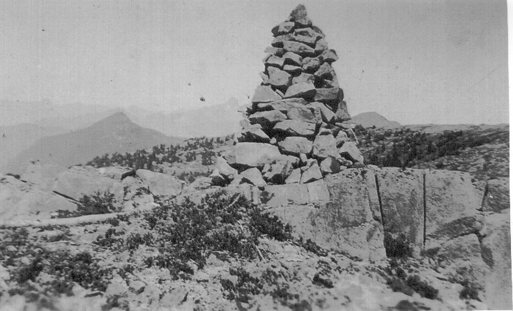
William DeVoe climbed Mt. Heber on 11 September 1913 and named it after his deceased brother Heber DeVoe.
The Prospector
By Walter L. Thurtell
The mountain peaks have been his goal,
He has toiled to their dizzy heights,
And the valley depths, where the waters roll,
Know the trace of his lonely nights.
The barren wastes of the desert sand,
Have hidden his footsteps, dim,
And the secret paths of the forest land
Are a highway sure, for him.
The granite crags of a world-old age,
Have echoed his riving steel,
For the wilderness is his heritage,
And his soul knows her wild appeal.
The pines have crashed to his ready axe,
And the rapids have hurled him on,
To the farthest lake where the moose-herd tracks,
He has passed with the eager Dawn.
The golden lure of the endless trail,
Has tugged at his restless heart,
And whether he win or is doomed to fail,
It means but another start.
For he knows the call of the sky lit way
That leads on the endless quest,
And he’s gone once more where the Night and Day,
Are the comrades that love him best.
1914
ACCVI Executive:
Chairman – William Foster
Vice Chairman – Alan Morkill
Secretary-Treasurer – Jennie McCulloch
Executive Committee – Margaret Cowell, Nancy McCulloch, Horace Westmorland, Robert McCaw, William Drewry
Events:
January 27 – Club lecture by William Foster titled “Mount Robson Park” at the Alexandra Club.
March 28 – Club’s 8th annual banquet at “Resthaven” Sidney.
July 3 – Club meeting at the home of William Foster.
November 24 – Club meeting at the Alexandra Club where it was discussed what the club should do towards the war effort.
December 18 – Club meeting at the Alexandra Club.
Section members who attended the ACC general summer camp at Yoho Valley July 21 to August 11: Arthur Wheeler, Clara Wheeler, Margaret Cowell, Jennie McCulloch, Sara Spencer, Miss Springer, Captain Clarke, William Foster, Stanley Mitchell.
Alpine Club Lecture
Reported in the Daily Colonist Wednesday January 28, 1914, p.6.
Mr. W. [William] W. Foster, M.P.P., president of the Alpine Club of Canada, gave an exceptionally interesting illustrated lecture last evening [January 27] to a large number of the members of the club and their guests at the Alexandra committee room. Mr. Foster took for his subject “Mount Robson Park,” the scene of last year’s annual camp of the club, and the successful ascent in which he participated. Photographs had been taken all along the journey, and consequently a most interesting collection of slides were thrown on the sheet, showing Mount Robson from every point, site of the camp, the Emperor Falls, which are the origin of the Fraser River, Berg Lake, Mount Whitehorn, Moose Pass, Smokey River, Captain Mackay climbing Mount Resplendent, which was climbed by about twenty members of the club, and many other beautiful views. A hearty vote of thanks was accorded to Mr. Foster at the conclusion of the lecture, proposed by Mr. [Arthur] Wheeler, who spoke of the modest manner in which Mr. Foster told of the difficult feat.
Describes Ascent of Mount Robson
Mr. W.W. Foster Delivers Entertaining Illustrated Lecture On Park Areas Of British Columbia
Reported in the Daily Colonist Tuesday March 10, 1914, p.3.
Mount Robson park was the subject of an exceedingly entertaining address by Mr. W [William] W. Foster, M.P.P., before the Victoria Natural History Society last evening [March 9]. Mr. Foster, whose discourse was beautifully illustrated, gave it greater scope than the title would indicate by outlining the provincial Government’s policy with respect to the preserving of park areas and by dwelling on its importance from the standpoint of the tourist. He also contributed an account of the conquering of the formidable mountain peak named by a party of Alpine Club members, consisting of himself, Conrad Kane, and Captain [Albert] MacCarthy, of New York. The description of the ascent was thrilling, and when the speaker finally told of the explorers’ success, his hearers felt some of the satisfaction he and his companions experienced as they stood on the ice-coated pinnacle and surveyed the prospect of the mountain, hill and dale unrolled beneath them. In his opening remarks Mr. Foster spoke of the action of administration in setting aside different extensive areas for park purposes. He thought it would be acknowledged that it was a move in the right direction. Speaking of Strathcona park, he said that in it were to be found mountains, rivers, streams, lakes—in fact everything to delight the visitor. Moreover, it was comparatively easy of access and would be made more so when two railways now underway reached its boundaries. References were made to the park in the vicinity of Banff, particular attention being given the magnificent Vermillion Valley, and to other such areas.
An Important Asset
Attention was drawn to the importance of this part of the Government’s policies from the viewpoint of the public interest. British Columbia had many natural resources. She was rich in minerals, agriculture, timber, etc., but in contemplating these things, the value of the scenic attractions of her mountains, valleys and rivers, was often overlooked. All that was necessary to ensure the country an immense income from the source, was transportation facilities, which were being secured, and advertising. The possibilities would bet better understood when it was pointed out that Switzerland, which was not larger than Vancouver Island, realized in income received from tourists, $150,00,000 per annum. British Columbia was many Switzerland’s rolled into one. In France, from the same source, there was received $500,000,000 each year. New Zealand being, like the Canadian West, comparatively new, made even a better comparison. Here it was found that the importance of the tourist was so well understood that the Government operated what was known as a “Tourist Bureau” and spent a great deal in informing the world of the colony’s attractions and the most convenient ways of seeing them. British Columbia, having a population of 90,000,000 people immediately to the south, and with the advantage of an imperial connection that could not be overrated, stood in a much better position than New Zealand.
Derivation Of Name
Mount Robson and the surrounding district, Mr. Foster stated, were of peculiar interest, the former being especially so to those having the propensities of the mountain climber. The mountain covered an area of forty square miles. Not many years ago little of a definite character was known concerning it. The available descriptions had been inaccurate. All this was accounted for by the fact that it was almost inaccessible. The conditions were now changing. Three railways ran close to it, namely, the Grand Trunk Pacific, the Canadian Northern and the Pacific Great Eastern. Two great highways traversed the district in its vicinity, one up the North Thompson River and the other through the historic Cariboo country. The mountain, he said, was named after an employee of the Hudson’s Bay Company. This was true also of the Yellow Head Pass and the Tete Jaune Cache. Mr. Foster gave an outline of the experiences of the Alpine Club members on their exploration of the Mount Robson Park area in 1913. Mention was made of the assistance tendered the party by the Grand Trunk Pacific and the C.P.R. companies. With the aid of the finest collection of mountain pictures ever shown here in public, the lecturer proceeded to give some insight into the beauties of the district in question and incidentally of the difficulties surmounted in the successful ascent of the before unconquerable mountain.
Climbing The Mountain
Before showing some splendid views of Mount Robson, Mr. Foster gave a brief sketch of his trip, in company with Conrad Kane, an Austrian guide, and Capt. MacCarthy, of New York, to the summit of the lordly mountain. The start had been made on a day far from promising with the idea of getting as far as possible toward their destination, in order that the final effort might be made and the goal accomplished on next day. The first camp had been located on a moraine far from the club’s headquarters and the blankets became of little use as the ice melted beneath them and the water seeped through. They had risen at 3 a.m. and reached the top of “Dome Mountain” at 8 o’clock. From this point their way had been a hard one. A climb at an angle of 65 degrees, with a wild, wind blowing about them, had to be made and the only foot-hold had been steps clipped in the ice. A similar performance was necessary to achieve the last few hundred yards of the journey, but, ultimately, they attained the pinnacle. Mr. Foster caused some amusement by his description of the next night spent on a sloping rock a short distance from the peak. On the conclusion of the address Mr. Foster was accorded a hearty vote of thanks by the society.
Alpine Club’s Third Annual Gathering
Director’s Report Shows Great Increase In Membership—Camp In Yoho Valley This Year
Reported in the Daily Colonist Saturday April 4, 1914, p.12.
The Vancouver Island section of the Alpine Club of Canada held its third annual dinner on Saturday, March 28 at “Resthaven.” Through the kindness of Dr. Gordon Cummings, the club was enabled to entertain its members and guests at this delightful spot, and no more ideal surroundings could be obtained for a “mountaineers’ banquet.” A special train of the Victoria and Sidney Railway Co. conveyed the members from the city at 5 o’clock, returning at midnight. The spacious dining-room looked like a Spring garden with the horseshoe shaped table beautifully decorated with hundreds of daffodils, vines and asparagus fern. This was the work of one of the Sidney members, Mrs. J. [James] J. White. The members were received by Mrs. [Clara] Wheeler, wife of the director of the Alpine Club, and Mrs. J.J. White. An excellent dinner was served, and at the close two toasts were responded to: “The King,” proposed by Mr. A. [Arthur] O. Wheeler and “The Alpine Club of Canada.” The latter was responded to, in an interesting speech, by Mr. W. [William] W. Foster, M.P.P., for the Islands District chairman of the V.I. section of the club. The director then read his annual message, which contained a resume of the year’s work and the plans for the coming year. The following is an extract from the message: “We have become a recognized national organization, with widespread international connections. Our annual camps have so far proved a success and have drawn from many places—not alone in Canada, but from the great Republic to the South, and from beyond the seas. The success is due, not to our own efforts alone, but to magnificent ranges of snow-clad, cloud-capped mountains that form the crowning glory of the North American continent, and of which we possess a goodly share. They have brought to our alpine gatherings, year by year, many enthusiasts who, through the fellowship of the camp fire, the partnership in the delights and dangers of long and hard climbs, and a mutual love of the wild beauties of Nature at her outposts, have become bound to us by ties that are more than personal friendship, that have brought home to us in a most concrete form the kinship of the Anglo-Saxon race.” The address drew attention to the fact that eight years ago the club was completed. The roll then showed sixty-seven members. At the present date it had a membership of close on 800, grouped in eight sections at various centers throughout Canada, at New York and in London, England. The Robson camp of 1913, in almost new territory, was a magnificent success. The annual camp will this year be held in the Upper Yoho Valley, near timber line, and will open on July 21, continuing for three weeks. The director said that the attractions of the Yoho Valley and its beauties were well known. After a hearty vote of thanks had been passed to the Sidney hostesses and to Dr. Gordon Cummings, the members and the guests adjourned to the rotunda for dancing.
Alpine Club Notes
Reported in Rod and Gun in Canada Vol. XVI, No. 1. June 1914, p.40.
The Vancouver Island section of the Alpine Club of Canada celebrated the eighth anniversary of its organization on March 28th. The third annual dinner of the section was held at Resthaven, Sidney, the beautiful, but little known, summer resort of which Dr. Gordon Cummings is the Managing Director. The outside members—for Sidney has nine resident members—arrived by the 6 o’clock train. Mr. William W. Foster, M.P.P., the Chairman of the Vancouver Island section, had his motor launch waiting for the party and promptly conveyed the members by water to Resthaven where they were received by Mr. Arthur O. Wheeler, the Father and Managing Director of the Club, and assisted by Mrs. Clara Wheeler, who since its inception has acted as official chaperone and upon whom years ago was confirmed the freedom of Club House and Camp for life. The large and handsome dinning room at the Resthaven looked very cosy and comfortable. The tables were a work of art, in the form of a horse-shoe, and with their white napery and gleaming silver, amidst the masses of flowers with which they were decorated, looked like a scene from fairyland. The charming results achieved were wholly due to Mrs. J.J. White who was responsible for the decorations. At close of an excellent menu two—and only two—toasts were drunk. “The King”, and the “Alpine Club of Canada.” The latter was proposed by the Chairman, W.W. Foster, in a most brilliant speech, terse and witty, in which he referred to the excellent work the Club was doing towards the development of the mountain ranges of Canada into a world’s recreation ground and the enormous revenue that would accrue to the country and the Province through such development. He referred also to the great appreciation the various governments interested in the said development had for the work done by the Alpine Club and that the splendid results it had achieved were due most largely to the hard work and perseverance of the Director and his knowledge and love of the mountain regions. In response to the toast, the Director sketched the work done by the Club during the past summer and outlined the programme for the coming one. A resolution of thanks was then passed to Dr. and Mrs. Cummings and the management of Resthaven, for their efforts to make the gathering a delightful one and in every was a success. The party then adjourned to a glorious Camp fire built by Mr. James J. White, assisted by J.P. Scarlett, when songs were sung in true camp fashion. The remainder of the evening was spent in the ballroom, where the entrancing strains of dreamy waltz music, rendered by Miss Lorna White, held the members till midnight, when a special train returned them to their homes.
Alpinists Meet
Reported in The Victoria Daily Times Tuesday July 7, 1914. p.5.
At a meeting of members of the Victoria branch of the Alpine Club of Canada held last Friday [July 3] at the residence of the chairman, William W. Foster, M.P.P., it was announced that about ten members of the local branch would be attending the camp which opens in the Upper Yoho valley on July 21, for three weeks. Mr. Foster reported that he had a letter from Arthur O. Wheeler, director of the club, who is at present staying at the club house in Banff after a sojourn in the Yoho where he has gone over the ground with some of his assistants, and has found the camp site and the possibilities of the district to the climber to be even better than he had anticipated. About 300 Alpinists from all parts of the Dominion, the United States and Europe are expected to join the camp this summer, which will make the event quite one of the biggest in the history of the club.
Camp In the Yoho
Reported in The Victoria Daily Times Tuesday July 21, 1914. p.11.
The ninth annual camp of the Alpine Club of Canada opened today for three weeks in the Upper Yoho valley, in the main range of the Rocky Mountains, and just about eighteen miles from Field. The growing popularity of mountaineering among Canadians, which is in no doubt largely due to the splendidly organized camps held in the past few years by the Alpine Club, is amply demonstrated in the increased number of campers, this year’s camp being attended by nearly three hundred. Among those who left Victoria during the last few days for the annual camp in the Yoho valley were Miss Margaret Cowell, Miss Sara A. Spencer, Miss Jennie L. McCulloch, Miss Springer and Captain Clarke. William W. Foster, M.P.P., chairman of the local section, left about a fortnight ago for the interior, and went into camp at Yoho early this week. Arthur O. Wheeler, the indefatigable director of the Alpine Club of Canada, is, as in previous years, in charge of the camp, and with the help of the capable secretary-treasurer, Stanley H. Mitchell, the gathering will no doubt enjoy the best of privileges in respect to organized climbs, accommodation, food and entertainment while in camp.
Leaving for Camp
Reported in the Daily Colonist Friday July 24, 1914, p.4.
Miss Margaret Cowell has left town to join the Alpine Club camp in the Yoho Valley. She expects to be away about three weeks.
Alpine Club In Strathcona Park
Reported in The Daily Colonist (Sunday Section) Sunday August 9, 1914, p.2.
H. Elworthy
It was a privilege and esteemed a great favor to be allowed to go into camp with the Alpine Club before becoming a member, and I take this opportunity to thank the members I met for their kindness during that too short outing. When the idea was first suggested to me some misgiving arose when realizing that by age, weight and habits I would be outclassed. But thanks to the novelties of the situations, beauties of the scenery, purity of the air and water, and last but not least, the good comradeship of the party, the time was spent in such serene happiness that everything else was forgotten. Warnick’s Camp was reached about 7 p.m. the first day, after about ten hours’ travel, mostly on the trail. The dinner provided by the Government, was excellent; and as the twilight waned the light from the camp fire served our purpose while listening to a concert rendered by the Government employees. Specially written words had been set to familiar airs and everything, including the mouth-organ solo, went off with vigor and entire absence of stage fright. Ten o’clock came mush too soon, but with one accord all retired. Next day we were on the trail again and the crossing of rivers on a single log was not easy to a novice. Fortunately, the club includes several experts, and with their friendly hands, always cheerfully extended whenever, needed, no serious inconvenience was experienced. There was, however, one little incident worth recording. The log in this case was deformed in point of rotundity and had so fallen that uppermost it was now something like a ridge on a house-top, sloping on both sides. The male members crossed it with long strides and nonchalance and one of the lady members deliberately plunged her hands into the pockets of her unmentionables, out of climbing season, before she gracefully did likewise. Later came another lady. She accepted the hand of a male escort, and both sallied forth; two right feet and then two lefts, slowly advancing about six inches at each stride, quite out of keeping with divided skirt. When about two-thirds of the log had been covered in this manner something went wrong, as the escort was in the river and speeding for the bank like a runaway motor. She, however, stood on the log in a most provoking manner; motionless and without visible sign of emotion, until her escort coupled up again and brought her safely to land. We had been mostly on trails in dense forests during the first five days, and consequently were not in the position to judge a general appearance of the Park. But the day of the Director’s [Arthur Wheeler] departure for Elkhorn [August 20], Colonel Reginald Thomson considered that those members of the party who had not accompanied him were also fit to climb, and as we sat around the camp fire that evening he made known his plan to us. I must pay tribute to the excellent way the Colonel planned everything for our comfort. Under his care and guidance, we all seemed to be one family, and to distinguish between the “children” one was known to him as “Peter Pan”; another as “Polly” and so on. The Colonel had arranged with professor James Macoun to take me up a mountain known as Macoun’s Lookout [Crest Mountain], from which point one of the best views of that portion of the park is obtainable. We started early on a delightful morning, soon reaching Drum Lake, where I had picnicked the previous day. The lake is a beauty spot and contains lots of fish, but arriving late on the picnic day, the sun up and the fish down, we saw only one trout. Possibly he had lost some of his chums and knew, too, that our breakfast had consisted of as much fish as was good for us. Anyway, he approached with head slightly on one side, examined the fly we had dexterously cast him, looked at what was going on ashore, smiled approvingly, and then, with a wiggle of his tail, retired rather than risk being landed and causing a break in merriment. But today our destination was the top of a mountain, and we climbed again and again until at last we reached a point where the Professor pointed out that by ascending a “chimney” we had not much further to go. This chimney I judged to be less than 200 feet high, and the plumb of the interior walls would gladden the heart of a master-mason; nor did there appear sufficient roughness for soot anywhere to lodge. It would almost seem that nature had intended for this for a short-cut, as the separation of the rock had left the interior of the chimney just about right for a man to climb with his feet. Unfortunately, neither the Professor nor myself had on suitable boots for that class of work so we continued the ascent by a more circuitous route. It is simply astonishing, in case of fatigue, how quickly the rarified atmosphere of high altitudes will restore normal physical conditions; but having previously experienced this when viewing Mt. Everest from Darjeeling, it was now such a surprise. On this occasion, too, I ate heartily of most delicious wild berries and was soon in condition to thoroughly enjoy the scenery. On the mountains to the East were patches of snow and the monotony of color of their tree covering was further relieved by cascades, which in one place extended a thousand or more feet without a break. North and West also were mountains of various shapes, but no one peak particularly conspicuous. In the valley Drum Lakes were the most prominent feature. Returning to the valley I gazed once more on something that had interested me before ascending the mountain, but which I could not see when there although very near to me. The face of the rocky summit overlooking Drum Lake, on which I had stood, for a drop of 500 or more feet is almost true perpendicular, smooth and barren. But just about the centre, the bulls-eye to speak, there is a small green spot which on closer inspection proves to be a clump of fir trees. By some freak of nature a pocket was formed in the wall in which these trees now grow; proof against all elements and machinations of man. It is now up to the Alpine Club to disprove the last assertion, and it would certainly be interesting to know the depth of the pocket which, judging from the trees, may be 100 or more feet deep. There is some fine timber in the park; but the absence of animals and bird life is very noticeable. The camps had been well placed and the surroundings of Lewis’ camp were particularly impressive while we held our first Sunday service. It was evening, and looking up as it were through a funnel formed by the big trees, a single star was visible and there was a glimmer of rising moon-light. Below all was dark save round the camp fire, and it seemed as though only human life was left. The absence of animal and bird life was now even more striking; the dogs about camp refused to bark; all that was audible was the voice of the water as it dashed over the stony river bed seeming to say that at last we had reached the trysting place of man and his Maker. The trip up Buttles Lake served its purpose for one could now realize how little of the park we had traversed; its diversified scenery and the possibilities of providing endless attractions for all visitors. On out return trip, by moonlight, we missed the glaciers and snowfields we had seen in the afternoon, but the changing lights at first playing on the tops of the mountains and later in the valleys revealed other beauties and made the four hours we spent in canoes, in covering the twenty miles, pass with extraordinary rapidity. I look forward at no distant date to go over the same ground again with the choice of improved trails, or motor roads; to find chalets instead of camps; clearings at selected places to afford views of the surroundings; deer and other animals in the timber; elk and buffalo grazing in meadows; plenty of game and singing birds, too. The possibilities are practically illimitable; but with all such luxuries I can look at no greater enjoyment than that experienced with members of the Alpine Club during the eleven days we spent in Strathcona Park in the Summer of 1912.
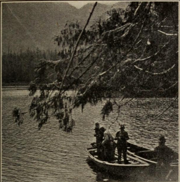
Foot of Buttle Lake.
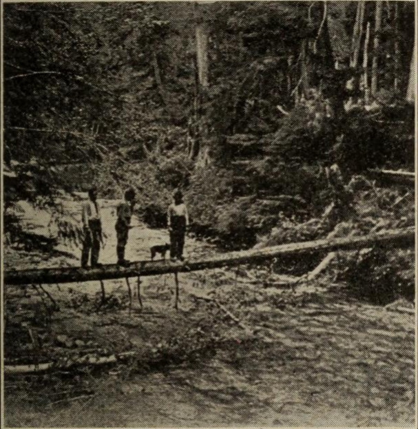
On the way to Drum Lake.
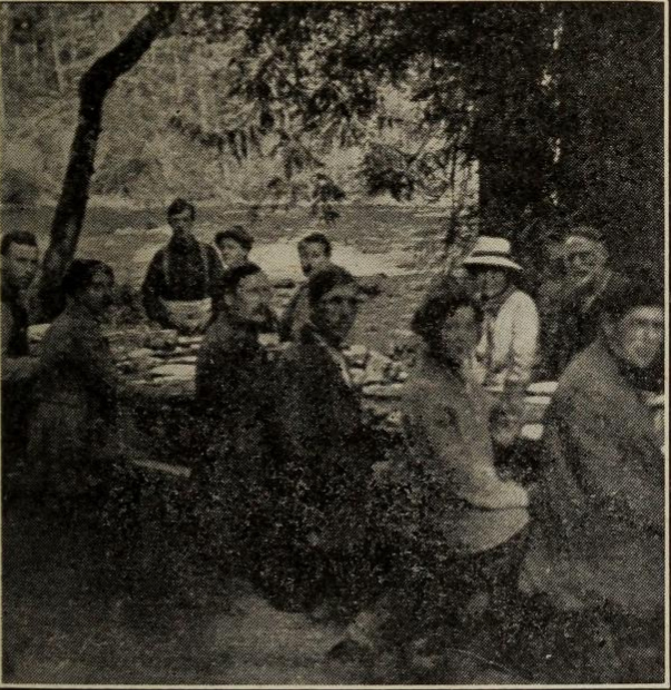
The Engineer’s Camp at the foot of Buttle Lake.
Alpine Club Meet
Plan Formulated for Patriotic Work—Many Members Already On Military Duty
Reported in the Daily Colonist Friday November 27, 1914, p.5.
The first meeting this season of the Vancouver Island section of the Alpine Club of Canada was held on Tuesday [November 24] evening in the Alexandra club. In the absence of the chairman, Mr. W. [William] W. Foster, M.P.P., on military duty, the chair was taken by the director, Mr. A. [Arthur] O. Wheeler, F.R.G.S. After the usual routine business had been disposed of, including a report on the successful camp held in the Upper Yoho Valley during July and August last, the chairman brought up for discussion the formulating of a plan whereby the club, as a unit, could lend its assistance during the present war. A plan was suggested and it was decided to submit it to Toronto, Montreal, Winnipeg and other sections of the club for approval and co-operation. It was considered that, with its membership of over 800 throughout Canada, the club would be able to do its share. It was found that twenty-four members were already on military duty, among them being the director’s son, Capt. E. [Edward] O. Wheeler, R.E., who went with the Indian troops. At the close of the business meeting, refreshments were served and a social half hour spent. The meeting adjourned until December 18.
Alpine Club Notes
Reported in Rod and Gun in Canada Vol. XVI, No. 9, February 1915. p.926.
The Vancouver Island Section held the opening meeting [at the Alexandra club] of the season on the evening of November 24 [1914]. Owing to the absence of the Chairman Mr. William W. Foster, absent on military duty, Mr. Arthur O. Wheeler took the chair. He announced that the Camp held in the Yoho Valley during the recent summer was one of the most successful held. Two hundred and six were under canvas as compared with 197 at the O’Hara Camp in 1909. In spite of the heavy charges for transportation the Camp finances were very satisfactory. The Chairman then introduced the principal subject of the evening. It was felt that the Club as a whole should make some definite presentation to the War Funds. Many members had gone to the front, but such action was an impossibility for the greater number. The ladies could knit and do needlework, but this did not seem exactly to satisfy the Club. Many suggestions were made and finally it was decided to get into communication at once with the other seven sections, in order that they might express their preference for one or the other of the schemes suggested. At the time of the writing the Secretary-Treasurer knows of 25 member who have gone to the front, but there were probably many others of whom he has not heard. A very interesting letter had been received from Lieutenant Edward O. Wheeler, R.E., from somewhere on the battle line. Definite information is forbidden. The neighborhood is interesting from the frequency of the “Jack Johnsons” and “Black Marias”, but he soon got accustomed to them. He is with the King’s Own Sappers and Miners an Indian Regiment. Conditions are quite as comfortable as could be expected. He also states that magazines and light reading matter are always most acceptable. The question of transport is a serious one, and magazines can always be left for anyone else who comes. The Secretary asks that we add to the list of gone-to-warers Reverend R.B. Winser of Coutts, Alberta, who was at the recent camp, Dr. and Mrs. Anderson of Fernie, H.W.A. Foster of Toronto, and William A. Alldritt of Winnipeg.
1915
ACCVI Executive:
Chairman – William Foster
Vice-Chairman – Robert McCaw
Secretary-Treasurer – Jennie McCulloch
Executive Committee – Margaret Cowell, Sara Spencer
Events:
January 19 – Club talk by Arthur Wheeler on “The Caves of Cheops, Selkirk Mountains.”
February 23 – Club meeting at Alexandra Club with talk by Robert McCaw on “Some Trips Taken During a Summer Spree Along the Banff-Windermere Motor Road.”
April 10 – Club’s 9th annual banquet at the Brentwood Hotel.
December 14 – At the annual meeting William Foster was elected Hon. Chairman, Robert McCaw, Chairman; Jennie McCulloch, secretary; and the following were elected members of the committee: William Drewry, William Dougan, Gordon Cameron, Nancy McCulloch, Margaret Cowell and Alan Morkill.
Section members who attended the annual summer camp at Ptarmigan Lake July 21 to August 11: Arthur and Clara Wheeler
Alpine Club Meeting
Reported in the Daily Colonist Wednesday January 13, 1915, p.8.
The regular monthly meeting of the Vancouver Island section of the Alpine Club of Canada will be held on Tuesday, the 19th instant, at 8:30 p.m., in the King’s Daughter’s Hall (opposite the Alexandra Club), when the director, Mr. A. [Arthur] O. Wheeler, F.R.G.S., will give an illustrated lecture entitled “The Caves of Cheops, Selkirk Mountains, British Columbia.” The lecture will be open to the general public, as well as to members.
“Caves of Cheops”
Reported in the Daily Colonist Thursday January 21, 1915, p.6.
An excellent audience met in the rest room of the King’s Daughter’s to listen to an address by Mr. A. [Arthur] O. Wheeler, F.R.G.S., director of the Alpine Club of Canada. Mr. Wheeler illustrated his story by lantern slides. His lecture took his audience to the neighborhood of Glacier House, or, more particularly, to the “Caves of Cheops,” in the Selkirk Mountains. He described the accident of their discovery in 1904 and his exploration of them the following year with two companions. Mr. Wheeler’s description of the flora and fauna of the district was also exceedingly interesting.
Alpine Club Meeting
Reported in the Daily Colonist Tuesday February 23, 1915, p.9.
At the regular monthly meeting of the Alpine Club of Canada, to be held tonight in the Alexandra Club, an address will be given by Mr. R. [Robert] D. McCaw, D.L.S., entitled “Some Trips Taken During a Summer Spree Along the Banff-Windermere Motor Road.”
Address Alpinists
R.D. McCaw Reads Interesting Paper on Trip in Windermere District: Assent of Mount Ball
Reported in The Victoria Daily Times Wednesday March 10, 1915. p.14.
At the last meeting of the Victoria branch of the Alpine Club of Canada, Arthur O. Wheeler, director, presided. Arrangements for the annual dinner in celebration of the founding of the club were discussed, and it was decided to hold this after Easter at the Brentwood Hotel. The feature of the evening was the excellent paper read by Robert D. McCaw on “A Few Side Trips Along The Banff-Windermere Motor Road.” The trip, the speaker explained, had been taken in the summer of 1913 during a photo-topographical survey he was taking for the B.C. department of public works. His summer’s work followed the course of the Vermillion River to its junction with the Upper Kootenay River, together with all valleys tributary to the first named stream. Among the more prominent alpine and scenic features referred to by Mr. McCaw was Mount Whymper, at the summit of which (9,321 feet above sea level) they established a photographic station and did some transit work. Mount Whymper was only introductory, however, to mount Ball, the ascent of which was attempted on June 25. The climb was commenced at 6 a.m., in the rain, which lasted most of the day. Among some of the interesting things seen were small rock rabbits and marmots, and a very fine ice cave was entered. The climb was continued until they reached the elevation of 10,200 feet, when the clouds settled so thickly that they decided to descend, without having reached the summit. Prospectors’ valley was well explored, also the district around Kaufmann Lake, Opabin Pass, Misko Pass and the ochre beds above the Ochre Creek. These were of historic interest, from the fact that centuries ago they are known to have been the rendezvous of Indians who trekked in from the prairies and other districts to get the decorative ochre for their war paint. The extensive remains of old tepee pole of the vicinity were some indications of the large number of Indians who visited the place. Ottertail Pass, Mount Sharp, Mount Helmet and the second (successful) attempt to ascend Mount Ball were described. At the summit of the last named they found a record of two ropes of climbers from the Alpine Club camp, Vermillion Pass (1912), which had been there the previous summer. The story of the ascent of Mount Ball was told in detail, and the closing chapters of the paper were devoted to the trail up the Simpson, through Ferro Pass, and the description of the view of Sunburst valley and Mount Assiniboine, all the features of special interest being pointed out by Mr. McCaw on a large map of the district which he had specially prepared. At the close of the address the speaker was accorded a hearty vote of thanks.
Gives Motor Ambulance
Reported in The Victoria Daily Times Thursday March 18, 1915. p.5.
The Alpine Club of Canada, of which Arthur O. Wheeler, of Sidney, is the director, has forwarded the sum of $2,144 to the Central committee of the Red Cross Society, Toronto, for the purchase of a motor ambulance for the use of the Canadian Expeditionary Force at the front. The ambulance is to be purchased through the Canadian Red Cross commissioner in London, and the gift represents the members of the Alpine Club throughout the dominion. Mr. Wheeler wishes to express through the local press his appreciation from members of the Victoria branch. Contributions were also received from members in England and the United States.
Alpine Club of Canada
Reported in Rod and Gun in Canada Vol. XVI, No. 11, April 1915. p.1116 – 1118.
On the evening of February 23rd, The Vancouver Island Section held its monthly meeting in Victoria. The Vice-Chairman Mr. Robert D. McCaw, D.L.S., B.C.L.S. read a most interesting paper on “Some Trips Taken During a Summer Spree Along the Banff-Windermere Motor Road.” Some of our readers will remember that the motor road is being built from Banff to Windermere in the Columbia Valley through the Vermillion and Sinclair passes which will open up a vast tract of magnificent mountain country practically unknown. The following extracts from the paper should be of interest to the general reader.
“Prospector Valley is the first large valley tributary to the Vermillion, named no doubt from the mineral claims situated therein. The valley is drained by Tokumm Creek, which joins the Vermillion about four miles below the Pass. The source of this creek lies in a snowfield at Opabin Pass between Mounts Biddle and Neptuak, and the width varies, the average being about fifty feet. At present a pack trail extends up stream about two miles, and a rider could get further by following the stream bed. The first interesting feature of the valley is the box canyon at the outlet. The mouth of this canyon is situated a few hundred feet from the confluence of Tokumm Creek with the Vermillion River, and extends for about one quarter of a mile upstream. Throughout its entire length the depth seldom falls short of seventy-five feet. Its walls are either sheer or concave, and are scarred by numerous potholes, some still containing a rounded rock, the scouring factor. Many of these potholes are situated more than fifty feet above the present high-water mark and tend to give the canyon a more or less grotesque appearance. In many places it is very narrow, and might be leaped across with ease. At one point there is a natural bridge about ten feet in width. About eight miles from the vermillion River and one-half mile to the north is Kaufmann Lake, contained in a hanging valley between Mt. Deltaform and Peak No. 6 of the Ten Peaks. This lake is about three quarters of a mile in length and does not attain a great width. A fringe of grass, besprinkled with wood anemones and other flowers encircles the lake, while the timber is clean, free from underbrush and pleasant to travel through. Especially beautiful is the alp land on the western slope. The snowfield between Mts. Deltaform and Tuzo is almost entirely visible from the lake which, with the glacier below, sends down the stream that causes the lake to exist. The shores would make an excellent camping ground, especially for those desirous of climbing Mt. Deltaform or any of the immediate peaks. The Opabin Pass lies at the source of Tokumm Creek and although horses cannot be taken over it, the tourists may cross the pass on foot and view the beautiful Lakes O’Hara and McArthur a short distance on the opposite side. A very interesting and peculiar freak of natural rock formation is found in the valley near Opabin Pass. A rock tower rises from the valley and supports on top a mass of rock resembling an eagle with wings outspread. Ochre Creek enters the Vermillion River at the point where it bends towards the southeast. The name is derived from the beds of mineral deposit near the junction. The ochre or paint beds as they are locally called, are found about one mile above the mouth of Ochre Creek, and lie a few hundred feet back from the Vermillion River. It has been deposited by mineral springs which lie about one thousand feet back from the river. Two of the springs resemble swamps with a bottom of ooze. One is a spring proper—a basin-shaped pool about four feet across. The mineral compound (iron oxide for the most part) is being deposited and is gradually building up the rim of the basin, which is now some three feet above the level of the surrounding ground. The water has that brackish, metallic taste peculiar to springs containing iron compounds. The three pools are situated within twenty-five feet of one another; the stream from them flows over first a yellow, then an orange, and then a reddish bed to the flats below. These extend for probably fifteen or twenty acres, the color running from buff to deep orange and, in some places, vermillion. They are drained by a creek which runs parallel to the river, its gravel bed colored by deposits from the water running over it. The colors become fainter and are soon lost in the Vermillion River. The paint beds are of historic interest from the fact that they have in times gone by been the rendezvous of Indians from the east who came there to satisfy themselves with decorative material in the way of war paint. As the ochre is very finely divided it would answer that purpose very well. The extensive remains of old tepee poles in the vicinity give some indication of the large number of Indians who made use of these deposits.”
Alpine Club Held Annual Banquet
Director Announced Annual Camp at Ptarmigan Valley; Patriotic Speeches
Reported in The Victoria Daily Times Monday April 12, 1915. p.14.
The interesting announcement that contrary to the expectation of the majority of the members, a camp would be held during the coming summer was made by Director Arthur O. Wheeler at the annual meeting of the Vancouver Island section of the Alpine Club of Canada held on Saturday evening (April 10). The camp is to be held in the Ptarmigan Valley, a few miles from Laggan, on the north side of the Canadian Pacific Railway. The camp will be held about the middle of July, will last twelve days, and will provide accommodation for seventy-five persons. The statement was heard with appreciation with several members present who hoped to be able to join the annual outing. The annual gathering took place on Saturday at the Brentwood Hotel, about thirty-five members and specially invited guests being present. The occasion was singularly enjoyable, the spacious new hotel, with its considerate hosts, affording unusual advantages for an affair of the kind. The proceeding opened with the usual banquet, Captain William W. Foster, M.P.P., chairman of the Vancouver Island section occupying the seat of honor, and at the head of the table with him being Mrs. Foster, Director A.O. Wheeler, Mrs. Clara Wheeler, William S. Drewry and Mrs. McCaw. The vice-chairman, Mr. Robert D. McCaw, occupied the other end of the long table, and others of the executive present were Miss Jennie L. McCulloch, the secretary-treasurer, and Misses Margaret Cowell and Sara A. Spencer. The tables were very effectively decorated, bowls of dogwood and wild lilies forming this principal feature in this respect, while a unique touch was found in the miniature Alpine scene of granite rock with its rope debonair Alpinists armed with ice axes. Place cards were threaded with the club colors, green, silver and white, and individual menu cards were made into attractive souvenirs with photographs of grandly picturesque spots in the Canadian Rockies. The first toast, “The King,” proposed by the chair, was responded to with loyal enthusiasm, the whole company joining in the national anthem. In his address Captain Foster reviewed the events leading up to the war, and of some of the more outstanding features of the grave conflict which was shaking Europe and the world to its very foundations. Before concluding he made reference to the splendid strength of Britain’s bulwark on the seas, speaking of the navy as “a cordon of iron round the British Isles.” The patriotic character of the address, was well as the feeling manner in which it was delivered, won for the speaker a very enthusiastic round of applause at its conclusion. Director A.O. Wheeler also spoke of the brave men who were fighting for the empire and the allies in the present war, expressing on behalf of the Alpine Club a wish for their safe return. He, too, was optimistic of the outcome. The principles for which the war was being waged must triumph. The game of mountaineering was said to bring out all that was best or worst in mankind; how much more would this saying apply to such a war as the present. Fifty-two members of the Alpine Club of Canada were now on military duty, some already having been wounded in the empire’s cause. About three months ago a suggestion had been submitted to the eight sections of the club for some co-operative expression of sympathy toward the empire. A motor-ambulance fund was opened, and the sum of $2,149 was send on March 15 to the executive chairman of the central committee of the Canadian Red Cross society of Toronto to be forwarded to the Canadian Red Cross commissioner in London for the purchase of the ambulance. English and American sections had been generous in donations to this fund, and on behalf of the society he wished to express appreciation for their attitude. Reviewing on this, its ninth birthday, the club’s activities for the past year, Mr. Wheeler stated that the attendance at the club house at Banff was the largest in the experience of the organization, viz., 162. The annual camp, which opened on July 21 and closed on August 11, was attended by 206 members, being the largest camp in the history of the club. Of the two Swiss guides who had been present with the club on that occasion, he had to record with regret the death of Walter Schauffelberger, news of whose death reached here just about three weeks ago. The thanks of the club were due to Hayter Reed, until recently manager of the C.P.R. hotels, for the loan of two additional Swiss guides, and to Mr. W. MacPherson, a passenger traffic manager for the western division of the C.P.R. Sympathy was extended to F.W. Freeborn. An interesting account of the more notable climbs and expeditions made by members of the club, aside from the annual camp, was include in the paper, which also noted the election of J.D. Paterson to succeed Dr. Coleman. The assembled company stood during the singing of the patriotic son, “The Soldier of the King,” Mr. McCaw accompanying at the piano. A very delightful paper entitled “Souffles des Alpes,” written by Mr. McHutcheon, a Scottish member of the society, was read by Gordon Cameron. The tables were cleared away after their dinner, and, to the accompaniment of Mr. Heaton’s playing, dancing was kept up till after midnight, proceedings concluding with the singing of the club song, “Hail to Our Mountains,” to the tune of the Russian national anthem. During the evening vocal solos were furnished by D.C. Hughes, Miss McLaren and Mrs. McCaw.
Annual Meeting of Alpine Club Branch
Enjoyable Banquet Held at Brentwood – Camp Arranged For This Summer
Reported in the Daily Colonist Tuesday April 13, 1915, p.4.
The annual banquet of the Vancouver Island branch of the Alpine Club of Canada was held on Saturday night [April 10] at the Brentwood Hotel. Capt. W. [William] W. Foster, M.P.P., chairman of the branch presided, and was accompanied at the head table by Mrs. Foster, Director A. [Arthur] O. Wheeler, Mrs. [Clara] Wheeler, W. [William] S. Drewry and Mrs. McCaw. The vice-chairman took the other end of the table, others of the executive who were present being Miss J. [Jennie] L. McCulloch, the secretary-treasurer and the Misses M. [Margaret] Cowell and Sara E. Spencer. In addition, some thirty-five members and invited guests were present. After the loyal toast had been honored, Capt. Foster gave a patriotic address, which was followed by a review of the club’s activities by Mr. A.O. Wheeler, the club’s director. Mr. Wheeler mentioned that fifty-two members of the Alpine Club of Canada were serving with the troops, several having already suffered wounds in the Empire’s cause. A motor ambulance fund had been opened and $2,149 sent on March 15 to be forwarded to the Canadian red Cross commissioner in London for the purchase of the ambulance. A paper written by Mr. McHutcheon entitled “Soffles des Alpes,” read by Mr. Gordon Cameron, was much appreciated, after which the remainder of the evening was spent in the enjoyment of music and dancing. The following ladies and gentlemen contributed to the musical programme: Mr. and Mrs. McCaw, Miss McLaren and Messrs. D.C. Hughes and Heaton, the proceedings coming to a close with the singing of the club song, “Hail to Our Mountains.” The tables were very effectively decorated, bowls of dogwood and wild lilies forming the principal feature in this respect a unique touch was found in the miniature Alpine scene of granite rock with its rope of debonair Alpinists armed with ice axes. Place cards were threaded with the club colors, green, silver and white, and individual menu cards were made into attractive souvenirs with photographs of grandly picturesque spots in the Canada Rockies. The camp is to be held this year in Ptarmigan Valley, near Laggan about the middle of July.
Alpine Club Notes
Reported in Rod and Gun in Canada Vol. XVI, No. 12, May 1915. p.1209 – 1210.
An additional extract from the paper referred to in our last issue is being read by Mr. Robert D. McCaw, D.L.S., B.C.L.S. at a meeting of the Vancouver Island Section, may be of interest to readers of this department.
“On August 2 [1914] I made my second and successful attempt on Mt. Ball, accompanied by two of my assistants. The start was made from a camp on Hawk Creek to the south of the mountain. It was five minutes to seven when we left, and we followed the west fork of this stream from a short distance and started to climb the side of Isabelle Peak in order to get into the glacier bed which I had in mind from previous ascents in the neighborhood. Fortunately, the timber was very thinly scattered and climbing was not fatiguing. This glacier bed was reached about an hour and a half after leaving camp, and it is one of the most interesting features that I found during the whole summer. It is about three-quarters of a mile in length and varies in width, averaging about a quarter of a mile. The entire surface has been worn by glacial movement and in part is very smooth. The grade is not heavy and one could generally strike a fairly quick pace in going over it. Potholes and fissures occur all over the surface and the rock in places has the appearance of a honey-comb cut in half. Some of the potholes appear as if they had been drilled so regular are they in shape. The depth varied up to twenty feet. One in particular I noticed had a stream of water falling from its side part way down and disappearing by a subterranean passage. The composition of the bed is of fairly soft rock with dikes of harder rock between which the soft has been gouged out. On the east and west the bed is bound by high, steep serrated ridges. There was no water flowing over the bed, all the water from the snow and ice fields finding outlet through an under-ground passage or passages. The floor of the amphitheater rises more steeply towards the north and at the upper edge of the bed are huge piles of morainal detritus. We climbed over these piles of rocks and estimated that they must have been one hundred and fifty feet high. Over this pile of rock one is immediately upon Glacier No. 6. Practically all of the fresh snow had disappeared from the forefoot, and but few snow bridges were left, so that we had to find the narrow parts in the crevasses in order to jump across. It was rather interesting as we ascended the glacier and looked down into the crevasses, which were getting deeper, to imagine what it would feel like to be precipitated below. The ice cap on the summit was getting more distinct and we were still about 1000 feet below it, and the glacier we were on was bounded at the upper end and sides by steep rock walls, with chimneys and one or two snow couloirs. We were undecided as to a route and did not choose until we reached the bergschrund. This was rather formidable looking, but would have to be crossed to reach a snow couloir on our left. Another route was by means of a chimney on our right hand and a little further back on the glacier. The crevasse at the edge was crossed easily in a narrow part and a steep snow slope ascended at the base of a chimney. I might say that we put on the rope when we first started upon the ice and took it off while going up this chimney. It was but fifty feet high and although short was slow work. One of us ascended half way and dropped the rope to assist the other two, making the top in two shifts, and using elbows, knees, feet and hands in order to get a grip on the rock which had few good hand and foot holds. Above this chimney a steep terraced rock slope took us to the snowfield above without difficulty. We again roped and zig-zagged to the summit and found ourselves on the ridge south of the main dome, which was about half a mile north. We wandered south along the ridge to a rock tower and sat down to enjoy a prune or a raisin, I’ve forgotten which, and the scenery. I do not remember what the time was here. The day was bright and sunshiny, and only one who has been on a big peak such a day can form any idea of what the surroundings look like. The myriads of snow peaks all around and Assiniboine towering loftily above all those away to the southeast, with Goodsir, the Ten Peaks, Deltaform and many others on the west, are impossible of description. When we had partially satisfied our visions, we followed along near the edge of the snow cornice northerly to the first dome, or Ball junior as I called it. The dome is a separate part of Mt. Ball and is about 10,200 feet in altitude above sea level. A narrow col connects it with the main dome. In descending the north face of the small dome some thirty ice steps were required, and we were on the col. Looking back along the ridge which, incidentally, is a part of the continental divide, we could see the great snow cornice or overhang upon which we had been travelling, and rather shuddered when the step drop, some 1,500 feet to the slopes below on the Alberta side of the mountain, met our eyes. Again, looking northerly, a most spectacular ice fall from the great dome is seen in the Alberta side. The glacier falls down a precipitous slope for one thousand feet or more, and is fissured, crevassed and contorted in a most wonderful manner. Seracs stood out in parts and now and again great blocks of ice went crashing and roaring to the slopes below. An almost continuous groaning and creaking was heard as if the whole glacier was trying to break away. We continued across the col and sat down by a small trickle of water to eat lunch. Strange to say, we must have decided upon the same location that some previous climbers had chosen, as several Peter’s Milk Chocolate covers were still there, and a piece of shale had the initials F>W.H. scratched upon it. Having partially satisfied our appetites, as I am sorry to say most of the sandwiches had disappeared before this, we zig-zagged up the side of the main dome and reached the last bit of rock near the top. Here we found the stone man erected by previous climbers. Of course, we looked for the container holding the precious documents and found that our predecessors had fared most sumptuously on Bartlett pears, as a tin can with the label still intact held the records. A piece of paper with the names of two ropes of climbers from the Alpine Club Camp, vermillion Pass, 1912, was found therein. And now arose a difficulty. None of us had a pencil and we wanted to place all our names upon record. Happily, one of the boys had a soft nosed bullet which was immediately sharpened and the names of J.P. Scarlett, J.M. Thomas and R.D. McCaw were forth-with added to the list with the date, and the work upon which we were engaged. The record contained the signatures of Rudolph Aemmer, Francis MacMillan, Malcom Bright, A.P. Coleman, C.B. Sissons, Blanche Hume, T.H. Ingram and F.W. Hewton. Appended was the statement that they had had a pleasant trip from camp byway of the main valley. The cairn was rebuilt and we proceeded to the summit which is almost at the north edge of the snow and ice cap. We did not remain here long as it was two o’clock p.m. and camp must be reached for the evening meal. We descended by practically the same route and reached camp at five-forty-five p.m. having made the ascent of 5,700 feet, visited the main ridges, and returned to camp in a little less than eleven hours well pleased with the day. Mt. Ball is undoubtedly one of the most interesting glacier hung mountains in this portion of the Rockies. There are six separate glaciers on its sides with numerous small hanging glaciers and two ice caps. The snowfields are not of great extent, but the cornices are immense and have large overhangs. Mt. Ball was first ascended by Mr. J.D. Patterson in 1904 but at the time I did not know of it, and so did not look for further records.”
Alpine Club Camps
Programmes Of Summer Camps Ready; Arrangements for Accommodating Guests at Club House
Reported in The Victoria Daily Times Wednesday May 26, 1915. p.13.
The Alpine Club of Canada has issued programmes of the summer camps to be held under its auspices this year. Arrangements have been made to outfit small camping parties from the club house, Banff, for expeditions in the vicinity. A camp is ready for occupation in the club grounds on Tuesday, June 15, and will be in operation while the club house is open. Each tent house will accommodate two, but occupants should bring their own camp bedding and toilet articles, towels, soap, etc. Those who cannot conveniently take bedding may obtain two pairs of blankets, also a pillow, for a small charge per day. Camp meals will be served at regular hours in the dining room. The club house is two miles from the railway station, and special livery will be operated in connection there-with for the benefit of visitors and guests.
Would Retain Name of Highest Peak
A.O. Wheeler Makes Protest Against Change of Mount Robson
Reported in The Victoria Daily Times Monday November 8, 1915. p.14.
Since the suggestion was first mooted by Sir Richard McBride that the name of Mount Robson be changed to Mount Cavell, in memory of the British Red cross nurse who was murdered by Germans in Brussels, there has been some little discussion as to the origin of the naming of the mountain. The first though is rather naturally that it is so called in honor of Hon. John Robson, a former premier of the province, but this is not so, the name going back for beyond this time. The peak is the highest point in British Columbia of the Rocky Mountains, and has of recent years given a name to the Mount Robson Park, one of the National Parks of Canada. It has been a popular climb for the members of the Alpine Club, and the references to it in literature and handbooks are frequent. Arthur O. Wheeler, director of the Alpine Club of Canada, makes a protest against the proposed change as involving a loss that would be greatly felt, “by the extinction of a name that will forever be identified with the great central mass if that contains a distinctive scenic world of its own.” Mr. Wheeler quotes H.J. Moberly, the well-known Hudson’s Bay Company factor, to whom he had written three years ago to ask if he knew anything of the origin of the name. It is mentioned by Milton and Cheadle, who made the trip across the continent on horse back in 1863, but the reference to it in their book rather proves that it was an existing name than that it was given by them, as the former chief geographer of the department of the interior thought. What Mr. Moberly says is that years before the Northwest Fur Company was amalgamated with the H.B. Co., which occurred in 1821, it was the custom of the aggressive Montreal group of fur traders to send out parties for two-year trips hunting and trading. One of these was under Peter S. Ogden—for whom Ogden Point, the site of the new breakwater, is named—and then west of the Rockies he scattered his hunters in parties each under a foreman. One of the parties was under the charge of a man named Robson, with its camp somewhere in the vicinity of the mountain, and on account of the commanding mass it was made the rallying point where all the parties came together to return east. It would easily happen that “Robson’s Peak” would be used to describe it under these circumstances. Mr. Wheeler suggest that if it is desired to perpetuate Miss Cavell’s name through the permanence of a mountain peak, the name might be added to the existing name of Mount Edith, in the Rocky Mountain Park, near Banff. This he describes as a strikingly sharp peak, rising as a splendid spire in full view of the many thousands who pass up and down the Bow River. “While willing in such behalf to relinquish the sentimental reverence for historic names that is held by all mountain lovers, were such a relinquishment the only course, I feel satisfied that the end desired should be obtained quite as appropriately without such a change, and hope that further consideration will see the matter in this light,” writes Mr. Wheeler.
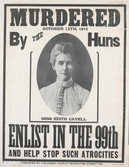
Recruitment poster for the 99th Battalion, Canadian Expeditionary Force.
1916
ACCVI Executive:
Honorary Chairman – William Foster
Chairman – Robert McCaw
Secretary-Treasurer – Jennie McCulloch
Executive Committee – William Drewry, William Dougan, Gordon Cameron, Nancy McCulloch, Margaret Cowell, Alan Morkill
Events:
January – Meeting cancelled owing to unprecedented weather conditions.
February – Club meeting where Arthur Wheeler gave a talk on his summer work in the High Rock Range and Frederick Godsal gave a talk about climbing in Southern Alberta.
March 25 – Club’s annual banquet held at the Brentwood Hotel. Twenty-four members and their guests were present. Paul A. Wallace (Toronto) was guest at the dinner.
December 18 – The Vancouver Island Section held its annual meeting on 18th of December at the Brentwood Hotel. The Chairman for the ensuing year will be Robert McCaw and Secretary Jennie McCulloch, 912 Linden Avenue, Victoria, both being re-elected. Monthly meetings will be held at the Brentwood Hotel, being equally convenient for the Victoria and Sidney members.
Eleventh annual ACC summer camp at Healy Creek, Bow Valley July 13 – July 31: Outfit – All ladies climbing must wear knickerbockers with puttees or gaiters. Skirts and bloomers are a danger when climbing. Section members who attended the camp: Arthur and Clara Wheeler, William Foster, Stanley Mitchell.
Alpine Club Holds Annual Banquet
Director A.O. Wheeler Delivers Address at Anniversary Dinner Held at Brentwood Hotel
Reported in The Victoria Daily Times Monday March 27, 1916. p.13.
“Our members, near and dear, whom we picture in our mind’s eye as associated with the great exploits and the little incidents of our past camps are moving to the march of armed thousands who shake the earth with their tread; shot and shell are all around them; their lives are momentarily in danger. And still, it could not be otherwise. What is right must be maintained; what is right must prevail. We can only pray that the end will soon be, and that our dearly loved comrades will be able once more to gather with us amidst the grand mountains we love so well.” Arthur O. Wheeler, director of the Alpine Club of Canada, was speaking at the tenth anniversary dinner of the Vancouver Island section of the organization which was held on Saturday [March 25] evening at the Brentwood Hotel. Twenty-four members and friends were present, the chairman of the local section, Robert D. McCaw, presiding. Speeches, music and dancing were adjuncts to this annual gathering of members. By request of the chairman Mr. Wheeler acted as toastmaster at the banquet, a sumptuous repast which has been arranged with commendable foresight by the management of the Brentwood Hotel. There were four tables, arranged as a quadrangle round a smaller table displaying the Union Jack in the spacious dining room. The first toast, “The King,” was responded to by the whole gathering rising and singing the national Anthem. Hearty applause followed the drinking of the toast to the Alpine Club Director, A.O. Wheeler, proposed by William S. Drewry, the director responding to this by reading his annual address of which the above paragraph is a part.
Directors Address
“It is sad that the occasion of our tenth anniversary should be marred by the throes of a death struggle in which many of our best known and loved members are in imminent peril of their lives,” began the director. “For the second time we have gathered to celebrate this annual occasion while the sound of great guns is in our ears and the clash of armed hosts fill us with dread. It is difficult in the view of the mighty happenings that are taking place to give our interest and attention to such minor details of existence as our Alpine Club affairs. But the club has been the means of creating close friendship, and many are now in the midst of the dangers and hardships of the greatest war the world has ever known. Even so, word comes to us in cherry fashion from the forefront of the battleline that our comrades there have us well in mind, and are looking forward with keen anticipation to the day when we shall again foregather round the camp fire. To us, at home, it should be a sacred trust to keep our Alpine circle well preserved and ready to supply the desire so keenly expressed by those who are risking their lives for all we hold dear. It was with this object in view that we endeavored, last year, to carry on as usual in spite of the majority opinion of the club.” The director proceeded to review the club doings for the year just closed, devoting quite a part of his address to the work of the annual camp in the Rockies last summer when 103 members were under canvas and several “first ascents” made, while small groups of enthusiasts had attempted independent climbs in other parts of the mountains, Mt. Cavell (named in commemoration of the martyred Nurse Edith Cavell) being among the number. Reference was also made to the good climbs that are within reach of the club house at Banff, which will be opened again as usual on June 1 for summer climbers, the result of which would be made known, while efforts were being made at the present time to negotiate a camp. The Alpine Club Journal, it was announced, would be brought out as usual.”
Planning Reunion
“I am already planning a great reunion beneath everlasting snows of Mt. Assiniboine,” the director continued. When the times comes, I feel sure that it will be the greatest occasion of our existence. Eighty-four of our members are on military duty. Of these 21 have acquired honor of service of their country, either by wounds, as prisoners of war, by honorable mention, or by decorations and orders. Their names are as follows, the rank indicating promotion: L.S. Amery, Captain on general staff; W.A. Aldritt, prisoner at Gutersloh; C.G. Arthur, D.S.O.; F.C. Bell, Major, wounded, mentioned in dispatches twice; R.J. Casement, Corp. D.C.M.; J.A. Clark, Lieutenant Colonel; R.P. Clark, Military Cross; W.W. Foster, Captain, divisional grenade instructor; C.W. Gray, wounded; Dr. J.A. Gunn, Lieutenant Colonel; J.H. Heskeths, Major, D.S.O.; J.R.N. Irven, lieutenant, wounded; S.L. Jones, Captain, twice wounded; F.V. Longstaff, Major; C.H. Mitchell, Lieutenant Colonel, mentioned in dispatches, Cross of the Legion of Honor; W.F.M. Pearce, wounded; E.F. Pilkington, Major; F.A. Robertson, Major; T. Trant, wounded; A.F. Wedgewood, wounded; E.O. Wheeler, Captain, Military Cross, Cross of Legion of Honor, mentioned three times in dispatches.” The assembled company stood again to drink a toast to these members and their comrades who were so nobly fulfilling the best traditions of the nation, and supplemented the silent deference by singing with great feeling “Soldiers of the King.”
Other Speakers
Joshua E. Umbach, chief draughtsman in the surveyor general’s department of the provincial government, read a poem, “Mike Mullen,” by the late J. Herrick McGregor, “a good business man, a good mountaineer, a good soldier, who died in Flanders fighting for his country.” The tribute was supplemented by a few words from A.O. Wheeler, expressive of his admiration and love of the dead soldier. Others who spoke were James. J. White, of Sidney; Mr. Roche, Gordon Cameron, who read a parody on “The Walrus” (from Alice in Wonderland), having very direct reference to Alpinists. The musical part of the programme was by no means negligible in the evening’s enjoyment, among those who contributed charming numbers being Miss Eva Hart [Mrs. Eva Gillian—1880-1978—known professionally as Eva Hart arrived in Victoria from England in 1912 and became a well-known singer in the theatre] (whose name was specifically mentioned in the vote of thanks at the end of the entertainment): Mrs. R.D. McCaw, Miss McLaren, Mr. Tomlinson and others, Miss White, R.D. McCaw and A. Dobson very able accompanists for the singers, and the first two named also played for dancing which was kept up until midnight.
Alpine Club Notes
Notes From The Vancouver Island Section
Reported in Rod and Gun in Canada Vol. XVII, No. 12, May 1916. p.29 – 30.
“Although in common with all other organizations our Section is feeling the effects of the war,” writes the Secretary [Jennie McCulloch] of the Vancouver Island Section, “many of our members, including our popular Chairman, Captain William W. Foster, being at the front, we have kept up our regular monthly meetings during the past winter. The meetings have, as formerly, been held at the comfortable Alexandra Club, where the cheery open fire and the coffee and sandwiches at the close of the meeting have served as substitutes for our Camp-fire and tea tent of summer days. At the December [1915] meeting the proposed change of the name Mount Robson to Mount Cavell was taken up and discussed. There was much opposition to the change, but as correspondence with the Geographic Board at Ottawa disclosed the fact that no application for such change had been received by them, as indicated by the newspapers, it was decided to let the matter rest. Since then, as we all know, the name “Cavell” has been given to another mountain. Election of officers was also held at this meeting. The January meeting had to be cancelled owing to unprecedented weather conditions which prevailed in Victoria about this time, a genuine Eastern “Blizzard” holding sway that evening and the Sidney trains being held up the Director [Arthur Wheeler], who was giving the address of the evening, was unable to come. At the February meeting two very interesting papers were read. In the first Mr. Arthur Wheeler gave us an account of his summer’s work in the High Rock Range, including a description of the thrilling electrical storm on Gould’s Dome while the party were at work there. Mr. Frederick W. Godsal, of Cowley, Alta., in the second paper gave us an account of some of his climbers in Southern Alberta, and these happened to be not far from the region which Mr. Wheeler had just spoken. We were fortunate in having with us two other out-of-town members as guests, besides Mr. Godsal, Miss Pearce of Calgary and Reverend W.F. O’Neill Fisher, of Greencourt, Alta. The Annual Dinner, celebrating the anniversary of the Club, was held at the beautiful Brentwood Hotel on Saturday, March 25th, and was a decided success. Twenty-four members and their guests were present and a most enjoyable evening spent. At the close of the splendid dinner three cheers were given, “The King,” “The Alpine Club”, and “Our Members at the Front,” all of which were heartily-drunk and well responded to. The Director then read his annual address, after which an informal programme of music and dancing was enjoyed. “Paul A.W. Wallace, of Toronto, who will be remembered as the Assistant Secretary at the Robson Camp, was present as a guest at our dinner.”
Alpine Club Will Camp in Bow Valley
Eleventh Annual Camp Will Keep Alive Camp-Fire Circle On Behalf of Members At The Front.
Reported in the Daily Colonist Sunday July 23, 1916, p.9.
The Alpine Club of Canada has arranged to hold its eleventh annual camp – the second war camp – in the Bow Valley. The camp will be known as “The Bow Valley Camp,” and will be operated in conjunction with the Club house at Banff. It will open on Thursday, July 12, and close Monday July 31. The object of the camp is announced to be to keep alive the camp-fire circle on behalf of the members now on active military service for the Empire. Accommodation will be prepared for 100 persons. In accordance with clause 14 of the constitution, the annual meeting of the club will be held during the camp for the election of officers, presentation of reports, and transactions of business. The main camp will be placed in the Bow Valley, on the south side of the river, below the Massive Range, at an altitude of between 5,000 and 6,000 feet above sea level. This range contains a number of fine peaks, of which Pilot Mountain, Mount Brett, one unnamed, and Mount Bourgeau are the most conspicuous. It is the home of the wild goat, and flocks congregate in the alpine meadows of its hanging valleys. Facilities will be provided to cross the Bow River and so to visit Hole-In-The-Wall Mount, Mount Edith, and Mount Louie, the last a difficult peak yet unclimbed. There are many other fine peaks in the area.
Off To Banff
Reported in The Victoria Daily Times Friday August 4, 1916. p.11.
Miss Jennie McCulloch left early in the week for Banff, where she will spend her vacation as a guest at the club house of the Alpine Club of Canada.
1917
ACCVI Executive:
Chairman – Robert McCaw
Secretary-Treasurer – Jennie McCulloch
Events:
March 28 – Club’s annual banquet held at the Brentwood Hotel. Twenty members present.
Section members who attended the ACC’s twelfth annual summer camp held at Cataract Valley July 17 – July 31: Arthur Wheeler, Edward Wheeler, William Foster.
Ye tumbling streams and towering peaks,
That fill my soul with ecstasy.
Belittle every tongue that speaks,
Would that I might sing praise to thee!
And tell the world of raptures rare
Which I behold: but I am dumb.
The spell is on me – visions fair
Fill my poor brain, but words won’t come.
By Adeline Baxter in Rod and Gun in Canada Vol. XIX, No. 7, December 1917. p.808.
Alpine Club Dinner
Reported in the Daily Colonist Saturday March 24, 1917, p.4.
The members of the Vancouver Island section of the Alpine Club of Canada are holding their annual dinner at Brentwood on Wednesday evening, the 28th instant. As many of their numbers are now at the front serving their country, and others have fallen during the war, the usual programme of music and dancing following the dinner, will be dispensed with, and in its place a number of lantern views of the Canadian Rockies and the New Zealand Alps will be shown. To this latter entertainment the guests of the hotel and any others interested will be made welcome, and a silver collection in aid of the Red Cross funds will be taken.
Alpine Club Notes
Mountain Views Substituted for Usual Speech-Making at Annual Dinner of Vancouver Island Section
Reported in Rod and Gun in Canada Vol. XIX, No. 1, June 1917. p.90.
The seventh annual dinner of the Vancouver Island Section of the Alpine Club of Canada took place on Wednesday, March 28th, at the Brentwood Hotel. The function was presided over as usual by the President, Mr. Robert D. McCaw, 20 members being present. A particularly pretty arrangement of wild lilies and Oregon grape formed the centre piece of the table, the ladies responsible for this artistic setting being Mrs. Clara Wheeler and Mrs. J.J. White, of Sidney, who made an excursion to a neighboring island to gather the flowers. The customary after dinner speeches and musical programme were dispensed with this year and in their stead were shown some very fine Alpine views, visitors at the hotel other than the Alpine Club members being invited into the lounge at this point to share in the pleasures of the entertainment. At the conclusion of the excellent repast prepared by the hotel management three toasts were proposed, “The King,” “The Alpine Club,” and “Our Absent Members,” being responded to by the members silently standing and drinking to the honor of each. In his annual address to the Club, Director Arthur Wheeler made special reference to Captain Arthur F. Wedgewood, one of the Club members, news of whose death in the service of the Empire had just a day or two ago been received. Captain Wedgewood was an Englishman, but had been over in this country several times and had joined the Canadian Alpine Club camps in the Rockies on more than one occasion. His death was a real loss to the Club, but was the voluntary sacrifice of yet another patriot in defense of the principles for which Allies were fighting. Announcement was also made that this year’s camp would be at Cathedral Mountain, the site of the 1913 Camp. An auxiliary camp was to be at Lake O’Hara. The beautiful Alpine pictures which were subsequently thrown on the screen were of views in the Canadian Rockies and the New Zealand Alps. The former were by Mr. Arthur Wheeler, F.R.G.S., and the latter by Herbert O. Frind, F.R.G.S. Among Mr. Wheeler’s pictures was one of Major William W. Foster, honorary president of the Vancouver Island Section of the Club, and for the past two years on active service at the front. This was greeted with a demonstration of enthusiasm, their soldier president being very popular not only with the local section but throughout the Club membership. Another popular picture was that of captain Edward. O. Wheeler, R.E., Director Wheeler’s son, now in India after serving in the Mesopotamia campaign; while other soldier members’ pictures thrown on the screen were those of Colonel C.H. Mitchell, of Toronto; the late Major Stanley Jones, of Calgary, who died of wounds received in battle, and Captain Arthur Wedgewood, mention of whom is made above. After the pictures a collection in aid of the Red Cross was taken up amongst the members, the sum of $9.00 being realized. It was late in the evening when the gathering dispersed, Victoria and Sidney members returning to their home by the latest trains going in the respective directions.
Mining In British Columbia
Bear River, Clayoquot Division
Reported in The Daily Colonist Friday October 12, 1917, p.13.
By E. Jacobs
In his comprehensive “Report on the Copper-Gold-Silver Ore Deposits on Vancouver Island and Adjacent Islands.” printed in the last Annual report of the Minister of Mines, Mr. W.M. Brewer gave the following information relative to the bear River district of Clayoquot Mining Division. Bear River flows from the north into Bedwell Sound, to the northern arm of Clayoquot Sound at a distance of about twenty-five miles from the settlement of Clayoquot and Tofino, at the entrance of the last named sound. There is a weekly steamer service from Victoria to these settlements during the Summer months and a service three times each month during the Winter season. During 1898, 1899 and 1900 there was considerable activity in mining operations in this part of Clayoquot Mining Division, which was examined by Mr. Herbert Carmichael in 1899, whose report is published in the Minister of Mines Report for that year. Since then and until 1914, when the Ptarmigan Mines, Limited, commenced operations on the mineral claims acquired on the Bear River side of the Big Interior Mountain, there was practically no interest taken in this region. Prospectors merely continued to hold their claims by either doing the annual assessment work or restaking the ground, as it reverted to the Government. Until the commencement of the war the Ptarmigan Mines, Limited, was engaged in building a wagon road and bridges up the Bear River Valley in order to reach the property of the company, which is situated about 15 miles from the mouth of Bear River, at an elevation of about 5,300 feet above sea-level, but since then that company has suspended operations. During 1916 there was some revival of interest by prospectors in the Bear River district and some new locations were made late in the season. The surface ores found in the mountains adjacent to the river are usually of rather exceptional value. The outcroppings occur as gossan [an intensely oxidized, weathered or decomposed rock, usually the upper and exposed part of an ore deposit or mineral vein], under which ore-lenses of chalcopyrite mixed with magnetite are found, belonging to the contact-metamorphic replacement type of ore-deposit. The development work done has not been sufficient to warrant the expression of an opinion as to possibilities that may result from further development. A selected sample from the Galena mineral claim, owned by Mr. Joe Drinkwater, situated about five miles above the mouth of Bear River, taken from the bottom of a shallow winze [a steeply inclined passageway in a mine. When worked upwards from a lower level it is usually called a raise; when sunk downward from a higher level it may be called a sump.], assayed: Gold, trace; Silver, trace; copper 21.4 per cent. Another sample from same claim at thee face of an open-cut approach to an adit assayed: Gold, trace; Silver, 0.2 oz.; Copper, 3.1 per cent.
Alpine Club Has Brilliant Record
Reported in the Daily Colonist Saturday November 17, 1917, p.9.
The Alpine Club of Canada is justly proud of the part taken by its members in the war. Eighty-nine of them – a large proportion of the total – have gone on active service. Seventeen of these has [sic] been killed, sixteen wounded, and two are prisoners of war. Eight have been mentioned in dispatches, one of them twice and another four times. Six have won the military cross, four the D.S.O., one the C.M.G., two the Cross of the Legion of Honor and one the Croix de Guerre. It is indeed a fine Roll of Honor.
1918
ACCVI Executive:
Honorary Chairman – William Foster
Chairman – Robert McCaw
Secretary-Treasurer – Jennie McCulloch
Events:
March 28 – Club’s 12th annual Banquet at Alexandra House.
April 13 – Arthur Wheeler gave an illustrated talk in aid of the Red Cross Society.
Section members who attended the ACC general camp at Paradise Valley from July 16 to July 31: Arthur and Clara Wheeler, Alan Campbell.
Alpine Club Notes
Reported in Rod and Gun in Canada Vol. XIX, No. 8, February 1918. p.1044
The Vancouver Island Section held its Annual Meeting at Brentwood Hotel, near Victoria when again the former officers were re-elected: Colonel William W. Foster, D.S.O., Hon. Chairman, Robert D. McCaw, Chairman, and Miss Jennie L. McCulloch, 912 Linden Ave, Victoria, Secretary. It was decided to hold a meeting in January at which a programme would be submitted by different members each item being limited to ten minutes—just half the space of an ordinary sermon.
Hymn for High Place
In darkened days of strife and fear,
When far from home and hold,
I do essay my soul to cheer,
As did wise men of old;
When folk do go in doleful guise
And are for life afraid
I to the hills will lift mine eyes
From whence doth come my aid.
I shall my soul a temple make
Where hills stand up on high;
Thither my sadness shall I take
And comfort there descry;
For every good and noble mount
This message doth extend—
That evil men must render count
And evil days must end.
For, sooth, it is a kindly sight
To see God’s mountain tall
That vanquisheth each lesser height
As great hearts vanquish small;
Stand up, stand up, ye holy hills,
As saints and seraphs do,
That we may hear these present ills
And lead men safely through.
Let high and low repair and go
To where great hills endure;
Let strong and weak be there to seek
Their comfort and their cure;
And for all hills in fair array
Now thanks and blessings give,
And, bearing healthful hearts away
Home go and stoutly live.
Alpine Club Annual Dinner
Reported in the Daily Colonist Friday March 29, 1918, p.6.
Alpine Club of Canada anniversary dinner on Thursday March 28 at Alexandra House in Victoria. Mr. Arthur O. Wheeler talked about the war effort of club members and read a letter from Lieut.-Col. William W. Foster. Talk of annual camp in Paradise Valley the site of the 1907 camp. Mr. Robert D. McCaw toastmaster.
Annual Dinner of The Vancouver Island Section of The Alpine Club of Canada
The Alpine Club Still “Carries On”
Reported in Rod and Gun in Canada Vol. XIX, No. 12, May 1918. p.1419 – 1420.
“The Alpine Club of Canada has “carried on” since the beginning of the war, and it proposes to carry on as long as its members make it possible to do so. We are under the deepest obligation to our members who are fighting, and it is their deepest wish again to be able to enjoy in our camps the ecstasies of the great hills……. To Have allowed the club to become obsolete would have taken away from our soldier members one of their joyous visions of the future, when peace shall once more reign supreme.” This clause in the address of Director Arthur O. Wheeler at the anniversary dinner of the Vancouver Island Section of the Alpine Club of Canada at Alexandra House conveyed the general feeling of the membership and met with hearty endorsement. A letter read at the gathering from Lieutenant-Colonel William W. Foster, Hon. Chairman of the V.I. section of the Club, who has been in France for nearly three years, still further justified the stand made by the Club in respect to “carrying on,” indicating that one of the happiest prospects which the future held for overseas members now serving in the King’s Army was that of some day returning to Canada to take part in the annual Alpine Club meet in the Rockies. Mr. Wheeler announced that it has been decided to hold the main camp in the coming summer in Paradise Valley on the site of the camp of 1907, an outlying camp, to be in charge of Mr. T.B. Moffat, to be in Consolation Valley. In addition, tents will be placed in Larch Valley for the use of climbers of peaks in the vicinity. The club house at Banff is to be open as usual and is to be in charge of the secretary-treasurer. In the course of his annual address the Director referred to the death of two of the members, Sergeant. R.C. Morrison and Corporal. J.C. Oxborough. Reverend A. Gillies-Wilken, another member, had been released from the German prison camp. Distinctions which had been won by other members were enumerated as follows: Lieutenant-Colonel J.A. Clark, D.S.O. and Bar; Lieutenant-Colonel Charles H. Mitchell, Belgian Croix de Guerre; and Lieutenant-Colonel William W. Foster, Bar to D.S.O. and Belgian Croix de Guerre. Miss M.J. Monk had been invalided home, and Miss M.A.E. Clarke, V.A.D. had married Captain E.M. Phillips, but was still continuing her hospital work.
Toasts: Mr. Robert D. McCaw acted as toast-master, the toasts being “The King,”; “Absent Members,” proposed by Mr. William S. Drewry and responded to by Mr. C.B. Reynolds, who was wounded in the battle of the Somme in 1916 and is now in Esquimalt Military Convalescent Hospital, the “Alpine Club,” proposed by Mr. Frederick W. Godsal and responded to by Mr. Stanley H. Mitchell; “Colonel Foster” proposed By Mr. McCaw and responded to by Mr. Arthur O. Wheeler. The artistic menu cards, bearing a photo of the club house in Banff, were the work of Mr. McCaw. The photo was kindly loaned by Mr. Waites of Calgary. At the close of the dinner an informal programme of music and recitations was rendered by Miss Eva Hart and Miss O. Pearson.
Honored By Italy
Lieut.-Col. Charles Mitchell, Known to All B.C. Alpine Club Members, Wins Further Distinction
Reported in the Daily Colonist Tuesday May 7, 1918, p.5.
Members of the Alpine Club of Canada who live in Victoria and other parts of British Columbia, and who have been ta any of the annual camps with Lieut.-Colonel Charles Mitchell, who is on the executive of the Club, will be interested to learn that this indomitable climber and distinguished soldier has won still another decoration. This time it is the Italian “Order of the Crown,” with which he was recently decorated by King Victor Emmanuel. Colonel Mitchell was at the Alpine Club meet at Mount Robson in 1913, the year that Colonel W. [William] W. Foster (the B.C. representative on the Alpine Club executive) made the ascent of the highest peak of the Canadian Rockies. In 1914 Colonel Mitchell came out to join the camp again, but war broke out before he fulfilled his intentions, and he was in Victoria for a few days before returning to offer his services to the Government for duty overseas. For a long time, he gave signal service in the Intelligence Department, and there are a few Canadians who have been more decorated. He holds the D.S.O., the C.M.G. (Britain), the Legion of Honor (France), the Order of Leopold and the Croix de Guerre (Belgium), and now the “Order of the Crown” (Italy.) Before the war this distinguished officer was a practicing civil engineer in Toronto. For many years a member of the militia force in Ontario, he was always greatly interested in tactics, a fact which will be well remembered by those who associated with him in camp and elsewhere.
Alpine Club Camp
Was Opened in Paradise Valley in Canadian Rockies Yesterday
Reported in The Victoria Daily Times Wednesday July 17, 1918. p.8.
Local mountaineering enthusiasts will doubtless be interested to hear that the thirteenth annual camp of the Alpine Club of Canada opened yesterday at Paradise Valley. In the Canadian Rockies, with an outlying camp in Consolation Valley, on the east side of the main range, near Lake Louise Moraine Lake. In these ideal surroundings the members of the club will spend two weeks of climbing and general exploration. The two camps are centrally situated in the great group of which Mounts Hungabee, Victoria, Lefroy and Aberdeen are the dominating peaks. Seven glacier and six mountain passes are close at hand. Paradise Valley camp is directly below Mount Aberdeen; Mount Temple is immediately across the valley. To become an active member of the club the ascent of a glacier-hung peak over 10,000 feet high is required. The honorary president is Sir Edmund Walker, C.V.O., of Toronto; Mrs. Julia W. Henshaw is honorary secretary, and Arthur O. Wheeler, A.C.F.R.G.S., of Sidney, Vancouver Island, is director. The membership includes 600 climbers in Canada, United States and the British Isles.
Old Hobby Attracts Midst War’s Stress
Lieut.-Col. Foster, In Spite of Activities Overseas Looks Forward to Enjoying Season Of Mountain Climbing.
Reported in the Daily Colonist Saturday December 28, 1918, p.12.
To hold through four years of intense military activities a keen desire to return to an old hobby is a very fine proof either of the fidelity of the individual to an old love or of supreme attractions of the said hobby. Yet Lieut.-Col. W. [William] W. Foster, for several years one of the most ardent members of the Alpine Club of Canada, during the whole period of the Great War in letters to Director A. [Arthur] O. Wheeler and other alpinists, has never shown any waning of the old zest which took him year after year into the heart of the Rockies to master some new difficulty of crag and peak. As a soldier he made a great name, and has won many decorations, and as his home is still in Victoria, where his wife and children are still living and awaiting his home-coming, a long letter, which he wrote to the Director of the Alpine Club of Canada, under date November 23 from Belgium, will be interesting to a great many people here as elsewhere throughout the Province. Colonel Foster is the Western vice-president of the Alpine Club of Canada. He was one of the party of the Alpine Club who made the first complete ascent of Mount Robson, the highest peak in the Canadian Rockies, in 1913, the annual club camp that year being at the base of the mountain. His letter indicates the deep-rooted call of the great hills that becomes part of the very being of the true mountaineer., and it is safe to say that the same spirit is characteristic of all the Alpine Club’s members who went into the war. All who have been heard from during the four years show the same intense desire to get back to the region of the snow-crowned peaks for which British Columbia is so justly celebrated all over the world. Among the many members of the club who have distinguished themselves particularly in the war Colonel Foster has chief place. Leaving as a captain in the 2nd C.M.R. he is now lieutenant-colonel commanding the 52nd Battalion, and has to his credit the D.S.O. and two bars, the Croix de Guerre of Belgium, the Croix de Guerre of France (gold star), and has five times been mentioned in dispatches.
1919
ACCVI Executive:
Honorary Chairman – William Foster
Chairman – Robert McCaw
Secretary – Gordon Cameron
Secretary-Treasurer – Jennie McCulloch
Executive Committee – William Alldritt, William Drewry, Francis Robertson, Margaret Cowell, William Everall.
Events:
March 28 – Club’s 13th annual banquet at Brentwood Hotel.
December 2 – Club meeting to elect executive at Jennie McCulloch’s, Linden Ave.
Section members at the ACC general summer “Victory Camp” at Yoho Valley July 22 – August 5: Arthur and Clara Wheeler, William Foster, Jennie McCulloch.
Section members who passed away in 1919: Ethelbert Scholefield
Wheeler to Give Talk
Reported in the Daily Colonist Sunday March 9, 1919, p.6.
Mr. Arthur O. Wheeler is to give a talk on “Surveying the Great Divide of the Rockies” to the Victoria Branch of the Engineering Institute of Canada at Girls Central School on Thursday March 13, 8 p.m. Admission is free and open to the public.
Anniversary Noted in Usual Manner
Alpine Club of Canada Held Annual Dinner At Brentwood—Returned Soldier Members Speak.
Reported in the Daily Colonist Sunday March 30, 1919, p.4.
The Alpine Club of Canada sustained a well-established custom on Friday evening [March 28] by holding a banquet, on this occasion marking its thirteenth anniversary. The gathering took place at Brentwood Hotel, 21 members meeting round the festive board and sharing the programme of speeches, illustrated lecture, music and dancing that was arranged by way of entertainment after dinner. But one regret was expressed during the course of the evening, that being Lieut.-Col. William W. Foster, D.S.O., M.C., chairman of the Victoria section of the club who went overseas shortly after the annual banquet in the Winter of 1915, had not reached the Coast in time to take part in the proceedings. Director Arthur O. Wheeler and Mr. Robert D. McCaw shared the duties of toastmaster, the first toast proposed being the loyal one of “King and Empire.” Interesting short speeches by returned soldier members of the club were given in response to three of the subsequent toasts, “The Victorious Allies,” “Our Members Overseas” and “The Returned Overseas Members,” the speakers being Mr. C.B. Reynolds, Major Francis A. Robertson, D.S.O., and Flight-Lieut. Gordon Cameron, respectively. Mr. Stanley H. Mitchell, secretary of the Alpine Club of Canada, responded to the toast to the Alpine Club of Canada.
Director’s Address
Director A.O. Wheeler’s was an exhaustive review of the activities of the club during the past year, while detail reference was made to those of its members who had distinguished themselves overseas in the war. “Not least among the records of Canadians and Americans are those of the individual members of the Alpine Club of Canada – Canadians, British, Americans. In all the 113 known members, men and women, have been on active service since the war began. The highest known rank, previous to the war, of any member volunteering was that of major. There are now 12 majors, nine lieutenant-colonels and two brigadier-generals. Below the rank of major are 26 captains and one honorary captain (Mrs. J. [Julia] W. Henshaw), one lieutenant-commander (USA), 24 lieutenants and one honorary lieutenant, French Army (Mrs. Stanley Jones), and five sergeants. Thus, out of 113 volunteers from the Alpine Club who have been on active service overseas 79 hold commanding rank. That speaks for efficiency.” Continuing, the director detailed the distinctions won by Alpine Club members during the war. Eleven members had been killed, two taken prisoners of war and a dozen or more wounded, some several times. Since the last anniversary Lieut. J. Tyler, USA, Air Service, and Lieut. T.J. Taylor, Victoria, had given their lives.
Glorious Record
“It is a glorious record, and one that might have been expected of mountain men and women in a period of such magnificent heroism,” noted the speaker. A number of officers (members of the Alpine Club) had won further distinctions since the last Journal was published: Colonel R.P. Clark, now promoted to Brigadier-General; Col. John A. Clark, Vancouver, promoted to Brigadier-General; Col. Charles H. Mitchell, C.B., Rose of Italy; Col. W.W. Foster, 2nd Bar to D.S.O.; Major F.A. Robertson, Victoria, D.S.O.; Major W.M. Pearce, Calgary, M.C.; Capt. Alan Morkill, M.C.; Lieut. T.J. Tyler, Croix de Guerre.
Victory Camp
Passing from the soldier members’ record of the past, the speaker went on to refer to “the Victory Camp” which is to be held during the coming summer at the summit of Yoho Pass, and to the “Welcome Home Camp” at Mount Assiniboine in 1920, at which it is hoped to have all soldier members as guests. Reference was also made to the Congress of Alpinism to be held at Monaco in the spring of next year. The Alpine Club of Canada has been given full recognition by the inclusion of President Patterson, the two vice-presidents, Colonels Mitchell and Foster and Mr. A.O. Wheeler. “Thirteen years we have been in existence, and are still going strong,” concluded the Director. “Thirteen is supposed to be a hoodoo number. I have always considered it a lucky one, and the fact that our future turns upon it at a general period of reconstruction of the world will, I hope, prove my contention to be correct.”
Lantern Lecture
After the Director’s address the diners adjourned to the big hall, where Mr. Wheeler gave a very interesting lecture, illustrated by wonderfully fine lantern slides, about the mountain terrain lying between the G.T.P. and C.P.R. and big areas of which he traversed in connection with the B.C. boundary survey which is being carried out. The remainder of the evening was pleasantly informal, Miss Jennie McCulloch and Mr. McCaw providing music for dancing, and Mrs. McCaw and Miss McCulloch contributing vocal and pianoforte solos respectively which were greatly enjoyed. Alpine Club songs were used to choruses, in which everyone joined, and the time was pleasantly filled until nearly midnight. All the arrangements were admirably carried out by the special committee composed of Mr. and Mrs. Wheeler, Miss [Margaret] Cowell and Mr. McCaw (who designed very clever souvenir cards), and the hotel furnished an excellent dinner, which was by no means the least of the numerous pleasures of the occasion.
Victory Camp Will Be in The Yoho Valley
Alpinists Meet July 22 To August 5 In Heart of Rockies—Splendid Climbs In Mountainous Region.
Reported in the Daily Colonist Saturday June 21, 1919, p.5.
The prospectus for the fourteenth annual camp of the Alpine Club of Canada has just been issued, and shows that the members who are joining the gathering this year will meet on July 22 to August 5 near the summit of Yoho Pass beside Yoho Lake at “Victory Camp,” with an outlying camp near the mouth of the Upper Yoho Valley. The Alpine Club of Canada was founded in 1906, with Mr. Arthur O. Wheeler, the present director, as its head, and the spirit of the organization has continued to grow in a wonderful way, even surviving the period of the war, which took such large numbers of the members overseas. This year many of the men who have not been able to attend camp since 1914 owing to the fact that they were carrying arms will be back in camp again, and it is expected that the camp gathering will be exceptionally interesting. The main camp as already mentioned, is near the summit of Yoho Pass, near a picturesque little mountain tarn surrounded by groves of spruce and little meadows, where avalanche lilies and white heather grow in abundance. Mountains that may be reached from camp are Mounts Wapta, Field, Michael’s Peak, the Vice-President and President, Mount Carnarvon, Mount Burgess, and others. From the Upper Yoho (the outlying) camp there are in addition Mounts Kerr, Marpole, Kiwyetinok Peak, Whaleback, Isolated Peak, Mount Gordon, Mount McArthur, Mount Des Poilus and Mount Collie. Those who are ambitious can extend their expeditions. A graduating climb, as all members know, is 10,000 feet. Any mountains filling the necessary requirements will be accepted as graduating climbs by aspirants to active membership. The prospectus points out one little thing that the average peripatetic in British Columbia does not know: That Yoho is the Indian word for Grand! Glorious! Wonderful! The Yoho Valley comprises the maximum of mountain scenery in the minimum of area. The usual accommodation provided by the Alpine Club will be furnished. Field Station on the C.P.R., will be the point of arrival by train, while Emerald Lake Chalet, which is to be open for the season, can be made a starting point for the main camp by those who wish. Mr. A.O. Wheeler, who left Sidney, Vancouver Island, about two weeks ago, is in Banff at the present time organizing his survey, and of course will be present when the camp meets in July. The annual, meeting of the club, which always takes place during the holding of the camp, will be very interesting this year, although probably next year the gathering may be even more interesting, the name of the camp already being given as “Welcome Home,” as it is proposed to invite all returned soldier members to attend this gathering as the guests of the club. At the annual meeting this year it is proposed to bring up for discussion the erection of a suitable memorial at the club house, Banff, as a record of the members of the club who have been on active service during the war and to formulate plans for establishing a fund in this connection.
Fosters Leave for Camp
Reported in The Victoria Daily Times Tuesday July 15, 1919. p.6.
Lieutenant-Colonel William W. Foster, D.S.O., M.C., has returned after an absence of several weeks’ duration in Ottawa, and with Mrs. Foster will leave next week to join the Alpine Club camp in the Yoho Valley.
Alpinists Having Successful Camp
Vancouver Island Section Well Represented At Gathering Which Is Meeting This Year In Yoho Valley.
Reported in the Daily Colonist Thursday July 31, 1919, p.9.
Lieut.-Col. William W. Foster, president of the Vancouver Island Section of the Alpine Club of Canada; Mrs. Foster, Miss Jeannie McCulloch, secretary and other members of the organization from here who followed Director Arthur O. Wheeler and Dominion Secretary Stanley Mitchell into the mountains to join the Victory camp of the Alpine Club at Summit Lake, are evidently, together with those from other parts of Canada who are attending the first of the post-war gatherings, enjoying the very best of conditions for the annual outing. Summit Lake is above the Yoho Valley and the camp opened on July 22 for a fortnight. More than one hundred of the members are attending this year, and although this number is not so large as some prior to 1914, this is more than anticipated earlier in the season. Field is the starting point, and camp can be reached by either the Burgess Pass trail, about seven miles, or by way of Emerald Lake. On arriving at camp, one is served with afternoon tea Vancouver Island, Vancouver, Calgary, Edmonton, Macleod, Saskatoon and Winnipeg are responsible for the larger proportion of the campers, but there are about twenty-five members from the United States from as far east as New York, New Jersey and as far south as Indiana. Tuesday, July 22, the first night in camp, a sing-song from the club’s song book was held round the cheerful camp fire, where acquaintanceships were renewed and expeditions for the coming days discussed. On Wednesday parties were made up for the ascent of Mount Michael, hikes to Takakkaw Falls and other points of interest. On Thursday some of the more ardent members climbed Mount Wapta, others walking to the Twin Falls. In the evening the New York section took hold of the entertainment and furnished an excellent programme. On Friday a graduation climb of Mount Vice-President was to take place, but rain prevented any climbing.
Alpine Club of Canada Victory Camp
Reported in the Daily Colonist Tuesday August 19, 1919, p.8.
The “Victory Camp” of the Alpine Club of Canada, held on Yoho Lake the last week of July and the first week of August, was remarkable in that it constituted a reunion of many members who have been overseas during the period of the war and have been unable to attend any of the war-time camps. After ascending Mount Vice President on July 26 with a party, Lieut.-Col. William W. Foster, president of the Vancouver Island section of the Alpine Club and Western vice-president, gave a most interesting address on the work of the Canadian troops in the late war, closing with a continuance for the period of reconstruction upon which the country is entering, of the splendid and patient effort and unfaltering patriotism that had been the factors in winning the war.
Recorded in the personal diary of Stanley Baynes, Port Alberni, September 16 to 14, 1919.
Sept. 16. Tuesday Ellen [Stanley’s wife] drove Mr [Frederick] Godsal to the Port where we took train to Cameron Lake, arriving the about 1 PM. From here we walked to the Nanaimo & Alberni Rd, & about 200 yards towards Alberni met the trail to Mt Arrowsmith. Took zig-zags up a divide first on the left bank of a small stream, then crosses over to the right ultimately leaving the stream far below. The stream gathering its water from the N side of Mt Arrowsmith.
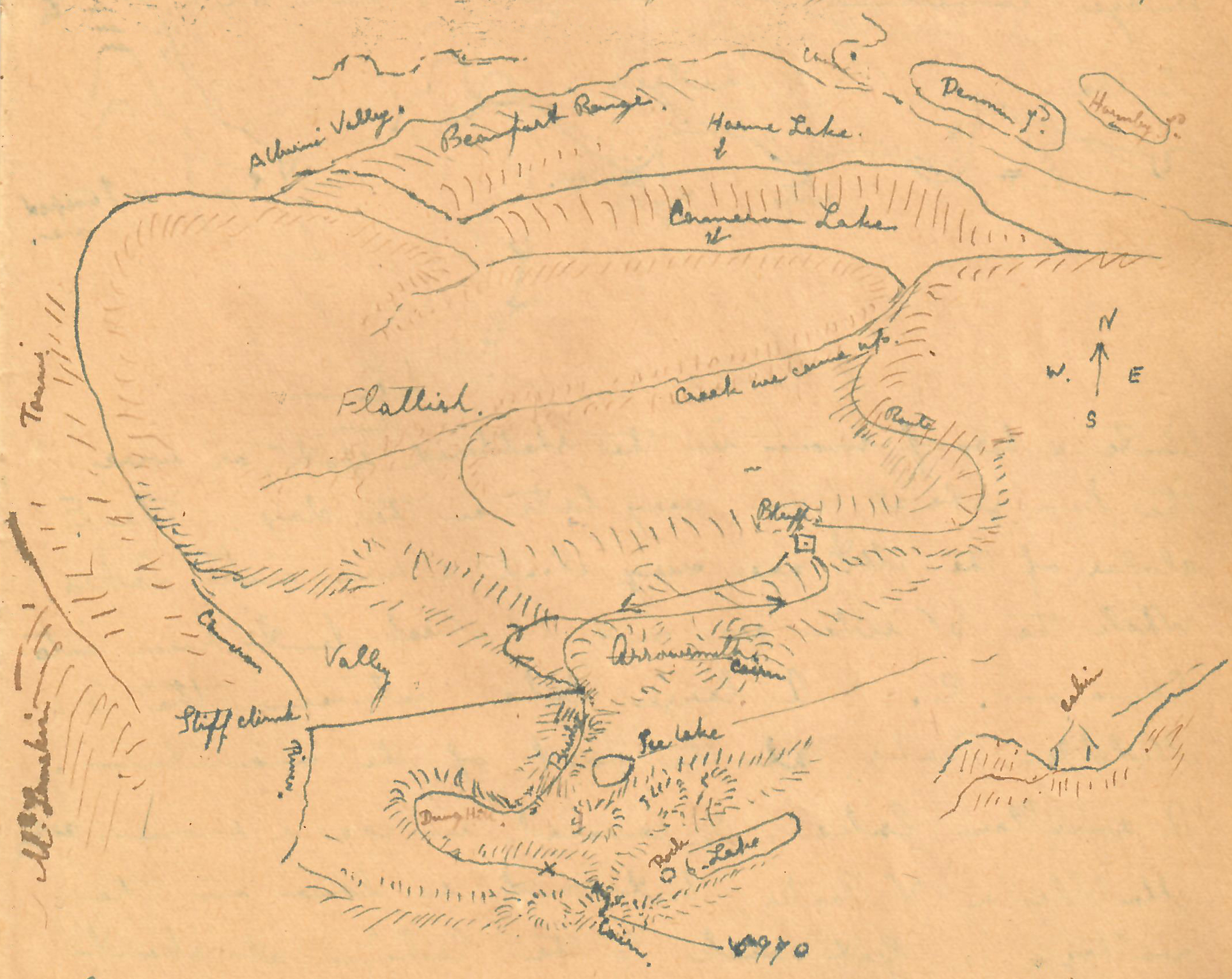
Stanley Baynes, Map 1
Got to the Cabin about 6 PM. Saw the sun set in the W & full moon rise in the E, the moon rising about the same time as the Sun left. Stayed at the Cabin. All night rather cold. Spring up here. Pink & White Heather, Lupine, Thistles, Bluebells, Strawberries, White Rhododendron? Saycle plant? & a lot of other kinds not found in the valley. It seemed a sin to step on them. Trees. Yellow cedar, Hemlock, Jack Pine and others. Some fair sized timber. Park like. There seems to be three sets of Peaks with bridge connecting with the Peaks but deep descent to the bridges.
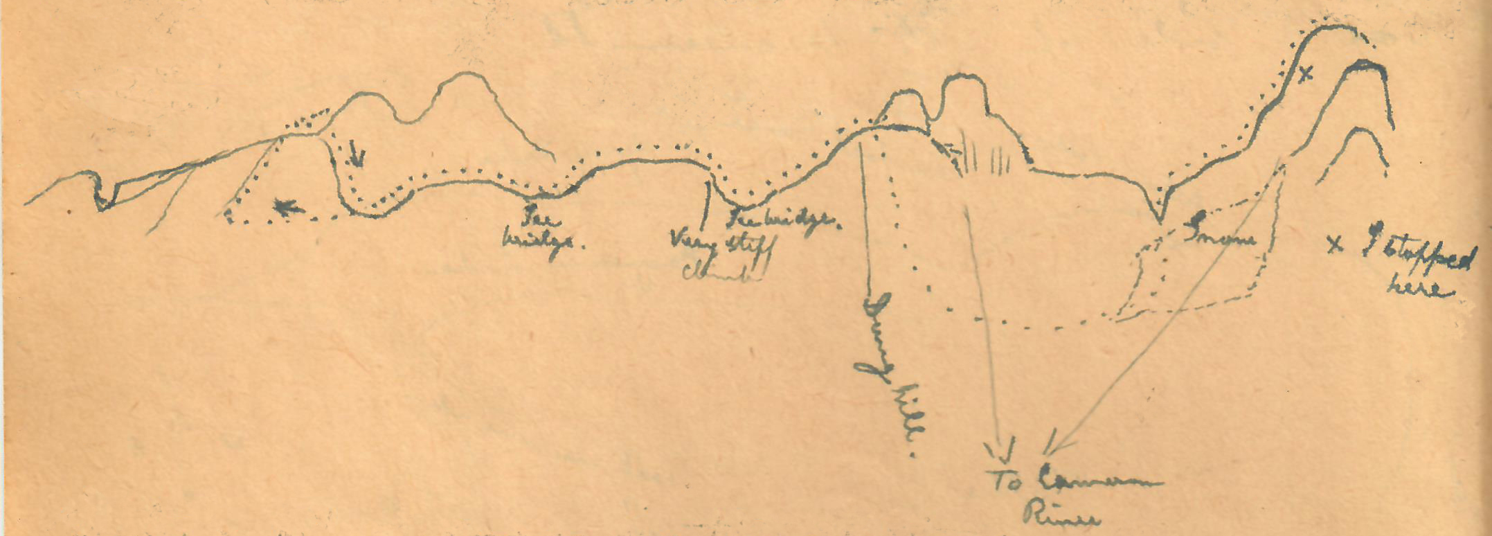
Stanley Baynes, Map 2
Quite a bit of snow in the sheltered spots or where the sun gets at them very late in the day. The E slopes of the Mt are very steep & run into Lakes. While the W side are not so steep, but run into Cameron R. A large lake between the S and Middle Peaks at the foot of the mountain. A smaller lake, ½ covered in ice & snow between Middle and N Peaks but not so low in the valley. Got back to the cabin at about 6 PM leaving it at about 7 AM. Saw the Sun rise and the moon set at nearly the same time.
Sept. 18. Thursday left for Alberni. Left the Cabin at 7 AM & got to Cameron Lake by10 AM. Walked to within 5 mile of Alberni. Got a lift, roadmen going home. Summit 1300 odd ft high. The Cowichan trail is close to the summit. Mr. Godsal stayed with the Lees. I went on to [?]. Mr. Godsal spent his 66 birthday on the top of Mt Arrowsmith.
Alpinists Elect Officers for Year
Col. W.W. Foster Is Honorary Chairman Of Local Section, Mr. R.D. McCaw, Chairman – Plan Meetings.
Reported in the Daily Colonist Wednesday December 4, 1919, p.13.
The election of officers for the ensuing year was held in connection with the meeting of the Victoria Section of the Alpine Club of Canada on Tuesday [December 2] evening at the home of retiring secretary, Miss Jennie McCulloch, Linden Avenue. The following was the result: Hon. Chairman William W. Foster; Chairman, Mr. Robert D. McCaw; Secretary, Mr. Gordon Cameron. The executive is to be composed of Mr. W. [William] A. Alldritt, Mr. W. [William] S. Drewry, Major Francis A. Robertson, Miss [Margaret] Cowell, Miss McCulloch and Capt. [William] Everall. Mr. Reynolds will represent that Vancouver Island section of the club on the Photographic Committee, whose duties lie in the direction of collecting photographs of interest to the society. Mr. Arthur O. Wheeler, director of the Alpine Club of Canada, was present at the meeting, and stated that the organization hereafter would publish a quarterly review, to which the secretary of the local section would be asked to send reports four times yearly, the said reports to be a resume of the activities of the Vancouver Island society. The local section has already made tentative plans for the January, February and March meeting, at each of which two members will read papers. It is the intention also to invite several people to address public meetings to be arranged under the auspices of the society information having already been received of a number of famous Alpinists, a noted natural history student, and a lady botanist who are expected on the Coast within the next few months. If they can be prevailed upon to lecture here the meetings will be arranged. The membership of the society here numbers about thirty.
1920
The Next Decade: 1920-1929

ACCVI History is a work in progress.